Sub-Sarface Dams (SSD) [Kenya]
- Création :
- Mise à jour :
- Compilateur : Guyo Roba
- Rédacteur : –
- Examinateur : Rima Mekdaschi Studer
technologies_3340 - Kenya
- Résumé complet en PDF
- Résumé complet en PDF pour impression
- Résumé complet dans le navigateur
- Résumé complet (non formaté)
- Sub-Sarface Dams (SSD): 22 juin 2018 (inactive)
- Sub-Sarface Dams (SSD): 7 mai 2018 (inactive)
- Sub-Sarface Dams (SSD): 17 juillet 2018 (inactive)
- Barrages souterrains: 15 août 2018 (inactive)
- Barrages souterrains: 5 décembre 2018 (inactive)
- Barrages souterrains: 3 septembre 2018 (inactive)
- Barrages souterrains: 2 novembre 2021 (public)
Voir les sections
Développer tout Réduire tout1. Informations générales
1.3 Conditions relatives à l'utilisation par WOCAT des données documentées
Quand les données ont-elles été compilées (sur le terrain)?
11/01/2018
Le compilateur et la(les) personne(s) ressource(s) acceptent les conditions relatives à l'utilisation par WOCAT des données documentées:
Oui
1.4 Déclaration sur la durabilité de la Technologie décrite
Est-ce que la Technologie décrite ici pose problème par rapport à la dégradation des terres, de telle sorte qu'elle ne peut pas être déclarée comme étant une technologie de gestion durable des terres?
Non
2. Description de la Technologie de GDT
2.1 Courte description de la Technologie
Définition de la Technologie:
These are constructions stretching across the sand filled dry riverbed, down towards the impermeable floor of the riverbed. They are totally submerged into the ground. For example by fully covering after construction by sand. This are done along dry rivers with huge sand deposits, which has high yield potential and where water can be easily extracted. The aim is to raise groundwater tables and increase the storage capacity for water withdrawals.
2.2 Description détaillée de la Technologie
Description:
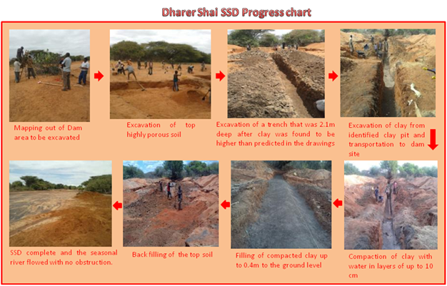
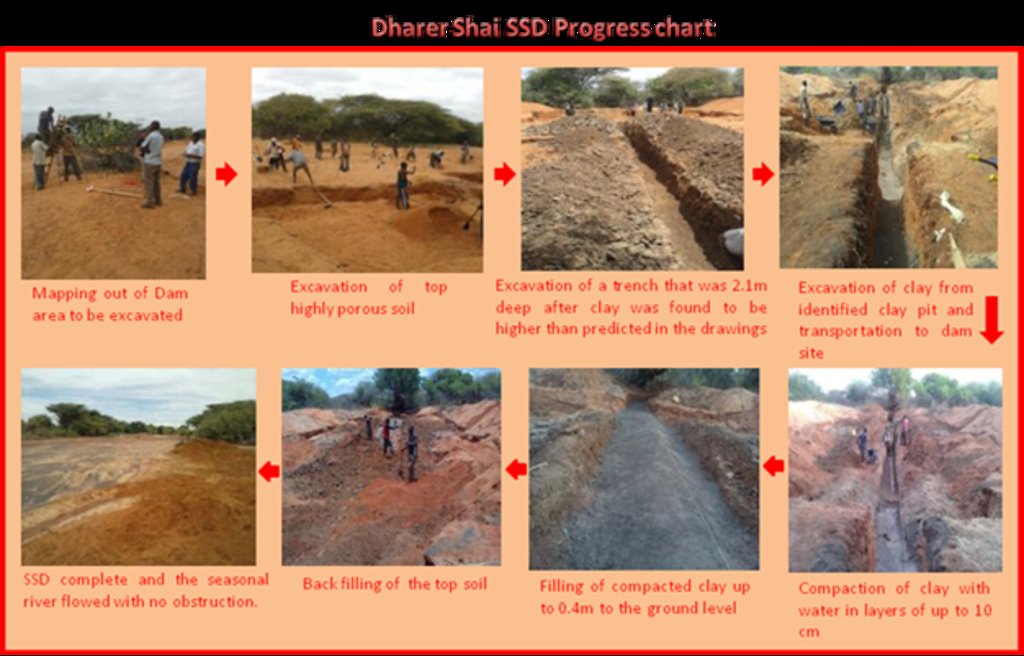
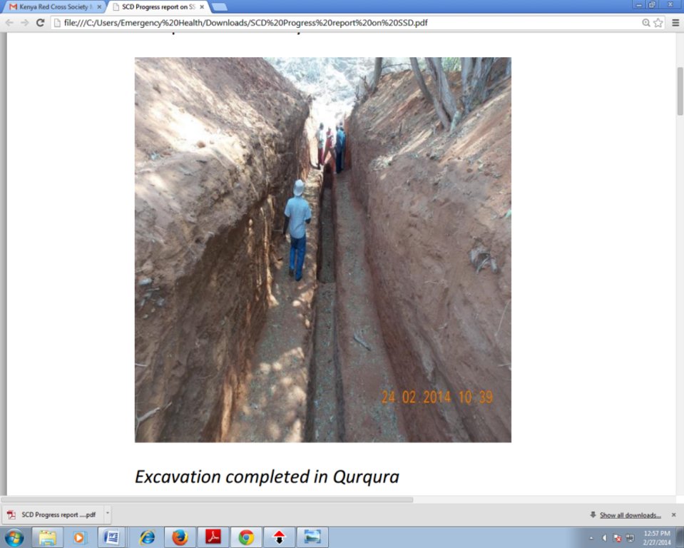
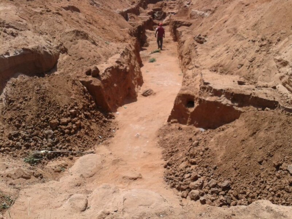
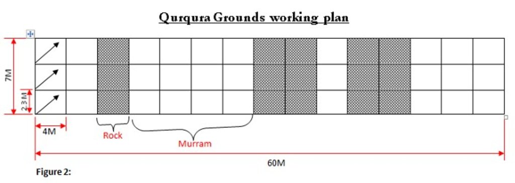
The technology is applied in northern rangeland of Isiolo County which is managed under communal management systems. The technology involves soil excavation which are typically subdivided into a number of square chambers measuring 4X2.3X2.2= 20.2M3 (not to scale). Then, excavation and transportation of clay soil from the clay pit and final compaction of clay soil after approximately a week, and lying out of the concrete and refilling of the sand. Finally, a liner is placed. The technology functions as underground water storage infrastructure. The development of Sub-Surface Dams (SSDs) was done through Cash for Work program where local labours comprising of 40-50 persons are engaged in excavation, compactions and developing the liners. Typical activities include, excavation of top porous soil, excavation of sample pits within the excavated area, checking filtration rates of soil, compaction of soil on which dam liners are laid, smoothing the sharp liners along which the dam liners are laid, making grooves to anchor the dam liner, laying the dam liner, anchoring the dam liner with a mixture of cement, water proof and sand with water (motor) and finally drying of the motor and filling back of sand. The technology aim to improve water access for livestock in ways that support wider management and utilization of the rangeland and as such strength the resilience of pastoralists to droughts. Inputs such as farm tools like jembe, panga, spades and human labour are required to develop SSD. The technology improves water supply/availability, thereby extending the period of livestock grazing in areas where typically water is depleted before the pasture. This effectively gives pastoral groups, an extra grazing time (typically 2 extra months) that is not too long to lead to land degradation through over-grazing but long enough to enable pastoralist utilize the remaining pasture in wet season grazing areas. In so doing, the technology enable balanced use of vast communal lands without livestock retreating to dry season grazing areas. The extended grazing period is instrumental in building resilience of pastoral communities in the face of climate variability. The technology was instrumental in fostering both balanced utilization of land and strengthening sustainable use of the vast rangeland by moderating the mobility between wet season and dry season grazing areas. The water stored through the technology stays longer, in this case study, the water lasted for 5 months after the end of the rainy season. Normally, the water is depleted within 2 months after the rainy period. The technology is also cheap and easy to understand and construct (especially in areas with clay as the underlying impermeable material) with a possibility of the communities to be taught how to identify suitable site and the entire process of construction. However, in areas without clay soil, the excavation of clay and transportation can be labour intensive and expensive.
2.3 Photos de la Technologie
2.5 Pays/ région/ lieux où la Technologie a été appliquée et qui sont couverts par cette évaluation
Pays:
Kenya
Région/ Etat/ Province:
Northern Kenya
Autres spécifications du lieu:
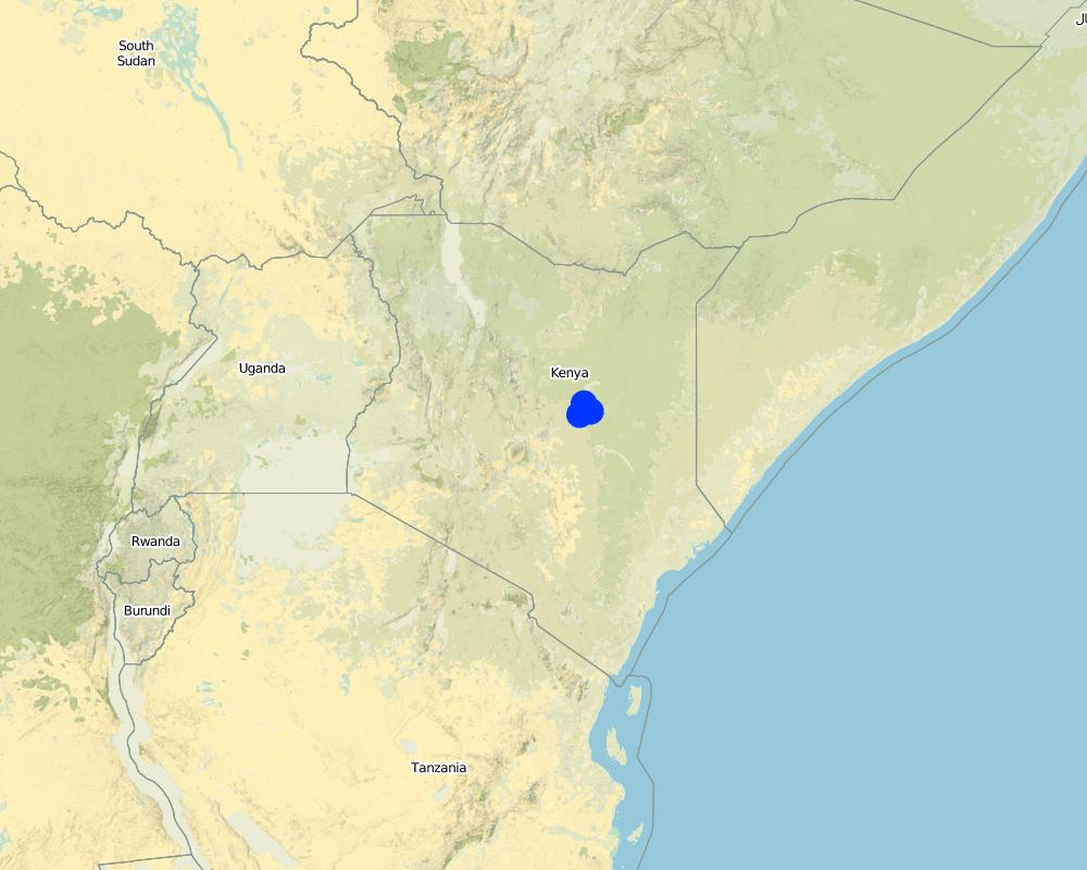
Garba Tula, Isiolo County
Map
×2.7 Introduction de la Technologie
Spécifiez comment la Technologie a été introduite: :
- par le biais de projets/ d'interventions extérieures
3. Classification de la Technologie de GDT
3.1 Principal(aux) objectif(s) de la Technologie
- améliorer la production
- réduire, prévenir, restaurer les terres dégradées
- atténuer le changement climatique et ses impacts
- créer un impact économique positif
- créer un impact social positif
3.2 Type(s) actuel(s) d'utilisation des terres, là où la Technologie est appliquée

Pâturages
Pâturage extensif:
- Semi-nomadisme/ pastoralisme
Commentaires:
Communal grazing area that is shared by 2 and more pastoral groups
3.3 Informations complémentaires sur l'utilisation des terres
Approvisionnement en eau des terres sur lesquelles est appliquée la Technologie:
- pluvial
Densité d'élevage/ chargement (si pertinent):
Fluctuates, depending on seasons and pasture availability
3.4 Groupe de GDT auquel appartient la Technologie
- pastoralisme et gestion des pâturages
3.5 Diffusion de la Technologie
Spécifiez la diffusion de la Technologie:
- appliquée en des points spécifiques ou concentrée sur une petite surface
Commentaires:
Sub-Surface Dams are only suitable in areas along the river, with suitable density of sand deposits
3.6 Mesures de GDT constituant la Technologie

structures physiques
- S5: Barrages/retenues, micro-bassins, étangs
3.7 Principaux types de dégradation des terres traités par la Technologie

autre
Commentaires:
Mismatch of pasture and water resources - there are areas where pastures are plenty but surface rain water is depleted earlier than pasture.
3.8 Prévention, réduction de la dégradation ou réhabilitation des terres dégradées
Spécifiez l'objectif de la Technologie au regard de la dégradation des terres:
- prévenir la dégradation des terres
- réduire la dégradation des terres
Commentaires:
The SSD technology increase water availability is period immediately after the rain, hence ensuring better pasture utilization and more sustainable use of land
4. Spécifications techniques, activités, intrants et coûts de mise en œuvre
4.1 Dessin technique de la Technologie
4.2 Spécification/ explications techniques du dessin technique
The SSD has initial excavation works. The construction of the SSD was constructed by 50 laborers. The design attached represent an Aerial view of the area of excavation that is subdivided into 45 square chambers of 4X2.3X2.2= 20.2M3 (not to scale). Each of the chambers were excavated by 5 laborers. The estimated time for excavation as per the plan was estimated to be five days. Excavation and transportation of the clay from the clay pit was estimated to take an approximate of five days while the compacting of the clay will follow one week later, and laying out of the concrete and refilling of the sand for another week. The liner will then be finally placed. in summary, the excavation of sand takes 5days, and the excavation of clay soil takes another 5days while concrete placing, compacting of clay as well as putting of liner and refilling of sand takes 10 days.
4.3 Informations générales sur le calcul des intrants et des coûts
Indiquez le coût salarial moyen de la main d'œuvre par jour:
3.5 USD per day
4.4 Activités de mise en place/ d'établissement
| Activité | Type de mesures | Calendrier | |
|---|---|---|---|
| 1. | Removing sand over dyke and Man-days for excavating and transporting soil to dam site | Autres mesures | 21 days for 45 casual labourers |
| 2. | Building and compaction soil in dam wall | Structurel | 3 days for 45 casual labourers |
| 3. | Supplying water for compaction | Autres mesures | 0.5 day for 45 casual labourers |
| 4. | Back-filling sand on dam | Autres mesures | 1 day for 45 casual labourers |
| 5. | Supplying water for compacting soil in dam wall | Autres mesures | 2 days for 45 casual labourers |
| 6. | Compacting soil and placing liners | Autres mesures | 12 days for 45 casual labourers |
Commentaires:
The construction of SSD was done through “Cash for work” which is participatory process that involves community mobilization, identification of beneficiaries and formation of “Cash for work” committees, registrations and verification of beneficiaries and implementation/supervision of the work.
4.5 Coûts et intrants nécessaires à la mise en place
| Spécifiez les intrants | Unité | Quantité | Coûts par unité | Coût total par intrant | % des coût supporté par les exploitants des terres | |
|---|---|---|---|---|---|---|
| Main d'œuvre | tools - jembe, spade etc. | pieces | 80,0 | 5,33 | 426,4 | |
| Main d'œuvre | Removing sand over dyke and Man-days for excavating and transporting soil to dam site | per day | 945,0 | 4,0 | 3780,0 | |
| Main d'œuvre | Building and compaction soil in dam wall | per day | 135,0 | 4,0 | 540,0 | |
| Equipements | Supplying water for compaction | per day | 22,5 | 4,0 | 90,0 | |
| Equipements | Back-filling sand on dam | per day | 45,0 | 4,0 | 180,0 | |
| Equipements | Supplying water for compacting soil in dam wall | per day | 90,0 | 4,0 | 360,0 | |
| Equipements | Compacting soil and placing liners | per day | 540,0 | 4,0 | 2160,0 | |
| Coût total de mise en place de la Technologie | 7536,4 | |||||
4.6 Activités d'entretien/ récurrentes
| Activité | Type de mesures | Calendrier/ fréquence | |
|---|---|---|---|
| 1. | Training of communities to manage and maintain the structures | Structurel | yearly |
4.7 Coûts et intrants nécessaires aux activités d'entretien/ récurrentes (par an)
| Spécifiez les intrants | Unité | Quantité | Coûts par unité | Coût total par intrant | % des coût supporté par les exploitants des terres | |
|---|---|---|---|---|---|---|
| Main d'œuvre | Labour for site protection and maintenance of hygiene | per site | 10,0 | 100,0 | 1000,0 | |
| Coût total d'entretien de la Technologie | 1000,0 | |||||
Commentaires:
Water User Associations on the sites are trained on the management of the structures on behalf of the community e.g. on the protection of structure and hygiene maintenance.
4.8 Facteurs les plus importants affectant les coûts
Décrivez les facteurs les plus importants affectant les coûts :
Distance of the sub-surface dam from villages, extent of destruction by floods and human activities
5. Environnement naturel et humain
5.1 Climat
Précipitations annuelles
- < 250 mm
- 251-500 mm
- 501-750 mm
- 751-1000 mm
- 1001-1500 mm
- 1501-2000 mm
- 2001-3000 mm
- 3001-4000 mm
- > 4000 mm
Spécifications/ commentaires sur les précipitations:
because of the climate change, the rainfall is becoming more erratic
Indiquez le nom de la station météorologique de référence considérée:
Isiolo
Zone agro-climatique
- semi-aride
5.2 Topographie
Pentes moyennes:
- plat (0-2 %)
- faible (3-5%)
- modéré (6-10%)
- onduleux (11-15%)
- vallonné (16-30%)
- raide (31-60%)
- très raide (>60%)
Reliefs:
- plateaux/ plaines
- crêtes
- flancs/ pentes de montagne
- flancs/ pentes de colline
- piémonts/ glacis (bas de pente)
- fonds de vallée/bas-fonds
Zones altitudinales:
- 0-100 m
- 101-500 m
- 501-1000 m
- 1001-1500 m
- 1501-2000 m
- 2001-2500 m
- 2501-3000 m
- 3001-4000 m
- > 4000 m
Indiquez si la Technologie est spécifiquement appliquée dans des:
- non pertinent
5.3 Sols
Profondeur moyenne du sol:
- très superficiel (0-20 cm)
- superficiel (21-50 cm)
- modérément profond (51-80 cm)
- profond (81-120 cm)
- très profond (>120 cm)
Texture du sol (de la couche arable):
- grossier/ léger (sablonneux)
Texture du sol (> 20 cm sous la surface):
- grossier/ léger (sablonneux)
Matière organique de la couche arable:
- moyen (1-3%)
5.4 Disponibilité et qualité de l'eau
Profondeur estimée de l’eau dans le sol:
5-50 m
Disponibilité de l’eau de surface:
faible/ absente
Qualité de l’eau (non traitée):
eau potable
La salinité de l'eau est-elle un problème? :
Non
La zone est-elle inondée?
Non
5.5 Biodiversité
Diversité des espèces:
- élevé
Diversité des habitats:
- élevé
5.6 Caractéristiques des exploitants des terres appliquant la Technologie
Sédentaire ou nomade:
- Semi-nomade
Orientation du système de production:
- mixte (de subsistance/ commercial)
Revenus hors exploitation:
- moins de 10% de tous les revenus
Niveau relatif de richesse:
- moyen
Individus ou groupes:
- groupe/ communauté
Niveau de mécanisation:
- travail manuel
Genre:
- hommes
Age des exploitants des terres:
- personnes d'âge moyen
5.7 Superficie moyenne des terres détenues ou louées par les exploitants appliquant la Technologie
- < 0,5 ha
- 0,5-1 ha
- 1-2 ha
- 2-5 ha
- 5-15 ha
- 15-50 ha
- 50-100 ha
- 100-500 ha
- 500-1 000 ha
- 1 000-10 000 ha
- > 10 000 ha
Cette superficie est-elle considérée comme de petite, moyenne ou grande dimension (en se référant au contexte local)?
- grande dimension
5.8 Propriété foncière, droits d’utilisation des terres et de l'eau
Propriété foncière:
- communauté/ village
Droits d’utilisation des terres:
- communautaire (organisé)
Droits d’utilisation de l’eau:
- communautaire (organisé)
5.9 Accès aux services et aux infrastructures
santé:
- pauvre
- modéré
- bonne
éducation:
- pauvre
- modéré
- bonne
assistance technique:
- pauvre
- modéré
- bonne
emploi (par ex. hors exploitation):
- pauvre
- modéré
- bonne
marchés:
- pauvre
- modéré
- bonne
énergie:
- pauvre
- modéré
- bonne
routes et transports:
- pauvre
- modéré
- bonne
eau potable et assainissement:
- pauvre
- modéré
- bonne
services financiers:
- pauvre
- modéré
- bonne
6. Impacts et conclusions
6.1 Impacts sur site que la Technologie a montrés
Impacts socio-économiques
Production
production animale
gestion des terres
Disponibilité et qualité de l'eau
disponibilité de l'eau pour l'élevage
Impacts écologiques
Réduction des risques de catastrophe et des risques climatiques
impacts de la sécheresse
6.2 Impacts hors site que la Technologie a montrés
disponibilité de l'eau
6.3 Exposition et sensibilité de la Technologie aux changements progressifs et aux évènements extrêmes/catastrophes liés au climat (telles que perçues par les exploitants des terres)
Extrêmes climatiques (catastrophes)
Catastrophes climatiques
| Comment la Technologie fait-elle face à cela? | |
|---|---|
| sécheresse | bien |
6.4 Analyse coûts-bénéfices
Quels sont les bénéfices comparativement aux coûts de mise en place (du point de vue des exploitants des terres)?
Rentabilité à long terme:
positive
Quels sont les bénéfices comparativement aux coûts d'entretien récurrents (du point de vue des exploitants des terres)?
Rentabilité à long terme:
très positive
Commentaires:
The technology has limited running and maintenance costs once its done fairly well.
6.5 Adoption de la Technologie
- 1-10%
Parmi tous ceux qui ont adopté la Technologie, combien d'entre eux l'ont fait spontanément, à savoir sans recevoir aucune incitation matérielle ou aucun paiement?
- 0-10%
6.6 Adaptation
La Technologie a-t-elle été récemment modifiée pour s'adapter à l'évolution des conditions?
Non
6.7 Points forts/ avantages/ possibilités de la Technologie
| Points forts/ avantages/ possibilités du point de vue de l'exploitant des terres |
|---|
| The technology created opportunity to graze in wet season grazing areas for extra 2 months period after rainy seasons. The technology has provided additional water that extended, albeit slightly, the grazing period of the land-users. In so doing, the land users utilized the pasture without retreating to traditional dry season grazing areas. |
| The extra grazing months has reduced overall livestock mortality during droughts and also improved resilience of pastoral community. |
| The distance traveled and effort required to access water was reduced. Community members reported reduced distances covered and time spent in search of water for livestock. In some instances the distance reduced from 12-15 Km to 3 Km. Community members also mentioned reduction in conflict incidences over water resources in some areas due to adequate supply of water as a result of construction of water infrastructure. |
| Points forts/ avantages/ possibilités du point de vue du compilateur ou d'une autre personne ressource clé |
|---|
| The technology has created an opportunity to optimally use the grazing area and overall reduced land degradation. The technology Improves access to water for livestock in ways which promote more sustainable management of rangeland resources and as such strengthening the resilience of local communities. |
| The validation process prior to construction of the SSD is draws critical lessons of identifying and agreeing on where to construct the SSD in a way that fit within broader sustainable rangeland management in a manner that ensured sustainable and efficient utilization of pasture and browse resources in targeted areas. The increase in water supply allowed livestock to graze additional 2-3 months in target areas before shifting to dry grazing areas where previously they migrated before exhausting the pasture and browse resources due to water scarcity. |
6.8 Faiblesses/ inconvénients/ risques de la Technologie et moyens de les surmonter
| Faiblesses/ inconvénients/ risques du point de vue de l’exploitant des terres | Comment peuvent-ils être surmontés? |
|---|---|
| When the construction season for SSD is not well planned, there is likelihood/risks of the dams being washed away by flash floods. | Better planning and timing of the development of SDD, just slightly before the onset of rainfall. |
7. Références et liens
7.1 Méthodes/ sources d'information
- compilation à partir de rapports et d'autres documents existants
7.3 Liens vers les informations pertinentes disponibles en ligne
Titre/ description:
Promoting resilience by influencing water infrastructure development in community managed rangelands of Kenya
URL:
https://portals.iucn.org/library/sites/library/files/documents/2014-088.pdf
Titre/ description:
Balancing water infrastructure in community-managed rangelands in the arid and semi-arid lands of Kenya
URL:
https://portals.iucn.org/library/sites/library/files/documents/2014-089.pdf
Liens et modules
Développer tout Réduire toutLiens
Aucun lien
Modules
Aucun module trouvé


