Landslip and stream bank stabilisation [Népal]
- Création :
- Mise à jour :
- Compilateur : Dileep Kumar Karna
- Rédacteur : –
- Examinateurs : David Streiff, Deborah Niggli
Bans ko bhatta, Manra bandhi (Nepali)
technologies_1491 - Népal
Voir les sections
Développer tout Réduire tout1. Informations générales
1.2 Coordonnées des personnes-ressources et des institutions impliquées dans l'évaluation et la documentation de la Technologie
Spécialiste GDT:
Spécialiste GDT:
Spécialiste GDT:
Spécialiste GDT:
Spécialiste GDT:
Spécialiste GDT:
Spécialiste GDT:
Singh Bijendra
bijendra25@hotmail.com
DSCO
Kabhrepalanchok, Nepal
Népal
exploitant des terres:
Basnet Druba P.
Népal
Spécialiste GDT:
Nom du projet qui a facilité la documentation/ l'évaluation de la Technologie (si pertinent)
People and Resource Dynamics Project, Nepal (PARDYP)Nom du projet qui a facilité la documentation/ l'évaluation de la Technologie (si pertinent)
Book project: where the land is greener - Case Studies and Analysis of Soil and Water Conservation Initiatives Worldwide (where the land is greener)Nom du ou des institutions qui ont facilité la documentation/ l'évaluation de la Technologie (si pertinent)
District Soil Conservation Office (DSCO) - NépalNom du ou des institutions qui ont facilité la documentation/ l'évaluation de la Technologie (si pertinent)
ICIMOD International Centre for Integrated Mountain Development (ICIMOD) - NépalNom du ou des institutions qui ont facilité la documentation/ l'évaluation de la Technologie (si pertinent)
Chittagong Hill Tracts Development Board (CHTDB) - BangladeshNom du ou des institutions qui ont facilité la documentation/ l'évaluation de la Technologie (si pertinent)
G.B. Pant Institute of Himalayan Einvironment & Development (G.B. Pant Institute of Himalayan Einvironment & Development) - IndeNom du ou des institutions qui ont facilité la documentation/ l'évaluation de la Technologie (si pertinent)
CSKHPKV Palampur (CSKHPKV Palampur) - Inde1.3 Conditions relatives à l'utilisation par WOCAT des données documentées
Quand les données ont-elles été compilées (sur le terrain)?
12/02/2003
Le compilateur et la(les) personne(s) ressource(s) acceptent les conditions relatives à l'utilisation par WOCAT des données documentées:
Oui
1.5 Référence au(x) questionnaire(s) sur les Approches de GDT

Integrated watershed management for landslip and stream bank … [Népal]
Integrated watershed management as an example for landslip and stream bank stabilisation based on fostering a partnership between community institutions, line agencies, district authorities and consultants
- Compilateur : Dileep Kumar Karna
2. Description de la Technologie de GDT
2.1 Courte description de la Technologie
Définition de la Technologie:
Integration of vegetative and structural measures for landslip, stream bank and gully stabilisation on hillsides.
2.2 Description détaillée de la Technologie
Description:
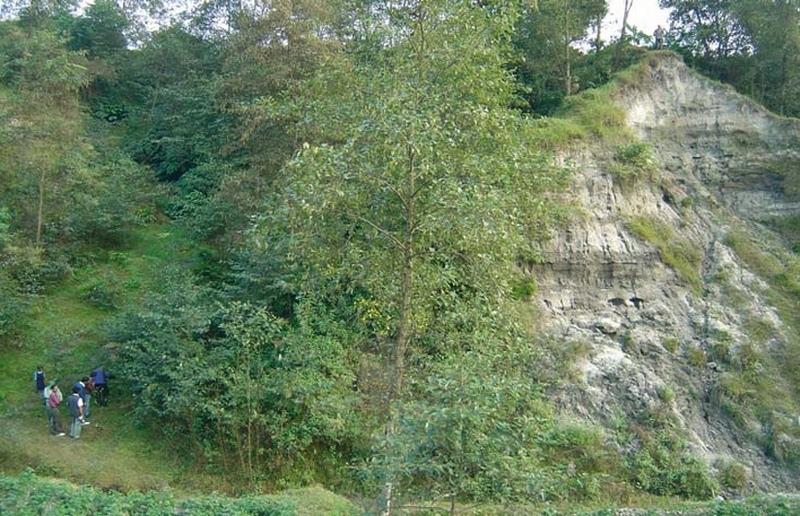
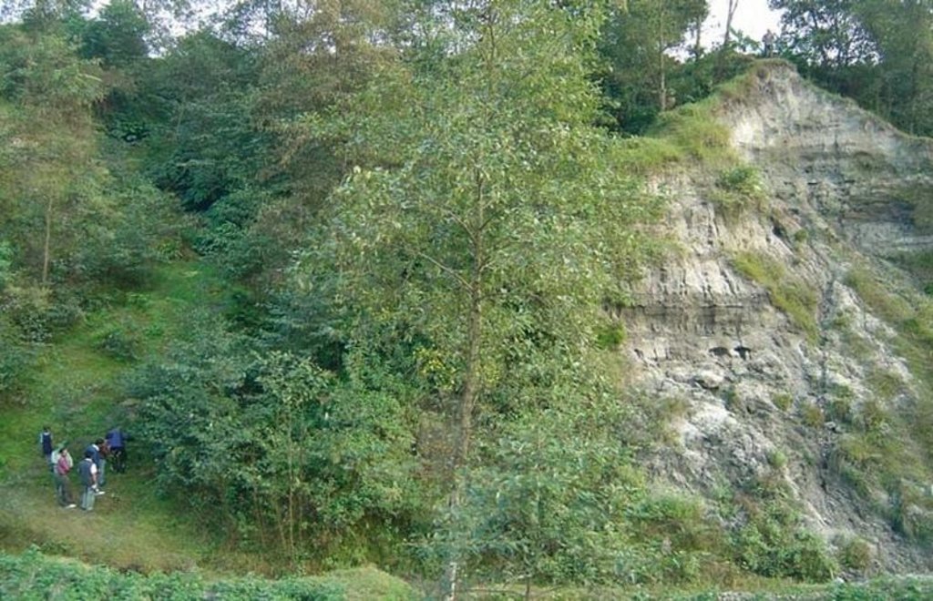
A combination of measures, implemented by a group of neighbouring families, is used to address landslips, gully formation and stream bank erosion problems in the middle hills of Nepal. All these processes affect the stability of adjacent agricultural land and cause problems downstream. Small-scale farming is dominant in the area surrounding the treated land - which theoretically belongs to the government but is used by these families.
This pilot technological package is proving suitable in Nepal for steep/very steep slopes under subhumid climates within an altitudinal range of 1,000-1,500 m a.s.l. This type of intervention, combined with the active involvement of stakeholders (who contribute three quarters of the cost), was recently introduced to Nepal under a watershed management programme, co-funded by the European Commission (see related approach ‘Integrated watershed management’).
Initially, ditches with bunds on the lower side are constructed along the contour. Within the gullies and along the stream banks, cement bags (filled with cement, brick chips, sand and/or earth) are placed to avoid deepening of the channel. Wattle fences, made from woven bamboo are also used as checks in the gullies. These structures are complemented by vegetative measures: Nepalese alder (Alnus nepalensis), bamboo (Dendrocalamus sp.), cardamom (Elettaria cardamomum), and broom grass (Thyosonaelana maxima) are planted. These species establish quickly in degraded sites and also control erosion, stabilise land and serve as cash crops, and for fodder, fuelwood and timber. Alder (locally called utis) is a nitrogen-fixing multipurpose tree which helps restore soil fertility.
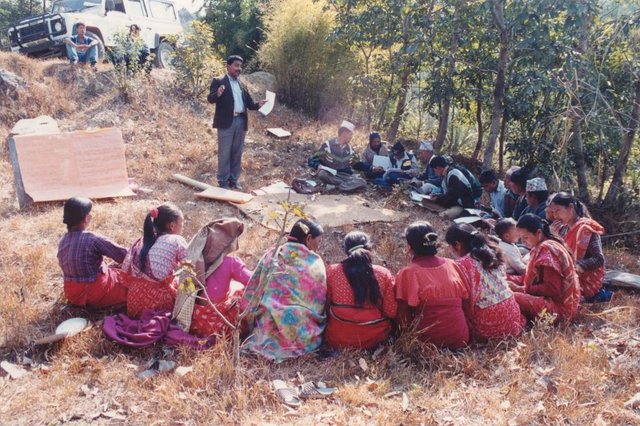
Farmers can get economic benefits within a few years from these plants. Another advantage of this package is that the vegetative resources needed are locally available and cheap. Furthermore farmers already know how to propagate them. Maintenance costs are negligible. Once established, the stabilised and revegetated sites provide improved environments for birds and insects – thus favouring biodiversity - and they help protect natural springs. In this case study, the economic returns from the cash crops mainly go to one family. Another few families also utilise this site, extracting common products (fodder, litter, timber) for domestic use. Additionally, the location is regularly used as an unofficial demonstration site, being visited by various people (farmers, SWC specialists) interested in the technology. This represents an indirect benefit to a larger number of people and strengthens institutions at household and community levels.
2.3 Photos de la Technologie
2.5 Pays/ région/ lieux où la Technologie a été appliquée et qui sont couverts par cette évaluation
Pays:
Népal
Région/ Etat/ Province:
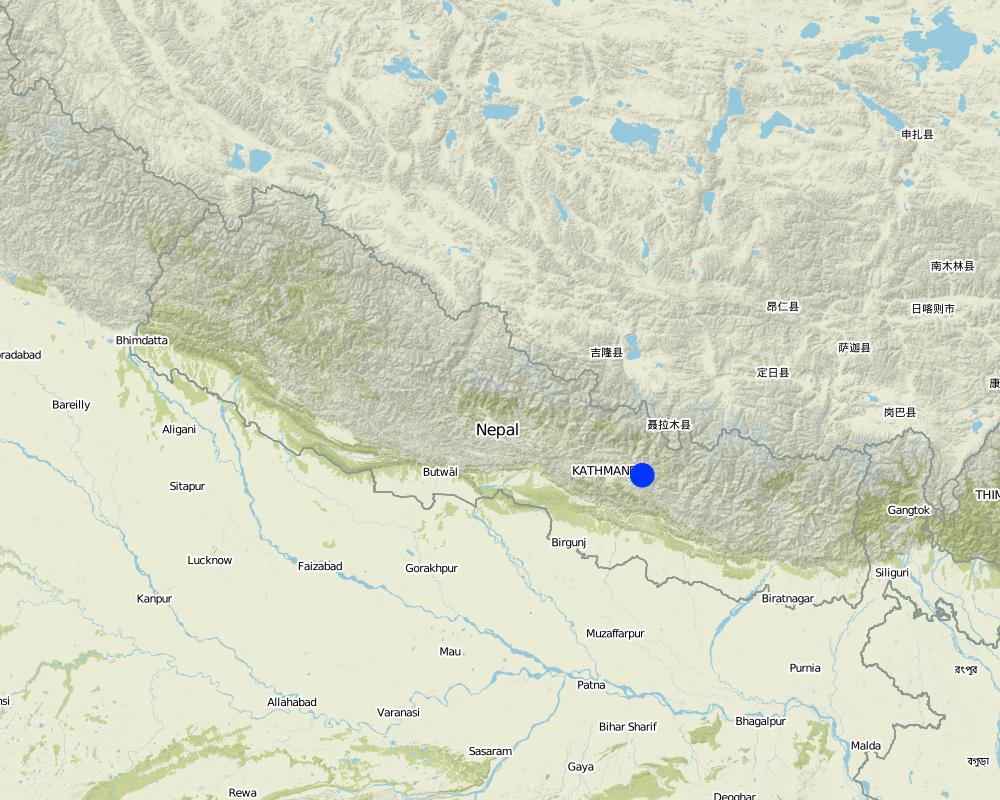
Kathmandu
Autres spécifications du lieu:
Kathmandu/Bagmati watershed
Map
×2.6 Date de mise en œuvre de la Technologie
Si l'année précise est inconnue, indiquez la date approximative: :
- il y a plus de 50 ans (technologie traditionnelle)
2.7 Introduction de la Technologie
Spécifiez comment la Technologie a été introduite: :
- par le biais de projets/ d'interventions extérieures
3. Classification de la Technologie de GDT
3.1 Principal(aux) objectif(s) de la Technologie
- réduire, prévenir, restaurer les terres dégradées
3.2 Type(s) actuel(s) d'utilisation des terres, là où la Technologie est appliquée

Mixte (cultures/ pâturages/ arbres), incluant l'agroforesterie
- Sylvo-pastoralisme
Principaux produits/ services:
major cash crop: Nepalese Alder (Alnus nepalensis), Bamboo (Dendroc) and broom grass (Thysanolaena maxima)

Terres improductives
Précisez:
Wasteland (degraded shrubland before SWC)
Remarques:
degraded , no annual crops, occasionally grazed
Commentaires:
Major land use problems (compiler’s opinion): - concentrated runoff from upstream agricultural areas
- landslides, gullies and stream bank erosion
- gullies back-cutting into fertile agricultural land and threatening irrigation canals and homesteads
Major land use problems (land users’ perception): Landslide and gully erosion due to poor vegetative cover (steepness and lack of effective drainage/ diversion system).
Future (final) land use (after implementation of SLM Technology): Mixed: Ma: Agro-silvopastoralism
Constraints of wastelands (degraded shrubland) (before SWC) (degraded , no annual crops, occasionally grazed)
3.3 Informations complémentaires sur l'utilisation des terres
Approvisionnement en eau des terres sur lesquelles est appliquée la Technologie:
- pluvial
Nombre de période de croissance par an: :
- 2
Précisez:
Longest growing period in days: 180 Longest growing period from month to month: Jun - Nov
3.4 Groupe de GDT auquel appartient la Technologie
- mesures en travers de la pente
- réduction des risques de catastrophe fondée sur les écosystèmes
3.5 Diffusion de la Technologie
Spécifiez la diffusion de la Technologie:
- répartie uniformément sur une zone
Si la Technologie est uniformément répartie sur une zone, indiquez la superficie couverte approximative:
- 0,1-1 km2
Commentaires:
Total area covered by the SLM Technology is 0.14 km2.
The Approach covered a bigger area. This is just one example.
3.6 Mesures de GDT constituant la Technologie

pratiques végétales
- V1: Couverture d’arbres et d’arbustes

structures physiques
- S2: Diguettes, digues
3.7 Principaux types de dégradation des terres traités par la Technologie

érosion hydrique des sols
- Wg: ravinement/ érosion en ravines
- Wm: mouvements de masse/ glissements de terrain
- Wr: érosion des berges

dégradation chimique des sols
- Cn: baisse de la fertilité des sols et réduction du niveau de matière organique (non causée par l’érosion)
Commentaires:
Main causes of degradation: deforestation / removal of natural vegetation (incl. forest fires), education, access to knowledge and support services (lack of knowledge)
3.8 Prévention, réduction de la dégradation ou réhabilitation des terres dégradées
Spécifiez l'objectif de la Technologie au regard de la dégradation des terres:
- prévenir la dégradation des terres
- réduire la dégradation des terres
Commentaires:
Secondary goals: rehabilitation / reclamation of denuded land
4. Spécifications techniques, activités, intrants et coûts de mise en œuvre
4.1 Dessin technique de la Technologie
Auteur:
Mats Gurtner
4.2 Spécification/ explications techniques du dessin technique
Land slip and stream bank
protection: an overview of the
multiple and integrated vegetative
and structural measures: cut-off drain
1. landslip area
2. banana trees
3. alder trees
4. bamboo wattle fences
5. cardamom
6. planting bamboo
7. cement bag check dams
8. broom grass
9. cutting bamboo
10. stream bank
11. agricultural fi elds in a fl at area
Insert 1: Bamboo wattle fence
combined with retention ditch and
grassed bund to stabilise steep slopes and gullies.
Insert 2: Old cement bags fi lled to
form checks in gullies
Technical knowledge required for field staff / advisors: high
Technical knowledge required for land users: high
Main technical functions: control of concentrated runoff: impede / retard, reduction of slope angle, reduction of slope length, improvement of ground cover, stabilisation of soil
Secondary technical functions: control of concentrated runoff: drain / divert, increase of infiltration, introduction of cash crop
Scattered / dispersed
Vegetative material: T : trees / shrubs, F : fruit trees / shrubs, C : perennial crops, G : grass
Vertical interval within rows / strips / blocks (m): 2 m
Trees/ shrubs species: Alnus nepalenses
Fruit trees / shrubs species: Dendrocalamus sp.
Perennial crops species: Large cardamom
Grass species: Broom grass
Diversion ditch/ drainage
Spacing between structures (m): 10 m
Depth of ditches/pits/dams (m): 0.25 m
Width of ditches/pits/dams (m): 0.1 m
Length of ditches/pits/dams (m): 10 m
Terrace: forward sloping
Spacing between structures (m): 10 m
Structural measure: sediment sand / trap
Vertical interval between structures (m): 1-4 m
Spacing between structures (m): 0.3 m
Depth of ditches/pits/dams (m): 3-4 m
Width of ditches/pits/dams (m): 0.8 m
Structural measure: cement bags
Structural measure: wattle fences
Construction material (concrete): Sand/cement .
Construction material (other): Bamboo culm cutting (1.5 m long)
Slope (which determines the spacing indicated above): 100%
If the original slope has changed as a result of the Technology, the slope today is: 15%
Vegetation is used for stabilisation of structures.
4.3 Informations générales sur le calcul des intrants et des coûts
Spécifiez la manière dont les coûts et les intrants ont été calculés:
- par superficie de la Technologie
Indiquez la taille et l'unité de surface:
1.4 ha
Indiquez la monnaie utilisée pour le calcul des coûts:
- dollars US
Indiquez le coût salarial moyen de la main d'œuvre par jour:
1.35
4.4 Activités de mise en place/ d'établissement
| Activité | Type de mesures | Calendrier | |
|---|---|---|---|
| 1. | Preparing site for implementation of vegetative measures | Végétale | June |
| 2. | Planting of alder (Alnus nepalensis,), cardamom (Elettaria cardamomum), | Végétale | July - August |
| 3. | Watering of new plants using buckets | Végétale | Mar- May (1st year) |
| 4. | Application of farmyard manure at time of planting | Végétale | Time of planting and every December |
| 5. | Weeding | Végétale | January |
| 6. | Earthing up new plants with soil | Végétale | January |
| 7. | Construction of contour bunds and ditches | Structurel | January–April |
| 8. | Stabilisation of slopes using bamboo wattle fences, and gullies using the check dams | Structurel | |
| 9. | Gully stabilisation as walls of cement bags are placed across the gullies and along stream banks | Structurel | June |
| 10. | Preparing the site for planting | Structurel | June |
4.5 Coûts et intrants nécessaires à la mise en place
| Spécifiez les intrants | Unité | Quantité | Coûts par unité | Coût total par intrant | % des coût supporté par les exploitants des terres | |
|---|---|---|---|---|---|---|
| Main d'œuvre | Stabilisation of gully and vegetative measures | Persons/day | 1567,0 | 1,35 | 2115,45 | 75,0 |
| Equipements | Tools | ha | 1,0 | 55,0 | 55,0 | 100,0 |
| Equipements | Empty cement bags | pieces | 600,0 | 0,0166666 | 10,0 | |
| Matériel végétal | Bamboo cuttings | pieces | 600,0 | 0,9416666 | 565,0 | 50,0 |
| Engrais et biocides | Compost / manure | ha | 1,0 | 10,0 | 10,0 | 10,0 |
| Matériaux de construction | Cement bags filled | pieces | 30,0 | 4,166666 | 125,0 | |
| Matériaux de construction | Alder saplings | pieces | 2500,0 | 0,016 | 40,0 | 100,0 |
| Matériaux de construction | Seedlings cardamon | pieces | 400,0 | 0,0125 | 5,0 | |
| Coût total de mise en place de la Technologie | 2925,45 | |||||
Si le coût n'est pas pris en charge à 100% par l'exploitant des terres, indiquez qui a financé le coût restant:
By different stakeholders
Commentaires:
Duration of establishment phase: 12 month(s)
4.6 Activités d'entretien/ récurrentes
| Activité | Type de mesures | Calendrier/ fréquence | |
|---|---|---|---|
| 1. | Apply farmyard manure | Végétale | January /1 |
| 2. | Weed | Végétale | January /1 |
| 3. | Prepare land for further planting of large cardamom and broom grass | Végétale | March-April /1 |
| 4. | Thin cardamom, bamboo, alder, broom grass with a knife: | Végétale | May,June /1 |
| 5. | Replant cardamom, broom grass, bamboo that did not establish | Végétale | June,July /1 |
| 6. | Earth up | Végétale | Aug-Sep and January /1 |
| 7. | Prune alders | Végétale | December.,January /1 |
4.7 Coûts et intrants nécessaires aux activités d'entretien/ récurrentes (par an)
| Spécifiez les intrants | Unité | Quantité | Coûts par unité | Coût total par intrant | % des coût supporté par les exploitants des terres | |
|---|---|---|---|---|---|---|
| Main d'œuvre | Maintaining plants | Persons/day | 41,0 | 1,35 | 55,35 | 100,0 |
| Equipements | Tools | ha | 1,0 | 10,0 | 10,0 | 100,0 |
| Matériel végétal | Compost / manure | ha | 1,0 | 5,0 | 5,0 | 100,0 |
| Coût total d'entretien de la Technologie | 70,35 | |||||
Commentaires:
Machinery/ tools: Activities are carried out manually using local and traditional tools:
The costs (per ha) are calculated for the entire SWC site (consisting of 1.4 ha) including all establishment and maintenance inputs. Labour costs: information based on oral information by farmer. Estimate was approx. 3 people per working day over 2 years.
4.8 Facteurs les plus importants affectant les coûts
Décrivez les facteurs les plus importants affectant les coûts :
labour is the major input.
5. Environnement naturel et humain
5.1 Climat
Précipitations annuelles
- < 250 mm
- 251-500 mm
- 501-750 mm
- 751-1000 mm
- 1001-1500 mm
- 1501-2000 mm
- 2001-3000 mm
- 3001-4000 mm
- > 4000 mm
Zone agro-climatique
- humide
Thermal climate class: subtropics
5.2 Topographie
Pentes moyennes:
- plat (0-2 %)
- faible (3-5%)
- modéré (6-10%)
- onduleux (11-15%)
- vallonné (16-30%)
- raide (31-60%)
- très raide (>60%)
Reliefs:
- plateaux/ plaines
- crêtes
- flancs/ pentes de montagne
- flancs/ pentes de colline
- piémonts/ glacis (bas de pente)
- fonds de vallée/bas-fonds
Zones altitudinales:
- 0-100 m
- 101-500 m
- 501-1000 m
- 1001-1500 m
- 1501-2000 m
- 2001-2500 m
- 2501-3000 m
- 3001-4000 m
- > 4000 m
Commentaires et précisions supplémentaires sur la topographie:
Slopes on average: Also hilly
5.3 Sols
Profondeur moyenne du sol:
- très superficiel (0-20 cm)
- superficiel (21-50 cm)
- modérément profond (51-80 cm)
- profond (81-120 cm)
- très profond (>120 cm)
Texture du sol (de la couche arable):
- grossier/ léger (sablonneux)
- moyen (limoneux)
Matière organique de la couche arable:
- moyen (1-3%)
Si disponible, joignez une description complète du sol ou précisez les informations disponibles, par ex., type de sol, pH/ acidité du sol, capacité d'échange cationique, azote, salinité, etc.
Soil fertility is low (sandy) - medium (loam)
Soil drainage / infiltration is medium
Soil water storage capacity is low
5.6 Caractéristiques des exploitants des terres appliquant la Technologie
Orientation du système de production:
- subsistance (auto-approvisionnement)
- mixte (de subsistance/ commercial)
Revenus hors exploitation:
- 10-50% de tous les revenus
Niveau relatif de richesse:
- moyen
Niveau de mécanisation:
- travail manuel
Indiquez toute autre caractéristique pertinente des exploitants des terres:
Population density: 200-500 persons/km2
Annual population growth: 2% - 3%
2% of the land users are very rich and own 40% of the land.
5% of the land users are rich and own 30% of the land.
85% of the land users are average wealthy and own 15% of the land.
3% of the land users are poor and own 10% of the land.
3% of the land users are poor and own 5% of the land.
Off-farm income specification: Off-farm activities: occasionally teaching at farmer's school; selling non-timber forest products on the market; some people workin markets/shops/onconstruction, sites, and similar ..
5.7 Superficie moyenne des terres détenues ou louées par les exploitants appliquant la Technologie
- < 0,5 ha
- 0,5-1 ha
- 1-2 ha
- 2-5 ha
- 5-15 ha
- 15-50 ha
- 50-100 ha
- 100-500 ha
- 500-1 000 ha
- 1 000-10 000 ha
- > 10 000 ha
5.8 Propriété foncière, droits d’utilisation des terres et de l'eau
Propriété foncière:
- état
Droits d’utilisation des terres:
- accès libre (non organisé)
6. Impacts et conclusions
6.1 Impacts sur site que la Technologie a montrés
Impacts socio-économiques
Production
production fourragère
qualité des fourrages
production de bois
Commentaires/ spécifiez:
including fuel wood
Revenus et coûts
revenus agricoles
Commentaires/ spécifiez:
cash crop introduction
charge de travail
Commentaires/ spécifiez:
high during establishment, low during maintenance
Autres impacts socio-économiques
input constraints
Commentaires/ spécifiez:
high during establishment, low during maintenance
input constraints for maintenance
Impacts socioculturels
situation sanitaire
Commentaires/ spécifiez:
due to cardamom’s medicinal properties
institutions communautaires
Commentaires/ spécifiez:
by way of community resource mobilisation (e.g. as a result of common establishment activities; visits to the site by outsiders)
institutions nationales
connaissances sur la GDT/ dégradation des terres
apaisement des conflits
Commentaires/ spécifiez:
especially in case of insecure land tenureship
Illegal extract of non-timber forest products
Commentaires/ spécifiez:
because of remoteness
Impacts écologiques
Cycle de l'eau/ ruissellement
ruissellement de surface
Quantité avant la GDT:
80 m3/ha/y
Quantité après la GDT:
35 m3/ha/y
drainage de l'excès d'eau
Sols
humidité du sol
couverture du sol
perte en sol
Quantité avant la GDT:
200 t/ha/y
Quantité après la GDT:
10 t/ha/yr
Autres impacts écologiques
soil erosion and sediment transport(locally)
Commentaires/ spécifiez:
soil erosion increase and increased sediment transport locally during establishment of structural measures (construction of wattle fences, terraces, cement bag walls in gullies)
6.2 Impacts hors site que la Technologie a montrés
flux des cours d'eau fiables et stables en saison sèche
inondations en aval
envasement en aval
pollution des rivières/ nappes phréatiques
stabilisation of upstream agricultural land
Commentaires/ spécifiez:
The agricultural land which is located on the upper portion of the SWC area is stabilised
runoff/transported sediments
grazing pressure
Commentaires/ spécifiez:
grazing pressure will increase on another site because of the SWC site is closed for grazing
6.3 Exposition et sensibilité de la Technologie aux changements progressifs et aux évènements extrêmes/catastrophes liés au climat (telles que perçues par les exploitants des terres)
Changements climatiques progressifs
Changements climatiques progressifs
| Saison | Type de changements/ extrêmes climatiques | Comment la Technologie fait-elle face à cela? | |
|---|---|---|---|
| températures annuelles | augmente | bien |
Extrêmes climatiques (catastrophes)
Catastrophes météorologiques
| Comment la Technologie fait-elle face à cela? | |
|---|---|
| pluie torrentielle locale | pas bien |
| tempête de vent locale | bien |
Catastrophes climatiques
| Comment la Technologie fait-elle face à cela? | |
|---|---|
| sécheresse | bien |
Catastrophes hydrologiques
| Comment la Technologie fait-elle face à cela? | |
|---|---|
| inondation générale (rivière) | pas bien |
Autres conséquences liées au climat
Autres conséquences liées au climat
| Comment la Technologie fait-elle face à cela? | |
|---|---|
| réduction de la période de croissance | bien |
6.4 Analyse coûts-bénéfices
Quels sont les bénéfices comparativement aux coûts de mise en place (du point de vue des exploitants des terres)?
Rentabilité à court terme:
négative
Rentabilité à long terme:
très positive
Quels sont les bénéfices comparativement aux coûts d'entretien récurrents (du point de vue des exploitants des terres)?
Rentabilité à court terme:
positive
Rentabilité à long terme:
très positive
6.5 Adoption de la Technologie
- plus de 50%
Si disponible, quantifiez (nombre de ménages et/ou superficie couverte):
38 households in an area of 1.4 ha
Parmi tous ceux qui ont adopté la Technologie, combien d'entre eux l'ont fait spontanément, à savoir sans recevoir aucune incitation matérielle ou aucun paiement?
- 50-90%
Commentaires:
47% of land user families have adopted the Technology with external material support
18 land user families have adopted the Technology with external material support
Comments on acceptance with external material support: survey results
53% of land user families have adopted the Technology without any external material support
20 land user families have adopted the Technology without any external material support
Comments on spontaneous adoption: survey results
There is a moderate trend towards spontaneous adoption of the Technology
Comments on adoption trend: estimates by the authors, based on the past trends of adoption.
6.7 Points forts/ avantages/ possibilités de la Technologie
| Points forts/ avantages/ possibilités du point de vue de l'exploitant des terres |
|---|
|
Family members have learnt the technology. it is easy to replicate. How can they be sustained / enhanced? Provide training and schooling to farmers to spread this information to others (eg through village initiatives supported by government). |
|
Better environment, increased biodiversity How can they be sustained / enhanced? As above |
|
Soil and water conservation How can they be sustained / enhanced? As above |
|
Fresh products, health benefits from cardamom How can they be sustained / enhanced? As above |
|
Income generation from cash cropping of cardamom, bamboo, broom grass) How can they be sustained / enhanced? As above |
| Points forts/ avantages/ possibilités du point de vue du compilateur ou d'une autre personne ressource clé |
|---|
|
The technology requires resources which are largely locally available and of low costs. How can they be sustained / enhanced? Raise awareness that landslide threatened stream banks and steep slops can be protected using local resources. |
|
Technology addresses livelihood constraints How can they be sustained / enhanced? Raise awareness that the technology is profitable. |
6.8 Faiblesses/ inconvénients/ risques de la Technologie et moyens de les surmonter
| Faiblesses/ inconvénients/ risques du point de vue du compilateur ou d'une autre personne ressource clé | Comment peuvent-ils être surmontés? |
|---|---|
| The technology is adopted more by better ressourced farmers | Government programmes should seek to involve poor farmers in land development with incentives for adopting recommennded technologies |
| Establishment costs are high | Subsidise the cost (extension service, projects), reduce establishment costs by designing alternative structural measures without use of cement. |
| Socio-economic conflicts can arise when the value of land is raised | Take equity issues into account when implementing such a programme, and spread the benefits. |
| Establishment is very labour intensive. |
7. Références et liens
7.2 Références des publications disponibles
Titre, auteur, année, ISBN:
IBIWMP (2003) Engineering Field Manual. Kathmandu: Government of Nepal, Department of Soil Conservation and Watershed Management Programme,Bagmati Integrated Watershed Management
Titre, auteur, année, ISBN:
Howell, J. (ed) (1999) Roadside Bio-engineering Reference Manual. Kathmandu: Government of Nepal, Department of Roads
Liens et modules
Développer tout Réduire toutLiens

Integrated watershed management for landslip and stream bank … [Népal]
Integrated watershed management as an example for landslip and stream bank stabilisation based on fostering a partnership between community institutions, line agencies, district authorities and consultants
- Compilateur : Dileep Kumar Karna
Modules
Aucun module trouvé


