Community supported pasture and rangeland rehabilitation works [Angola]
- Création :
- Mise à jour :
- Compilateur : Nicholas Euan Sharpe
- Rédacteur : Txaran Basterrechea
- Examinateurs : Rima Mekdaschi Studer, Alexandra Gavilano
technologies_3141 - Angola
- Résumé complet en PDF
- Résumé complet en PDF pour impression
- Résumé complet dans le navigateur
- Résumé complet (non formaté)
- Community supported pasture and rangeland rehabilitation works: 31 janvier 2018 (inactive)
- Community supported pasture and rangeland rehabilitation works: 16 février 2018 (inactive)
- Community supported pasture and rangeland rehabilitation works: 6 mars 2019 (inactive)
- Community supported pasture and rangeland rehabilitation works: 2 novembre 2021 (public)
Voir les sections
Développer tout Réduire tout1. Informations générales
1.2 Coordonnées des personnes-ressources et des institutions impliquées dans l'évaluation et la documentation de la Technologie
Spécialiste GDT:
Nom du projet qui a facilité la documentation/ l'évaluation de la Technologie (si pertinent)
Reabilitação de terras e gestão das áreas de pastagem nos sistemas de produção agro-pastoris dos pequenos produtores no sudoeste de Angola (RETESA)Nom du ou des institutions qui ont facilité la documentation/ l'évaluation de la Technologie (si pertinent)
FAO Angola (FAO Angola) - Angola1.3 Conditions relatives à l'utilisation par WOCAT des données documentées
Le compilateur et la(les) personne(s) ressource(s) acceptent les conditions relatives à l'utilisation par WOCAT des données documentées:
Oui
1.4 Déclaration sur la durabilité de la Technologie décrite
Est-ce que la Technologie décrite ici pose problème par rapport à la dégradation des terres, de telle sorte qu'elle ne peut pas être déclarée comme étant une technologie de gestion durable des terres?
Non
2. Description de la Technologie de GDT
2.1 Courte description de la Technologie
Définition de la Technologie:
Rehabilitation of rangelands involves selection of key pasture and fodder species, and their reintroduction into strategic areas through stakeholder participation. The technology is also supported by communal management plans, which were created to address the root causes of land degradation.
2.2 Description détaillée de la Technologie
Description:
This technology was developed and implemented through the RETESA Project “Land rehabilitation and rangelands management in smallholder agropastoral production systems in south-western Angola”. RETESA is a project owned and implemented by the Ministry of Environment of the Government of Angola, with technical and methodological assistance from The Food and Agriculture Organization of the United Nations (FAO), and financed by the Global Environment Facility (GEF).
Inappropriate grazing regimes and poor livestock management by pastoral communities in SW Angola have led to degradation of rangeland and pastoral resources, with perennial grassland species and shrubs having been effectively eliminated. This is despite the fact that the pastoral communities of the area know their environment extremely well and are aware of the land degradation happening around them. Under the project they identified crucial areas for rehabilitation works, selecting mostly areas around water points that have been in use both by local and transhumant herders. Through these works, the local community sought to (a) increase ground cover to reduce sediment loads entering waterways (erosion control), (b) provide shade for livestock, (c) increase forage production and (d) introduce legumes and multipurpose forage trees in areas of high animal traffic. A total of four areas in the Bibala and Virei Municipalities were identified for the activities.
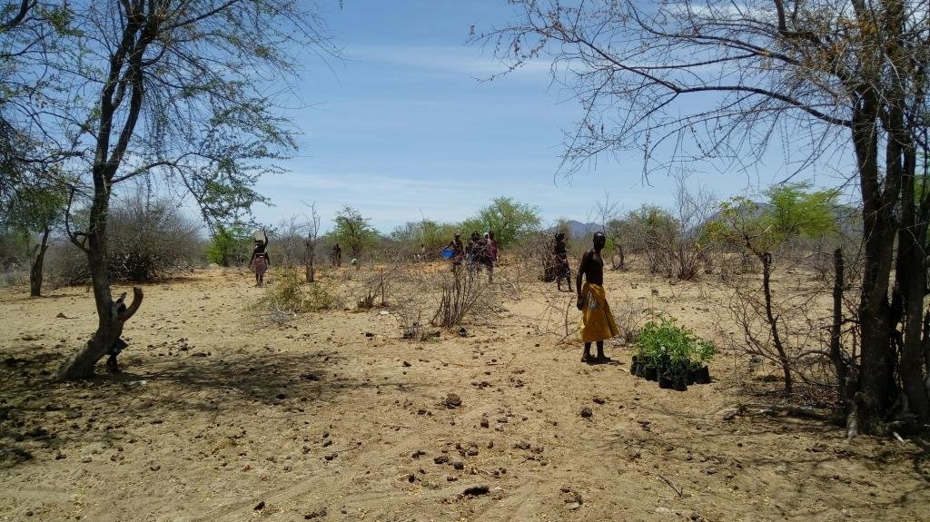
The communities were closely involved in the selection and propagation of plant species for the rehabilitation works. The project field staff also ran field palatability trials with them to confirm that the plants selected met their expectations. These participatory trials were also aimed at enhancing their understanding of livestock nutrition and how it related to animal health. Once the species were chosen, seed was collected by the communities and the Project Technicians, and was multiplied in 32 Agro-Pastoral Field School Nurseries and 2 Government funded Veterinary Research Stations. A total of 15 species were identified, with the grasses Eragrostis superba, Urochloa mosambicensis, and the trees Acacia nilotica, Faidherbia albida, Leucaena leucocephala and Moringa oleifera being the most valued by the communities as forage and multipurpose species. The trees were germinated from seed with success. However, native grass species failed to germinate by standard methods - early field trials having ruled out direct seeding methods. Thus they were multiplied by root division of plants collected from cultivated fields. This avoided removal of grass from natural areas.
As the majority of the areas selected for the rehabilitation works were focused around water points and waterways, the soils were generally alluvial, sandy loams. Precipitation is highest in the areas to the north: it ranges from 600 mm in the upper areas of the Bibala Municipality to 200 mm in the areas to the south in Virei. In general, the vegetation communities could be described as dry sclerophyll woodlands with Colophospermum mopane being the dominant tree species, with forest cover decreasing in height and density as one moves south toward drier areas.
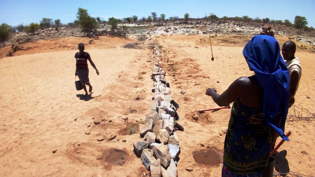
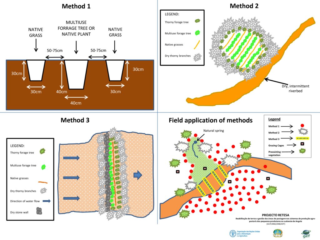
Through close collaboration with the participant communities, three rehabilitation methods were designed and improved upon throughout the Project's duration. Method 1 was used to plant open areas within the rehabilitation zone, Method 2 was employed to introduce and protect concentrated plantings of the selected species in strategic locations within the landscape, and Method 3 was preferred for the recuperation of riparian vegetation and to reduce sediment loads in waterways. The three methods used are described in more detail in the Technical Drawings. To increase the sense of ownership and thus the sustained effectiveness of the rehabilitation works, land management plans and other supporting activities were also carried out.
2.3 Photos de la Technologie
2.5 Pays/ région/ lieux où la Technologie a été appliquée et qui sont couverts par cette évaluation
Pays:
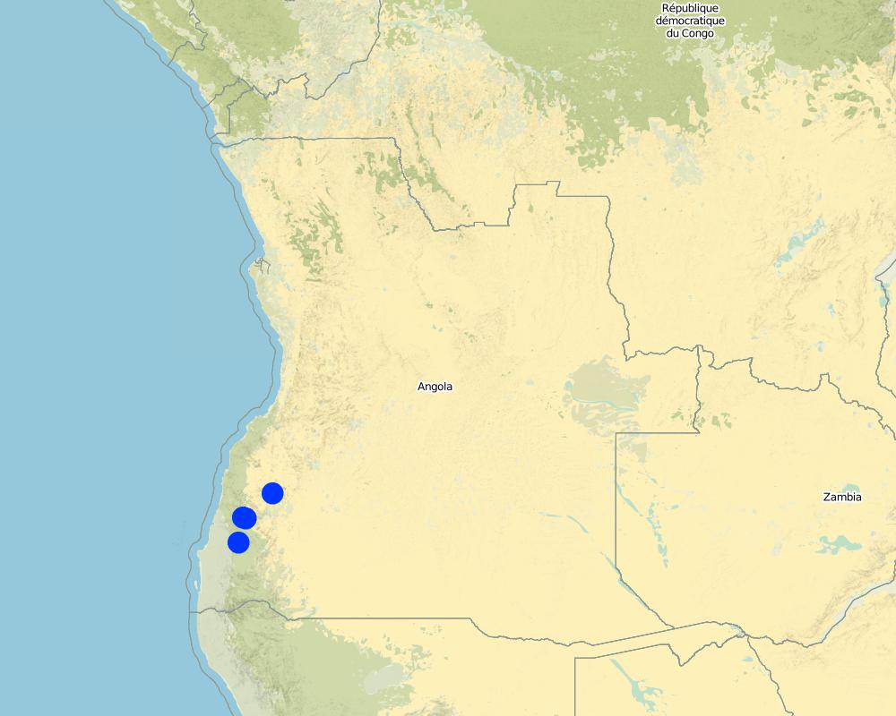
Angola
Région/ Etat/ Province:
Province of Namibe
Autres spécifications du lieu:
Municipalities of Bibala and Virei
Spécifiez la diffusion de la Technologie:
- appliquée en des points spécifiques ou concentrée sur une petite surface
Commentaires:
There are 3 main rehabilitation areas, all within the Namibe Province in Southern Angola.
Planting areas are selected due to their importance and relevance to the local communities. For the most part, the plantings have been centred around key water points. In order to increase impact and scale up the process of rangeland rehabilitation and improvement, management plans are negotiated and agreed upon by the communities through the Green Negotiated Territorial Development Approach (GreeNTD) processes.
Map
×2.6 Date de mise en œuvre de la Technologie
Si l'année précise est inconnue, indiquez la date approximative: :
- il y a moins de 10 ans (récemment)
2.7 Introduction de la Technologie
Spécifiez comment la Technologie a été introduite: :
- par le biais de projets/ d'interventions extérieures
Commentaires (type de projet, etc.) :
The proposed project: “Land rehabilitation and rangelands management in smallholders’ agropastoral production systems in southwestern Angola” (RETESA) is a joint effort by the Ministério do Ambiente (MA), Ministério da Agricultura e do Desenvolvimento Rural e das Pescas (MINANDER), Governo Provincial do Namibe, Governo Provincial do Huila, and Governo Provincial de Benguela, together with FAO and GEF. In line with the GEF-5 Land Degradation strategy, the project’s goal is to create an enhanced enabling environment in the agricultural sector and a sustained flow of agro-ecosystem services.
3. Classification de la Technologie de GDT
3.1 Principal(aux) objectif(s) de la Technologie
- améliorer la production
- réduire, prévenir, restaurer les terres dégradées
- préserver l'écosystème
- conserver/ améliorer la biodiversité
- réduire les risques de catastrophes
- s'adapter au changement et aux extrêmes climatiques et à leurs impacts
- atténuer le changement climatique et ses impacts
- créer un impact économique positif
3.2 Type(s) actuel(s) d'utilisation des terres, là où la Technologie est appliquée

Pâturages
Pâturage extensif:
- Pastoralisme de type semi-nomade
- Transhumance movements
Type d'animal:
- bétail - laitier
- bétail - bovins à viande
- caprine
Produits et services:
- viande
- lait

Voies d'eau, plans d'eau, zones humides
- Voies de drainage, voies d'eau
- Etangs, barrages, retenues d'eau
- Natural springs
Commentaires:
Number of growing seasons per year: 1
Livestock density: Official data is not available and true livestock numbers are unknown.
3.3 Est-ce que l’utilisation des terres a changé en raison de la mise en œuvre de la Technologie ?
Est-ce que l’utilisation des terres a changé en raison de la mise en œuvre de la Technologie ?
- Oui (Veuillez remplir les questions ci-après au regard de l’utilisation des terres avant la mise en œuvre de la Technologie)
Commentaires:
Crop land is increasing in the area as population increases and people move towards more sedimentary livelihoods.
3.4 Approvisionnement en eau
Approvisionnement en eau des terres sur lesquelles est appliquée la Technologie:
- pluvial
3.5 Groupe de GDT auquel appartient la Technologie
- pastoralisme et gestion des pâturages
- Amélioration de la couverture végétale/ du sol
3.6 Mesures de GDT constituant la Technologie

pratiques végétales
- V1: Couverture d’arbres et d’arbustes
- V2: Herbes et plantes herbacées pérennes

modes de gestion
- M2: Changement du niveau de gestion / d'intensification
Commentaires:
The management plans created at the community and administrative level identify a number of large areas which are to serve as 'Grazing Reverses' for the dry season. Therefore, the agreements call for all livestock to abandon the area at the onset of the first rains and not return until the Pastoral Management Forum agrees to open the area for grazing. Once open, the range is available to all pastoralists, those that live in the immediate area and those moving through on their transhumance migration.
3.7 Principaux types de dégradation des terres traités par la Technologie

érosion hydrique des sols
- Wt: perte de la couche superficielle des sols (couche arable)/ érosion de surface
- Wr: érosion des berges

dégradation biologique
- Bc: réduction de la couverture végétale
- Bh: perte d’habitats
- Bq: baisse de la quantité/ biomasse
- Bs: baisse de la qualité et de la composition/ diversité des espèces
- Bl: perte de la vie des sols
3.8 Prévention, réduction de la dégradation ou réhabilitation des terres dégradées
Spécifiez l'objectif de la Technologie au regard de la dégradation des terres:
- réduire la dégradation des terres
- restaurer/ réhabiliter des terres sévèrement dégradées
4. Spécifications techniques, activités, intrants et coûts de mise en œuvre
4.1 Dessin technique de la Technologie
Spécifications techniques (associées au dessin technique):
Planting is typically based on three different methods, as seen in the figure above.
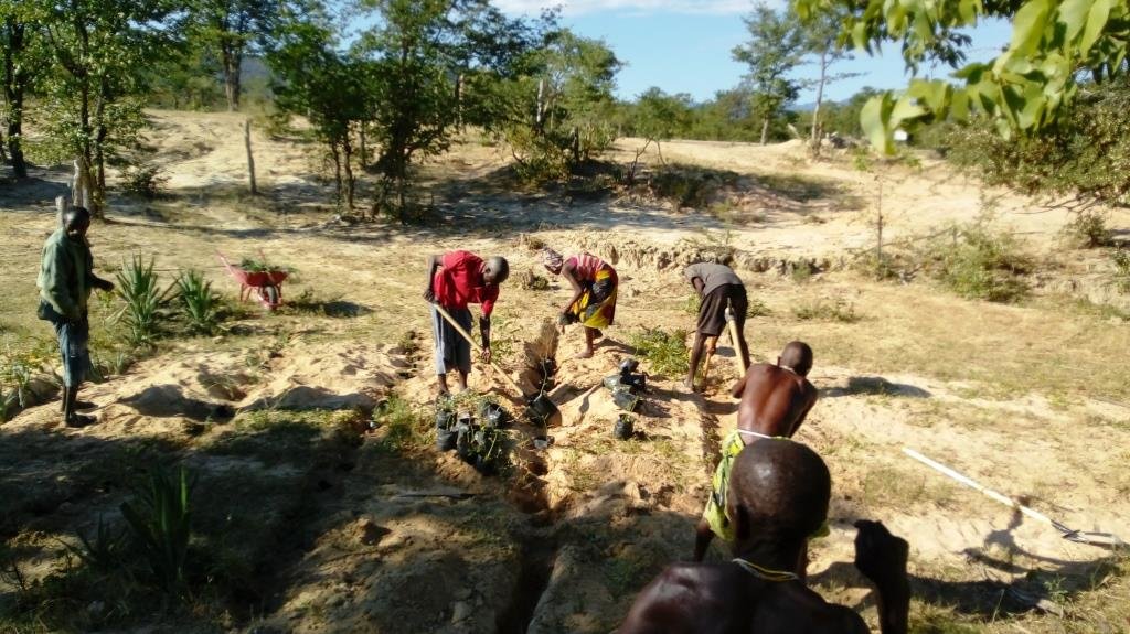
- Method 1 relies on placing a leguminous, multipurpose tree species in the ground with two native grass species to each side of the tree. The holes are dug and a small amount of manure is placed in the bottom of the hole, adding some water if it is readily available. Then the trees and grasses are planted and well-watered. Finally, a branch or two of thorny shrubs or trees are placed over the plants to protect them from being grazed (where possible, dead branches should be used, rather than cutting living plants).
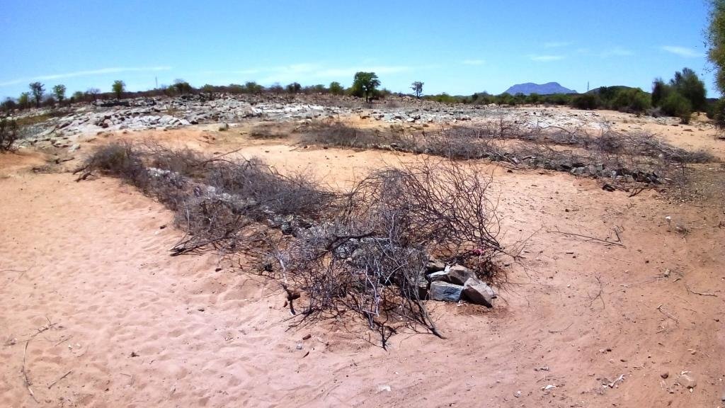
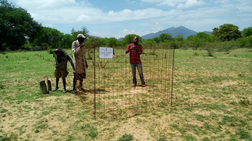
- Method 2 requires the creation of an enclosed, protected area which is then planted at high densities, preferably in low-lying areas where adequate soil moisture is available. Dry, dead branches from thorny trees and shrubs are used to create the enclosures and provide protection to these plantings.
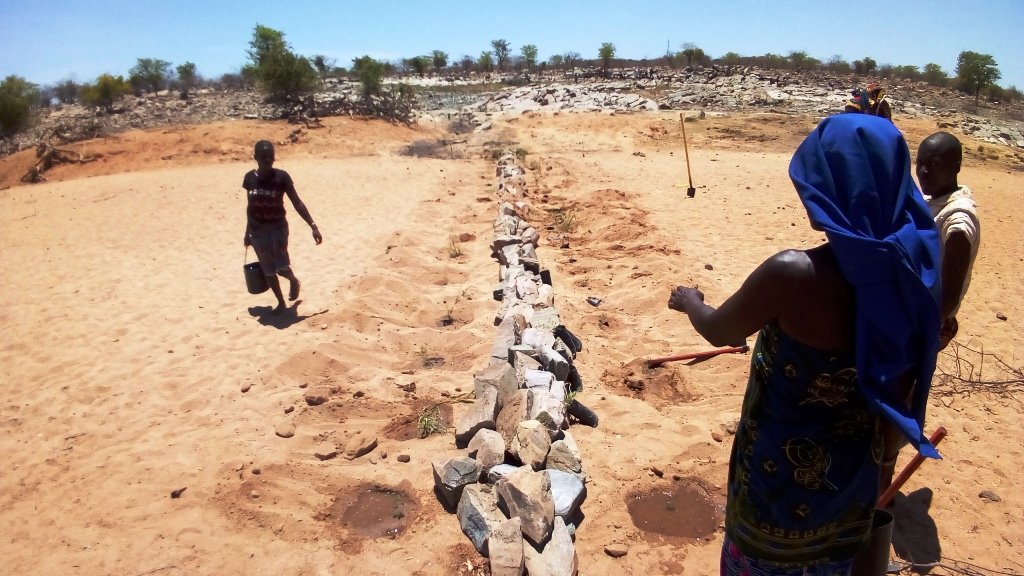
- Method 3 is based on the creation of a 'leaky weir', which is a small stone barrier, horizontal to the flow of water (on the contour) planted with a mixture of native riparian species. This is intended to slow the flow of water and stimulate the recovery of riparian vegetation. The plants are also protected with dry, dead branches from thorny trees and shrubs in this method.
To increase their effectiveness, it is recommended that the three methods be combined within the landscape, as seen in the 4th slide 'Field application of methods'.
Auteur:
Projecto RETESA
Date:
10/01/2018
4.2 Informations générales sur le calcul des intrants et des coûts
Spécifiez la manière dont les coûts et les intrants ont été calculés:
- par entité de la Technologie
Précisez l'unité:
3345 seedlings produced, delivered and planted
Précisez les dimensions de l'unité de terrain (le cas échéant):
3345 units
Indiquez la monnaie utilisée pour le calcul des coûts:
- dollars américains
Indiquez le coût salarial moyen de la main d'œuvre par jour:
6 Dollars
4.3 Activités de mise en place/ d'établissement
| Activité | Calendrier des activités (saisonnier) | |
|---|---|---|
| 1. | Meetings and field visits with participant communities to identify plant species and their uses | Best during growing season |
| 2. | Further meetings to decide on which species are to be multiplied and arrange seed collection | Near end of growing season |
| 3. | Seed collection and transportation | When seed is available (varies with species) |
| 4. | Instalation of irrigation systems | Most communiites need a water extraction and distribution system to create nurseries |
| 5. | Delivery of nursery supplies and instalation of shade cloth | Nurseries should have water access and shade |
| 6. | Planting of seeds and care for seedlings at nursery | Formed part of Agro-Pastoral Farmer Field School activities |
| 7. | Identification of planting areas and timing | Should be at beginning of rainy season, or when soil moisture permits |
| 8. | Organisation of materials and tools | At least 1 week before the planting |
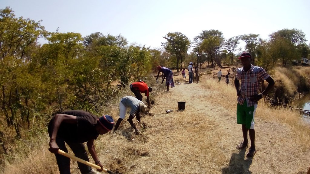
| 9. | Planting day (preparation of planting holes and transplanting of seedlings) | 2 days maximum was seen to be optimal |
| 10. | Watering until the plants are established | Usually a maximum of 3 watering over 1 week after the plantings |
| 11. | Follow up visits to make sure management agreements are being respected and plants are not being eaten by stock until they are ready | Plants should not be grazed for at least 6 months from planting time until they are well established |
Commentaires:
The activities and costs given were those needed to produce and plant 3,345 trees and grasses in the 4 rehabilitation areas. Given that 3,345 plants were produced at a cost of $3284.75, the cost per plant produced and planted in the field is $0.98. Seedlings available through local, government nurseries were $2.00 per unit, but only exotic ornamentals were available. However, it can be expected that in other contexts and locations, it would be cheaper to buy seedlings, instead of training communities and creating numerous small-scale nurseries, though clearly these communities will not ‘own’ the process as well as if they were involved from the beginning.
4.4 Coûts et intrants nécessaires à la mise en place
| Spécifiez les intrants | Unité | Quantité | Coûts par unité | Coût total par intrant | % des coût supporté par les exploitants des terres | |
|---|---|---|---|---|---|---|
| Main d'œuvre | Project Technicians/Drivers/Consultants, etc | Person-days | 30,0 | 20,0 | 600,0 | |
| Main d'œuvre | Plant identification activities and seed collection | Person-days | 10,0 | 6,0 | 60,0 | 100,0 |
| Main d'œuvre | Plant nursery creation and plant production | Person-days | 16,0 | 6,0 | 96,0 | 100,0 |
| Main d'œuvre | Participation during planting days | Person-days | 25,0 | 10,0 | 250,0 | 90,0 |
| Equipements | Vehicle | Trips | 10,0 | 40,0 | 400,0 | |
| Equipements | Nursery supplies (including water system which also supplies water to Farmer Field School) | Materials | 1,0 | 800,0 | 800,0 | 10,0 |
| Equipements | Planting supplies (shovels, hoes, wheelbarrows, etc.) | Materials | 1,0 | 120,0 | 120,0 | |
| Equipements | Other improvements to water point (fencing, cement blocks, cement, hoses, etc.) | Materials | 1,0 | 250,0 | 250,0 | |
| Equipements | Maps (traced onto paper from projected images for management purposes) | Materials | 1,0 | 10,0 | 10,0 | |
| Equipements | Food and Refreshments | Per person | 25,0 | 2,5 | 62,5 | |
| Engrais et biocides | Manure (50 grams per sack, 12.500 sacks) | Kilos | 625,0 | 0,25 | 156,25 | 100,0 |
| Matériaux de construction | Shade-cloth | m2 | 320,0 | 1,5 | 480,0 | |
| Coût total de mise en place de la Technologie | 3284,75 | |||||
| Coût total de mise en place de la Technologie en dollars américains (USD) | 3284,75 | |||||
Si le coût n'est pas pris en charge à 100% par l'exploitant des terres, indiquez qui a financé le coût restant:
Remaining costs were provided by the RETESA Project.
Commentaires:
Production depends on the ability of the pastoral communities to produce viable plants. If they are unable to do so, then plants can be bought from Government funded nurseries, though costs per plant will most rise though it can substitute the need for having to purchase a water supply system. The total shown here reflects a percentage (16%) of the costs of installing a water system that supplied water to the whole of the Agro-Pastoral Farmer Field School. These systems usually included a 10,000 litre water tank, a gasoline water pump, extraction pipe and parts, 100 to 200 mts of 1.5" hoses and parts and 3 kms of drip irrigation hose.
4.5 Activités d'entretien/ récurrentes
| Activité | Calendrier/ fréquence | |
|---|---|---|
| 1. | Meetings to ensure management agreements are being respected. | Once every 3 to 6 months, especially before and after rainy season. |
| 2. | Repairs and replacement of nursery supplies. | Once a year. |
| 3. | Replanting of dead seedlings | Just before and during rainy season. |
4.6 Coûts et intrants nécessaires aux activités d'entretien/ récurrentes (par an)
| Spécifiez les intrants | Unité | Quantité | Coûts par unité | Coût total par intrant | % des coût supporté par les exploitants des terres | |
|---|---|---|---|---|---|---|
| Main d'œuvre | Visits to sites and tour of planting areas. | Person-days | 4,0 | 20,0 | 80,0 | 50,0 |
| Main d'œuvre | Driver. | Person-days | 1,0 | 20,0 | 20,0 | |
| Main d'œuvre | Replanting of dead seedlings | Person-days | 2,0 | 6,0 | 12,0 | 100,0 |
| Main d'œuvre | Watering | Person-days | 14,0 | 6,0 | 84,0 | 100,0 |
| Equipements | Vehicle | Trips | 1,0 | 40,0 | 40,0 | |
| Equipements | Watering cans and buckets | Materials | 4,0 | 5,0 | 20,0 | |
| Coût total d'entretien de la Technologie | 256,0 | |||||
| Coût total d'entretien de la Technologie en dollars américains (USD) | 256,0 | |||||
Si le coût n'est pas pris en charge à 100% par l'exploitant des terres, indiquez qui a financé le coût restant:
The RETESA Project provided an important part of both material and technical support to the communities, though the communities also contributed substantially.
4.7 Facteurs les plus importants affectant les coûts
Décrivez les facteurs les plus importants affectant les coûts :
The activities and costs given were those needed to produce and plant 3,345 trees and grasses in the 4 rehabilitation areas. Given that 3.345 plants were produced at a cost of $3284.75, the cost per plant produced and planted in the field is $0.98. Seedlings avaliable through local, government nurseries were $2.00 per unit, but only exotic ornamentals were avaliable. However, it can be expected that in other contexts and locations, it would be cheaper to buy seedlings instead of training communities and creating numerous small scale nurseries, though clearly these communities will not appropriate the process as well as if they were involved from the beginning.
5. Environnement naturel et humain
5.1 Climat
Précipitations annuelles
- < 250 mm
- 251-500 mm
- 501-750 mm
- 751-1000 mm
- 1001-1500 mm
- 1501-2000 mm
- 2001-3000 mm
- 3001-4000 mm
- > 4000 mm
Spécifications/ commentaires sur les précipitations:
In the past, the rainy season started in October or November and ran until May. However, the rains in the last few years have fallen in January to April.
Indiquez le nom de la station météorologique de référence considérée:
None in the area.
Zone agro-climatique
- semi-aride
5.2 Topographie
Pentes moyennes:
- plat (0-2 %)
- faible (3-5%)
- modéré (6-10%)
- onduleux (11-15%)
- vallonné (16-30%)
- raide (31-60%)
- très raide (>60%)
Reliefs:
- plateaux/ plaines
- crêtes
- flancs/ pentes de montagne
- flancs/ pentes de colline
- piémonts/ glacis (bas de pente)
- fonds de vallée/bas-fonds
Zones altitudinales:
- 0-100 m
- 101-500 m
- 501-1000 m
- 1001-1500 m
- 1501-2000 m
- 2001-2500 m
- 2501-3000 m
- 3001-4000 m
- > 4000 m
Indiquez si la Technologie est spécifiquement appliquée dans des:
- non pertinent
Commentaires et précisions supplémentaires sur la topographie:
Usually the planting are undertaken along river plains and river banks, as they are the only areas that have the necessary soil moisture to ensure survival of the seedlings.
5.3 Sols
Profondeur moyenne du sol:
- très superficiel (0-20 cm)
- superficiel (21-50 cm)
- modérément profond (51-80 cm)
- profond (81-120 cm)
- très profond (>120 cm)
Texture du sol (de la couche arable):
- grossier/ léger (sablonneux)
Texture du sol (> 20 cm sous la surface):
- grossier/ léger (sablonneux)
Matière organique de la couche arable:
- faible (<1%)
5.4 Disponibilité et qualité de l'eau
Profondeur estimée de l’eau dans le sol:
< 5 m
Disponibilité de l’eau de surface:
faible/ absente
Qualité de l’eau (non traitée):
faiblement potable (traitement nécessaire)
La salinité de l'eau est-elle un problème? :
Oui
Précisez:
Many bores and wells cannot be used due to Salinity problems. Before planting, it is wise to make sure soil salinity is not problematic in areas identified.
La zone est-elle inondée?
Oui
Régularité:
épisodiquement
Commentaires et précisions supplémentaires sur la qualité et la quantité d'eau:
Water quality and quantity are major issues for the area. There are few if any reliable water sources in the area and most communities depend on wells dug in the river bottoms to supply their water.
5.5 Biodiversité
Diversité des espèces:
- moyenne
Diversité des habitats:
- faible
Commentaires et précisions supplémentaires sur la biodiversité:
The area is devoid of most wild animals due to the years of war the country experienced during the second half of the 20th century.
5.6 Caractéristiques des exploitants des terres appliquant la Technologie
Sédentaire ou nomade:
- Semi-nomade
Orientation du système de production:
- subsistance (auto-approvisionnement)
Revenus hors exploitation:
- 10-50% de tous les revenus
Niveau relatif de richesse:
- très pauvre
Individus ou groupes:
- individu/ ménage
Niveau de mécanisation:
- travail manuel
Genre:
- femmes
- hommes
Age des exploitants des terres:
- jeunes
- personnes d'âge moyen
Indiquez toute autre caractéristique pertinente des exploitants des terres:
The communities are still traditional though are currently being influenced by the globalisation process.
5.7 Superficie moyenne des terres utilisées par les exploitants des terres appliquant la Technologie
- < 0,5 ha
- 0,5-1 ha
- 1-2 ha
- 2-5 ha
- 5-15 ha
- 15-50 ha
- 50-100 ha
- 100-500 ha
- 500-1 000 ha
- 1 000-10 000 ha
- > 10 000 ha
Cette superficie est-elle considérée comme de petite, moyenne ou grande dimension (en se référant au contexte local)?
- grande dimension
Commentaires:
Agricultural plots are considered private and are usually between 1 to 2 hectares, though grazing land, which makes up the majority of the area, is still commonly owned and covers vast areas.
5.8 Propriété foncière, droits d’utilisation des terres et de l'eau
Propriété foncière:
- communauté/ village
Droits d’utilisation des terres:
- accès libre (non organisé)
Droits d’utilisation de l’eau:
- accès libre (non organisé)
5.9 Accès aux services et aux infrastructures
santé:
- pauvre
- modéré
- bonne
éducation:
- pauvre
- modéré
- bonne
assistance technique:
- pauvre
- modéré
- bonne
emploi (par ex. hors exploitation):
- pauvre
- modéré
- bonne
marchés:
- pauvre
- modéré
- bonne
énergie:
- pauvre
- modéré
- bonne
routes et transports:
- pauvre
- modéré
- bonne
eau potable et assainissement:
- pauvre
- modéré
- bonne
services financiers:
- pauvre
- modéré
- bonne
6. Impacts et conclusions
6.1 Impacts sur site que la Technologie a montrés
Impacts socio-économiques
Production
production fourragère
Quantité avant la GDT:
Low rangeland production
Quantité après la GDT:
Slight improvement
Commentaires/ spécifiez:
Difficult to measure. Rehabilitation works and the management plans for the rangeland areas have led to some improvement, though the droughts affecting the area during the interventions significantly affected rangeland fodder production.
qualité des fourrages
Quantité avant la GDT:
No crop residues or fodder plantings used
Quantité après la GDT:
Crop residues and fodder plantings incorporated in cropping areas
Commentaires/ spécifiez:
The process allowed Project Technicians to educate communities on the use of crop residues as fodder and the planting of multiuse trees within cropping areas to provide green fodder in the dry season. The reintroduction of drought tolerant, quality indigenous grasses should also lead an increase in fodder production over the coming year.
production animale
Quantité avant la GDT:
No planning for dry season grazing, apart from transhumance movements
Quantité après la GDT:
Crop residues and other cultivated forages produced for those animals that stay
Commentaires/ spécifiez:
The transhumance movements of livestock are still seen as the most adequate solution to changes in natural rangeland production, though most families leave behind some animals with the main family unit. These animals are now receiving the quality feed they need to remain productive and healthy.
gestion des terres
Quantité avant la GDT:
No management plans in place for commonly managed natural resources
Quantité après la GDT:
Participatory land management plans have been negociated and agreed
Commentaires/ spécifiez:
Simplified land management plans based on traditional livestock movements and cropping seasons have been negotiated and agreed by local stakeholders and municipal Administrators.
Disponibilité et qualité de l'eau
qualité de l'eau potable
Quantité avant la GDT:
Livestock and communities drink from same water
Quantité après la GDT:
Separate water drinking points for livestock and community
Commentaires/ spécifiez:
Unrestricted access of livestock to community domestic water points led to waterborne diseases and poor water quality. Separating livestock and domestic use has improved community health.
disponibilité de l'eau pour l'élevage
Commentaires/ spécifiez:
In addition to restricting livestock access to main water bodies, new drinking troughs have been built with community support.
qualité de l'eau pour l'élevage
Commentaires/ spécifiez:
By separating livestock drinking points and domestic water points, waterborne illnesses have been reduced. In at least one area a water tank and new drinking trough have been built with community support.
Impacts socioculturels
connaissances sur la GDT/ dégradation des terres
Quantité avant la GDT:
No education or training on land degradation
Quantité après la GDT:
Education and training on land degradation issues and rehabilitation methods
Commentaires/ spécifiez:
The majority of communities that have gone through the process now understand how poor land management leads to land degradation and steps they can take to reduce it.
Impacts écologiques
Cycle de l'eau/ ruissellement
quantité d'eau
Commentaires/ spécifiez:
Improved ground cover and the return of riparian vegetation would increase infiltration rates and decrease evapotranspiration rates and restore the micro water cycle. But this is also a long term process.
qualité de l'eau
Quantité avant la GDT:
Low
Quantité après la GDT:
Low in short term, improved in long term
Commentaires/ spécifiez:
Revegetation of river plains and river banks should lead to improved water quality though it will be a long term effect if the rehabilitation areas are respected.
ruissellement de surface
Quantité avant la GDT:
No method to deal with the high surface runoff rates in the area
Quantité après la GDT:
A method has been devised for reducing surface runoff rates.
Commentaires/ spécifiez:
The 'leaky weir' method (Rehabilitation method 3) has shown promise over the duration of the Project and could be applied at other landscape levels to reduce surface runoff.
Sols
couverture du sol
Commentaires/ spécifiez:
The reintroduction of native grasses in the area should lead to improved ground cover, binding the soil and reducing erosion rates.
perte en sol
Commentaires/ spécifiez:
The reintroduction of native grasses in the area should lead to improved ground cover ratios, binding the soil and reducing erosion rates.
cycle/ recharge des éléments nutritifs
Commentaires/ spécifiez:
Proper livestock management also ensures that manure is properly and evenly distributed in the field.
Biodiversité: végétale, animale
Couverture végétale
Quantité avant la GDT:
Reduced number of poor quality grass species
Quantité après la GDT:
Communities capacitated in plant multiplication methods
Commentaires/ spécifiez:
Apart from the rehabilitation works themselves, the local communities have been capacitated with methods to approach and deal with land degradation.
biomasse/ au dessus du sol C
diversité végétale
Commentaires/ spécifiez:
The reintroduction of native and leguminous plants has improved plant diversity both within rehabilitation areas and cultivated lands.
Réduction des risques de catastrophe et des risques climatiques
impacts de la sécheresse
microclimat
Commentaires/ spécifiez:
The works around the water points over time should lead to increase in vegetative cover, shade, habitat and reduced temperatures.
6.2 Impacts hors site que la Technologie a montrés
capacité tampon/de filtration
6.3 Exposition et sensibilité de la Technologie aux changements progressifs et aux évènements extrêmes/catastrophes liés au climat (telles que perçues par les exploitants des terres)
Changements climatiques progressifs
Changements climatiques progressifs
| Saison | Augmentation ou diminution | Comment la Technologie fait-elle face à cela? | |
|---|---|---|---|
| précipitations annuelles | décroît | bien | |
| précipitations saisonnières | printemps | décroît | bien |
6.4 Analyse coûts-bénéfices
Quels sont les bénéfices comparativement aux coûts de mise en place (du point de vue des exploitants des terres)?
Rentabilité à court terme:
neutre / équilibrée
Rentabilité à long terme:
positive
Quels sont les bénéfices comparativement aux coûts d'entretien récurrents (du point de vue des exploitants des terres)?
Rentabilité à court terme:
neutre / équilibrée
Rentabilité à long terme:
positive
6.5 Adoption de la Technologie
- cas isolés/ expérimentaux
De tous ceux qui ont adopté la Technologie, combien d'entre eux l'ont fait spontanément, à savoir sans recevoir aucune incitation matérielle, ou aucune rémunération? :
- 0-10%
6.6 Adaptation
La Technologie a-t-elle été récemment modifiée pour s'adapter à l'évolution des conditions?
Non
6.7 Points forts/ avantages/ possibilités de la Technologie
| Points forts/ avantages/ possibilités du point de vue de l'exploitant des terres |
|---|
| Communities learn about plants' role in the wider ecosystem, how to select and multiply key fruit, fodder or timber species and should see an increase in their horticultural and livestock production, leading to improved nutrition or income. |
| Done properly, it can be a cost-effective and reliable way to produce the plants needed within family units. |
| Points forts/ avantages/ possibilités du point de vue du compilateur ou d'une autre personne ressource clé |
|---|
| When the plants are produced in collaboration with the local pastoral communities, the benefits are wide ranging, promoting everything from environmental awareness to technical and practical knowledge. |
| It remains a cost-effective way of improving key productive species and increasing community resilience. |
| Increasing biomass and introducing better management cycles contribute to reducing land degradation and improve nutrient and energy cycling. |
6.8 Faiblesses/ inconvénients/ risques de la Technologie et moyens de les surmonter
| Faiblesses/ inconvénients/ risques du point de vue de l’exploitant des terres | Comment peuvent-ils être surmontés? |
|---|---|
| Can require stable supply of water, and labour costs can increase if water sources are not easily accessible. | Locate nurseries near reliable and accessible water sources. |
| Can require permanent residence, so as to be able to care for plants until they are developed and placed in the ground at the proper date in the calendar (before or during rainy season). | Not easy in nomadic cultures. |
| Early attempts often fail to produce lasting results. | Concentrate early efforts on small experimental plots so as to fine-tune planting methods and timing. |
| Faiblesses/ inconvénients/ risques du point de vue du compilateur ou d'une autre personne ressource clé | Comment peuvent-ils être surmontés? |
|---|---|
| The technology is usually not suitable for large areas of land (>1,000 hectares). | Compliment any rehabilitation efforts with improved management plans which are developed with stakeholder input and approval. |
| Plant losses are typically high, especially if rains fail to arrive, or if the year is abnormally dry. | Watch weather forecast to try and focus planting campaigns on those days with a high probability of rain. |
| Local species are often not valued by local officials and technicians, leading to a predominance of exotic species in rehabilitation works. | Undertake awareness and training sessions which highlight the value and uses of native species with local land users and administrative officials. |
7. Références et liens
7.1 Méthodes/ sources d'information
- visites de terrain, enquêtes sur le terrain
The Project has a number of activities in the communities where the technology was used so there were numerous visits and interviews.
- interviews/entretiens avec les exploitants des terres
Various information and survey methods were used throughout the RETESA Project, providing a solid basis from which to involve landusers and SLM specialists in decisionmaking processes.
- interviews/ entretiens avec les spécialistes/ experts de GDT
3 SLM specialists.
Quand les données ont-elles été compilées (sur le terrain)?
15/05/2017
7.3 Liens vers les informations pertinentes en ligne
Titre/ description:
FAO in Action: Using indigenous knowledge to reverse land degradation in Angola.
URL:
http://www.fao.org/in-action/using-indigenous-knowledge-to-reverse-land-degradation-in-angola/en/
Liens et modules
Développer tout Réduire toutLiens
Aucun lien
Modules
Aucun module trouvé


