Intensive agroforestry system [Colombie]
- Création :
- Mise à jour :
- Compilateur : Mathias Gurtner
- Rédacteur : –
- Examinateurs : Deborah Niggli, Alexandra Gavilano
Silvoagricultura (spanish)
technologies_1023 - Colombie
Voir les sections
Développer tout Réduire tout1. Informations générales
1.2 Coordonnées des personnes-ressources et des institutions impliquées dans l'évaluation et la documentation de la Technologie
Nom du projet qui a facilité la documentation/ l'évaluation de la Technologie (si pertinent)
Book project: where the land is greener - Case Studies and Analysis of Soil and Water Conservation Initiatives Worldwide (where the land is greener)1.3 Conditions relatives à l'utilisation par WOCAT des données documentées
Le compilateur et la(les) personne(s) ressource(s) acceptent les conditions relatives à l'utilisation par WOCAT des données documentées:
Oui
1.4 Déclaration sur la durabilité de la Technologie décrite
Est-ce que la Technologie décrite ici pose problème par rapport à la dégradation des terres, de telle sorte qu'elle ne peut pas être déclarée comme étant une technologie de gestion durable des terres?
Non
1.5 Référence au(x) Questionnaires sur les Approches de GDT (documentées au moyen de WOCAT)
Desarrollo Rural Integral Comunitario [Colombie]
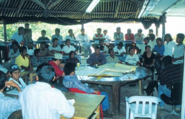
En un proceso participativo y comunitario y a través de la capacitación, la asistencia técnica y la suministración de insumos importantes se fomenta el establecimiento de un sistema agrosilicultural en la comunidad indÃgena.
- Compilateur : Mathias Gurtner
2. Description de la Technologie de GDT
2.1 Courte description de la Technologie
Définition de la Technologie:
A protective and productive high-input agroforestry system comprising multi-purpose ditches with bunds, live barriers of grass, contour ridging,
annual crops and fruit trees.
2.2 Description détaillée de la Technologie
Description:
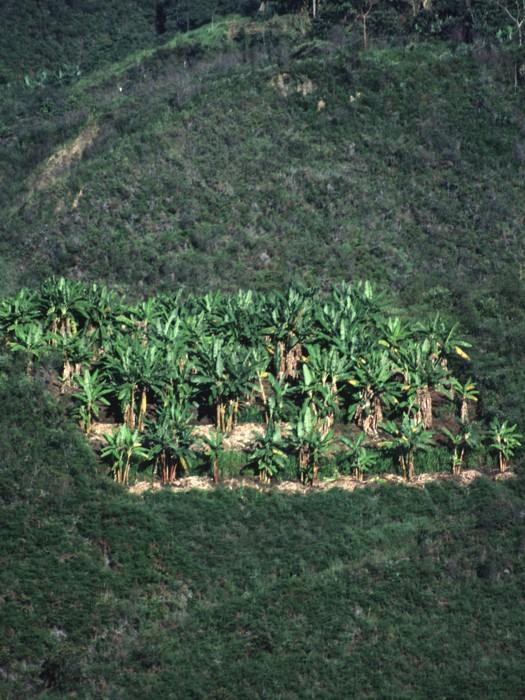
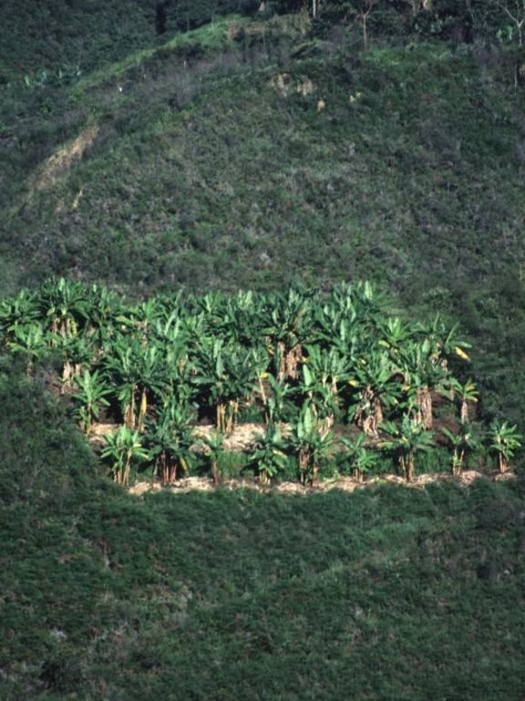
The intensive agroforestry system (silvoagricultura) combines traditional and newly developed practices adapted to the area’s conditions. The idea is to concentrate cropping on a limited area, a plot of 0.4 ha per household, in a highly integrated, intensive and diversified continuous land use system, thereby integrating soil and water conservation - specifically avoiding traditional slash and burn practices.
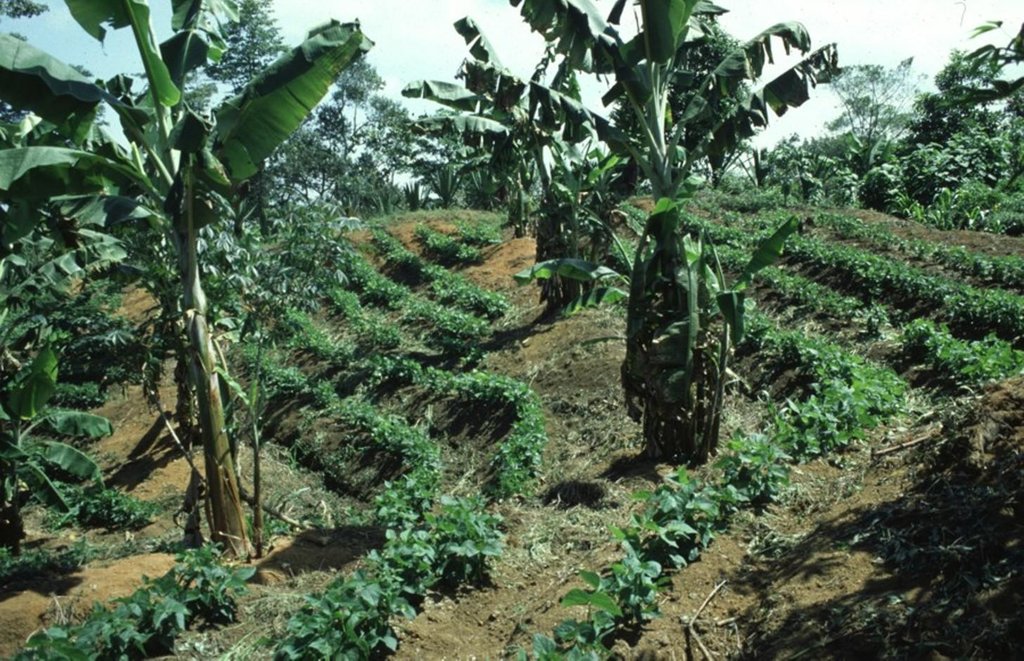
Each ‘agroforestry plot’ comprises four to five 50 cm wide and 40 m long multipurpose ditches that are excavated along the contour, 6 to 12 m apart, depending on the slope. The ditches retain runoff water which infiltrates the soil, thus reducing erosion and improving soil moisture. They also act as compost ditches for all types of organic residues on the farm. Residues, enriched with manure (from chickens and guinea pigs) are tipped into the ditches, and within 8 to12 months this decomposes into a fertile medium for the cultivation of vegetables and other crops.
The main purpose is to increase and diversify production, and at the same time to protect natural resources and regenerate degraded areas.
Grass strips are planted on the earth bund on the upper side of the ditch for stabilisation of the structure, retention of runoff and capture of eroded sediment. The grass is cut several times a year to feed guinea pigs, which in turn recycle this into manure. On the lower side of the contour ditches, fruit trees and bananas are planted. Rows of multipurpose trees (mainly indigenous species) are planted around each agroforestry plot as a windbreak and for economic reasons: yielding fruit and timber. Between the structures, annual (and semi-perennial) crops are grown on hand-dug micro-terraces/ridges, again sited along the contour. Some farmers intercrop with legumes. Supportive technologies are protection of wells,
afforestation and, where possible, irrigation to enhance production. Production is based on principles of organic farming.High initial inputs of external manure are subsidised by the project (CISEC; see associated approach). The remainder of each farmer’s land is left to natural regeneration, reforested, or where needed, used for conventional cropping
The system is implemented on degraded and often steep slopes in subhumid areas where intensive rainfall and dry periods alternate. The land is officially owned communally (an ‘Indigenous Reserve’), but land use rights are individual. The region has a high population density: people are basically of indigenous origin and live in very poor conditions.
2.3 Photos de la Technologie
2.5 Pays/ région/ lieux où la Technologie a été appliquée et qui sont couverts par cette évaluation
Pays:
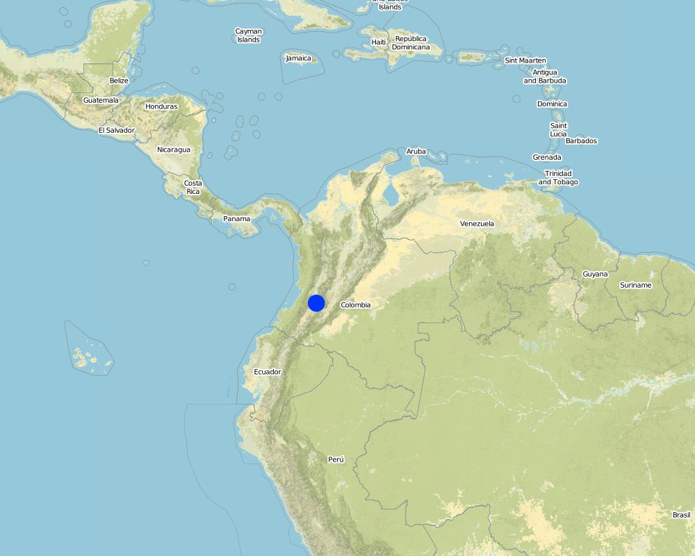
Colombie
Région/ Etat/ Province:
Cauca
Autres spécifications du lieu:
Santander de Quilichao
Spécifiez la diffusion de la Technologie:
- répartie uniformément sur une zone
Si la Technologie est uniformément répartie sur une zone, précisez la superficie couverte (en km2):
1,2
Commentaires:
Total area covered by the SLM Technology is 1.2 km2.
Map
×2.7 Introduction de la Technologie
Spécifiez comment la Technologie a été introduite: :
- par le biais de projets/ d'interventions extérieures
3. Classification de la Technologie de GDT
3.1 Principal(aux) objectif(s) de la Technologie
- améliorer la production
- réduire, prévenir, restaurer les terres dégradées
3.2 Type(s) actuel(s) d'utilisation des terres, là où la Technologie est appliquée
Les divers types d'utilisation des terres au sein du même unité de terrain: :
Oui
Précisez l'utilisation mixte des terres (cultures/ pâturages/ arbres):
- Agroforesterie

Terres cultivées
- Cultures annuelles
- Plantations d’arbres ou de buissons
Précisez:
Longest growing period in days: 240, Longest growing period from month to month: october untill may
Est-ce que les cultures intercalaires sont pratiquées?
Oui
Commentaires:
Major land use problems (compiler’s opinion): - soil degradation/reduced soil fertility
- inappropriate soil management: monoculture, slash and burn, no or short fallow periods
- intensive rainfall on steep, unprotected slopes
- drought and wind erosion in dry season
- lack of economic resources
- high population density
3.4 Approvisionnement en eau
Approvisionnement en eau des terres sur lesquelles est appliquée la Technologie:
- pluvial
3.5 Groupe de GDT auquel appartient la Technologie
- agroforesterie
- Amélioration de la couverture végétale/ du sol
- mesures en travers de la pente
3.6 Mesures de GDT constituant la Technologie

pratiques agronomiques
- A1: Couverture végétale/ du sol

pratiques végétales
- V1: Couverture d’arbres et d’arbustes
- V2: Herbes et plantes herbacées pérennes

structures physiques
- S2: Diguettes, digues
- S3: Fossés étagés, canaux, voies d'eau
- S4: Fossés isohypses, trous
Commentaires:
Type of agronomic measures: mixed cropping / intercropping, manure / compost / residues
3.7 Principaux types de dégradation des terres traités par la Technologie

érosion hydrique des sols
- Wt: perte de la couche superficielle des sols (couche arable)/ érosion de surface

érosion éolienne des sols
- Et: perte de la couche superficielle des sols (couche arable)

dégradation chimique des sols
- Cn: baisse de la fertilité des sols et réduction du niveau de matière organique (non causée par l’érosion)
Commentaires:
Main causes of degradation: crop management (annual, perennial, tree/shrub) (inadequate management of land with steep slopes), overgrazing (prior degradation by landowner's livestock), industrial activities and mining (degradation of gold mining and other products), education, access to knowledge and support services, inter-generational subdivision of land (traditional custom)
Secondary causes of degradation: deforestation / removal of natural vegetation (incl. forest fires) (primary forest alomst disappeared), poverty / wealth (lack of capital, poverty and further agricultural employers)
3.8 Prévention, réduction de la dégradation ou réhabilitation des terres dégradées
Spécifiez l'objectif de la Technologie au regard de la dégradation des terres:
- réduire la dégradation des terres
4. Spécifications techniques, activités, intrants et coûts de mise en œuvre
4.1 Dessin technique de la Technologie
Spécifications techniques (associées au dessin technique):
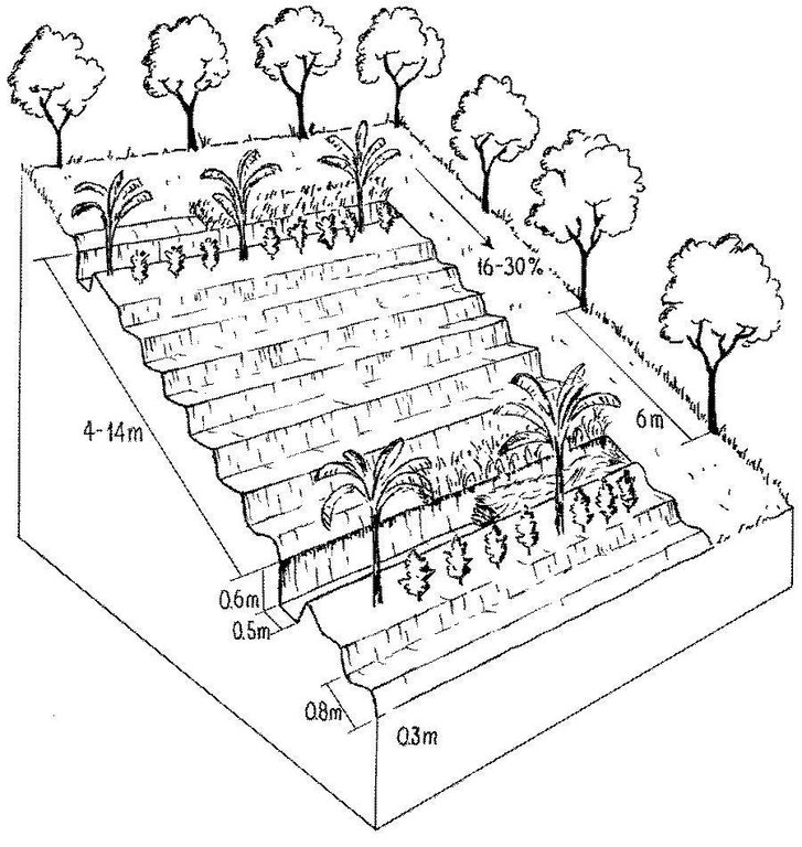
Detailed overview of the complex and intensive high-input, high output agroforestry system, usually limited to an area of 64 x 64 metres.
The agroforestry plots are bordered by trees of various species. Note the multipurpose ditches that serve as compost pits (lower ditch, right). Associated bunds are covered by grass (right).
Technical knowledge required for field staff / advisors: high
Technical knowledge required for land users: moderate
Main technical functions: control of raindrop splash, control of dispersed runoff: impede / retard, reduction of slope length, increase in organic matter, increase in nutrient availability (supply, recycling,…), increase / maintain water stored in soil
Secondary technical functions: reduction of slope angle, improvement of ground cover, increase of infiltration, sediment retention / trapping, sediment harvesting, reduction in wind speed
Vegetative measure: bananas
Vegetative material: F : fruit trees / shrubs
Vegetative measure: Vegetative material: F : fruit trees / shrubs
Slope (which determines the spacing indicated above): 16-30%
Auteur:
Mats Gurtner
4.3 Activités de mise en place/ d'établissement
| Activité | Calendrier des activités (saisonnier) | |
|---|---|---|
| 1. | 1. Clear land (only slashing, no burning). | Beginning of rainy season (April) |
| 2. | 2. Determine contours with A-frame, spacing between structures dependson slope (4 m between ditches on steepest slopes, 14 m on gentle slopes). | Beginning of rainy season (April) |
| 3. | 3. Dig ditches, build bunds above, and dig holes for tree seedlings. | Beginning of rainy season (April) |
| 4. | 4. Establish micro-terraces/ridges (earth enriched with manure and residues:all structures along the contour). | During the dry season (June to September) |
| 5. | 6. Plant grass strips on the bund (for stabilisation of structure). | During the dry season (June to September) |
| 6. | 7. Plant fruit/banana trees and legumes below the bunds. | During the dry season (June to September) |
| 7. | 8. Plant fruit and timber trees along the boundaries of the agroforestry | During the dry season (June to September) |
4.4 Coûts et intrants nécessaires à la mise en place
| Spécifiez les intrants | Unité | Quantité | Coûts par unité | Coût total par intrant | % des coût supporté par les exploitants des terres | |
|---|---|---|---|---|---|---|
| Main d'œuvre | labour | ha | 1,0 | 220,0 | 220,0 | 100,0 |
| Matériel végétal | seeds | ha | 1,0 | 15,0 | 15,0 | 5,0 |
| Matériel végétal | seedlings | ha | 1,0 | 450,0 | 450,0 | 5,0 |
| Engrais et biocides | compost/manure | ha | 1,0 | 600,0 | 600,0 | 5,0 |
| Coût total de mise en place de la Technologie | 1285,0 | |||||
| Coût total de mise en place de la Technologie en dollars américains (USD) | 1285,0 | |||||
Commentaires:
Duration of establishment phase: 12 month(s)
4.5 Activités d'entretien/ récurrentes
| Activité | Calendrier/ fréquence | |
|---|---|---|
| 1. | 5. Fill ditches with organic residues, adding earth mixed with manure. | During the dry season (June to September) / initial establishment |
| 2. | 4. Fill ditches with organic material, residues (after harvest), manure, etcand let it decompose. | |
| 3. | 6. Dig out compost and spread | (beginning of growing season (September) / |
| 4. | 7. Apply additional fertilizer/manure | / 3 times/year |
| 5. | 1. Cut grass ( grass used to feed guinea pigs). | /4–6 times/year |
| 6. | 2. Control weeds | /3 times/year |
| 7. | 5. Plant vegetables on fertile composted earth in ditches | /dry season, optional |
| 8. | 8. Plant various crops: contour cropping, intercropping, integrate greenmanures (legumes). | |
| 9. | 3. Rebuild/repair structures | dry season |
4.6 Coûts et intrants nécessaires aux activités d'entretien/ récurrentes (par an)
| Spécifiez les intrants | Unité | Quantité | Coûts par unité | Coût total par intrant | % des coût supporté par les exploitants des terres | |
|---|---|---|---|---|---|---|
| Main d'œuvre | labour | ha | 1,0 | 100,0 | 100,0 | 100,0 |
| Engrais et biocides | biocides | ha | 1,0 | 45,0 | 45,0 | 100,0 |
| Coût total d'entretien de la Technologie | 145,0 | |||||
| Coût total d'entretien de la Technologie en dollars américains (USD) | 145,0 | |||||
Commentaires:
Machinery/ tools: machete, shovel, pickaxes, A-frame, planting stick (chuzo)
As an exception in this case study costs are calculated per plot and not per ha, since establishment is strictly limited
to an area of 0.4 ha per household. The remaining area is not treated but left for natural regeneration of vegetation or
conventional farming (if needed). Labour costs vary according to slope: a typical/average situation is given in the tables above (no further details available). Note that for comparison purposes with other technologies on a per hectare basis these costs would equate to US$ 3,135 for establishment and US$ 355 for maintenance.
5. Environnement naturel et humain
5.1 Climat
Précipitations annuelles
- < 250 mm
- 251-500 mm
- 501-750 mm
- 751-1000 mm
- 1001-1500 mm
- 1501-2000 mm
- 2001-3000 mm
- 3001-4000 mm
- > 4000 mm
Zone agro-climatique
- subhumide
Thermal climate class: tropics
5.2 Topographie
Pentes moyennes:
- plat (0-2 %)
- faible (3-5%)
- modéré (6-10%)
- onduleux (11-15%)
- vallonné (16-30%)
- raide (31-60%)
- très raide (>60%)
Reliefs:
- plateaux/ plaines
- crêtes
- flancs/ pentes de montagne
- flancs/ pentes de colline
- piémonts/ glacis (bas de pente)
- fonds de vallée/bas-fonds
Zones altitudinales:
- 0-100 m
- 101-500 m
- 501-1000 m
- 1001-1500 m
- 1501-2000 m
- 2001-2500 m
- 2501-3000 m
- 3001-4000 m
- > 4000 m
5.3 Sols
Profondeur moyenne du sol:
- très superficiel (0-20 cm)
- superficiel (21-50 cm)
- modérément profond (51-80 cm)
- profond (81-120 cm)
- très profond (>120 cm)
Texture du sol (de la couche arable):
- grossier/ léger (sablonneux)
- moyen (limoneux)
Matière organique de la couche arable:
- abondant (>3%)
- moyen (1-3%)
5.6 Caractéristiques des exploitants des terres appliquant la Technologie
Orientation du système de production:
- subsistance (auto-approvisionnement)
- exploitation mixte (de subsistance/ commerciale)
Revenus hors exploitation:
- moins de 10% de tous les revenus
Niveau de mécanisation:
- travail manuel
Indiquez toute autre caractéristique pertinente des exploitants des terres:
Off-farm income specification: most farmers depend economically entirely on their own crop production
5.7 Superficie moyenne des terres utilisées par les exploitants des terres appliquant la Technologie
- < 0,5 ha
- 0,5-1 ha
- 1-2 ha
- 2-5 ha
- 5-15 ha
- 15-50 ha
- 50-100 ha
- 100-500 ha
- 500-1 000 ha
- 1 000-10 000 ha
- > 10 000 ha
5.8 Propriété foncière, droits d’utilisation des terres et de l'eau
Propriété foncière:
- communauté/ village
- individu, sans titre de propriété
Droits d’utilisation des terres:
- communautaire (organisé)
- individuel
6. Impacts et conclusions
6.1 Impacts sur site que la Technologie a montrés
Impacts socio-économiques
Production
production agricole
production fourragère
qualité des fourrages
production de bois
Revenus et coûts
revenus agricoles
disparités économiques
charge de travail
Impacts socioculturels
institutions communautaires
apaisement des conflits
Commentaires/ spécifiez:
friction between participants and non-participants
Impacts écologiques
Sols
humidité du sol
couverture du sol
perte en sol
acidité
Commentaires/ spécifiez:
high content of organic matter
Biodiversité: végétale, animale
contrôle des animaux nuisibles/ maladies
Réduction des risques de catastrophe et des risques climatiques
vitesse du vent
6.2 Impacts hors site que la Technologie a montrés
flux des cours d'eau fiables et stables en saison sèche
Commentaires/ spécifiez:
use of water for irrigation
envasement en aval
pollution des rivières/ nappes phréatiques
sédiments (indésirables) transportés par le vent
6.4 Analyse coûts-bénéfices
Quels sont les bénéfices comparativement aux coûts de mise en place (du point de vue des exploitants des terres)?
Rentabilité à court terme:
positive
Rentabilité à long terme:
très positive
Quels sont les bénéfices comparativement aux coûts d'entretien récurrents (du point de vue des exploitants des terres)?
Rentabilité à court terme:
positive
Rentabilité à long terme:
très positive
6.5 Adoption de la Technologie
Commentaires:
100% of land user families have adopted the Technology with external material support
260 land user families have adopted the Technology with external material support
There is a little trend towards spontaneous adoption of the Technology. There is a slight growing spontaneous adoption by land users living outside the approach area.
6.7 Points forts/ avantages/ possibilités de la Technologie
| Points forts/ avantages/ possibilités du point de vue du compilateur ou d'une autre personne ressource clé |
|---|
| Rehabilitation of soil fertility over short term |
| Increased and permanent production |
| Increased food security and balanced diet |
| Adapted to very heterogeneous climatic and topographic conditions. |
| Protective-productive system: compromise between land capability class (forest) and cultivation needs |
6.8 Faiblesses/ inconvénients/ risques de la Technologie et moyens de les surmonter
| Faiblesses/ inconvénients/ risques du point de vue du compilateur ou d'une autre personne ressource clé | Comment peuvent-ils être surmontés? |
|---|---|
| Rigid design of the technology and fixed guidelines for implementation activities (pre-conditions for incentive support by project) | Give more flexibility to the farmers for individual modifications. |
| High demand for manual labour |
Emphasis on group work, implement in dry season (when labour force is available at the household level). |
| High external inputs at the beginning (makes the technology very expensive) |
Manure is needed to restore soil fertility in the short-term, land users pay the inputs in form of labour in the CISEC; revolving funds and composting ensure manure supplies on the long term. |
| Decreased pH (soil acidity) |
Compensate by ecological improvements such as application of lime and ashes. |
7. Références et liens
7.1 Méthodes/ sources d'information
- visites de terrain, enquêtes sur le terrain
- interviews/entretiens avec les exploitants des terres
Quand les données ont-elles été compilées (sur le terrain)?
01/07/2004
7.2 Références des publications disponibles
Titre, auteur, année, ISBN:
CISEC . Establecimiento de Lotes de Silvoagricultura. 1998.
Titre, auteur, année, ISBN:
Gurtner M . Bodendegradierung und Bodenkonservierung inden Anden Kolumbiens – Eine Nachhaltigkeitsstudie im Rahmen des WOCAT-Programms, unpublished MSc Thesis, Science Faculty, University of Berne,Centre for Development and Environment. 1999.
Liens et modules
Développer tout Réduire toutLiens

Desarrollo Rural Integral Comunitario [Colombie]
En un proceso participativo y comunitario y a través de la capacitación, la asistencia técnica y la suministración de insumos importantes se fomenta el establecimiento de un sistema agrosilicultural en la comunidad indÃgena.
- Compilateur : Mathias Gurtner
Modules
Aucun module trouvé


