Tree row and grass strip to sustain filtering and productive function of the riparian zone [Kenya]
- Création :
- Mise à jour :
- Compilateur : Manuel Fischer
- Rédacteur : –
- Examinateurs : David Streiff, Alexandra Gavilano
technologies_1559 - Kenya
- Résumé complet en PDF
- Résumé complet en PDF pour impression
- Résumé complet dans le navigateur
- Résumé complet (non formaté)
- Tree row and grass strip to sustain filtering and productive function of the riparian zone: 28 mars 2017 (inactive)
- Tree row and grass strip to sustain filtering and productive function of the riparian zone: 28 mars 2017 (inactive)
- Tree row and grass strip to sustain filtering and productive function of the riparian zone: 30 mars 2017 (inactive)
- Tree row and grass strip to sustain filtering and productive function of the riparian zone: 9 mai 2019 (public)
Voir les sections
Développer tout Réduire tout1. Informations générales
1.2 Coordonnées des personnes-ressources et des institutions impliquées dans l'évaluation et la documentation de la Technologie
exploitant des terres:
Muthoni Mary Njagy
Nom du ou des institutions qui ont facilité la documentation/ l'évaluation de la Technologie (si pertinent)
CDE Centre for Development and Environment (CDE Centre for Development and Environment) - Suisse1.3 Conditions relatives à l'utilisation par WOCAT des données documentées
Le compilateur et la(les) personne(s) ressource(s) acceptent les conditions relatives à l'utilisation par WOCAT des données documentées:
Oui
2. Description de la Technologie de GDT
2.1 Courte description de la Technologie
Définition de la Technologie:
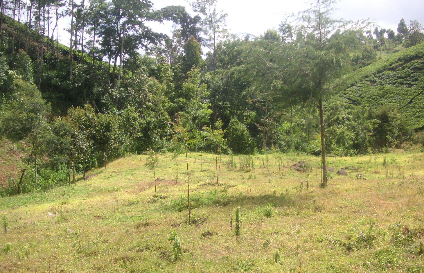
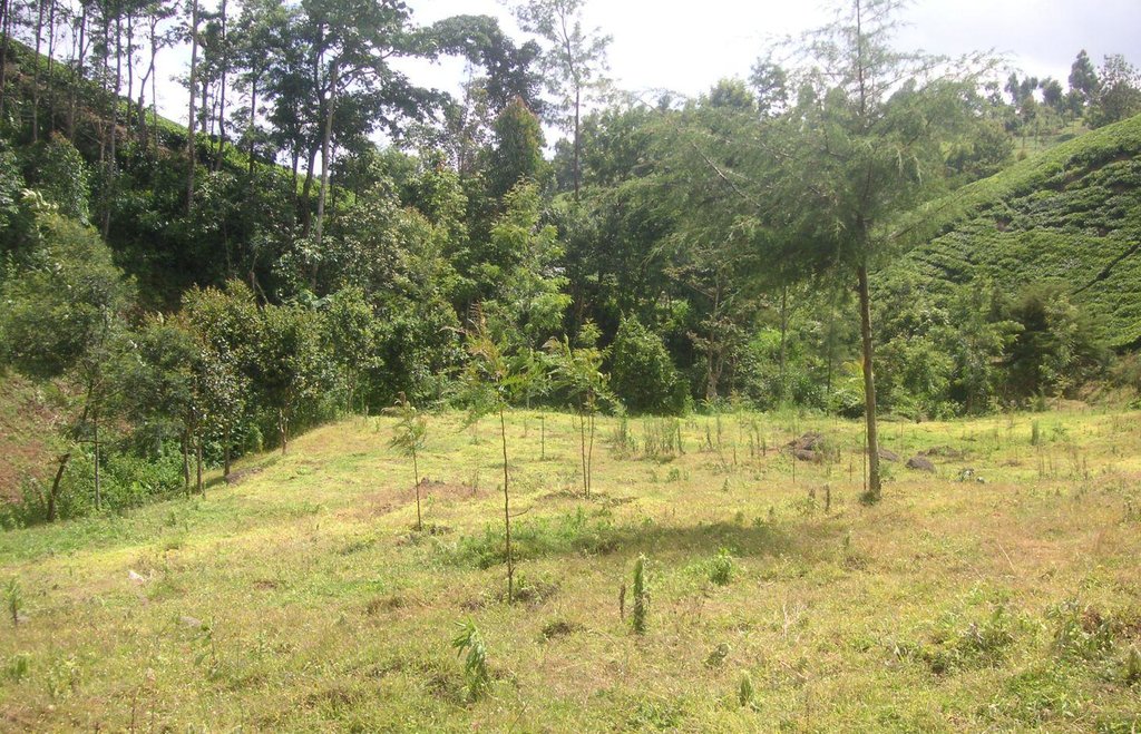
Tree line with adjacent grass strips as example of a productive and protective riparian area at Kapingazi River
2.2 Description détaillée de la Technologie
Description:
On the south-eastern slopes of Mt. Kenya, the conditions are ideal for agricultural activities. There is plenty of rainfall (2100 mm/year) which is usually reliable. However in the year 2000, the river Kapingazi dried up for the first time since many decades during a dry spell. This led to community activities that finally came up with a system of vegetative interventions to strengthen the riparian zones. The intervention consists of tree planting and establishment of grass strips along the river. Napier grass is planted to stabilize steep slopes and to supply material for the construction of tea baskets.
Purpose of the Technology: The goals of this technology are manifold. Firstly, the vegetation prevents surface water and eroded soil flowing from the agricultural fields directly into the river. Therefore, sediments and chemicals used on the field are retained in the riparian soils and do not pollute the river. Surface water flow from runoff during heavy storms is slowed down and infiltration on soils covered by grass and trees is increased. As a result more groundwater is recharged during the wet seasons, which can be released during the dry season. Thus peak or flood flows are reduced and low flows are improved. Damage during flood flows on the riverbank (through erosion and destabilizing the riparian vegetation) as well as damages of floods downstream can be reduced or avoided.
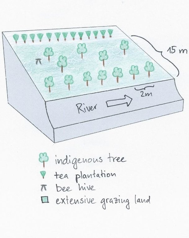
Establishment / maintenance activities and inputs: Before planting the indigenous trees, water guzzlers like eucalyptus trees were cut down. Indigenous seedlings were planted right along the river at a distance of 2m. Between the trees and the tea plantation a grass strip of up to 10m is established. Some trees were planted scattered on the grass strip. The young trees are surrounded by grasses which are cut regularly every 2 weeks. This reduces competition and enhances growth of the trees. As soon as the trees are big enough, they function as a source of firewood, they can be pruned every 5 months.
Natural / human environment: The studied plot is situated right below the natural mountain forest of Mt. Kenya at the south-eastern slope. The source of Kapingazi River can be found at 1.5 km of walking distance upslope of the plot. Agricultural circumstances are good because of the fertile, volcanic plots and the abundant precipitations. However, the terrain is quite steep.
The zone which is used for tea production reaches from an elevation of 1700 m.a.s.l to 2000 m.a.s.l. Most tea farmers own between 4 and 20 acres. The area of the riparian zone covers 6 m from the river edge and belongs to the government. Since the harvest of the tea leaves requires a high labour input, local workers are hired. Most of the harvest is done during the rainy season because the tea plants are growing fast in this period. For the tea production only the youngest leaves are used, transported in a basket on the worker’s back to the tea factory in the evening.
2.3 Photos de la Technologie
2.5 Pays/ région/ lieux où la Technologie a été appliquée et qui sont couverts par cette évaluation
Pays:
Kenya
Région/ Etat/ Province:
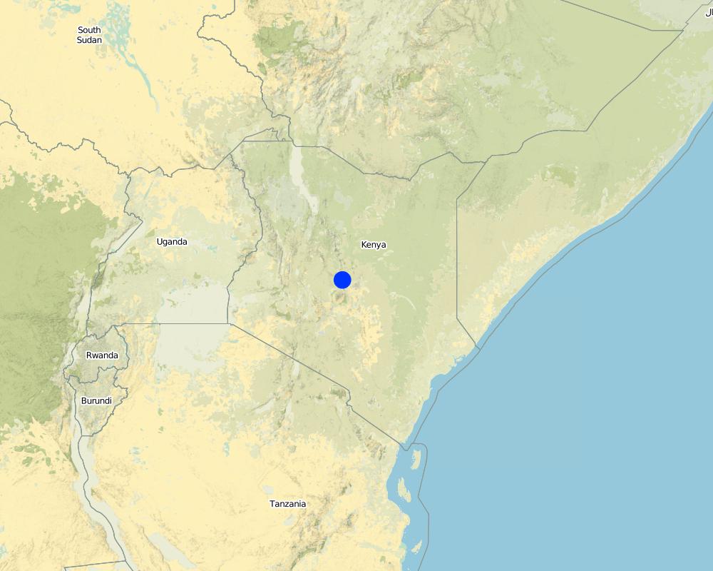
Kenya/Eastern Province
Autres spécifications du lieu:
Embu
Spécifiez la diffusion de la Technologie:
- répartie uniformément sur une zone
S'il n'existe pas d'informations exactes sur la superficie, indiquez les limites approximatives de la zone couverte:
- < 0,1 km2 (10 ha)
Commentaires:
Since the technology is only used by one farmer at a single spot, it does not make sense to indicate the area. Furthermore, the length along the river is more important than the area.
Map
×2.6 Date de mise en œuvre de la Technologie
Si l'année précise est inconnue, indiquez la date approximative: :
- il y a moins de 10 ans (récemment)
2.7 Introduction de la Technologie
Spécifiez comment la Technologie a été introduite: :
- grâce à l'innovation d'exploitants des terres
- par le biais de projets/ d'interventions extérieures
Commentaires (type de projet, etc.) :
In the year 2002 the new constitution obliged the government to take care of the water resources. The instrument for this were the WRUA (Water Resource Users Associations), local initiatives of land users that promote protective measures along the rivers.
3. Classification de la Technologie de GDT
3.1 Principal(aux) objectif(s) de la Technologie
- réduire, prévenir, restaurer les terres dégradées
3.2 Type(s) actuel(s) d'utilisation des terres, là où la Technologie est appliquée
Les divers types d'utilisation des terres au sein du même unité de terrain: :
Oui
Précisez l'utilisation mixte des terres (cultures/ pâturages/ arbres):
- Agroforesterie

Terres cultivées
- Cultures annuelles
- Plantations d’arbres ou de buissons
Cultures annuelles - Précisez les cultures:
- cultures fourragères - graminées
Plantations d'arbres et d'arbustes - Précisez les cultures:
- thé
Nombre de période de croissance par an: :
- 2
Précisez:
Longest growing period in days: 60 Longest growing period from month to month: april to may Second longest growing period in days: 60 Second longest growing period from month to month: november to december

Forêts/ bois
- Plantations d'arbres, boisements
Produits et services:
- Autres produits forestiers
- Conservation/ protection de la nature
- Beekeeping
Commentaires:
Major crop: Tea and Napier grass
Major land use problems (compiler’s opinion): The main land use problems are pollution of the riverwater, low rainwater storage that provokes floods, too few water during the dry season and riverbank erosion.
Major land use problems (land users’ perception): The main problem is the few water in the dry season that prevents irrigation.
Type of cropping system and major crops comments: Additionally, few food crops are planted in a relatively small homegarden.
3.5 Groupe de GDT auquel appartient la Technologie
- Amélioration de la couverture végétale/ du sol
3.6 Mesures de GDT constituant la Technologie

pratiques végétales
- V1: Couverture d’arbres et d’arbustes
- V2: Herbes et plantes herbacées pérennes
Commentaires:
Main measures: vegetative measures
Type of vegetative measures: aligned: -along boundary, scattered / dispersed
3.7 Principaux types de dégradation des terres traités par la Technologie

dégradation biologique
- Bs: baisse de la qualité et de la composition/ diversité des espèces

dégradation hydrique
- Hs: changement de la quantité d’eau de surface
- Hp: baisse de la qualité des eaux de surface
- Hw: réduction de la capacité tampon des zones humides
Commentaires:
Main type of degradation addressed: Hp: decline of surface water quality, Hw: reduction of the buffering capacity of wetland areas
Secondary types of degradation addressed: Bs: quality and species composition /diversity decline, Hs: change in quantity of surface water
Main causes of degradation: deforestation / removal of natural vegetation (incl. forest fires) (Riparian trees were chopped down.), education, access to knowledge and support services (People didn't know about the consequences of the deforestation.), planting directly next to river
3.8 Prévention, réduction de la dégradation ou réhabilitation des terres dégradées
Spécifiez l'objectif de la Technologie au regard de la dégradation des terres:
- prévenir la dégradation des terres
- réduire la dégradation des terres
4. Spécifications techniques, activités, intrants et coûts de mise en œuvre
4.1 Dessin technique de la Technologie
Spécifications techniques (associées au dessin technique):
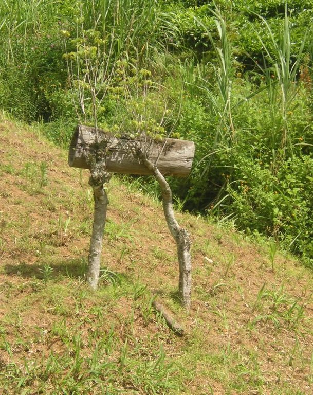
The area between the river and the tea plantation is used to establish a riparian habitat. Trees are planted along the river and also on the adjacent grazing land. The grass is cut regularly and used as fodder. A bee hive was installed to generate additional income.
Location: Manyatta. Embu / Eastern Province
Date: 28.12.2013
Technical knowledge required for field staff / advisors: low
Technical knowledge required for land users: low
Main technical functions: improvement of ground cover, increase of infiltration, sediment retention / trapping, sediment harvesting
Secondary technical functions: promotion of vegetation species and varieties (quality, eg palatable fodder)
Aligned: -along boundary
Vegetative material: T : trees / shrubs
Number of plants per (ha): 30
Vertical interval within rows / strips / blocks (m): 3
Scattered / dispersed
Vegetative material: G : grass
Trees/ shrubs species: indigenous trees, Napier grass
Grass species: normal grass
Auteur:
Manuel Fischer
4.2 Informations générales sur le calcul des intrants et des coûts
Indiquez la monnaie utilisée pour le calcul des coûts:
- dollars américains
Indiquez le coût salarial moyen de la main d'œuvre par jour:
3.33
4.3 Activités de mise en place/ d'établissement
| Activité | Calendrier des activités (saisonnier) | |
|---|---|---|
| 1. | Tree planting | During rainy season |
| 2. | Replanting of seedlings which dried up | |
| 3. | Planting trees | At the beginning of the rainy season |
4.4 Coûts et intrants nécessaires à la mise en place
| Spécifiez les intrants | Unité | Quantité | Coûts par unité | Coût total par intrant | % des coût supporté par les exploitants des terres | |
|---|---|---|---|---|---|---|
| Main d'œuvre | Tree planting during rain season | Persons/day | 6,0 | 3,3333333 | 20,0 | 100,0 |
| Main d'œuvre | Replanting of seedlings | Persons/day | 2,0 | 3,333333 | 6,67 | 100,0 |
| Main d'œuvre | Planting trees before rain season | Persons/day | 8,0 | 3,333333 | 26,67 | 100,0 |
| Matériel végétal | Seedlings | pieces | 70,0 | 0,111 | 7,77 | |
| Matériel végétal | Seedlings for replanting | pieces | 20,0 | 0,111 | 2,22 | 100,0 |
| Matériel végétal | Riparian seedlings | pieces | 90,0 | 0,034555 | 3,11 | 100,0 |
| Coût total de mise en place de la Technologie | 66,44 | |||||
| Coût total de mise en place de la Technologie en dollars américains (USD) | 66,44 | |||||
Commentaires:
Duration of establishment phase: 1 month(s)
4.5 Activités d'entretien/ récurrentes
| Activité | Calendrier/ fréquence | |
|---|---|---|
| 1. | Weeding the area around the trees to get fodder and boost the tree growth | every 2 weeks for 4 years |
| 2. | Weeding the lawns for better growth of the trees and for fodder | every 2 weeks during raining season |
4.6 Coûts et intrants nécessaires aux activités d'entretien/ récurrentes (par an)
| Spécifiez les intrants | Unité | Quantité | Coûts par unité | Coût total par intrant | % des coût supporté par les exploitants des terres | |
|---|---|---|---|---|---|---|
| Main d'œuvre | Weeding the area around the trees | Persons/day | 16,0 | 3,33333 | 53,33 | 100,0 |
| Main d'œuvre | Weeding the lawns | Persons/day | 64,0 | 3,33333 | 213,33 | 100,0 |
| Coût total d'entretien de la Technologie | 266,66 | |||||
| Coût total d'entretien de la Technologie en dollars américains (USD) | 266,66 | |||||
Commentaires:
Machinery/ tools: Jembe (Machete)
The costs were calculated for a riparian area with a length of 100m and a width of 10m, since hectares are difficult to apply on a riparian context. The determinant factor for the costs is labour. In this case, the costs are very low because the trees were only planted every 10 metres along the riparian. The seedlings have to be bought in a nursery. Most of the bushes regrow naturally and do not need any management.
Some of the seedlings had to be replanted, because they dried up. The required equipment like a spade is available on nearly every farm or can be borrowed from neighbours and is thus not added to the costs.
5. Environnement naturel et humain
5.1 Climat
Précipitations annuelles
- < 250 mm
- 251-500 mm
- 501-750 mm
- 751-1000 mm
- 1001-1500 mm
- 1501-2000 mm
- 2001-3000 mm
- 3001-4000 mm
- > 4000 mm
Spécifiez la pluviométrie moyenne annuelle (si connue), en mm:
2100,00
Spécifications/ commentaires sur les précipitations:
Most of the rain falls during the rainy seasons from April-May and Oct-Nov.
Zone agro-climatique
- subhumide
Thermal climate class: subtropics. http://www.mappedplanet.com/klima/klimadiagramm-39729-Nanyuki,Kenia
5.2 Topographie
Pentes moyennes:
- plat (0-2 %)
- faible (3-5%)
- modéré (6-10%)
- onduleux (11-15%)
- vallonné (16-30%)
- raide (31-60%)
- très raide (>60%)
Reliefs:
- plateaux/ plaines
- crêtes
- flancs/ pentes de montagne
- flancs/ pentes de colline
- piémonts/ glacis (bas de pente)
- fonds de vallée/bas-fonds
Zones altitudinales:
- 0-100 m
- 101-500 m
- 501-1000 m
- 1001-1500 m
- 1501-2000 m
- 2001-2500 m
- 2501-3000 m
- 3001-4000 m
- > 4000 m
5.3 Sols
Profondeur moyenne du sol:
- très superficiel (0-20 cm)
- superficiel (21-50 cm)
- modérément profond (51-80 cm)
- profond (81-120 cm)
- très profond (>120 cm)
Texture du sol (de la couche arable):
- moyen (limoneux)
Matière organique de la couche arable:
- moyen (1-3%)
Si disponible, joignez une description complète du sol ou précisez les informations disponibles, par ex., type de sol, pH/ acidité du sol, capacité d'échange cationique, azote, salinité, etc.
Soil fertility is medium
Soil drainage / infiltration is good
Soil water storage capacity is very high
5.4 Disponibilité et qualité de l'eau
Profondeur estimée de l’eau dans le sol:
< 5 m
Disponibilité de l’eau de surface:
bonne
Qualité de l’eau (non traitée):
eau potable
Commentaires et précisions supplémentaires sur la qualité et la quantité d'eau:
Availability of surface water: Also excess and poor/none
5.5 Biodiversité
Diversité des espèces:
- moyenne
5.6 Caractéristiques des exploitants des terres appliquant la Technologie
Orientation du système de production:
- exploitation mixte (de subsistance/ commerciale)
- commercial/ de marché
Revenus hors exploitation:
- > 50% de tous les revenus
Niveau relatif de richesse:
- riche
Individus ou groupes:
- employé (entreprise, gouvernement)
Niveau de mécanisation:
- travail manuel
Genre:
- femmes
- hommes
Indiquez toute autre caractéristique pertinente des exploitants des terres:
Land users applying the Technology are mainly Leaders / privileged
Population density: > 500 persons/km2
Off-farm income specification: Owner is a member of the parliament.
5.7 Superficie moyenne des terres utilisées par les exploitants des terres appliquant la Technologie
- < 0,5 ha
- 0,5-1 ha
- 1-2 ha
- 2-5 ha
- 5-15 ha
- 15-50 ha
- 50-100 ha
- 100-500 ha
- 500-1 000 ha
- 1 000-10 000 ha
- > 10 000 ha
Cette superficie est-elle considérée comme de petite, moyenne ou grande dimension (en se référant au contexte local)?
- moyenne dimension
5.8 Propriété foncière, droits d’utilisation des terres et de l'eau
Propriété foncière:
- individu, sans titre de propriété
Droits d’utilisation des terres:
- individuel
Droits d’utilisation de l’eau:
- individuel
Commentaires:
Land user was a former member of parliament
5.9 Accès aux services et aux infrastructures
santé:
- pauvre
- modéré
- bonne
éducation:
- pauvre
- modéré
- bonne
assistance technique:
- pauvre
- modéré
- bonne
emploi (par ex. hors exploitation):
- pauvre
- modéré
- bonne
marchés:
- pauvre
- modéré
- bonne
énergie:
- pauvre
- modéré
- bonne
routes et transports:
- pauvre
- modéré
- bonne
eau potable et assainissement:
- pauvre
- modéré
- bonne
services financiers:
- pauvre
- modéré
- bonne
6. Impacts et conclusions
6.1 Impacts sur site que la Technologie a montrés
Impacts socio-économiques
Production
production agricole
production fourragère
production de bois
Commentaires/ spécifiez:
Pruning of trees
Revenus et coûts
revenus agricoles
Autres impacts socio-économiques
Grass for basket production.
Fuelwood
Commentaires/ spécifiez:
Pruning the trees
Impacts socioculturels
opportunités culturelles
Commentaires/ spécifiez:
aesthetics
connaissances sur la GDT/ dégradation des terres
Livelihood and human well-being
Commentaires/ spécifiez:
Through the increase of the water quality, the technology improves the access to clean water.
Impacts écologiques
Cycle de l'eau/ ruissellement
quantité d'eau
qualité de l'eau
récolte/ collecte de l'eau
ruissellement de surface
Sols
humidité du sol
couverture du sol
Biodiversité: végétale, animale
diversité végétale
diversité animale
diversité des habitats
6.2 Impacts hors site que la Technologie a montrés
flux des cours d'eau fiables et stables en saison sèche
envasement en aval
pollution des rivières/ nappes phréatiques
6.3 Exposition et sensibilité de la Technologie aux changements progressifs et aux évènements extrêmes/catastrophes liés au climat (telles que perçues par les exploitants des terres)
Changements climatiques progressifs
Changements climatiques progressifs
| Saison | Augmentation ou diminution | Comment la Technologie fait-elle face à cela? | |
|---|---|---|---|
| températures annuelles | augmente | bien |
Extrêmes climatiques (catastrophes)
Catastrophes météorologiques
| Comment la Technologie fait-elle face à cela? | |
|---|---|
| pluie torrentielle locale | bien |
| tempête de vent locale | bien |
Catastrophes climatiques
| Comment la Technologie fait-elle face à cela? | |
|---|---|
| sécheresse | pas connu |
Catastrophes hydrologiques
| Comment la Technologie fait-elle face à cela? | |
|---|---|
| inondation générale (rivière) | pas bien |
Autres conséquences liées au climat
Autres conséquences liées au climat
| Comment la Technologie fait-elle face à cela? | |
|---|---|
| réduction de la période de croissance | bien |
6.4 Analyse coûts-bénéfices
Quels sont les bénéfices comparativement aux coûts de mise en place (du point de vue des exploitants des terres)?
Rentabilité à court terme:
légèrement négative
Rentabilité à long terme:
positive
Quels sont les bénéfices comparativement aux coûts d'entretien récurrents (du point de vue des exploitants des terres)?
Rentabilité à court terme:
légèrement négative
Rentabilité à long terme:
légèrement positive
6.5 Adoption de la Technologie
- 1-10%
Si disponible, quantifiez (nombre de ménages et/ou superficie couverte):
10% of all the riparian land users have adopted the technology
De tous ceux qui ont adopté la Technologie, combien d'entre eux l'ont fait spontanément, à savoir sans recevoir aucune incitation matérielle, ou aucune rémunération? :
- 11-50%
Commentaires:
70% of land user families have adopted the Technology with external material support
Comments on acceptance with external material support: 10% of all the riparian land users have adopted the technology. The external support was the provision of seedlings.
30% of land user families have adopted the Technology without any external material support
There is a moderate trend towards spontaneous adoption of the Technology
Comments on adoption trend: Through the action of several organisations, the attention of the land users is drawn to a proper riparian management.
6.7 Points forts/ avantages/ possibilités de la Technologie
| Points forts/ avantages/ possibilités du point de vue de l'exploitant des terres |
|---|
|
The river does not dry up easily during dry seasons. The grass yield can be used for fodder purposes. How can they be sustained / enhanced? disseminating the knowledge among the farmers. |
| Points forts/ avantages/ possibilités du point de vue du compilateur ou d'une autre personne ressource clé |
|---|
|
A vivid and stable riparian ecosystem is the key to ensure biodiversity and stability of the riverbanks. This leads to a smaller vulnerability to floods or droughts and combats degradation. How can they be sustained / enhanced? continuous awareness raising among the land users. |
6.8 Faiblesses/ inconvénients/ risques de la Technologie et moyens de les surmonter
| Faiblesses/ inconvénients/ risques du point de vue du compilateur ou d'une autre personne ressource clé | Comment peuvent-ils être surmontés? |
|---|---|
| Labour input for weeding is high | cutting grass at a bigger height |
7. Références et liens
7.1 Méthodes/ sources d'information
Liens et modules
Développer tout Réduire toutLiens
Aucun lien
Modules
Aucun module trouvé


