Lolldaiga Hills Ranch: Rotational Grazing and Boma-Based Land Reclamation [Kenya]
- Création :
- Mise à jour :
- Compilateur : Michael Herger
- Rédacteur : –
- Examinateurs : Donia Mühlematter, Hanspeter Liniger, Rima Mekdaschi Studer, Alexandra Gavilano
technologies_2982 - Kenya
- Résumé complet en PDF
- Résumé complet en PDF pour impression
- Résumé complet dans le navigateur
- Résumé complet (non formaté)
- Lolldaiga Hills Ranch: Rotational Grazing and Boma-Based Land Reclamation : 3 septembre 2018 (inactive)
- Lolldaiga Hills Ranch: Rotational Grazing and Boma-Based Land Reclamation: 4 septembre 2019 (inactive)
- Lolldaiga Hills Ranch: Rotational Grazing and Boma-Based Land Reclamation: 2 novembre 2021 (public)
- Lolldaiga Hills Ranch: Rotational Grazing and Boma-Based Land Reclamation : 22 février 2018 (inactive)
- Lolldaiga Hills Ranch: Rotational Grazing and Boma-Based Land Reclamation : 1 février 2018 (inactive)
Voir les sections
Développer tout Réduire tout1. Informations générales
1.2 Coordonnées des personnes-ressources et des institutions impliquées dans l'évaluation et la documentation de la Technologie
Personne(s)-ressource(s) clé(s)
exploitant des terres:
Tomlinson Lance
Lolldaiga Hills Ltd.
Kenya
1.3 Conditions relatives à l'utilisation par WOCAT des données documentées
Le compilateur et la(les) personne(s) ressource(s) acceptent les conditions relatives à l'utilisation par WOCAT des données documentées:
Oui
1.4 Déclaration sur la durabilité de la Technologie décrite
Est-ce que la Technologie décrite ici pose problème par rapport à la dégradation des terres, de telle sorte qu'elle ne peut pas être déclarée comme étant une technologie de gestion durable des terres?
Non
2. Description de la Technologie de GDT
2.1 Courte description de la Technologie
Définition de la Technologie:
Lolldaiga Hills ranch is a private ranch and conservancy with livestock production and tourism. Rotational grazing is used to manage livestock on semi-arid lands with limited water resources. Bare land is recovered by a "Boma” technology – strategic corralling of animals overnight on degraded land.
2.2 Description détaillée de la Technologie
Description:
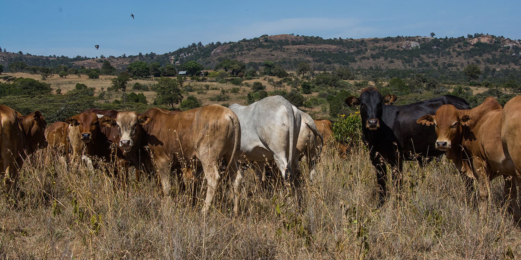
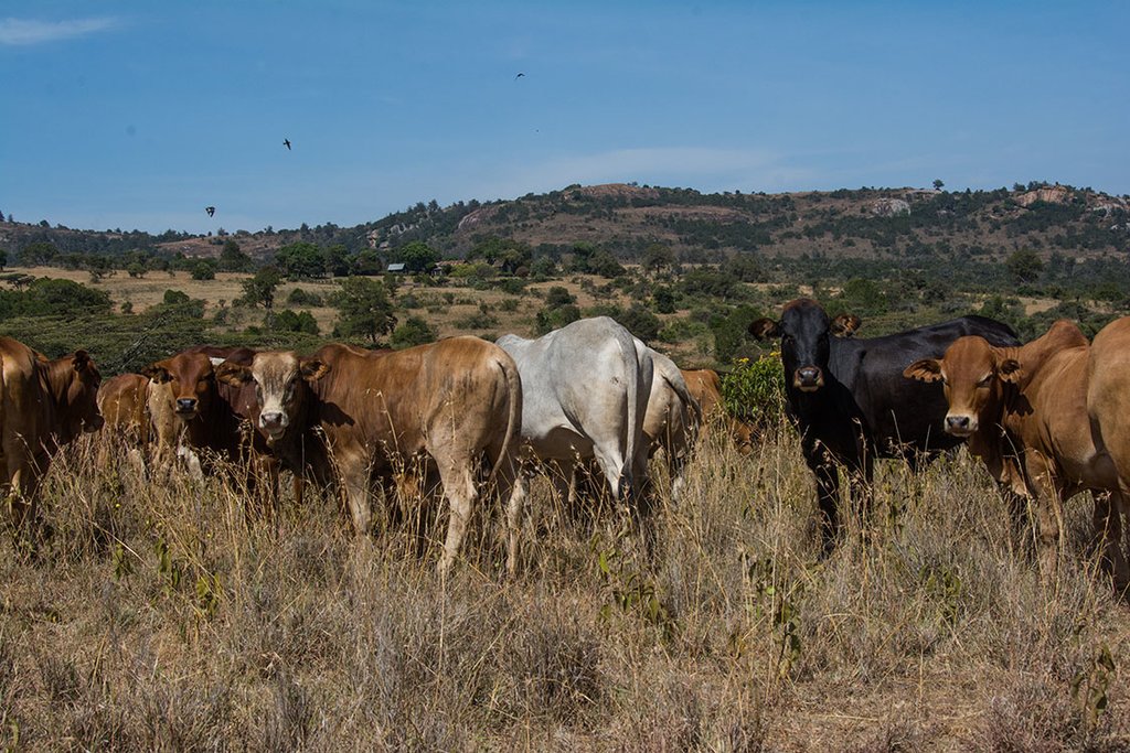
Livestock production on Lolldaiga Hills ranch is managed under an extensive grazing system for dairy, beef, sheep and camel production, with strategic fattening and selling, in harmony with conservation principles. The conservancy is dedicated to the sustainable conservation of critical habitat and wildlife. The ranch serves also as a training ground for the British Army.
Grazing is managed without fixed blocks. Grazing areas vary considerably, depending on rainfall and location within the farm. Similarly, grazing duration in one area also varies significantly (from two weeks to eight months). Starting after the long rains (April to May), livestock are moved gradually from north to south: movement only occurs when areas are completely grazed. They stay for about four months in the north and eight months in the south - due to better grass in the southern part. Some of the dry season grazing is land set aside for later use. They use, for instance, highland forests in the west where zebra and other livestock are largely absent. During the rains, grazing takes place on a much smaller area than during the dry season, where water can be a major challenge. Livestock are kept together, though steers/heifers/breeding cows/resting bulls are separated into different herds of 90-150 units per herd. But these are not tightly “bunched” as in other ranches in the area which apply “Holistic Management” principles, since bunching is not appropriate due to strong wind erosion. The closer livestock are aggregated, the more damage – that is dust generated - in dry areas. As is typical of private ranches in Laikipia, Lolldaiga supports some of the highest densities of wildlife in Kenya. The wild herbivore biomass density on private ranches is estimated by Georgiadis (2007) at 14 ha /TLU.
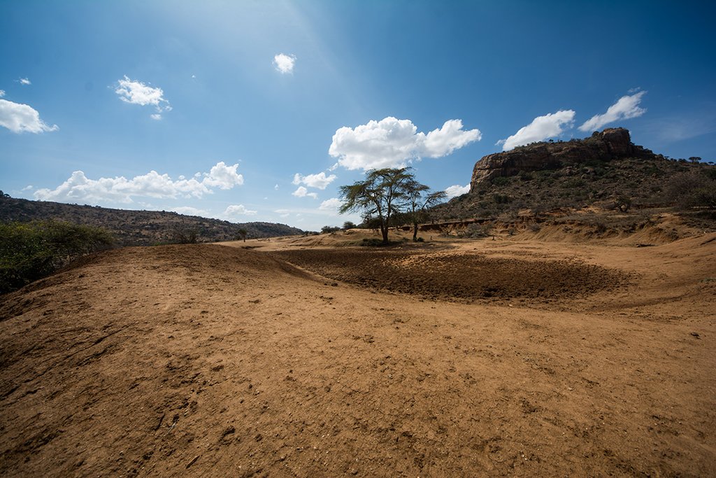
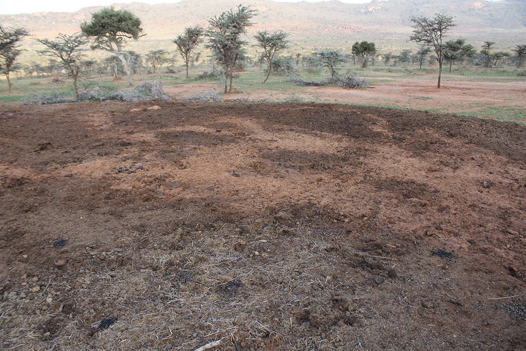
Whilst the livestock is moving, large bomas (corrals in Kiswahili) are constructed for the herds. Here, animals are closely together kept in protective enclosures overnight. Bomas are strategically sited on bare areas to recover the land through dung accumulation and breaking soil crusts by hooves. Currently, there are 20 bomas covering an area of 0.02 km2 (0.01% of their land). This can be taken to represent the area that can be restored each year. Boma sites are steadily but slightly shifted. On average, one boma is located on the same denuded patch for only one to two weeks during the dry season, and again for one week during the wet season.
In a single boma of 0.1 ha, 400 cows are corralled. Former bare patches with bomas have recovered well after just a few years. Results of a boma site comparison (see Herger 2018) have shown how bomas turn into ecological hotspots with a long-lasting effect. Amounts of soil organic carbon (SOC), as well as macro- and micronutrients in topsoil (especially) and subsoil of former boma sites were much higher than reference sites close-by. The chronology of former boma sites (1, 5, 9 years ago) also played a decisive role in soil parameters. Former boma sites from 5 and 9 years ago performed better than the most recent boma (1 year ago).
On the ranch, due to lack of rains, fodder supplements had to be purchased in 2016. However, it is usually water and not grazing that is the limiting factor on the rangeland.
Whereas cattle are sold to the leading meat producer "Farmer's Choice" (80% for domestic distribution, 20% for export to neighbouring countries and the Middle East), sheep are sold to East African Seafood (Nairobi) and camels to Somalis in town and local butcheries.
Lolldaiga also assists community grazing. The ranch helps neighbouring group ranches by allowing them access to their land for fattening purposes, but mostly as a grass bank during droughts (sometimes charging a small fee, sometimes none). During dry spells, they host on average 500-1000 heads from other communities. Along their fence informal (strictly "illegal") grazing of goats and sheep is tolerated.
2.3 Photos de la Technologie
2.5 Pays/ région/ lieux où la Technologie a été appliquée et qui sont couverts par cette évaluation
Pays:
Kenya
Région/ Etat/ Province:
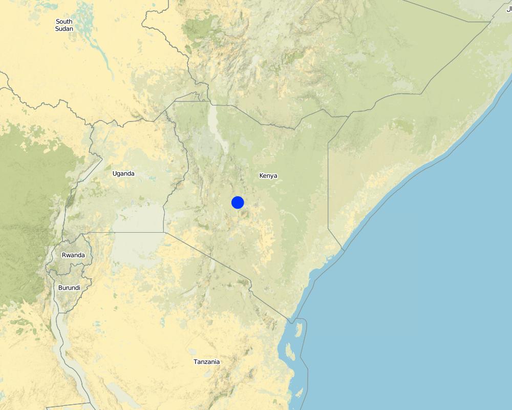
Laikipia
Spécifiez la diffusion de la Technologie:
- répartie uniformément sur une zone
Si la Technologie est uniformément répartie sur une zone, précisez la superficie couverte (en km2):
200,0
S'il n'existe pas d'informations exactes sur la superficie, indiquez les limites approximatives de la zone couverte:
- 100-1 000 km2
Commentaires:
Lolldaiga has an area size of 200 km2. Similar technologies are also applied on other ranches (see the documentations for "Il Ngwesi", "Makurian", and "Borana")
Map
×2.6 Date de mise en œuvre de la Technologie
Si l'année précise est inconnue, indiquez la date approximative: :
- il y a entre 10-50 ans
2.7 Introduction de la Technologie
Spécifiez comment la Technologie a été introduite: :
- grâce à l'innovation d'exploitants des terres
3. Classification de la Technologie de GDT
3.1 Principal(aux) objectif(s) de la Technologie
- améliorer la production
- réduire, prévenir, restaurer les terres dégradées
- préserver l'écosystème
- conserver/ améliorer la biodiversité
3.2 Type(s) actuel(s) d'utilisation des terres, là où la Technologie est appliquée

Pâturages
Pâturage extensif:
- Ranching
Type d'animal:
- chameaux
- ovins
- cattle
Produits et services:
- viande
- lait
- laine
Espèces:
ovins
Nombre:
1800
Espèces:
chameaux
Nombre:
140

Implantations, infrastructures
- Habitats, buildings
Remarques:
Few facilities for tourism.
Few farm houses.
Commentaires:
Grassed acacia bushland. Overall rather good vegetation coverage with some patches of bare ground. Especially in the northern part Lolldaiga is effected by the invasive species "Opuntia stricta". Dominant grasses: Pennisetum species, Eragrostis species, Cynadon species, Hyparrhenia species, Kelenger species. Dominant shrubs: Solyneum inconum, Lyceum europaeum, Barleria acuthodies, Grewia tembensis, Opuntia. Dominant trees: Acacia etbaica, Acacia drepanalobium, Acacia mellifera. Detailed list of all species (vegetation and wildlife) available (Herger 2018)
Main animal species and products: Cattle, sheep, camels; Milk, wool, beef, camel meat, and lamb/ mutton. High-quality segment. Domestic (80%, Nairobi and hotels), international distribution (20%, neighbouring countries and the Middle East) Livestock: 3,920 TLU; Stocking rate: 5.1 ha/TLU Pressure on land including wildlife numbers (estimated by Georgiadis 2007): 3.7 ha/TLU Livestock numbers: 5,200 cattle, 1,800 sheep, 140 camels Sales: Cattle 20% sales, Sheep 15%, Camels 10%. Additional 1,000-2,000 livestock units from neighbouring community farms during droughts. Goats and sheep illegally grazing along the fence are tolerated. Wildlife: Giraffe, antelope/gazelle (e.g. gerenuk, impala, Thomson's gazelle), baboons, zebra, dikdik, hares, elephant and others. More wildlife than on group ranches. Wildlife herbivore biomass density (Georgiadis 2007) 14 ha/TLU
Number of growing seasons per year: 2
Short rains in November and December. Long rains in April and May. Rains from (October) November to December are usually better in this area. Rainfalls with strong local variations and changing regimes.
Livestock density: 3'920 TLU; Stocking rate: 5.1 ha/TLU, Pressure on land including wildlife numbers (estimated by Georgiadis 2007): 3.7 ha/TLU
3.4 Approvisionnement en eau
Approvisionnement en eau des terres sur lesquelles est appliquée la Technologie:
- pluvial
3.5 Groupe de GDT auquel appartient la Technologie
- pastoralisme et gestion des pâturages
- Amélioration de la couverture végétale/ du sol
3.6 Mesures de GDT constituant la Technologie

modes de gestion
- M2: Changement du niveau de gestion / d'intensification
- M4: Changement majeur dans le calendrier des activités
3.7 Principaux types de dégradation des terres traités par la Technologie

érosion hydrique des sols
- Wt: perte de la couche superficielle des sols (couche arable)/ érosion de surface
- Wg: ravinement/ érosion en ravines

érosion éolienne des sols
- Et: perte de la couche superficielle des sols (couche arable)

dégradation physique des sols
- Pc: compaction
- Pk: scellage et encroûtement
- Pi: imperméabilisation des sols

dégradation biologique
- Bc: réduction de la couverture végétale
- Bh: perte d’habitats
- Bq: baisse de la quantité/ biomasse
- Bs: baisse de la qualité et de la composition/ diversité des espèces
- Bl: perte de la vie des sols
Commentaires:
Across the grasslands and rangelands, an increase in bare land and bush has been a clear trend all over Laikipia for many years, both on community-owned lands and private ranches. Major identified ecological problems (partly) caused by livestock production are: bare ground, low contents of soil organic carbon and plant-available nutrients, soil erosion (sealing, crusting, rills and gullies, water flow patterns, sheet erosion, pedestals), poor soil properties, undesirable species, and (increasing) woody and invasive species. The current major problem on rangelands is the invasive species Opuntia stricta, which however only could spread that widely because of degraded land in the first place. The technology aims at improving vegetation cover of the land and thereby reducing further degradation and restoring degraded land. However, Lolldaiga is clearly not as much affected by degradation (compare Herger 2018).
3.8 Prévention, réduction de la dégradation ou réhabilitation des terres dégradées
Spécifiez l'objectif de la Technologie au regard de la dégradation des terres:
- réduire la dégradation des terres
- restaurer/ réhabiliter des terres sévèrement dégradées
4. Spécifications techniques, activités, intrants et coûts de mise en œuvre
4.1 Dessin technique de la Technologie
4.2 Informations générales sur le calcul des intrants et des coûts
Spécifiez la manière dont les coûts et les intrants ont été calculés:
- par entité de la Technologie
Précisez l'unité:
Only livestock production related: Herders, animals treatment
Indiquez la monnaie utilisée pour le calcul des coûts:
- dollars américains
Indiquez le coût salarial moyen de la main d'œuvre par jour:
4.5
4.5 Activités d'entretien/ récurrentes
| Activité | Calendrier/ fréquence | |
|---|---|---|
| 1. | Herders, supervisors, watchmen etc | |
| 2. | Animal treatments (vaccination, spraying, injections) |
4.6 Coûts et intrants nécessaires aux activités d'entretien/ récurrentes (par an)
| Spécifiez les intrants | Unité | Quantité | Coûts par unité | Coût total par intrant | % des coût supporté par les exploitants des terres | |
|---|---|---|---|---|---|---|
| Main d'œuvre | Herders/employees | Person*days | 36000,0 | 4,5 | 162000,0 | |
| Autre | Animals treatments | Per TLU | 3920,0 | 11,0 | 43120,0 | |
| Coût total d'entretien de la Technologie | 205120,0 | |||||
| Coût total d'entretien de la Technologie en dollars américains (USD) | 205120,0 | |||||
Commentaires:
Animal treatment costs are estimated according to other ranches in the area since figures for Lolldaiga are missing. Figures are not reconfirmed data.
4.7 Facteurs les plus importants affectant les coûts
Décrivez les facteurs les plus importants affectant les coûts :
Labor
5. Environnement naturel et humain
5.1 Climat
Précipitations annuelles
- < 250 mm
- 251-500 mm
- 501-750 mm
- 751-1000 mm
- 1001-1500 mm
- 1501-2000 mm
- 2001-3000 mm
- 3001-4000 mm
- > 4000 mm
Spécifiez la pluviométrie moyenne annuelle (si connue), en mm:
376,00
Spécifications/ commentaires sur les précipitations:
Rainfall gauge Lolldaiga Northern gauge average from 2013-2016. Strong local (and temporal) variation, changing rainfall regimes.
Indiquez le nom de la station météorologique de référence considérée:
Rainfall gauge Lolldaiga Northern Gate
Zone agro-climatique
- semi-aride
5.2 Topographie
Pentes moyennes:
- plat (0-2 %)
- faible (3-5%)
- modéré (6-10%)
- onduleux (11-15%)
- vallonné (16-30%)
- raide (31-60%)
- très raide (>60%)
Reliefs:
- plateaux/ plaines
- crêtes
- flancs/ pentes de montagne
- flancs/ pentes de colline
- piémonts/ glacis (bas de pente)
- fonds de vallée/bas-fonds
Zones altitudinales:
- 0-100 m
- 101-500 m
- 501-1000 m
- 1001-1500 m
- 1501-2000 m
- 2001-2500 m
- 2501-3000 m
- 3001-4000 m
- > 4000 m
5.3 Sols
Profondeur moyenne du sol:
- très superficiel (0-20 cm)
- superficiel (21-50 cm)
- modérément profond (51-80 cm)
- profond (81-120 cm)
- très profond (>120 cm)
Texture du sol (de la couche arable):
- grossier/ léger (sablonneux)
- moyen (limoneux)
Texture du sol (> 20 cm sous la surface):
- grossier/ léger (sablonneux)
- moyen (limoneux)
Matière organique de la couche arable:
- moyen (1-3%)
Si disponible, joignez une description complète du sol ou précisez les informations disponibles, par ex., type de sol, pH/ acidité du sol, capacité d'échange cationique, azote, salinité, etc.
SOC 0.9-1.8 %
pH: 6.3
Clay: 9 %
Silt: 47 %
Sand: 44 %
More rangeland health data in Herger (2018)
5.4 Disponibilité et qualité de l'eau
Disponibilité de l’eau de surface:
moyenne
Qualité de l’eau (non traitée):
faiblement potable (traitement nécessaire)
La salinité de l'eau est-elle un problème? :
Non
La zone est-elle inondée?
Non
5.5 Biodiversité
Diversité des espèces:
- élevé
Diversité des habitats:
- élevé
Commentaires et précisions supplémentaires sur la biodiversité:
Grassed acacia bushland. Overall rather good vegetation coverage with some patches of bare ground. Especially in the northern part Lolldaiga is effected by the invasive species "Opuntia stricta". Dominant grasses: Pennisetum species, Eragrostis species, Cynadon species, Hyparrhenia species, Kelenger species. Dominant shrubs: Solyneum inconum, Lyceum europaeum, Barleria acuthodies, Grewia tembensis, Opuntia. Dominant trees: Acacia etbaica, Acacia drepanalobium, Acacia mellifera. Detailed list of all species (vegetation and wildlife) available (Herger 2018)
5.6 Caractéristiques des exploitants des terres appliquant la Technologie
Sédentaire ou nomade:
- Sédentaire
Orientation du système de production:
- commercial/ de marché
Revenus hors exploitation:
- 10-50% de tous les revenus
Niveau relatif de richesse:
- très riche
Individus ou groupes:
- individu/ ménage
Niveau de mécanisation:
- travail manuel
Genre:
- hommes
Age des exploitants des terres:
- personnes d'âge moyen
5.7 Superficie moyenne des terres utilisées par les exploitants des terres appliquant la Technologie
- < 0,5 ha
- 0,5-1 ha
- 1-2 ha
- 2-5 ha
- 5-15 ha
- 15-50 ha
- 50-100 ha
- 100-500 ha
- 500-1 000 ha
- 1 000-10 000 ha
- > 10 000 ha
Cette superficie est-elle considérée comme de petite, moyenne ou grande dimension (en se référant au contexte local)?
- grande dimension
5.8 Propriété foncière, droits d’utilisation des terres et de l'eau
Propriété foncière:
- individu, avec titre de propriété
Droits d’utilisation des terres:
- individuel
Droits d’utilisation de l’eau:
- individuel
Commentaires:
Masai in the area have claimed that land leases of white settlers have expired and the land belongs to them. Government states the land belongs to the private ranchers, but the future development is unknown. There have already been conflicts and are likely to happen again. On the other hand, cooperation with group ranches has increased.
5.9 Accès aux services et aux infrastructures
santé:
- pauvre
- modéré
- bonne
éducation:
- pauvre
- modéré
- bonne
assistance technique:
- pauvre
- modéré
- bonne
emploi (par ex. hors exploitation):
- pauvre
- modéré
- bonne
marchés:
- pauvre
- modéré
- bonne
énergie:
- pauvre
- modéré
- bonne
routes et transports:
- pauvre
- modéré
- bonne
eau potable et assainissement:
- pauvre
- modéré
- bonne
services financiers:
- pauvre
- modéré
- bonne
6. Impacts et conclusions
6.5 Adoption de la Technologie
- cas isolés/ expérimentaux
Si disponible, quantifiez (nombre de ménages et/ou superficie couverte):
Similar practices, but different. Most ranches implement Holistic Management.
6.6 Adaptation
La Technologie a-t-elle été récemment modifiée pour s'adapter à l'évolution des conditions?
Non
6.7 Points forts/ avantages/ possibilités de la Technologie
| Points forts/ avantages/ possibilités du point de vue de l'exploitant des terres |
|---|
| Ability to allow the land to recover. |
| Drought resilience. |
| Points forts/ avantages/ possibilités du point de vue du compilateur ou d'une autre personne ressource clé |
|---|
| The listed advantages from Lance Tomlinson, the land user, are shared by the compiler's view. Lolldaiga has moderate stocking rates and good management, resulting in an overall fairly good condition of the rangeland. However, there are some bare patches, invasive species, and erosion features, also because of the influence of the neighbouring group ranch “Makurian”. |
7. Références et liens
7.1 Méthodes/ sources d'information
- visites de terrain, enquêtes sur le terrain
6 field visits with included "rangeland health assessment" in different parts of Lolldaiga where I could see the condition of the land as well as several other visits of the area.
- interviews/entretiens avec les exploitants des terres
Meetings with the grazing manager, general manager, owner of the ranch as well as with two resource people involved in the Lolldaiga Research programme.
- interviews/ entretiens avec les spécialistes/ experts de GDT
Truman Young
Dan Rubenstein
Dino Martins
John Letai
Samali Letai
Peter Hetz
Dominic Maringa
Joseph Putunoi
Patrick Ekodere
- compilation à partir de rapports et d'autres documents existants
Herger (2018)
Scientific papers, LWF reports etc.
Quand les données ont-elles été compilées (sur le terrain)?
22/01/2017
7.2 Références des publications disponibles
Titre, auteur, année, ISBN:
Herger, M.B. (2018). Environmental Impacts of Red Meat Production. MSc Thesis. University of Bern.
Disponible à partir d'où? Coût?
University of Bern
Titre, auteur, année, ISBN:
Georgiadis, N.J., Olivero, I.N., Romanach, S.S. (2007). Savanna herbivore dynamics in a livestock-dominated landscape: I. Dependence on land use, rainfall, density, and time. Biology Conservation 137(3): 461-472.
Disponible à partir d'où? Coût?
Online
Liens et modules
Développer tout Réduire toutLiens
Aucun lien
Modules
Aucun module trouvé


