Implementing Site Quarantine to reduce rangeland degradation in the highlands of Badghis [Afghanistan]
- Création :
- Mise à jour :
- Compilateur : Shamsulhaq Shams
- Rédacteurs : Mir Wali Khan Lakanwal, Mohammad Mustafa Sahebzada, Obaidullah Durani, Megha bajaj
- Examinateurs : Rima Mekdaschi Studer, Illias Animon, Muhammad Ishaq Safi
قرنطینه و مدیریت چرا در ارتفاعات بادغیس برای کاهش تخریب مراتع
technologies_7459 - Afghanistan
- Résumé complet en PDF
- Résumé complet en PDF pour impression
- Résumé complet dans le navigateur
- Résumé complet (non formaté)
- Implementing Site Quarantine to reduce rangeland degradation in the highlands of Badghis: 13 mars 2025 (inactive)
- Implementing Site Quarantine to reduce rangeland degradation in the highlands of Badghis: 24 mars 2025 (inactive)
- Implementing Site Quarantine to reduce rangeland degradation in the highlands of Badghis: 6 mai 2025 (public)
Voir les sections
Développer tout Réduire tout1. Informations générales
1.2 Coordonnées des personnes-ressources et des institutions impliquées dans l'évaluation et la documentation de la Technologie
Personne(s)-ressource(s) clé(s)
Spécialiste GDT:
Spécialiste GDT:
exploitant des terres:
Akrami Abdul Ghafar
Deh Beranj Rangeland Management Association
Afghanistan
exploitant des terres:
Jami Mula Abdul Rhaman
Deh Beranj Rangeland Management Association
Afghanistan
exploitant des terres:
Baqiri Habibullah
Deh Beranj Rangeland Management Association
Afghanistan
exploitant des terres:
Sadat Serajulhaq
Deh Beranj RMA
Afghanistan
Nom du projet qui a facilité la documentation/ l'évaluation de la Technologie (si pertinent)
Community-based sustainable land and forest management in AfghanistanNom du ou des institutions qui ont facilité la documentation/ l'évaluation de la Technologie (si pertinent)
FAO Afghanistan (FAO Afghanistan) - Afghanistan1.3 Conditions relatives à l'utilisation par WOCAT des données documentées
Le compilateur et la(les) personne(s) ressource(s) acceptent les conditions relatives à l'utilisation par WOCAT des données documentées:
Oui
1.4 Déclaration sur la durabilité de la Technologie décrite
Est-ce que la Technologie décrite ici pose problème par rapport à la dégradation des terres, de telle sorte qu'elle ne peut pas être déclarée comme étant une technologie de gestion durable des terres?
Non
2. Description de la Technologie de GDT
2.1 Courte description de la Technologie
Définition de la Technologie:
Restoring degraded rangelands through quarantine in Qadis district, Badghis Afghanistan.
2.2 Description détaillée de la Technologie
Description:
The project “Community-based sustainable land and forest management in Afghanistan”, implemented by FAO with the financial support of GEF, aimed to promote biodiversity conservation, climate change mitigation, and rangeland productivity through introducing community-based sustainable land and forest management (SLM/SFM) practices in rangeland and forest areas within five targeted provinces, including Badghis, that benefited rural communities that rely on these ecosystems for their livelihood.
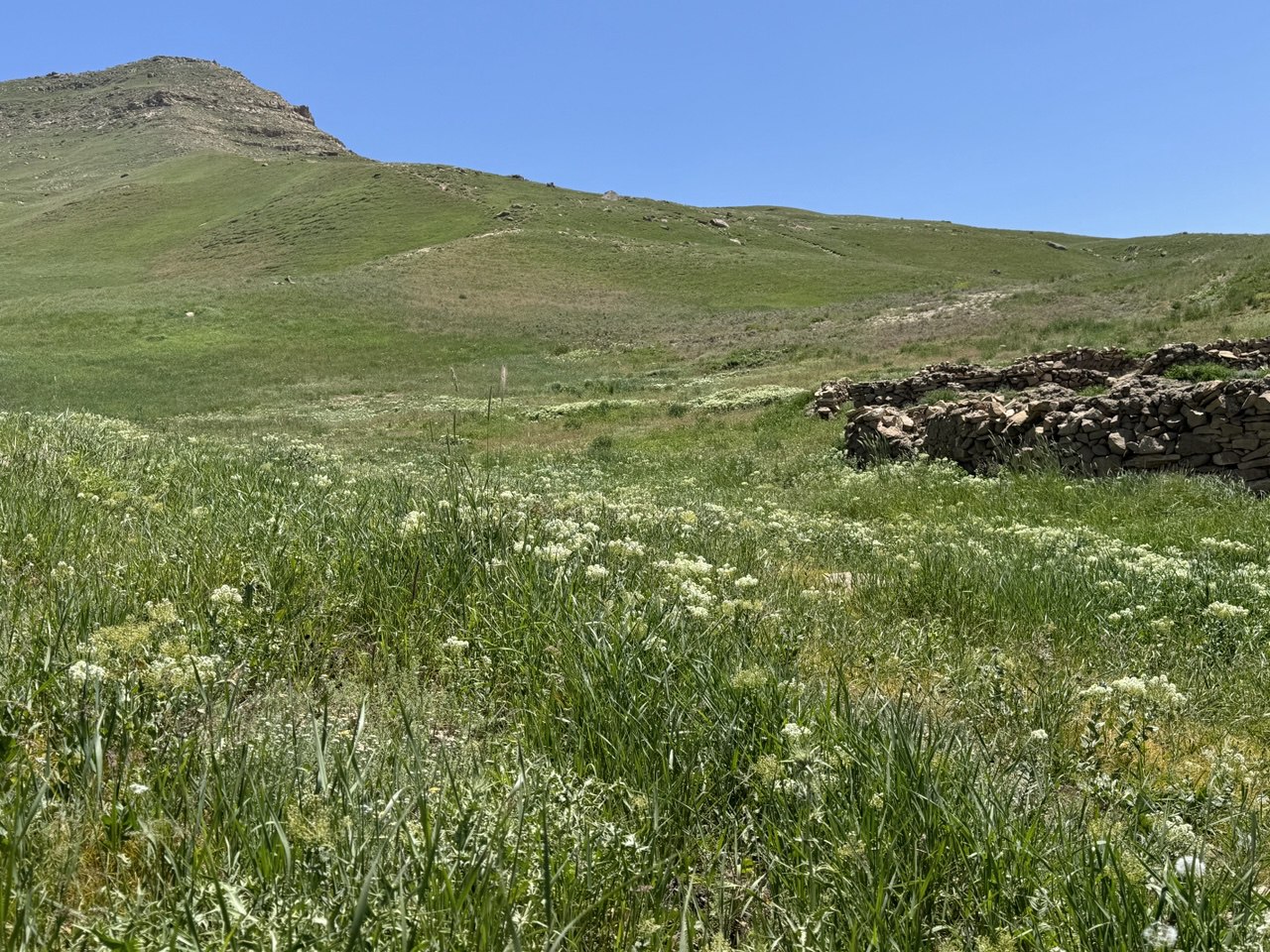
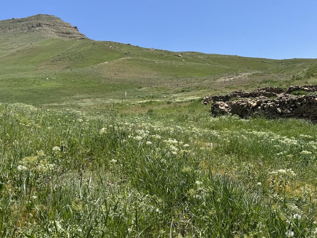
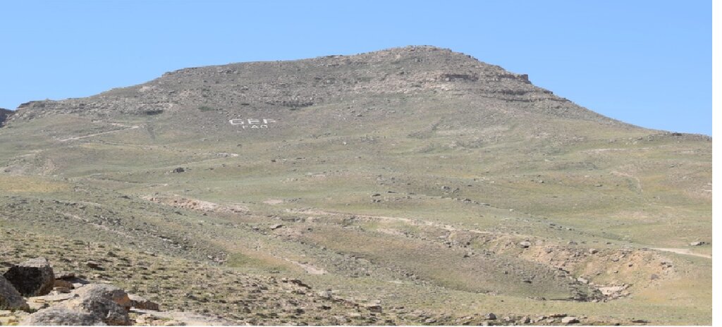
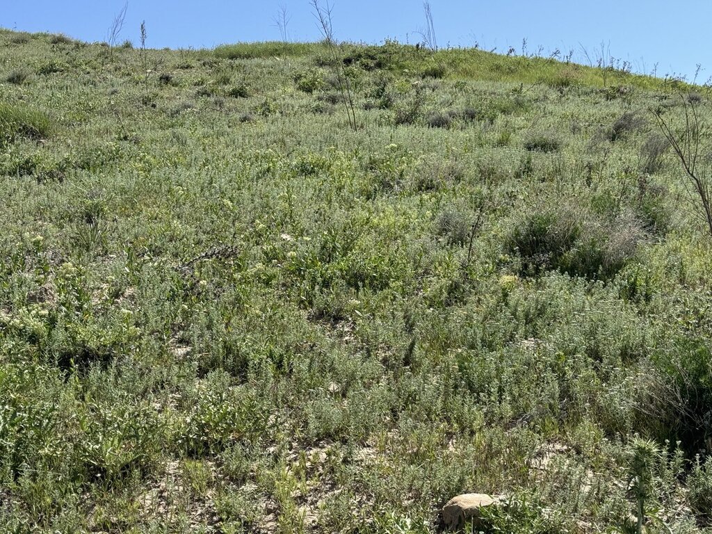
In June 2022, a 1,000-hectare rangeland quarantine area was established to promote the rehabilitation of degraded land and restore the natural vegetation cover. This area was strategically enclosed with clearly marked benchmark boundaries to prevent grazing and ensure its complete protection. By protecting this area from human interference and grazing, the land has been given the opportunity to recover naturally.
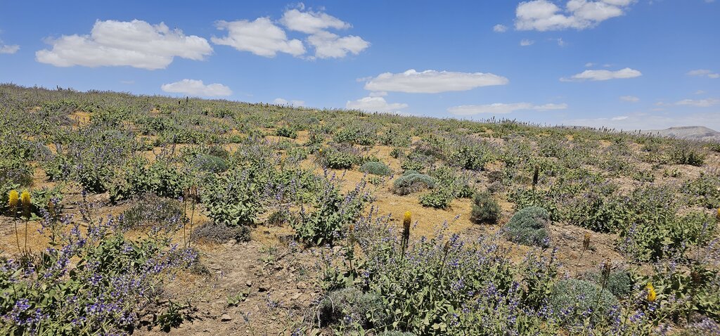
The quarantine area has shown remarkable improvements in the health of its ecosystem. Native grasses, shrubs, and bushes have successfully rehabilitated, with noticeable growth and regeneration. The efforts to protect this area have allowed these plants to thrive without the pressure of overgrazing, leading to the revitalization of the local flora.
A significant outcome of the quarantine area is its role as a natural seed bank. Native seeds collected from this rehabilitated land are now being stored and used for reseeding other degraded rangelands. These seeds, adapted to the local environment, have high potential for successful regeneration when used to restore other areas facing similar ecological challenges. This process not only supports the rehabilitation of nearby rangelands but also contributes to the long-term sustainability and resilience of the local ecosystem.
The success of this quarantine area highlights the importance of protective measures and demonstrates the potential for land recovery through strategic interventions. As a result, this area serves as a model for rangeland rehabilitation. The lessons from the technology applied can be a valuable resource for future restoration efforts across the region.
2.3 Photos de la Technologie
Remarques générales concernant les photos:
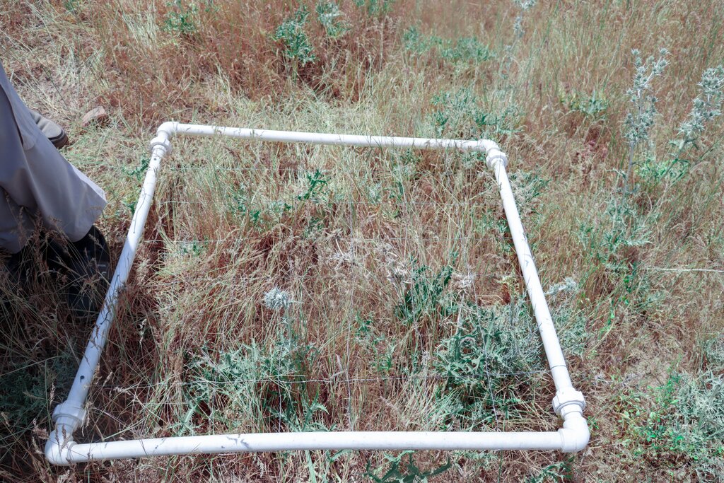
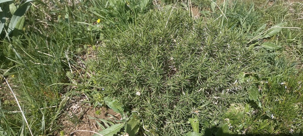
Since this area is under rangeland quarantine, we have observed significant changes, such as the natural regeneration of grasses, shrubs, bushes, biodiversity and habitat.
2.4 Vidéos de la Technologie
Date:
28/01/2025
Lieu:
Deh Beranj village, Qadis district, Badghis Afghanistan
Nom du vidéaste:
Abdullah Kheradmand
2.5 Pays/ région/ lieux où la Technologie a été appliquée et qui sont couverts par cette évaluation
Pays:
Afghanistan
Région/ Etat/ Province:
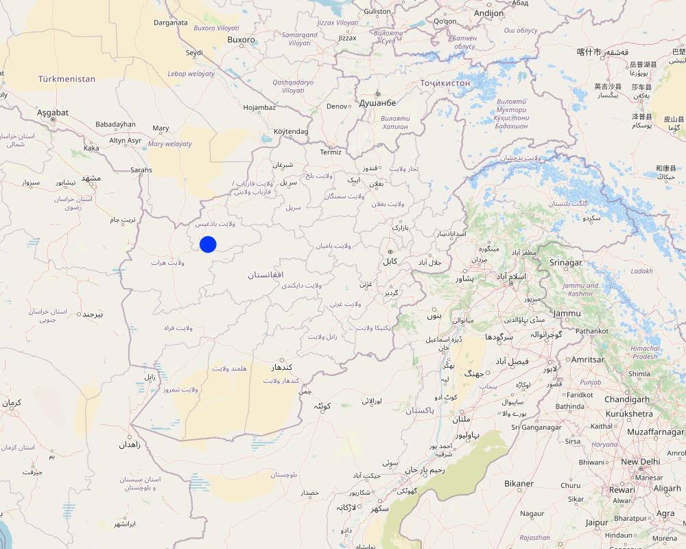
Badghis province
Autres spécifications du lieu:
Deh Beranj Rangeland Management Association, Qadis district
Spécifiez la diffusion de la Technologie:
- répartie uniformément sur une zone
Si la Technologie est uniformément répartie sur une zone, précisez la superficie couverte (en km2):
10,0
Est-ce que les sites dans lesquels la Technologie est appliquée sont situés dans des zones protégées en permanence?
Non
Map
×2.6 Date de mise en œuvre de la Technologie
Indiquez l'année de mise en œuvre:
2022
2.7 Introduction de la Technologie
Spécifiez comment la Technologie a été introduite: :
- par le biais de projets/ d'interventions extérieures
Commentaires (type de projet, etc.) :
GEF-06 SLM project in Afghanistan
3. Classification de la Technologie de GDT
3.1 Principal(aux) objectif(s) de la Technologie
- améliorer la production
- réduire, prévenir, restaurer les terres dégradées
- préserver l'écosystème
- conserver/ améliorer la biodiversité
- atténuer le changement climatique et ses impacts
3.2 Type(s) actuel(s) d'utilisation des terres, là où la Technologie est appliquée
Les divers types d'utilisation des terres au sein du même unité de terrain: :
Non

Pâturages
Pâturage extensif:
- Pastoralisme de type semi-nomade
Pâturage intensif/ production fourragère :
- Prairies améliorées
Type d'animal:
- ovins
Est-ce que la gestion intégrée cultures-élevage est pratiquée?
Non
Produits et services:
- viande
- lait
Espèces:
ovins
Nombre:
50000
3.4 Approvisionnement en eau
Approvisionnement en eau des terres sur lesquelles est appliquée la Technologie:
- pluvial
Commentaires:
Rainfall occurs in December to April
3.5 Groupe de GDT auquel appartient la Technologie
- fermeture de zones (arrêt de tout usage, appui à la réhabilitation)
- pastoralisme et gestion des pâturages
- Amélioration de la couverture végétale/ du sol
3.6 Mesures de GDT constituant la Technologie

pratiques végétales
- V1: Couverture d’arbres et d’arbustes

modes de gestion
- M5: Contrôle/ changement de la composition des espèces
- M6: Gestion des déchets (recyclage, réutilisation ou réduction)
3.7 Principaux types de dégradation des terres traités par la Technologie

érosion hydrique des sols
- Wt: perte de la couche superficielle des sols (couche arable)/ érosion de surface

dégradation physique des sols
- Pw: saturation en eau des sols

dégradation biologique
- Bc: réduction de la couverture végétale
- Bf: effets néfastes des feux
- Bs: baisse de la qualité et de la composition/ diversité des espèces
3.8 Prévention, réduction de la dégradation ou réhabilitation des terres dégradées
Spécifiez l'objectif de la Technologie au regard de la dégradation des terres:
- réduire la dégradation des terres
4. Spécifications techniques, activités, intrants et coûts de mise en œuvre
4.1 Dessin technique de la Technologie
Spécifications techniques (associées au dessin technique):
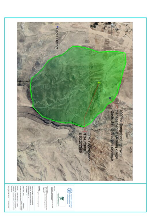
• Green area indicates where grasses regenerated and the GPS shows exact quarantined area.
• Rangeland quarantine was implemented for three years to facilitate the recovery of grasses. By restricting access to degraded areas, we allowed native vegetation to regenerate without disturbance. The grazing exclusion is by social fencing.
• The boundary mark is not a fence but functions as one. Constructed from rocks (1 x 1.5 x 2 meters), the boundary marks are placed every 100 to 200 meters around the rangeland quarantine area to clearly mark its boundaries and prevent or control grazing, ensuring the area remains closed for its recovery.
• Stakeholder involvement through inclusion of local communities in planning and implementation processes.
Auteur:
Shamsulhaq Shams
Date:
10/12/2024
4.2 Informations générales sur le calcul des intrants et des coûts
Spécifiez la manière dont les coûts et les intrants ont été calculés:
- par superficie de la Technologie
Indiquez la taille et l'unité de surface:
1000 Ha
Indiquez la monnaie utilisée pour le calcul des coûts:
- dollars américains
Indiquez le coût salarial moyen de la main d'œuvre par jour:
5 USD
4.3 Activités de mise en place/ d'établissement
| Activité | Calendrier des activités (saisonnier) | |
|---|---|---|
| 1. | Survey and site selection followed by feasibility study | 1st month 10/04/2022 |
| 2. | Preparing construction material (eg. assembling rocks) | 2nd month 08/05/2022 |
| 3. | Construction of boundary marks around the area | 3rd month 01/06/2022 |
| 4. | Capacity building of the target communities | 4th month 05/07/2022 |
| 5. | Hiring guard for patrolling the area | 5th month 01/08/2022 |
4.4 Coûts et intrants nécessaires à la mise en place
| Spécifiez les intrants | Unité | Quantité | Coûts par unité | Coût total par intrant | % des coût supporté par les exploitants des terres | |
|---|---|---|---|---|---|---|
| Main d'œuvre | Skilled labour for construction of boundary mark | person/day | 60,0 | 11,0 | 660,0 | 100,0 |
| Main d'œuvre | Unskilled labour for construction of boundary mark | person/day | 130,0 | 5,0 | 650,0 | 100,0 |
| Main d'œuvre | Guard for patrolling the area | person/day | 2,0 | 1015,0 | 2030,0 | 50,0 |
| Matériaux de construction | Rock | M3 | 100,0 | 1,41 | 141,0 | 100,0 |
| Coût total de mise en place de la Technologie | 3481,0 | |||||
| Coût total de mise en place de la Technologie en dollars américains (USD) | 3481,0 | |||||
Si le coût n'est pas pris en charge à 100% par l'exploitant des terres, indiquez qui a financé le coût restant:
50% of the costs of guards for patrolling the area was paid by the FAO-GEF project
Commentaires:
Cost of skilled labour for construction of the boundary marks was paid by FAO-GEF project.
4.5 Activités d'entretien/ récurrentes
| Activité | Calendrier/ fréquence | |
|---|---|---|
| 1. | Patrolling the area | All seasons/regular |
4.6 Coûts et intrants nécessaires aux activités d'entretien/ récurrentes (par an)
| Spécifiez les intrants | Unité | Quantité | Coûts par unité | Coût total par intrant | % des coût supporté par les exploitants des terres | |
|---|---|---|---|---|---|---|
| Main d'œuvre | Guard for patrolling the area (second year) | person/year | 2,0 | 1015,0 | 2030,0 | 50,0 |
| Coût total d'entretien de la Technologie | 2030,0 | |||||
| Coût total d'entretien de la Technologie en dollars américains (USD) | 2030,0 | |||||
4.7 Facteurs les plus importants affectant les coûts
Décrivez les facteurs les plus importants affectant les coûts :
Skilled and unskilled labour
5. Environnement naturel et humain
5.1 Climat
Précipitations annuelles
- < 250 mm
- 251-500 mm
- 501-750 mm
- 751-1000 mm
- 1001-1500 mm
- 1501-2000 mm
- 2001-3000 mm
- 3001-4000 mm
- > 4000 mm
Spécifiez la pluviométrie moyenne annuelle (si connue), en mm:
250,00
Spécifications/ commentaires sur les précipitations:
Winter (January, February, March)
Dry periods start from May till November
Zone agro-climatique
- semi-aride
Annual temperature is 25 degrees
5.2 Topographie
Pentes moyennes:
- plat (0-2 %)
- faible (3-5%)
- modéré (6-10%)
- onduleux (11-15%)
- vallonné (16-30%)
- raide (31-60%)
- très raide (>60%)
Reliefs:
- plateaux/ plaines
- crêtes
- flancs/ pentes de montagne
- flancs/ pentes de colline
- piémonts/ glacis (bas de pente)
- fonds de vallée/bas-fonds
Zones altitudinales:
- 0-100 m
- 101-500 m
- 501-1000 m
- 1001-1500 m
- 1501-2000 m
- 2001-2500 m
- 2501-3000 m
- 3001-4000 m
- > 4000 m
Indiquez si la Technologie est spécifiquement appliquée dans des:
- situations concaves
Commentaires et précisions supplémentaires sur la topographie:
1800 m above sea level and slope angle is 20 %
5.3 Sols
Profondeur moyenne du sol:
- très superficiel (0-20 cm)
- superficiel (21-50 cm)
- modérément profond (51-80 cm)
- profond (81-120 cm)
- très profond (>120 cm)
Texture du sol (de la couche arable):
- fin/ lourd (argile)
Texture du sol (> 20 cm sous la surface):
- fin/ lourd (argile)
Matière organique de la couche arable:
- faible (<1%)
5.4 Disponibilité et qualité de l'eau
Profondeur estimée de l’eau dans le sol:
> 50 m
Disponibilité de l’eau de surface:
moyenne
Qualité de l’eau (non traitée):
eau potable
La qualité de l'eau fait référence à:
à la fois les eaux souterraines et de surface
La salinité de l'eau est-elle un problème? :
Non
La zone est-elle inondée?
Non
5.5 Biodiversité
Diversité des espèces:
- élevé
Diversité des habitats:
- moyenne
Commentaires et précisions supplémentaires sur la biodiversité:
The rangelands are characterized by flora diversity and likely host a variety of plant species that are adapted to arid conditions. These include drought-resistant grasses like Eragrostis species, shrubs like Acantholimon caryophllaceum, Artemisia and some endemic plant species unique to the region (Achillea nabilis, Cardaria draba, Cousinia resinosa).
5.6 Caractéristiques des exploitants des terres appliquant la Technologie
Sédentaire ou nomade:
- Semi-nomade
Orientation du système de production:
- exploitation mixte (de subsistance/ commerciale)
Revenus hors exploitation:
- moins de 10% de tous les revenus
Niveau relatif de richesse:
- pauvre
Individus ou groupes:
- groupe/ communauté
Niveau de mécanisation:
- travail manuel
Genre:
- hommes
Age des exploitants des terres:
- personnes d'âge moyen
5.7 Superficie moyenne des terres utilisées par les exploitants des terres appliquant la Technologie
- < 0,5 ha
- 0,5-1 ha
- 1-2 ha
- 2-5 ha
- 5-15 ha
- 15-50 ha
- 50-100 ha
- 100-500 ha
- 500-1 000 ha
- 1 000-10 000 ha
- > 10 000 ha
Cette superficie est-elle considérée comme de petite, moyenne ou grande dimension (en se référant au contexte local)?
- petite dimension
5.8 Propriété foncière, droits d’utilisation des terres et de l'eau
Propriété foncière:
- communauté/ village
Droits d’utilisation des terres:
- communautaire (organisé)
Droits d’utilisation de l’eau:
- communautaire (organisé)
Est-ce que les droits d'utilisation des terres sont fondés sur un système juridique traditionnel?
Oui
Précisez:
Traditional land use rights
Commentaires:
Land use rights are held collectively by communities, reflecting a communal approach to resource management.
5.9 Accès aux services et aux infrastructures
santé:
- pauvre
- modéré
- bonne
éducation:
- pauvre
- modéré
- bonne
assistance technique:
- pauvre
- modéré
- bonne
emploi (par ex. hors exploitation):
- pauvre
- modéré
- bonne
marchés:
- pauvre
- modéré
- bonne
énergie:
- pauvre
- modéré
- bonne
routes et transports:
- pauvre
- modéré
- bonne
eau potable et assainissement:
- pauvre
- modéré
- bonne
services financiers:
- pauvre
- modéré
- bonne
6. Impacts et conclusions
6.1 Impacts sur site que la Technologie a montrés
Impacts socio-économiques
Production
production fourragère
Quantité avant la GDT:
500 kg fodder/ hectare
Quantité après la GDT:
900 kg fodder/hectare
Commentaires/ spécifiez:
Preventing overgrazing helps maintain plant cover and allows for recovery periods, leading to increased biomass production.
production animale
Quantité avant la GDT:
0.5 liter per sheep/day
Quantité après la GDT:
1 liter per sheep/day
Commentaires/ spécifiez:
Enhancing the quality and availability of forage provid sheep with a more nutritious diet, which directly impacts milk production.
Disponibilité et qualité de l'eau
qualité de l'eau potable
Quantité avant la GDT:
Contaminated water with minerals
Quantité après la GDT:
Leading to clearer and cleaner water
Commentaires/ spécifiez:
Effective rangeland management practices enhance the overall health of the ecosystem, leading to improved drinking water quality through better infiltration due to better soil cover and less water runoff.
Impacts socioculturels
sécurité alimentaire/ autosuffisance
Commentaires/ spécifiez:
Sustainable rangeland management supports local economies by providing livelihoods through livestock production, which can improve food access and self-sufficiency in communities.
situation sanitaire
Quantité avant la GDT:
Less nutritious animal products
Quantité après la GDT:
More nutritious animal products
Commentaires/ spécifiez:
Enhanced forage quality leads to healthier livestock, which provides better quality meat and dairy products, contributing to improved nutrition for communities.
connaissances sur la GDT/ dégradation des terres
Quantité avant la GDT:
Little capacity building
Quantité après la GDT:
Capacity building for 500 members of the Rangeland Management Association
Commentaires/ spécifiez:
Training programs for farmers and land managers, increasing their knowledge about sustainable practices and land conservation techniques.
Impacts écologiques
Cycle de l'eau/ ruissellement
ruissellement de surface
Commentaires/ spécifiez:
Rangeland improvement practices can significantly reduce surface runoff, enhance soil health, and improve water quality
drainage de l'excès d'eau
Commentaires/ spécifiez:
More efficient excess water drainage, enhancing soil structure, reducing waterlogging, and promoting overall ecological health.
Sols
couverture du sol
Quantité avant la GDT:
20% soil cover
Quantité après la GDT:
80-90% soil cover
Commentaires/ spécifiez:
Enhanced soil cover leads to healthier ecosystems, improved soil conditions, and increased biodiversity.
Biodiversité: végétale, animale
Couverture végétale
Quantité avant la GDT:
20%
Quantité après la GDT:
80-90%
Commentaires/ spécifiez:
Enhanced vegetation cover leads to healthier ecosystems, improved soil conditions, and increased biodiversity
biomasse/ au dessus du sol C
Quantité avant la GDT:
20-30% biomass
Quantité après la GDT:
80-90% biomass
Commentaires/ spécifiez:
Rangeland improvement practices significantly boost biomass and above-ground carbon levels, enhancing ecosystem productivity and contributing to carbon sequestration efforts.
diversité végétale
Quantité avant la GDT:
60/plants per square meter
Quantité après la GDT:
200/plants per square meter
Commentaires/ spécifiez:
Enhanced plant diversity leads to healthier ecosystems, increased resilience, and improved overall productivity.
espèces bénéfiques
Quantité avant la GDT:
Limited Beneficial Species
Quantité après la GDT:
Increased Beneficial Species
Commentaires/ spécifiez:
Rangeland improvement practices significantly boost the presence and impact of beneficial species, enhancing soil health, ecosystem stability, and overall productivity.
Réduction des risques de catastrophe et des risques climatiques
impacts de la sécheresse
Quantité avant la GDT:
500 kg fodder/ha
Quantité après la GDT:
800 kg fodder/ ha
Commentaires/ spécifiez:
Rangeland improvement practices significantly mitigate the impacts of drought, enhancing soil moisture retention, vegetation resilience by enhancing the land's ability to retain moisture and support vegetation growth, and overall ecosystem stability.
émissions de carbone et de gaz à effet de serre
Quantité avant la GDT:
80000 m3/ winter season
Quantité après la GDT:
20000 m3/ winter season
Commentaires/ spécifiez:
Healthy, diverse plant communities capture and sequester more carbon dioxide through photosynthesis, contributing to greater carbon sequestration and contributing to climate change mitigation efforts.
Précisez l'évaluation des impacts sur site (sous forme de mesures):
N/A
6.2 Impacts hors site que la Technologie a montrés
inondations en aval
Quantité avant la GDT:
10-12 times /year
Quantité après la GDT:
Zero floods per year
Commentaires/ spécifiez:
Risk and impact of downstream flooding is significantly reduced by enhancing vegetation cover, improving soil health, and promoting better water management.
sédiments (indésirables) transportés par le vent
Quantité avant la GDT:
more sediment transport
Quantité après la GDT:
Zero sediment transport
Commentaires/ spécifiez:
With vegetation cover, there is significantly less sediment being transported by wind
impact des gaz à effet de serre
Quantité avant la GDT:
20 tons CO2 removed/year
Quantité après la GDT:
50 tons CO2 removed/year
Commentaires/ spécifiez:
Healthy rangelands help absorb more carbon in plants and soil, which lowers the amount of CO₂ in the atmosphere. When these lands are grazed properly, they allow perennial and annual grasses to regrow. This regrowth not only captures more carbon but also improves soil health.
Précisez l'évaluation des impacts extérieurs (sous forme de mesures):
N/A
6.3 Exposition et sensibilité de la Technologie aux changements progressifs et aux évènements extrêmes/catastrophes liés au climat (telles que perçues par les exploitants des terres)
Changements climatiques progressifs
Changements climatiques progressifs
| Saison | Augmentation ou diminution | Comment la Technologie fait-elle face à cela? | |
|---|---|---|---|
| températures annuelles | décroît | modérément | |
| précipitations annuelles | augmente | modérément |
Extrêmes climatiques (catastrophes)
Catastrophes météorologiques
| Comment la Technologie fait-elle face à cela? | |
|---|---|
| tempête de vent locale | modérément |
Catastrophes climatiques
| Comment la Technologie fait-elle face à cela? | |
|---|---|
| canicule | modérément |
| sécheresse | modérément |
Catastrophes hydrologiques
| Comment la Technologie fait-elle face à cela? | |
|---|---|
| crue éclair | modérément |
6.4 Analyse coûts-bénéfices
Quels sont les bénéfices comparativement aux coûts de mise en place (du point de vue des exploitants des terres)?
Rentabilité à court terme:
légèrement positive
Rentabilité à long terme:
très positive
Quels sont les bénéfices comparativement aux coûts d'entretien récurrents (du point de vue des exploitants des terres)?
Rentabilité à court terme:
positive
Rentabilité à long terme:
très positive
Commentaires:
Improved rangelands often lead to higher forage yields, supporting larger and healthier livestock populations. This can result in increased income for land users.
6.5 Adoption de la Technologie
- cas isolés/ expérimentaux
De tous ceux qui ont adopté la Technologie, combien d'entre eux l'ont fait spontanément, à savoir sans recevoir aucune incitation matérielle, ou aucune rémunération? :
- 0-10%
6.6 Adaptation
La Technologie a-t-elle été récemment modifiée pour s'adapter à l'évolution des conditions?
Non
6.7 Points forts/ avantages/ possibilités de la Technologie
| Points forts/ avantages/ possibilités du point de vue de l'exploitant des terres |
|---|
| Rangeland quarantine allow for better management of pasture resources leading to improved pasture and grass quality. |
| Rangeland quarantine increased productivity can maximize the land's carrying capacity leading to higher livestock productivity per unit area. |
| Rangeland quarantine helps prevent overgrazing, reduces parasite loads, minimizes soil compaction, and allows for more natural feeding behaviors, all of which contribute to overall animal health. |
| Reduce greenhouse gas emissions through carbon sequestration. |
| Properly managed rangeland quarantine can promote biodiversity by creating varied habitats and supporting a range of plant and animal species. |
| Implementing rangeland quarantine can lead to knowledge transfer among farmers, researchers, and agricultural extension services, fostering innovation and best practices in sustainable land management. |
6.8 Faiblesses/ inconvénients/ risques de la Technologie et moyens de les surmonter
| Faiblesses/ inconvénients/ risques du point de vue de l’exploitant des terres | Comment peuvent-ils être surmontés? |
|---|---|
| Ensuring the right number of animals on each grazing area can be challenging, leading to risks of overgrazing or underutilization. | Stocking rate management. |
| Rangeland quarantine can lead to social conflicts among different user groups, such as conflicting interests between livestock owners, conservationists, and indigenous communities. | Facilitating dialogue among stakeholders, promoting collaborative rangeland management approaches, respecting traditional land tenure systems, and fostering community-based conflict resolution mechanisms can help manage. |
| Faiblesses/ inconvénients/ risques du point de vue du compilateur ou d'une autre personne ressource clé | Comment peuvent-ils être surmontés? |
|---|---|
| When grazing animals are quarantined, their numbers may increase in certain areas, leading to overgrazing. This can result in habitat degradation and loss of plant diversity. | Implement managed grazing systems to control population densities and prevent overgrazing. This can include rotational grazing practices. |
7. Références et liens
7.1 Méthodes/ sources d'information
- visites de terrain, enquêtes sur le terrain
5
- interviews/entretiens avec les exploitants des terres
12
- interviews/ entretiens avec les spécialistes/ experts de GDT
2
- compilation à partir de rapports et d'autres documents existants
2
Quand les données ont-elles été compilées (sur le terrain)?
23/10/2024
7.4 Observations d'ordre général
This questionnaire serves as an ideal model to showcase the work modality and shared experiences with other regions. By evaluating this type of work model, individuals interested in this field can easily adjust their activities and increase their chances of success.
Liens et modules
Développer tout Réduire toutLiens
Aucun lien
Modules
Aucun module trouvé


