Ex-post and ex-ante soil sealing maps
(ប្រទេសប៉ូឡូញ)
Mapy procesu zasklepiania gleb (Polish)
ការពណ៌នា
Ex-post and ex-ante soil sealing maps
The technology utilizes soil agricultural maps and provides information on quality of sealed soils.
It involves cellular automata software to build the model of land use change and produce the forecasts for various soil protection scenarios.
Spatial development of the functional areas. These are mostly areas of soil protection for food production purposes. The delineation is based on land productivity information (present on soil-agricultural maps), distribution of high nature value areas, need for establishment of “green rings” around the bigger cities.
The maps will be sent to the municipal authorities, with a scientific comment on the problem. The technology enables determining the scale of the soil sealing threat in the province, also what is the soil quality class of the area of interest. In the municipalities with the greatest soil sealing problem and with perspective to expand in the future, there is a need for new legal regulations to force soil protection in local spatial plans. The regional spatial planning office should become a coordinator for the local spatial planning offices, to raise the knowledge about how to use soil digital maps in spatial planning, especially in the case of protecting the soil against soil sealing process. For the municipalities, large scale maps are produced, which contain results of soil sealing forecasting model.
Land use maps of at least 10-meter resolution are produced for two historical periods through classification of the satellite images and using available local land use information. The information on land use change is superimposed on maps characterizing soil quality in order to detect to what extend the urbanization took place on valuable soils. The new sealed area, reflecting the built up sprawl of at least last 15 years, consists with expansion of the following land use classes: continuous residential area, commercial/industrial area and transport facilities. The soils under these new land use types fully lost their environmental functions.
In the soil sealing forecasts the Cellular Automata-based Metronamica model is used. The software was developed and provided by the Research Institute from Knowledge Systems (RIKS) from Maastricht, The Netherlands. The software utilizes cellular automata model to spatially distribute areas of particular land use classes with assumption that the neighborhood of a cell (surrounding cells) influences the transition of this cell into other land use class in the next time step. The method utilizes land use maps and soil quality maps.
ទីតាំង
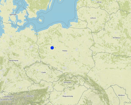
ទីតាំង: Poznań, Poland/Great Poland province, ប្រទេសប៉ូឡូញ
ចំនួនទីកន្លែងបច្ចេកទេស ដែលវិភាគ:
ចំណុចយោងភូមិសាស្ត្រនៃទីតាំងជ្រើសរើស
ការសាយភាយនៃបច្ចេកទេស: ត្រូវបានផ្សព្វផ្សាយត្រឹមតំបន់មួយ (199.0 km²)
តើស្ថិតក្នុងតំបន់ការពារអចិន្ត្រៃយ៍?:
កាលបរិច្ឆេទនៃការអនុវត្ត: តិចជាង 10ឆ្នាំមុន (ថ្មី)
ប្រភេទនៃការណែនាំឱ្យអនុវត្តន៍៖
-
តាមរយៈការបង្កើតថ្មីរបស់អ្នកប្រើប្រាស់ដី
-
ជាផ្នែកនៃប្រព័ន្ធប្រពៃណី (> 50 ឆ្នាំ)
-
ពេលកំពុងពិសោធន៍
-
តាមរយៈគម្រោង / អន្តរាគមន៍ពីខាងក្រៅ
គោលបំណងចម្បងៗ
-
ធ្វើឱ្យប្រសើរឡើងនូវផលិតកម្ម
-
កាត់បន្ថយ, បង្ការ, ស្តារឡើងវិញនូវការធ្លាក់ចុះគុណភាពដី
-
អភិរក្សប្រព័ន្ធអេកូឡូស៊ី
-
ការពារតំបន់ទីជម្រាល/តំបន់ខ្សែទឹកខាងក្រោមបញ្ចូលជាមួយបច្ចេកទេសផ្សេងទៀត
-
អភិរក្ស/ធ្វើឱ្យប្រសើរឡើងជីវចម្រុះ
-
កាត់បន្ថយហានិភ័យនៃគ្រោះមហន្តរាយ
-
បន្ស៊ាំទៅនឹងការប្រែប្រួលអាកាសធាតុ/គ្រោះមហន្តរាយ និងផលប៉ះពាល់របស់វា
-
កាត់បន្ថយការប្រែប្រួលអាកាសធាតុ និងផលប៉ះពាល់របស់វា
-
បង្កើតផលប្រយោជន៍សេដ្ឋកិច្ច
-
បង្កើតផលប្រយោជន៍សង្គម
-
Create and spread knowledge
ការប្រើប្រាស់ដី
-
ដីដាំដំណាំ
ចំនួនសារដែលដាំដំណាំក្នុងមួយឆ្នាំ: 1
ការផ្គត់ផ្គង់ទឹក
-
ទឹកភ្លៀង
-
ទឹកភ្លៀង និងប្រព័ន្ធស្រោចស្រព
-
ប្រព័ន្ធស្រោចស្រពទាំងស្រុង
គោលបំណងទាក់ទងនឹងការធ្លាក់ចុះគុណភាពដី
-
ការការពារការធ្លាក់ចុះគុណភាពដី
-
ការកាត់បន្ថយការធ្លាក់ចុះគុណភាពដី
-
ការជួសជុល/ ស្តារឡើងវិញនៃឱនភាពដីធ្ងន់ធ្ងរ
-
ការបន្ស៊ាំទៅនឹងការធ្លាក់ចុះគុណភាពដី
-
ដែលមិនអាចអនុវត្តបាន
ប្រភេទនៃការធ្លាក់ចុះគុណភាពដីដែលបានដោះស្រាយ
-
ការបាត់បង់រូបសាស្ត្រនៃដី - Pu: បាត់បង់នូវផលិតភាពជីវៈដោយសារសកម្មភាពផ្សេងៗ
ក្រុម SLM
-
កាត់បន្ថយហានិភ័យនៃបញ្ហាលើប្រព័ន្ធអេកូឡូស៊ី
-
Creating and sharing knowledge
វិធានការ SLM
-
វិធានការគ្រប់គ្រង - M2: ការផ្លាស់ប្តូរការគ្រប់គ្រង/ កម្រិតអាំងតង់ស៊ីតេ
គំនូរបច្ចេកទេស
លក្ខណៈបច្ចេកទេស
This is a schema for soil sealing maps developement.
Technical knowledge required for land users: moderate (Developers)
Technical knowledge required for Administration: high
Technical knowledge required for Researchers: high
Main technical functions: improvement of surface structure (crusting, sealing), increase of infiltration, spatial arrangement and diversification of land use
Secondary technical functions: improvement of water quality, buffering / filtering water
Change of land use type: Limited conversion of agricultural land into urban purposes.
Change of land use practices / intensity level: Steering new constructions to soils with less functions. Limited sealing of high quality soils.
ការបង្កើតនិងការថែទាំ៖ សកម្មភាព ធាតុចូល និងថ្លៃដើម
ការគណនាធាតុចូល និងថ្លៃដើម
- ថ្លៃដើមត្រូវបានគណនា៖
- រូបិយប័ណ្ណសម្រាប់ការគណនាថ្លៃដើម៖ មិនមាន
- អត្រាប្តូរប្រាក់ (ទៅជាដុល្លារអាមេរិក)៖ 1 USD = មិនមាន
- ថ្លៃឈ្នួលជាមធ្យមក្នុង ១ ថ្ងៃ៖ មិនមាន
កត្តាសំខាន់បំផុតដែលមានឥទ្ធិពលលើថ្លៃដើម
មិនមាន
សកម្មភាពបង្កើតបច្ចេកទេស
n.a.
សកម្មភាពថែទាំ
n.a.
បរិស្ថានធម្មជាតិ
បរិមាណទឹកភ្លៀងជាមធ្យមប្រចាំឆ្នាំ
-
< 250 មម
-
251-500 មម
-
501-750 មម
-
751-1,000 មម
-
1,001-1,500 មម
-
1,501-2,000 មម
-
2,001-3,000 មម
-
3,001-4,000 មម
-
> 4,000 មម
តំបន់កសិអាកាសធាតុ
-
សើម
-
មានភ្លៀងមធ្យម
-
មានភ្លៀងតិចតួច
-
ស្ងួត
លក្ខណៈសម្គាល់នៃអាកាសធាតុ
Thermal climate class: temperate
ជម្រាល
-
រាបស្មើ (0-2%)
-
ជម្រាលតិចតួច (3-5%)
-
មធ្យម (6-10%)
-
ជម្រាលខ្ពស់បន្តិច (11-15%)
-
ទីទួល (16-30%)
-
ទីទួលចោត (31-60%)
-
ទីទួលចោតខ្លាំង (>60%)
ទម្រង់ដី
-
ខ្ពង់រាប
-
កំពូលភ្នំ
-
ជម្រាលភ្នំ
-
ជម្រាលទួល
-
ជម្រាលជើងភ្នំ
-
បាតជ្រលងភ្នំ
រយៈកម្ពស់ធៀបនឹងនីវ៉ូទឹកសមុទ្រ
-
0-100 ម
-
101-500 ម
-
501-1,000 ម
-
1,001-1,500 ម
-
1,501-2,000 ម
-
2,001-2,500 ម
-
2,501-3,000 ម
-
3,001-4,000 ម
-
> 4,000 ម
បច្ចេកទេសត្រូវបានអនុវត្តនៅក្នុង
-
សណ្ឋានដីប៉ោង
-
សណ្ឋានដីផត
-
មិនពាក់ព័ន្ធទាំងអស់
ជម្រៅដី
-
រាក់ខ្លាំង (0-20 សម)
-
រាក់ (21-50 សម)
-
មធ្យម (51-80 សម)
-
ជ្រៅ (81-120 សម)
-
ជ្រៅខ្លាំង (> 120 សម)
វាយនៈភាពដី (ដីស្រទាប់ខាងលើ)
-
គ្រើម/ មានពន្លឺ (ខ្សាច់)
-
មធ្យម (ល្បាយ, ល្បាប់)
-
ម៉ត់/ ធ្ងន់ (ឥដ្ឋ)
វាយនភាពដី (> 20 សម ក្រោមស្រទាប់លើ)
-
គ្រើម/ មានពន្លឺ (ខ្សាច់)
-
មធ្យម (ល្បាយ, ល្បាប់)
-
ម៉ត់/ ធ្ងន់ (ឥដ្ឋ)
កម្រិតសារធាតុសរីរាង្គក្នុងដីស្រទាប់លើ
-
ខ្ពស់ (>3%)
-
មធ្យម (1-3%)
-
ទាប (<1%)
ដង្ហើមទឹកក្នុងដី
-
ផ្ទៃខាងលើ
-
< 5 ម
-
5-50 ម
-
> 50 ម
ភាពអាចរកបាននៃទឹកលើដី
-
លើស
-
ល្អ
-
កម្រិតមធ្យម
-
មិនមាន/ គ្មាន
គុណភាពទឹក (មិនបានធ្វើប្រព្រឹត្តិកម្ម)
-
ទឹកពិសារដែលមានគុណភាពល្អ
-
ទឹកពិសារដែលគ្មានគុណភាព (តម្រូវឱ្យមានការសំអាត)
-
ទឹកសម្រាប់តែការធ្វើកសិកម្ម (ស្រោចស្រព)
-
ទឹកមិនអាចប្រើប្រាស់បាន
គុណភាពទឹក គឺផ្តោតទៅលើ៖
តើមានបញ្ហាទឹកប្រៃហូរចូលដែរឬទេ?
ការកើតឡើងនៃទឹកជំនន់
ភាពសំបូរបែបនៃជម្រកធម្មជាតិ
ចរិតលក្ខណៈរបស់អ្នកប្រើប្រាស់ដីដែលប្រើបច្ចេកទេស SLM
ទីផ្សារ
-
សម្រាប់ហូបក្នុងគ្រួសារ (ផ្គត់ផ្គង់ខ្លួនឯង)
-
ពាក់កណ្តាលពាណិជ្ជកម្ម (ផ្គត់ផ្គង់ខ្លួនឯង/ ពាណិជ្ជកម្ម)
-
ពាណិជ្ជកម្ម/ ទីផ្សារ
ចំណូលក្រៅកសិដ្ឋាន
-
តិចជាង 10% នៃចំណូល
-
10-50% នៃចំណូល
-
ច្រើនជាង 50% នៃចំណូល
កម្រិតជីវភាព
-
មិនល្អខ្លាំង
-
មិនល្អ
-
មធ្យម
-
មាន
-
មានខ្លាំង
កម្រិតនៃការប្រើគ្រឿងយន្ត
-
ប្រើកម្លាំងពលកម្ម
-
ប្រើកម្លាំងសត្វ
-
គ្រឿងយន្ត/ ម៉ាស៊ីន
នៅមួយកន្លែង ឬពនេចរ
-
នៅមួយកន្លែង
-
ពាក់កណ្តាលពនេចរ
-
ពនេចរ
បុគ្គល ឬក្រុម
-
ធ្វើខ្លួនឯង/ គ្រួសារ
-
ជាក្រុម/ សហគមន៍
-
សហករ
-
មានបុគ្គលិក (ក្រុមហ៊ុន, រដ្ឋ)
អាយុ
-
កុមារ
-
យុវវ័យ
-
វ័យកណ្តាល
-
មនុស្សចាស់
ផ្ទៃដីប្រើប្រាស់ក្នុងមួយគ្រួសារ
-
< 0.5 ហិកតា
-
0.5-1 ហិកតា
-
1-2 ហិកតា
-
2-5 ហិកតា
-
5-15 ហិកតា
-
15-50 ហិកតា
-
50-100 ហិកតា
-
100-500 ហិកតា
-
500-1,000 ហិកតា
-
1,000-10,000 ហិកតា
-
> 10,000 ហិកតា
មាត្រដ្ឋាន
-
ខ្នាតតូច
-
ខ្នាតមធ្យម
-
ខ្នាតធំ
ភាពជាម្ចាស់ដីធ្លី
-
រដ្ឋ
-
ក្រុមហ៊ុន
-
ភូមិ
-
ក្រុម
-
ឯកជន មិនមានកម្មសិទ្ធ
-
ឯកជន មានកម្មសិទ្ធ
សិទ្ធិប្រើប្រាស់ដី
-
អាស្រ័យផលសេរី (មិនមានការកំណត់)
-
ជាក្រុម (មានដែនកំណត់)
-
កិច្ចសន្យាជួល
-
ឯកជន
សិទ្ធិប្រើប្រាស់ទឹក
-
អាស្រ័យផលសេរី (មិនមានការកំណត់)
-
ជាក្រុម (មានដែនកំណត់)
-
កិច្ចសន្យាជួល
-
ឯកជន
ប្រើប្រាស់សេវាកម្ម និងហេដ្ឋារចនាសម្ព័ន្ធ
ការងារ (ឧ. ការងារក្រៅកសិដ្ឋាន)
ផលប៉ះពាល់
ផលប៉ះពាល់សេដ្ឋកិច្ចសង្គម
ផលិតកម្មចំណីសត្វ
comparing to baseline scenario
ទំហំផ្ទៃដីផលិតកម្ម (ដីថ្មីដែលបានដាំដុះ/ ប្រើប្រាស់)
comparing to baseline scenario
ទឹកប្រើប្រាស់សម្រាប់ស្រោចស្រព
comparing to baseline scenario
គុណភាពទឹកស្រោចស្រព
comparing to baseline scenario
ផលប៉ះពាល់វប្បធម៌សង្គម
សន្តិសុខស្បៀង/ ភាពគ្រប់គ្រាន់ខ្លួនឯង
comparing to baseline scenario
ឱកាសនៃការបង្កើតថ្មី
comparing to baseline scenario
ចំណេះដឹង SLM / ការធ្លាក់ចុះគុណភាពដី
ផលប៉ះពាល់ក្នុងបរិវេណ
ទឹកដែលអាចទាញមកប្រើប្រាស់បាន (ទឹកក្រោមដី ទឹក-springs)
ទឹកជំនន់ខ្សែទឹកខាងក្រោម (មិនត្រូវការ)
ការវិភាគថ្លៃដើម និងអត្ថប្រយោជន៍
អត្ថប្រយោជន៍បើប្រៀបធៀបនឹងថ្លៃដើមក្នុងការបង្កើតបច្ចេកទេស
អត្ថប្រយោជន៍បើប្រៀបធៀបនឹងថ្លៃដើមក្នុងការថែទាំបច្ចេកទេស
ការទទួលយក និងការបន្ស៊ាំ
ភាគរយនៃអ្នកប្រើប្រាស់ដីនៅតំបន់ដែលបានទទួលយកបច្ចេកទេស
-
តែមួយករណី /ពិសោធន៍
-
1-10%
-
11-50%
-
> 50%
ក្នុងចំណោមអ្នកទទួលយកបច្ចេកទេសនេះ តើមានប៉ុន្មានភាគរយដែលបានអនុវត្តន៍ដោយមិនបានទទួលការលើកទឹកចិត្តជាសម្ភារៈ?
-
0-10%
-
11-50%
-
51-90%
-
91-100%
តើថ្មីៗនេះ បច្ចេកទេសនេះត្រូវបានកែតម្រូវដើម្បីបន្ស៊ាំទៅនឹងស្ថានភាពប្រែប្រួលដែរឬទេ?
ចំពោះលក្ខខណ្ឌប្រែប្រួលណាមួយដែលត្រូវបានបន្ស៊ាំ?
-
ការប្រែប្រួលអាកាសធាតុ/គ្រោះមហន្តរាយធម្មជាតិ
-
បម្រែបម្រួលទីផ្សារ
-
កម្លាំងពលកម្មដែលអាចរកបាន (ចំណាកស្រុក)
សេក្តីសន្និដ្ឋាន និងមេរៀនបទពិសោធន៍
ភាពខ្លាំង: ទស្សនៈអ្នកប្រើប្រាស់ដី
ភាពខ្លាំង: ទស្សនៈរបស់អ្នកចងក្រង ឬបុគ្គលសំខាន់ផ្សេងទៀត
-
Analysis of various scenarios possible
-
Decisions in spatial planning based on empirical data in spatial format
ចំណុចខ្សោយ/ គុណវិបត្តិ/ ហានិភ័យ : ទស្សនៈអ្នកប្រើប្រាស់ដីវិធីដោះស្រាយ
ចំណុចខ្សោយ/ គុណវិបត្តិ/ ហានិភ័យ : ទស្សនៈរបស់អ្នកចងក្រង ឬបុគ្គលសំខាន់ផ្សេងទៀតវិធីដោះស្រាយ
-
Lack of regulations forcing use of the technology
Pressenting examples of implementation in order to encourage to apply at local level strategies
-
Potential errors in forecasts
Improving the data quality and model effectiveness.
ឯកសារយោង
អ្នកត្រួតពិនិត្យ
-
Fabian Ottiger
-
Alexandra Gavilano
កាលបរិច្ឆេទនៃការអនុវត្ត: 7 ខែ កក្កដា ឆ្នាំ 2015
កែតម្រូវចុងក្រោយ: 14 ខែ មិថុនា ឆ្នាំ 2019
បុគ្គលសំខាន់ៗ
-
Tomasz Miturski - អ្នកជំនាញឯកទេស SLM
ការពណ៌នាលម្អិតក្នុងប្រព័ន្ធគ្រប់គ្រងទិន្នន័យរបស់វ៉ូខេត
ឯកសារនេះត្រូវបានសម្របសម្រួលដោយ
ស្ថាប័ន៖
- Institute of Soil Science and Plant Cultivation (Institute of Soil Science and Plant Cultivation) - ប្រទេសប៉ូឡូញ
គម្រោង
- Preventing and Remediating degradation of soils in Europe through Land Care (EU-RECARE )


