The prevention of soil sealing
(Polônia)
Zapobieganie zasklepianiu gleb (Polish)
Descrição
The prevention of soil sealing is an approach in which stakeholders are making spatial planning decisions based on the new map of soil sealing, in case of protecting the most valuable soils.
Aims / objectives: The aim of this approach is to show how spatial planning decisions, should be made by taking into account the soil sealing problem. As the consequence of urbanization pressure, the urban sprawl is crossing municipal boundaries of Poznań. In the whole study site area, 53,3 % are arable lands, located mostly on loams, silts or sandy clay soils. Wielkopolska province has got the highest farm productivity per ha in Poland. Based on EEA data, sealed surfaces constitute 16 % of the city area. Soil sealing problem is a consequence of the urban sprawl process, which affects mainly the municipalities near by the Poznań city borders. To support decision-making in municipalities spatial planning offices, the data from the soil sealing maps is used to select the most appropriate areas to build new houses mostly on low quality soils.
Methods: Land use maps of at least 10-meter resolution are produced for two historical periods
through classification of the satellite images and using available local land use
information. The information on land use change is superimposed on maps
characterizing soil quality in order to detect to what extend the urbanization took place
on valuable soils. The new sealed area, reflecting the built up sprawl of at least last 15
years, consists with expansion of the following land use classes: continuous residential
area, commercial/industrial area and transport facilities. The soils under these new land
use types fully lost their environmental functions. In the soil sealing forecasts the
Cellular Automata-based Metronamica model is used. The final maps consist of the spatial planning aspect, soil sealing area and the scientific comment about the soil sealing problem.
Localização
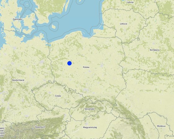
Localização: Poznan, Poland, Wielkopolska, Polônia
Geo-referência de locais selecionados
Data de início: n.a.
Ano de término: n.a.
Tipo de abordagem
-
Tradicional/Indígena
-
Iniciativa/inovação local recente
-
Baseado em projeto/programa
Objetivos de aproximação e ambiente propício
Principais metas / objetivos da abordagem
The Approach focused on SLM only
The main aim of this Approach is to utilize soil agricultural maps and provide information on quality of sealed soils. Send those maps to the municipal authorities, with a scientific comment on the problem. For the whole province, these maps should be made based on the digital soil maps in scale 1:25 000.
The SLM Approach addressed the following problems: The best type of soil is being sealed by new house constructions sites. People from the city center are moving out to municipalities which are near by the border of the city. They are building their houses mostly on agricultural fields in a chaotic way, in much cases on the highest quality soils. This urban sprawl process, affects negatively the soil ecosystem services by the soil sealing and also decrease the quality of inhabitants life.
Condições que permitem a implementação da Tecnologia(s) aplicada(s) sob a Abordagem
Condições que dificultam a implementação da Tecnologia(s) aplicada(s) sob a Abordagem
-
Quadro institucional: In Poland, for every area there were made soil maps in scale 1:5000 and 1:25000. On those maps besides soil data there is also information about house areas and land use types. Most of those maps are still only in paper version, which makes it very hard to use them in spatial planning.
Treatment through the SLM Approach: We will digitize the paper version of soil maps for the municipalities, and also update the map content about the land use.
Participação e papel das partes interessadas envolvidas
Partes interessadas envolvidas na abordagem e seus papéis
| Que partes interessadas/órgãos de implementação estavam envolvidos na abordagem? |
Especifique as partes interessadas |
Descreva o papel das partes interessadas |
| Especialistas em GST/ consultor agrícola |
|
|
| Governo local |
|
|
| Governo nacional (planejadores, responsáveis pelas decisões) |
Wielkopolska province, the Office of spatial planning in Poznań |
|
Envolvimento do usuários de terra/comunidades locais nas diferentes fases da abordagem
Nenhum
Passivo
Apoio externo
Participativo
Automobilização
Iniciação/motivação
The project was introduced throught RECARE project
Planejamento
Wielkopolska province, the Office of spatial planning in Poznań. They firstly had chosen in which municipalities there is the biggest soil sealing problem
Implementação
Wielkopolska province, the Office of spatial planning in Poznań. It is implemented in the spatial planning strategy in the Wielkopolska province.
Monitoramento/avaliação
Institute of soil science and plant cultivation in Pulawy. There is a discussion on a regular basis with the stakeholders.
Tomada de decisão sobre a seleção da Tecnologia GST
As decisões foram tomadas por
-
Somente usuários da terra (iniciativa própria)
-
Principalmente usuários da terra, apoiados por especialistas em GST
-
todos os atores relevantes, como parte de uma abordagem participativa
-
Principalmente especialistas em GST, após consulta com usuários da terra
-
Somente especialistas em GST
-
Políticos/líderes
As decisões foram tomadas com base em
-
Avaliação de conhecimento bem documentado de GST (tomada de decisão baseada em evidências)
-
Resultados de pesquisa
-
Experiência pessoal e opiniões (não documentado)
Suporte técnico, reforço das capacidades e gestão do conhecimento
As seguintes atividades ou serviços têm sido parte da abordagem
-
Reforço das capacidades/ formação
-
Serviço de consultoria
-
Fortalecimento da instituição (desenvolvimento organizacional)
-
Monitoramento e avaliação
-
Pesquisa
Reforço das capacidades/formação
Foi fornecido treinamento às seguintes partes interessadas
-
Usuários de terra
-
Equipe de campo/consultores
-
office workers form the Office of spatial planning
Tipo de formação
-
Em exercício
-
Agricultor para agricultor
-
Áreas de demonstração
-
Reuniões públicas
-
Cursos
Serviço de consultoria
Foi prestado um serviço de consultoria
-
nas áreas dos usuários da terra
-
Em centros permanentes
Advisory service is quite adequate to ensure the continuation of land conservation activities
Fortalecimento institucional
As instituições foram fortalecidas / estabelecidas
-
Não
-
Sim, pouco
-
Sim, moderadamente
-
Sim, significativamente
Descreva instituição, papéis e responsabilidades, membros, etc.
Tipo de apoio
-
Financeiro
-
Reforço das capacidades/ formação
-
Equipamento
Mais detalhes
On the first workshop.
Monitoramento e avaliação
technical aspects were ad hoc monitored by government through observations; indicators: Advisory meetings
area treated aspects were ad hoc monitored by government through observations; indicators: only in municipalities with the highest soil sealing threat
management of Approach aspects were regular monitored by project staff through observations; indicators: advisory meetings
There were no changes in the Approach as a result of monitoring and evaluation
There were no changes in the Technology as a result of monitoring and evaluation
Pesquisa
As pesquisas trataram dos seguintes tópicos
-
Sociologia
-
Economia/Marketing
-
Ecologia
-
Tecnologia
Research was carried out on station
Financiamento e apoio material externo
Orçamento anual em USD para o componente GST
-
< 2.000
-
2.000-10.000
-
10.000-100.000
-
100.000-1.000.000
-
> 1.000.000
Precise annual budget: n.a.
Approach costs were met by the following donors: international non-government: 90.0%; local government (district, county, municipality, village etc): 10.0%
Os seguintes serviços ou incentivos foram fornecidos aos usuários de terras
-
Apoio financeiro/material concedido aos usuários da terra
-
Subsídios para insumos específicos
-
Crédito
-
Outros incentivos ou instrumentos
Análise de impactos e declarações finais
Impactos da abordagem
Não
Sim, pouco
Sim, moderadamente
Sim, significativamente
A abordagem auxiliou os usuários da terra a implementar e manter as tecnologias de GST?
It had raised the awareness about the value of soil ecosystem services, and had shown how big is the scale of soil sealing. This information have started to be very useful in case of taking new spatial planning decisions by the planners.
A abordagem concedeu autonomia aos grupos social e economicamente desfavorecidos?
This isn't connected with the soil sealing threat
A abordagem melhorou as questões de posse de terra/diretos do usuário que inibiam a implementação das tecnologias de GST?
Did other land users / projects adopt the Approach?
Our every stakeholder have adopted the Approach.
Principal motivação dos usuários da terra para implementar a GST
-
Produção aumentada
-
Lucro (lucrabilidade) aumentado, melhora da relação custo-benefício
-
Degradação do solo reduzida
-
Riscos de desastre reduzido
-
Carga de trabalho reduzida
-
Pagamentos/subsídios
-
normas e regulamentos (multas)/aplicação
-
Prestígio, pressão social/coesão social
-
Afiliação a movimento/projeto/grupo/rede
-
Consciência ambiental
-
Costumes e crenças, moral
-
melhoria dos conhecimentos e aptidões de GST
-
Melhoria estética
-
Atenuação de conflitos
Atividades de sustentabilidade de abordagem
Os usuários da terra podem sustentar o que foi implementado através da Abordagem (sem apoio externo)?
Yes, they can continue the Approach activities without support. But we are opened for cooperation/consulting if there will be a need to make some improvements in this Approach.
Conclusões e experiências adquiridas
Pontos fortes: visão do usuário de terra
Pontos fortes: a visão do/a compilador/a ou de outra pessoa capacitada
-
The analysis are made base on the low scale maps : 1:5000 and 1:25000. (How to sustain/ enhance this strength: Update the land use information in spatial data format)
Pontos fracos/desvantagens/riscos: visão do usuário de terracomo superar
Pontos fracos/desvantagens/riscos: a visão do/a compilador/a ou de outra pessoa capacitadacomo superar
-
The commune authorities don't think about long therm consequences in soil loss. They don't see soil sealing as a threat.
Raise the awareness about soil ecosystem services, especially about soil sealing threat. Showing them on the maps, the results of various prediction model, in which the urban sprawl will be still uncontrolled.
Referências
Data da documentação: 18 de Fevereiro de 2016
Última atualização: 19 de Junho de 2017
Pessoas capacitadas
-
Tomasz Miturski (tmiturski@iung.pulawy.pl) - Especialista em GST
Descrição completa no banco de dados do WOCAT
A documentação foi facilitada por
Instituição
- Institute of Soil Science and Plant Cultivation (Institute of Soil Science and Plant Cultivation) - Polônia
Projeto
- Preventing and Remediating degradation of soils in Europe through Land Care (EU-RECARE )


