The prevention of soil sealing [Polônia]
- Criação:
- Atualização:
- Compilador/a: Tomasz Miturski
- Editor: –
- Revisor: Fabian Ottiger
Zapobieganie zasklepianiu gleb (Polish)
approaches_2540 - Polônia
Veja as seções
Expandir tudo Recolher tudo1. Informação geral
1.2 Detalhes do contato das pessoas capacitadas e instituições envolvidas na avaliação e documentação da abordagem
Nome do projeto que facilitou a documentação/avaliação da Abordagem (se relevante)
Preventing and Remediating degradation of soils in Europe through Land Care (EU-RECARE )Nome da(s) instituição(ões) que facilitou(ram) a documentação/avaliação da Abordagem (se relevante)
Institute of Soil Science and Plant Cultivation (Institute of Soil Science and Plant Cultivation) - Polônia1.3 Condições em relação ao uso da informação documentada através de WOCAT
Quando os dados foram compilados (no campo)?
03/04/2015
O/a compilador/a e a(s) pessoa(s) capacitada(s) aceitam as condições relativas ao uso de dados documentados através da WOCAT:
Sim
1.4 Referência ao(s) questionário(s) sobre tecnologias da GST
Ex-post and ex-ante soil sealing maps [Polônia]
Ex-post and ex-ante soil sealing maps
- Compilador/a: Tomasz Miturski
2. Descrição da abordagem de GST
2.1 Descrição curta da abordagem
The prevention of soil sealing is an approach in which stakeholders are making spatial planning decisions based on the new map of soil sealing, in case of protecting the most valuable soils.
2.2 Descrição detalhada da abordagem
Descrição detalhada da abordagem:
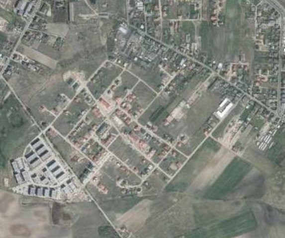
Aims / objectives: The aim of this approach is to show how spatial planning decisions, should be made by taking into account the soil sealing problem. As the consequence of urbanization pressure, the urban sprawl is crossing municipal boundaries of Poznań. In the whole study site area, 53,3 % are arable lands, located mostly on loams, silts or sandy clay soils. Wielkopolska province has got the highest farm productivity per ha in Poland. Based on EEA data, sealed surfaces constitute 16 % of the city area. Soil sealing problem is a consequence of the urban sprawl process, which affects mainly the municipalities near by the Poznań city borders. To support decision-making in municipalities spatial planning offices, the data from the soil sealing maps is used to select the most appropriate areas to build new houses mostly on low quality soils.
Methods: Land use maps of at least 10-meter resolution are produced for two historical periods
through classification of the satellite images and using available local land use
information. The information on land use change is superimposed on maps
characterizing soil quality in order to detect to what extend the urbanization took place
on valuable soils. The new sealed area, reflecting the built up sprawl of at least last 15
years, consists with expansion of the following land use classes: continuous residential
area, commercial/industrial area and transport facilities. The soils under these new land
use types fully lost their environmental functions. In the soil sealing forecasts the
Cellular Automata-based Metronamica model is used. The final maps consist of the spatial planning aspect, soil sealing area and the scientific comment about the soil sealing problem.
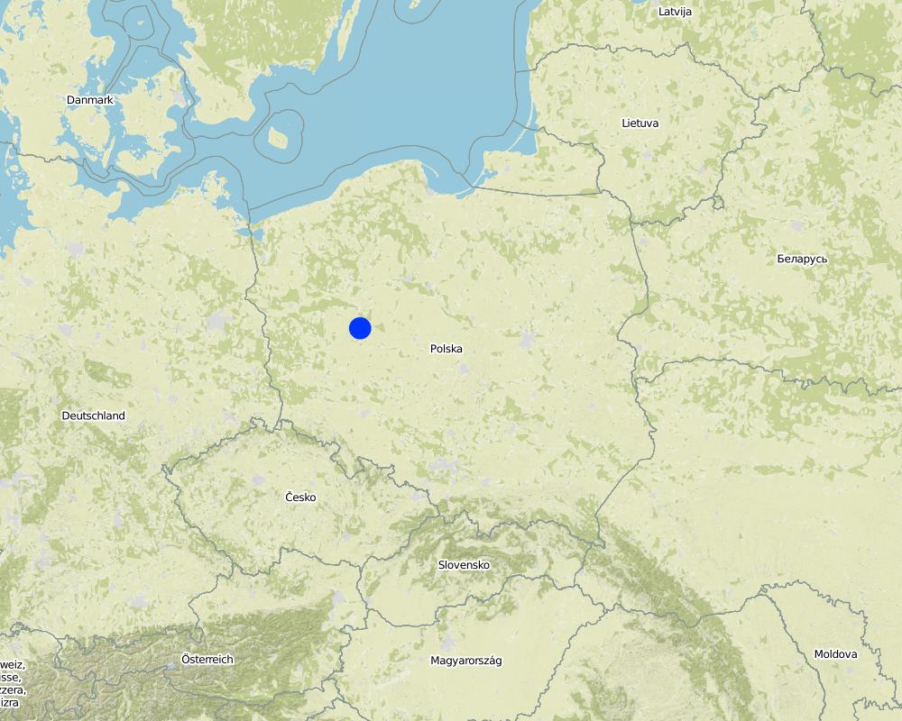
2.5 País/região/locais onde a abordagem foi aplicada
País:
Polônia
Região/Estado/Província:
Poland, Wielkopolska
Especificação adicional de localização:
Poznan
Map
×2.7 Tipo de abordagem
- Baseado em projeto/programa
2.8 Principais metas/objetivos da abordagem
The Approach focused on SLM only
The main aim of this Approach is to utilize soil agricultural maps and provide information on quality of sealed soils. Send those maps to the municipal authorities, with a scientific comment on the problem. For the whole province, these maps should be made based on the digital soil maps in scale 1:25 000.
The SLM Approach addressed the following problems: The best type of soil is being sealed by new house constructions sites. People from the city center are moving out to municipalities which are near by the border of the city. They are building their houses mostly on agricultural fields in a chaotic way, in much cases on the highest quality soils. This urban sprawl process, affects negatively the soil ecosystem services by the soil sealing and also decrease the quality of inhabitants life.
2.9 Condição que propiciam ou inibem a implementação de tecnologia/tecnologias aplicada(s) segundo a abordagem
Quadro institucional
- Inibitivo
In Poland, for every area there were made soil maps in scale 1:5000 and 1:25000. On those maps besides soil data there is also information about house areas and land use types. Most of those maps are still only in paper version, which makes it very hard to use them in spatial planning.
Treatment through the SLM Approach: We will digitize the paper version of soil maps for the municipalities, and also update the map content about the land use.
3. Participação e papel das partes interessadas envolvidas
3.1 Partes interessadas envolvidas na abordagem e seus papéis
- Especialistas em GST/ consultor agrícola
- Governo local
- Governo nacional (planejadores, responsáveis pelas decisões)
Wielkopolska province, the Office of spatial planning in Poznań
3.2 Envolvimento do usuários de terra/comunidades locais nas diferentes fases da abordagem
| Envolvimento do usuários de terra/comunidades locais | Especifique quem estava envolvido e descreva as atividades | |
|---|---|---|
| Iniciação/motivação | Nenhum | The project was introduced throught RECARE project |
| Planejamento | Participativo | Wielkopolska province, the Office of spatial planning in Poznań. They firstly had chosen in which municipalities there is the biggest soil sealing problem |
| Implementação | Nenhum | Wielkopolska province, the Office of spatial planning in Poznań. It is implemented in the spatial planning strategy in the Wielkopolska province. |
| Monitoramento/avaliação | Automobilização | Institute of soil science and plant cultivation in Pulawy. There is a discussion on a regular basis with the stakeholders. |
| Research | Nenhum |
3.4 Decisão sobre a seleção de tecnologia/tecnologias de GST
Especifique quem decidiu sobre a seleção de tecnologia/tecnologias a serem implementadas:
- Somente especialistas em GST
Explique:
Decisions on the method of implementing the SLM Technology were made by by SLM specialists alone (top-down)
4. Suporte técnico, reforço das capacidades e gestão do conhecimento
4.1 Reforço das capacidades/ formação
Foi oferecida formação aos usuários da terra/outras partes interessadas?
Sim
- office workers form the Office of spatial planning
4.2 Serviço de consultoria
Os usuários de terra têm acesso a um serviço de consultoria?
Sim
Descreva/comentários:
Advisory service is quite adequate to ensure the continuation of land conservation activities
4.3 Fortalecimento da instituição (desenvolvimento organizacional)
As instituições foram fortalecidas ou estabelecidas através da abordagem?
- Sim, pouco
Especifique a que nível (níveis) as instituições foram fortalecidas ou estabelecidas:
- Local
Especifique o tipo de apoio:
- Reforço das capacidades/ formação
Dê mais detalhes:
On the first workshop.
4.4 Monitoramento e avaliação
Monitoramento e avaliação são partes da abordagem?
Sim
Comentários:
technical aspects were ad hoc monitored by government through observations; indicators: Advisory meetings
area treated aspects were ad hoc monitored by government through observations; indicators: only in municipalities with the highest soil sealing threat
management of Approach aspects were regular monitored by project staff through observations; indicators: advisory meetings
There were no changes in the Approach as a result of monitoring and evaluation
There were no changes in the Technology as a result of monitoring and evaluation
4.5 Pesquisa
A pesquisa foi parte da abordagem?
Sim
Especifique os tópicos:
- Tecnologia
Dê mais detalhes e indique quem realizou a pesquisa:
Research was carried out on station
5. Financiamento e apoio material externo
5.1 Orçamento anual para o componente de GST da abordagem
Comentários (p. ex. principais fontes de recursos/principais doadores):
Approach costs were met by the following donors: international non-government: 90.0%; local government (district, county, municipality, village etc): 10.0%
5.4 Crédito
Foi concedido crédito segundo a abordagem para atividades de GST?
Não
6. Análise de impactos e declarações finais
6.1 Impactos da abordagem
A abordagem auxiliou os usuários da terra a implementar e manter as tecnologias de GST?
- Não
- Sim, pouco
- Sim, moderadamente
- Sim, significativamente
It had raised the awareness about the value of soil ecosystem services, and had shown how big is the scale of soil sealing. This information have started to be very useful in case of taking new spatial planning decisions by the planners.
A abordagem concedeu autonomia aos grupos social e economicamente desfavorecidos?
- Não
- Sim, pouco
- Sim, moderadamente
- Sim, significativamente
This isn't connected with the soil sealing threat
A abordagem melhorou as questões de posse de terra/diretos do usuário que inibiam a implementação das tecnologias de GST?
- Não
- Sim, pouco
- Sim, moderadamente
- Sim, significativamente
Did other land users / projects adopt the Approach?
- Não
- Sim, pouco
- Sim, moderadamente
- Sim, significativamente
Our every stakeholder have adopted the Approach.
Did the Approach lead to improved livelihoods / human well-being?
- Não
- Sim, pouco
- Sim, moderadamente
- Sim, significativamente
This isn't connected with the soil sealing threat
Did the Approach help to alleviate poverty?
- Não
- Sim, pouco
- Sim, moderadamente
- Sim, significativamente
This isn't connected with the soil sealing threat
6.2 Principal motivação dos usuários da terra para implementar a GST
- Consciência ambiental
6.3 Atividades de sustentabilidade de abordagem
Os usuários da terra podem manter o que foi implementado através da abordagem (sem apoio externo)?
- Sim
Caso afirmativo, descreva como:
Yes, they can continue the Approach activities without support. But we are opened for cooperation/consulting if there will be a need to make some improvements in this Approach.
6.4 Pontos fortes/vantagens da abordagem
| Pontos fortes/vantagens/oportunidades na visão do/a compilador/a ou de outra pessoa capacitada |
|---|
| The analysis are made base on the low scale maps : 1:5000 and 1:25000. (How to sustain/ enhance this strength: Update the land use information in spatial data format) |
6.5 Pontos fracos, desvantagens da tecnologia e formas de superá-los
| Pontos fracos/vantagens/riscos na visão do/a compilador/a ou de outra pessoa capacitada | Como eles podem ser superados? |
|---|---|
| The commune authorities don't think about long therm consequences in soil loss. They don't see soil sealing as a threat. | Raise the awareness about soil ecosystem services, especially about soil sealing threat. Showing them on the maps, the results of various prediction model, in which the urban sprawl will be still uncontrolled. |
7. Referências e links
7.1 Métodos/fontes de informação
- visitas de campo, pesquisas de campo
- entrevistas com usuários de terras
Links e módulos
Expandir tudo Recolher tudoLinks
Ex-post and ex-ante soil sealing maps [Polônia]
Ex-post and ex-ante soil sealing maps
- Compilador/a: Tomasz Miturski
Módulos
Não há módulos