The prevention of soil sealing [Польша]
- Создание:
- Обновить:
- Составитель: Tomasz Miturski
- Редактор: –
- Рецензент: Fabian Ottiger
Zapobieganie zasklepianiu gleb (Polish)
approaches_2540 - Польша
Просмотреть разделы
Развернуть все Свернуть все1. Общая информация
1.2 Контактные данные специалистов и организаций, участвующих в описании и оценке Подхода
Название проекта, содействовавшего документированию/оценке Подхода (если применимо)
Preventing and Remediating degradation of soils in Europe through Land Care (EU-RECARE )Название организации (-ий), содействовавших документированию/оценке Подхода (если применимо)
Institute of Soil Science and Plant Cultivation (Institute of Soil Science and Plant Cultivation) - Польша1.3 Условия, регламентирующие использование собранных ВОКАТ данных
Когда были собраны данные (на местах)?
03/04/2015
Составитель и ответственный/-ые специалист(-ы) согласны с условиями, регламентирующими использование собранных ВОКАТ данных:
Да
1.4 Ссылка (-и) на Анкету (-ы) по Технологиям УЗП
Ex-post and ex-ante soil sealing maps [Польша]
Ex-post and ex-ante soil sealing maps
- Составитель: Tomasz Miturski
2. Описание Подхода УЗП
2.1 Краткое описание Подхода
The prevention of soil sealing is an approach in which stakeholders are making spatial planning decisions based on the new map of soil sealing, in case of protecting the most valuable soils.
2.2 Подробное описание Подхода
Подробное описание Подхода:
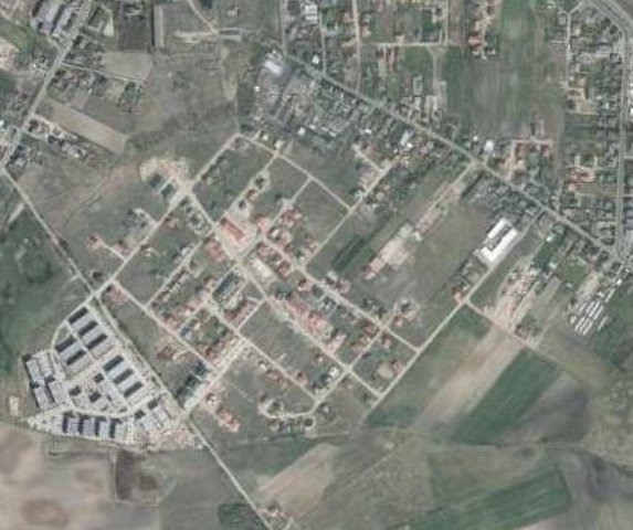
Aims / objectives: The aim of this approach is to show how spatial planning decisions, should be made by taking into account the soil sealing problem. As the consequence of urbanization pressure, the urban sprawl is crossing municipal boundaries of Poznań. In the whole study site area, 53,3 % are arable lands, located mostly on loams, silts or sandy clay soils. Wielkopolska province has got the highest farm productivity per ha in Poland. Based on EEA data, sealed surfaces constitute 16 % of the city area. Soil sealing problem is a consequence of the urban sprawl process, which affects mainly the municipalities near by the Poznań city borders. To support decision-making in municipalities spatial planning offices, the data from the soil sealing maps is used to select the most appropriate areas to build new houses mostly on low quality soils.
Methods: Land use maps of at least 10-meter resolution are produced for two historical periods
through classification of the satellite images and using available local land use
information. The information on land use change is superimposed on maps
characterizing soil quality in order to detect to what extend the urbanization took place
on valuable soils. The new sealed area, reflecting the built up sprawl of at least last 15
years, consists with expansion of the following land use classes: continuous residential
area, commercial/industrial area and transport facilities. The soils under these new land
use types fully lost their environmental functions. In the soil sealing forecasts the
Cellular Automata-based Metronamica model is used. The final maps consist of the spatial planning aspect, soil sealing area and the scientific comment about the soil sealing problem.
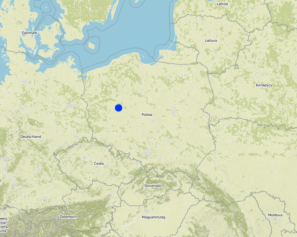
2.5 Страна/ регион/ место, где применялся Подход
Страна:
Польша
Административная единица (Район/Область):
Poland, Wielkopolska
Более точная привязка места:
Poznan
Map
×2.7 Тип Подхода
- в рамках проекта/ программы
2.8 Каковы цели/ задачи Подхода
The Approach focused on SLM only
The main aim of this Approach is to utilize soil agricultural maps and provide information on quality of sealed soils. Send those maps to the municipal authorities, with a scientific comment on the problem. For the whole province, these maps should be made based on the digital soil maps in scale 1:25 000.
The SLM Approach addressed the following problems: The best type of soil is being sealed by new house constructions sites. People from the city center are moving out to municipalities which are near by the border of the city. They are building their houses mostly on agricultural fields in a chaotic way, in much cases on the highest quality soils. This urban sprawl process, affects negatively the soil ecosystem services by the soil sealing and also decrease the quality of inhabitants life.
2.9 Условия содействующие применению Технологии/ Технологий в рамках Подхода или затрудняющие его
Институциональные условия
- затрудняют
In Poland, for every area there were made soil maps in scale 1:5000 and 1:25000. On those maps besides soil data there is also information about house areas and land use types. Most of those maps are still only in paper version, which makes it very hard to use them in spatial planning.
Treatment through the SLM Approach: We will digitize the paper version of soil maps for the municipalities, and also update the map content about the land use.
3. Участие и распределение ролей заинтересованных сторон
3.1 Заинтересованные стороны, участвующие в реализации Подхода и их роли
- эксперты по УЗП/ сельскому хозяйству
- местные власти
- государственные власти (отвечающие за планирование или принятие решений)
Wielkopolska province, the Office of spatial planning in Poznań
3.2 Участие местных землепользователей/ местных сообществ на разных стадиях реализации Подхода
| Участие местных землепользователей/ местных сообществ | Перечислите участников и опишите их вовлеченность | |
|---|---|---|
| инициирование/ мотивация | нет | The project was introduced throught RECARE project |
| планирование | интерактивное | Wielkopolska province, the Office of spatial planning in Poznań. They firstly had chosen in which municipalities there is the biggest soil sealing problem |
| выполнение | нет | Wielkopolska province, the Office of spatial planning in Poznań. It is implemented in the spatial planning strategy in the Wielkopolska province. |
| мониторинг/ оценка | самоорганизация | Institute of soil science and plant cultivation in Pulawy. There is a discussion on a regular basis with the stakeholders. |
| Research | нет |
3.4 Принятие решений по выбору Технологии/ Технологий УЗП
Укажите, кто принимал решение по выбору применяемой Технологии/ Технологий:
- исключительно специалисты по УЗП
Поясните:
Decisions on the method of implementing the SLM Technology were made by by SLM specialists alone (top-down)
4. Техническая поддержка, повышение компетенций и управление знаниями
4.1 Повышение компетенций/ обучение
Проводилось ли обучение землепользователей/ других заинтересованных лиц?
Да
- office workers form the Office of spatial planning
4.2 Консультационные услуги
Есть ли у землепользователей возможность получать консультации?
Да
Описание/ комментарий:
Advisory service is quite adequate to ensure the continuation of land conservation activities
4.3 Институциональная (организационная) поддержка
В ходе реализации Подхода были ли организованы новые институциональные структуры или поддержаны уже существующие?
- да, немного
Укажите уровень, на котором структуры были укреплены или вновь созданы:
- местные
Укажите тип поддержки:
- повышение компетенций/ обучение
Подробнее:
On the first workshop.
4.4 Мониторинг и оценка
Являются ли мониторинг и оценка частью Подхода?
Да
Комментарии:
technical aspects were ad hoc monitored by government through observations; indicators: Advisory meetings
area treated aspects were ad hoc monitored by government through observations; indicators: only in municipalities with the highest soil sealing threat
management of Approach aspects were regular monitored by project staff through observations; indicators: advisory meetings
There were no changes in the Approach as a result of monitoring and evaluation
There were no changes in the Technology as a result of monitoring and evaluation
4.5 Научные исследования
Были ли научные исследования частью Подхода?
Да
Укажите темы исследований:
- технология
Напишите подробнее и назовите тех, кто выполнял исследования:
Research was carried out on station
5. Финансирование и внешняя материальная поддержка
5.1 Годовой бюджет мероприятий по УЗП в рамках Подхода
Комментарий (например, основные источники финансирования/ ключевые доноры):
Approach costs were met by the following donors: international non-government: 90.0%; local government (district, county, municipality, village etc): 10.0%
5.4 Кредитование
Предоставлялись ли в рамках Подхода кредиты на мероприятия УЗП?
Нет
6. Анализ влияния и заключительные положения
6.1 Влияние Подхода
Сумел ли Подход помочь землепользователям внедрить и поддерживать технологии УЗП?
- Нет
- Да, немного
- Да, умеренно
- Да, существенно
It had raised the awareness about the value of soil ecosystem services, and had shown how big is the scale of soil sealing. This information have started to be very useful in case of taking new spatial planning decisions by the planners.
Сумел ли Подход расширить возможности социально и экономически уязвимых групп?
- Нет
- Да, немного
- Да, умеренно
- Да, существенно
This isn't connected with the soil sealing threat
Сумел ли Подход разрешить правовые проблемы землевладения/ землепользования, препятствующие использованию технологий УЗП?
- Нет
- Да, немного
- Да, умеренно
- Да, существенно
Did other land users / projects adopt the Approach?
- Нет
- Да, немного
- Да, умеренно
- Да, существенно
Our every stakeholder have adopted the Approach.
Did the Approach lead to improved livelihoods / human well-being?
- Нет
- Да, немного
- Да, умеренно
- Да, существенно
This isn't connected with the soil sealing threat
Did the Approach help to alleviate poverty?
- Нет
- Да, немного
- Да, умеренно
- Да, существенно
This isn't connected with the soil sealing threat
6.2 Основные причины, побуждающие землепользователей внедрять УЗП
- экологическая сознательность
6.3 Долгосрочная устойчивость мероприятий в рамках Подхода
Могут ли землепользователи самостоятельно (без внешней поддержки) продолжать применение того, что было реализовано в рамках Подхода?
- да
Если да, опишите как:
Yes, they can continue the Approach activities without support. But we are opened for cooperation/consulting if there will be a need to make some improvements in this Approach.
6.4 Сильные стороны/ преимущества Подхода
| Сильные стороны/ преимущества/ возможности по мнению составителя или других ключевых специалистов |
|---|
| The analysis are made base on the low scale maps : 1:5000 and 1:25000. (How to sustain/ enhance this strength: Update the land use information in spatial data format) |
6.5 Слабые стороны/ недостатки Подхода и пути их преодоления
| Слабые стороны/ недостатки/ риски по мнению составителя или ответственных специалистов | Возможные пути их преодоления/снижения? |
|---|---|
| The commune authorities don't think about long therm consequences in soil loss. They don't see soil sealing as a threat. | Raise the awareness about soil ecosystem services, especially about soil sealing threat. Showing them on the maps, the results of various prediction model, in which the urban sprawl will be still uncontrolled. |
7. Справочные материалы и ссылки
7.1 Методы сбора/источники информации
- выезды на места, полевые обследования
- опросы землепользователей
Ссылки и модули
Развернуть все Свернуть всеСсылки
Ex-post and ex-ante soil sealing maps [Польша]
Ex-post and ex-ante soil sealing maps
- Составитель: Tomasz Miturski
Модули
Нет модулей