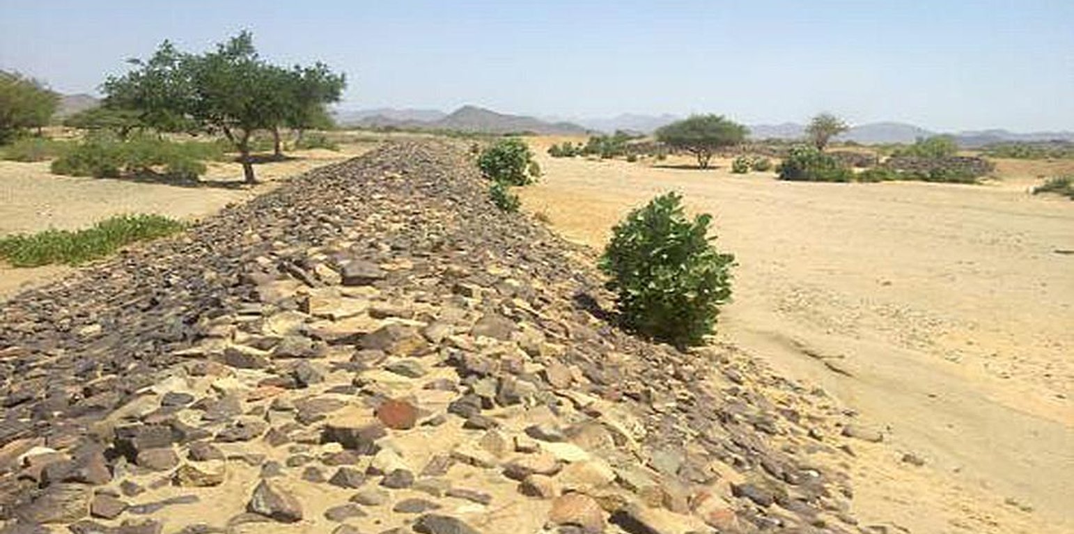


Water Spreading (or Spate Irrigation) can be done through the construction of an angled bank or weir – with a spillway in case of excess flow – to divert a “khor” (ephemeral stream) and spread it (using spaced contour bunds) for crop production.
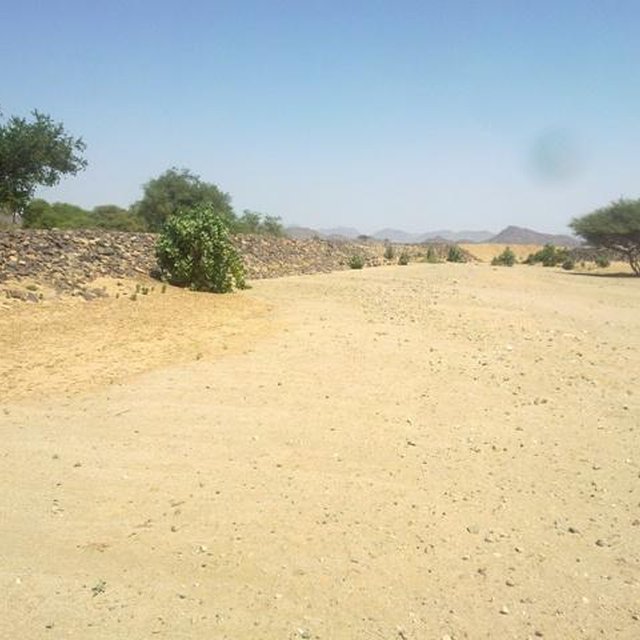
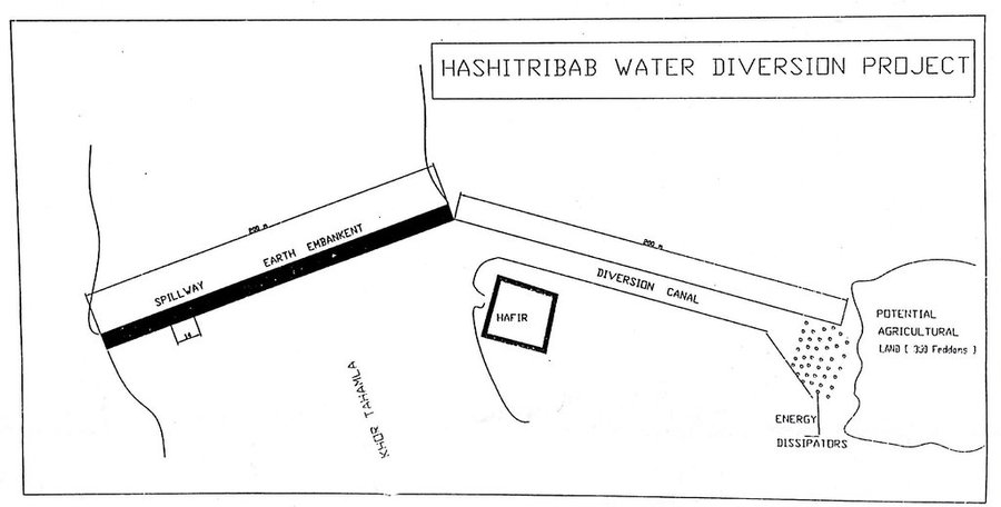
Water Spreading from khors or wadis where channelized runoff/ floodwater is diverted onto plains which are then cultivated on residual moisture. An example of a scheme which was constructed in 1999 is located at Hashitribab, some 7 km from Sinkat on the road towards Kassala. This scheme, comprising a stone-pitched earth diversion barrier across a khor (an ephemeral water course), is documented by using among others the WOCAT Questionnaire and WOCAT’s QA. While the diversion is still intact and provides water to the fields about one kilometre downstream (there were young sorghum plants growing at the time of the visit in November 2011) maintenance will be needed.
There was only a very small input of voluntary labour in its original construction (comprising a contribution in terms of stone pitching).
Construction by the Government, using machinery, with little local contribution might explain why voluntary maintenance of the structures has been negligible. Water spreading schemes have gradually expanded in number over the last 20 years in Red Sea State (according to Sayed Dabloub’s personal comment). Currently it was confirmed that there are new sites under planning and construction.
The purposes of diversion dam construction was to divert the main water course to take its way in the crop growing area replacing the old one and being controlled by small diversion dams (terraces to spread water for even water distribution through the original land. These terraces remarkably reduce gully formation.
Most important purpose is to provide water to growing crops in an area which is too dry for rain fed production and where no source for irrigation is available. It secures moisture during the growing season, by allowing more water to penetrate soil and to preserve moisture for a longer period at plant root zone.
The decrease of flood water velocity leads to silt accumulation and other debris materials which increase soil capability in providing moisture, nutrients and maintain soil structure and conservation.
For the earthen/stone-pitched diversion structure with spillway and small haffir alongside machines have been used (mainly loaders provided by the government) which excavated and built the bund. In addition local communities were involved in some aspects of the establishment (mainly stone pitching) supported/subsidized with incentives. The structure/scheme at Hashitribab (close to Sinkat) was built in 1999 (and no maintenance has been done since that time). It helps in watering about 500 feddan (c. 200 hectares) of agricultural area where water is spread by the use of small contour bunds: these were also constructed using subsidies and machines.
Terraces are usually used to control water spreading along the cropped area. Those terraces usually receive the water at low speed velocity. For that reason they are very small in size and volume. Usually they are located in very gentle and uniformed areas. The terraces can be constructed by simple hand tool and tractors accessories. But the prolonged drought makes the maintenance difficult as the dry soil is more susceptible to wind erosion and sand accumulation on both sides of the dam and the bottom of the bund is one of several desertification phenomenon in the region. But the wind-blown sand is one of the most serious one especially in the dry lands of the Red Sea State. Contour survey for land leveling slope identification and location is an important step before implementation.
The study site is located in the arid region of Red Sea State where steep hills from north-south inland mountains are interrupted by arid plains. The population density is low and the population depends on both cropping and livestock with high incidence of poverty. For this reason there should be a clear plan for construction and community extension approach to care about the maintenance of the technology. About 120 families live in Hashitribab area. All the year round they secure their provision by storing food crops in particular sorghum.
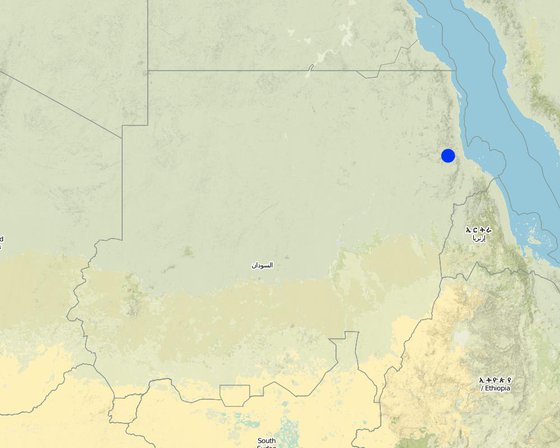
Localização: Sinkat Locality, Red Sea, Sudão
Nº de sites de tecnologia analisados:
Difusão da tecnologia: Uniformemente difundida numa área (approx. 1-10 km2)
Em uma área permanentemente protegida?:
Data da implementação: 10-50 anos atrás
Tipo de introdução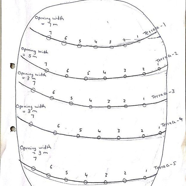


| Especifique a entrada | Unidade | Quantidade | Custos por unidade (n.a.) | Custos totais por entrada (n.a.) | % dos custos arcados pelos usuários da terra |
| Mão-de-obra | |||||
| labour | ha | 1,0 | 57,0 | 57,0 | |
| Equipamento | |||||
| machine use | ha | 1,0 | 355,0 | 355,0 | |
| Custos totais para a implantação da tecnologia | 412.0 | ||||
| Custos totais para o estabelecimento da Tecnologia em USD | 412.0 | ||||
Relative to nothing otherwise
Floodwaters diverted will not reach original destination and those former beneficiaries
Due to more reliable production despite low and variable rainfall
Floodwaters diverted will not reach original destination