level bund with double stone walls [Etiópia]
- Criação:
- Atualização:
- Compilador/a: Sabina Erny
- Editor: –
- Revisor: Fabian Ottiger
cab
technologies_1061 - Etiópia
Veja as seções
Expandir tudo Recolher tudo1. Informação geral
1.2 Detalhes do contato das pessoas capacitadas e instituições envolvidas na avaliação e documentação da tecnologia
Nome da(s) instituição(ões) que facilitou(ram) a documentação/ avaliação da Tecnologia (se relevante)
Department of Geography, University of Basel (Department of Geography, University of Basel) - Suíça1.3 Condições em relação ao uso da informação documentada através de WOCAT
Quando os dados foram compilados (no campo)?
05/09/2003
O/a compilador/a e a(s) pessoa(s) capacitada(s) aceitam as condições relativas ao uso de dados documentados através da WOCAT:
Sim
1.5 Referência ao(s) questionário(s) sobre as abordagens da GST
food-for-work programm [Etiópia]
food-for-work programm with distribution of grains and oil
- Compilador/a: Sabina Erny
2. Descrição da tecnologia de GST
2.1 Descrição curta da tecnologia
Definição da tecnologia:
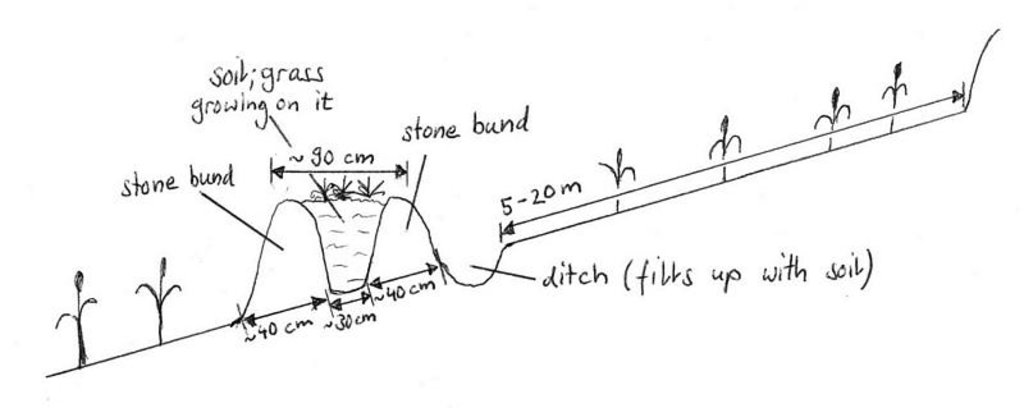
level bund with double stone walls with soil and grass to stabilize the structure
2.2 Descrição detalhada da tecnologia
Descrição:
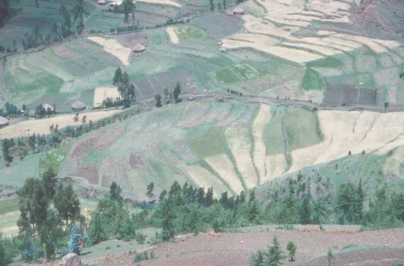
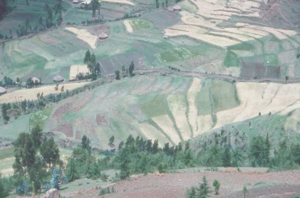
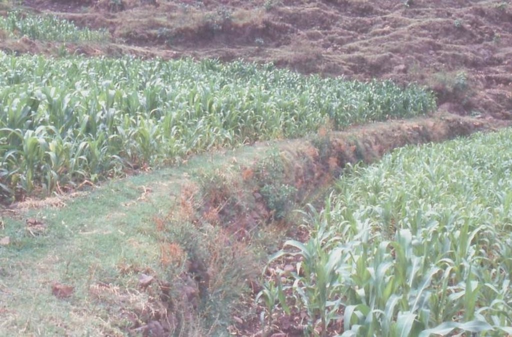
Two level rows of stones are piled up and the space between them is filled up with soil. Grass is growing on it so it can stabilize the bund. The soil can accumulate behind the bund. The land and the bunds slowly develop into terraces. It is combined with contour ploughing.
Purpose of the Technology: control runoff and soil erosion
Establishment / maintenance activities and inputs: through food-for-work program. Maintenance is up to the farmers, some maintain it regularly, throughout the year, others don't.
Natural / human environment: on gentle and steep slopes
2.3 Fotos da tecnologia
2.5 País/região/locais onde a tecnologia foi aplicada e que estão cobertos nesta avaliação
País:
Etiópia
Região/Estado/Província:
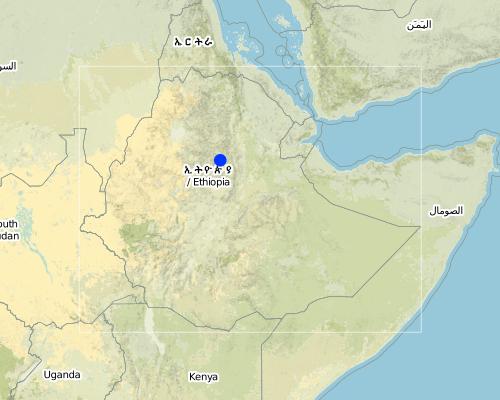
South Wello
Map
×2.6 Data da implementação
Caso o ano exato seja desconhecido, indique a data aproximada:
- menos de 10 anos atrás (recentemente)
2.7 Introdução da tecnologia
Especifique como a tecnologia foi introduzida:
- através de projetos/intervenções externas
Comentários (tipos de projeto, etc.):
it was implemented by the government
3. Classificação da tecnologia de GST
3.1 Principal/principais finalidade(s) da tecnologia
- Reduz, previne, recupera a degradação do solo
3.2 Tipo(s) atualizado(s) de uso da terra onde a tecnologia foi aplicada

Terra de cultivo
- Cultura anual

Pastagem
Comentários:
Major land use problems (compiler’s opinion): erosion, decline of soil fertility and yield decline other major SWC specialist: shortage of grazing land and of forage
Major land use problems (land users’ perception): erosion, runoff, drought, climate
Grazingland comments: area closure: only during July-October some areas are closed, otherwise no area closure any more. Make hay for the cattle to feed them in the dry season.
Type of cropping system and major crops comments: barley/wheat/emmer wheat - beans or teff - maize - barley/wheat/emmer wheat - beans or teff - maize
3.3 Mais informações sobre o uso da terra
Abastecimento de água para a terra na qual a tecnologia é aplicada:
- Precipitação natural
Número de estações de cultivo por ano:
- 2
Especifique:
Longest growing period in days: 150 Longest growing period from month to month: Jul - Nov Second longest growing period in days: 150 Second longest growing period from month to month: Feb - Jun
3.4 Grupo de GST ao qual pertence a tecnologia
- Solo/cobertura vegetal melhorada
- Medidas de curva de nível
3.5 Difusão da tecnologia
Especifique a difusão da tecnologia:
- Uniformemente difundida numa área
Caso a tecnologia seja uniformemente difundida numa área, indique a área coberta aproximada:
- 0,1-1 km2
3.6 Medidas de GST contendo a tecnologia

Medidas estruturais
- S2: Barragens, bancos
Comentários:
Main measures: structural measures
Secondary measures: vegetative measures
Type of agronomic measures: contour tillage
3.7 Principais tipos de degradação da terra abordados pela tecnologia

Erosão do solo pela água
- Wt: Perda do solo superficial/erosão de superfície
- Wo: efeitos de degradação externa
Comentários:
Main type of degradation addressed: Wt: loss of topsoil / surface erosion
Secondary types of degradation addressed: Wo: offsite degradation effects
4. Especificações técnicas, implementação de atividades, entradas e custos
4.1 Desenho técnico da tecnologia
4.2 Especificações técnicas/ explicações do desenho técnico
Drawing showing a level bund with double stone walls, Maybar, Ethiopia
Location: Maybar. Wello
Technical knowledge required for field staff / advisors: moderate
Technical knowledge required for land users: low
Main technical functions: reduction of slope angle, reduction of slope length
Secondary technical functions: improvement of soil structure, increase in soil fertility
Contour tillage
Remarks: because of the design of the terraces
If the original slope has changed as a result of the Technology, the slope today is (see figure below): 10.00%
Construction material (earth): earth from the ditch just behind the structure on the upper side
Construction material (stone): normal, big stones from the field
If the original slope has changed as a result of the Technology, the slope today is: 10%
Lateral gradient along the structure: 0%
Vegetation is used for stabilisation of structures.
4.3 Informação geral em relação ao cálculo de entradas e custos
Outro/moeda nacional (especifique):
birr
Indique a taxa cambial do dólar norte americano para a moeda local (se relevante): 1 USD =:
8,8
Indique a média salarial da mão-de-obra contratada por dia:
0.50
4.4 Atividades de implantação
| Atividade | Tipo de medida | Periodicidade | |
|---|---|---|---|
| 1. | it has grown itself on the bund | Vegetativo | |
| 2. | measurement of fields, to know where to build the bunds | Estrutural | |
| 3. | constructing the stonewalls | Estrutural | December - January |
| 4. | filling the bunds in between with soils from the ditch behind the structure, on the upper side | Estrutural | December - January, sometimes in November and June |
4.6 Atividades recorrentes/manutenção
| Atividade | Tipo de medida | Periodicidade/frequência | |
|---|---|---|---|
| 1. | contour ploughing | Agronômico | dry season and rainseason / several times |
| 2. | none, cattle are grazing on it | Vegetativo | |
| 3. | observation | Estrutural | December-January/every year after harvesting |
| 4. | rebuilding the structure | Estrutural | December-January/every 1-3 years |
4.8 Fatores mais importantes que afetam os custos
Descreva os fatores mais determinantes que afetam os custos:
the slope: the steeper, the more bunds are needed; labour is a problem if there is no food-for-work any more
5. Ambiente natural e humano
5.1 Clima
Precipitação pluviométrica anual
- <250 mm
- 251-500 mm
- 501-750 mm
- 751-1.000 mm
- 1.001-1.500 mm
- 1.501-2.000 mm
- 2.001-3.000 mm
- 3.001-4.000 mm
- > 4.000 mm
Especifique a média pluviométrica anual em mm (se conhecida):
1067,00
Zona agroclimática
- Subúmido
Moist dega
5.2 Topografia
Declividade média:
- Plano (0-2%)
- Suave ondulado (3-5%)
- Ondulado (6-10%)
- Moderadamente ondulado (11-15%)
- Forte ondulado (16-30%)
- Montanhoso (31-60%)
- Escarpado (>60%)
Formas de relevo:
- Planalto/planície
- Cumes
- Encosta de serra
- Encosta de morro
- Sopés
- Fundos de vale
Zona de altitude:
- 0-100 m s.n.m.
- 101-500 m s.n.m.
- 501-1.000 m s.n.m.
- 1.001-1.500 m s.n.m.
- 1.501-2.000 m s.n.m.
- 2.001-2.500 m s.n.m.
- 2.501-3.000 m s.n.m.
- 3.001-4.000 m s.n.m.
- > 4.000 m s.n.m.
Comentários e outras especificações sobre a topografia:
Landforms: Hill slopes (ranked1, mainly steep hills), footslopes and ridges (both ranked 2)
Slopes on average: Hilly (ranked 1), rolling (ranked 2, more than 80% of the land has a slope degree from over 13%) and steep (ranked 3)
5.3 Solos
Profundidade do solo em média:
- Muito raso (0-20 cm)
- Raso (21-50 cm)
- Moderadamente profundo (51-80 cm)
- Profundo (81-120 cm)
- Muito profundo (>120 cm)
Textura do solo (solo superficial):
- Fino/pesado (argila)
Matéria orgânica do solo superficial:
- Alto (>3%)
- Médio (1-3%)
Caso disponível anexe a descrição completa do solo ou especifique as informações disponíveis, p. ex. tipo de solo, PH/acidez do solo, nitrogênio, capacidade de troca catiônica, salinidade, etc.
Soil depth on average: Very shallow (about 40% of the area) and moderately deep (both ranked 1), shallow and deep (both ranked 2)
Soil texture: Fine/heavy (of the major soil type)
Soil fertility: Medium
Topsoil organic matter: High (ranked 1, in the major soil type) and medium (ranked 2)
Soil drainage/infiltration: Medium (ranked 1) and poor (ranked 2, somtimes there is waterlogging)
Soil water storage capacity: Low (ranked 1) and medium (ranked 2)
5.6 Características dos usuários da terra que utilizam a tecnologia
Rendimento não agrícola:
- 10-50% de toda renda
Nível relativo de riqueza:
- Rico
Nível de mecanização:
- Trabalho manual
- Tração animal
Indique outras características relevantes dos usuários da terra:
Population density: 100-200 persons/km2
10% of the land users are rich and own 38% of the land (only rough estimates).
58% of the land users are average wealthy and own 36% of the land (only rough estimates).
32% of the land users are poor and own 26% of the land (only rough estimates).
Off-farm income specification: farmers employ others for ploughing, so they can go to the market
Level of mechanization: Animal traction (ranked 1, ploughing with oxen) and manual work (ranked 2, hacking)
5.8 Propriedade de terra, direitos de uso da terra e de uso da água
Propriedade da terra:
- Estado
Direitos do uso da terra:
- Indivíduo
6. Impactos e declarações finais
6.4 Análise do custo-benefício
Como os benefícios se comparam aos custos de implantação (do ponto de vista dos usuários da terra)?
Retornos a curto prazo:
levemente negativo
Retornos a longo prazo:
positivo
Como os benefícios se comparam aos custos recorrentes/de manutenção(do ponto de vista dos usuários da terra)?
Retornos a curto prazo:
levemente positivo
Retornos a longo prazo:
positivo
6.5 Adoção da tecnologia
Se disponível, determine a quantidade (número de unidades familiares e/ou área abordada):
200
Entre todos aqueles que adotaram a tecnologia, quantos adotaram espontaneamente, ou seja, sem receber nenhum incentivo material/pagamentos?
- 0-10%
Comentários:
100% of land user families have adopted the Technology with external material support
200 land user families have adopted the Technology with external material support
Comments on acceptance with external material support: estimates
Comments on spontaneous adoption: estimates
There is a little trend towards spontaneous adoption of the Technology
Comments on adoption trend: some farmers are building level bund with double stone wallss without any incentives
7. Referências e links
7.2 Referências às publicações disponíveis
Título, autor, ano, ISBN:
Biological soil conservation techniques for Maybar area, Ethiopia. Kassaye Goshu. 1997.
Disponível de onde? Custos?
CDE, Bern
Título, autor, ano, ISBN:
Classification of the Environment Conditions. H.-J. Krüger. 2003.
Disponível de onde? Custos?
CDE, Bern
Título, autor, ano, ISBN:
Area of Maybar, Wello, Ethiopia: Long-term Monitoring of the Agricultural Environment 1981-1994
Disponível de onde? Custos?
CDE, Bern
Título, autor, ano, ISBN:
The Use, Maintenance and Development of Soil and Water Conservation Measures by Small-Scale Farming Householfs in Different Agro-Climatic Zones of Northern Shewa and Southern Wello, Ethiopia.Yohannes Gebre Michael. 1999.
Disponível de onde? Custos?
CDE, Bern
Links e módulos
Expandir tudo Recolher tudoLinks

food-for-work programm [Etiópia]
food-for-work programm with distribution of grains and oil
- Compilador/a: Sabina Erny
Módulos
Não há módulos


