Auto-Flowing Slurry Dam [China]
- Criação:
- Atualização:
- Compilador/a: Yan ZHANG
- Editor: –
- Revisor: David Streiff
Falling Water Dam
technologies_1364 - China
Veja as seções
Expandir tudo Recolher tudo1. Informação geral
1.2 Detalhes do contato das pessoas capacitadas e instituições envolvidas na avaliação e documentação da tecnologia
Nome da(s) instituição(ões) que facilitou(ram) a documentação/ avaliação da Tecnologia (se relevante)
Department of Resources and Environmental Science, Beijing Normal University (Department of Resources and Environmental Science, Beijing Normal University) - China1.3 Condições em relação ao uso da informação documentada através de WOCAT
Quando os dados foram compilados (no campo)?
16/05/2002
O/a compilador/a e a(s) pessoa(s) capacitada(s) aceitam as condições relativas ao uso de dados documentados através da WOCAT:
Sim
1.5 Referência ao(s) questionário(s) sobre as abordagens da GST
Falling Water Dam [China]
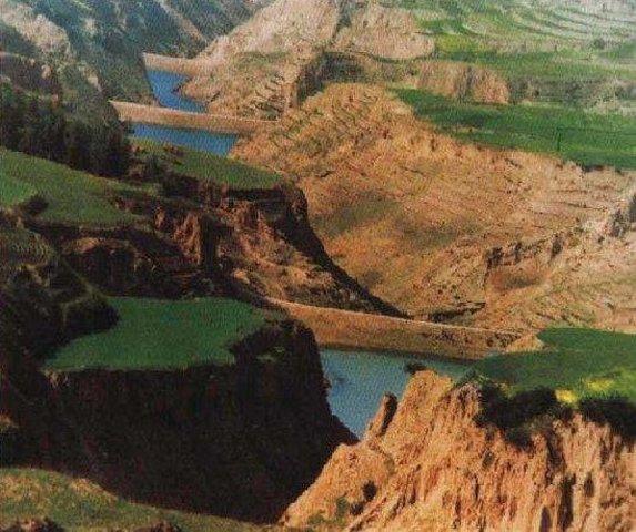
The falling water dams are widely built in the middle reach of the Yellow River, the typical dams are filled with dense slurry by water flow from upland. The approach is implemented mainly by government investment.
- Compilador/a: Yan ZHANG
2. Descrição da tecnologia de GST
2.1 Descrição curta da tecnologia
Definição da tecnologia:
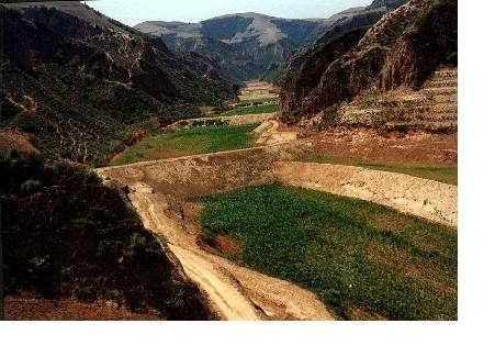
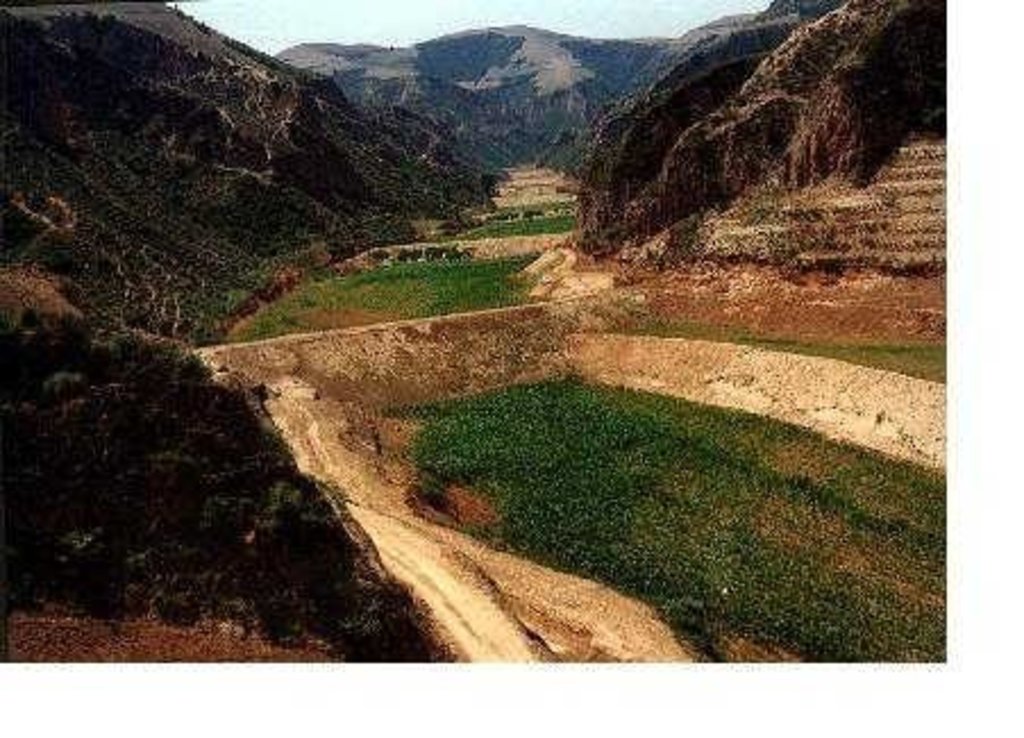
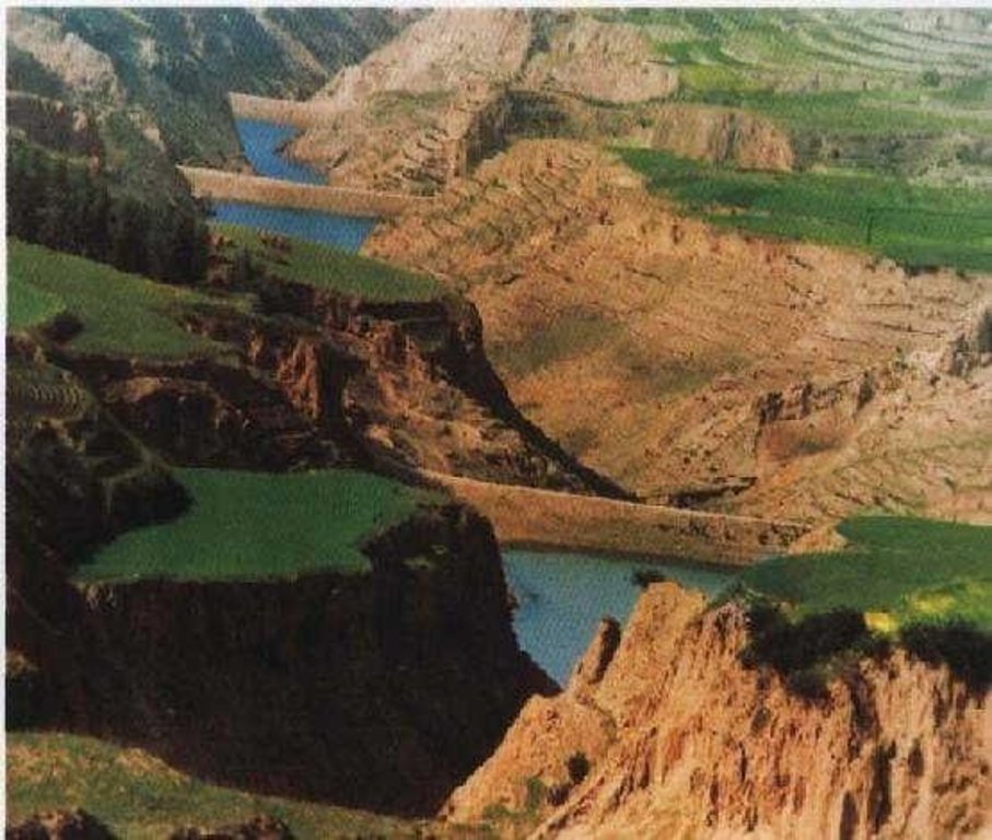
Auto-flowing slurry dams is filled with dense slurry by water flow from upland to maintain eroded soil particles and runoff.
2.2 Descrição detalhada da tecnologia
Descrição:
Falling water filled dams distribute widely in the middle reaches of the Yellow River, they are used to store water and wrap sediment which result from soil and water loss. On the Loess Plateau, in addition to the conditions of deep gully and steep slope, earth above the top of the dams can be used to build dams. First, soil is loosed with squirt guns, exploded or manually dug. Then, water is pumped up to the loose earth so as to rush the soil down along transporting ditch, turning the soil into dense mud to dam level surrounded by tamped banks. Under the press of gravity, the mud dehydrates, consolidates and becomes uniformly dense body of the dams. Compared with dams in other areas, the water power filled dams in the Yellow River basin are characterized by much denser mud, uniform particles and body texture, smaller transect of dams body, and wide applicability to soil materials such as sand soil, loess soil and weathering residue. The types of dams have widely applied to build moderate and small reservoirs and silt arresters in the middle reaches of the Yellow River, they play an important role in increase in agricultural production and reduction of sediment into the Yellow River.
2.3 Fotos da tecnologia
2.5 País/região/locais onde a tecnologia foi aplicada e que estão cobertos nesta avaliação
País:
China
Região/Estado/Província:
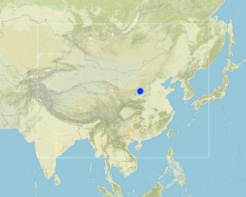
Shanxi, Shaanxi, etc.
Map
×2.6 Data da implementação
Caso o ano exato seja desconhecido, indique a data aproximada:
- mais de 50 anos atrás (tradicional)
2.7 Introdução da tecnologia
Especifique como a tecnologia foi introduzida:
- Como parte do sistema tradicional (>50 anos)
Comentários (tipos de projeto, etc.):
The technology was developed by local people during the conservation practice in 1950s.
3. Classificação da tecnologia de GST
3.1 Principal/principais finalidade(s) da tecnologia
- Melhora a produção
3.2 Tipo(s) atualizado(s) de uso da terra onde a tecnologia foi aplicada

Terra de cultivo
- Cultura anual
Comentários:
Major land use problems (compiler’s opinion): 1. Slope land is used as cropland
2. Too little ground cover to protect soil from erosion
3. Over grazing in wind erosion area
Major land use problems (land users’ perception): 1. Little cropland for food supply
2. The land productivity is too low
3. The benefit of returning cropland to graze land or woodland is not definite now except the compensate from government
3.3 Mais informações sobre o uso da terra
Número de estações de cultivo por ano:
- 1
Especifique:
Longest growing period in days: 165Longest growing period from month to month: May - Sep
3.4 Grupo de GST ao qual pertence a tecnologia
- Gestão de irrigação (inclusive abastecimento de água, drenagem)
3.5 Difusão da tecnologia
Especifique a difusão da tecnologia:
- Uniformemente difundida numa área
Caso a tecnologia seja uniformemente difundida numa área, indique a área coberta aproximada:
- > 10.000 km2
Comentários:
Total area covered by the SLM Technology is 13062 m2.
Dams filled by water power are applied mainly in the middle reach of the Yellow River, including the provinces of Shanxi, Shaanxi, Inner Mongolia, Ningxia, Gansu, Qinghai, Henan, etc. The types of dams were used since 1950s, and most the dams being used were built in 1970s.
3.6 Medidas de GST contendo a tecnologia

Medidas estruturais
- S5: Represa, bacia, lago
Comentários:
Main measures: structural measures
3.7 Principais tipos de degradação da terra abordados pela tecnologia

Erosão do solo pela água
- Wt: Perda do solo superficial/erosão de superfície
- Wg: Erosão por ravinas/ravinamento

Erosão do solo pelo vento
- Et: Perda do solo superficial

Deteriorização química do solo
- Cn: declínio de fertilidade e teor reduzido de matéria orgânica (não causado pela erosão)

Degradação da água
- Ha: aridificação
Comentários:
Main type of degradation addressed: Wg: gully erosion / gullying, Ha: aridification
Secondary types of degradation addressed: Wt: loss of topsoil / surface erosion, Et: loss of topsoil, Cn: fertility decline and reduced organic matter content
Main causes of degradation: other natural causes (avalanches, volcanic eruptions, mud flows, highly susceptible natural resources, extreme topography, etc.) specify, poverty / wealth (Lack of captial), education, access to knowledge and support services (Lack of knowledge)
3.8 Redução, prevenção ou recuperação da degradação do solo
Especifique o objetivo da tecnologia em relação a degradação da terra:
- Não aplicável
4. Especificações técnicas, implementação de atividades, entradas e custos
4.2 Especificações técnicas/ explicações do desenho técnico
Technical knowledge required for field staff / advisors: low
Technical knowledge required for land users: low
Main technical functions: control of concentrated runoff: retain / trap, water harvesting / increase water supply, sediment retention / trapping, sediment harvesting
Secondary technical functions: control of raindrop splash, control of dispersed runoff: retain / trap, control of dispersed runoff: impede / retard, control of concentrated runoff: impede / retard, control of concentrated runoff: drain / divert, reduction of slope angle, reduction of slope length, improvement of ground cover, increase of surface roughness, increase in organic matter, increase of infiltration, increase / maintain water stored in soil, water spreading, reduction in wind speed, increase in soil fertility, improvement of soil structure
Construction material (earth): Loess earth
Slope (which determines the spacing indicated above): 45%
If the original slope has changed as a result of the Technology, the slope today is: 30%
Lateral gradient along the structure: 60%
For water harvesting: the ratio between the area where the harvested water is applied and the total area from which water is collected is: 1:1
4.3 Informação geral em relação ao cálculo de entradas e custos
Especifique a moeda utilizada para os cálculos de custo:
- Dólares norte-americanos
Indique a média salarial da mão-de-obra contratada por dia:
3.00
4.4 Atividades de implantação
| Atividade | Tipo de medida | Periodicidade | |
|---|---|---|---|
| 1. | preparing earth | Estrutural | n/a |
| 2. | pumping water | Estrutural | n/a |
| 3. | preparing base of the dam and its perimetric banks | Estrutural | n/a |
| 4. | Flushing the prepared earth with water inside the banks of the dam | Estrutural | 0.1~1 |
| 5. | After dehydration and consolidation of the earth, repeat 3 and 4. | Estrutural | n/a |
4.5 Custos e entradas necessárias para a implantação
Comentários:
Duration of establishment phase: 540 month(s)
4.6 Atividades recorrentes/manutenção
| Atividade | Tipo de medida | Periodicidade/frequência | |
|---|---|---|---|
| 1. | Keeping the top of the dam level and free of crevice, water or rubbish | Estrutural | timely |
| 2. | Keeping the top of the dam level and free of crevice, water or rubbish | Estrutural | |
| 3. | Keeping the slope of the dam compact and free of rill or weed. | Estrutural | timely |
| 4. | Keeping the slope of the dam compact and free of rill or weed. | Estrutural | |
| 5. | Keeping the observation equipment work in order. | Estrutural | timely |
| 6. | Keeping the observation equipment work in order. | Estrutural | |
| 7. | Preventing the base the dam from destroying by white ants and other animals. | Estrutural | April to October/once a year |
4.7 Custos e entradas necessárias pata a manutenção/atividades recorrentes (por ano)
Comentários:
The volume of structure.
4.8 Fatores mais importantes que afetam os custos
Descreva os fatores mais determinantes que afetam os custos:
Since the dam construction uses local materials, the most important factors affecting the cost are labor and equipment
5. Ambiente natural e humano
5.1 Clima
Precipitação pluviométrica anual
- <250 mm
- 251-500 mm
- 501-750 mm
- 751-1.000 mm
- 1.001-1.500 mm
- 1.501-2.000 mm
- 2.001-3.000 mm
- 3.001-4.000 mm
- > 4.000 mm
Zona agroclimática
- Semiárido
- Árido
5.2 Topografia
Declividade média:
- Plano (0-2%)
- Suave ondulado (3-5%)
- Ondulado (6-10%)
- Moderadamente ondulado (11-15%)
- Forte ondulado (16-30%)
- Montanhoso (31-60%)
- Escarpado (>60%)
Formas de relevo:
- Planalto/planície
- Cumes
- Encosta de serra
- Encosta de morro
- Sopés
- Fundos de vale
Zona de altitude:
- 0-100 m s.n.m.
- 101-500 m s.n.m.
- 501-1.000 m s.n.m.
- 1.001-1.500 m s.n.m.
- 1.501-2.000 m s.n.m.
- 2.001-2.500 m s.n.m.
- 2.501-3.000 m s.n.m.
- 3.001-4.000 m s.n.m.
- > 4.000 m s.n.m.
Indique se a tecnologia é aplicada especificamente em:
- Não relevante
Comentários e outras especificações sobre a topografia:
Landform: Also plateau/plain
5.3 Solos
Profundidade do solo em média:
- Muito raso (0-20 cm)
- Raso (21-50 cm)
- Moderadamente profundo (51-80 cm)
- Profundo (81-120 cm)
- Muito profundo (>120 cm)
Textura do solo (solo superficial):
- Médio (limoso, siltoso)
- Fino/pesado (argila)
Matéria orgânica do solo superficial:
- Médio (1-3%)
- Baixo (<1%)
Caso disponível anexe a descrição completa do solo ou especifique as informações disponíveis, p. ex. tipo de solo, PH/acidez do solo, nitrogênio, capacidade de troca catiônica, salinidade, etc.
Soil fertility: low
Soil drainage / infiltration: medium - good
Soil water storage capacity: high - very high
5.6 Características dos usuários da terra que utilizam a tecnologia
Rendimento não agrícola:
- 10-50% de toda renda
Nível relativo de riqueza:
- Média
- Rico
Indique outras características relevantes dos usuários da terra:
Population density: 50-100 persons/km2
Annual population growth: 0.5% - 1%
Relative level of wealth: rich, average, poor
There are almost no people very rich in the area.
Rich people are as same as average people.
40% of the land users are average wealthy and own 20% of the land (Average people in the area where the SWC is applied should offer labor for the construction.).
Poor people can offer labor for the construction.
Very poor people are relatively rare and they are often in poor health.
Off-farm income specification: Most young male farmers often go to the city or town to earn money
5.8 Propriedade de terra, direitos de uso da terra e de uso da água
Propriedade da terra:
- Estado
Direitos do uso da terra:
- Acesso livre (não organizado)
- Comunitário (organizado)
6. Impactos e declarações finais
6.1 Impactos no local mostrados pela tecnologia
Impactos ecológicos
Ciclo hídrico/escoamento
Escoamento superficial
Quantidade anterior à GST:
43
Quantidade posterior à GST:
35
Solo
Perda de solo
Quantidade anterior à GST:
80
Quantidade posterior à GST:
21
6.4 Análise do custo-benefício
Como os benefícios se comparam aos custos de implantação (do ponto de vista dos usuários da terra)?
Retornos a curto prazo:
positivo
Retornos a longo prazo:
muito positivo
Como os benefícios se comparam aos custos recorrentes/de manutenção(do ponto de vista dos usuários da terra)?
Retornos a curto prazo:
positivo
Retornos a longo prazo:
muito positivo
6.5 Adoção da tecnologia
- 1-10%
Se disponível, determine a quantidade (número de unidades familiares e/ou área abordada):
80'000 households (3 percent of the area)
Entre todos aqueles que adotaram a tecnologia, quantos adotaram espontaneamente, ou seja, sem receber nenhum incentivo material/pagamentos?
- 10-50%
Comentários:
5% of land user families have adopted the Technology with external material support
50000 land user families have adopted the Technology with external material support
Comments on acceptance with external material support: estimates
1% of land user families have adopted the Technology without any external material support
30000 land user families have adopted the Technology without any external material support
Comments on spontaneous adoption: estimates
There is a strong trend towards spontaneous adoption of the Technology
Comments on adoption trend: Although the local people adopt the SWC Technology willingly, it is usually invested, designed and constructed by the land owner, the local government.
7. Referências e links
7.2 Referências às publicações disponíveis
Título, autor, ano, ISBN:
Special Planning Of Soil And Water Conservation in Xinzhou Region , Shanxi Province. 1986-1990.
Disponível de onde? Custos?
Library of the Resource and Environmental Department, Beijing Normal University.
Título, autor, ano, ISBN:
How to design the dry masonry dam in the Hanjiachuan watershed. Tianyuzhu, Wangzuliang. Beijing. Water conservation in Beijing. 2000.
Disponível de onde? Custos?
Library of the Resource and Environmental Department, Beijing Normal University.
Links e módulos
Expandir tudo Recolher tudoLinks

Falling Water Dam [China]
The falling water dams are widely built in the middle reach of the Yellow River, the typical dams are filled with dense slurry by water flow from upland. The approach is implemented mainly by government investment.
- Compilador/a: Yan ZHANG
Módulos
Não há módulos


