Grass buffer zones alongside waterways in cropland [Noruega]
- Criação:
- Atualização:
- Compilador/a: Kamilla Skaalsveen
- Editores: Anne-Grete Buseth Blankenberg, Dominika Krzeminska, Zhanguo Bai
- Revisores: Rima Mekdaschi Studer, William Critchley
Grasdekt buffersone
technologies_1656 - Noruega
- Resumo completo em PDF
- Resumo completo em PDF para impressão
- Resumo completo no navegador
- Resumo completo (sem formatação)
- Grass buffer zones alongside waterways in cropland: 3 de Fevereiro de 2023 (public)
- Grass buffer zones alongside waterways in cropland: 17 de Junho de 2022 (inactive)
- Grass Covered Riparian Buffer Strips: 5 de Setembro de 2019 (inactive)
- Grass Covered Riparian Buffer Strips: 16 de Março de 2017 (inactive)
- Grass Covered Riparian Buffer Strips: 16 de Março de 2017 (inactive)
Veja as seções
Expandir tudo Recolher tudo1. Informação geral
1.2 Detalhes do contato das pessoas capacitadas e instituições envolvidas na avaliação e documentação da tecnologia
Especialista em GST:
Especialista em GST:
Nome do projeto que facilitou a documentação/avaliação da Tecnologia (se relevante)
OPtimal strategies to retAIN and re-use water and nutrients in small agricultural catchments across different soil-climatic regions in Europe (OPTAIN)Nome do projeto que facilitou a documentação/avaliação da Tecnologia (se relevante)
Preventing and Remediating degradation of soils in Europe through Land Care (EU-RECARE )Nome da(s) instituição(ões) que facilitou(ram) a documentação/ avaliação da Tecnologia (se relevante)
Norwegian Institute for Agricultural and Environme (Norwegian Institute for Agricultural and Environme) - Noruega1.3 Condições em relação ao uso da informação documentada através de WOCAT
O/a compilador/a e a(s) pessoa(s) capacitada(s) aceitam as condições relativas ao uso de dados documentados através da WOCAT:
Sim
1.4 Declaração de sustentabilidade da tecnologia descrita
A tecnologia descrita aqui é problemática em relação a degradação da terra de forma que não pode ser declarada uma tecnologia de gestão sustentável de terra?
Não
1.5 Referência ao(s) questionário(s) sobre abordagens GST (documentado(s) usando WOCAT)
Regional Environmental program [Noruega]
Regulations and financial grants for reduction of pollution and promotion of the cultural landscape.
- Compilador/a: Kamilla Skaalsveen
2. Descrição da tecnologia de GST
2.1 Descrição curta da tecnologia
Definição da tecnologia:
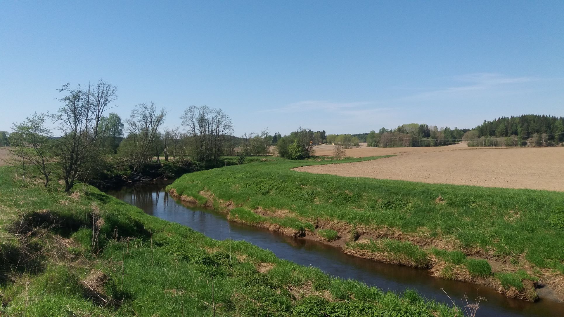
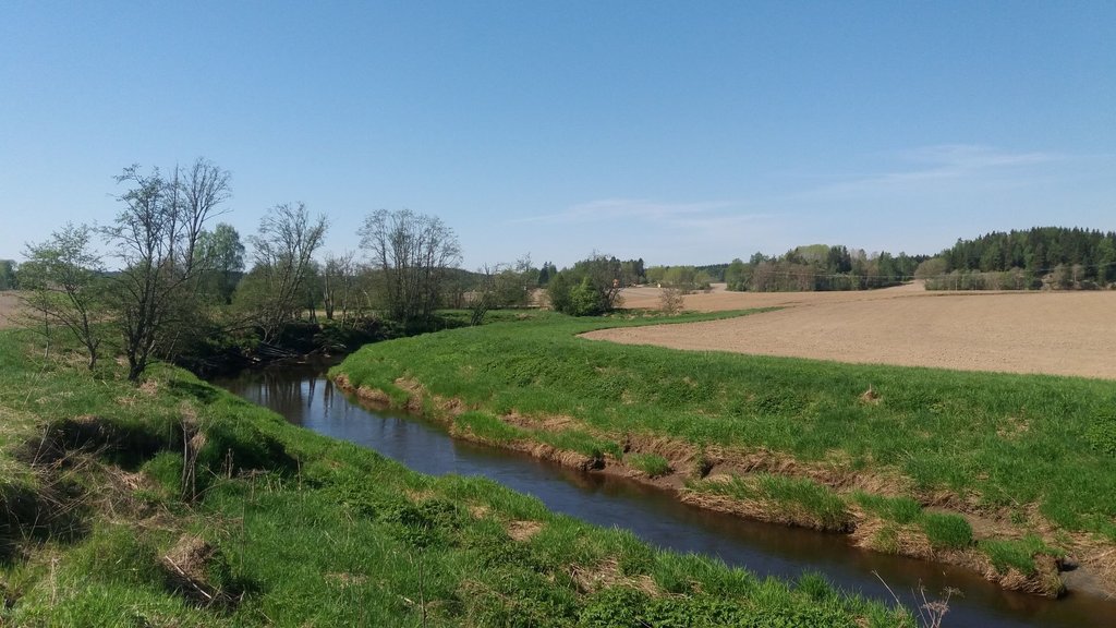
Grass buffer zones are established along waterways in cropland to reduce the surface runoff rate, and the amounts of sediment, nutrients and pesticides in the runoff.
2.2 Descrição detalhada da tecnologia
Descrição:
Commonly used names: buffer zones, buffer strips, riparian buffers
Purpose/aim: Vegetative buffers are areas of permanent vegetation located within and between agricultural fields and the watercourses to which they drain. The purpose of the vegetative buffer is to intercept, and reduce the rates of surface runoff and to reduce loads of sediment, nutrients and pesticide delivered to waterways. The processes involved are filtration, sedimentation, infiltration and absorption. Reducing the input of particles and nutrients into surface waterways is desirable both to improve water quality and to prevent eutrophication of downstream water bodies. In Norway, buffer zones are primarily established to reduce surface runoff of particles and phosphorus. However, vegetation in these zones can also serve other useful functions, such as protection against bank erosion, production of biomass, and/or provision of habitats for wildlife.
Establishment/maintenance activities:
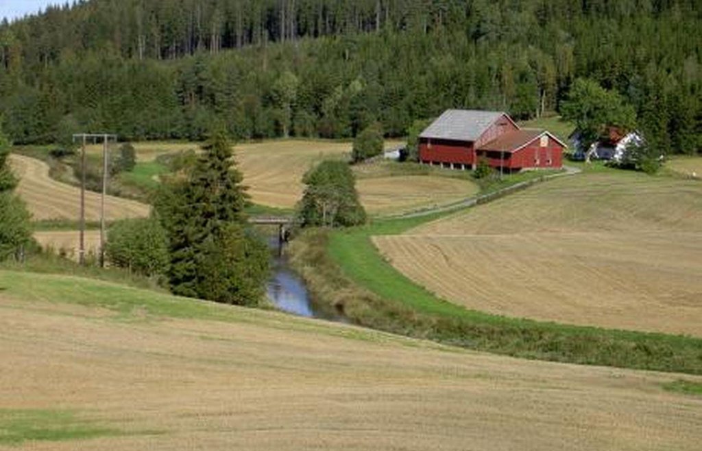
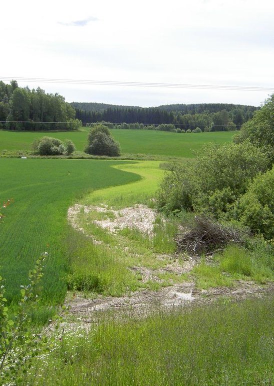
Buffer zones are most commonly designed to retain inputs of nutrients and particles from adjacent fields. Vegetative buffers may be constructed or naturally vegetated, within or alongside fields, or adjacent to drainage ditches, streams, lakes, ponds, and wetlands. The buffer zones may consist of grass for fodder production, or be natural vegetation composed of herbs, weeds, bushes and trees.
In Norway, farmers receive subsidies when the area is still used for production, e.g. grass production for fodder. Farmers leave a strip in cropland for grass and herbs to grow alongside rivers, streams and lakes that intersect their cropland areas. It is recommended to sow grass when establishing grass buffer zones. Robust and dense grass types with a high uptake of nutrients are often the best suited for the purpose. The grass strips should generally not be ploughed, fertilized or treated by herbicides, but some exceptions may be made. The degree to which the grass is harvested varies with the grass type and if it is valuable for livestock fodder.
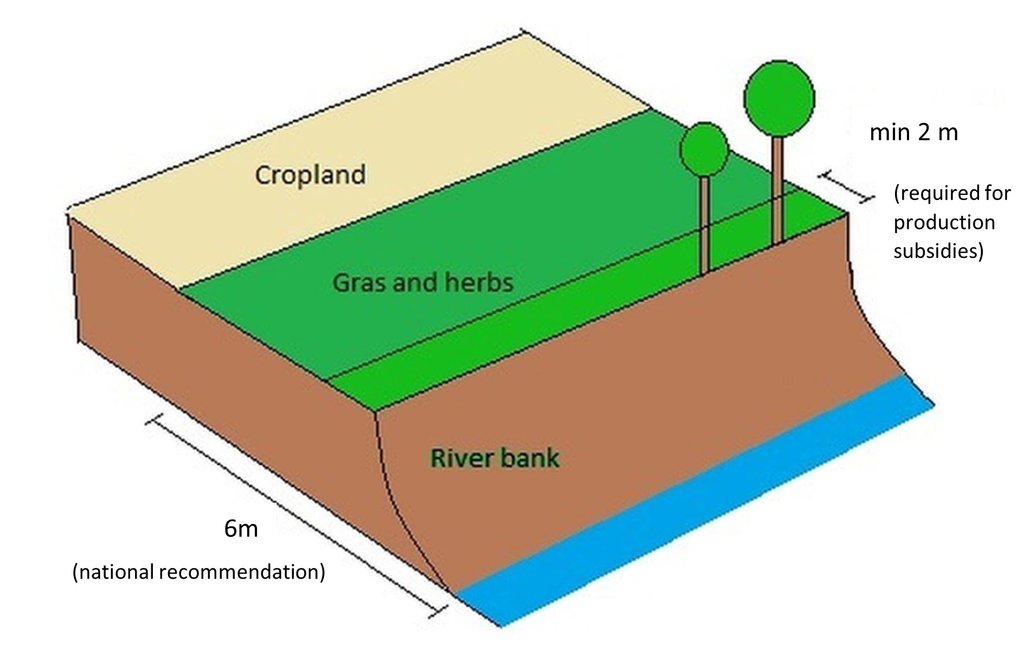
Buffer zones are one of the most common measures in Norway, and the requirements for the dimension of buffer zones have changed with time - and depend on the region. According to current regulations, buffer zones between the field and the watercourse have to be a minimum of 2 meters in order to qualify for production subsidies (PT-forskriften, § 4). In addition, there is a national recommendation (RMP) to maintain a minimum 6-metre wide buffer zone along all watercourses. However, regional guidelines (RMP) can differ from national ones and the width recommendation differ from county to county.
Benefits/impact: The effectiveness of buffer zones in retaining nutrients and soil particles has been explored by many authors. Retention capacity for phosphorus in buffer zones depends on several factors including vegetation, soil type, slope, hydrological conditions, and the width of the zone. There are large variations in the effectiveness of buffer zones: 32-91% retention of sediment, 26-100% retention of phosphorus and 0-100% retention of nitrogen. The retention effect of grass buffer zones along the Hobøl River, measured with rainfall simulation experiments under the BUFFERKLIMA project (Krzeminska et al., 2020), was: 86-94% for sediment, 86-86% for phosphorus and 78-89% for nitrogen.
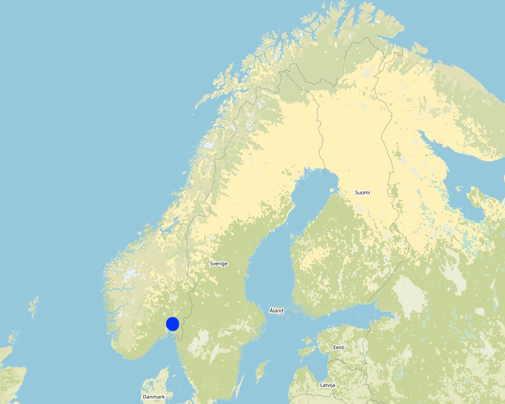
Natural / human environment: The information about this Technology is based on investigations and/or reports from different part of Norway. For the purpose of the OPTAIN project, the technology is further presented in the natural and human environment context of the Kråkstad River catchment - a Norwegian Case Study catchment within the project.
The Kråkstad River is mainly situated in the Ski municipality in the South-Eastern part of Norway. The river catchment is a western tributary of the Vansjø-Hobøl watercourse, also known as the Morsa watercourse. The Kråkstad River catchment area is c. 51 km², 43% of which is agricultural land. Cereals are the major crop, produced on the heavy clays soils. The main environmental challenge in the area is water quality (incl. high phosphorus pollution) and soil erosion (incl. riverbank erosion and quick-clay landslides).The Morsa watercourse is a drinking water resource and there are specific environmental regulations for land management supported by subsidies through the Regional Environmental Programme (RMP).
2.3 Fotos da tecnologia
2.5 País/região/locais onde a tecnologia foi aplicada e que estão cobertos nesta avaliação
País:
Noruega
Região/Estado/Província:
Viken county
Especificação adicional de localização:
The Vansjø - Hobøl catchment
Especifique a difusão da tecnologia:
- Uniformemente difundida numa área
Se a área precisa não for conhecida, indicar a área aproximada coberta:
- 1-10 km2
O(s) local(is) tecnológico(s) está(ão) localizado(s) em uma área permanentemente protegida?
Não
Map
×2.6 Data da implementação
Caso o ano exato seja desconhecido, indique a data aproximada:
- 10-50 anos atrás
2.7 Introdução da tecnologia
Especifique como a tecnologia foi introduzida:
- durante experiências/ pesquisa
- através de projetos/intervenções externas
- Regional Environmental Programme (RMP)
Comentários (tipos de projeto, etc.):
The Morsa Project (morsa.org)
Buffer zones along streams and lakes are measures eligible for subsidies under the Regional Environmental Programme (RMP).
3. Classificação da tecnologia de GST
3.1 Principal/principais finalidade(s) da tecnologia
- Reduz, previne, recupera a degradação do solo
- Protege uma bacia/zonas a jusante – em combinação com outra tecnologia
3.2 Tipo(s) atualizado(s) de uso da terra onde a tecnologia foi aplicada

Terra de cultivo
- Cultura anual
Cultivo anual - Especificar culturas:
- cereais - outros
- small grains
Número de estações de cultivo por ano:
- 1
Especifique:
Longest growing period in days: 135Longest growing period from month to month: May to mid September

Floresta/bosques
Produtos e serviços:
- Lenha
Comentários:
Major land use problems (compiler’s opinion): Erosion, flooding and landslides, eutrophication of rivers and lakes.
Major land use problems (land users’ perception): Cropland is occupied by the buffer strips, which may lead to decreased production and loss of income.
3.3 O uso do solo mudou devido à implementação da Tecnologia?
O uso do solo mudou devido à implementação da Tecnologia?
- Sim (Por favor, preencha as perguntas abaixo com relação ao uso do solo antes da implementação da Tecnologia)
Uso do solo misturado dentro da mesma unidade de terra:
Não

Terra de cultivo
- Cultura anual
Cultivo anual - Especificar culturas:
- culturas forrageiras - gramíneas
Comentários:
When buffer zones are implemented, part of the cropland is occupied by the grass strips. The grass strips should generally not be ploughed, fertilized or treated by herbicides, but some exceptions may be made. The degree to which it is harvested varies with the grass type, and if it is used for animal fodder.
3.4 Abastecimento de água
Abastecimento de água para a terra na qual a tecnologia é aplicada:
- Precipitação natural
3.5 Grupo de GST ao qual pertence a tecnologia
- Gestão de água de superfície (nascente, rio, lagos, mar)
3.6 Medidas de GST contendo a tecnologia

Medidas vegetativas
- V2: gramíneas e plantas herbáceas perenes
3.7 Principais tipos de degradação da terra abordados pela tecnologia

Erosão do solo pela água
- Wt: Perda do solo superficial/erosão de superfície
- Wg: Erosão por ravinas/ravinamento
- Wm: movimento de massas/deslizamentos
- Wr: erosão das margens

Degradação da água
- Hp: declínio da qualidade de água de superfície
Comentários:
Main type of degradation addressed:
Wt: loss of topsoil / surface erosion
Hp: decline of surface water quality
Secondary types of degradation addressed:
Wg: gully erosion/gullying,
Wr: riverbank erosion
Wm: mass movements/landslides,
Main causes of degradation:
soil management - use of fertilizer and heavy machinery (compression of the soil and low infiltration rate)
crop management - annual, perennial, tree/shrub
heavy / extreme rainfall (intensity/amounts) - more flooding and erosion, floods
Secondary causes of degradation:
deforestation / removal of natural vegetation (incl. forest fires) - the runoff has a lower retention time in the forest. Leads to higher velocity and more flooding of downstream cropland areas),
change of seasonal rainfall - heavier rainfall events due to climate change,
land tenure
governance / institutional
3.8 Redução, prevenção ou recuperação da degradação do solo
Especifique o objetivo da tecnologia em relação a degradação da terra:
- Prevenir degradação do solo
- Reduzir a degradação do solo
Comentários:
Main goals: mitigation / reduction of land degradation
Secondary goals: prevention of land degradation
4. Especificações técnicas, implementação de atividades, entradas e custos
4.1 Desenho técnico da tecnologia
Especificações técnicas (relacionada ao desenho técnico):
A technical drawing of a grass buffer zone - example setup based on the Norwegian recomendation
Technical knowledge required for field staff / advisors: low
Technical knowledge required for land users: low
Main technical functions: control of concentrated runoff: impede / retard
Secondary technical functions: control of raindrop splash, control of dispersed runoff: retain / trap, control of dispersed runoff: impede / retard, control of concentrated runoff: retain / trap, improvement of ground cover, increase of surface roughness, increase of infiltration, increase / maintain water stored in soil, improvement of water quality, buffering / filtering water, sediment retention / trapping, sediment harvesting
Aligned: -along boundary
Vegetative material: T : trees / shrubs
Vegetative measure: Along waterways
Vegetative material: G : grass
Trees/ shrubs species: Naturally
Grass species: Seeded
Autor:
Kamilla Skaalsveen
4.2 Informação geral em relação ao cálculo de entradas e custos
Especifique como custos e entradas foram calculados:
- Por unidade de tecnologia
Especifique a unidade:
a buffer zone strip along the stream or lake
Especificar as dimensões da unidade (se for relevante):
dimensions can vary greatly
Outro/moeda nacional (especifique):
Kroner (NOK)
Se for relevante, indique a taxa de câmbio do USD para moeda local (por exemplo, 1 USD = 79,9 Real): 1 USD =:
8,89
Indique a média salarial da mão-de-obra contratada por dia:
c.a. 3000 NOK (it is only the cost of the time assuming 8h work per day, 320-500 NOK/hour; person; machinery, equipment, materials not included)
4.3 Atividades de implantação
| Atividade | Periodicidade (estação do ano) | |
|---|---|---|
| 1. | Plowing | 1 time/yr |
| 2. | Harrowing | 2-3 times/yr |
| 3. | Sowing grass | 2-3 times/yr |
| 4. | Harvesting grass | 2-3 times/yr |
4.4 Custos e entradas necessárias para a implantação
| Especifique a entrada | Unidade | Quantidade | Custos por unidade | Custos totais por entrada | % dos custos arcados pelos usuários da terra | |
|---|---|---|---|---|---|---|
| Mão-de-obra | Ploughing | zone/farmer/day | 1,0 | 321,0 | 321,0 | 7,0 |
| Mão-de-obra | Harrowing | zone/farmer/day | 1,0 | 321,0 | 321,0 | 7,0 |
| Mão-de-obra | Sowing grass | zone/farmer/day | 1,0 | 321,0 | 321,0 | 7,0 |
| Mão-de-obra | Harvesting grass | zone/farmer/day | 1,0 | 321,0 | 321,0 | 7,0 |
| Custos totais para a implantação da tecnologia | 1284,0 | |||||
| Custos totais para o estabelecimento da Tecnologia em USD | 144,43 | |||||
Se o usuário da terra arca com menos que 100% dos custos, indique quem cobre os custos remanescentes:
Grass covered buffer zones are measures eligible for subsidies under the Regional Environmental Programme (RMP)
Comentários:
The costs of establishment and management of grass covered buffer zone are the same as in the case of regular crop land management. The subsidy is compensation for land withdrawn from the main production (crop land).
Grass covered buffer zones are measures eligible for subsidies under Regional Environmental Programme (RMP) - between 2019 and 2022 the subsidy for grass covered buffer zones was 15 kr/m in Viken county.
4.5 Atividades recorrentes/manutenção
| Atividade | Periodicidade/frequência | |
|---|---|---|
| 1. | Ploughing | Every 5th year |
| 2. | Harrowing | Every 5th year |
| 3. | Sowing grass | Every 5th year |
| 4. | Harvesting grass | 1-2 times/yr |
Comentários:
These areas are often used as grass production areas so some maintenance and harvesting of grass is needed.
4.6 Custos e entradas necessárias pata a manutenção/atividades recorrentes (por ano)
| Especifique a entrada | Unidade | Quantidade | Custos por unidade | Custos totais por entrada | % dos custos arcados pelos usuários da terra | |
|---|---|---|---|---|---|---|
| Mão-de-obra | Ploughing | zone/farmer/day | 1,0 | 53,0 | 53,0 | |
| Mão-de-obra | Harrowing | zone/farmer/day | 1,0 | 321,0 | 321,0 | |
| Mão-de-obra | Sowing grass | Day | 1,0 | 321,0 | 321,0 | |
| Mão-de-obra | Harvesting grass | Day | 1,0 | 321,0 | 321,0 | |
| Custos totais para a manutenção da tecnologia | 1016,0 | |||||
| Custos totais de manutenção da Tecnologia em USD | 114,29 | |||||
Se o usuário da terra arca com menos que 100% dos custos, indique quem cobre os custos remanescentes:
Grass covered buffer zones are eligible for subsidies under the Regional Environmental Programme (RMP)
Comentários:
The costs of establishment and management of grass covered buffer zones are are the same as in case of regular crop land management.
Maintenance of grassed buffer zones is a part of the subsidy system:
-production subsidies - the regulations relating to production subsidies include a number of environmental standards that farmers must meet to receive production support, including two-metre buffer zones along water ways. A farmer who does not comply with the requirements may lose part of their production subsidies.
- RMP - Buffer zones may be eligible for subsidies under the Regional Environmental Programme (RMP) – for 2019-2022 the subsidy level for maintaining grass covered buffer zones was 15 kr/m in the Viken region. The subsidy is compensation for land withdrawn from the main production (crop land).
4.7 Fatores mais importantes que afetam os custos
Descreva os fatores mais determinantes que afetam os custos:
The costs of establishment and management of grass buffer zone are are the same as in case of regular crop land management. The subsidy is compensation for land withdrawn from the main production (crop land).
Establishment and maintenance costs of buffer strip depends mostly on:
- the area (width and continuity) of the buffer strip.
- type of vegetation
- possibility to use the grass as a fodder.
5. Ambiente natural e humano
5.1 Clima
Precipitação pluviométrica anual
- <250 mm
- 251-500 mm
- 501-750 mm
- 751-1.000 mm
- 1.001-1.500 mm
- 1.501-2.000 mm
- 2.001-3.000 mm
- 3.001-4.000 mm
- > 4.000 mm
Zona agroclimática
- Subúmido
- Semiárido
Thermal climate class: temperate
Thermal climate class: boreal
5.2 Topografia
Declividade média:
- Plano (0-2%)
- Suave ondulado (3-5%)
- Ondulado (6-10%)
- Moderadamente ondulado (11-15%)
- Forte ondulado (16-30%)
- Montanhoso (31-60%)
- Escarpado (>60%)
Formas de relevo:
- Planalto/planície
- Cumes
- Encosta de serra
- Encosta de morro
- Sopés
- Fundos de vale
Zona de altitude:
- 0-100 m s.n.m.
- 101-500 m s.n.m.
- 501-1.000 m s.n.m.
- 1.001-1.500 m s.n.m.
- 1.501-2.000 m s.n.m.
- 2.001-2.500 m s.n.m.
- 2.501-3.000 m s.n.m.
- 3.001-4.000 m s.n.m.
- > 4.000 m s.n.m.
5.3 Solos
Profundidade do solo em média:
- Muito raso (0-20 cm)
- Raso (21-50 cm)
- Moderadamente profundo (51-80 cm)
- Profundo (81-120 cm)
- Muito profundo (>120 cm)
Textura do solo (solo superficial):
- Médio (limoso, siltoso)
- Fino/pesado (argila)
Textura do solo (>20 cm abaixo da superfície):
- Médio (limoso, siltoso)
- Fino/pesado (argila)
Matéria orgânica do solo superficial:
- Médio (1-3%)
Caso disponível anexe a descrição completa do solo ou especifique as informações disponíveis, p. ex. tipo de solo, PH/acidez do solo, nitrogênio, capacidade de troca catiônica, salinidade, etc.
Soil fertility is medium-high
Soil drainage/infiltration is poor
Soil water storage capacity is very low-low
5.4 Disponibilidade e qualidade de água
Lençol freático:
< 5 m
Disponibilidade de água de superfície:
Bom
Qualidade da água (não tratada):
apenas para uso agrícola (irrigação)
A qualidade da água refere-se a:
tanto de águas subterrâneas quanto de superfície
A salinidade da água é um problema?
Não
Ocorre inundação da área?
Sim
Regularidade:
Frequentemente
5.5 Biodiversidade
Diversidade de espécies:
- Baixo
Diversidade de habitat:
- Baixo
5.6 Características dos usuários da terra que utilizam a tecnologia
Sedentário ou nômade:
- Sedentário
Orientação de mercado do sistema de produção:
- misto (subsistência/comercial)
- Comercial/mercado
Rendimento não agrícola:
- 10-50% de toda renda
- >50% de toda renda
Nível relativo de riqueza:
- Média
- Rico
Indivíduos ou grupos:
- Indivíduo/unidade familiar
Nível de mecanização:
- Mecanizado/motorizado
Gênero:
- Mulheres
- Homens
Idade dos usuários da terra:
- Jovens
- meia-idade
Indique outras características relevantes dos usuários da terra:
Land users applying the Technology are mainly common / average land users
Population density: < 10 persons/km2
Annual population growth: < 0.5%
10% of the land users are rich and own 10% of the land.
90% of the land users are average wealthy and own 90% of the land.
5.7 Área média de terrenos utilizados pelos usuários de terrenos que aplicam a Tecnologia
- < 0,5 ha
- 0,5-1 ha
- 1-2 ha
- 2-5 ha
- 5-15 ha
- 15-50 ha
- 50-100 ha
- 100-500 ha
- 500-1.000 ha
- 1.000-10.000 ha
- > 10.000 ha
É considerado pequena, média ou grande escala (referente ao contexto local)?
- Média escala
5.8 Propriedade de terra, direitos de uso da terra e de uso da água
Propriedade da terra:
- Indivíduo, intitulado
Direitos do uso da terra:
- Comunitário (organizado)
- Indivíduo
Direitos do uso da água:
- Acesso livre (não organizado)
5.9 Acesso a serviços e infraestrutura
Saúde:
- Pobre
- Moderado
- Bom
Educação:
- Pobre
- Moderado
- Bom
Assistência técnica:
- Pobre
- Moderado
- Bom
Emprego (p. ex. não agrícola):
- Pobre
- Moderado
- Bom
Mercados:
- Pobre
- Moderado
- Bom
Energia:
- Pobre
- Moderado
- Bom
Vias e transporte:
- Pobre
- Moderado
- Bom
Água potável e saneamento:
- Pobre
- Moderado
- Bom
Serviços financeiros:
- Pobre
- Moderado
- Bom
6. Impactos e declarações finais
6.1 Impactos no local mostrados pela tecnologia
Impactos socioeconômicos
Produção
Produção agrícola
Área de produção
Comentários/especificar:
The grass (from buffer strips) is often unfit for fodder
Renda e custos
Rendimento agrícola
Comentários/especificar:
Despite subsidies, many farmers view grass buffer zones as a financial loss since the grass is often unfit for fodder.
Diversidade de fontes de rendimento
Carga de trabalho
Impactos socioculturais
Improved livelihoods and human well-being
Comentários/especificar:
Because of the drinking water quality
Impactos ecológicos
Ciclo hídrico/escoamento
Qualidade de água
Comentários/especificar:
less sediment and nutrient input to surface water
Solo
Cobertura do solo
Perda de solo
Compactação do solo
Ciclo e recarga de nutrientes
Biodiversidade: vegetação, animais
Diversidade vegetal
Espécies benéficas
Diversidade de habitat
6.2 Impactos externos mostrados pela tecnologia
Poluição de água subterrânea/rio
Capacidade de tamponamento/filtragem
6.3 Exposição e sensibilidade da tecnologia às mudanças climáticas graduais e extremos/desastres relacionados ao clima (conforme o ponto de vista dos usuários da terra)
Mudança climática gradual
Mudança climática gradual
| Estação do ano | aumento ou diminuição | Como a tecnologia lida com isso? | |
|---|---|---|---|
| Temperatura anual | aumento | bem | |
| Precipitação pluviométrica anual | aumento | bem |
Extremos (desastres) relacionados ao clima
Desastres meteorológicos
| Como a tecnologia lida com isso? | |
|---|---|
| Temporal local | moderadamente |
| Tempestade de vento local | bem |
Desastres climatológicos
| Como a tecnologia lida com isso? | |
|---|---|
| Seca | bem |
Desastres hidrológicos
| Como a tecnologia lida com isso? | |
|---|---|
| Inundação geral (rio) | moderadamente |
Outras consequências relacionadas ao clima
Outras consequências relacionadas ao clima
| Como a tecnologia lida com isso? | |
|---|---|
| Período de crescimento reduzido | bem |
6.4 Análise do custo-benefício
Como os benefícios se comparam aos custos de implantação (do ponto de vista dos usuários da terra)?
Retornos a curto prazo:
levemente negativo
Retornos a longo prazo:
neutro/balanceado
Como os benefícios se comparam aos custos recorrentes/de manutenção(do ponto de vista dos usuários da terra)?
Retornos a curto prazo:
levemente negativo
Retornos a longo prazo:
levemente negativo
6.5 Adoção da tecnologia
- 11-50%
De todos aqueles que adotaram a Tecnologia, quantos o fizeram espontaneamente, ou seja, sem receber nenhum incentivo/ pagamento material?
- 0-10%
Comentários:
There is no trend towards spontaneous adoption of the Technology. Doubts about the retention capacity of buffer zones reduce farmers’ motivation.
Local regulations determine that farmers only receive subsidies per production area along with financial grants if they implement the technology.
6.6 Adaptação
A tecnologia foi recentemente modificada para adaptar-se as condições variáveis?
Não
6.7 Pontos fortes/vantagens/oportunidades da tecnologia
| Pontos fortes/vantagens/oportunidades na visão do usuário da terra |
|---|
| Probably good for the environment |
| Pontos fortes/vantagens/oportunidades na visão do/a compilador/a ou de outra pessoa capacitada |
|---|
|
The grass captures sediments and nutrients from the cropland How can they be sustained / enhanced? May be more efficient with a change in grass type (but this has not been not tested) |
|
Reduced fertilizer usage How can they be sustained / enhanced? Continue in the same way |
|
Co-operation between farmers How can they be sustained / enhanced? Joint utilization of the buffer strips for grass production |
6.8 Pontos fracos, desvantagens/riscos da tecnologia e formas de superá-los
| Pontos fracos/desvantagens/riscos na visão do usuário da terra | Como eles podem ser superados? |
|---|---|
| Loss of productive cropland | Narrower buffer strips |
| Not always good for the farm economy | Review the subsidies scheme |
| Doubts about the effectiveness of the technology (infiltration and stream bank erosion) |
| Pontos fracos/vantagens/riscos na visão do/a compilador/a ou de outra pessoa capacitada | Como eles podem ser superados? |
|---|---|
| Low infiltration rates | Less heavy machinery on the buffer strips and a wider zone of natural vegetation along the banks |
7. Referências e links
7.1 Métodos/fontes de informação
- visitas de campo, pesquisas de campo
BUFFERKLIMA project (Krzeminska et al 2020)
Projects within Halden, MORSA and PURA water region (Blankenberg and Skarbøvik, 2020)
- compilação de relatórios e outra documentação existente
Quando os dados foram compilados (no campo)?
10/02/2022
7.2 Referências às publicações disponíveis
Título, autor, ano, ISBN:
Blankenberg, A-G.B., Skarbøvik E., 2020. Phosphorus retention, erosion protection and farmers’ perceptions of riparian buffer zones with grass and natural vegetation: Case studies from South-Eastern Norway.
Disponível de onde? Custos?
Ambio
Título, autor, ano, ISBN:
Krzeminska D, Blankenberg A‐G, Bøe F, Nemes A, Skarbøvik E. 2020.Renseeffekt og kanterosjon i kantsoner med forskjellig vegetasjonstype.
Disponível de onde? Custos?
NIBIO website
Título, autor, ano, ISBN:
Blankenberg, A-G.B., Skarbøvik E., Kværnø S. 2017. Effekt av buffersoner ‐ på vannmiljø og andre økosystemtjenester.
Disponível de onde? Custos?
NIBIO website
7.3 Links para informações on-line relevantes
Título/ descrição:
Blankenberg and Skarbøvik, 2020. Phosphorus retention, erosion protection and farmers’ perceptions of riparian buffer zones with grass and natural vegetation: Case studies from South-Eastern Norway.
URL:
https://link.springer.com/content/pdf/10.1007/s13280-020-01361-5.pdf
Título/ descrição:
Krzeminska D, Blankenberg A‐G, Bøe F, Nemes A, Skarbøvik E. 2020.Renseeffekt og kanterosjon i kantsoner med forskjellig vegetasjonstype.
URL:
https://nibio.brage.unit.no/nibio-xmlui/bitstream/handle/11250/2645890/NIBIO_RAPPORT_2020_6_30.pdf?sequence=2&isAllowed=y
Título/ descrição:
Blankenberg, A-G.B., Skarbøvik E., Kværnø S. 2017. Effekt av buffersoner ‐ på vannmiljø og andre økosystemtjenester.
URL:
https://nibio.brage.unit.no/nibio-xmlui/bitstream/handle/11250/2448787/NIBIO_RAPPORT_2017_3_14.pdf?sequence=2&isAllowed=y
7.4 Comentários gerais
no remarks
Links e módulos
Expandir tudo Recolher tudoLinks

Regional Environmental program [Noruega]
Regulations and financial grants for reduction of pollution and promotion of the cultural landscape.
- Compilador/a: Kamilla Skaalsveen
Módulos
Não há módulos


