Firebreaks [Senegal]
- Criação:
- Atualização:
- Compilador/a: Dieter Nill
- Editor: –
- Revisores: Fabian Ottiger, Alexandra Gavilano
Pare-feux (French)
technologies_1615 - Senegal
Veja as seções
Expandir tudo Recolher tudo1. Informação geral
1.2 Detalhes do contato das pessoas capacitadas e instituições envolvidas na avaliação e documentação da tecnologia
Especialista em GST:
Dorlöchter-Sulser Sabine
Misereor
Alemanha
Especialista em GST:
Daniel André
Ministère des Eaux et Forêts, Senegal
Senegal
Nome do projeto que facilitou a documentação/avaliação da Tecnologia (se relevante)
Manual of Good Practices in Small Scale Irrigation in the Sahel (GIZ )Nome da(s) instituição(ões) que facilitou(ram) a documentação/ avaliação da Tecnologia (se relevante)
Deutsche Gesellschaft für Internationale Zusammenarbeit (GIZ) GmbH (GIZ) - AlemanhaNome da(s) instituição(ões) que facilitou(ram) a documentação/ avaliação da Tecnologia (se relevante)
Misereor - AlemanhaNome da(s) instituição(ões) que facilitou(ram) a documentação/ avaliação da Tecnologia (se relevante)
Direction des Eaux et Forêts, Chasses et de la conservation des Sols - Senegal1.3 Condições em relação ao uso da informação documentada através de WOCAT
O/a compilador/a e a(s) pessoa(s) capacitada(s) aceitam as condições relativas ao uso de dados documentados através da WOCAT:
Sim
2. Descrição da tecnologia de GST
2.1 Descrição curta da tecnologia
Definição da tecnologia:
Firebreaks cut vast tracts of rangeland into smaller areas, with a view to limiting damage in the event of wildfire.
2.2 Descrição detalhada da tecnologia
Descrição:
This technique is used on rangeland with rainfall between 150 and 300 mm. Firebreaks are a precautionary measure designed to protect forage on rangelands during the dry season. Bushfires are frequent on good-quality rangeland with over 1t/ha of biomass.
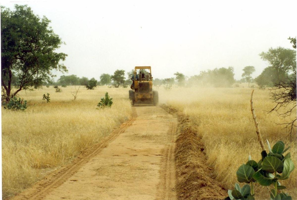
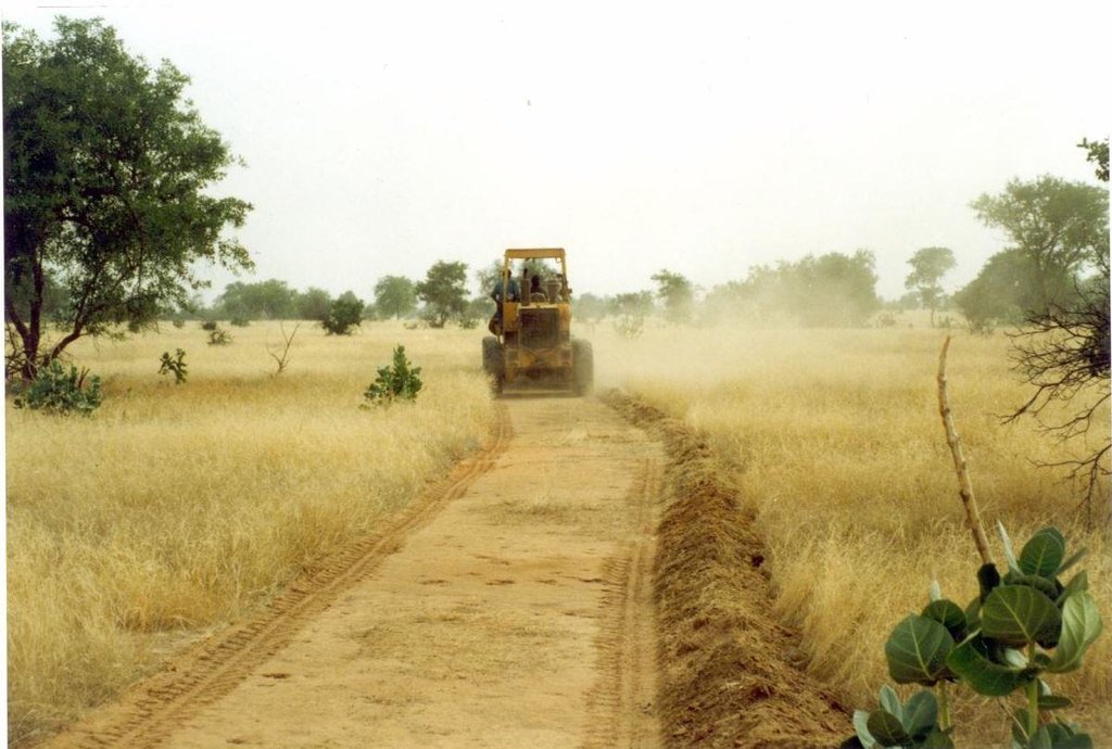
Purpose of the Technology: Firebreaks cut vast tracts of rangeland into smaller areas, with a view to limiting damage in the event of wildfire. They can also be established along traditional tracks. The gap in the vegetation makes it easier to put fires out along the corridor, which facilitates rapid access. When the fire reaches the firebreak, there is no combustible material to fuel it and it burns itself out.
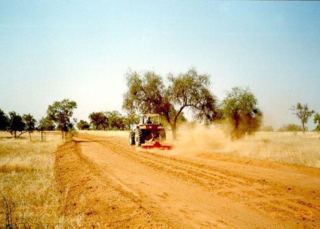
Establishment / maintenance activities and inputs: There are two techniques for creating firebreaks: (i) the manual method and (ii) the mechanised method. In both cases, a 10 to 15 m wide corridor is cleared perpendicular to the prevailing wind direction after the rainy season. Fires only poses a threat in the Sahel area in the dry season following a good rainy season when grass growth is good. The corridor is cleared of all herbaceous vegetation manually, using tools such as rakes, shovels and axes, or mechanically using a tractor pulling a large harrow, a four-wheel-drive vehicle pulling the blades behind it or graders. Trees are pruned, but left in place.
The sustainability of firebreaks depends on how well they are maintained. Once they have been created, they need to be cleared every year if grasses have grown over them again. If there is little vegetation growth, they can
be maintained once every two years or as required. If they are cleared manually, the communities or commune authorities must be well organised to ensure that the work is properly carried out. Good organisation is also required to ensure an effective response in the event of a fire (mobile unit).
2.3 Fotos da tecnologia
2.5 País/região/locais onde a tecnologia foi aplicada e que estão cobertos nesta avaliação
País:
Senegal
Região/Estado/Província:
Senegal
Especificação adicional de localização:
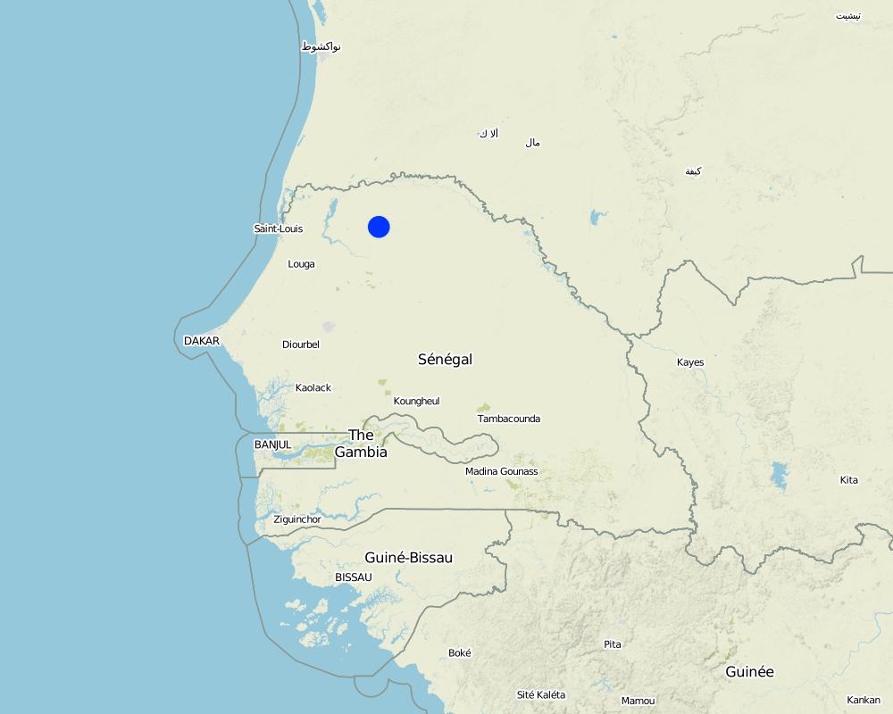
Ferlo Region
Especifique a difusão da tecnologia:
- Uniformemente difundida numa área
Se a área precisa não for conhecida, indicar a área aproximada coberta:
- 100-1.000 km2
Map
×2.6 Data da implementação
Caso o ano exato seja desconhecido, indique a data aproximada:
- 10-50 anos atrás
2.7 Introdução da tecnologia
Especifique como a tecnologia foi introduzida:
- através de projetos/intervenções externas
Comentários (tipos de projeto, etc.):
Developed in other countries. Implemented and disseminated as part of projects and programmes undertaken from the 1980s onwards. Implemented by GIZ (German Federal Enterprise for International Cooperation): Projet PASP (Projet d‘Autopromotion Pastorale dans le Ferlo - Project to Promote Self-Help of Pastoralists in the Ferlo Region) in Northern Senegal.
3. Classificação da tecnologia de GST
3.1 Principal/principais finalidade(s) da tecnologia
- Reduzir riscos de desastre
3.2 Tipo(s) atualizado(s) de uso da terra onde a tecnologia foi aplicada

Pastagem
Comentários:
Major land use problems (compiler’s opinion): Bushfires are frequent on good-quality rangeland with over 1t/ha of biomass; bushfire only poses a threat in the Sahel area in the dry season following a good rainy season when grass growth is good.
Constraints of common grazing land
Constraints of forested government-owned land or commons
Number of growing seasons per year: 1
Longest growing period in days: 120 Longest growing period from month to month: August to October
3.5 Grupo de GST ao qual pertence a tecnologia
- Redução de riscos de desastre baseada no ecossitema
3.6 Medidas de GST contendo a tecnologia

Medidas vegetativas
- V3: Limpeza da vegetação
Comentários:
Main measures: vegetative measures
3.7 Principais tipos de degradação da terra abordados pela tecnologia

Degradação biológica
- Bc: redução da cobertura vegetal
- Bf: efeitos prejudiciais de incêndios
Comentários:
Main type of degradation addressed: Bf: detrimental effects of fires
Secondary types of degradation addressed: Bc: reduction of vegetation cover
Main causes of degradation: other human induced causes (specify) (man made fires, natural flashes during thunderstorms), droughts
3.8 Redução, prevenção ou recuperação da degradação do solo
Especifique o objetivo da tecnologia em relação a degradação da terra:
- Prevenir degradação do solo
4. Especificações técnicas, implementação de atividades, entradas e custos
4.1 Desenho técnico da tecnologia
Especificações técnicas (relacionada ao desenho técnico):
Technical knowledge required for field staff / advisors: moderate
Technical knowledge required for land users: low
Main technical functions: control of fires, reduction of dry material (fuel for wildfires)
Vegetative measure: clearing of vegetation
Vegetative material: G : grass
Vegetative measure: Vegetative material: G : grass
Vegetative measure: Vegetative material: G : grass
Vegetative measure: Vegetative material: G : grass
4.3 Atividades de implantação
| Atividade | Periodicidade (estação do ano) | |
|---|---|---|
| 1. | A 10 to 15 m wide corridor is cleared perpendicular to the prevailing wind direction after the rainy season of all herbaceous vegetation manually, using tools such as rakes, shovels and axes, or mechanically using a tractor pulling a large harrow, a four- wheel-drive vehicle pulling the blades behind it or graders. | |
| 2. | Trees are pruned, but left in place |
4.5 Atividades recorrentes/manutenção
| Atividade | Periodicidade/frequência | |
|---|---|---|
| 1. | Once they have been created, they need to be cleared every year if grasses have grown over them again. If there is little vegetation growth, they can be maintained once every two years or as required. |
4.7 Fatores mais importantes que afetam os custos
Descreva os fatores mais determinantes que afetam os custos:
Manual method:
• equipment, such as rakes, shovels and axes
• labour.
Mechanised method:
• four-wheel-drive vehicle, tractor or land grader
• harrow
• labour to clear the corridor.
5. Ambiente natural e humano
5.1 Clima
Precipitação pluviométrica anual
- <250 mm
- 251-500 mm
- 501-750 mm
- 751-1.000 mm
- 1.001-1.500 mm
- 1.501-2.000 mm
- 2.001-3.000 mm
- 3.001-4.000 mm
- > 4.000 mm
Zona agroclimática
- Semiárido
Thermal climate class: subtropics
5.2 Topografia
Declividade média:
- Plano (0-2%)
- Suave ondulado (3-5%)
- Ondulado (6-10%)
- Moderadamente ondulado (11-15%)
- Forte ondulado (16-30%)
- Montanhoso (31-60%)
- Escarpado (>60%)
Formas de relevo:
- Planalto/planície
- Cumes
- Encosta de serra
- Encosta de morro
- Sopés
- Fundos de vale
Zona de altitude:
- 0-100 m s.n.m.
- 101-500 m s.n.m.
- 501-1.000 m s.n.m.
- 1.001-1.500 m s.n.m.
- 1.501-2.000 m s.n.m.
- 2.001-2.500 m s.n.m.
- 2.501-3.000 m s.n.m.
- 3.001-4.000 m s.n.m.
- > 4.000 m s.n.m.
Comentários e outras especificações sobre a topografia:
Slopes on average: Also moderate (6-10%)
5.3 Solos
Profundidade do solo em média:
- Muito raso (0-20 cm)
- Raso (21-50 cm)
- Moderadamente profundo (51-80 cm)
- Profundo (81-120 cm)
- Muito profundo (>120 cm)
Textura do solo (solo superficial):
- Médio (limoso, siltoso)
- Fino/pesado (argila)
Caso disponível anexe a descrição completa do solo ou especifique as informações disponíveis, p. ex. tipo de solo, PH/acidez do solo, nitrogênio, capacidade de troca catiônica, salinidade, etc.
Soil fertility: Medium and low
Soil drainage/infiltration: Medium and poor
Soil water storage capacity: Medium and low
5.4 Disponibilidade e qualidade de água
Lençol freático:
5-50 m
Disponibilidade de água de superfície:
Médio
Comentários e outras especificações sobre a qualidade e a quantidade da água:
Ground water table: 5-50m ( > 10 m)
Availability of surface water: Medium (surface runoff generated by limited but intense rainfalls)
5.5 Biodiversidade
Diversidade de espécies:
- Baixo
5.6 Características dos usuários da terra que utilizam a tecnologia
Nível relativo de riqueza:
- Muito pobre
- Pobre
Gênero:
- Homens
Indique outras características relevantes dos usuários da terra:
Population density: 10-50 persons/km2
Annual population growth: 3% - 4%
(mostly poor households below poverty line).
Off-farm income specification: men migrate temporarily or permanently to cities for off-farm income
5.7 Área média de terrenos utilizados pelos usuários de terrenos que aplicam a Tecnologia
- < 0,5 ha
- 0,5-1 ha
- 1-2 ha
- 2-5 ha
- 5-15 ha
- 15-50 ha
- 50-100 ha
- 100-500 ha
- 500-1.000 ha
- 1.000-10.000 ha
- > 10.000 ha
É considerado pequena, média ou grande escala (referente ao contexto local)?
- Pequena escala
5.8 Propriedade de terra, direitos de uso da terra e de uso da água
Propriedade da terra:
- Estado
Direitos do uso da terra:
- Comunitário (organizado)
Direitos do uso da água:
- Comunitário (organizado)
Comentários:
traditional land use rights on fields, communal land on pasture and forest land
5.9 Acesso a serviços e infraestrutura
Saúde:
- Pobre
- Moderado
- Bom
Educação:
- Pobre
- Moderado
- Bom
Assistência técnica:
- Pobre
- Moderado
- Bom
Emprego (p. ex. não agrícola):
- Pobre
- Moderado
- Bom
Mercados:
- Pobre
- Moderado
- Bom
Energia:
- Pobre
- Moderado
- Bom
Vias e transporte:
- Pobre
- Moderado
- Bom
Água potável e saneamento:
- Pobre
- Moderado
- Bom
Serviços financeiros:
- Pobre
- Moderado
- Bom
6. Impactos e declarações finais
6.1 Impactos no local mostrados pela tecnologia
Impactos socioeconômicos
Produção
Risco de falha de produção
Renda e custos
Carga de trabalho
Outros impactos socioeconômicos
Establishment and maintenance costs
Impactos socioculturais
Atenuação de conflitos
Improved livelihoods and human well-being
Comentários/especificar:
Preventing wildfire contributes to safeguarding the fauna and flora over vast tracts of rangeland, which would otherwise be destroyed. It also avoids enormous economic losses in terms of livestock and infrastructure (herding villages, forage). When rangelands remain intact, nomadic livestock keepers tend to stay within their area.
Impactos ecológicos
Clima e redução de riscos de desastre
Emissão de carbono e gases de efeito estufa
Risco de incêndio
6.3 Exposição e sensibilidade da tecnologia às mudanças climáticas graduais e extremos/desastres relacionados ao clima (conforme o ponto de vista dos usuários da terra)
Mudança climática gradual
Mudança climática gradual
| Estação do ano | aumento ou diminuição | Como a tecnologia lida com isso? | |
|---|---|---|---|
| Temperatura anual | aumento | bem |
Extremos (desastres) relacionados ao clima
Desastres meteorológicos
| Como a tecnologia lida com isso? | |
|---|---|
| Temporal local | bem |
| Tempestade de vento local | bem |
Desastres climatológicos
| Como a tecnologia lida com isso? | |
|---|---|
| Seca | bem |
Desastres hidrológicos
| Como a tecnologia lida com isso? | |
|---|---|
| Inundação geral (rio) | bem |
Outras consequências relacionadas ao clima
Outras consequências relacionadas ao clima
| Como a tecnologia lida com isso? | |
|---|---|
| Período de crescimento reduzido | bem |
6.4 Análise do custo-benefício
Como os benefícios se comparam aos custos de implantação (do ponto de vista dos usuários da terra)?
Retornos a curto prazo:
positivo
Retornos a longo prazo:
positivo
Como os benefícios se comparam aos custos recorrentes/de manutenção(do ponto de vista dos usuários da terra)?
Retornos a curto prazo:
levemente positivo
Retornos a longo prazo:
levemente positivo
Comentários:
Both the short-term and the long-term benefits are very positive assuming that maintenance is done.
6.5 Adoção da tecnologia
Se disponível, determine a quantidade (número de unidades familiares e/ou área abordada):
100% of the area covered
De todos aqueles que adotaram a Tecnologia, quantos o fizeram espontaneamente, ou seja, sem receber nenhum incentivo/ pagamento material?
- 0-10%
Comentários:
100% of land user families have adopted the Technology with external material support
Comments on acceptance with external material support: Fire breaks are economically viable but investment is high and generally asks for public investment. Cost sharing of beneficiaries has to be decided locally based on local conditions.
There is no trend towards spontaneous adoption of the Technology
Comments on adoption trend: Asks for strong commitment of either beneficiaries and or local government.
6.7 Pontos fortes/vantagens/oportunidades da tecnologia
| Pontos fortes/vantagens/oportunidades na visão do/a compilador/a ou de outra pessoa capacitada |
|---|
|
Preventing wildfire contributes to safeguarding the fauna and flora over vast tracts of rangeland, which would otherwise be destroyed. How can they be sustained / enhanced? The sustainability of firebreaks depends on how well they are maintained. Once they have been created, they need to be cleared every year if grasses have grown over them again. If there is little vegetation growth, they can be maintained once every two years or as required. If they are cleared manually, the communities or commune authorities must be well organised to ensure that the work is properly carried out. Good organisation is also required to ensure an effective response in the event of a fire (mobile unit). |
| It also avoids enormous economic losses in terms of livestock and infrastructure (herding villages, forage). When rangelands remain intact, nomadic livestock keepers tend to stay within their area. |
6.8 Pontos fracos, desvantagens/riscos da tecnologia e formas de superá-los
| Pontos fracos/vantagens/riscos na visão do/a compilador/a ou de outra pessoa capacitada | Como eles podem ser superados? |
|---|---|
| The lack of financial and logistic resources is a constraint on the creation of firebreaks, and it is often difficult to organise the beneficiaries (nomadic livestock keepers) asked to participate financially or physically in the work required to establish and maintain them. | Once the financing has been secured, considerable efforts are required to raise awareness about the need to prevent fires and mobilise the livestock keepers in a particular grazing area to become involved in the work. |
7. Referências e links
7.1 Métodos/fontes de informação
7.3 Links para informações on-line relevantes
Título/ descrição:
Good Practices in Soil and Water Conservation. A contribution to adaptation and farmers´ resilience towards climate change in the Sahel. Published by GIZ in 2012.
URL:
http://agriwaterpedia.info/wiki/Main_Page
Links e módulos
Expandir tudo Recolher tudoLinks
Não há links
Módulos
Não há módulos


