Water Spreading (typical example from Hashatribab) [Судан]
- Создание:
- Обновить:
- Составитель: Abdalla Osman Eisa
- Редактор: –
- Рецензент: Deborah Niggli
Sidud (Local Arabic) - Tarrit (Beja dialect) for earth dams
technologies_1292 - Судан
Просмотреть разделы
Развернуть все Свернуть все1. Общая информация
1.2 Контактные данные специалистов и организаций, участвующих в описании и оценке Технологии
Специалист по УЗП:
Название организации (-ий), содействовавших документированию/оценке Технологии (если применимо)
Soil Conservation, Land Use and Water Adminstratio (Soil Conservation, Land Use and Water Adminstratio) - Судан1.3 Условия, регламентирующие использование данных, собранных ВОКАТ
Составитель и ответственный(-ые) специалист(-ы) согласны с условиями, регламентирующими использование собранных ВОКАТ данных:
Да
1.4 Декларация по устойчивости описываемой Технологии
Вызывает ли описанная здесь Технология проблемы деградации земель настолько, что ее нельзя назвать природосберегающей?
Нет
1.5 Ссылка на Анкету (-ы) по Подходам УЗП
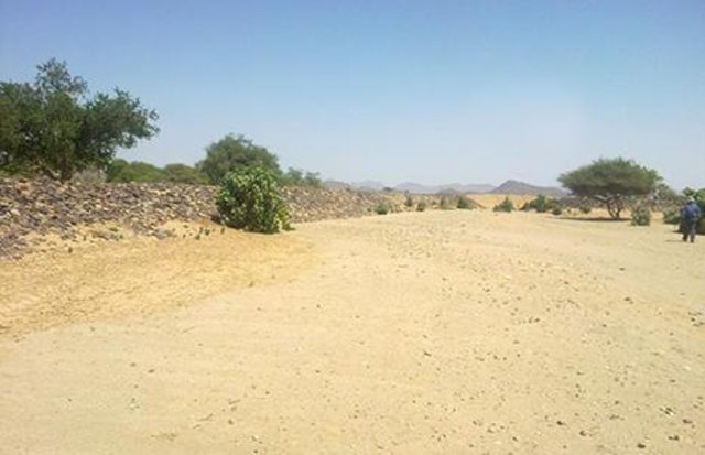
Water Spreading (typical example from Hashatribab) [Судан]
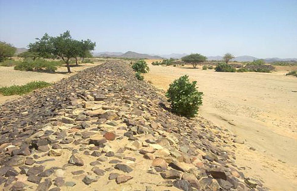
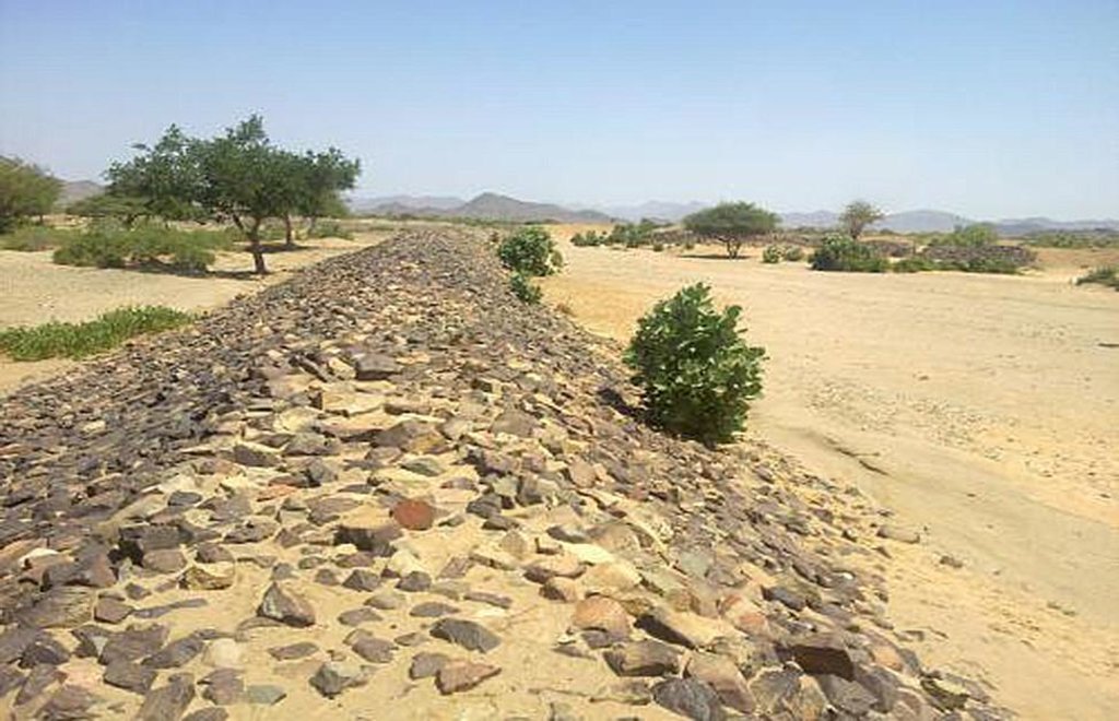
Construction of water spreading system on khor and wadi with machinery jointly government and farmers in dam compaction and pitching.
- Составитель: Abdalla Osman Eisa
2. Описание Технологии УЗП
2.1 Краткое описание Технологии
Определение Технологии:
Water Spreading (or Spate Irrigation system) conducted through the construction of earth dam structures at the khor cross section.
2.2 Подробное описание Технологии
Описание:
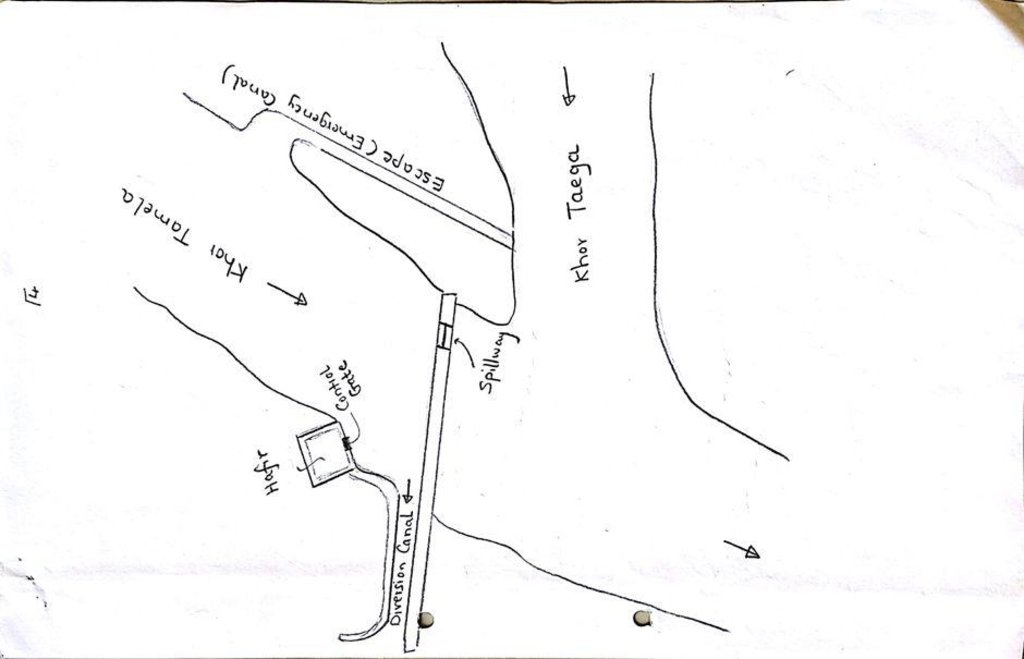
Water Spreading (or Spate Irrigation) can be done through the construction of an angled bank or weir – with a spillway in case of excess flow – to divert a “khor” (ephemeral stream) and spread it (using spaced contour bunds) for crop production.
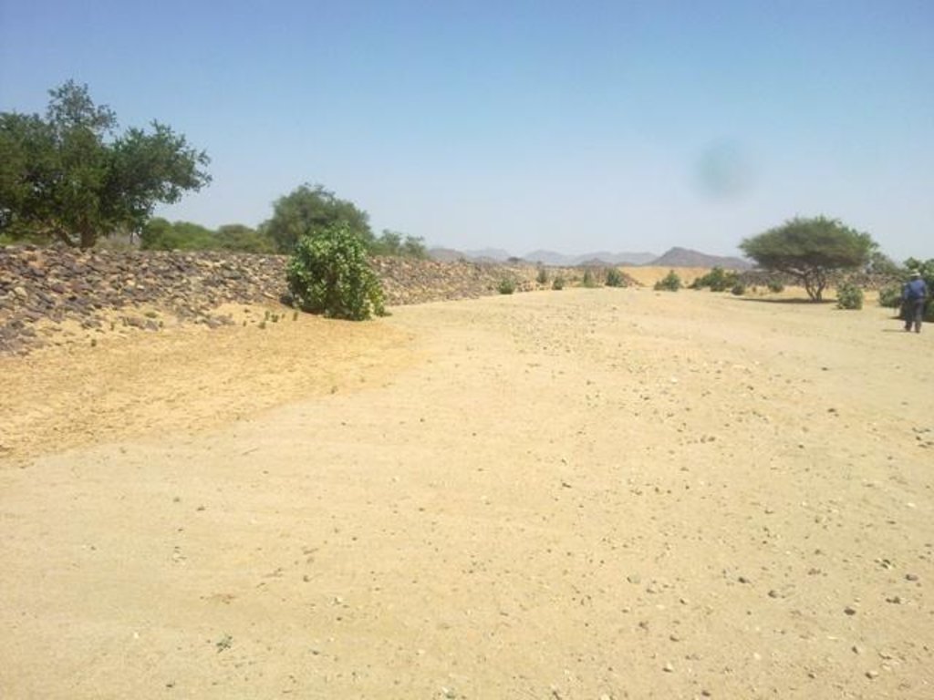
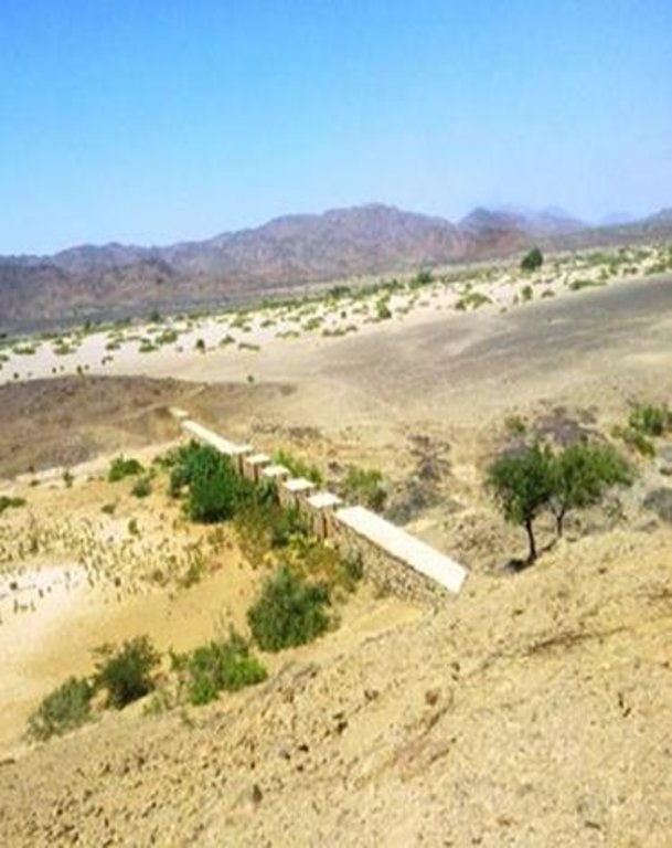
Water Spreading from khors or wadis where channelized runoff/ floodwater is diverted onto plains which are then cultivated on residual moisture. An example of a scheme which was constructed in 1999 is located at Hashitribab, some 7 km from Sinkat on the road towards Kassala. This scheme, comprising a stone-pitched earth diversion barrier across a khor (an ephemeral water course), is documented by using among others the WOCAT Questionnaire and WOCAT’s QA. While the diversion is still intact and provides water to the fields about one kilometre downstream (there were young sorghum plants growing at the time of the visit in November 2011) maintenance will be needed.
There was only a very small input of voluntary labour in its original construction (comprising a contribution in terms of stone pitching).
Construction by the Government, using machinery, with little local contribution might explain why voluntary maintenance of the structures has been negligible. Water spreading schemes have gradually expanded in number over the last 20 years in Red Sea State (according to Sayed Dabloub’s personal comment). Currently it was confirmed that there are new sites under planning and construction.
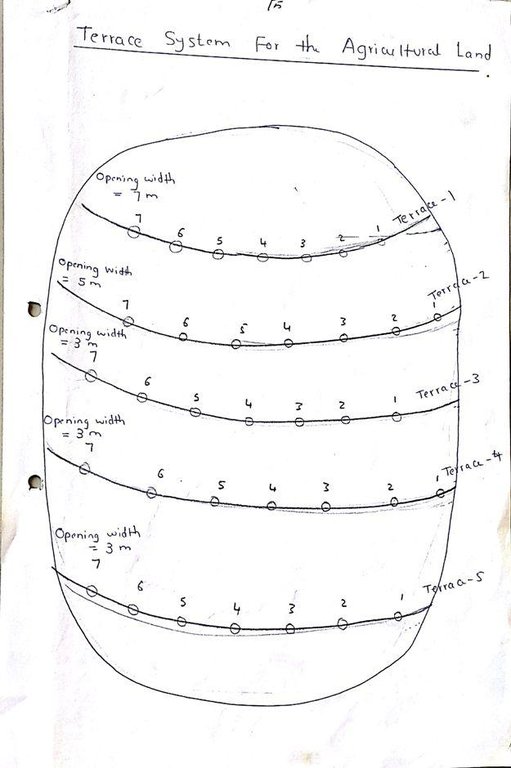
The purposes of diversion dam construction was to divert the main water course to take its way in the crop growing area replacing the old one and being controlled by small diversion dams (terraces to spread water for even water distribution through the original land. These terraces remarkably reduce gully formation.
Most important purpose is to provide water to growing crops in an area which is too dry for rain fed production and where no source for irrigation is available. It secures moisture during the growing season, by allowing more water to penetrate soil and to preserve moisture for a longer period at plant root zone.
The decrease of flood water velocity leads to silt accumulation and other debris materials which increase soil capability in providing moisture, nutrients and maintain soil structure and conservation.
For the earthen/stone-pitched diversion structure with spillway and small haffir alongside machines have been used (mainly loaders provided by the government) which excavated and built the bund. In addition local communities were involved in some aspects of the establishment (mainly stone pitching) supported/subsidized with incentives. The structure/scheme at Hashitribab (close to Sinkat) was built in 1999 (and no maintenance has been done since that time). It helps in watering about 500 feddan (c. 200 hectares) of agricultural area where water is spread by the use of small contour bunds: these were also constructed using subsidies and machines.
Terraces are usually used to control water spreading along the cropped area. Those terraces usually receive the water at low speed velocity. For that reason they are very small in size and volume. Usually they are located in very gentle and uniformed areas. The terraces can be constructed by simple hand tool and tractors accessories. But the prolonged drought makes the maintenance difficult as the dry soil is more susceptible to wind erosion and sand accumulation on both sides of the dam and the bottom of the bund is one of several desertification phenomenon in the region. But the wind-blown sand is one of the most serious one especially in the dry lands of the Red Sea State. Contour survey for land leveling slope identification and location is an important step before implementation.
The study site is located in the arid region of Red Sea State where steep hills from north-south inland mountains are interrupted by arid plains. The population density is low and the population depends on both cropping and livestock with high incidence of poverty. For this reason there should be a clear plan for construction and community extension approach to care about the maintenance of the technology. About 120 families live in Hashitribab area. All the year round they secure their provision by storing food crops in particular sorghum.
2.3 Фотографии, иллюстрирующие Технологию
2.5 Страна/ регион/ места, где применяется Технология, информация о которых собрана в данной Анкете
Страна:
Судан
Административная единица (Район/Область):
Red Sea
Более точная привязка места:
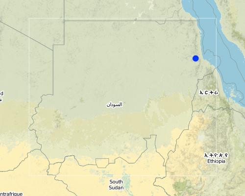
Sinkat Locality
Map
×2.6 Сколько лет применяется данная Технология
Если год начала применения Технологии достоверно неизвестен, дайте примерную оценку:
- 10-50 лет назад
2.7 Внедрение Технологии
Укажите, как именно Технология УЗП была внедрена:
- как инновация (инициатива) землепользователей
Пояснения (тип проекта и т.д.):
This scheme was built – in 1999 - on the site of a smaller traditional diversion
3. Классификация Технологии УЗП
3.1 Основные цели и задачи реализации Технологии
- повышение производства
- снижение или предотвращение деградации земель, восстановление нарушенных земель
3.2 Текущий(-ие) тип(-ы) землепользования на территории, где применяется Технология

Пахотные угодья и плантации
- Однолетние культуры
Пояснения:
Major land use problems (compiler’s opinion): Soil vulnerability to erosion due to rainfall irregularity and characterized by drought cycles; in some years rainfall recorded complete absence. Bare and and dried soils are easily affected by erosion agents (wind and water erosion) as these soils are weakly tolerant. Soils in plains are very poor, not renewable and are affected more than soils in seasonable rivers which are renewable with high soil water moisture.
Major land use problems (land users’ perception): Rain fed soils are weak in moisture holding capacity contrast to soils in flush irrigation soils and preferably used for seasonal cultivation by users and producing stable food crops with good productivity besides all underground water for human consumption and livestock through wells at reasonable depths are to be found.
Future (final) land use (after implementation of SLM Technology): Cropland: Ca: Annual cropping
3.3 Дополнительная информация о землепользовании
другое (например, паводковое):
- post-flooding
Число урожаев за год:
- 1
Поясните:
Longest growing period in days: 90
3.4 Категория УЗП, к которой относится Технология
- мероприятия по влагозадержанию и снижению эрозии почв на склонах
- Водоотвод и осушение
3.5 Распределение Технологии по площади
Охарактеризуйте пространственное распространение Технологии :
- равномерно-однородное применение на определенной площади
Если Технология равномерно применяется на той или иной территории, укажите ее приблизительную общую площадь:
- 1-10 км2
Пояснения:
This covers just one example of water spreading within the State: there are many but their exact extent is not known. The 2.5 km2 covers the area of the spate water diversion structure in the upper/ mid-stream and the zone where the crop is grown closer to the coastal area. The same is practiced throughout the area in the Red Sea State (It is over 100 and crop are approximately range between 20,000 to 30,000 feddans as an average in the State)
3.6 Мероприятия УЗП, выполняемые в рамках Технологии

инженерные мероприятия
- И2: Насыпи, валы
3.7 Основные проблемы деградации земель, на решение которых направлена Технология

водная эрозия почв
- ВЭп: поверхностная эрозия/смыв верхних почвенных горизонтов
- ВЭл: овражная эрозия / оврагообразование
- ВЭд: косвенное воздействие водной эрозии
Пояснения:
Main causes of degradation: crop management (annual, perennial, tree/shrub) (Clearance of land from resdues to mitigate erosion), overgrazing (Stocking at trees and shrubs continue during the flowering stage preventing seeds production.), industrial activities and mining (To manage mining activities.), change in temperature (Reduced rainfall rate and more affection by wind erosion.), change of seasonal rainfall (More unpredictable and uncertain), Heavy / extreme rainfall (intensity/amounts) (affect in water erosin), droughts (affect passively on the vegetation cover and disintegration of rural families.), poverty / wealth (Not able to conserve resources)
Secondary causes of degradation: soil management (Breaking and blanking soil clods, and leveling and furrowing to increase soil roughness specially at wet seasons to reduce water erodability.), deforestation / removal of natural vegetation (incl. forest fires) (excessive use of tree products), over-exploitation of vegetation for domestic use (Rising population and thus more resource requirements. This is typically is round growing population at urban at centres unlike to people in rural areas except at rainy season where they are gathered), urbanisation and infrastructure development (Sequence to absence of infrastructures and related problems of drought increased rural migration to urban areas.), wind storms / dust storms (Erosion of top soil by wind blown.), floods (unless controlled), inputs and infrastructure: (roads, markets, distribution of water points, other, …) (Blocking water flow in some areas), education, access to knowledge and support services (Low environmental awareness and preparedness.)
3.8 Предотвращение и снижение деградации земель, или восстановление нарушенных земель
Укажите цель Технологии по отношению к деградации земель :
- предотвращение деградации земель
- восстановление/ реабилитация нарушенных земель
4. Технические характеристики, мероприятия по практической реализации, вложения и стоимость
4.1 Технический рисунок, иллюстрирующий Технологию
4.2 Спецификация / пояснения к техническому рисунку
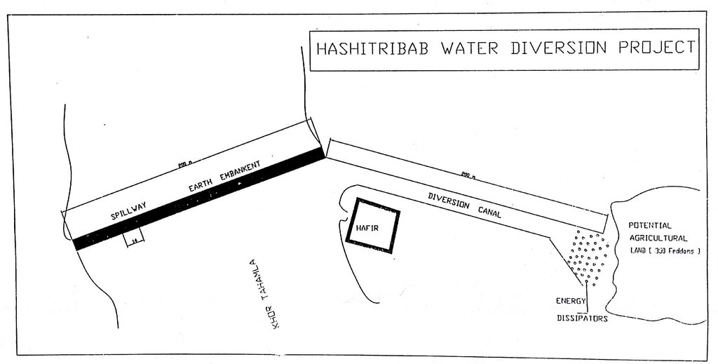
Drawing shows the diversion dams, reservoir (hafir) and channal
Location: Hshateribab. Sinkat Locality
Date: 1998
Technical knowledge required for field staff / advisors: moderate (Agriculture extension)
Technical knowledge required for land users: low (Raising community technical capacity)
Main technical functions: control of raindrop splash, control of dispersed runoff: retain / trap, control of concentrated runoff: retain / trap, improvement of ground cover, increase of surface roughness, increase of infiltration, increase of groundwater level / recharge of groundwater, water spreading
Dam/ pan/ pond
Width of ditches/pits/dams (m): 9
Height of bunds/banks/others (m): 2.5
Width of bunds/banks/others (m): 6
Length of bunds/banks/others (m): ˃100
Wall/ barrier
Height of bunds/banks/others (m): 2.5
Width of bunds/banks/others (m): 6
Length of bunds/banks/others (m): ˃100
Lateral gradient along the structure: 0.5 - 1%
4.4 Мероприятия, необходимые для начала реализации
| Деятельность | Тип мероприятия | Сроки | |
|---|---|---|---|
| 1. | Excavation of foundation trenches. | Инженерные | 1 week |
| 2. | Backfilling with heavy soil | Инженерные | 1 day |
| 3. | Establishment diversion structure | Инженерные | 8 weeks |
| 4. | Stonepitching by hand | Инженерные | 3 weeks |
| 5. | Construction of spillway | Инженерные | 2 weeks |
4.5 Вложения и затраты, необходимые для начала реализации
| Опишите затраты | Единица | Количество | Затраты на единицу | Общая стоимость на единицу | % затрат, оплаченных землепользователями | |
|---|---|---|---|---|---|---|
| Оплата труда | labour | ha | 1,0 | 57,0 | 57,0 | |
| Оборудование | machine use | ha | 1,0 | 355,0 | 355,0 | |
| Общая стоимость запуска Технологии | 412,0 | |||||
4.6 Поддержание/ текущее обслуживание
| Деятельность | Тип мероприятия | Сроки/ повторяемость проведения | |
|---|---|---|---|
| 1. | Tillage | Агрономические | before fluding period |
4.7 Стоимость поддержания/ текущего обслуживания ( в год)
Пояснения:
For the diversion structure and spillway at time of construction (1999)
4.8 Наиболее значимые факторы, влияющие на стоимость затрат
Опишите наиболее значимые факторы, влияющие на стоимость затрат:
The slope and depth of the wadi/ khor to be diverted
5. Природные и социально-экономические условия
5.1 Климат
Среднегодовое количество осадков
- < 250 мм
- 251-500 мм
- 501-750 мм
- 751-1000 мм
- 1001-1500 мм
- 1501-2000 мм
- 2001-3000 мм
- 3001-4000 мм
- > 4000 мм
Агроклиматическая зона
- засушливая
Thermal climate class: tropics
5.2 Рельеф
Склоны (преобладающие):
- пологие (0-2%)
- покатые (3-5%)
- покато-крутые (6-10%)
- крутые (11-15%)
- очень крутые (16-30%)
- чрезвычайно крутые (31-60%)
- обрывистые (>60%)
Формы рельефа:
- плато/ равнины
- гребни хребтов/холмов
- склоны гор
- склоны холмов
- подножья
- днища долин
Зона высотной поясности:
- 0-100 м над уровнем моря
- 101-500 м н.у.м.
- 501-1000 м н.у.м.
- 1001-1500 м н.у.м.
- 1501-2000 м н.у.м.
- 2001-2500 м н.у.м.
- 2501-3000 м н.у.м.
- 3001-4000 м н.у.м.
- > 4 тыс. м н.у.м.
5.3 Почвы
Средняя мощность почв:
- поверхностные (0-20 см)
- неглубокие (21-50 см)
- умеренно глубокие (51-80 см)
- глубокие (81-120 см)
- очень глубокие (> 120 см)
Содержание органического вещества в верхнем горизонте:
- низкое (< 1%)
5.4 Доступность и качество воды
Уровень грунтовых вод:
< 5 м
Качество воды (без обработки):
питьевая вода плохого качества (необходима обработка)
5.6 Характеристика землепользователей, применяющих Технологию
Рыночная ориентация производства:
- натуральное хозяйство (самообеспечение)
Доходы из других источников:
- 10-50% всех доходов
Индивидуальное или коллективное хозяйство:
- частное/ домовладение
Уровень механизации:
- ручной труд
Пол:
- женщины
- мужчины
Укажите другие важные характеристики землепользователей:
Land users applying the Technology are mainly disadvantaged land users
Population density: < 10 persons/km2
Annual population growth: 2% - 3%
100% of the land users are poor.
Off-farm income specification: Other activities include casual labour and livestock raising
5.7 Средний размер земельных участков, арендуемых или находящихся в собственности землепользователей, применяющих Технологию
- < 0,5 га
- 0,5-1 га
- 1-2 га
- 2-5 га
- 5-15 га
- 15-50 га
- 50-100 га
- 100-500 га
- 500-1000 га
- 1000-10000 га
- > 10000 га
Считается ли это мелким, средним или крупным хозяйством (по местным масштабам)?
- мелкое
5.8 Собственность на землю, права на земле- и водопользование
Землевладелец:
- общинная/ поселковая
- индивидуальная, оформленная в собственность
Право землепользования:
- общинное (контролируемое)
- индивидуальное
5.9 Доступ к базовым услугам и инфраструктуре
медицинское обслуживание:
- плохой
- средний
- хорошая
образование:
- плохой
- средний
- хорошая
технические консультации:
- плохой
- средний
- хорошая
занятость (вне хозяйства):
- плохой
- средний
- хорошая
рынки:
- плохой
- средний
- хорошая
электроснабжение:
- плохой
- средний
- хорошая
транспорт и дорожная сеть:
- плохой
- средний
- хорошая
водоснабжение и канализация:
- плохой
- средний
- хорошая
6. Воздействия и заключительные положения
6.1 Влияние Технологии УЗП в пределах территории ее применения
Социально-экономическое воздействие
Продуктивность
производство сельскозяйственных культур
Комментарий/ пояснения:
Relative to nothing otherwise
производство кормов
риск потери продуктивности
площадь, используемая для производства продукции
Доступность и качество воды
доступность питьевой воды
Доходы и затраты
доходы хозяйства
разнообразие источников дохода
Социальное и культурное воздействие
продовольственная безопасность/ самообеспечение
культурные возможности
возможности отдыха и рекреации
местное самоуправление
competition with natural ecosystem
Комментарий/ пояснения:
Floodwaters diverted will not reach original destination and those former beneficiaries
contribution to human well-being
Комментарий/ пояснения:
Due to more reliable production despite low and variable rainfall
Экологическое воздействие
Водный цикл/ поверхностный сток
количество воды
качество воды
сбор воды/ водоудержание
поверхностный сток
испарение
Почвы
влажность почв
почвенный покров
почвенное / подземное органическое вещество/ углерод
Другие экологические последствия
competition with natural ecosystem
Комментарий/ пояснения:
Floodwaters diverted will not reach original destination
6.2 Влияние Технологии за пределами территории ее применения
доступность воды
подтопление ниже по течению
6.3 Подверженность и чувствительность Технологии УЗП к постепенным изменениям климата и экстремальным погодным явлениям/ стихийным бедствиям, связанным с изменением климата (в понимании землепользователей)
Постепенное изменение климата
Постепенное изменение климата
| Сезон | Тип изменения климата/ экстремального явления | Насколько успешно Технология справляется с этим? | |
|---|---|---|---|
| среднегодовые температуры | увеличилось | хорошо |
Экстремальные явления, связанные с изменением климата (стихийные бедствия)
Гидрологические стихийные бедствия
| Насколько успешно Технология справляется с этим? | |
|---|---|
| регулярные наводнения (выход рек из берегов) | хорошо |
Пояснения:
Construction of water spreading devices serves to preserve water, reduce the waste, increase soil moisture capacity and raise soil fertility (silt accumulation)
6.4 Анализ эффективности затрат
Насколько получаемый результат сопоставим с первоначальными вложениями (с точки зрения землепользователей)?
Эффективность затрат в краткосрочной перспективе:
слабо позитивное
Эффективность затрат в долгосрочной перспективе:
позитивное
Пояснения:
no maintenance carried out so not applicable here
6.5 Внедрение Технологии
- более 50%
Пояснения:
75% of land user families have adopted the Technology with external material support
102 land user families have adopted the Technology with external material support, scheme construction subsidised by Government
15% of land user families have adopted the Technology without any external material support
18 land user families have adopted the Technology without any external material support
There is no trend towards spontaneous adoption of the Technology. People cannot construct khor/ wadi diversion barriers themselves by hand
6.7 Сильные стороны/ преимущества/ возможности Технологии
| Сильные стороны/ преимущества/ возможности по мнению составителя или других ключевых специалистов |
|---|
| Useful and important in the area where floodwater harvesting/ spate irrigation is the only option for crop production. No rain fed irrigation system on the Red Sea State unlike to other Sudan. |
6.8 Слабые стороны/ недостатки/ риски Технологии и пути их преодоления
| Слабые стороны/ недостатки/ риски по мнению землепользователей | Возможные пути их преодоления/снижения? |
|---|---|
| SLM not falls under the community responsibility. They believe SLM is completely Gos role. | Land users awareness and involvement |
| They don’t think that community plays a role in the ongoing soil and vegetation degradation | Rotational grazing and seed broadcasting |
| They also say no regular concern by the government is given in relation to land reclamation | A location of budget and equipment to reclaim land and natural vegetation conservation. |
| They confirm that the physical conditions played a great role in land degradation e.g. drought aridity and high temperatures . | To ensure water harvesting and without waste. |
| Слабые стороны/ недостатки/ риски по мнению составителя или ответственных специалистов | Возможные пути их преодоления/снижения? |
|---|---|
| High cost (needs machinery to move earth) | More support from Government and outside |
| Not enough trained personnel | More up-grading skills are required |
| Very little data available (apart from construction details) | Better system of monitoring and evaluation |
| Low technical capacity of the community | Capacity building and training |
7. Справочные материалы и ссылки
7.1 Методы сбора/ источники информации
- выезды на места, полевые обследования
- опросы землепользователей
Ссылки и модули
Развернуть все Свернуть всеСсылки

Water Spreading (typical example from Hashatribab) [Судан]
Construction of water spreading system on khor and wadi with machinery jointly government and farmers in dam compaction and pitching.
- Составитель: Abdalla Osman Eisa
Модули
Нет модулей


