Grass strips [Нигер]
- Создание:
- Обновить:
- Составитель: Dieter Nill
- Редактор: –
- Рецензенты: Deborah Niggli, Alexandra Gavilano
Bandes enherbées (French)
technologies_1621 - Нигер
Просмотреть разделы
Развернуть все Свернуть все1. Общая информация
1.2 Контактные данные специалистов и организаций, участвующих в описании и оценке Технологии
Специалист по УЗП:
Mamadou Abdou Gaoh Sani
Programme d’Appui à l’agriculture Productive (PROMAP), Niamey, Niger
Нигер
Название проекта, содействовавшего документированию/оценке Технологии (если применимо)
Good Practices in Soil and Water Conservation - A contribution to adaptation and farmers ́ resilience towards climate change in the Sahel (GIZ)Название организации (-ий), содействовавших документированию/оценке Технологии (если применимо)
Deutsche Gesellschaft für Internationale Zusammenarbeit (GIZ) GmbH (GIZ) - Германия1.3 Условия, регламентирующие использование данных, собранных ВОКАТ
Составитель и ответственный(-ые) специалист(-ы) согласны с условиями, регламентирующими использование собранных ВОКАТ данных:
Да
1.4 Декларация по устойчивости описываемой Технологии
Вызывает ли описанная здесь Технология проблемы деградации земель настолько, что ее нельзя назвать природосберегающей?
Нет
2. Описание Технологии УЗП
2.1 Краткое описание Технологии
Определение Технологии:
Grass strips slow down runoff, increase infiltration and retain sediment, thus increasing crop production.
2.2 Подробное описание Технологии
Описание:
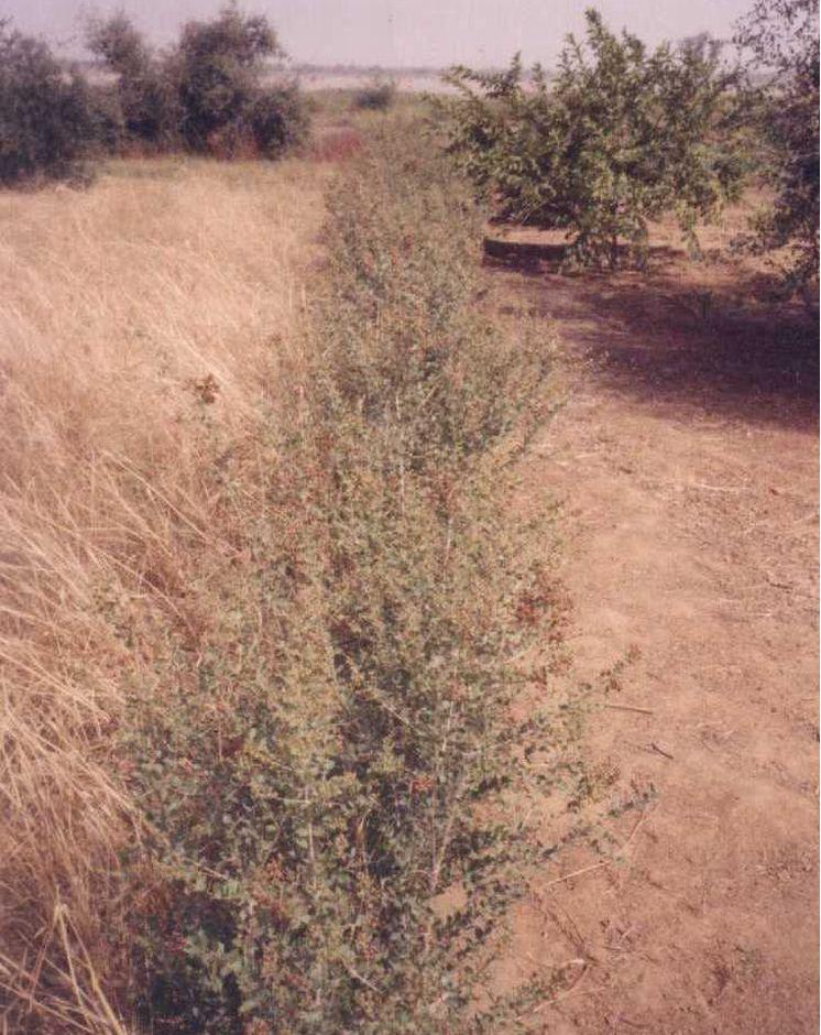
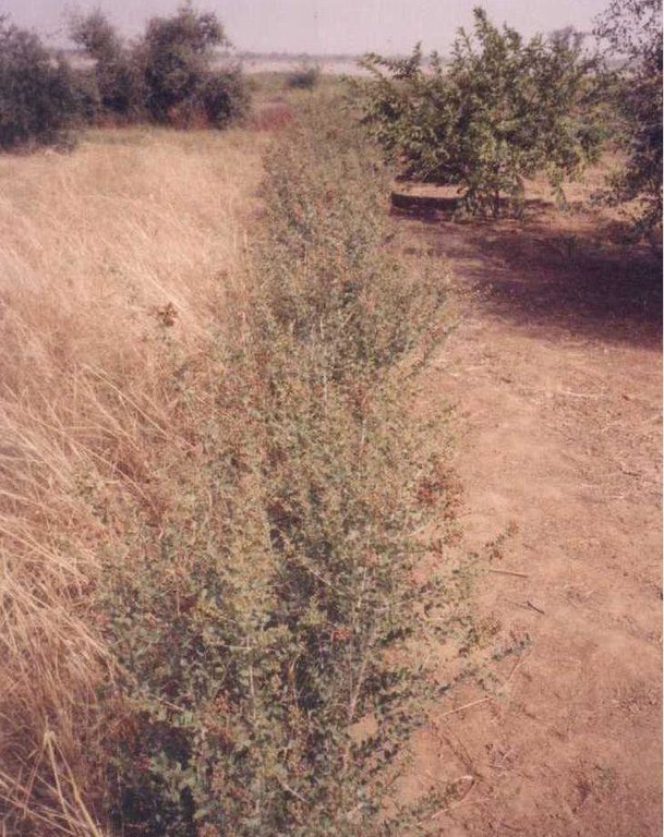
Grass strips measuring 0.80 m to 1 m wide are planted 20 to 80 m apart on low-gradient terrain. Local grasses (for example, Andropogon gayanus, Cymbopogon schoenateus and Vetivera nigritiana) are sown or planted (plantlets) at the start of the rainy season. Like stone bunds, grass strips are planted along the natural contour of the land to slow down runoff, increase infiltration and retain sediment. Grass strips get bigger as sediment builds up, which maintains their capacity to retain water, unlike mechanical structures (stone bunds and dikes).
The species of grass are chosen according to what the farmers want to use them for (straw, hay, mat weaving, roofing, construction of straw granaries, brooms, etc.). In cattle and sheep raising areas, the use of fodder plants can increase interest in this technique and ensure wider acceptance. It is recommended that the development of grass strips be combined with assisted natural regeneration (woody species) or the planting of trees.
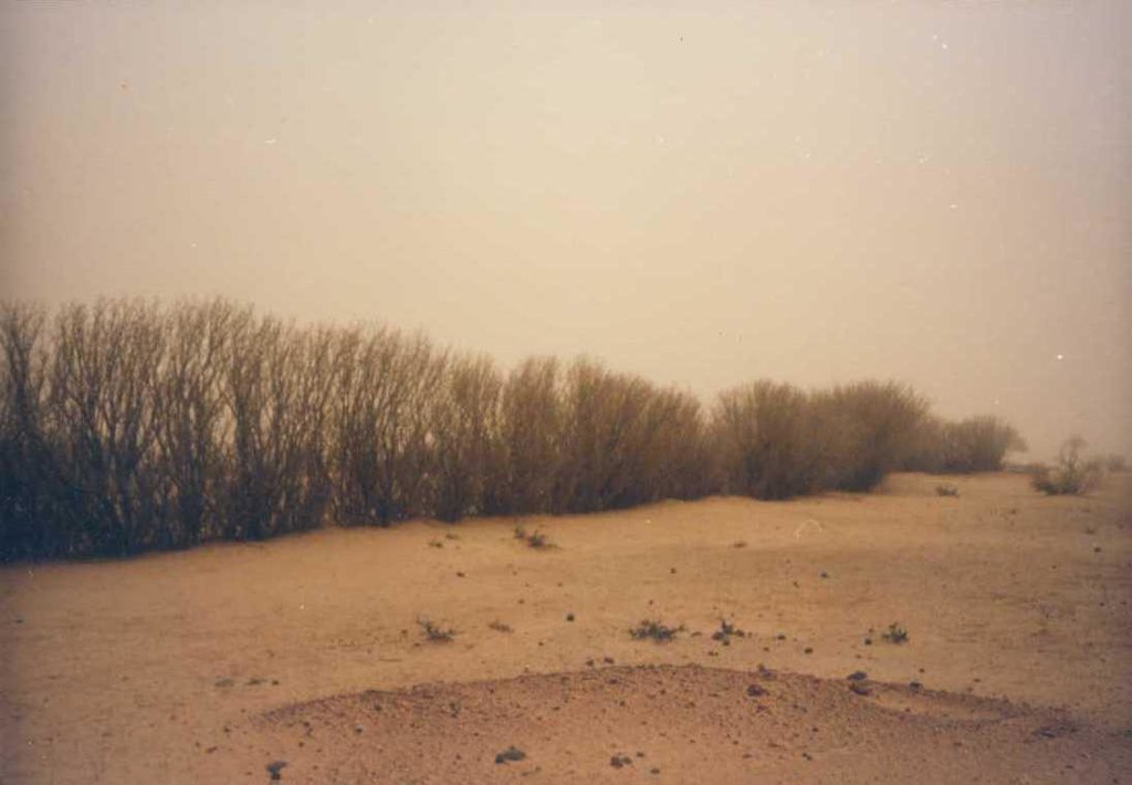
Designed as an erosion control measure, grass strips slow down runoff in the event of heavy rain. They distribute rainwater more evenly over the land and improve infiltration which is particularly important when there are dry spells in the rainy season. Sediment builds up behind the grass strips, thereby reducing the erosion of fertile soil layers. The roots of the plants bind the soil and hold it in place. Although the vegetation growing in the strips competes with the crops to some extent for water, the overall effect on yields is positive. Crops are also protected from wind erosion. Thanks to the vegetation cover they provide, grass strips contribute to lowering soil temperature.
Like contour stone bunds, grass strips reduce the harmful effects of heavy rain and violent downpours, events that are expected to increase as a result of climate change.
Compared with plots without grass strips, millet yields were 50 kg per hectare per year higher, and straw yields 125 kg higher on plots with grass strips. Yields can be substantially improved by combining grass strips with the application of organic fertiliser, mulch or pen manure. The best results, an average increase of 280 kg of millet grain per hectare (370 kg of straw per hectare), were achieved by combining them with mulching and pen manuring. Grass strips therefore improve yields of cereals and forage for livestock (straw and grass growing on the strips).
Increased crop output increases household food security and improves livestock feeding. The straw cut on the grass strips can also be used for other purposes (fencing and roofing). It is also a source of income, as traditional products made with straw, such as woven mats, can be sold.
Grass growth tends to be patchy, and resowing is required several times to fill in the gaps in the strip. In order to protect the grass strips from grazing animals during the first year, it is recommended that the area be monitored, which requires strict control over the village herds and flocks and those of nomadic livestock keepers.
Some grasses tend to invade crop fields. It is therefore important to control them by cutting them down before they flower and to tend the strips regularly, straightening and cutting back the edges.
Any dead plants in the grass strips must be regularly replaced. Grass strips are more likely to be maintained if they are economically profitable, for example, if they produce hay for livestock or their output can be sold as forage or construction material.
It is a technique designed mainly for cropland, but can also be used on rangeland, provided that the plants are protected when the grass strips are put in place. Grass strips are suitable for areas in the Sahel and the Sudan with rainfall ranging between 400 and 1,000 mm/year and gently sloping terrain (< 2%). Ecological units that benefit from the implementation of this measure include dune land, pediments and plains (highland pediments). Grass strips are particularly appropriate for non-stony land in areas with higher rainfall levels.
2.3 Фотографии, иллюстрирующие Технологию
2.5 Страна/ регион/ места, где применяется Технология, информация о которых собрана в данной Анкете
Страна:
Нигер
Административная единица (Район/Область):
Niger
Более точная привязка места:
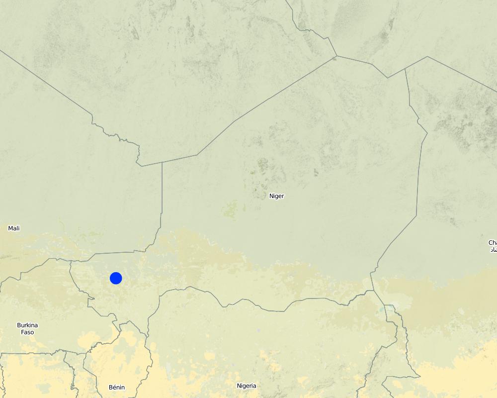
Filingué, Ouallam, Tillabéri, Tera
Охарактеризуйте пространственное распространение Технологии :
- равномерно-однородное применение на определенной площади
Если точная область неизвестна, укажите приблизительную площадь:
- 10-100 км2
Пояснения:
After three seasons of promoting this technique, grass strips had been established on a total area of 4674 hectares (sometimes in combination with other measures). Over half of the improved land is located in the Filingué area (2587 hectares), followed by Ouallam with 1042 hectares. However, only small areas were improved with grass strips in Tillabéri and Tera (228 hectares and 817 hectares respectively), where acceptance of this technique was low
Map
×2.6 Сколько лет применяется данная Технология
Если год начала применения Технологии достоверно неизвестен, дайте примерную оценку:
- 10-50 лет назад
2.7 Внедрение Технологии
Укажите, как именно Технология УЗП была внедрена:
- через проекты/ внешнее вмешательство
Пояснения (тип проекта и т.д.):
developed, implemented and disseminated as part of projects and programmes undertaken from the 1980s onwards to combat desertification and improve natural resource management. Implemented by GIZ (German Federal Enterprise for International Cooperation), PDRT (Projet de développement rural de Tahoua - Tahoua Rural Development Project), PASP (Projet de protection intégrée des ressources agro-sylvo-pastorales Tillabéri-Nord - Project for the Integrated Protection of Agricultural, Forest and Rangeland Resources in Tillabéri-Nord), and PATECORE (project for land development and resource conservation in Plateau Central Burkina Faso)
3. Классификация Технологии УЗП
3.1 Основные цели и задачи реализации Технологии
- снижение или предотвращение деградации земель, восстановление нарушенных земель
3.2 Текущий(-ие) тип(-ы) землепользования на территории, где применяется Технология

Пахотные угодья и плантации
- Однолетние культуры
Число урожаев за год:
- 1
Поясните:
Longest growing period in days: 120, Longest growing period from month to month: August to October

Пастбищные угодья
Экстенсивный выпас:
- Полукочевое скотоводство
Интенсивный выпас/ выращивание кормов:
- Стойловое содержание/ нулевой выпас
Пояснения:
Major land use problems (compiler’s opinion): soil erosion by water and wind, fertility decline
Livestock density: 1-10 LU /km2
3.4 Водоснабжение
Обеспеченность водой участков, где реализуется Технология :
- богарные земли
3.5 Категория УЗП, к которой относится Технология
- Кочевое животноводство и пастбищное хозяйство
- мероприятия по влагозадержанию и снижению эрозии почв на склонах
3.6 Мероприятия УЗП, выполняемые в рамках Технологии

Мероприятия с использованием растительности
- Р1: Древесный и кустарниковый покров
- Р2: Злаковые и многолетние травянистые растения
Пояснения:
Type of vegetative measures: aligned: -contour
3.7 Основные проблемы деградации земель, на решение которых направлена Технология

водная эрозия почв
- ВЭп: поверхностная эрозия/смыв верхних почвенных горизонтов

ветровая эрозия почв
- Эп: утрата плодородного слоя почвы

ухудшение химических свойств почв
- Хп: Снижение плодородия и уменьшение содержания органического вещества (вызванное не эрозией, а другими причинами)

деградация водных ресурсов
- Ва: почвенная засуха
Пояснения:
Main causes of degradation: soil management (Unadapted landuse methods, reduced or abandoned fallow periods), crop management (annual, perennial, tree/shrub) (Neglect of fallow periods and crop rotation), droughts (due to heat waves), population pressure (rapidly growing population increasing pressure on land), land tenure (insecure access to land and collectively managed communal land), poverty / wealth (very poor population)
Secondary causes of degradation: deforestation / removal of natural vegetation (incl. forest fires) (deforestation through overgrazing and fire wood collection), over-exploitation of vegetation for domestic use (firewood collection), overgrazing (cattle, sheep and goats), change in temperature (Climate change: heat waves), change of seasonal rainfall (more variable onset of rain), Heavy / extreme rainfall (intensity/amounts) (more variable and intensive rains), wind storms / dust storms (frequent storms), floods (due to intensive rain storms), labour availability (some migration of men to nearby cities), education, access to knowledge and support services (high level of illiteracy)
3.8 Предотвращение и снижение деградации земель, или восстановление нарушенных земель
Укажите цель Технологии по отношению к деградации земель :
- предотвращение деградации земель
- снижение деградации земель
4. Технические характеристики, мероприятия по практической реализации, вложения и стоимость
4.1 Технический рисунок, иллюстрирующий Технологию
Спецификация (пояснения к техническому рисунку):
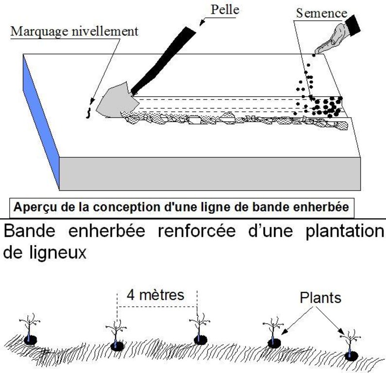
Grass strips measuring 0.80 m to 1 m wide are planted 20 to 80 m apart on low-gradient terrain. Local grasses (for example, Andropogon gayanus, Cymbopogon schoenateus and Vetivera nigritiana) are sown or planted (plantlets) along the natural contour at the start of the rainy season.
Technical knowledge required for field staff / advisors: moderate
Technical knowledge required for land users: low
Main technical functions: control of dispersed runoff: retain / trap, control of dispersed runoff: impede / retard, control of concentrated runoff: retain / trap, control of concentrated runoff: impede / retard, improvement of ground cover, stabilisation of soil (eg by tree roots against land slides), increase in organic matter, increase in nutrient availability (supply, recycling,…), increase of infiltration, increase / maintain water stored in soil, water harvesting / increase water supply, sediment retention / trapping, sediment harvesting, reduction in wind speed, increase of biomass (quantity), promotion of vegetation species and varieties (quality, eg palatable fodder)
Secondary technical functions: increase of groundwater level / recharge of groundwater
Aligned: -contour
Vegetative material: T : trees / shrubs, G : grass
Number of plants per (ha): 200
Spacing between rows / strips / blocks (m): 20-80
Width within rows / strips / blocks (m): 0.8-1
Grass species: Andropogon gayanus, Cymbopogon schoenateus and Vetivera nigritiana
Автор:
PASP
4.2 Общая информация по необходимым вложениям и стоимости
другая/ национальная валюта (название):
CFA Franc
4.3 Мероприятия, необходимые для начала реализации
| Деятельность | Время (сессия) | |
|---|---|---|
| 1. | marking out the contour lines | |
| 2. | making 10-15 cm deep furrows in which to plant the seeds or seedlings | |
| 3. | sowing or planting 1 to 4 rows per strip. |
4.4 Вложения и затраты, необходимые для начала реализации
| Опишите затраты | Единица | Количество | Затраты на единицу | Общая стоимость на единицу | % затрат, оплаченных землепользователями | |
|---|---|---|---|---|---|---|
| Оплата труда | labour | ha | 1,0 | 46,7 | 46,7 | 100,0 |
| Посадочный материал | seeds | ha | 1,0 | 3,3 | 3,3 | 100,0 |
| Общая стоимость запуска Технологии | 50,0 | |||||
| Общие затраты на создание Технологии в долларах США | 50,0 | |||||
4.5 Поддержание/ текущее обслуживание
| Деятельность | Сроки/ повторяемость проведения | |
|---|---|---|
| 1. | resowing is required several times. Any dead plants in the grass strips must be regularly replaced. | |
| 2. | Cutting down grasses which invade crop fields. | |
| 3. | straightening and cutting back the edges |
4.7 Наиболее значимые факторы, влияющие на стоимость затрат
Опишите наиболее значимые факторы, влияющие на стоимость затрат:
Labour: 6 man-days per ha
• marking out the contour lines
• making 10-15 cm deep furrows in which to plant the seeds or seedlings
• sowing or planting 1 to 4 rows per strip. Upkeep: 2.5 man-days per year.
Other costs:
• grass seeds or seedlings
• equipment: water-tube level.
5. Природные и социально-экономические условия
5.1 Климат
Среднегодовое количество осадков
- < 250 мм
- 251-500 мм
- 501-750 мм
- 751-1000 мм
- 1001-1500 мм
- 1501-2000 мм
- 2001-3000 мм
- 3001-4000 мм
- > 4000 мм
Агроклиматическая зона
- полузасушливая
Thermal climate class: subtropics
5.2 Рельеф
Склоны (преобладающие):
- пологие (0-2%)
- покатые (3-5%)
- покато-крутые (6-10%)
- крутые (11-15%)
- очень крутые (16-30%)
- чрезвычайно крутые (31-60%)
- обрывистые (>60%)
Формы рельефа:
- плато/ равнины
- гребни хребтов/холмов
- склоны гор
- склоны холмов
- подножья
- днища долин
Зона высотной поясности:
- 0-100 м над уровнем моря
- 101-500 м н.у.м.
- 501-1000 м н.у.м.
- 1001-1500 м н.у.м.
- 1501-2000 м н.у.м.
- 2001-2500 м н.у.м.
- 2501-3000 м н.у.м.
- 3001-4000 м н.у.м.
- > 4 тыс. м н.у.м.
5.3 Почвы
Средняя мощность почв:
- поверхностные (0-20 см)
- неглубокие (21-50 см)
- умеренно глубокие (51-80 см)
- глубокие (81-120 см)
- очень глубокие (> 120 см)
Гранулометрический состав (верхнего горизонта):
- средние фракции (суглинистый, супесчаный)
- тонкодисперсный/ тяжёлый (глинистый)
Содержание органического вещества в верхнем горизонте:
- низкое (< 1%)
5.4 Доступность и качество воды
Уровень грунтовых вод:
5-50 м
Доступность поверхностных вод:
средняя
Качество воды (без обработки):
исключительно для сельскохозяйственного использования (орошение)
5.5 Биоразнообразие
Видовое разнообразие:
- низкое
5.6 Характеристика землепользователей, применяющих Технологию
Рыночная ориентация производства:
- натуральное хозяйство (самообеспечение)
Доходы из других источников:
- 10-50% всех доходов
Относительный уровень достатка:
- очень плохой
- плохой
Уровень механизации:
- ручной труд
- тягловая сила
Пол:
- мужчины
Укажите другие важные характеристики землепользователей:
Population density: 10-50 persons/km2
Annual population growth: 3% - 4% (mostly poor households below poverty line).
Off-farm income specification: men migrate temporarily or permanently to cities for off-farm income, women and men seasonally carry out paid farm work
5.7 Средняя площадь земель, используемых землепользователями с применением Технологии
- < 0,5 га
- 0,5-1 га
- 1-2 га
- 2-5 га
- 5-15 га
- 15-50 га
- 50-100 га
- 100-500 га
- 500-1000 га
- 1000-10000 га
- > 10000 га
Считается ли это мелким, средним или крупным хозяйством (по местным масштабам)?
- мелкое
5.8 Собственность на землю, права на земле- и водопользование
Землевладелец:
- государственная
- индивидуальная, не оформленная в собственность
Право землепользования:
- неограниченное (неконтролируемое)
Право водопользования:
- неограниченное (неконтролируемое)
Пояснения:
traditional land use rights prevail. On fields individual land use rights, communal rights on pasture and forest land (collection of wood and other products (fruits, medicinal plants))
5.9 Доступ к базовым услугам и инфраструктуре
медицинское обслуживание:
- плохой
- средний
- хорошая
образование:
- плохой
- средний
- хорошая
технические консультации:
- плохой
- средний
- хорошая
занятость (вне хозяйства):
- плохой
- средний
- хорошая
рынки:
- плохой
- средний
- хорошая
электроснабжение:
- плохой
- средний
- хорошая
транспорт и дорожная сеть:
- плохой
- средний
- хорошая
водоснабжение и канализация:
- плохой
- средний
- хорошая
финансовые услуги:
- плохой
- средний
- хорошая
6. Воздействия и заключительные положения
6.1 Влияние Технологии УЗП в пределах территории ее применения
Социально-экономическое воздействие
Продуктивность
производство сельскозяйственных культур
производство кормов
производство продуктов животноводства
риск потери продуктивности
площадь, используемая для производства продукции
Комментарий/ пояснения:
Part of the plot is taken up by the grass strips, reducing the area left for growing crops
Доходы и затраты
доходы хозяйства
разнообразие источников дохода
объем работ
Другое социально-экономическое воздействие
competition of grasses with crops
Социальное и культурное воздействие
продовольственная безопасность/ самообеспечение
смягчение конфликтов
contribution to human well-being
Комментарий/ пояснения:
Increased crop output increases household food security and improves livestock feeding. The straw cut on the grass strips can also be used for other purposes (fencing and roofing). It is also a source of income, as traditional products made with straw, such as woven mats, can be sold.
Экологическое воздействие
Водный цикл/ поверхностный сток
сбор воды/ водоудержание
поверхностный сток
Почвы
влажность почв
почвенный покров
утрата почв
круговорот/ восполнение питательных веществ
Климат и снижение риска стихийных бедствий
скорость ветра
6.2 Влияние Технологии за пределами территории ее применения
подтопление ниже по течению
отложение наносов ниже по течению
отложения, переносимые ветром
6.3 Подверженность и чувствительность Технологии УЗП к постепенным изменениям климата и экстремальным погодным явлениям/ стихийным бедствиям, связанным с изменением климата (в понимании землепользователей)
Постепенное изменение климата
Постепенное изменение климата
| Сезон | увеличение или уменьшение | Насколько успешно Технология справляется с этим? | |
|---|---|---|---|
| среднегодовые температуры | увеличилось | хорошо |
Экстремальные явления, связанные с изменением климата (стихийные бедствия)
Погодные стихийные бедствия
| Насколько успешно Технология справляется с этим? | |
|---|---|
| местные ливневые дожди | хорошо |
| местные ураганы | хорошо |
Стихийные бедствия климатического характера
| Насколько успешно Технология справляется с этим? | |
|---|---|
| засухи | плохо |
Гидрологические стихийные бедствия
| Насколько успешно Технология справляется с этим? | |
|---|---|
| регулярные наводнения (выход рек из берегов) | хорошо |
Другие воздействия, связанные с изменением климата
Другие воздействия, связанные с изменением климата
| Насколько успешно Технология справляется с этим? | |
|---|---|
| сокращение вегетационного периода | не известно |
6.4 Анализ эффективности затрат
Насколько получаемый результат сопоставим с первоначальными вложениями (с точки зрения землепользователей)?
Эффективность затрат в краткосрочной перспективе:
слабо позитивное
Эффективность затрат в долгосрочной перспективе:
слабо позитивное
Насколько получаемый результат сопоставим с текущими расходами по поддержанию технологии (с точки зрения землепользователей)?
Эффективность затрат в краткосрочной перспективе:
слабо позитивное
Эффективность затрат в долгосрочной перспективе:
слабо позитивное
6.5 Внедрение Технологии
Пояснения:
In the Tillabéri area, in northern Niger, the adoption of grass strips varies greatly from one place to another. After three seasons of promoting this technique, grass strips had been established on a total area of 4,674 hectares (sometimes in combination with other measures). Over half of the improved land is located in the Filingué area (2,587 hectares), followed by Ouallam with 1,042 hectares.
However, only small areas were improved with grass strips in Tillabéri and Tera (228 hectares and 817 hectares respectively), where acceptance of this technique was low.
In spite of good results in terms of increased production and soil improvement, grass strips have only been widely accepted in southern Niger (Maradi and Zinder). Farmers are of the view that grass strips could be confused with plot boundaries.
The availability of land in southern Niger may be another factor that facilitates acceptance of the measure is this area. Part of the plot is taken up by the grass strips, reducing the area left for growing crops. This hinders acceptance in areas where land is limited. The reduced crop-growing area is offset by better per-hectare grain, straw and hay yields. Certain grasses (such as Andropogon gayanus) have a harmful effect on nearby crops. The systematic exploitation of the grass strips as a source of straw or hay improves acceptance of the technique. In the Tillabéri area, in Niger, the adoption of grass strips varies greatly from one place to another. After three seasons of promoting this technique, grass strips had been established on a total area of 4,674 hectares (sometimes in combination with other measures). Over half of the improved land is located in the Filingué area (2,587 hectares), followed by Ouallam with 1,042 hectares. However, only small areas were improved with grass strips in Tillabéri and Tera (228 hectares and 817 hectares respectively), where acceptance of this technique was low. In spite of good results in terms of increased production and soil improvement, grass strips have only been widely accepted in southern Niger (Maradi and Zinder). Farmers are of the view that grass strips could be confused with plot boundaries. The availability of land in southern Niger may be another factor that facilitates acceptance of the measure is this area. Part of the plot is taken up by the grass strips, reducing the area left for growing crops. This hinders acceptance in areas where land is limited. The reduced crop-growing area is offset by better per-hectare grain, straw and hay yields. Certain grasses (such as Andropogon gayanus) have a harmful effect on nearby crops. The systematic exploitation of the grass strips as a source of straw or hay improves acceptance of the technique. At first, people living in the areas covered by the PDRT project were reluctant to establish grass strips. They considered them to be weeds with no place on their farmland. With time and exchange visits within the country, they began to accept the technique.
6.7 Сильные стороны/ преимущества/ возможности Технологии
| Сильные стороны/ преимущества/ возможности по мнению составителя или других ключевых специалистов |
|---|
| reduce the harmful effects of heavy rain and violent downpours, events that are expected to increase as a result of climate change |
| improve rainwater harvesting and water retention in the soil |
| contribute to creating vegetation cover, which provides a habitat for biodiversity |
| contribute to lowering soil temperature and are also effective in reducing wind erosion. As the vegetation provides shelter from the wind, fine particles of soil accumulate behind the strips. |
| Increased crop output increases household food security and improves livestock feeding. The straw cut on the grass strips can also be used for other purposes (fencing and roofing). It is also a source of income, as traditional products made with straw, such as woven mats, can be sold. |
6.8 Слабые стороны/ недостатки/ риски Технологии и пути их преодоления
| Слабые стороны/ недостатки/ риски по мнению составителя или ответственных специалистов | Возможные пути их преодоления/снижения? |
|---|---|
| Grass growth tends to be patchy, and resowing is required several times to fill in the gaps in the strip. Strips with bare patches are not effective in retaining water, and rilling can be caused by water gushing through the gaps. | The clumps must therefore be arranged in staggered rows and the strips made wide enough to prevent this problem. |
| With the use of certain types of grasses that grow in clumps, such as Andropogon grass, gaps are left between the tufts, and water spurting through these gaps can cause rilling. | |
| In spite of good results in terms of increased production and soil improvement, grass strips have only been widely accepted in southern Niger (Maradi and Zinder). Farmers are of the view that grass strips could be confused with plot boundaries. | |
| Certain grasses (such as Andropogon gayanus) have a harmful effect on nearby crops. | |
| Part of the plot is taken up by the grass strips, reducing the area left for growing crops. This hinders acceptance in areas where land is limited. |
7. Справочные материалы и ссылки
7.1 Методы сбора/ источники информации
- выезды на места, полевые обследования
- опросы землепользователей
Когда были собраны данные (на местах)?
01/07/2012
7.2 Ссылки на опубликованные материалы
Название, автор, год публикации, ISBN:
Good Practices in Soil and Water Conservation. A contribution to adaptation and farmers´ resilience towards climate change in the Sahel. Published by GIZ in 2012.
Где опубликовано? Стоимость?
http://agriwaterpedia.info/wiki/Main_Page
Ссылки и модули
Развернуть все Свернуть всеСсылки
Нет ссылок
Модули
Нет модулей


