Riverbed reclamation & silt trapping for sugarcane [Kenya]
- Creation:
- Update:
- Compiler: Kithinji Mutunga
- Editor: –
- Reviewers: David Streiff, Alexandra Gavilano
Kyanda (Kikamab)
technologies_1096 - Kenya
View sections
Expand all Collapse all1. General information
1.2 Contact details of resource persons and institutions involved in the assessment and documentation of the Technology
SLM specialist:
Ngati Mbuvi
MOARD
Kenya
SLM specialist:
Mwendwa Linus
MOARD
Kenya
Name of the institution(s) which facilitated the documentation/ evaluation of the Technology (if relevant)
Food and Agriculture Organization of the United Nations (FAO) - Italy1.3 Conditions regarding the use of data documented through WOCAT
The compiler and key resource person(s) accept the conditions regarding the use of data documented through WOCAT:
Yes
2. Description of the SLM Technology
2.1 Short description of the Technology
Definition of the Technology:
Silt harvesting on riverbeds to maximise sugarcane growing in semi arid area
2.2 Detailed description of the Technology
Description:
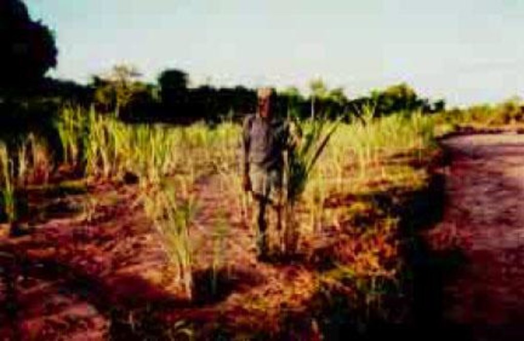
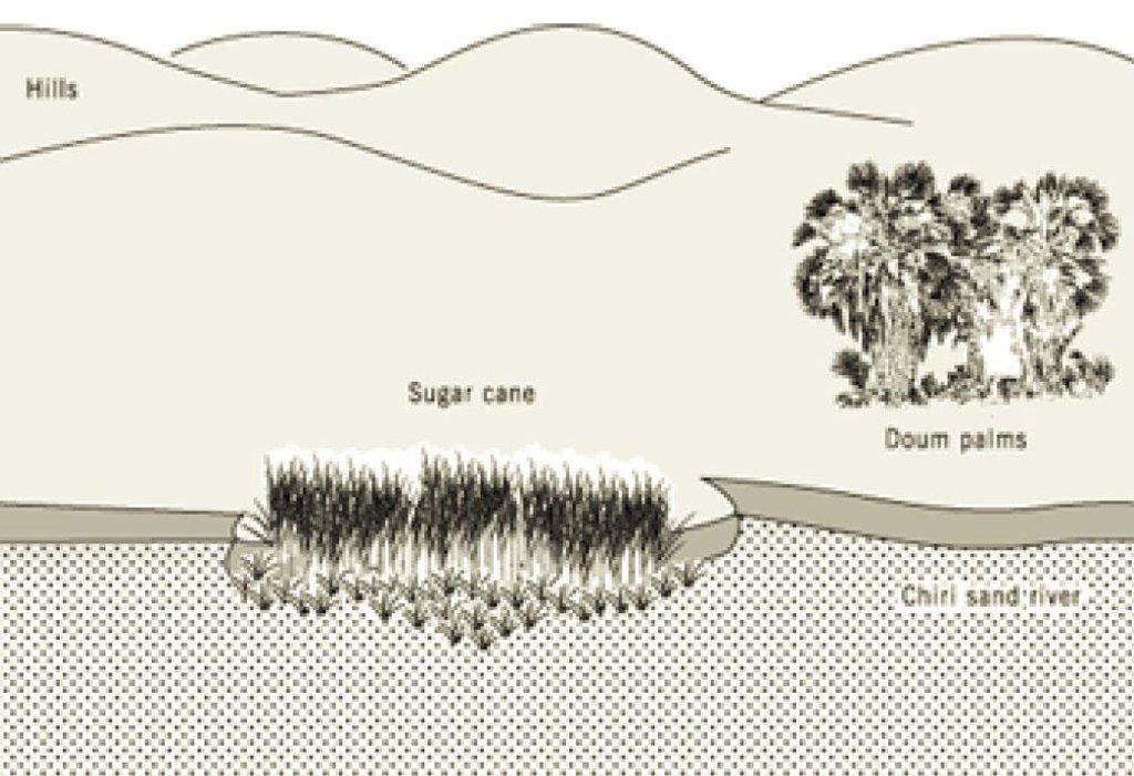
The technology first involves fencing off part of a riverbed with cut thorn scrub in order to keep livestock away. The enclosed area is then mulched with brushwood and herbaceous materials in places. Sugar cane is planted and harvested piecemeal when mature. Kamuti plants a perennial grass (Cynodon dactylon) between the canes to help bind the sand. This exercise has been done, incrementally, over a series of seasons, enclosing an increasingly large area. When the rains return and the river flows, floodwater passes through and over the sugar cane and silt is deposited as the flow is slowed.
Purpose of the Technology: This initiative is categorized as an agronomic/vegetative measure, for reclamation of land. Its purpose is to increase water stored in the soil and to increase fertility by sediment harvesting, as a way of making land productive, while simultaneously addressing riverbed erosion. Farm income increase from the sale of sugar cane is the main production/ socio-economic benefit, while the ecological benefits include sediment accumulation, soil (ie riverbed and bank) loss reduction, soil cover improvement, increase in soil moisture and increase in soil fertility.
Establishment / maintenance activities and inputs: The action involves cutting tree branches, trimming pegs about 1m long, and hammering these pegs into the bed of the sand river, parallel to the bank, enclosing a long narrow strip. This initial strip may be 10 metres wide in a riverbed of 100 meters wide. The tree branches and trimmings are used to form a brushwood-netting barrier, which protects the area from livestock, and simultaneously slows the river flow and traps sediments. To further strengthen the barrier, star grass (Cynodon dactylon) is planted along the line of the fence. Inside the fenced-off area, sugar cane cuttings are buried at a depth of 0.4 m, and the same grass planted between the canes. The area is mulched with brushwood, which rots down to increase organic matter in the soil. These cuttings sprout and an intercrop of grass and sugar cane is the result. Maintenance comprises repairing the fence and cutting grass for mulching. No special tools are required. To be effective, the technology requires mulching every season, as the old mulch is covered by the silt load during the rainy period. The perimeter fence is maintained seasonally and requires considerable material. Occasionally when the rainfall is heavy, the sugar cane is swept away by floods and needs replacing.
Natural / human environment: The farm on which this technology is applied is in the arid far-north of Mwingi District. During the rainy season the farm can be inaccessible. The farmer, who is over 60 years of age, lives with his wives and children in what effectively forms a mini-village. The annual average rainfall in this area is barely 500 mm, and famine years are common. Temperatures are consistently high. The farm borders a dry sand riverbed.
2.3 Photos of the Technology
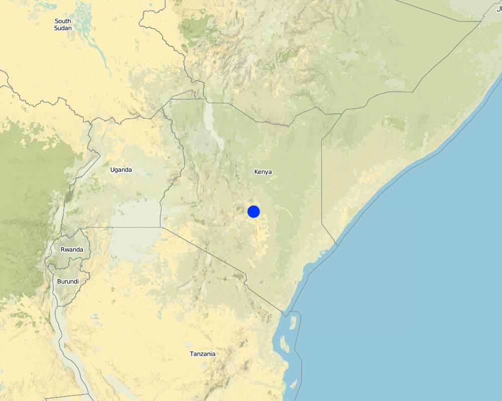
2.5 Country/ region/ locations where the Technology has been applied and which are covered by this assessment
Country:
Kenya
Region/ State/ Province:
Eastern Province
Specify the spread of the Technology:
- evenly spread over an area
If the Technology is evenly spread over an area, specify area covered (in km2):
0.01
If precise area is not known, indicate approximate area covered:
- < 0.1 km2 (10 ha)
Comments:
Total area covered by the SLM Technology is 0.01 km2.
This technology is along a riverbed and it is not adapted by other farmers
Map
×2.6 Date of implementation
If precise year is not known, indicate approximate date:
- more than 50 years ago (traditional)
2.7 Introduction of the Technology
Specify how the Technology was introduced:
- as part of a traditional system (> 50 years)
Comments (type of project, etc.):
Farmer own intiative
3. Classification of the SLM Technology
3.1 Main purpose(s) of the Technology
- improve production
- reduce, prevent, restore land degradation
3.2 Current land use type(s) where the Technology is applied

Cropland
- Perennial (non-woody) cropping
Perennial (non-woody) cropping - Specify crops:
- sugar cane
- star grass (Cynodon dactylon)
Number of growing seasons per year:
- 2
Specify:
Longest growing period in days: 75 Longest growing period from month to month: Mar - May Second longest growing period in days: 60 Second longest growing period from month to month: Nov - Dec
Comments:
Main crop: star grass (Cynodon dactylon) and sugar cane
Major land use problems (compiler’s opinion): Extensive grazing of animals/unit area, uncontrolled felling and burning of tree in land preparation, low soil fertility due to continuous cultivation without conservation.
Major land use problems (land users’ perception): Low yields hence opening of large areas for cultivation. Difficult soils, hence ploughing during the rains. Infertile soils.
3.4 Water supply
Water supply for the land on which the Technology is applied:
- rainfed
3.5 SLM group to which the Technology belongs
- minimal soil disturbance
- water harvesting
3.6 SLM measures comprising the Technology

agronomic measures
- A7: Others

vegetative measures
- V2: Grasses and perennial herbaceous plants

structural measures
- S6: Walls, barriers, palisades, fences

management measures
- M1: Change of land use type
Comments:
Main measures: agronomic measures, vegetative measures, management measures
Type of agronomic measures: mulching, zero tillage / no-till
3.7 Main types of land degradation addressed by the Technology

soil erosion by water
- Wg: gully erosion/ gullying

chemical soil deterioration
- Cn: fertility decline and reduced organic matter content (not caused by erosion)
Comments:
Main type of degradation addressed: Wg: gully erosion / gullying
Secondary types of degradation addressed: Cn: fertility decline and reduced organic matter content
4. Technical specifications, implementation activities, inputs, and costs
4.1 Technical drawing of the Technology
Technical specifications (related to technical drawing):
Reclaiming part of sand river bed with Sugar cane
Kenya
Technical knowledge required for field staff / advisors: moderate
Technical knowledge required for land users: high
Main technical functions: increase / maintain water stored in soil
Secondary technical functions: sediment retention / trapping, sediment harvesting, increase in soil fertility
Mulching
Material/ species: grasses
Quantity/ density: 2
Remarks: grass scattered
Grass species: stargrass
Change of land use type: fencing off portion of river bed
4.2 General information regarding the calculation of inputs and costs
other/ national currency (specify):
Kenya shilling
If relevant, indicate exchange rate from USD to local currency (e.g. 1 USD = 79.9 Brazilian Real): 1 USD =:
70.0
Indicate average wage cost of hired labour per day:
1.50
4.3 Establishment activities
| Activity | Timing (season) | |
|---|---|---|
| 1. | fencing | after rains |
| 2. | mulching with bushes | before rains |
| 3. | planting of sugarcane | dry season |
| 4. | cuting grass for mulch | rainy season |
| 5. | fencing riverbed to keep off animals | after rain |
| 6. | planting grass | after rain |
4.4 Costs and inputs needed for establishment
Comments:
Duration of establishment phase: 24 month(s)
4.5 Maintenance/ recurrent activities
| Activity | Timing/ frequency | |
|---|---|---|
| 1. | fencing | dry season / when height goes down |
| 2. | mulching with trash | dry '' / after clearing |
| 3. | grass planting | dry / before rains |
| 4. | sugarcane planting | wet / end of rain |
| 5. | collection of mulch | dry / biannual |
| 6. | fencing | after rain /biannual |
| 7. | cutting grass for mulch | rainy /biannual |
| 8. | scatterin thorn bushes | during rain /biannual |
| 9. | fencing | after rain / each cropping season |
| 10. | spreading brushwood | after / annual |
4.6 Costs and inputs needed for maintenance/ recurrent activities (per year)
Comments:
Machinery/ tools: oxen plough, 2 pangas , 2 hoes
the above cost were calculated in terms of purchase of tools,material and manday used.
4.7 Most important factors affecting the costs
Describe the most determinate factors affecting the costs:
labour affects cost as it is required in large quantities
5. Natural and human environment
5.1 Climate
Annual rainfall
- < 250 mm
- 251-500 mm
- 501-750 mm
- 751-1,000 mm
- 1,001-1,500 mm
- 1,501-2,000 mm
- 2,001-3,000 mm
- 3,001-4,000 mm
- > 4,000 mm
Agro-climatic zone
- semi-arid
- arid
5.2 Topography
Slopes on average:
- flat (0-2%)
- gentle (3-5%)
- moderate (6-10%)
- rolling (11-15%)
- hilly (16-30%)
- steep (31-60%)
- very steep (>60%)
Landforms:
- plateau/plains
- ridges
- mountain slopes
- hill slopes
- footslopes
- valley floors
Altitudinal zone:
- 0-100 m a.s.l.
- 101-500 m a.s.l.
- 501-1,000 m a.s.l.
- 1,001-1,500 m a.s.l.
- 1,501-2,000 m a.s.l.
- 2,001-2,500 m a.s.l.
- 2,501-3,000 m a.s.l.
- 3,001-4,000 m a.s.l.
- > 4,000 m a.s.l.
5.3 Soils
Soil depth on average:
- very shallow (0-20 cm)
- shallow (21-50 cm)
- moderately deep (51-80 cm)
- deep (81-120 cm)
- very deep (> 120 cm)
Topsoil organic matter:
- medium (1-3%)
- low (<1%)
If available, attach full soil description or specify the available information, e.g. soil type, soil PH/ acidity, Cation Exchange Capacity, nitrogen, salinity etc.
Topsoil organic matter: Becomes medium after the technology
Soil drainage / infiltration is medium - good
Soil water storage capacity is very low - medium
5.6 Characteristics of land users applying the Technology
Off-farm income:
- 10-50% of all income
Relative level of wealth:
- poor
- average
Level of mechanization:
- manual work
- animal traction
Indicate other relevant characteristics of the land users:
Population density: < 10 persons/km2
Annual population growth: 3% - 4%
5% of the land users are very rich and own 33% of the land.
10% of the land users are rich and own 25% of the land.
30% of the land users are average wealthy and own 12% of the land.
40% of the land users are poor and own 8% of the land.
15% of the land users are poor and own 21% of the land.
Off-farm income specification: most of harvest are low and hence dependent on off farm income.
Level of mechanization: Animal traction is used for assembling the thorny bushes and for marking farrows
5.8 Land ownership, land use rights, and water use rights
Land ownership:
- communal/ village
- individual, not titled
Land use rights:
- open access (unorganized)
- communal (organized)
6. Impacts and concluding statements
6.1 On-site impacts the Technology has shown
Socio-economic impacts
Production
crop production
Comments/ specify:
Sugar cane
Income and costs
farm income
Comments/ specify:
Sugar cane
Ecological impacts
Water cycle/ runoff
surface runoff
Quantity before SLM:
60
Quantity after SLM:
20
Soil
soil moisture
soil cover
soil loss
Quantity before SLM:
12
Quantity after SLM:
5
nutrient cycling/ recharge
6.4 Cost-benefit analysis
How do the benefits compare with the establishment costs (from land users’ perspective)?
Short-term returns:
slightly positive
Long-term returns:
very positive
How do the benefits compare with the maintenance/ recurrent costs (from land users' perspective)?
Short-term returns:
positive
Long-term returns:
very positive
6.5 Adoption of the Technology
- 1-10%
If available, quantify (no. of households and/ or area covered):
30 households (1% of the area stated)
Of all those who have adopted the Technology, how many did so spontaneously, i.e. without receiving any material incentives/ payments?
- 91-100%
Comments:
30 land user families have adopted the Technology without any external material support
Comments on spontaneous adoption: estimates
There is a moderate trend towards spontaneous adoption of the Technology
Comments on adoption trend: after farmer tour organised by the PFI most are attempting. At least five farmers had adopted the innovation by the beginning of 1999 (exact figures not available). This is a particularly site-specific system, and thus wide replication is simply not possible. It is only relevant to those who have farms bordering sand rivers with wide beds.
6.7 Strengths/ advantages/ opportunities of the Technology
| Strengths/ advantages/ opportunities in the compiler’s or other key resource person’s view |
|---|
| This innovation demonstrates how productive use can be made of sub-surface moisture in sand rivers in arid areas while simultaneously protecting the riverbed and bank from erosion |
| Farm income increase through land reclamation |
6.8 Weaknesses/ disadvantages/ risks of the Technology and ways of overcoming them
| Weaknesses/ disadvantages/ risks in the compiler’s or other key resource person’s view | How can they be overcome? |
|---|---|
|
Planting within a riverbed is, strictly speaking, against regulations. |
Such technologies should not be attempted without consulting the local agricultural office. |
| The fence is constructed with thorn bush cuttings which have to be constantly replenished |
A live fence is recommended as an alternative to constantly having to replenish the fence with cut thorn bush. The fence is required to avoid grazing of the cane by domestic livestock. |
7. References and links
7.1 Methods/ sources of information
7.2 References to available publications
Title, author, year, ISBN:
Farm management Guidelines. 1989.
Available from where? Costs?
MOA, Nairobi
Title, author, year, ISBN:
Kithinji M., Critchley W. 2001. Farmers' initiatives in land husbandry: Promising technologies for the drier areas of East Africa. RELMA Technical Report series no. 27
Links and modules
Expand all Collapse allLinks
No links
Modules
No modules


