Terracing for soil erosion protection [Brazil]
- Creation:
- Update:
- Compiler: Stefan Hohnwald
- Editor: –
- Reviewers: Fabian Ottiger, Alexandra Gavilano
Terraços contra erosão
technologies_1275 - Brazil
View sections
Expand all Collapse all1. General information
1.2 Contact details of resource persons and institutions involved in the assessment and documentation of the Technology
SLM specialist:
Schindewolf Marcus
Technische Universität Bergakademie Freiberg
Germany
Name of the institution(s) which facilitated the documentation/ evaluation of the Technology (if relevant)
Georg August Universität Göttingen (Georg August Universität Göttingen) - GermanyName of the institution(s) which facilitated the documentation/ evaluation of the Technology (if relevant)
Technische Universität Bergakademie Freiberg - Germany1.3 Conditions regarding the use of data documented through WOCAT
The compiler and key resource person(s) accept the conditions regarding the use of data documented through WOCAT:
Yes
2. Description of the SLM Technology
2.1 Short description of the Technology
Definition of the Technology:
Terracing of landscapes against soil erosion for soy, corn, cotton, and sugar cane production of large enterprises in Central Brazil
2.2 Detailed description of the Technology
Description:
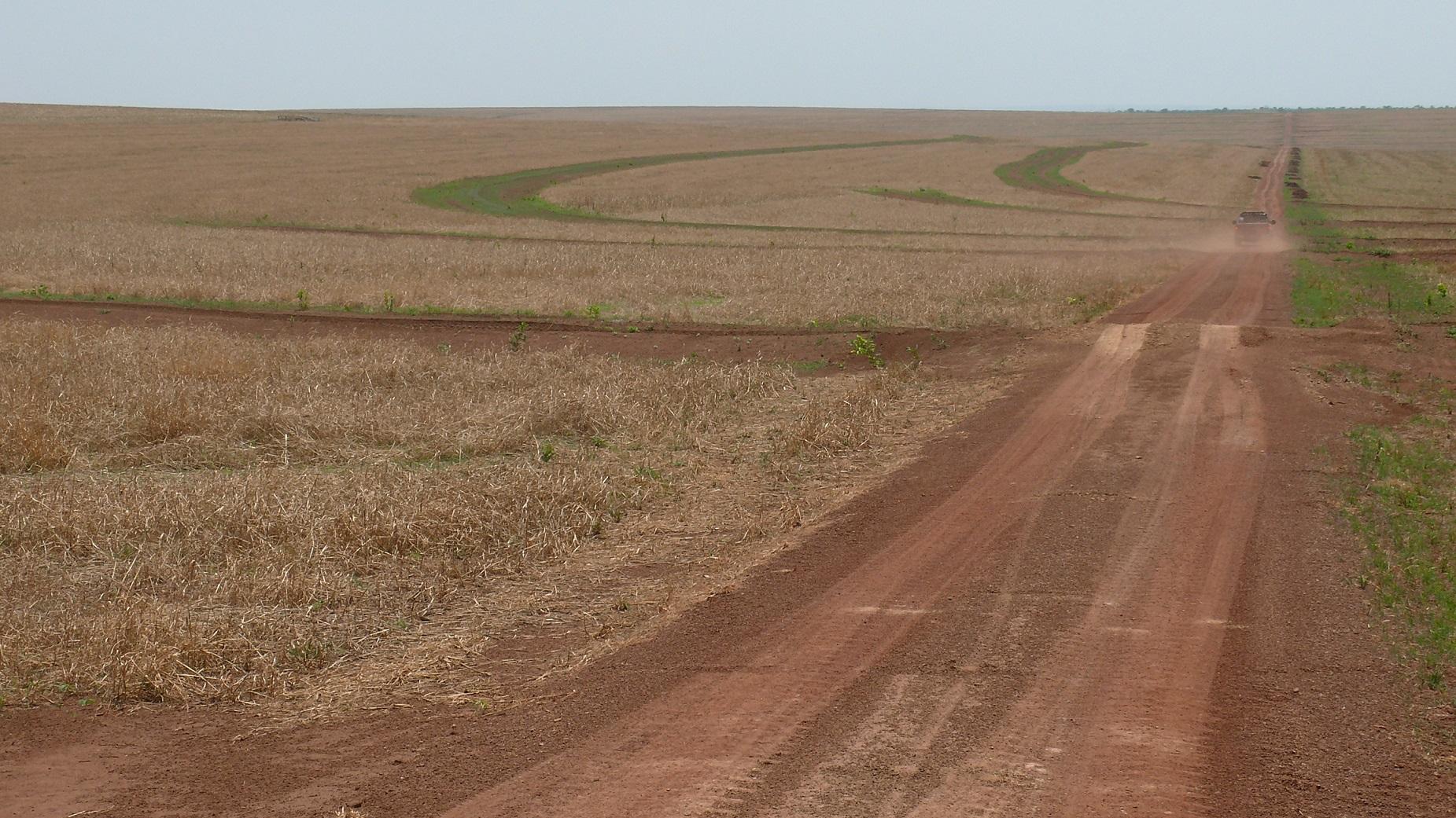
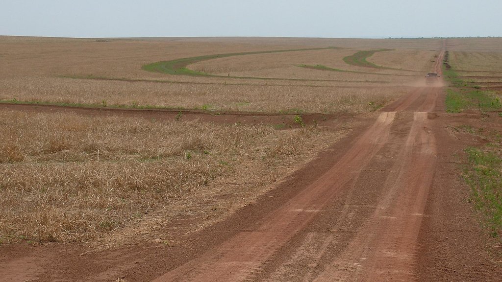
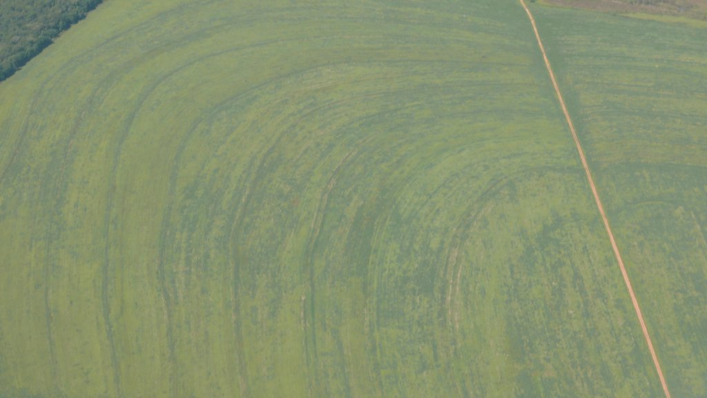
Medium to slightly inclined tablelands in the cerrados are protected by soil terraces against soil erosion, building kilometer long and up to 1m high terraces.
Purpose of the Technology: The purpose of the terraces is to protect the cotton, corn, and soy bean fields against top-soil losses due to heavy tropical rain events that occur during the starting rainy season. It is predicted and modeled for the future that heavy rain events will increase in the following decades.
Establishment / maintenance activities and inputs: High-input machinery like tractors are used to install the terraces. These terraces have to be repaired and improved periodically, e.g. every 5 years.
Natural / human environment: The terraces are necessary because the potential natural vegetation, the cerrado forests that protected the soils before, have been converted to huge farmlands that are now directly exposed to heavy tropical rainfalls and soil erosion.
2.3 Photos of the Technology
2.5 Country/ region/ locations where the Technology has been applied and which are covered by this assessment
Country:
Brazil
Region/ State/ Province:
Mato Grosso
Further specification of location:
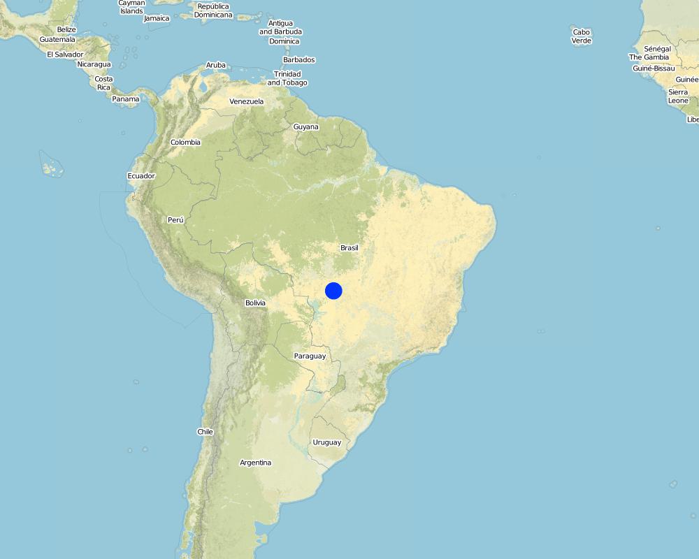
Campo Verde, Primavera do Leste
Specify the spread of the Technology:
- evenly spread over an area
If precise area is not known, indicate approximate area covered:
- > 10,000 km2
Comments:
Boundary points of the Technology area: Cerrado biome of central Brazil.
Map
×2.6 Date of implementation
If precise year is not known, indicate approximate date:
- 10-50 years ago
2.7 Introduction of the Technology
Specify how the Technology was introduced:
- through land users' innovation
3. Classification of the SLM Technology
3.2 Current land use type(s) where the Technology is applied

Cropland
- Annual cropping
- Perennial (non-woody) cropping
Annual cropping - Specify crops:
- cereals - maize
- fibre crops - cotton
- legumes and pulses - soya
Perennial (non-woody) cropping - Specify crops:
- sugar cane
Number of growing seasons per year:
- 2
Specify:
Longest growing period in days: 6Longest growing period from month to month: corn/soySecond longest growing period in days: 3Second longest growing period from month to month: soy
Comments:
Major land use problems (compiler’s opinion): biodiversity loss, water pollution, soil erosion.
Major land use problems (land users’ perception): climate change, market prices, erosion.
Future (final) land use (after implementation of SLM Technology): Cropland: Ca: Annual cropping
3.3 Has land use changed due to the implementation of the Technology?
Has land use changed due to the implementation of the Technology?
- Yes (Please fill out the questions below with regard to the land use before implementation of the Technology)

Grazing land
- Extensive grazing
3.4 Water supply
Water supply for the land on which the Technology is applied:
- rainfed
3.5 SLM group to which the Technology belongs
- cross-slope measure
- terracing
3.6 SLM measures comprising the Technology

agronomic measures
- A3: Soil surface treatment

vegetative measures
- V2: Grasses and perennial herbaceous plants

structural measures
- S1: Terraces

management measures
- M1: Change of land use type
Comments:
Secondary measures: agronomic measures, vegetative measures, structural measures, management measures
3.7 Main types of land degradation addressed by the Technology

soil erosion by water
- Wt: loss of topsoil/ surface erosion
- Wg: gully erosion/ gullying
- Wm: mass movements/ landslides

soil erosion by wind
- Ed: deflation and deposition
Comments:
Main type of degradation addressed: Wt: loss of topsoil / surface erosion
Secondary types of degradation addressed: Wg: gully erosion / gullying, Wm: mass movements / landslides, Ed: deflation and deposition
Main causes of degradation: change of seasonal rainfall, Heavy / extreme rainfall (intensity/amounts)
Secondary causes of degradation: soil management, crop management (annual, perennial, tree/shrub), deforestation / removal of natural vegetation (incl. forest fires), disturbance of water cycle (infiltration / runoff), change in temperature, wind storms / dust storms, floods, droughts, land tenure, labour availability, inputs and infrastructure: (roads, markets, distribution of water points, other, …), education, access to knowledge and support services, governance / institutional
3.8 Prevention, reduction, or restoration of land degradation
Comments:
Main goals: prevention of land degradation
Secondary goals: mitigation / reduction of land degradation, rehabilitation / reclamation of denuded land
4. Technical specifications, implementation activities, inputs, and costs
4.1 Technical drawing of the Technology
Technical specifications (related to technical drawing):
Terraces are planned at the desk and implemented by bull-dozers.
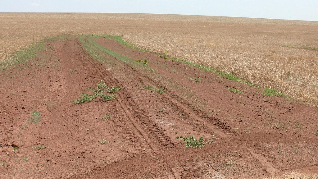
Close-up of a recently improved terrace of a slightly inclined corn field.
Location: Campo Verde. Mato Grosso
Date: 30.09.2011
Technical knowledge required for field staff / advisors: high (precision farming)
Technical knowledge required for land users: high (precision farming)
Main technical functions: control of dispersed runoff: retain / trap, control of concentrated runoff: retain / trap, sediment retention / trapping, sediment harvesting
Secondary technical functions: control of dispersed runoff: impede / retard, control of concentrated runoff: impede / retard, control of concentrated runoff: drain / divert, reduction of slope angle, reduction of slope length, improvement of ground cover, increase of surface roughness, improvement of surface structure (crusting, sealing), improvement of topsoil structure (compaction), improvement of subsoil structure (hardpan), stabilisation of soil (eg by tree roots against land slides), increase in organic matter, increase in nutrient availability (supply, recycling,…), increase of infiltration, increase / maintain water stored in soil, increase of groundwater level / recharge of groundwater, water harvesting / increase water supply, water spreading, improvement of water quality, buffering / filtering water, reduction in wind speed, increase of biomass (quantity), promotion of vegetation species and varieties (quality, eg palatable fodder), control of fires, reduction of dry material (fuel for wildfires), spatial arrangement and diversification of land use
Terrace: forward sloping
Vertical interval between structures (m): 5
Spacing between structures (m): 50
Terrace: bench level
Vertical interval between structures (m): 5
Spacing between structures (m): 50
Construction material (earth): 90%
Construction material (stone): 10%
Slope (which determines the spacing indicated above): 3%
If the original slope has changed as a result of the Technology, the slope today is: 2%
Lateral gradient along the structure: 1%
Author:
Hohnwald, Rotdornweg 9, 37120 Bovenden
4.2 General information regarding the calculation of inputs and costs
other/ national currency (specify):
Reais
If relevant, indicate exchange rate from USD to local currency (e.g. 1 USD = 79.9 Brazilian Real): 1 USD =:
3.2
Indicate average wage cost of hired labour per day:
16.00
4.3 Establishment activities
| Activity | Timing (season) | |
|---|---|---|
| 1. | Establishment | 3 |
4.4 Costs and inputs needed for establishment
| Specify input | Unit | Quantity | Costs per Unit | Total costs per input | % of costs borne by land users | |
|---|---|---|---|---|---|---|
| Labour | Labour | ha | 1.0 | 160.0 | 160.0 | 100.0 |
| Equipment | Machine use | ha | 1.0 | 100.0 | 100.0 | 100.0 |
| Total costs for establishment of the Technology | 260.0 | |||||
| Total costs for establishment of the Technology in USD | 81.25 | |||||
Comments:
Duration of establishment phase: 1 month(s)
Life span of established technology: 5 years
Life span of repairs: 3 years
Number of parties sharing: 1
4.5 Maintenance/ recurrent activities
| Activity | Timing/ frequency | |
|---|---|---|
| 1. | repairing | 3 |
| 2. | repairing | 1 |
4.6 Costs and inputs needed for maintenance/ recurrent activities (per year)
| Specify input | Unit | Quantity | Costs per Unit | Total costs per input | % of costs borne by land users | |
|---|---|---|---|---|---|---|
| Labour | Labour | ha | 1.0 | 50.0 | 50.0 | 100.0 |
| Equipment | Machine use | ha | 1.0 | 100.0 | 100.0 | 100.0 |
| Total costs for maintenance of the Technology | 150.0 | |||||
| Total costs for maintenance of the Technology in USD | 46.88 | |||||
Comments:
Machinery/ tools: bulldozer
4.7 Most important factors affecting the costs
Describe the most determinate factors affecting the costs:
The costs are determined by labour time, gas costs, machinery maintenance
5. Natural and human environment
5.1 Climate
Annual rainfall
- < 250 mm
- 251-500 mm
- 501-750 mm
- 751-1,000 mm
- 1,001-1,500 mm
- 1,501-2,000 mm
- 2,001-3,000 mm
- 3,001-4,000 mm
- > 4,000 mm
Agro-climatic zone
- sub-humid
Thermal climate class: tropics
Thermal climate class: subtropics
5.2 Topography
Slopes on average:
- flat (0-2%)
- gentle (3-5%)
- moderate (6-10%)
- rolling (11-15%)
- hilly (16-30%)
- steep (31-60%)
- very steep (>60%)
Landforms:
- plateau/plains
- ridges
- mountain slopes
- hill slopes
- footslopes
- valley floors
Altitudinal zone:
- 0-100 m a.s.l.
- 101-500 m a.s.l.
- 501-1,000 m a.s.l.
- 1,001-1,500 m a.s.l.
- 1,501-2,000 m a.s.l.
- 2,001-2,500 m a.s.l.
- 2,501-3,000 m a.s.l.
- 3,001-4,000 m a.s.l.
- > 4,000 m a.s.l.
Comments and further specifications on topography:
Altitudinal zone: 501-1001 m a.s.l. (cerrado)
5.3 Soils
Soil depth on average:
- very shallow (0-20 cm)
- shallow (21-50 cm)
- moderately deep (51-80 cm)
- deep (81-120 cm)
- very deep (> 120 cm)
Soil texture (topsoil):
- coarse/ light (sandy)
- medium (loamy, silty)
Topsoil organic matter:
- medium (1-3%)
If available, attach full soil description or specify the available information, e.g. soil type, soil PH/ acidity, Cation Exchange Capacity, nitrogen, salinity etc.
Soil fertility is low
Soil drainage/infiltration is good
Soil water storage capacity is medium
5.4 Water availability and quality
Ground water table:
5-50 m
Availability of surface water:
good
Water quality (untreated):
for agricultural use only (irrigation)
Comments and further specifications on water quality and quantity:
Availability of surface water: good, medium
5.5 Biodiversity
Species diversity:
- high
5.6 Characteristics of land users applying the Technology
Market orientation of production system:
- commercial/ market
Off-farm income:
- less than 10% of all income
Relative level of wealth:
- rich
- very rich
Individuals or groups:
- individual/ household
Level of mechanization:
- mechanized/ motorized
Gender:
- men
Indicate other relevant characteristics of the land users:
Land users applying the Technology are mainly common / average land users
Population density: < 10 persons/km2
Annual population growth: 1% - 2%
5.7 Average area of land used by land users applying the Technology
- < 0.5 ha
- 0.5-1 ha
- 1-2 ha
- 2-5 ha
- 5-15 ha
- 15-50 ha
- 50-100 ha
- 100-500 ha
- 500-1,000 ha
- 1,000-10,000 ha
- > 10,000 ha
Is this considered small-, medium- or large-scale (referring to local context)?
- large-scale
5.8 Land ownership, land use rights, and water use rights
Land ownership:
- individual, titled
5.9 Access to services and infrastructure
health:
- poor
- moderate
- good
education:
- poor
- moderate
- good
technical assistance:
- poor
- moderate
- good
employment (e.g. off-farm):
- poor
- moderate
- good
markets:
- poor
- moderate
- good
energy:
- poor
- moderate
- good
roads and transport:
- poor
- moderate
- good
drinking water and sanitation:
- poor
- moderate
- good
financial services:
- poor
- moderate
- good
6. Impacts and concluding statements
6.1 On-site impacts the Technology has shown
Socio-economic impacts
Production
crop production
land management
Socio-cultural impacts
SLM/ land degradation knowledge
conflict mitigation
Ecological impacts
Water cycle/ runoff
water quantity
surface runoff
groundwater table/ aquifer
Soil
soil moisture
soil loss
Climate and disaster risk reduction
fire risk
wind velocity
6.2 Off-site impacts the Technology has shown
reliable and stable stream flows in dry season
downstream flooding
damage on neighbours' fields
6.3 Exposure and sensitivity of the Technology to gradual climate change and climate-related extremes/ disasters (as perceived by land users)
Gradual climate change
Gradual climate change
| Season | increase or decrease | How does the Technology cope with it? | |
|---|---|---|---|
| annual temperature | increase | well |
Climate-related extremes (disasters)
Meteorological disasters
| How does the Technology cope with it? | |
|---|---|
| local rainstorm | not well |
| local windstorm | not well |
Climatological disasters
| How does the Technology cope with it? | |
|---|---|
| drought | well |
Hydrological disasters
| How does the Technology cope with it? | |
|---|---|
| general (river) flood | not well |
Other climate-related consequences
Other climate-related consequences
| How does the Technology cope with it? | |
|---|---|
| reduced growing period | well |
6.4 Cost-benefit analysis
How do the benefits compare with the establishment costs (from land users’ perspective)?
Short-term returns:
negative
Long-term returns:
slightly positive
How do the benefits compare with the maintenance/ recurrent costs (from land users' perspective)?
Short-term returns:
slightly negative
Long-term returns:
neutral/ balanced
6.5 Adoption of the Technology
Of all those who have adopted the Technology, how many did so spontaneously, i.e. without receiving any material incentives/ payments?
- 91-100%
Comments:
10% of land user families have adopted the Technology with external material support
90% of land user families have adopted the Technology without any external material support
There is a little trend towards spontaneous adoption of the Technology
6.7 Strengths/ advantages/ opportunities of the Technology
| Strengths/ advantages/ opportunities in the compiler’s or other key resource person’s view |
|---|
| Long-term soil conservation against prognosticated heavy rain fall with climate change. |
6.8 Weaknesses/ disadvantages/ risks of the Technology and ways of overcoming them
| Weaknesses/ disadvantages/ risks in the compiler’s or other key resource person’s view | How can they be overcome? |
|---|---|
| In some cases the terraces are even exaggerated. |
7. References and links
7.1 Methods/ sources of information
Links and modules
Expand all Collapse allLinks
No links
Modules
No modules


