Gully healing for growing bananas [Tanzania, United Republic of]
- Creation:
- Update:
- Compiler: Patrick Gervas Mbanguka Lameck
- Editor: –
- Reviewers: David Streiff, Alexandra Gavilano
technologies_1392 - Tanzania, United Republic of
View sections
Expand all Collapse all1. General information
1.2 Contact details of resource persons and institutions involved in the assessment and documentation of the Technology
Name of the institution(s) which facilitated the documentation/ evaluation of the Technology (if relevant)
Inades Formation Tanzania (Inades Formation Tanzania)1.3 Conditions regarding the use of data documented through WOCAT
The compiler and key resource person(s) accept the conditions regarding the use of data documented through WOCAT:
Yes
2. Description of the SLM Technology
2.1 Short description of the Technology
Definition of the Technology:
Gully healing using bananas as barriers
2.2 Detailed description of the Technology
Description:
Gully pits (2'*2'*2') are dug across the gully. Smaller pits are dug in the bigger ones. Manure is filled in the smaller ones. Bananas are planted in the pits. Trash is filled in the bigger pits. A trash line is dug and supported by pegs. The speed of the runoff is lowered by the pits and trashline. The plants regenerate in the gully.
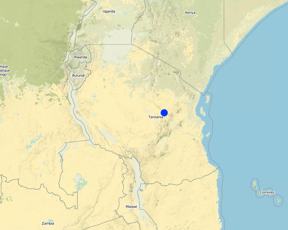
2.5 Country/ region/ locations where the Technology has been applied and which are covered by this assessment
Country:
Tanzania, United Republic of
Further specification of location:
Dodoma/Kongwa
Specify the spread of the Technology:
- evenly spread over an area
If precise area is not known, indicate approximate area covered:
- < 0.1 km2 (10 ha)
Map
×2.6 Date of implementation
If precise year is not known, indicate approximate date:
- more than 50 years ago (traditional)
2.7 Introduction of the Technology
Specify how the Technology was introduced:
- as part of a traditional system (> 50 years)
Comments (type of project, etc.):
farmer innovation
3. Classification of the SLM Technology
3.1 Main purpose(s) of the Technology
- reduce, prevent, restore land degradation
3.2 Current land use type(s) where the Technology is applied

Cropland
- Annual cropping
- Perennial (non-woody) cropping
- Tree and shrub cropping
Annual cropping - Specify crops:
- cereals - maize
- fruits
Perennial (non-woody) cropping - Specify crops:
- banana/plantain/abaca
- sugar cane
Number of growing seasons per year:
- 1
Specify:
Longest growing period in days: 120; Second longest growing period in days: 60
Comments:
Major land use problems (compiler’s opinion): gully erosion due to the steep slopes
3.5 SLM group to which the Technology belongs
- improved ground/ vegetation cover
- cross-slope measure
3.6 SLM measures comprising the Technology

structural measures
- S4: Level ditches, pits
3.7 Main types of land degradation addressed by the Technology

soil erosion by water
- Wg: gully erosion/ gullying

chemical soil deterioration
- Cn: fertility decline and reduced organic matter content (not caused by erosion)

water degradation
- Ha: aridification
Comments:
Secondary types of degradation addressed: Cn: fertility decline and reduced organic matter content, Ha: aridification
3.8 Prevention, reduction, or restoration of land degradation
Specify the goal of the Technology with regard to land degradation:
- restore/ rehabilitate severely degraded land
Comments:
Secondary goals: prevention of land degradation, mitigation / reduction of land degradation
4. Technical specifications, implementation activities, inputs, and costs
4.1 Technical drawing of the Technology
Technical specifications (related to technical drawing):
Technical knowledge required for field staff / advisors: moderate
Technical knowledge required for land users: high
Main technical functions: control of concentrated runoff: impede / retard
Secondary technical functions: control of concentrated runoff: retain / trap, sediment harvesting
Structural measure: diversion ditch/cut-off drain
Vertical interval between structures (m): 1
Spacing between structures (m): 6
Depth of ditches/pits/dams (m): 0.6
Width of ditches/pits/dams (m): 0.6
Length of ditches/pits/dams (m): 0.6
Width of bunds/banks/others (m): 0.6
Length of bunds/banks/others (m): 0.6
Structural measure: bunds/banks: contour
Vertical interval between structures (m): 1
Spacing between structures (m): 6
Structural measure: trash
Vertical interval between structures (m): 1
Spacing between structures (m): 6
Height of bunds/banks/others (m): 0.5
Width of bunds/banks/others (m): 1
Construction material (earth): top soil
Construction material (other): crop remain, farmyard manure
Lateral gradient along the structure: 5.00%
4.2 General information regarding the calculation of inputs and costs
other/ national currency (specify):
Tanzanian shillings
If relevant, indicate exchange rate from USD to local currency (e.g. 1 USD = 79.9 Brazilian Real): 1 USD =:
800.0
Indicate average wage cost of hired labour per day:
1.90
4.4 Costs and inputs needed for establishment
| Specify input | Unit | Quantity | Costs per Unit | Total costs per input | % of costs borne by land users | |
|---|---|---|---|---|---|---|
| Labour | Labour | persons/day/ha | 336.0 | 1.9 | 638.4 | 90.0 |
| Equipment | Tools | ha | 1.0 | 11.25 | 11.25 | 100.0 |
| Fertilizers and biocides | Seedlings | ha | 1.0 | 1250.0 | 1250.0 | 100.0 |
| Construction material | Trash | ha | 1.0 | 960.0 | 960.0 | 30.0 |
| Total costs for establishment of the Technology | 2859.65 | |||||
| Total costs for establishment of the Technology in USD | 3.57 | |||||
Comments:
Duration of establishment phase: 36 month(s)
4.6 Costs and inputs needed for maintenance/ recurrent activities (per year)
| Specify input | Unit | Quantity | Costs per Unit | Total costs per input | % of costs borne by land users | |
|---|---|---|---|---|---|---|
| Labour | Labour | persons/day/ha | 9.5 | 1.9 | 18.05 | 100.0 |
| Construction material | Trash | ha | 1.0 | 320.0 | 320.0 | 100.0 |
| Total costs for maintenance of the Technology | 338.05 | |||||
| Total costs for maintenance of the Technology in USD | 0.42 | |||||
4.7 Most important factors affecting the costs
Describe the most determinate factors affecting the costs:
cost of farmyard manure, labour, steep slopes
5. Natural and human environment
5.1 Climate
Annual rainfall
- < 250 mm
- 251-500 mm
- 501-750 mm
- 751-1,000 mm
- 1,001-1,500 mm
- 1,501-2,000 mm
- 2,001-3,000 mm
- 3,001-4,000 mm
- > 4,000 mm
Specifications/ comments on rainfall:
Also 751-1000 mm
Agro-climatic zone
- semi-arid
- arid
5.2 Topography
Slopes on average:
- flat (0-2%)
- gentle (3-5%)
- moderate (6-10%)
- rolling (11-15%)
- hilly (16-30%)
- steep (31-60%)
- very steep (>60%)
Landforms:
- plateau/plains
- ridges
- mountain slopes
- hill slopes
- footslopes
- valley floors
Altitudinal zone:
- 0-100 m a.s.l.
- 101-500 m a.s.l.
- 501-1,000 m a.s.l.
- 1,001-1,500 m a.s.l.
- 1,501-2,000 m a.s.l.
- 2,001-2,500 m a.s.l.
- 2,501-3,000 m a.s.l.
- 3,001-4,000 m a.s.l.
- > 4,000 m a.s.l.
Comments and further specifications on topography:
Slopes on average: Also steep
Landforms: Also footslopes
5.3 Soils
Soil depth on average:
- very shallow (0-20 cm)
- shallow (21-50 cm)
- moderately deep (51-80 cm)
- deep (81-120 cm)
- very deep (> 120 cm)
Soil texture (topsoil):
- coarse/ light (sandy)
- medium (loamy, silty)
Topsoil organic matter:
- medium (1-3%)
- low (<1%)
If available, attach full soil description or specify the available information, e.g. soil type, soil PH/ acidity, Cation Exchange Capacity, nitrogen, salinity etc.
Soil depth on average: Also shallow
Soil fertility is medium
Soil drainage / infiltration is medium
Soil water storage capacity is medium
5.6 Characteristics of land users applying the Technology
Market orientation of production system:
- subsistence (self-supply)
- mixed (subsistence/ commercial)
Relative level of wealth:
- average
- rich
Level of mechanization:
- manual work
- animal traction
Indicate other relevant characteristics of the land users:
2% of the land users are very rich and own 30% of the land.
5% of the land users are rich and own 10% of the land.
43% of the land users are average wealthy and own 40% of the land.
30% of the land users are poor and own 15% of the land.
20% of the land users are poor and own 5% of the land.
Level of mechanization: Manual labour with hand hoes and animal traction used for transport
5.7 Average area of land used by land users applying the Technology
- < 0.5 ha
- 0.5-1 ha
- 1-2 ha
- 2-5 ha
- 5-15 ha
- 15-50 ha
- 50-100 ha
- 100-500 ha
- 500-1,000 ha
- 1,000-10,000 ha
- > 10,000 ha
Comments:
Average area of land owned or leased by land users applying the Technology: Also 0.5-1 ha
5.8 Land ownership, land use rights, and water use rights
Land ownership:
- individual, not titled
6. Impacts and concluding statements
6.1 On-site impacts the Technology has shown
Socio-economic impacts
Production
crop production
fodder production
Socio-cultural impacts
community institutions
national institutions
Ecological impacts
Soil
soil moisture
soil cover
soil loss
Other ecological impacts
soil fertility
6.2 Off-site impacts the Technology has shown
downstream flooding
downstream siltation
6.4 Cost-benefit analysis
How do the benefits compare with the establishment costs (from land users’ perspective)?
Short-term returns:
very positive
Long-term returns:
very positive
How do the benefits compare with the maintenance/ recurrent costs (from land users' perspective)?
Short-term returns:
very positive
Long-term returns:
very positive
6.5 Adoption of the Technology
- 1-10%
If available, quantify (no. of households and/ or area covered):
10 household covering 5 percent of the area (5 percent of all land users)
Of all those who have adopted the Technology, how many did so spontaneously, i.e. without receiving any material incentives/ payments?
- 91-100%
Comments:
10 land user families have adopted the Technology without any external material support
There is a little trend towards spontaneous adoption of the Technology
Comments on adoption trend: because of the badly eroded gullies and heavy earth work
6.7 Strengths/ advantages/ opportunities of the Technology
| Strengths/ advantages/ opportunities in the compiler’s or other key resource person’s view |
|---|
|
heals the gully How can they be sustained / enhanced? make use of live barrier |
|
grow crops in the gully How can they be sustained / enhanced? increased crop production |
|
reduce floods downstream How can they be sustained / enhanced? downstream users can make use of the floods |
6.8 Weaknesses/ disadvantages/ risks of the Technology and ways of overcoming them
| Weaknesses/ disadvantages/ risks in the compiler’s or other key resource person’s view | How can they be overcome? |
|---|---|
| if upstreamusers have no innovation floods are not easy to control | if upstreamusers have no innovation floods are not easy to control |
7. References and links
7.1 Methods/ sources of information
Links and modules
Expand all Collapse allLinks
No links
Modules
No modules