
Gully blocking by stone checks [Kenya]
- Creation:
- Update:
- Compiler: Kithinji Mutunga
- Editor: –
- Reviewers: David Streiff, Alexandra Gavilano
technologies_1490 - Kenya
View sections
Expand all Collapse all1. General information
1.2 Contact details of resource persons and institutions involved in the assessment and documentation of the Technology
Key resource person(s)
SLM specialist:
SLM specialist:
Mburu Charles
MOARD
Kenya
SLM specialist:
Kameti Stephen
MOARD
Kenya
1.3 Conditions regarding the use of data documented through WOCAT
The compiler and key resource person(s) accept the conditions regarding the use of data documented through WOCAT:
Yes
2. Description of the SLM Technology
2.1 Short description of the Technology
Definition of the Technology:
Blocking of a gully by use of stone checks in order to impede runoff and improve soil moisture for crop production
2.2 Detailed description of the Technology
Description:
Stone checks are constructed across the gully at horizontal intervals of 10 - 15 m. The check dams vary in size, but are generally 1- 1.5 m high, 1 m wide at the top (base width is greater) and stretch for some 5 - 10 metres across the gully. The checks are flat across the top, except for one end which is lowered to act as a spillway for overflow. As has been pointed out already, these are constructed in stages every rainy season, keeping pace with the rate of siltation. Stone for construction is collected from around the farm. These
checks slow down runoff, encourage sedimentation of organically rich deposits and create a moist and fertile gully bed, suited to crop production. Bananas, pawpaws and annual crops are planted between the stone checks.
Purpose of the Technology: The aim of this technology is to slow down runoff in the gully and harvest the silt. Its purpose is primarily for perennial (and annual) cropping. With respect to
soil and water conservation, impact is achieved through control of concentrated runoff, by retention/ trapping of sediment, by reduction of slope and thereby reclamation of land within a gully.
Establishment / maintenance activities and inputs: Maintenance is a continuous process. There is a regular demand for adding more layers to the check dams as they silt up, and an occasional need to repair broken checks.
Natural / human environment: Mwaniki Mutembei is a young family man, who took the decision some years ago to devote his energies to farming. As he expressed in his interview in the PFI video, he became disillusioned with casual contract labour, and decided to work for himself instead, on his own land. Although he has 4 hectares of farmland, it is situated in one of the driest sub-locations of Migwani, namely Thitani, and the land itself is infertile and shallow. Mwaniki is certainly resource-poor.
2.3 Photos of the Technology
Media Gallery
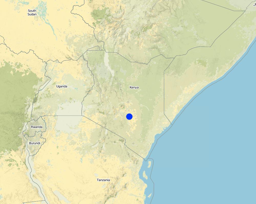
2.5 Country/ region/ locations where the Technology has been applied and which are covered by this assessment
Country:
Kenya
Region/ State/ Province:
Eastern Province
Specify the spread of the Technology:
- evenly spread over an area
If the Technology is evenly spread over an area, specify area covered (in km2):
0.04
If precise area is not known, indicate approximate area covered:
- 0.1-1 km2
Comments:
Total area covered by the SLM Technology is 0.04 km2.
technology covers a portion of the farm.
Map
×2.6 Date of implementation
If precise year is not known, indicate approximate date:
- more than 50 years ago (traditional)
2.7 Introduction of the Technology
Specify how the Technology was introduced:
- as part of a traditional system (> 50 years)
Comments (type of project, etc.):
It was a person intiative
3. Classification of the SLM Technology
3.1 Main purpose(s) of the Technology
- reduce, prevent, restore land degradation
3.2 Current land use type(s) where the Technology is applied

Cropland
- Annual cropping
Number of growing seasons per year:
- 2
Specify:
Longest growing period in days: 120 Longest growing period from month to month: Apr - Jul Second longest growing period in days: 90 Second longest growing period from month to month: Oct - Jan
Comments:
Major land use problems (compiler’s opinion): soil infertility due to washing of important nutients through leaching. Lack of technology by the land users
Major land use problems (land users’ perception): lack of tools, credit. Proper trainingand market information market. Poor access roads
3.4 Water supply
Water supply for the land on which the Technology is applied:
- rainfed
3.5 SLM group to which the Technology belongs
- integrated soil fertility management
- water diversion and drainage
3.6 SLM measures comprising the Technology

structural measures
- S5: Dams, pans, ponds
Comments:
Main measures: structural measures
3.7 Main types of land degradation addressed by the Technology

soil erosion by water
- Wt: loss of topsoil/ surface erosion
- Wg: gully erosion/ gullying

chemical soil deterioration
- Cn: fertility decline and reduced organic matter content (not caused by erosion)

water degradation
- Ha: aridification
Comments:
Main type of degradation addressed: Wg: gully erosion / gullying
Secondary types of degradation addressed: Wt: loss of topsoil / surface erosion, Cn: fertility decline and reduced organic matter content, Ha: aridification
4. Technical specifications, implementation activities, inputs, and costs
4.1 Technical drawing of the Technology
Technical specifications (related to technical drawing):
Stone checks in the gully: note side spillways
Kenya
Technical knowledge required for field staff / advisors: moderate
Technical knowledge required for land users: high
Main technical functions: control of concentrated runoff: impede / retard, increase / maintain water stored in soil
Secondary technical functions: control of concentrated runoff: retain / trap, reduction of slope length, sediment retention / trapping, sediment harvesting, improvement of soil structure, increase in soil fertility
Construction material (earth): acquired from the side of the gully
Construction material (concrete): to reinforce the gully
Vegetation is used for stabilisation of structures.
4.2 General information regarding the calculation of inputs and costs
other/ national currency (specify):
Kenya shillings
If relevant, indicate exchange rate from USD to local currency (e.g. 1 USD = 79.9 Brazilian Real): 1 USD =:
70.0
Indicate average wage cost of hired labour per day:
2.14
4.3 Establishment activities
| Activity | Timing (season) | |
|---|---|---|
| 1. | layout of the embankment | dry season |
| 2. | widening of the gully | dry season |
| 3. | planting of stabiliser | rain season |
4.4 Costs and inputs needed for establishment
Comments:
Duration of establishment phase: 48 month(s)
4.5 Maintenance/ recurrent activities
| Activity | Timing/ frequency | |
|---|---|---|
| 1. | repair of embankments | dry season/occasional |
| 2. | addition of more layers of check | dry season/seasonally |
| 3. | planting of grass, trees | rain season/seasonally |
4.6 Costs and inputs needed for maintenance/ recurrent activities (per year)
Comments:
length of the structures
4.7 Most important factors affecting the costs
Describe the most determinate factors affecting the costs:
cost of labour. Slope
5. Natural and human environment
5.1 Climate
Annual rainfall
- < 250 mm
- 251-500 mm
- 501-750 mm
- 751-1,000 mm
- 1,001-1,500 mm
- 1,501-2,000 mm
- 2,001-3,000 mm
- 3,001-4,000 mm
- > 4,000 mm
Agro-climatic zone
- semi-arid
- arid
5.2 Topography
Slopes on average:
- flat (0-2%)
- gentle (3-5%)
- moderate (6-10%)
- rolling (11-15%)
- hilly (16-30%)
- steep (31-60%)
- very steep (>60%)
Landforms:
- plateau/plains
- ridges
- mountain slopes
- hill slopes
- footslopes
- valley floors
Altitudinal zone:
- 0-100 m a.s.l.
- 101-500 m a.s.l.
- 501-1,000 m a.s.l.
- 1,001-1,500 m a.s.l.
- 1,501-2,000 m a.s.l.
- 2,001-2,500 m a.s.l.
- 2,501-3,000 m a.s.l.
- 3,001-4,000 m a.s.l.
- > 4,000 m a.s.l.
5.3 Soils
Soil depth on average:
- very shallow (0-20 cm)
- shallow (21-50 cm)
- moderately deep (51-80 cm)
- deep (81-120 cm)
- very deep (> 120 cm)
Soil texture (topsoil):
- coarse/ light (sandy)
- medium (loamy, silty)
Topsoil organic matter:
- medium (1-3%)
If available, attach full soil description or specify the available information, e.g. soil type, soil PH/ acidity, Cation Exchange Capacity, nitrogen, salinity etc.
Soil texture (topsoil): Also fine
Soil fertility is medium - high
Soil drainage / infiltration is good - poor
Soil water storage capacity is low - high
5.6 Characteristics of land users applying the Technology
Off-farm income:
- less than 10% of all income
Relative level of wealth:
- poor
- average
Level of mechanization:
- manual work
- animal traction
Indicate other relevant characteristics of the land users:
Population density: 10-50 persons/km2
Annual population growth: 2% - 3%
5% of the land users are rich and own 35% of the land.
50% of the land users are average wealthy and own 40% of the land.
30% of the land users are poor and own 20% of the land.
15% of the land users are poor and own 5% of the land.
Off-farm income specification: few employed persons outside
5.8 Land ownership, land use rights, and water use rights
Land ownership:
- individual, not titled
Land use rights:
- leased
- individual
6. Impacts and concluding statements
6.1 On-site impacts the Technology has shown
Socio-economic impacts
Production
crop production
Comments/ specify:
bananas and pawpaws
production area
Comments/ specify:
500 square metres
Income and costs
farm income
Ecological impacts
Water cycle/ runoff
surface runoff
Quantity before SLM:
50
Quantity after SLM:
10
Soil
soil loss
Quantity before SLM:
5.5
Quantity after SLM:
0
6.4 Cost-benefit analysis
How do the benefits compare with the establishment costs (from land users’ perspective)?
Short-term returns:
slightly negative
Long-term returns:
positive
How do the benefits compare with the maintenance/ recurrent costs (from land users' perspective)?
Short-term returns:
neutral/ balanced
Long-term returns:
very positive
6.5 Adoption of the Technology
- 1-10%
If available, quantify (no. of households and/ or area covered):
12 households and they cover an area of 1 percent
Of all those who have adopted the Technology, how many did so spontaneously, i.e. without receiving any material incentives/ payments?
- 91-100%
Comments:
12 land user families have adopted the Technology without any external material support
Comments on spontaneous adoption: estimates
There is a little trend towards spontaneous adoption of the Technology
Comments on adoption trend: As the main work of construction, involving superficial quarrying of stone, is very labour demanding, it makes the technology expensive to undertake. Because of this, and also due to the fact that it is a
very site specific technology, adoption has so far been limited to a handful of farmers locally.
6.7 Strengths/ advantages/ opportunities of the Technology
| Strengths/ advantages/ opportunities in the compiler’s or other key resource person’s view |
|---|
| Making use of generally infertile and unproductive land by creatively manipulating a gully |
| Increased land area for production |
| Increased crop yield (bananas and pawpaws) and improved farm income |
7. References and links
7.1 Methods/ sources of information
7.2 References to available publications
Title, author, year, ISBN:
PFI Mid term evaluation report. 1998.
Available from where? Costs?
PFI Mwingi box 319 Mwingi
Title, author, year, ISBN:
PFI Regional workshop report. 1999.
Available from where? Costs?
PFI Mwingi box 319 Mwingi
Title, author, year, ISBN:
Kithinji M., Critchley W. 2001. Farmers' initiatives in land husbandry: Promising technologies for the drier areas of East Africa. RELMA Technical Report series no. 27
Links and modules
Expand all Collapse allLinks
No links
Modules
No modules