
Small Water Impounding Project (SWIP) [Philippines]
- Creation:
- Update:
- Compiler: Philippine Overview of Conservation Approaches and Technologies
- Editor: –
- Reviewers: Deborah Niggli, Alexandra Gavilano
technologies_1507 - Philippines
View sections
Expand all Collapse all1. General information
1.2 Contact details of resource persons and institutions involved in the assessment and documentation of the Technology
SLM specialist:
Teresita Sandoval
Bureau of Soils and Water Management
Philippines
SLM specialist:
Rondal Jose
Bureau of Soils and Water Management
Philippines
SLM specialist:
Lucas Rodolfo
Bureau of Soils and Water Management
Philippines
Name of the institution(s) which facilitated the documentation/ evaluation of the Technology (if relevant)
Bureau of Soils and Water Management (Bureau of Soils and Water Management) - Philippines1.3 Conditions regarding the use of data documented through WOCAT
The compiler and key resource person(s) accept the conditions regarding the use of data documented through WOCAT:
Yes
1.4 Declaration on sustainability of the described Technology
Is the Technology described here problematic with regard to land degradation, so that it cannot be declared a sustainable land management technology?
No
2. Description of the SLM Technology
2.1 Short description of the Technology
Definition of the Technology:
Development of micro-catchment for soil and water conservation and for the provision of supplementary irrigation during the dry season.
2.2 Detailed description of the Technology
Description:
Small Water Impounding Project (SWIP) is a water harvesting and storage structure consisting of an earth embankment spillway, outlet works and canal facilities. It is designed for soil and water conservation and flood control by holding as much water as possible during the rainy season. The reduced volume and force of runoff subsequently reduced their eroding power of water thereby minimizing soil erosion and silting of fertile bottom lands. The reservoir with its stored water is an important supplemental source of water for agriculture and is also used for fisheries. SWIP development involves a holistic approach. The watershed is developed for land use that enhances water infiltration and minimizes soil erosion (for the long life of the reservoir). The most common use of the watershed is agro-forestry. The service area is used for high value crops that minimizes the use of water on a controlled basis. A holistic and integrated approach is done in managing the micro-watershed. The farmer-beneficiaries of the irrigation water and those of the watershed are organized into an association. They maintain the system and protect the watershed by advocating sustainable agriculture.
2.3 Photos of the Technology
Media Gallery
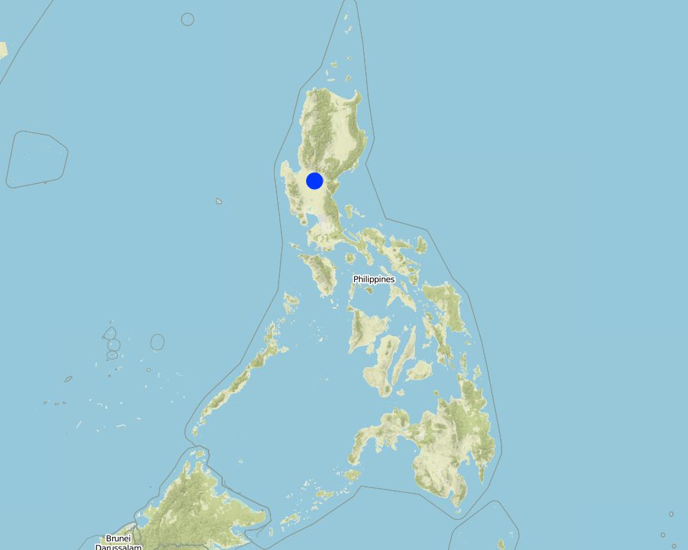
2.5 Country/ region/ locations where the Technology has been applied and which are covered by this assessment
Country:
Philippines
Region/ State/ Province:
Nueva Ecija
Further specification of location:
Nueva Ecija
Specify the spread of the Technology:
- evenly spread over an area
If the Technology is evenly spread over an area, specify area covered (in km2):
10.0
If precise area is not known, indicate approximate area covered:
- 1-10 km2
Comments:
Total area covered by the SLM Technology is 10 km2.
Because of the recurring El Nino phonomenon, the government fast-tracked the development of small water impounding projects during the 90's to counteract severe water shortages especially for upland areas.
Map
×2.6 Date of implementation
If precise year is not known, indicate approximate date:
- less than 10 years ago (recently)
2.7 Introduction of the Technology
Specify how the Technology was introduced:
- through projects/ external interventions
Comments (type of project, etc.):
From other areas with simlar condition (areas where runoff can be collected and impounded and used for supplementary irrigation)
3. Classification of the SLM Technology
3.1 Main purpose(s) of the Technology
- improve production
- conserve ecosystem
3.2 Current land use type(s) where the Technology is applied

Cropland
- Annual cropping
- Perennial (non-woody) cropping
- rice
Number of growing seasons per year:
- 2
Specify:
Longest growing period in days: 180, Longest growing period from month to month: May - Oct; Second longest growing period in days: 120, Second longest growing period from month to month: Nov - Feb
Comments:
Major land use problems (compiler’s opinion): Long term sustainability of agricultural system is seriously in doubt. Because farmers cannot practice intensive agriculture, income is low.
Major land use problems (land users’ perception): Low yield and cannot raise two crops of rice in one year. High inputs required. Small farm area and lack of irrigation facilities.
3.4 Water supply
Water supply for the land on which the Technology is applied:
- mixed rainfed-irrigated
3.5 SLM group to which the Technology belongs
- irrigation management (incl. water supply, drainage)
- surface water management (spring, river, lakes, sea)
3.7 Main types of land degradation addressed by the Technology

soil erosion by water
- Wt: loss of topsoil/ surface erosion

chemical soil deterioration
- Cn: fertility decline and reduced organic matter content (not caused by erosion)

water degradation
- Ha: aridification
3.8 Prevention, reduction, or restoration of land degradation
Specify the goal of the Technology with regard to land degradation:
- restore/ rehabilitate severely degraded land
4. Technical specifications, implementation activities, inputs, and costs
4.1 Technical drawing of the Technology

Technical specifications (related to technical drawing):
General map and typical plan of a Small Water Impounding Project (SWIP)
Location: Talugtug. Nueva Ecija
Technical knowledge required for field staff / advisors: moderate
Technical knowledge required for land users: moderate
Main technical functions: water harvesting / increase water supply
Secondary technical functions: control of dispersed runoff: retain / trap, increase of infiltration
Vegetative measure: contour
Vegetative material: F : fruit trees / shrubs
Number of plants per (ha): 100
Vertical interval between rows / strips / blocks (m): 10
Spacing between rows / strips / blocks (m): 10
Vertical interval within rows / strips / blocks (m): 10
Width within rows / strips / blocks (m): 10
Vegetative measure: downstream side of the dam
Vegetative material: F : fruit trees / shrubs
Vertical interval between rows / strips / blocks (m): 0.5
Spacing between rows / strips / blocks (m): 0.5
Vertical interval within rows / strips / blocks (m): 0.5
Width within rows / strips / blocks (m): 0.5
Vegetative measure: forest trees
Vegetative material: F : fruit trees / shrubs
Number of plants per (ha): 4,000
Vertical interval between rows / strips / blocks (m): 2
Spacing between rows / strips / blocks (m): 2
Vertical interval within rows / strips / blocks (m): 2
Width within rows / strips / blocks (m): 2
Vegetative measure: Vegetative material: F : fruit trees / shrubs
Trees/ shrubs species: mahogany, G-melina
Fruit trees / shrubs species: mango
Grass species: vetive (to protect the downstream slope of dam)
Other species: banana
Author:
Jose D. Rondal, Quezon City, Philippines
4.2 General information regarding the calculation of inputs and costs
other/ national currency (specify):
Phil. Peso
If relevant, indicate exchange rate from USD to local currency (e.g. 1 USD = 79.9 Brazilian Real): 1 USD =:
40.0
Indicate average wage cost of hired labour per day:
4.00
4.3 Establishment activities
| Activity | Timing (season) | |
|---|---|---|
| 1. | clearing | onset of rains May-June) |
| 2. | layout/staking | onset of rains |
| 3. | digging of holes | onset of rains |
| 4. | basal fertilization | onset of rains |
| 5. | planting | onset of rains |
4.4 Costs and inputs needed for establishment
| Specify input | Unit | Quantity | Costs per Unit | Total costs per input | % of costs borne by land users | |
|---|---|---|---|---|---|---|
| Labour | labour | ha | 1.0 | 39000.0 | 39000.0 | |
| Equipment | machine use | ha | 1.0 | 55000.0 | 55000.0 | |
| Total costs for establishment of the Technology | 94000.0 | |||||
| Total costs for establishment of the Technology in USD | 2350.0 | |||||
Comments:
Duration of establishment phase: 12 month(s)
4.5 Maintenance/ recurrent activities
| Activity | Timing/ frequency | |
|---|---|---|
| 1. | Weeding | rainy season /monthly |
| 2. | Fertilization | /twice a year |
| 3. | Irrigation | dry season /weekly |
4.6 Costs and inputs needed for maintenance/ recurrent activities (per year)
| Specify input | Unit | Quantity | Costs per Unit | Total costs per input | % of costs borne by land users | |
|---|---|---|---|---|---|---|
| Labour | labour | ha | 1.0 | 900.0 | 900.0 | 100.0 |
| Equipment | animal traction | ha | 1.0 | 375.0 | 375.0 | 100.0 |
| Total costs for maintenance of the Technology | 1275.0 | |||||
| Total costs for maintenance of the Technology in USD | 31.88 | |||||
Comments:
Length, height and width of structure and the source of materials like gravels and stones.
4.7 Most important factors affecting the costs
Describe the most determinate factors affecting the costs:
The source of materials like stones/gravels affect the cost. Usually, these are hauled from long distances. Also the construction of access roads adds substantially to the cost.
5. Natural and human environment
5.1 Climate
Annual rainfall
- < 250 mm
- 251-500 mm
- 501-750 mm
- 751-1,000 mm
- 1,001-1,500 mm
- 1,501-2,000 mm
- 2,001-3,000 mm
- 3,001-4,000 mm
- > 4,000 mm
Agro-climatic zone
- humid
- sub-humid
Thermal climate class: tropics
5.2 Topography
Slopes on average:
- flat (0-2%)
- gentle (3-5%)
- moderate (6-10%)
- rolling (11-15%)
- hilly (16-30%)
- steep (31-60%)
- very steep (>60%)
Landforms:
- plateau/plains
- ridges
- mountain slopes
- hill slopes
- footslopes
- valley floors
Altitudinal zone:
- 0-100 m a.s.l.
- 101-500 m a.s.l.
- 501-1,000 m a.s.l.
- 1,001-1,500 m a.s.l.
- 1,501-2,000 m a.s.l.
- 2,001-2,500 m a.s.l.
- 2,501-3,000 m a.s.l.
- 3,001-4,000 m a.s.l.
- > 4,000 m a.s.l.
5.3 Soils
Soil depth on average:
- very shallow (0-20 cm)
- shallow (21-50 cm)
- moderately deep (51-80 cm)
- deep (81-120 cm)
- very deep (> 120 cm)
Soil texture (topsoil):
- medium (loamy, silty)
- fine/ heavy (clay)
Topsoil organic matter:
- medium (1-3%)
- low (<1%)
5.6 Characteristics of land users applying the Technology
Market orientation of production system:
- subsistence (self-supply)
- mixed (subsistence/ commercial)
Off-farm income:
- 10-50% of all income
Relative level of wealth:
- poor
- average
Indicate other relevant characteristics of the land users:
Population density: 50-100 persons/km2
Annual population growth: 1% - 2%
5% of the land users are very rich and own 25% of the land (4).
10% of the land users are rich and own 25% of the land.
50% of the land users are average wealthy and own 40% of the land.
30% of the land users are poor and own 5% of the land.
5.7 Average area of land used by land users applying the Technology
- < 0.5 ha
- 0.5-1 ha
- 1-2 ha
- 2-5 ha
- 5-15 ha
- 15-50 ha
- 50-100 ha
- 100-500 ha
- 500-1,000 ha
- 1,000-10,000 ha
- > 10,000 ha
Comments:
Only a small part of the landholding can be cultivated intensively.
5.8 Land ownership, land use rights, and water use rights
Land ownership:
- individual, not titled
- individual, titled
Land use rights:
- open access (unorganized)
- individual
6. Impacts and concluding statements
6.1 On-site impacts the Technology has shown
Socio-economic impacts
Production
crop production
Comments/ specify:
rice production
fodder production
fodder quality
wood production
production area
Income and costs
farm income
Other socio-economic impacts
Fish production
Comments/ specify:
Fish culture
Socio-cultural impacts
recreational opportunities
Comments/ specify:
Picnic grounds
community institutions
Comments/ specify:
Farmers are organized into an association
SLM/ land degradation knowledge
Comments/ specify:
Including soil fertility management
Employment creation
Comments/ specify:
During construction
Ecological impacts
Soil
soil moisture
soil cover
Comments/ specify:
Woodland taking over grassland
soil loss
Comments/ specify:
reservoir area
Biodiversity: vegetation, animals
plant diversity
Other ecological impacts
Soil fertility
6.2 Off-site impacts the Technology has shown
water availability
Comments/ specify:
Increased groundwater recharge
reliable and stable stream flows in dry season
Comments/ specify:
dry season flow
downstream flooding
downstream siltation
6.4 Cost-benefit analysis
How do the benefits compare with the establishment costs (from land users’ perspective)?
Short-term returns:
slightly negative
Long-term returns:
very positive
How do the benefits compare with the maintenance/ recurrent costs (from land users' perspective)?
Short-term returns:
very positive
Long-term returns:
very positive
6.5 Adoption of the Technology
Of all those who have adopted the Technology, how many did so spontaneously, i.e. without receiving any material incentives/ payments?
- 0-10%
Comments:
100% of land user families have adopted the Technology with external material support
180 land user families have adopted the Technology with external material support
6.7 Strengths/ advantages/ opportunities of the Technology
| Strengths/ advantages/ opportunities in the land user’s view |
|---|
| Increase in farm income |
| Opportunity for other farming opportunities (fish including shell farming) |
| Strengths/ advantages/ opportunities in the compiler’s or other key resource person’s view |
|---|
| It is a holistic and integrated approach to watershed management/development |
| Immediate economic impact |
| Institutional strengthening |
6.8 Weaknesses/ disadvantages/ risks of the Technology and ways of overcoming them
| Weaknesses/ disadvantages/ risks in the land user’s view | How can they be overcome? |
|---|---|
| High establishment cost |
| Weaknesses/ disadvantages/ risks in the compiler’s or other key resource person’s view | How can they be overcome? |
|---|---|
| High initial investment cost | Cost-sharing among different agencies. Beneficiaries to subsidize labor |
| Loss of productive land (reservoir area) | Compensation of affected farmers |
7. References and links
7.1 Methods/ sources of information
- field visits, field surveys
- interviews with land users
When were the data compiled (in the field)?
16/05/2000
7.2 References to available publications
Title, author, year, ISBN:
Small Water Impounding Project (SWIP) for Productivity Improvement of Paddy Soils: The case of Talugtug, Nueva Ecija, Philippines, 2000, Rodolfo M. Lucas, Samuel Contreras, Teresita Sandoval
Links and modules
Expand all Collapse allLinks
No links
Modules
No modules