
Spring cleaning and creating a water point [Kyrgyzstan]
- Creation:
- Update:
- Compiler: Abdybek Asanaliev
- Editor: –
- Reviewers: Deborah Niggli, Alexandra Gavilano
Булакты тазалоо
technologies_1538 - Kyrgyzstan
View sections
Expand all Collapse all1. General information
1.2 Contact details of resource persons and institutions involved in the assessment and documentation of the Technology
Name of the institution(s) which facilitated the documentation/ evaluation of the Technology (if relevant)
Kyrgyz Agrarian University (Kyrgyz Agrarian University) - Kyrgyzstan1.3 Conditions regarding the use of data documented through WOCAT
The compiler and key resource person(s) accept the conditions regarding the use of data documented through WOCAT:
Yes
1.4 Declaration on sustainability of the described Technology
Is the Technology described here problematic with regard to land degradation, so that it cannot be declared a sustainable land management technology?
No
2. Description of the SLM Technology
2.1 Short description of the Technology
Definition of the Technology:
Cleaning the spring and creating an animal watering point to reduce livestock trampling and erosion
2.2 Detailed description of the Technology
Description:
Saz village has 4,000 ha of a pasture land area, which is divided into close to village, intensive, and far away pastures. 30% of the pastures are close to village, and used in spring, autumn and winter. In summer and autumn livestock is grazed on intensive and far away pastures.
One of the disadvantages of the close to village pastures is the lack of water for livestock consumption. Daily at noon, shepherds bring their livestock to the Sokuluk river to water it. As a result livestock has to range between village, pasture and river four times per day, which led to the creation of numerous trails on the pastures contributing to soil erosion. Pasture erosion is obviously visible near the river and around the village.
At the same time, there was a spring in one of the canyons clogged up with stones and mud. As the stream of water was not sufficient to quench livestock's thirst, the herders used to direct it straight to the river.
Aytkulov Duyshon, a resident of Saz village, cleaned this spring and built a watering point for animals with support of the CAMP "Alatoo" and the local administration. First, the exact effluence of the spring was determined and cleaned from mud. Then, 15 meters below this spot three interlinked troughs were constructed. These throughs were 1,8 m long, 0,5 m wide and 0,5 m deep. Each following trough was located below the previous one and water could flow through in form of a cascade. Below these troughs a pool (2 m diameter) was built. The edges of the troughs were set 0,2 m above the soil to prevent clogging up of water with stones and soil. At the end of the construction the troughs were connected with pipes to the place the water was coming out. This place was edged with stones and a tube was placed into a small 0,30 m trench. At this water point, 15-17 animals (depending on their size) can drink water simultaneously. As a result of this work livestock had to move twice per day - in the morning and in the evening. On the eroded pathways non palatable plants began to grow.
The purpose of this technology is the provision of safe drinking water for livestock and to prevent pasture erosion.
Realization of the technology became possible after the workshop on "Sustainable use of natural resources through soil and water conservation technologies" organized by CAMP "Alatoo". During this workshop villagers developed a project using the CAMP "Alatoo"'s collection of technologies on soil and water conservation. Aytkulov Duyshon (the leader) and his team developed a project on cleaning the spring and creating a water point. The group contributed to the introduction of the technology and CAMP "Alatoo" financed part of the cost.
The spring is located at 1,600 m asl. in the Sary Koo canyon. The area is covered with different types of grass and with a shrubby vegetation (spirea, barberry, hawthorn and wold rose) on the north slope. Eroded pathways are visible on the slopes and at the bottom of the canyon a gully is developing. People use the three types of pastures (close to village, intensive and far away pastures) under "the pasture law of KR". A pasture committee has not yet been established. The village does not practice pasture rotation and a pasture use plan does not exist. But local administration has issued a decision on dates when livestock should be grazed on intensive and on far away pastures in order to protect crops from livestock damages.
2.3 Photos of the Technology
Media Gallery

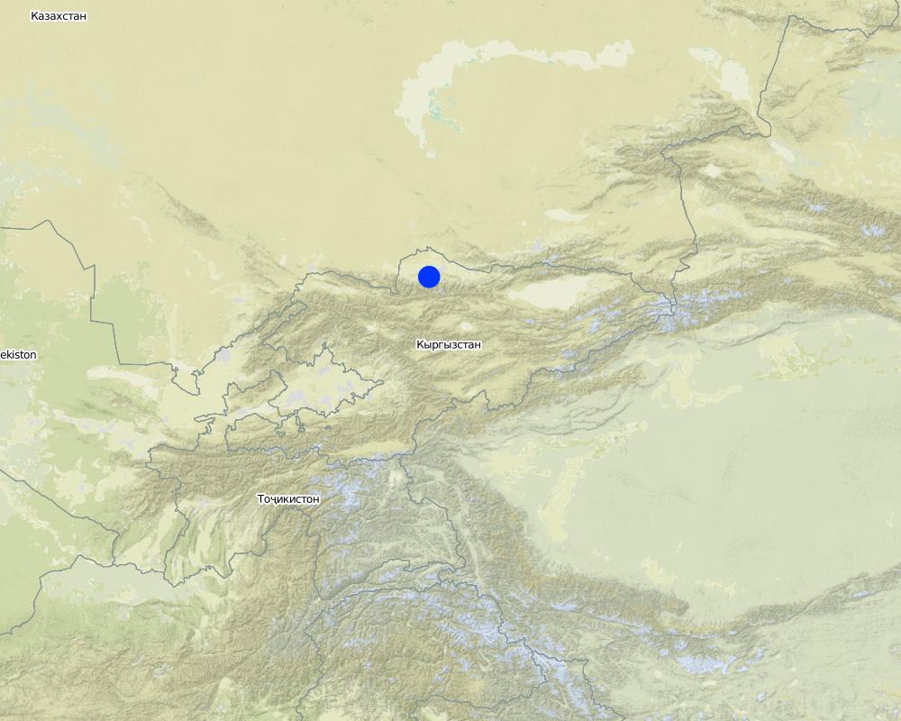
2.5 Country/ region/ locations where the Technology has been applied and which are covered by this assessment
Country:
Kyrgyzstan
Region/ State/ Province:
Kyrgyz Republic
Further specification of location:
Sokuluk
Comments:
Total area covered by the SLM Technology is 1 km2.
This technology covers the pasture area of 100ha
Map
×2.6 Date of implementation
If precise year is not known, indicate approximate date:
- more than 50 years ago (traditional)
2.7 Introduction of the Technology
Specify how the Technology was introduced:
- through projects/ external interventions
Comments (type of project, etc.):
Technology was introduced in 2006.
3. Classification of the SLM Technology
3.1 Main purpose(s) of the Technology
- improve production
3.2 Current land use type(s) where the Technology is applied
Land use mixed within the same land unit:
Yes
Specify mixed land use (crops/ grazing/ trees):
- Agro-pastoralism (incl. integrated crop-livestock)

Cropland
Number of growing seasons per year:
- 1
Specify:
Longest growing period in days: 170, Longest growing period from month to month: from April to October Livestock density (if relevant):

Grazing land
Extensive grazing:
- Semi-nomadic pastoralism
- cattle
Comments:
Major land use problems (compiler’s opinion): Degradation of pasture lands due to overgrazing.
Major land use problems (land users’ perception): Increase of livestock numbers and decrease of the pasture productivity which is a result of trampling by grazing cattle.
Semi-nomadism / pastoralism: In summer cattle is grazed on far away pastures. In autumn after the crop collection, crop lands are used as pastures.
Livestock density: 10-25 LU /km2
3.4 Water supply
Water supply for the land on which the Technology is applied:
- full irrigation
3.5 SLM group to which the Technology belongs
- irrigation management (incl. water supply, drainage)
- surface water management (spring, river, lakes, sea)
3.6 SLM measures comprising the Technology

structural measures
- S11: Others
3.7 Main types of land degradation addressed by the Technology

soil erosion by water
- Wg: gully erosion/ gullying
- Wc: coastal erosion
Comments:
Main causes of degradation: overgrazing (Increase in livestock number, lack of plan for grazing), urbanisation and infrastructure development (The bridge was reconstructed.), droughts (During droughts water amount in the spring decreases)
Secondary causes of degradation: soil management (Spring was not cleaned)
3.8 Prevention, reduction, or restoration of land degradation
Specify the goal of the Technology with regard to land degradation:
- reduce land degradation
4. Technical specifications, implementation activities, inputs, and costs
4.1 Technical drawing of the Technology

Technical specifications (related to technical drawing):
left: Technical drawing of the spring.
right: Cross-section of the construction.
Location: Saz village. Chuy
Date: 26/12/2011
Technical knowledge required for field staff / advisors: high (It is necessary to know about the condition of soil and water)
Technical knowledge required for land users: moderate (Basic construction knowledge is needed)
Main technical functions: water harvesting / increase water supply
Spillway
Vertical interval between structures (m): 0.5
Spacing between structures (m): 0
Depth of ditches/pits/dams (m): 0.5
Width of ditches/pits/dams (m): 0.5
Length of ditches/pits/dams (m): 1.8
Construction material (stone): used to edge the beginning of the spring
Construction material (concrete): to strengthen the watering point, i.e troughs
Author:
Asanaliev A., Bishkek
4.2 General information regarding the calculation of inputs and costs
other/ national currency (specify):
soms
If relevant, indicate exchange rate from USD to local currency (e.g. 1 USD = 79.9 Brazilian Real): 1 USD =:
40.0
Indicate average wage cost of hired labour per day:
10.00
4.3 Establishment activities
| Activity | Timing (season) | |
|---|---|---|
| 1. | Cleaning the spring | spring |
| 2. | Construction of the watering point | spring |
4.4 Costs and inputs needed for establishment
| Specify input | Unit | Quantity | Costs per Unit | Total costs per input | % of costs borne by land users | |
|---|---|---|---|---|---|---|
| Labour | labour | 1.0 | 112.0 | 112.0 | 100.0 | |
| Construction material | cement | 1.0 | 200.0 | 200.0 | 30.0 | |
| Total costs for establishment of the Technology | 312.0 | |||||
| Total costs for establishment of the Technology in USD | 7.8 | |||||
Comments:
Duration of establishment phase: 0 month(s)
4.5 Maintenance/ recurrent activities
| Activity | Timing/ frequency | |
|---|---|---|
| 1. | Cleaning the troughs from the earth and stones | 2 times: in spring & autumn |
4.6 Costs and inputs needed for maintenance/ recurrent activities (per year)
| Specify input | Unit | Quantity | Costs per Unit | Total costs per input | % of costs borne by land users | |
|---|---|---|---|---|---|---|
| Labour | labour | 1.0 | 12.0 | 12.0 | 100.0 | |
| Total costs for maintenance of the Technology | 12.0 | |||||
| Total costs for maintenance of the Technology in USD | 0.3 | |||||
4.7 Most important factors affecting the costs
Describe the most determinate factors affecting the costs:
The cost depends on the depth of the troughs, the type of soil, labor cost and price for cement.
5. Natural and human environment
5.1 Climate
Annual rainfall
- < 250 mm
- 251-500 mm
- 501-750 mm
- 751-1,000 mm
- 1,001-1,500 mm
- 1,501-2,000 mm
- 2,001-3,000 mm
- 3,001-4,000 mm
- > 4,000 mm
Specifications/ comments on rainfall:
Rainfall events take place mainly in spring and autumn
Agro-climatic zone
- semi-arid
Thermal climate class: temperate. Temperate zone, 4 seasons are clearly distinguished
5.2 Topography
Slopes on average:
- flat (0-2%)
- gentle (3-5%)
- moderate (6-10%)
- rolling (11-15%)
- hilly (16-30%)
- steep (31-60%)
- very steep (>60%)
Landforms:
- plateau/plains
- ridges
- mountain slopes
- hill slopes
- footslopes
- valley floors
Altitudinal zone:
- 0-100 m a.s.l.
- 101-500 m a.s.l.
- 501-1,000 m a.s.l.
- 1,001-1,500 m a.s.l.
- 1,501-2,000 m a.s.l.
- 2,001-2,500 m a.s.l.
- 2,501-3,000 m a.s.l.
- 3,001-4,000 m a.s.l.
- > 4,000 m a.s.l.
5.3 Soils
Soil depth on average:
- very shallow (0-20 cm)
- shallow (21-50 cm)
- moderately deep (51-80 cm)
- deep (81-120 cm)
- very deep (> 120 cm)
Soil texture (topsoil):
- medium (loamy, silty)
Topsoil organic matter:
- medium (1-3%)
5.4 Water availability and quality
Ground water table:
> 50 m
Availability of surface water:
medium
Water quality (untreated):
good drinking water
5.5 Biodiversity
Species diversity:
- medium
5.6 Characteristics of land users applying the Technology
Off-farm income:
- less than 10% of all income
Individuals or groups:
- groups/ community
Gender:
- women
- men
Indicate other relevant characteristics of the land users:
Land users applying the Technology are mainly common / average land users
Population density: < 10 persons/km2
Annual population growth: 1% - 2%
5% of the land users are rich and own 10% of the land.
75% of the land users are average wealthy and own 80% of the land.
20% of the land users are poor and own 10% of the land.
5.7 Average area of land used by land users applying the Technology
- < 0.5 ha
- 0.5-1 ha
- 1-2 ha
- 2-5 ha
- 5-15 ha
- 15-50 ha
- 50-100 ha
- 100-500 ha
- 500-1,000 ha
- 1,000-10,000 ha
- > 10,000 ha
Is this considered small-, medium- or large-scale (referring to local context)?
- medium-scale
5.8 Land ownership, land use rights, and water use rights
Land ownership:
- individual, titled
Land use rights:
- individual
5.9 Access to services and infrastructure
health:
- poor
- moderate
- good
education:
- poor
- moderate
- good
technical assistance:
- poor
- moderate
- good
employment (e.g. off-farm):
- poor
- moderate
- good
markets:
- poor
- moderate
- good
energy:
- poor
- moderate
- good
roads and transport:
- poor
- moderate
- good
drinking water and sanitation:
- poor
- moderate
- good
financial services:
- poor
- moderate
- good
6. Impacts and concluding statements
6.1 On-site impacts the Technology has shown
Socio-economic impacts
Production
crop production
animal production
Quantity before SLM:
15
Quantity after SLM:
20
Comments/ specify:
The weight of sheep is going up as result of improving water supply.
Income and costs
expenses on agricultural inputs
Quantity before SLM:
0
Quantity after SLM:
1%
Comments/ specify:
Communities are haze inputs to construction of spring water. They could not do it. In this case increased expenses on agricultural inputs.
economic disparities
Quantity before SLM:
0
Quantity after SLM:
2
Comments/ specify:
Those shepherds, who do not use this watering point loose 2 hours per day for bringing their livestock down to the river.
Socio-cultural impacts
recreational opportunities
Quantity before SLM:
2ч/водопой
Quantity after SLM:
0
community institutions
SLM/ land degradation knowledge
Comments/ specify:
Previously only 2 specialists knew about land degradation. 11 people were trained.
conflict mitigation
Comments/ specify:
Conflict between a shepherd, who brings his livestock earlier and occupies the pasture around the watering point, with another shepher, who arrives on the pasture later.
Ecological impacts
Water cycle/ runoff
harvesting/ collection of water
Quantity before SLM:
0
Quantity after SLM:
1
Comments/ specify:
A water point is created.
Soil
soil compaction
Quantity before SLM:
intense
Quantity after SLM:
slight
Comments/ specify:
Animal tropes compaction is reduced.
6.2 Off-site impacts the Technology has shown
water availability
Quantity before SLM:
0
Quantity after SLM:
1
Comments/ specify:
Spring was not suitable for watering. After cleaning, it became the main water consumption place for all animals in the pastures.
reliable and stable stream flows in dry season
Quantity before SLM:
0,5%
Quantity after SLM:
90%
Comments/ specify:
90% of the water runoff reaches the troughs.
6.3 Exposure and sensitivity of the Technology to gradual climate change and climate-related extremes/ disasters (as perceived by land users)
Gradual climate change
Gradual climate change
| Season | increase or decrease | How does the Technology cope with it? | |
|---|---|---|---|
| annual temperature | increase | not well |
Climate-related extremes (disasters)
Meteorological disasters
| How does the Technology cope with it? | |
|---|---|
| local rainstorm | not well |
Other climate-related consequences
Other climate-related consequences
| How does the Technology cope with it? | |
|---|---|
| reduced growing period | not known |
6.4 Cost-benefit analysis
How do the benefits compare with the establishment costs (from land users’ perspective)?
Short-term returns:
positive
Long-term returns:
positive
6.5 Adoption of the Technology
Comments:
25% of land user families have adopted the Technology with external material support
100 land user families have adopted the Technology with external material support
200 households graze their livestock on the right bank of the river, where the water point was created. But this pasture area has a capacity for only for half of them (50 ha).
100% of land user families have adopted the Technology without any external material support
25 land user families have adopted the Technology without any external material support
There is a little trend towards spontaneous adoption of the Technology
Another watering point was built in Tosh Bulak village.
6.7 Strengths/ advantages/ opportunities of the Technology
| Strengths/ advantages/ opportunities in the land user’s view |
|---|
| Livestock productivity has improved since better supply of water on the pastures. |
| Strengths/ advantages/ opportunities in the compiler’s or other key resource person’s view |
|---|
| Mitigating pasture erosion through decreasing animal trampling. |
| Increase in livestock productivity through decrease of of pasturing and increase in grazing time. |
6.8 Weaknesses/ disadvantages/ risks of the Technology and ways of overcoming them
| Weaknesses/ disadvantages/ risks in the land user’s view | How can they be overcome? |
|---|---|
| Watering point is clogging up | In spring and autumn the watering point must be cleaned up. |
| Weaknesses/ disadvantages/ risks in the compiler’s or other key resource person’s view | How can they be overcome? |
|---|---|
| Spring is not regularly cleaned. | Increased control over the condition of the spring and maintenance of the watering point by the local administration. |
7. References and links
7.1 Methods/ sources of information
- field visits, field surveys
- interviews with land users
When were the data compiled (in the field)?
26/12/2011
7.2 References to available publications
Title, author, year, ISBN:
Отчеты «ОФ САМР-Алатоо» по мониторингу и оценке внедренных ПВСТ в селе Саз.
Available from where? Costs?
Офис «ОФ САМР-Алатоо»
Links and modules
Expand all Collapse allLinks
No links
Modules
No modules