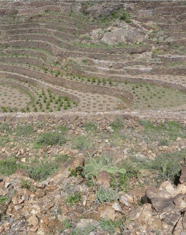
Bench terraces covered with small stones [Yemen]
- Creation:
- Update:
- Compiler: ahmed algalal
- Editor: –
- Reviewers: David Streiff, Alexandra Gavilano
المدرجات المغطاه بالأحجار
technologies_1560 - Yemen
View sections
Expand all Collapse all1. General information
1.2 Contact details of resource persons and institutions involved in the assessment and documentation of the Technology
SLM specialist:
Name of the institution(s) which facilitated the documentation/ evaluation of the Technology (if relevant)
Agricultural Research and Extension Authority (AREA) - Yemen1.3 Conditions regarding the use of data documented through WOCAT
The compiler and key resource person(s) accept the conditions regarding the use of data documented through WOCAT:
Yes
1.5 Reference to Questionnaire(s) on SLM Approaches (documented using WOCAT)
Building and rehabilitation of agricultural terraces. [Yemen]
Pay incentives for farmers rehabilitate degraded terraces in order to face the crisis of increasing food prices.
- Compiler: ahmed algalal
2. Description of the SLM Technology
2.1 Short description of the Technology
Definition of the Technology:
Building terraces in steep areas for the purpose of reducing the slope, water harvesting and soil moisture conservation.
2.2 Detailed description of the Technology
Description:
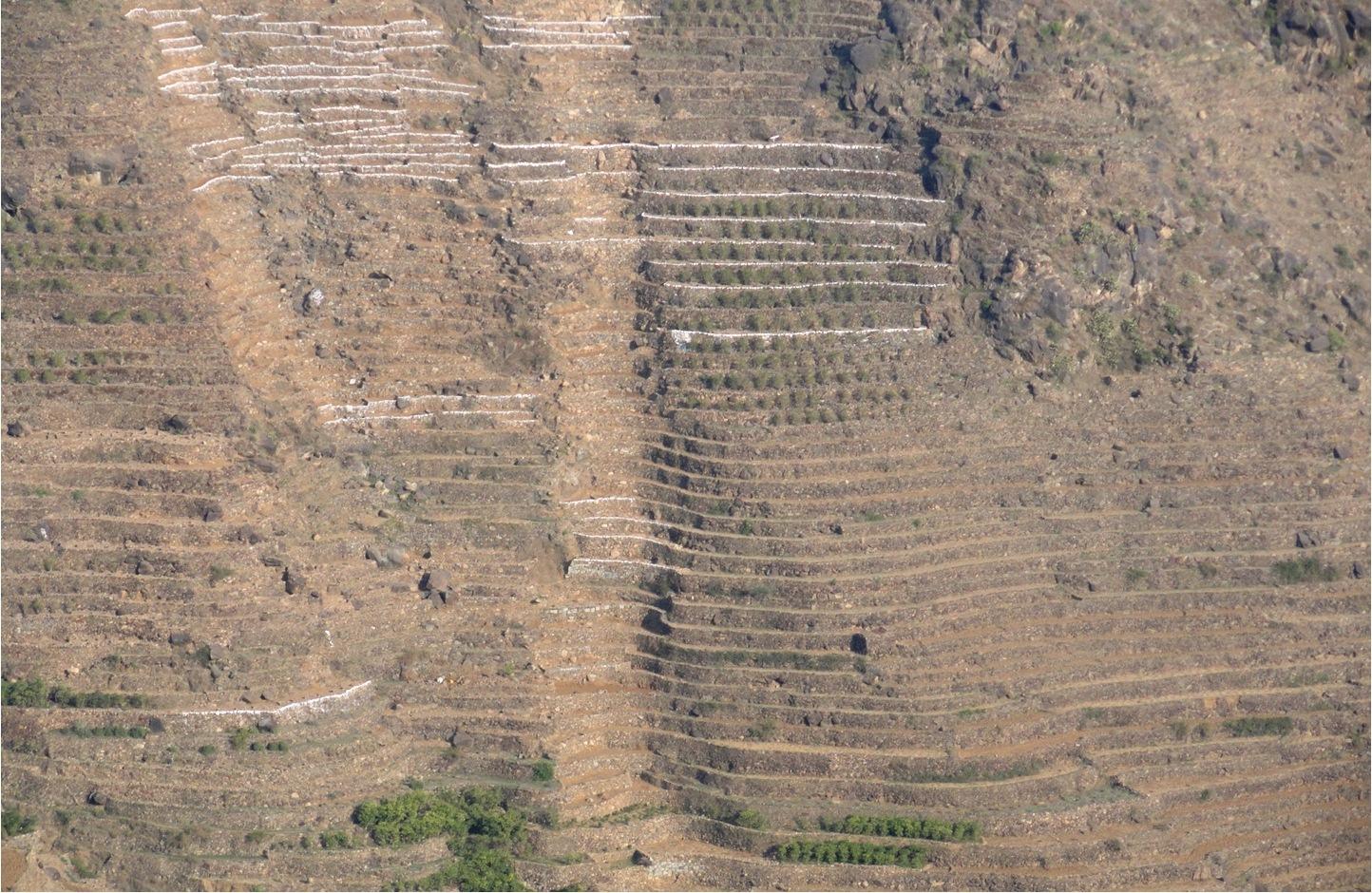
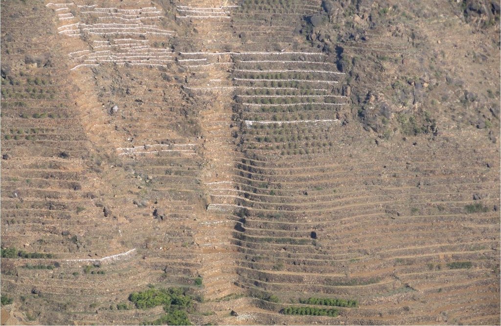
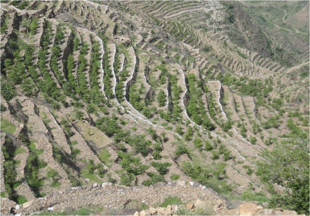
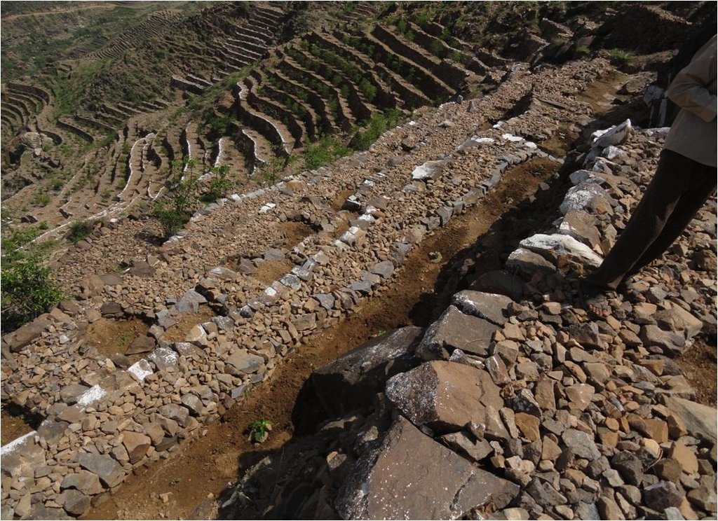
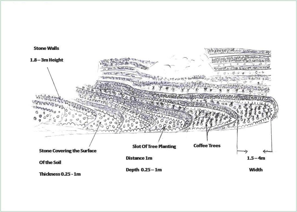
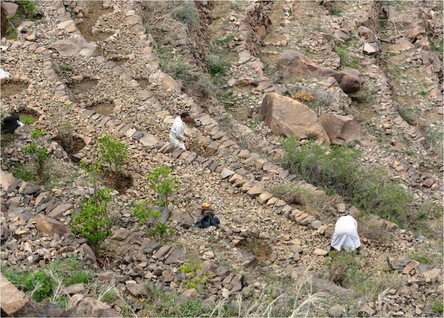
Cutting and collecting stones for the construction of terraces on steep slopes of the mountains, structural measure to reduce the length and angle of the slope and the speed of runoff. This makes it easier to harvest water and reserving deposits. A wall terraces is built of stones where the height of a wall should be increased height of 1.8 - 3 m, a width of 1.5 - 4.3 m and the length from 8 - 14 m to keep the accumulated deposits. The cutting stones are brought from distant places for the purpose of building the walls. These terraces are similar to mountain terraces but the top soil surface can be covered with stones to protect it from heavy rain storms and prevent sheet erosion that results from raindrops hitting the bare top soil surface. The stone layer, also prevents evaporation and maintains soil moisture. The stones are arranged in a layer of about 0.25 – 0.7 m thickness over the entire surface of the soil except where to put the coffee trees with an average diameter of 1 m. It is difficult to use equipment in the process of building the terraces due to severe slopes. Therefore it is a labor intensive process of manually building terraces. Due to the slow process of construction it requires a lot of time. However, building terraces on steep slopes can lead to increased erosion in the absence of well maintaining outlets that allow draining the excess water from one terrace to another, avoiding breaking of terraces' walls. In any case, terraces need regular maintenance to ensure the sustainability of this technology. The landscape of the region is mountainous, bench terraces which are used for crop production exist in slopes exceeding 60%. The texture of the soil is silty loam and the depth of the terraces is moderate to deep. Due to small holdings and steepness of the terraces, the local implements are used for land preparation. The climate in the region is arid to semi-arid and annual precipitation ranges between 200 and 450 mm. The major crop in this area is coffee, which is cultivated because of its high economic value on the market.
2.3 Photos of the Technology
2.5 Country/ region/ locations where the Technology has been applied and which are covered by this assessment
Country:
Yemen
Region/ State/ Province:
Sanaa governorate
Further specification of location:
Bani Ismail- Manakha District
Specify the spread of the Technology:
- evenly spread over an area
If precise area is not known, indicate approximate area covered:
- 0.1-1 km2
Comments:
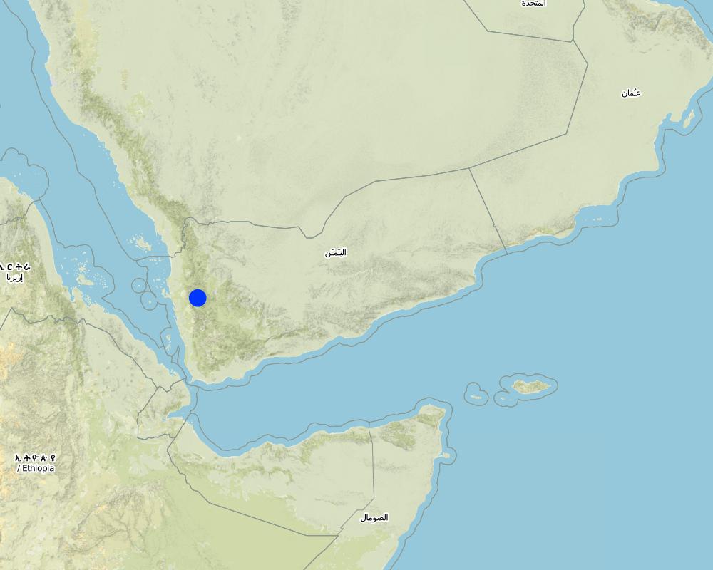
Bani Ismail's Uzlah is situated in west part of the capital Sana'a
Total area covered by the SLM Technology is 0.75 km2.
Map
×2.6 Date of implementation
If precise year is not known, indicate approximate date:
- more than 50 years ago (traditional)
2.7 Introduction of the Technology
Specify how the Technology was introduced:
- as part of a traditional system (> 50 years)
Comments (type of project, etc.):
It is very ancient technology but was rehabilitated in 2011 by the users of the land by getting a fund from the Social Fund for Development
3. Classification of the SLM Technology
3.1 Main purpose(s) of the Technology
- reduce, prevent, restore land degradation
3.2 Current land use type(s) where the Technology is applied

Cropland
- Tree and shrub cropping
Tree and shrub cropping - Specify crops:
- coffee, open grown
Number of growing seasons per year:
- 1
Specify:
Longest growing period in days: 90
Comments:
Major land use problems (compiler’s opinion): Water erosion in the form of Gullies, large stones loss (landslides) due to the sever steepness in addition to low soil moisture.
Major land use problems (land users’ perception): Soil erosion
Future (final) land use (after implementation of SLM Technology): Cropland: Ct: Tree and shrub cropping
3.3 Has land use changed due to the implementation of the Technology?

Cropland
- Tree and shrub cropping
Comments:
Future (final) land use (after implementation of SLM Technology): Cropland: Ct: Tree and shrub cropping
3.4 Water supply
Water supply for the land on which the Technology is applied:
- rainfed
Comments:
Water supply: post-flooding
3.5 SLM group to which the Technology belongs
- cross-slope measure
- water harvesting
- water diversion and drainage
3.6 SLM measures comprising the Technology

structural measures
- S1: Terraces
3.7 Main types of land degradation addressed by the Technology

soil erosion by water
- Wg: gully erosion/ gullying

biological degradation
- Bc: reduction of vegetation cover

water degradation
- Ha: aridification
Comments:
Secondary types of degradation addressed: Ha: aridification
Main causes of degradation: Heavy / extreme rainfall (intensity/amounts) (Severe rainstorm), other natural causes (avalanches, volcanic eruptions, mud flows, highly susceptible natural resources, extreme topography, etc.) specify (Severe slopes and fall of large rock masses), land tenure (Fragmentation of holdings), Immigration and search for other income sources
Secondary causes of degradation: over-exploitation of vegetation for domestic use (For domestic use due to lack of gas as a fuel source), poverty / wealth (Poverty), education, access to knowledge and support services
3.8 Prevention, reduction, or restoration of land degradation
Specify the goal of the Technology with regard to land degradation:
- reduce land degradation
- restore/ rehabilitate severely degraded land
4. Technical specifications, implementation activities, inputs, and costs
4.1 Technical drawing of the Technology
Technical specifications (related to technical drawing):
Flat agricultural terraces covered with stones on the soil surface
Location: Bani Ismail. Sana'a governorate - Manakha district
Date: 5/3/2013
Technical knowledge required for field staff / advisors: high (Construction process needs skill and experience)
Technical knowledge required for land users: low (Has experience)
Main technical functions: control of raindrop splash, reduction of slope angle, reduction of slope length, increase / maintain water stored in soil, water harvesting / increase water supply, Reduce speed of runoff
Secondary technical functions: sediment retention / trapping, sediment harvesting
Terrace: bench level
Vertical interval between structures (m): 1.8 -3
Spacing between structures (m): 1.5 – 4.3
Height of bunds/banks/others (m): 1.8 -3
Width of bunds/banks/others (m): 1.5– 4.3
Length of bunds/banks/others (m): 8 - 14
Structural measure: The Coverage with stones
Width of bunds/banks/others (m): 1.5– 4.3
Length of bunds/banks/others (m): 8 - 14
Construction material (earth): Remove residuals of water erosion and refill the soil-eroded with soil
Construction material (stone): Construction of walls from the existing stones in the region
Slope (which determines the spacing indicated above): 66.7%
Lateral gradient along the structure: 0%
For water harvesting: the ratio between the area where the harvested water is applied and the total area from which water is collected is: 1:1
Author:
AL Galal
4.2 General information regarding the calculation of inputs and costs
Specify currency used for cost calculations:
- USD
Indicate average wage cost of hired labour per day:
6.30
4.3 Establishment activities
| Activity | Timing (season) | |
|---|---|---|
| 1. | Remove the spate deposits and filing the gullies with soil, then the top soil surface has to be leveled | Before the rain season |
| 2. | Collecting and transporting stones | Before the rain season |
| 3. | Building the walls of the terraces | Before the rain season |
| 4. | Cover the top soil surface of the earth with stones | Before the rain season |
4.4 Costs and inputs needed for establishment
| Specify input | Unit | Quantity | Costs per Unit | Total costs per input | % of costs borne by land users | |
|---|---|---|---|---|---|---|
| Labour | Building terraces | ha | 1.0 | 42430.0 | 42430.0 | 11.0 |
| Equipment | Tools | ha | 1.0 | 100.0 | 100.0 | 100.0 |
| Total costs for establishment of the Technology | 42530.0 | |||||
| Total costs for establishment of the Technology in USD | 42530.0 | |||||
Comments:
Duration of establishment phase: 7 month(s)
4.5 Maintenance/ recurrent activities
| Activity | Timing/ frequency | |
|---|---|---|
| 1. | Repair walls that were destroyed | annually after the rain season |
| 2. | Inverse the soil covered with stones |
4.6 Costs and inputs needed for maintenance/ recurrent activities (per year)
| Specify input | Unit | Quantity | Costs per Unit | Total costs per input | % of costs borne by land users | |
|---|---|---|---|---|---|---|
| Labour | Repair walls that were destroyed | ha | 1.0 | 50.0 | 50.0 | 100.0 |
| Labour | Inverse the soil covered with stones | ha | 1.0 | 186.0 | 186.0 | 100.0 |
| Total costs for maintenance of the Technology | 236.0 | |||||
| Total costs for maintenance of the Technology in USD | 236.0 | |||||
Comments:
It is important to note that the implemented works to achieved is about 6 hectare, the project which support money against work, contributed with 231720.54$ to cover most of works such as collecting and transfer stones, and constructing the wall of terraces at 16639.16 m, and covering soil surface with stones for an area estimated of 53560.08 m2. While the land users performed cleaning waste of constructions, filling the target area with soil and leveling it. The total cost of constructing per hectare for building walls terraces at 3273.2 m long and 1.8-3 m height and covering soil surface with stones for an area of 8926.68 m2, and 0.25-0.7 m thick, this cost including other works which already have discussion before.
4.7 Most important factors affecting the costs
Describe the most determinate factors affecting the costs:
1- Collecting and transporting stones and arable soil manually as a result of the bad road accessibility.
2- Severe steep slopes
5. Natural and human environment
5.1 Climate
Annual rainfall
- < 250 mm
- 251-500 mm
- 501-750 mm
- 751-1,000 mm
- 1,001-1,500 mm
- 1,501-2,000 mm
- 2,001-3,000 mm
- 3,001-4,000 mm
- > 4,000 mm
Agro-climatic zone
- semi-arid
Thermal climate class: temperate
5.2 Topography
Slopes on average:
- flat (0-2%)
- gentle (3-5%)
- moderate (6-10%)
- rolling (11-15%)
- hilly (16-30%)
- steep (31-60%)
- very steep (>60%)
Landforms:
- plateau/plains
- ridges
- mountain slopes
- hill slopes
- footslopes
- valley floors
Altitudinal zone:
- 0-100 m a.s.l.
- 101-500 m a.s.l.
- 501-1,000 m a.s.l.
- 1,001-1,500 m a.s.l.
- 1,501-2,000 m a.s.l.
- 2,001-2,500 m a.s.l.
- 2,501-3,000 m a.s.l.
- 3,001-4,000 m a.s.l.
- > 4,000 m a.s.l.
Comments and further specifications on topography:
Altitudinal zone: 1400 m a.s.l.
5.3 Soils
Soil depth on average:
- very shallow (0-20 cm)
- shallow (21-50 cm)
- moderately deep (51-80 cm)
- deep (81-120 cm)
- very deep (> 120 cm)
Soil texture (topsoil):
- medium (loamy, silty)
Topsoil organic matter:
- low (<1%)
If available, attach full soil description or specify the available information, e.g. soil type, soil PH/ acidity, Cation Exchange Capacity, nitrogen, salinity etc.
Soil depth on average: 150 cm
Soil texture: Flood deposits
Topsoil organic matter: Soil covered with stones except where the tree plantation
Soil fertility is low
Soil drainage / infiltration is medium - good
Soil water storage capacity is medium - high
5.4 Water availability and quality
Availability of surface water:
poor/ none
Water quality (untreated):
poor drinking water (treatment required)
5.5 Biodiversity
Species diversity:
- low
5.6 Characteristics of land users applying the Technology
Market orientation of production system:
- mixed (subsistence/ commercial)
Off-farm income:
- 10-50% of all income
Relative level of wealth:
- poor
Individuals or groups:
- groups/ community
Level of mechanization:
- manual work
- animal traction
Gender:
- men
Indicate other relevant characteristics of the land users:
Land users applying the Technology are mainly common / average land users
Difference in the involvement of women and men: Men have more experience and more power for work than the women.
Women carried out the weeding in the field in addition to food preparation at home.
Population density: 200-500 persons/km2
Annual population growth: 3% - 4%
10% of the land users are average wealthy and own 60% of the land.
90% of the land users are poor and own 40% of the land.
5.7 Average area of land used by land users applying the Technology
- < 0.5 ha
- 0.5-1 ha
- 1-2 ha
- 2-5 ha
- 5-15 ha
- 15-50 ha
- 50-100 ha
- 100-500 ha
- 500-1,000 ha
- 1,000-10,000 ha
- > 10,000 ha
Is this considered small-, medium- or large-scale (referring to local context)?
- medium-scale
5.8 Land ownership, land use rights, and water use rights
Land ownership:
- individual, titled
Land use rights:
- individual
Water use rights:
- communal (organized)
5.9 Access to services and infrastructure
health:
- poor
- moderate
- good
education:
- poor
- moderate
- good
technical assistance:
- poor
- moderate
- good
employment (e.g. off-farm):
- poor
- moderate
- good
markets:
- poor
- moderate
- good
energy:
- poor
- moderate
- good
roads and transport:
- poor
- moderate
- good
drinking water and sanitation:
- poor
- moderate
- good
financial services:
- poor
- moderate
- good
6. Impacts and concluding statements
6.1 On-site impacts the Technology has shown
Socio-economic impacts
Production
crop production
risk of production failure
production area
land management
Income and costs
farm income
workload
Other socio-economic impacts
Growth of weeds competing for water
Comments/ specify:
Due to coverage of the top surface of soil with stones
Socio-cultural impacts
food security/ self-sufficiency
SLM/ land degradation knowledge
conflict mitigation
Comments/ specify:
As a result of not repair the damage occurring in some of the terraces and that lead to the damage of other terraces.
Ecological impacts
Water cycle/ runoff
harvesting/ collection of water
surface runoff
excess water drainage
evaporation
Soil
soil moisture
soil cover
soil loss
soil crusting/ sealing
soil compaction
Other ecological impacts
soil fertility
6.2 Off-site impacts the Technology has shown
downstream flooding
downstream siltation
6.3 Exposure and sensitivity of the Technology to gradual climate change and climate-related extremes/ disasters (as perceived by land users)
Gradual climate change
Gradual climate change
| Season | increase or decrease | How does the Technology cope with it? | |
|---|---|---|---|
| annual temperature | increase | well |
Climate-related extremes (disasters)
Meteorological disasters
| How does the Technology cope with it? | |
|---|---|
| local rainstorm | well |
Climatological disasters
| How does the Technology cope with it? | |
|---|---|
| drought | well |
6.4 Cost-benefit analysis
How do the benefits compare with the establishment costs (from land users’ perspective)?
Short-term returns:
slightly negative
Long-term returns:
positive
How do the benefits compare with the maintenance/ recurrent costs (from land users' perspective)?
Short-term returns:
slightly positive
Long-term returns:
positive
6.5 Adoption of the Technology
- > 50%
If available, quantify (no. of households and/ or area covered):
120 households covering 100 percent of the stated area
Of all those who have adopted the Technology, how many did so spontaneously, i.e. without receiving any material incentives/ payments?
- 0-10%
Comments:
120 land user families have adopted the Technology with external material support
There is a moderate trend towards spontaneous adoption of the Technology
The technology is one of the old folk traditions, but due to the deterioration of the living conditions of families and high maintenance costs the terraces left abandoned and when support is available by the government to help farmers rehabilitate and terraces rundown Reclamation. As for the adoption of the technique is essentially the traditional techniques of farmers and they have knowledge of their importance, but in the event of major damage farmers are unable to repair where it needs to expensive costs. Consequently, farmers have to leave and search for another source of income through internal migration. Such as these damages do not happen like this only in the event of a heavy rainstorms and it is very rare, which leads to washed and destroyed many of the terraces. Consequently, the farmer cannot repair the damage by himself. As previously stated it was targeting a group of land users who do not applied to the project to ask for help.
6.7 Strengths/ advantages/ opportunities of the Technology
| Strengths/ advantages/ opportunities in the compiler’s or other key resource person’s view |
|---|
|
This ancient technology is original and appropriate to the local situation How can they be sustained / enhanced? Raise awareness among land users of the importance of maintaining the technology. |
|
The sustainable cropping of the soil terraces on steep slopes prevent soil loss and degradation How can they be sustained / enhanced? Continue maintenance and appropriate land management |
|
Increase soil moisture How can they be sustained / enhanced? Periodic maintenance |
|
Reducing runoff and increasing water harvesting How can they be sustained / enhanced? Periodic maintenance |
|
Improve soil fertility How can they be sustained / enhanced? Continue to add organic matter to increase soil fertility and conservation |
6.8 Weaknesses/ disadvantages/ risks of the Technology and ways of overcoming them
| Weaknesses/ disadvantages/ risks in the compiler’s or other key resource person’s view | How can they be overcome? |
|---|---|
| The high cost of rehabilitation and maintenance of the terraces by an individual user | Strengthening cooperation and assistance in the rehabilitation and maintenance collectively by land users |
| High runoff may lead to the erosion of terraces | Planting the upper part of higher slopes with trees or water breakers (controls) for water runoff to reduce the flow velocity, as well as periodic maintenance of watercourses and water outlets in the terraces |
| Cover the surface of the soil with stones may lead to soil compaction | To avoid compaction due to covering soil with stones reduce the thickness of this layer |
7. References and links
7.1 Methods/ sources of information
7.2 References to available publications
Title, author, year, ISBN:
Technical study for construction and reclamation for terraces in some villages, Bani Ismail's uzlah, Manakhah district.2- Mid-monthly reports for implanting terraces construction in Bani Ismail's uzlah, Manakhah district.3- General Census of Population, Housing and Establishment (Census, 2004).4- Guide of agricultural climate in Yemen (Al Khorasani, 2005).
Available from where? Costs?
Social Fund for Development, Sana'a 976714496722- Social Fund for Development, Sana'a 97671449672 3-Central Bureau of Statistics4-Agricultural Research and Extension Authority, AREA
Links and modules
Expand all Collapse allLinks

Building and rehabilitation of agricultural terraces. [Yemen]
Pay incentives for farmers rehabilitate degraded terraces in order to face the crisis of increasing food prices.
- Compiler: ahmed algalal
Modules
No modules


