Wetland system [Italy]
- Creation:
- Update:
- Compiler: Nicola Dal Ferro
- Editor: –
- Reviewers: Fabian Ottiger, Alexandra Gavilano
Aree umide in territori agrari
technologies_1647 - Italy
View sections
Expand all Collapse all1. General information
1.2 Contact details of resource persons and institutions involved in the assessment and documentation of the Technology
SLM specialist:
Morari Francesco
University of Padova
Italy
Name of project which facilitated the documentation/ evaluation of the Technology (if relevant)
Preventing and Remediating degradation of soils in Europe through Land Care (EU-RECARE )Name of the institution(s) which facilitated the documentation/ evaluation of the Technology (if relevant)
University of Padova (UNIPD) - Italy1.3 Conditions regarding the use of data documented through WOCAT
The compiler and key resource person(s) accept the conditions regarding the use of data documented through WOCAT:
Yes
1.5 Reference to Questionnaire(s) on SLM Approaches (documented using WOCAT)
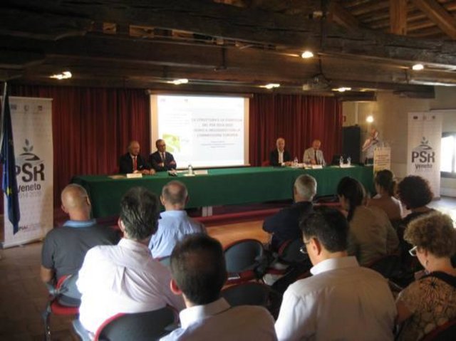
Rural development programme in the Veneto region [Italy]
Developing rural areas in the Veneto region through sustainable land management policies
- Compiler: Nicola Dal Ferro
2. Description of the SLM Technology
2.1 Short description of the Technology
Definition of the Technology:
Vegetated water basins for the control of diffuse pollution
2.2 Detailed description of the Technology
Description:
In the last 50 years high intensive monoculture practices implied an oversimplification of agro-ecosystems, a decline of biodiversity and a deterioration in the quality of water resources. The need to prevent nonpoint surface water pollution form agricultural practices has recently led to consider wetlands as effective depurative systems. Construction and maintenance of wetlands have been supported by the Veneto region as an agri-environmental measure through the Rural Development Programme (RDP).
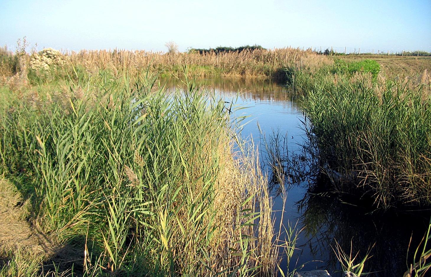
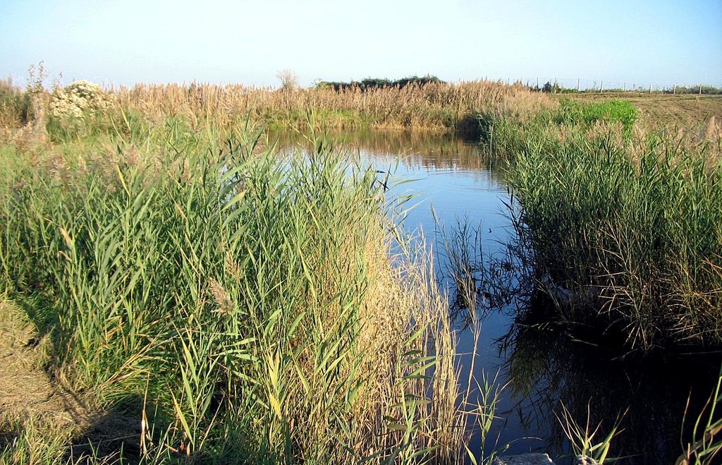
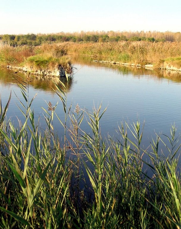
Purpose of the Technology: Wetland systems (WSs) depurate water resources from diffuse pollution, creating a semi-natural environment that promote wildlife and generally biodiversity. WS are characterised by the complete submersion (or for most part of the year) of the soil and a slow water flow that favour environmental and natural functions such as denitrification, flood control, suspended solids sedimentation. Moreover wetlands have been proposed as an alternative land use in reclaimed areas below the sea level which are facing problems of subsidence.
Establishment / maintenance activities and inputs: Thanks to their effectiveness on the improvement of agri-ecosystems, the maintenance and creation of wetland systems have been supported by the regional government in order to reduce the environmental impacts of conventional agriculture practices. The area invested to create a wetland depends on the input pollutants, the size of the area that is considered and the availability of space. The creation of a wetland system provides the establishment of emergent and submerged aquatic macrophytes on a water basin ca. 50 cm depth. The efficacy of water depuration is strictly related to the water residence time.
Natural / human environment: Adopting wetland systems allows to achieve several environmental benefits. Generally, the ecosystem is positively affected by the introduction of a water basin as it provides food, nesting cover and shaded areas to wildlife species. Sediment deposition, anaerobic denitrification conditions and the purifying effect of aquatic plants reduce eutrophication and improve the water quality. Due to their semi-natural structure and high differentiation of plant species, WSs enhance the quality of life through the improvement of agricultural landscape and the creation of recreational areas.
2.3 Photos of the Technology
2.5 Country/ region/ locations where the Technology has been applied and which are covered by this assessment
Country:
Italy
Region/ State/ Province:
Italy
Further specification of location:
Veneto region
2.6 Date of implementation
If precise year is not known, indicate approximate date:
- 10-50 years ago
2.7 Introduction of the Technology
Specify how the Technology was introduced:
- during experiments/ research
3. Classification of the SLM Technology
3.1 Main purpose(s) of the Technology
- conserve ecosystem
- protect a watershed/ downstream areas – in combination with other Technologies
3.2 Current land use type(s) where the Technology is applied

Cropland
- Annual cropping
Annual cropping - Specify crops:
- cereals - maize
- legumes and pulses - soya
- wheat
Number of growing seasons per year:
- 1
Specify:
Longest growing period in days: 210 Longest growing period from month to month: March to OctoberSecond longest growing period in days: 180

Waterways, waterbodies, wetlands
- Swamps, wetlands
Comments:
Major land use problems (compiler’s opinion): Diffuse water pollution due to intensive agriculture
Future (final) land use (after implementation of SLM Technology): Other: Oo: Other: wastelands, deserts, glaciers, swamps, recreation areas, etc
3.3 Has land use changed due to the implementation of the Technology?
Has land use changed due to the implementation of the Technology?
- Yes (Please fill out the questions below with regard to the land use before implementation of the Technology)

Cropland
- Annual cropping
3.4 Water supply
Water supply for the land on which the Technology is applied:
- mixed rainfed-irrigated
Comments:
Water supply: rainfed, full irrigation
3.5 SLM group to which the Technology belongs
- wetland protection/ management
3.6 SLM measures comprising the Technology

structural measures
- S11: Others
Comments:
Main measures: structural measures
Specification of other structural measures: Water basin
3.7 Main types of land degradation addressed by the Technology

biological degradation
- Bh: loss of habitats
- Bs: quality and species composition/ diversity decline

water degradation
- Hp: decline of surface water quality
Comments:
Main type of degradation addressed: Bh: loss of habitats, Bs: quality and species composition /diversity decline, Hp: decline of surface water quality
Main causes of degradation: soil management, population pressure
Secondary causes of degradation: crop management (annual, perennial, tree/shrub), deforestation / removal of natural vegetation (incl. forest fires)
3.8 Prevention, reduction, or restoration of land degradation
Specify the goal of the Technology with regard to land degradation:
- prevent land degradation
- reduce land degradation
Comments:
Main goals: prevention of land degradation
Secondary goals: mitigation / reduction of land degradation
4. Technical specifications, implementation activities, inputs, and costs
4.1 Technical drawing of the Technology
Technical specifications (related to technical drawing):
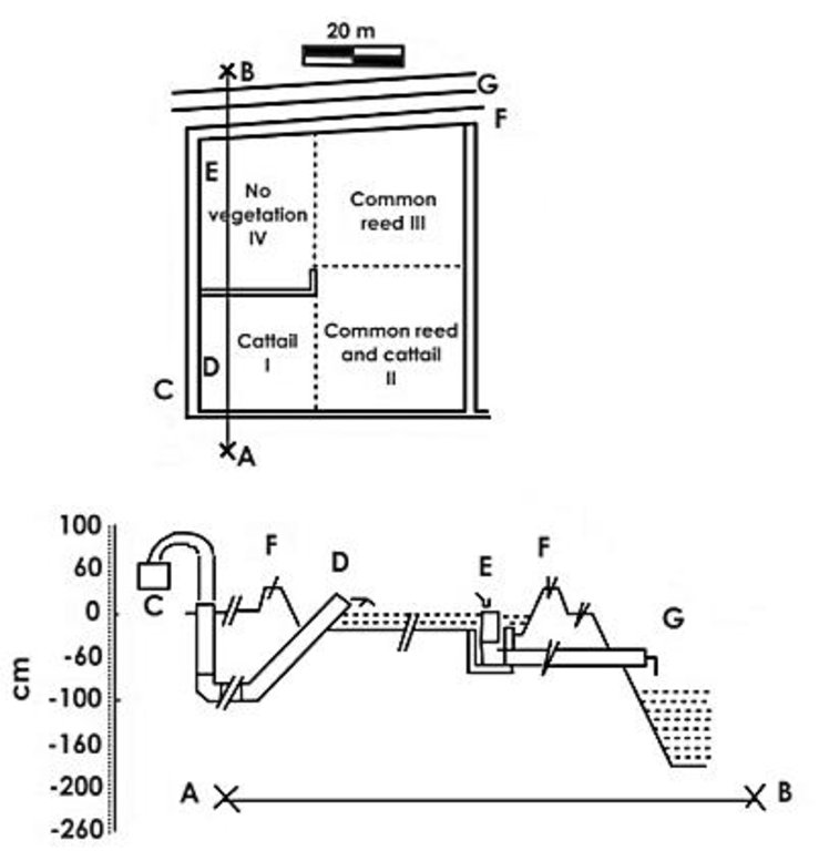
Plan and longitudinal view of a constructed wetland sited at the Experimental Farm of University of Padova. A-B: longitudinal section; C: pump; D: wetland inlet; E: wetland outlet; F: side bank; G: stream.
Location: Legnaro. Padova, Italy
Technical knowledge required for field staff / advisors: high
Technical knowledge required for land users: moderate
Main technical functions: control of dispersed runoff: retain / trap, control of dispersed runoff: impede / retard, improvement of water quality, buffering / filtering water
Dam/ pan/ pond
Height of bunds/banks/others (m): 0.3
Width of bunds/banks/others (m): 10
Length of bunds/banks/others (m): 40
Construction material (earth): Wetland banks are made locally by soil. Dimensions refer to 1 m3 water to treat/day
Author:
Passoni et al., 2009
4.2 General information regarding the calculation of inputs and costs
other/ national currency (specify):
Euro €
If relevant, indicate exchange rate from USD to local currency (e.g. 1 USD = 79.9 Brazilian Real): 1 USD =:
0.8
Indicate average wage cost of hired labour per day:
21.00
4.3 Establishment activities
| Activity | Timing (season) | |
|---|---|---|
| 1. | Capital costs for land, site investigation, plants, water control, media | |
| 2. | Not available |
4.4 Costs and inputs needed for establishment
| Specify input | Unit | Quantity | Costs per Unit | Total costs per input | % of costs borne by land users | |
|---|---|---|---|---|---|---|
| Other | Capital costs. System implementation | ha | 1.0 | 2500.0 | 2500.0 | 30.0 |
| Total costs for establishment of the Technology | 2500.0 | |||||
| Total costs for establishment of the Technology in USD | 3125.0 | |||||
5. Natural and human environment
5.1 Climate
Annual rainfall
- < 250 mm
- 251-500 mm
- 501-750 mm
- 751-1,000 mm
- 1,001-1,500 mm
- 1,501-2,000 mm
- 2,001-3,000 mm
- 3,001-4,000 mm
- > 4,000 mm
Agro-climatic zone
- sub-humid
Thermal climate class: temperate
5.2 Topography
Slopes on average:
- flat (0-2%)
- gentle (3-5%)
- moderate (6-10%)
- rolling (11-15%)
- hilly (16-30%)
- steep (31-60%)
- very steep (>60%)
Landforms:
- plateau/plains
- ridges
- mountain slopes
- hill slopes
- footslopes
- valley floors
Altitudinal zone:
- 0-100 m a.s.l.
- 101-500 m a.s.l.
- 501-1,000 m a.s.l.
- 1,001-1,500 m a.s.l.
- 1,501-2,000 m a.s.l.
- 2,001-2,500 m a.s.l.
- 2,501-3,000 m a.s.l.
- 3,001-4,000 m a.s.l.
- > 4,000 m a.s.l.
5.3 Soils
Soil depth on average:
- very shallow (0-20 cm)
- shallow (21-50 cm)
- moderately deep (51-80 cm)
- deep (81-120 cm)
- very deep (> 120 cm)
Soil texture (topsoil):
- coarse/ light (sandy)
- medium (loamy, silty)
Topsoil organic matter:
- medium (1-3%)
- low (<1%)
If available, attach full soil description or specify the available information, e.g. soil type, soil PH/ acidity, Cation Exchange Capacity, nitrogen, salinity etc.
Soil fertility is low-medium
Soil drainage/infiltration is medium
Soil water storage capacity is medium
5.4 Water availability and quality
Ground water table:
on surface
Availability of surface water:
good
Water quality (untreated):
for agricultural use only (irrigation)
Comments and further specifications on water quality and quantity:
Water quality (untreated): For agricultural use only (surface water) and good drinking water (groundwater)
5.5 Biodiversity
Species diversity:
- medium
5.6 Characteristics of land users applying the Technology
Market orientation of production system:
- commercial/ market
Off-farm income:
- less than 10% of all income
Relative level of wealth:
- average
- rich
Individuals or groups:
- individual/ household
Level of mechanization:
- mechanized/ motorized
Indicate other relevant characteristics of the land users:
Population density: 200-500 persons/km2
Annual population growth: 0.5% - 1%
5.7 Average area of land used by land users applying the Technology
- < 0.5 ha
- 0.5-1 ha
- 1-2 ha
- 2-5 ha
- 5-15 ha
- 15-50 ha
- 50-100 ha
- 100-500 ha
- 500-1,000 ha
- 1,000-10,000 ha
- > 10,000 ha
Is this considered small-, medium- or large-scale (referring to local context)?
- medium-scale
5.8 Land ownership, land use rights, and water use rights
Land use rights:
- individual
5.9 Access to services and infrastructure
health:
- poor
- moderate
- good
education:
- poor
- moderate
- good
technical assistance:
- poor
- moderate
- good
employment (e.g. off-farm):
- poor
- moderate
- good
markets:
- poor
- moderate
- good
energy:
- poor
- moderate
- good
roads and transport:
- poor
- moderate
- good
drinking water and sanitation:
- poor
- moderate
- good
financial services:
- poor
- moderate
- good
6. Impacts and concluding statements
6.1 On-site impacts the Technology has shown
Socio-economic impacts
Production
crop production
Water availability and quality
irrigation water availability
irrigation water quality
Socio-cultural impacts
cultural opportunities
Comments/ specify:
Increased awareness on biodiversity
recreational opportunities
Comments/ specify:
Agro-tourism in improved natural areas
Improved livelihoods and human well-being
Comments/ specify:
Improved agricultural landscape, biodiversity, agro-ecology and generally natural spaces, even for recreational activities. Moreover reduced water pollution.
Ecological impacts
Water cycle/ runoff
water quality
Biodiversity: vegetation, animals
plant diversity
beneficial species
habitat diversity
6.2 Off-site impacts the Technology has shown
water availability
reliable and stable stream flows in dry season
downstream siltation
groundwater/ river pollution
buffering/ filtering capacity
6.3 Exposure and sensitivity of the Technology to gradual climate change and climate-related extremes/ disasters (as perceived by land users)
Gradual climate change
Gradual climate change
| Season | increase or decrease | How does the Technology cope with it? | |
|---|---|---|---|
| annual temperature | increase | well |
Climate-related extremes (disasters)
Meteorological disasters
| How does the Technology cope with it? | |
|---|---|
| local rainstorm | well |
Climatological disasters
| How does the Technology cope with it? | |
|---|---|
| drought | not well |
Hydrological disasters
| How does the Technology cope with it? | |
|---|---|
| general (river) flood | well |
Other climate-related consequences
Other climate-related consequences
| How does the Technology cope with it? | |
|---|---|
| reduced growing period | well |
6.4 Cost-benefit analysis
How do the benefits compare with the establishment costs (from land users’ perspective)?
Short-term returns:
negative
Long-term returns:
positive
How do the benefits compare with the maintenance/ recurrent costs (from land users' perspective)?
Short-term returns:
neutral/ balanced
Long-term returns:
positive
Comments:
There is a need of initial investment, however wetlands can improve the multifunctionality of agricultural systems and create additional economic opportunities to the agro-ecological benefits.
6.5 Adoption of the Technology
Comments:
Comments on acceptance with external material support: The technology was supported by regional government and some farmers adopted it. However small farms (the majority in the area, just few hectares) can more difficulty adopt the technology due to a wide area required for its implementation.
Comments on spontaneous adoption: Very few adopted spontaneusly the technology
There is a little trend towards spontaneous adoption of the Technology
6.7 Strengths/ advantages/ opportunities of the Technology
| Strengths/ advantages/ opportunities in the compiler’s or other key resource person’s view |
|---|
|
Improves surface water quality How can they be sustained / enhanced? strenghten and support maintenance activity |
|
Increases recreational areas How can they be sustained / enhanced? Better territorial marketing |
|
Favours biodiversity and faces the loss of habitats How can they be sustained / enhanced? Enlarge wetland areas |
6.8 Weaknesses/ disadvantages/ risks of the Technology and ways of overcoming them
| Weaknesses/ disadvantages/ risks in the compiler’s or other key resource person’s view | How can they be overcome? |
|---|---|
| Reduces crop production | Differentiate the farmers' income |
7. References and links
7.1 Methods/ sources of information
7.2 References to available publications
Title, author, year, ISBN:
Treatment wetlands, Kadlec R.H & Wallace S.D., 2008
Title, author, year, ISBN:
Programma di sviluppo rurale per il veneto 2007-2013, Regione Veneto, 2007. Dipartimento Agricoltura e Sviluppo Rurale.
Links and modules
Expand all Collapse allLinks

Rural development programme in the Veneto region [Italy]
Developing rural areas in the Veneto region through sustainable land management policies
- Compiler: Nicola Dal Ferro
Modules
No modules


