Pond development in wetland areas [Lao People's Democratic Republic]
- Creation:
- Update:
- Compiler: kang phanvongsa
- Editors: Bounthanom Bouahom, Pasalath Khounsy
- Reviewers: Nicole Harari, Oulaytham Lasasimma, Alexandra Gavilano
technologies_2905 - Lao People's Democratic Republic
View sections
Expand all Collapse all1. General information
1.2 Contact details of resource persons and institutions involved in the assessment and documentation of the Technology
Key resource person(s)
land user:
Inphet Amthae
Lao People's Democratic Republic
land user:
keosonghueang tulan
Lao People's Democratic Republic
Name of project which facilitated the documentation/ evaluation of the Technology (if relevant)
Scaling-up SLM practices by smallholder farmers (IFAD)Name of the institution(s) which facilitated the documentation/ evaluation of the Technology (if relevant)
National Agriculture and Forestry Research Institute (NAFRI) - Lao People's Democratic Republic1.3 Conditions regarding the use of data documented through WOCAT
The compiler and key resource person(s) accept the conditions regarding the use of data documented through WOCAT:
Yes
1.4 Declaration on sustainability of the described Technology
Is the Technology described here problematic with regard to land degradation, so that it cannot be declared a sustainable land management technology?
No
2. Description of the SLM Technology
2.1 Short description of the Technology
Definition of the Technology:
Conversion of wetland plots into fishpond.
2.2 Detailed description of the Technology
Description:
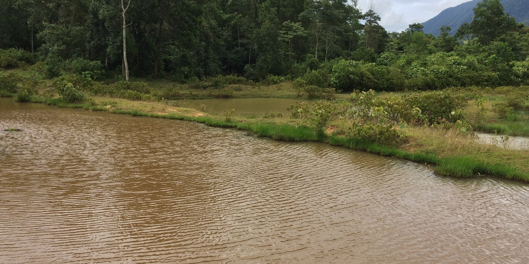
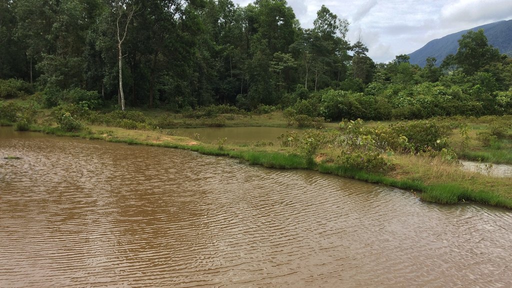
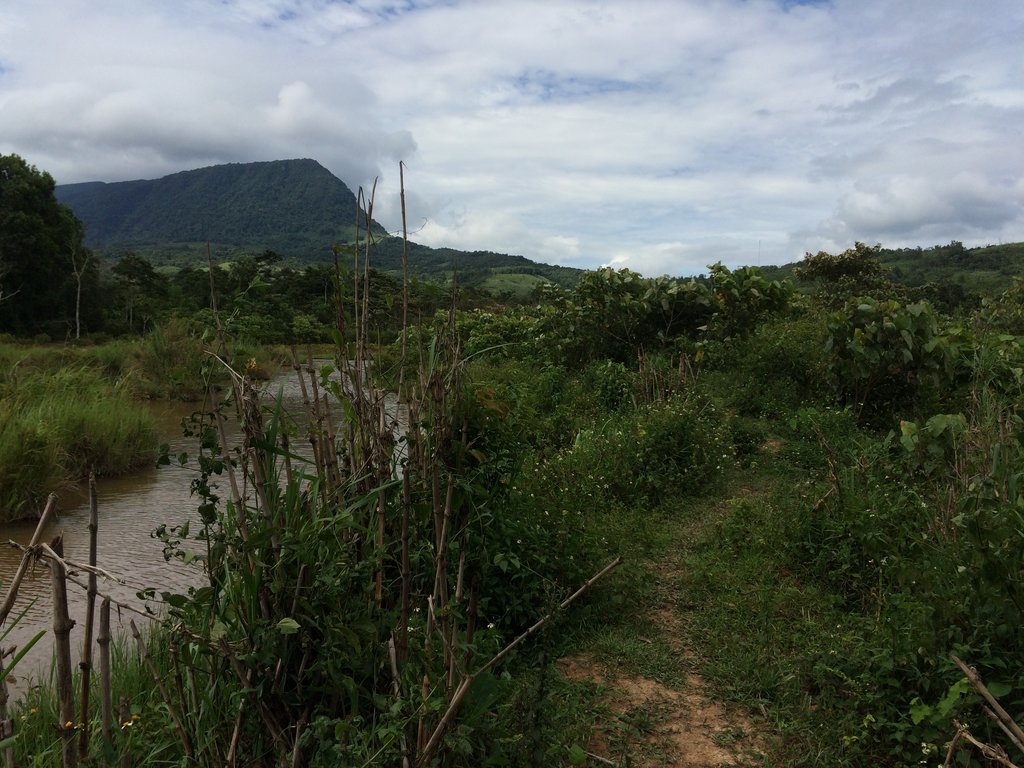
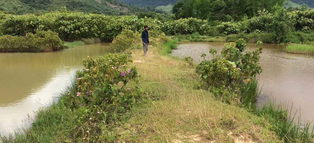
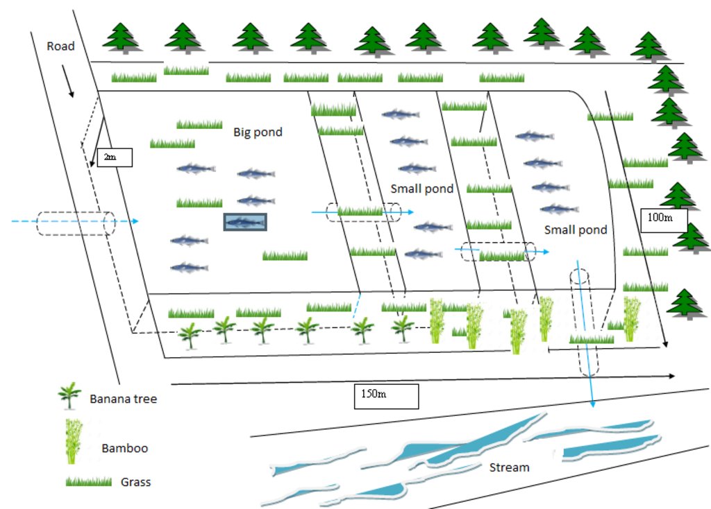
At Asoy village and its neighboring villages in the Salavan Province of Lao PDR some rice fields were regularly flood prone during rainy season (August ̶ October) because of a newly constructed road containing culverts leading first through the rice fields and then into natural water ways. Therefore, in 2005 one of the village's land users spread the idea to convert this regularly damaged and increasingly unproductive rice land into fish ponds. The soil texture in this area is mostly clayey and therefore also generally not very suitable for agriculture, but certainly appropriate for water holding throughout the year. Thus, the main objective of these pond constructions was the raising of fishes for income generation and for getting water for household purposes during dry season; e.g. for gardening, fodder production, and for banana and bamboo cultivation along the edges of the pond dikes. The fishpond should also provide water for livestock such as cattle, buffalo, and poultry farming. The construction of the ponds in the case documented here started by shutting off the culvert at the inlets by using sawn wood and clay to close the concrete pipe (Ø80 cm) crossing the road. After, vegetation clearance was required by using a bulldozer. A backhoe then was applied to excavate an area of 1.5 ha to create a first big pond (150 m long and 100 m wide). The excavated soil was used directly for the dike construction. The dikes were around 2.5 m high and 2 m wide. For the first big pond only two dikes had to be shaped because the other two sides were road and fallow. At completion of the big pond, two smaller ponds have been constructed also by backhoe directly next to it. The first of them encompasses an area of 2,000 square meters (20 m x 100 m) and the second 3,000 square meters (30 m x 100 m). After this, four new Ø40 cm drainage pipes were installed; a first one throughout the road leading into the first pond, two of them connecting the ponds and the last pipe is needed to lead the water finally into the natural water way. The pipes have to be installed at a height of 50 cm from the edges. To stabilize the ponds Napier grass, banana, and bamboo can be cultivated on the top of the dikes. Maintenance of the pond requires regular cutting of the Napier grass, which is done by hand. Also regular weeding of the dike’s edges is required, as well as the stabilization of the embankments by using timber and soil. Where repair is required, the timber can be placed vertically, and then filled out with soil. The ponds are hold and maintained individually by the land owner and the benefit of them is considerable. The annual fish production is approximately 1 ton , equivalent to 15 million Kip . The ponds also store water for utilization during dry season especially for the animals (cattle, buffalos, and poultries). The grass growing on the edges can serve as fodder for animals. Banana and bamboo shoots can be consumed and sold for income generation. Material from branches of bamboo trees is used for handicrafts such as baskets and bamboo sheets for house walls, etc. The fishpond improves the aquatic ecosystem habitats in the area. The pond provides spawning areas for a large variety of fish, shrimp, crab, and frog species. However, with changing climate and rainfall patterns it happened that the ponds dried up and the soil became hard with rapidly growing weed around the ponds. Plants such as Napier and banana that are cultivated on the edge of the dikes can die. On the other hand in particular years, there flash floods occur that can affect the dikes due to rapid water runoff; in consequence also fish and other aquatic species can be lost and crops can be damaged. Nonetheless, the land owners at Asoy village prefer this technology and want to expand and improve it, when they have capability or when support from external institutions can be expected (e.g. training in fish breeding and required equipment such as hapa fish net for fish nursery, air pump, dip nets and harvesting net). Finally, the fishponds have been expanded to neighboring villages as well.
2.3 Photos of the Technology
2.5 Country/ region/ locations where the Technology has been applied and which are covered by this assessment
Country:
Lao People's Democratic Republic
Region/ State/ Province:
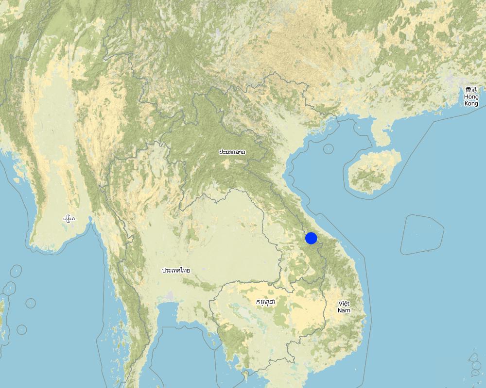
Samoaui district, Salavan province
Further specification of location:
Asoy village
Specify the spread of the Technology:
- applied at specific points/ concentrated on a small area
Map
×2.6 Date of implementation
Indicate year of implementation:
2005
If precise year is not known, indicate approximate date:
- 10-50 years ago
2.7 Introduction of the Technology
Specify how the Technology was introduced:
- through land users' innovation
3. Classification of the SLM Technology
3.1 Main purpose(s) of the Technology
- improve production
- reduce, prevent, restore land degradation
- create beneficial economic impact
3.2 Current land use type(s) where the Technology is applied

Waterways, waterbodies, wetlands
- Ponds, dams
Main products/ services:
Fishs
Comments:
Number of growing seasons per year: 1
Livestock density : 5 buffalo, 7 goats, 30 pigs, 7 cows
3.3 Has land use changed due to the implementation of the Technology?
Has land use changed due to the implementation of the Technology?
- Yes (Please fill out the questions below with regard to the land use before implementation of the Technology)

Other
Specify:
Wetland
Comments:
Before implementation of the Technology this land was a wetland that is unsuitable for agricultural activities
3.4 Water supply
Water supply for the land on which the Technology is applied:
- rainfed
3.5 SLM group to which the Technology belongs
- water harvesting
- beekeeping, aquaculture, poultry, rabbit farming, silkworm farming, etc.
3.6 SLM measures comprising the Technology

structural measures
- S5: Dams, pans, ponds
3.7 Main types of land degradation addressed by the Technology

soil erosion by water
- Wg: gully erosion/ gullying

water degradation
- Hw: reduction of the buffering capacity of wetland areas
3.8 Prevention, reduction, or restoration of land degradation
Specify the goal of the Technology with regard to land degradation:
- adapt to land degradation
4. Technical specifications, implementation activities, inputs, and costs
4.1 Technical drawing of the Technology
Technical specifications (related to technical drawing):
- The dykes height is approximately 2.5m, and the water level from the bottom to the drainage pipe is 2 meters, and the canal width is 3 meters.
- The total size is 100m x150m
- Slope 3-5 %
- Water storage capacity 30,000m3
- Water storage area 1.5 ha
- Development inputs include land, concrete pipes, and sawn woods
- Fish species include: tilapia, grass fish, and crab
Author:
Phonesyli phanvongsa
Date:
05/07/2017
4.2 General information regarding the calculation of inputs and costs
Specify how costs and inputs were calculated:
- per Technology unit
Specify unit:
1.5 ha
other/ national currency (specify):
kip
If relevant, indicate exchange rate from USD to local currency (e.g. 1 USD = 79.9 Brazilian Real): 1 USD =:
8500.0
Indicate average wage cost of hired labour per day:
50,000
4.3 Establishment activities
| Activity | Timing (season) | |
|---|---|---|
| 1. | Close up the stream | before on set of rain |
| 2. | Exaction works at the bog wetland or seasonal flood prone area | |
| 3. | Build dykes (use backhoe) |
4.4 Costs and inputs needed for establishment
| Specify input | Unit | Quantity | Costs per Unit | Total costs per input | % of costs borne by land users | |
|---|---|---|---|---|---|---|
| Labour | labour | person-day | 50.0 | 50000.0 | 2500000.0 | 100.0 |
| Labour | excavator | machine | 1.0 | 3000000.0 | 3000000.0 | 100.0 |
| Equipment | hoe | piece | 20.0 | 50000.0 | 1000000.0 | 100.0 |
| Equipment | shovel | piece | 20.0 | 30000.0 | 600000.0 | 100.0 |
| Equipment | knife | piece | 5.0 | 20000.0 | 100000.0 | 100.0 |
| Plant material | fodder | bunch | 3.0 | 20000.0 | 60000.0 | 100.0 |
| Other | Fry | Fry | 2400.0 | 1000.0 | 2400000.0 | 100.0 |
| Total costs for establishment of the Technology | 9660000.0 | |||||
| Total costs for establishment of the Technology in USD | 1136.47 | |||||
Comments:
The costs for the driver is included in the hiring costs the excavator of the pond.
4.5 Maintenance/ recurrent activities
| Activity | Timing/ frequency | |
|---|---|---|
| 1. | Canal maintenance | yearly |
| 2. | Canal reparation | yearly |
| 3. | Canal reparation | yearly |
4.6 Costs and inputs needed for maintenance/ recurrent activities (per year)
| Specify input | Unit | Quantity | Costs per Unit | Total costs per input | % of costs borne by land users | |
|---|---|---|---|---|---|---|
| Labour | labour | person | 6.0 | 50000.0 | 300000.0 | |
| Equipment | hoe | piece | 1.0 | 50000.0 | 50000.0 | |
| Equipment | shovel | piece | 2.0 | 30000.0 | 60000.0 | |
| Equipment | knife | piece | 1.0 | 20000.0 | 20000.0 | |
| Equipment | trolley | piece | 2.0 | 250000.0 | 500000.0 | |
| Total costs for maintenance of the Technology | 930000.0 | |||||
| Total costs for maintenance of the Technology in USD | 109.41 | |||||
4.7 Most important factors affecting the costs
Describe the most determinate factors affecting the costs:
Cost for labour and backhoe service is the most important input.
5. Natural and human environment
5.1 Climate
Annual rainfall
- < 250 mm
- 251-500 mm
- 501-750 mm
- 751-1,000 mm
- 1,001-1,500 mm
- 1,501-2,000 mm
- 2,001-3,000 mm
- 3,001-4,000 mm
- > 4,000 mm
Specify average annual rainfall (if known), in mm:
2000.00
Specifications/ comments on rainfall:
Rainy season from May to November, highest rainfall between July to October. dry season from December to March April (rainfall)
Indicate the name of the reference meteorological station considered:
Samoui Agriculture Office
Agro-climatic zone
- humid
5.2 Topography
Slopes on average:
- flat (0-2%)
- gentle (3-5%)
- moderate (6-10%)
- rolling (11-15%)
- hilly (16-30%)
- steep (31-60%)
- very steep (>60%)
Landforms:
- plateau/plains
- ridges
- mountain slopes
- hill slopes
- footslopes
- valley floors
Altitudinal zone:
- 0-100 m a.s.l.
- 101-500 m a.s.l.
- 501-1,000 m a.s.l.
- 1,001-1,500 m a.s.l.
- 1,501-2,000 m a.s.l.
- 2,001-2,500 m a.s.l.
- 2,501-3,000 m a.s.l.
- 3,001-4,000 m a.s.l.
- > 4,000 m a.s.l.
Indicate if the Technology is specifically applied in:
- convex situations
5.3 Soils
Soil depth on average:
- very shallow (0-20 cm)
- shallow (21-50 cm)
- moderately deep (51-80 cm)
- deep (81-120 cm)
- very deep (> 120 cm)
Soil texture (topsoil):
- fine/ heavy (clay)
Soil texture (> 20 cm below surface):
- medium (loamy, silty)
- fine/ heavy (clay)
Topsoil organic matter:
- medium (1-3%)
5.4 Water availability and quality
Ground water table:
5-50 m
Availability of surface water:
good
Water quality (untreated):
good drinking water
Is water salinity a problem?
No
Is flooding of the area occurring?
Yes
Regularity:
frequently
5.5 Biodiversity
Species diversity:
- medium
Habitat diversity:
- medium
5.6 Characteristics of land users applying the Technology
Sedentary or nomadic:
- Sedentary
Market orientation of production system:
- subsistence (self-supply)
Off-farm income:
- 10-50% of all income
Relative level of wealth:
- average
Individuals or groups:
- individual/ household
Level of mechanization:
- manual work
Gender:
- men
Age of land users:
- youth
- middle-aged
5.7 Average area of land used by land users applying the Technology
- < 0.5 ha
- 0.5-1 ha
- 1-2 ha
- 2-5 ha
- 5-15 ha
- 15-50 ha
- 50-100 ha
- 100-500 ha
- 500-1,000 ha
- 1,000-10,000 ha
- > 10,000 ha
Is this considered small-, medium- or large-scale (referring to local context)?
- medium-scale
5.8 Land ownership, land use rights, and water use rights
Land ownership:
- individual, titled
Land use rights:
- individual
Water use rights:
- individual
5.9 Access to services and infrastructure
health:
- poor
- moderate
- good
education:
- poor
- moderate
- good
technical assistance:
- poor
- moderate
- good
employment (e.g. off-farm):
- poor
- moderate
- good
markets:
- poor
- moderate
- good
energy:
- poor
- moderate
- good
roads and transport:
- poor
- moderate
- good
drinking water and sanitation:
- poor
- moderate
- good
financial services:
- poor
- moderate
- good
6. Impacts and concluding statements
6.1 On-site impacts the Technology has shown
Socio-economic impacts
Production
crop production
Comments/ specify:
After ponds construction various crops can be planted on the dike of the ponds.
animal production
Quantity before SLM:
Very rare
Quantity after SLM:
1 ton of fish
Comments/ specify:
Before, only small amount of fish was captured because the fish came only from natural water bodies. The farmer also increased the poultry due to the fish ponds.
risk of production failure
Comments/ specify:
Before, only small amount of fish was captured because the fish came only from natural water bodies. The farmer also increased the poultry due to the fish ponds.
land management
Quantity before SLM:
No management (bog wetland)
Quantity after SLM:
fish farm management
Comments/ specify:
water harvesting and fish production
Water availability and quality
water availability for livestock
Comments/ specify:
Before they was only a not very suitable natural bog area that accumulated peat from dead plant material and contained only shallow water. After the pond construction the water was deep enough for fish production, drinking water for livestock and also for crop irrigation.
Income and costs
expenses on agricultural inputs
Comments/ specify:
After completion of the pond the farmer has to buy costly fish breed every year from Vietnam (1000 kip/fry)
farm income
Comments/ specify:
Before the pond construction the farmer produced only for reaching self sufficiency without any income from the agricultural production. After implementation of the technology the farmer got income from fish, crop and fruit at around 15 million kip/year.
diversity of income sources
Comments/ specify:
Previously there is not any income from agriculture produce, after pond have been complete, they have many kind of produce for sell such as banana, vegetation, fish
workload
Comments/ specify:
Previously the farmer relied on natural wetland without substantial maintenance work. Then after completing the ponds the farmer has to spend quite a lot of work time to maintain them properly.
Socio-cultural impacts
food security/ self-sufficiency
Comments/ specify:
After pond construction the family was able to increase food sedcurity and self-sufficiency as they got supplmentary fish, fruits and other crops for self-consumption. Futher, they were able to sale the products and by this getting money when required.
recreational opportunities
Comments/ specify:
The pond serves now as recreational site for fishing and swimming.
Ecological impacts
Water cycle/ runoff
harvesting/ collection of water
Comments/ specify:
Before, the water streamed though the land without beeing harvested. Since the creation of the ponds - which were surrounded by dykes - the water were collected and stored easily for different already mentioned purposes.
surface runoff
Comments/ specify:
Soil surface runoff and accumulate in down stream. the ponds can control and reduced runoff by by overflow, the sediment are accumulated on pond bottom
Biodiversity: vegetation, animals
beneficial species
Comments/ specify:
There are many kind of animals in the area including prey ( rats, fish, frogs...) and predators ( snakes, snake fish, bird...), all acting as a small food chain elements.
habitat diversity
Comments/ specify:
The increase in animal types and animal species in the area indicates the increase of the habitat diversity.
6.3 Exposure and sensitivity of the Technology to gradual climate change and climate-related extremes/ disasters (as perceived by land users)
Gradual climate change
Gradual climate change
| Season | increase or decrease | How does the Technology cope with it? | |
|---|---|---|---|
| annual temperature | increase | moderately | |
| seasonal temperature | dry season | increase | well |
| annual rainfall | increase | moderately | |
| seasonal rainfall | wet/ rainy season | decrease | moderately |
Climate-related extremes (disasters)
Meteorological disasters
| How does the Technology cope with it? | |
|---|---|
| local rainstorm | very well |
| local hailstorm | very well |
Climatological disasters
| How does the Technology cope with it? | |
|---|---|
| drought | well |
Hydrological disasters
| How does the Technology cope with it? | |
|---|---|
| flash flood | well |
Biological disasters
| How does the Technology cope with it? | |
|---|---|
| insect/ worm infestation | moderately |
Other climate-related consequences
Other climate-related consequences
| How does the Technology cope with it? | |
|---|---|
| extended growing period | moderately |
6.4 Cost-benefit analysis
How do the benefits compare with the establishment costs (from land users’ perspective)?
Short-term returns:
neutral/ balanced
Long-term returns:
slightly positive
How do the benefits compare with the maintenance/ recurrent costs (from land users' perspective)?
Short-term returns:
slightly positive
Long-term returns:
slightly positive
6.5 Adoption of the Technology
- > 50%
Of all those who have adopted the Technology, how many did so spontaneously, i.e. without receiving any material incentives/ payments?
- 91-100%
6.6 Adaptation
Has the Technology been modified recently to adapt to changing conditions?
No
6.7 Strengths/ advantages/ opportunities of the Technology
| Strengths/ advantages/ opportunities in the land user’s view |
|---|
| Increased aquatic resources with a variety of species including crabs, shrimps, fishes, snails |
| Suitable to carry out agricultural activities all year-round including crops and animal raising |
| Increased food security and cash crop production |
| Strengths/ advantages/ opportunities in the compiler’s or other key resource person’s view |
|---|
| Having sufficient food for the whole year from agriculture production such as crops and animals |
| Able to produce fry for individual ponds and distribute to others |
| Able to store water for agricultural activities (cultivation and animal feeding) during dry season |
| Able to generate income for households from integrated fishing practices |
6.8 Weaknesses/ disadvantages/ risks of the Technology and ways of overcoming them
| Weaknesses/ disadvantages/ risks in the land user’s view | How can they be overcome? |
|---|---|
| Lack of fund to maintain the ponds | Producing fry by themselves for sale. By this, creating fund for solid maintenance work. |
| Occasional floods cause repair work of the pond dykes | |
| Some times, occurring droughts run the ponds dry. |
| Weaknesses/ disadvantages/ risks in the compiler’s or other key resource person’s view | How can they be overcome? |
|---|---|
| Lack of expertise in fish raising and breeding | provide fish breeding training activities for local people |
| Lack of fund for fish raising and fish breeding (purchase of juvenile fish is needed) | provide equipment or fish breeds |
7. References and links
7.1 Methods/ sources of information
- field visits, field surveys
1 place
- interviews with land users
2 persons
When were the data compiled (in the field)?
04/07/2017
Links and modules
Expand all Collapse allLinks
No links
Modules
No modules


