Vegetative riparian buffers [Hungary]
- Creation:
- Update:
- Compiler: Brigitta Szabó
- Editors: Piroska Kassai, Zoltan Toth
- Reviewers: William Critchley, Rima Mekdaschi Studer
Vízparti erdős puffersáv
technologies_6204 - Hungary
View sections
Expand all Collapse all1. General information
1.2 Contact details of resource persons and institutions involved in the assessment and documentation of the Technology
Name of project which facilitated the documentation/ evaluation of the Technology (if relevant)
OPtimal strategies to retAIN and re-use water and nutrients in small agricultural catchments across different soil-climatic regions in Europe (OPTAIN)Name of the institution(s) which facilitated the documentation/ evaluation of the Technology (if relevant)
Institute for Soil Sciences, Centre for Agricultural Research (ATK TAKI) - Hungary1.3 Conditions regarding the use of data documented through WOCAT
The compiler and key resource person(s) accept the conditions regarding the use of data documented through WOCAT:
Yes
1.4 Declaration on sustainability of the described Technology
Is the Technology described here problematic with regard to land degradation, so that it cannot be declared a sustainable land management technology?
No
2. Description of the SLM Technology
2.1 Short description of the Technology
Definition of the Technology:
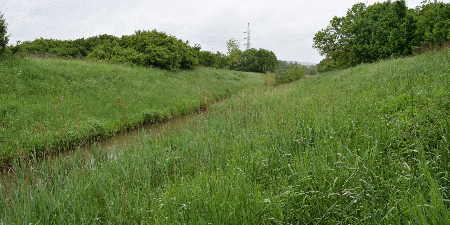
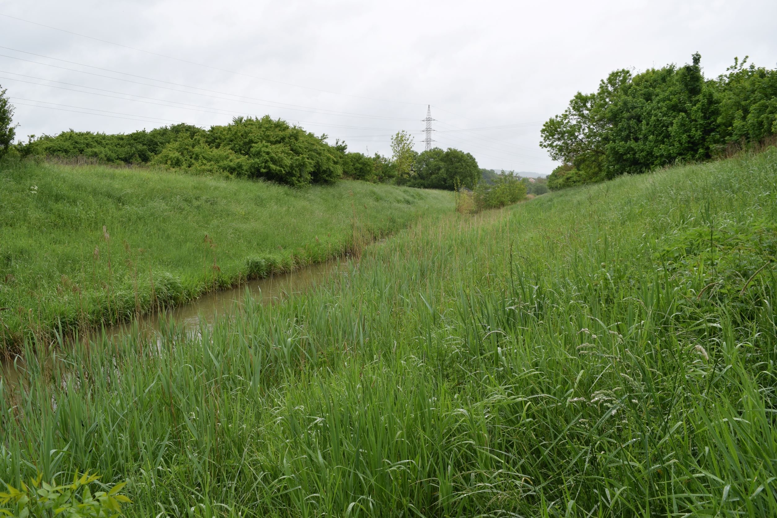
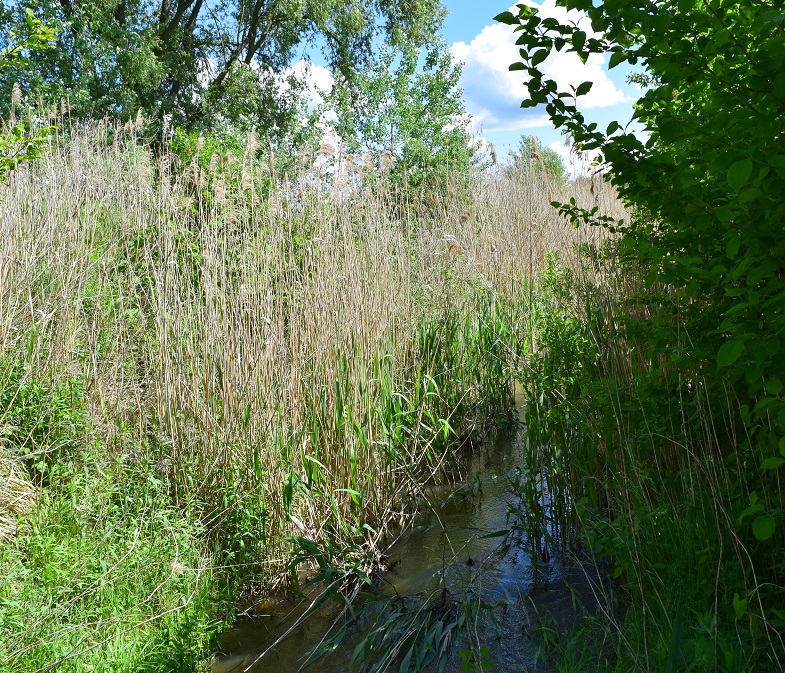
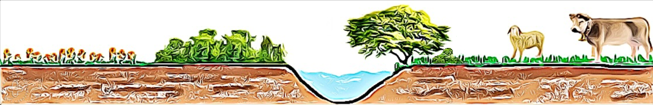
Vegetative riparian buffers are strips of trees, bushes and grass alongside surface water bodies such as streams or ponds. Their main function is to provide a natural buffer strip to filter out nutrient and sediment transported from agricultural fields and prevent it reaching the water bodies - as well as maintaining undisturbed green corridors.
2.2 Detailed description of the Technology
Description:
Vegetative riparian buffers are strips of trees and other vegetation alongside surface water bodies such as streams or ponds. They are used in natural environments, as well as in urban, agricultural and wetland areas. Their main function is to provide a natural buffer to increase infiltration, and to filter out nutrients and sediment transported from agricultural fields – thus preventing it reaching (and polluting) water bodies. Riparian buffers also help moderate flow. Creating such green corridors alongside waterlines is advantageous ecologically as well. However, land users usually prefer cultivating the largest possible area of land, so they dislike leaving significant areas abandoned to nature. Another complaint is that riparian buffers provide habitats for wildlife, often resulting in damage to cropland.
Where a natural buffer does not exist - mostly in the neighbourhood of agricultural fields - it can be created by planting trees and bushes alongside the water body. Variable buffer width design with an average width of 15 m (max. 20 m) is recommended.
2.3 Photos of the Technology
Media Gallery

2.4 Videos of the Technology
Comments, short description:
no videos available
Location:
-
Name of videographer:
-
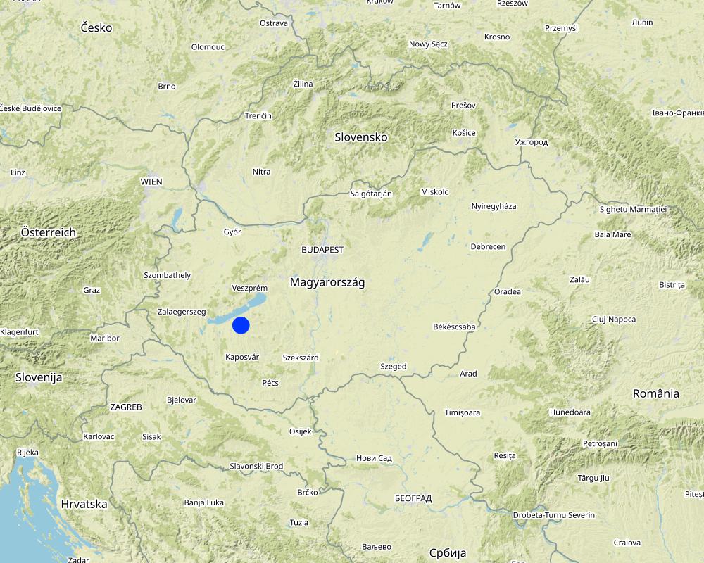
2.5 Country/ region/ locations where the Technology has been applied and which are covered by this assessment
Country:
Hungary
Region/ State/ Province:
Somogy
Further specification of location:
The site where the technology is applied is situated within the catchment of Tetves stream, which belongs to the Balaton Catchment Area in the western Hungary. The climate is moderately warm, moderately humid, mean annual temperature is about 10 ˚C. The average amount of rainfall is between 600 and 700 mm / year.
Specify the spread of the Technology:
- applied at specific points/ concentrated on a small area
Is/are the technology site(s) located in a permanently protected area?
No
Map
×2.6 Date of implementation
If precise year is not known, indicate approximate date:
- 10-50 years ago
2.7 Introduction of the Technology
Specify how the Technology was introduced:
- as part of a traditional system (> 50 years)
3. Classification of the SLM Technology
3.1 Main purpose(s) of the Technology
- reduce, prevent, restore land degradation
- conserve ecosystem
- protect a watershed/ downstream areas – in combination with other Technologies
3.2 Current land use type(s) where the Technology is applied
Land use mixed within the same land unit:
No

Cropland
- Annual cropping
Annual cropping - Specify crops:
- cereals - barley
- cereals - maize
- cereals - wheat (winter)
- oilseed crops - sunflower, rapeseed, other
Number of growing seasons per year:
- 1
Is intercropping practiced?
Yes
Is crop rotation practiced?
Yes
If yes, specify:
winter wheat-maize-sunflower-barley

Grazing land
Extensive grazing:
- Semi-nomadic pastoralism
Animal type:
- cattle - dairy and beef (e.g. zebu)

Waterways, waterbodies, wetlands
- Drainage lines, waterways
3.3 Has land use changed due to the implementation of the Technology?
Has land use changed due to the implementation of the Technology?
- Yes (Please fill out the questions below with regard to the land use before implementation of the Technology)
Land use mixed within the same land unit:
No

Forest/ woodlands
- (Semi-)natural forests/ woodlands
- Tree plantation, afforestation
(Semi-)natural forests/ woodlands: Specify management type:
- Dead wood/ prunings removal
Tree plantation, afforestation: Specify origin and composition of species:
- Mixed varieties
Type of tree plantation, afforestation:
- temperate continental forest plantation
Type of tree:
- Salix species
- Alnus glutionosa
Are the trees specified above deciduous or evergreen?
- deciduous
Products and services:
- Nature conservation/ protection
3.4 Water supply
Water supply for the land on which the Technology is applied:
- rainfed
3.5 SLM group to which the Technology belongs
- natural and semi-natural forest management
- forest plantation management
- surface water management (spring, river, lakes, sea)
3.6 SLM measures comprising the Technology

vegetative measures
- V1: Tree and shrub cover
3.7 Main types of land degradation addressed by the Technology

soil erosion by water
- Wr: riverbank erosion
- Wo: offsite degradation effects

water degradation
- Hp: decline of surface water quality
- Hq: decline of groundwater quality
3.8 Prevention, reduction, or restoration of land degradation
Specify the goal of the Technology with regard to land degradation:
- reduce land degradation
4. Technical specifications, implementation activities, inputs, and costs
4.1 Technical drawing of the Technology
Technical specifications (related to technical drawing):
A variable buffer width design with a basic width of 15 m (max 20 m) is recommended.
Author:
Piroska Kassai
Date:
15/03/2023
4.2 General information regarding the calculation of inputs and costs
Specify how costs and inputs were calculated:
- per Technology area
Indicate size and area unit:
hectare (20X500 m)
Specify currency used for cost calculations:
- USD
Indicate average wage cost of hired labour per day:
50
4.3 Establishment activities
| Activity | Timing (season) | |
|---|---|---|
| 1. | Soil preparation | any season |
| 2. | Planting | autumn |
4.4 Costs and inputs needed for establishment
| Specify input | Unit | Quantity | Costs per Unit | Total costs per input | % of costs borne by land users | |
|---|---|---|---|---|---|---|
| Labour | Soil preparation | person-day | 2.0 | 50.0 | 100.0 | 100.0 |
| Labour | Planting (4000 seedlings on 1 hectare) | person-day | 3.0 | 50.0 | 150.0 | 100.0 |
| Equipment | Soil preparation | hiring cost/day | 1.0 | 400.0 | 400.0 | 100.0 |
| Equipment | Planting | hiring cost/day | 1.0 | 100.0 | 100.0 | 100.0 |
| Plant material | Seedlings | piece | 4000.0 | 0.1 | 400.0 | 100.0 |
| Total costs for establishment of the Technology | 1150.0 | |||||
| Total costs for establishment of the Technology in USD | 1150.0 | |||||
If land user bore less than 100% of costs, indicate who covered the remaining costs:
-
4.5 Maintenance/ recurrent activities
| Activity | Timing/ frequency | |
|---|---|---|
| 1. | No maintenance required |
4.6 Costs and inputs needed for maintenance/ recurrent activities (per year)
| Specify input | Unit | Quantity | Costs per Unit | Total costs per input | % of costs borne by land users | |
|---|---|---|---|---|---|---|
| Labour | No maintenance required |
If land user bore less than 100% of costs, indicate who covered the remaining costs:
-
4.7 Most important factors affecting the costs
Describe the most determinate factors affecting the costs:
-
5. Natural and human environment
5.1 Climate
Annual rainfall
- < 250 mm
- 251-500 mm
- 501-750 mm
- 751-1,000 mm
- 1,001-1,500 mm
- 1,501-2,000 mm
- 2,001-3,000 mm
- 3,001-4,000 mm
- > 4,000 mm
Specify average annual rainfall (if known), in mm:
653.00
Specifications/ comments on rainfall:
the distribution of the precipitation is uneven
Indicate the name of the reference meteorological station considered:
Keszthely meteorological station
Agro-climatic zone
- sub-humid
5.2 Topography
Slopes on average:
- flat (0-2%)
- gentle (3-5%)
- moderate (6-10%)
- rolling (11-15%)
- hilly (16-30%)
- steep (31-60%)
- very steep (>60%)
Landforms:
- plateau/plains
- ridges
- mountain slopes
- hill slopes
- footslopes
- valley floors
Altitudinal zone:
- 0-100 m a.s.l.
- 101-500 m a.s.l.
- 501-1,000 m a.s.l.
- 1,001-1,500 m a.s.l.
- 1,501-2,000 m a.s.l.
- 2,001-2,500 m a.s.l.
- 2,501-3,000 m a.s.l.
- 3,001-4,000 m a.s.l.
- > 4,000 m a.s.l.
Indicate if the Technology is specifically applied in:
- concave situations
5.3 Soils
Soil depth on average:
- very shallow (0-20 cm)
- shallow (21-50 cm)
- moderately deep (51-80 cm)
- deep (81-120 cm)
- very deep (> 120 cm)
Soil texture (topsoil):
- medium (loamy, silty)
Soil texture (> 20 cm below surface):
- medium (loamy, silty)
Topsoil organic matter:
- medium (1-3%)
5.4 Water availability and quality
Ground water table:
< 5 m
Availability of surface water:
good
Water quality (untreated):
poor drinking water (treatment required)
Water quality refers to:
surface water
Is water salinity a problem?
No
Is flooding of the area occurring?
Yes
5.5 Biodiversity
Species diversity:
- high
Habitat diversity:
- high
5.6 Characteristics of land users applying the Technology
Sedentary or nomadic:
- Sedentary
Market orientation of production system:
- commercial/ market
Off-farm income:
- less than 10% of all income
Relative level of wealth:
- average
Individuals or groups:
- individual/ household
Level of mechanization:
- mechanized/ motorized
Gender:
- men
Age of land users:
- middle-aged
5.7 Average area of land used by land users applying the Technology
- < 0.5 ha
- 0.5-1 ha
- 1-2 ha
- 2-5 ha
- 5-15 ha
- 15-50 ha
- 50-100 ha
- 100-500 ha
- 500-1,000 ha
- 1,000-10,000 ha
- > 10,000 ha
Is this considered small-, medium- or large-scale (referring to local context)?
- small-scale
5.8 Land ownership, land use rights, and water use rights
Land ownership:
- individual, not titled
- individual, titled
Land use rights:
- leased
- individual
Water use rights:
- communal (organized)
Are land use rights based on a traditional legal system?
Yes
5.9 Access to services and infrastructure
health:
- poor
- moderate
- good
education:
- poor
- moderate
- good
technical assistance:
- poor
- moderate
- good
employment (e.g. off-farm):
- poor
- moderate
- good
markets:
- poor
- moderate
- good
energy:
- poor
- moderate
- good
roads and transport:
- poor
- moderate
- good
drinking water and sanitation:
- poor
- moderate
- good
financial services:
- poor
- moderate
- good
6. Impacts and concluding statements
6.1 On-site impacts the Technology has shown
Socio-economic impacts
Production
crop production
Comments/ specify:
Crop production will decrease slightly because the cultivated area will be less, but it is not significant from an economic point of view.
production area
Socio-cultural impacts
recreational opportunities
Comments/ specify:
It creates shade and a pleasant space for recreation.
Ecological impacts
Water cycle/ runoff
water quality
Comments/ specify:
Both on-site and off-site positive effect can be observed because the inflow waters (e.g Tetves) quality can help to protect Lake Balaton from eutrophication.
Soil
soil loss
Biodiversity: vegetation, animals
Vegetation cover
Comments/ specify:
Riparian buffers are permanent vegetation covers.
habitat diversity
Comments/ specify:
It provides a wildlife habitat and corridors for terrestrial organisms
6.2 Off-site impacts the Technology has shown
groundwater/ river pollution
buffering/ filtering capacity
Comments/ specify:
It can filter nutrients, pesticides, and animal waste from agricultural land runoff
6.3 Exposure and sensitivity of the Technology to gradual climate change and climate-related extremes/ disasters (as perceived by land users)
Gradual climate change
Gradual climate change
| Season | increase or decrease | How does the Technology cope with it? | |
|---|---|---|---|
| annual temperature | increase | well | |
| seasonal rainfall | summer | decrease | moderately |
Climate-related extremes (disasters)
Hydrological disasters
| How does the Technology cope with it? | |
|---|---|
| landslide | not well |
6.4 Cost-benefit analysis
How do the benefits compare with the establishment costs (from land users’ perspective)?
Short-term returns:
slightly negative
Long-term returns:
neutral/ balanced
How do the benefits compare with the maintenance/ recurrent costs (from land users' perspective)?
Short-term returns:
neutral/ balanced
Long-term returns:
slightly positive
6.5 Adoption of the Technology
- 11-50%
Of all those who have adopted the Technology, how many did so spontaneously, i.e. without receiving any material incentives/ payments?
- 91-100%
6.6 Adaptation
Has the Technology been modified recently to adapt to changing conditions?
No
6.7 Strengths/ advantages/ opportunities of the Technology
| Strengths/ advantages/ opportunities in the land user’s view |
|---|
| Soil erosion/sediment control |
| Strengths/ advantages/ opportunities in the compiler’s or other key resource person’s view |
|---|
| Trees in riparian areas can efficiently take up excess nutrients |
| It can decrease sediment inputs to surface waters |
| It can create riparian habitat |
6.8 Weaknesses/ disadvantages/ risks of the Technology and ways of overcoming them
| Weaknesses/ disadvantages/ risks in the land user’s view | How can they be overcome? |
|---|---|
| It overshadows the edge of the neighboring parcel and decrease the yield | |
| Wild animals living there can cause damages on croplands | |
| Can cause the spread of weeds on the neighboring parcels |
| Weaknesses/ disadvantages/ risks in the compiler’s or other key resource person’s view | How can they be overcome? |
|---|---|
| Conflicts can occur between the water managment authority and farmers regarding the border of the cultivated area |
7. References and links
7.1 Methods/ sources of information
- field visits, field surveys
2
- interviews with SLM specialists/ experts
1
When were the data compiled (in the field)?
11/05/2021
7.2 References to available publications
Title, author, year, ISBN:
Jiang et al. 2020: Riparian buffer effectiveness as a function of buffer design and input loads
Available from where? Costs?
https://acsess.onlinelibrary.wiley.com/doi/10.1002/jeq2.20149
7.3 Links to relevant online information
Title/ description:
EUROPEAN NWRM PLATFORM
URL:
http://nwrm.eu/
7.4 General comments
no comments
Links and modules
Expand all Collapse allLinks
No links
Modules
No modules