Detention ponds [Germany]
- Creation:
- Update:
- Compiler: Felix Witing
- Editors: Michael Strauch, Mona Pauer
- Reviewers: William Critchley, Rima Mekdaschi Studer
Rückhaltebecken
technologies_6265 - Germany
View sections
Expand all Collapse all1. General information
1.2 Contact details of resource persons and institutions involved in the assessment and documentation of the Technology
SLM specialist:
SLM specialist:
SLM specialist:
Schürz Christoph
Helmholtz Centre for Environmental Research (UFZ)
Germany
Name of project which facilitated the documentation/ evaluation of the Technology (if relevant)
OPtimal strategies to retAIN and re-use water and nutrients in small agricultural catchments across different soil-climatic regions in Europe (OPTAIN)Name of the institution(s) which facilitated the documentation/ evaluation of the Technology (if relevant)
Helmholtz Centre for Environmental Research (UFZ) - Germany1.3 Conditions regarding the use of data documented through WOCAT
The compiler and key resource person(s) accept the conditions regarding the use of data documented through WOCAT:
Yes
1.4 Declaration on sustainability of the described Technology
Is the Technology described here problematic with regard to land degradation, so that it cannot be declared a sustainable land management technology?
No
2. Description of the SLM Technology
2.1 Short description of the Technology
Definition of the Technology:
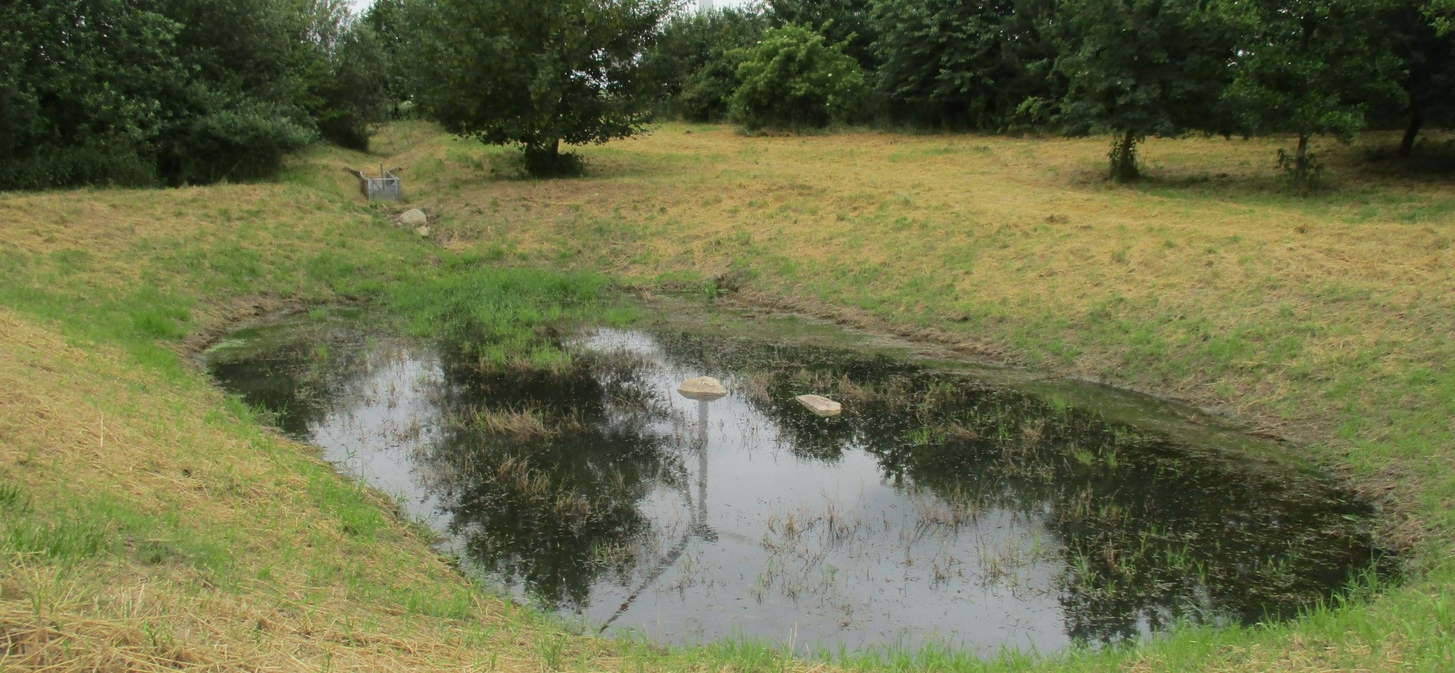
Detention ponds are artificially excavated basins that collect stormwater runoff and eroded sediment from the upstream catchment. The water stored in these ponds is slowly released into a water body or it infiltrates into the groundwater – or both. Their primary functions are flood control, erosion control and water quality improvement.
2.2 Detailed description of the Technology
Description:
This documentation focuses on a detention basin constructed to hold surface runoff at the lowest point of an agricultural catchment. A well-designed detention pond is an effective flood control and landscape management measure. It stores surface runoff and releases it through controlled flow, infiltration, or evaporation (or a combination), and reduces nutrient inputs to the adjacent water body by filtering out sediment and nutrients through particle deposition, or nutrient uptake by plants. On average, water treatment in a detention pond can remove about 50-60% of suspended solids, 30-35% of total phosphorus and total nitrogen, and 25-65% of metals. Ponds also provide habitat for terrestrial, riparian and aquatic species. In addition to their ecological impact, they have an aesthetic and cultural value to society, for example, as a demonstration of effective sustainable water management.
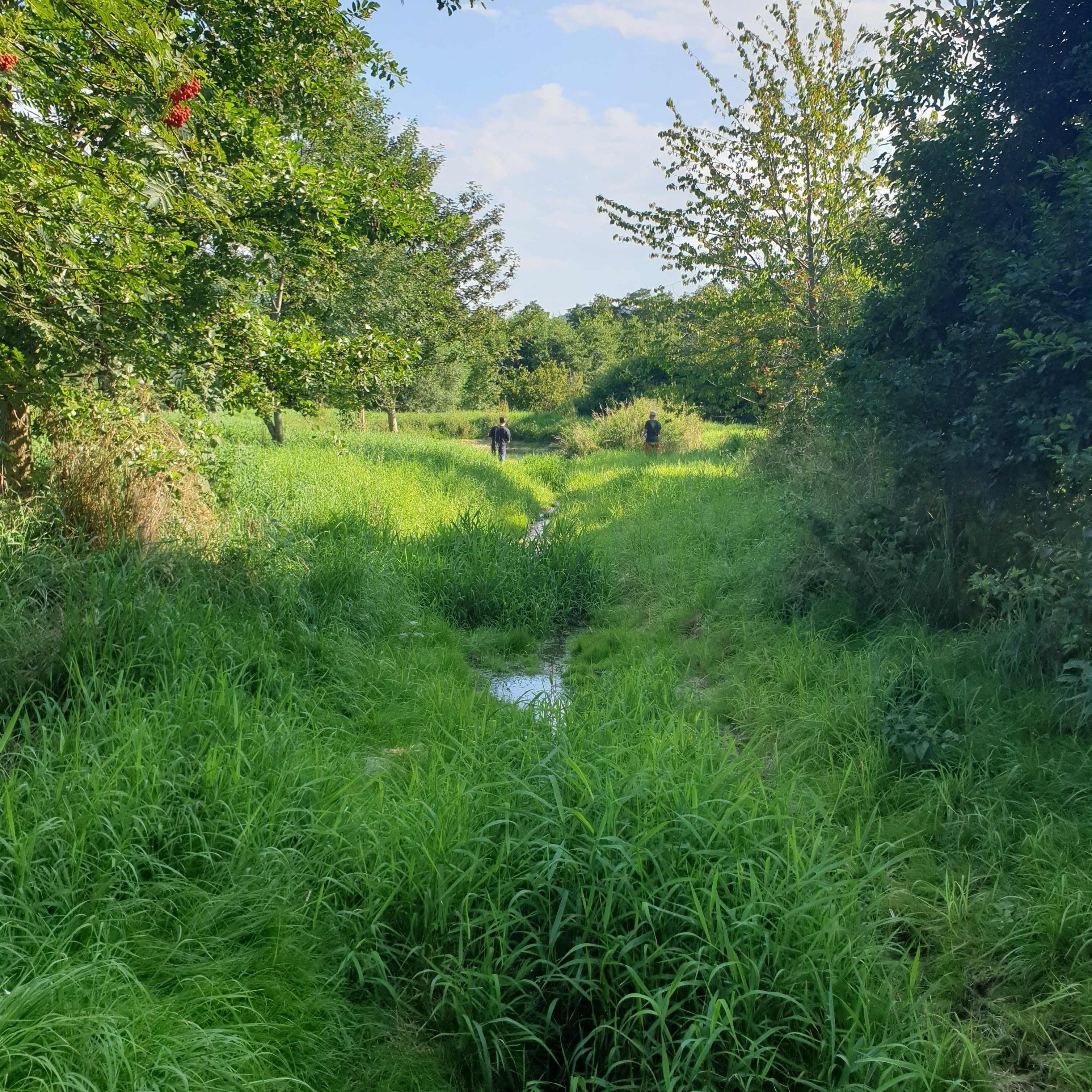
The detention basin described here was constructed by excavating a new depression and ditch system. It consists of a 450 m long inlet channel, a 250 m² pond, and an overflow channel that diverts excess water downstream to the nearest river (Schwarzer Schöps). However, there are no outlet structures for draining water that is captured in the pond (apart from the overflow). All the collected water seeps into the ground and soil particles settle. As a general rule, the size of such a pond should be 3-7% of the upstream catchment and should be able to hold at least the precipitation of a 1 in 30 year rainfall event. However, as the infiltration of the collected water is rather slow, the efficiency is reduced for successive events and overflowing is common. The depth should be between 1.2 m and 2.0 m. A deeper pond can lead to stratification and anoxic conditions, while a shallower pond may cause algal blooms and high biological activity in the summer. Water stored in the pond should remain for at least 20 days to ensure biological treatment.
The construction of the detention pond in this documentation was initiated as a compensation and replacement measure for the construction of a new road in 2016. Accordingly, the road construction authority, the landscape conservation association and a farmer were involved in the implementation.
As usual with such measures there are drawbacks as well as positive impact for landowners. The measure consumes a lot of land, which automatically results in yield losses. It is expensive to build and not easy to construct - and requires the help of an engineering firm while also being time-consuming to maintain. Maintenance is required to sustain the benefits of the technology. For a pond such as that documented here, the following maintenance activities are necessary: during the first three years, maintenance includes mowing the surrounding green area and the dried out pond and channel three times per year. After the fourth year, maintenance includes (a) an annual function check, (b) a check for pest infestation every two years, and (c) suppression of excess woody growth every eight to ten years. Twice a year (mid-June and late August), the grass around the pond and in the intake channel is mowed and the clippings are removed. Shrubs and woody plants are maintained, especially by pruning woody plants (every 8 to 10 years) and coppicing sections of shrubs (every 10 to 15 years). In the long term, it may be necessary to remove the deposited sediments in order to maintain the retention capacity.
2.3 Photos of the Technology
Media Gallery
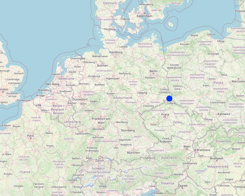
2.5 Country/ region/ locations where the Technology has been applied and which are covered by this assessment
Country:
Germany
Region/ State/ Province:
Saxony
Further specification of location:
Reichenbach
Specify the spread of the Technology:
- applied at specific points/ concentrated on a small area
Is/are the technology site(s) located in a permanently protected area?
No
Map
×2.6 Date of implementation
If precise year is not known, indicate approximate date:
- 10-50 years ago
2.7 Introduction of the Technology
- Compensation measure
Comments (type of project, etc.):
The construction of the detention pond was initiated as a compensation measure for the construction for the road construction project "S70 OU Reichenbach 2. BA".
3. Classification of the SLM Technology
3.1 Main purpose(s) of the Technology
- reduce, prevent, restore land degradation
- conserve ecosystem
- protect a watershed/ downstream areas – in combination with other Technologies
- reduce risk of disasters
- create beneficial social impact
3.2 Current land use type(s) where the Technology is applied
Land use mixed within the same land unit:
No

Other
Specify:
extensively farmed grassland
3.3 Has land use changed due to the implementation of the Technology?
Has land use changed due to the implementation of the Technology?
- No (Continue with question 3.4)
3.4 Water supply
Water supply for the land on which the Technology is applied:
- rainfed
3.5 SLM group to which the Technology belongs
- water harvesting
- ecosystem-based disaster risk reduction
3.6 SLM measures comprising the Technology

structural measures
- S5: Dams, pans, ponds
3.7 Main types of land degradation addressed by the Technology

soil erosion by water
- Wt: loss of topsoil/ surface erosion
- Wg: gully erosion/ gullying

water degradation
- Hs: change in quantity of surface water
- Hg: change in groundwater/aquifer level
3.8 Prevention, reduction, or restoration of land degradation
Specify the goal of the Technology with regard to land degradation:
- reduce land degradation
- restore/ rehabilitate severely degraded land
4. Technical specifications, implementation activities, inputs, and costs
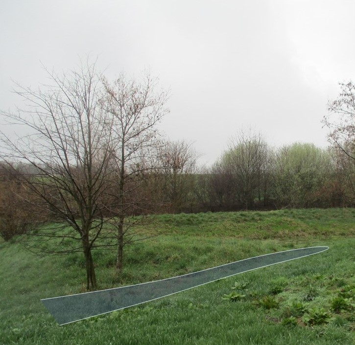
4.1 Technical drawing of the Technology

Technical specifications (related to technical drawing):
Securing dam stability by willow sticks.
Author:
LISt Gesellschaft für Verkehrswesen und ingenieurtechnische Dienstleistungen mbH, Bereich Kompensationsmaßnahmenmanagement
Date:
29/02/2016

Technical specifications (related to technical drawing):
A detention pond (in genreral) consists of a sediment forebay (pretreatment system), a permanent pool that is intended to remain wet throughout the year (but may dry out), a temporary storage pond for flood attenuation, and a shallow zone or aquatic bench along the edge of the permanent pool to support wetland planting that provides ecological and safety benefits. It should be wedge-shaped with a length to width ratio of between 3:1 and 5:1. The side slope shouldn’t be steeper than 1:3 for public safety and maintenance access.
Author:
Hunt et al. (2020)
Date:
20/02/2020
4.2 General information regarding the calculation of inputs and costs
Specify how costs and inputs were calculated:
- per Technology unit
Specify unit:
Detention pond (as documented here)
Specify dimensions of unit (if relevant):
225 m², ca. 337,5 m³ (water depth of 1,5m)
other/ national currency (specify):
€
If relevant, indicate exchange rate from USD to local currency (e.g. 1 USD = 79.9 Brazilian Real): 1 USD =:
0.91
Indicate average wage cost of hired labour per day:
18.70 € per hour
4.3 Establishment activities
| Activity | Timing (season) | |
|---|---|---|
| 1. | remove topsoil | |
| 2. | profile water body according to site plan (Standing water 1.5 m deep, ditch 0.5-1.5m deep) | |
| 3. | installing of inlet channel | |
| 4. | installing erosion protection on embankments | |
| 5. | cover the topsoil / terrain profiling | |
| 6. | planting of shrubs & aquatic plants along the shoreline | |
| 7. | ditch connection to Schwarzer-Schöps | |
| 8. | reprofiling ditches (90m) | |
| 9. | desilting of drainage ditch to Schwarzer-Schöps | |
| 10. | subsequent installation of a spillway (beak structure: 'Schnabelbauwerk') and willow sticks as an erosion control measure for the ditch connection to Schwarzer-Schöps. |
4.4 Costs and inputs needed for establishment
If you are unable to break down the costs in the table above, give an estimation of the total costs of establishing the Technology:
25250.0
If land user bore less than 100% of costs, indicate who covered the remaining costs:
The costs were covered by the road construction authority (compensation measure for the construction of a new road)
Comments:
based on estimated average costs (nwrm.eu)
4.5 Maintenance/ recurrent activities
| Activity | Timing/ frequency | |
|---|---|---|
| 1. | completion and development maintenance (mowing of the green area and the water-free water body) | first three years: three times per year |
| 2. | functional check | after the fourth year: every year |
| 3. | check for pest infestation | after the fourth year : every other year |
| 4. | check to suppress unwanted woody growth | after the fourth year: every 8 to 10 years |
| 5. | grass around the pond and in the intake channel is mowed and the clippings are removed | after the fourth year: twice a year (mid-June and late August) |
| 6. | pruning woody plants | every 8 to 10 years |
| 7. | putting sections of shrubs on stock | every 10 to 15 years |
4.6 Costs and inputs needed for maintenance/ recurrent activities (per year)
If you are unable to break down the costs in the table above, give an estimation of the total costs of maintaining the Technology:
618.0
If land user bore less than 100% of costs, indicate who covered the remaining costs:
The costs are covered by the road construction authority (compensation measure for the construction of a new road)
Comments:
estimated average costs (nwrm.eu)
4.7 Most important factors affecting the costs
Describe the most determinate factors affecting the costs:
From the government perspective: A budget must be set aside annually for necessary maintenance to ensure functional efficiency.
5. Natural and human environment
5.1 Climate
Annual rainfall
- < 250 mm
- 251-500 mm
- 501-750 mm
- 751-1,000 mm
- 1,001-1,500 mm
- 1,501-2,000 mm
- 2,001-3,000 mm
- 3,001-4,000 mm
- > 4,000 mm
Specifications/ comments on rainfall:
Average annual rainfall in mm: 750.82 mm/a
Name of the meteorological station: https://whh-kliwes.de/mapview
Agro-climatic zone
- sub-humid
Length of growing period (LGP): 209 days
(https://www.umwelt.sachsen.de/dauer-der-vegetationsperiode-30631.html)
5.2 Topography
Slopes on average:
- flat (0-2%)
- gentle (3-5%)
- moderate (6-10%)
- rolling (11-15%)
- hilly (16-30%)
- steep (31-60%)
- very steep (>60%)
Landforms:
- plateau/plains
- ridges
- mountain slopes
- hill slopes
- footslopes
- valley floors
Altitudinal zone:
- 0-100 m a.s.l.
- 101-500 m a.s.l.
- 501-1,000 m a.s.l.
- 1,001-1,500 m a.s.l.
- 1,501-2,000 m a.s.l.
- 2,001-2,500 m a.s.l.
- 2,501-3,000 m a.s.l.
- 3,001-4,000 m a.s.l.
- > 4,000 m a.s.l.
Indicate if the Technology is specifically applied in:
- concave situations
5.3 Soils
Soil depth on average:
- very shallow (0-20 cm)
- shallow (21-50 cm)
- moderately deep (51-80 cm)
- deep (81-120 cm)
- very deep (> 120 cm)
Soil texture (topsoil):
- coarse/ light (sandy)
- medium (loamy, silty)
Soil texture (> 20 cm below surface):
- medium (loamy, silty)
Topsoil organic matter:
- high (>3%)
If available, attach full soil description or specify the available information, e.g. soil type, soil PH/ acidity, Cation Exchange Capacity, nitrogen, salinity etc.
Luvisol (German soil classification system: Parabraunerde)
5.4 Water availability and quality
Ground water table:
< 5 m
Availability of surface water:
poor/ none
Water quality (untreated):
poor drinking water (treatment required)
Water quality refers to:
surface water
Is water salinity a problem?
No
Is flooding of the area occurring?
No
5.5 Biodiversity
Species diversity:
- medium
Habitat diversity:
- high
5.6 Characteristics of land users applying the Technology
Sedentary or nomadic:
- Sedentary
Off-farm income:
- less than 10% of all income
Relative level of wealth:
- rich
Individuals or groups:
- groups/ community
- employee (company, government)
Level of mechanization:
- mechanized/ motorized
Gender:
- women
- men
Age of land users:
- middle-aged
5.7 Average area of land used by land users applying the Technology
- < 0.5 ha
- 0.5-1 ha
- 1-2 ha
- 2-5 ha
- 5-15 ha
- 15-50 ha
- 50-100 ha
- 100-500 ha
- 500-1,000 ha
- 1,000-10,000 ha
- > 10,000 ha
Comments:
The technology was not built and is not maintained by a land user, but by a public authority (road construction authority).
5.8 Land ownership, land use rights, and water use rights
Land ownership:
- state
Land use rights:
- individual
Water use rights:
- communal (organized)
Are land use rights based on a traditional legal system?
No
5.9 Access to services and infrastructure
health:
- poor
- moderate
- good
education:
- poor
- moderate
- good
technical assistance:
- poor
- moderate
- good
employment (e.g. off-farm):
- poor
- moderate
- good
markets:
- poor
- moderate
- good
energy:
- poor
- moderate
- good
roads and transport:
- poor
- moderate
- good
drinking water and sanitation:
- poor
- moderate
- good
financial services:
- poor
- moderate
- good
6. Impacts and concluding statements
6.1 On-site impacts the Technology has shown
Socio-economic impacts
Water availability and quality
irrigation water availability
Income and costs
expenses on agricultural inputs
Comments/ specify:
not on agricultural inputs, but establishment and maintenance consume a lot of money.
workload
Ecological impacts
Water cycle/ runoff
water quality
Comments/ specify:
Improved water quality of subsequent river Schwarzer-Schöps.
excess water drainage
Soil
soil moisture
Comments/ specify:
Soil moisture next to the retention pond increased due to infiltration.
Biodiversity: vegetation, animals
plant diversity
Comments/ specify:
More plant diversity compared to normal farmed grassland.
animal diversity
habitat diversity
Climate and disaster risk reduction
flood impacts
Specify assessment of on-site impacts (measurements):
The assessment is based on expert judgements. It is not based on on-site measurements.
6.2 Off-site impacts the Technology has shown
water availability
groundwater/ river pollution
Specify assessment of off-site impacts (measurements):
The assessment is based on the expertise of the compilers and not on measurements in the case study.
6.3 Exposure and sensitivity of the Technology to gradual climate change and climate-related extremes/ disasters (as perceived by land users)
Gradual climate change
Gradual climate change
| Season | increase or decrease | How does the Technology cope with it? | |
|---|---|---|---|
| annual rainfall | decrease | well |
Climate-related extremes (disasters)
Meteorological disasters
| How does the Technology cope with it? | |
|---|---|
| local rainstorm | very well |
Climatological disasters
| How does the Technology cope with it? | |
|---|---|
| heatwave | well |
Comments:
In past summers there was little or no water left in the pond.
6.4 Cost-benefit analysis
How do the benefits compare with the establishment costs (from land users’ perspective)?
Short-term returns:
very negative
Long-term returns:
negative
How do the benefits compare with the maintenance/ recurrent costs (from land users' perspective)?
Short-term returns:
slightly negative
Long-term returns:
neutral/ balanced
6.5 Adoption of the Technology
- single cases/ experimental
6.6 Adaptation
Has the Technology been modified recently to adapt to changing conditions?
No
6.7 Strengths/ advantages/ opportunities of the Technology
| Strengths/ advantages/ opportunities in the land user’s view |
|---|
| temporary water-bearing habitat |
| biotopic network |
| buffer effect |
| Strengths/ advantages/ opportunities in the compiler’s or other key resource person’s view |
|---|
| effective flood control and landscape management measure |
| Stores surface runoff, slows it down, and releases it incrementally through controlled runoff, infiltration, or evaporation. Reduces nutrient inputs to adjacent water bodies. |
| aesthetic and cultural value for the society |
6.8 Weaknesses/ disadvantages/ risks of the Technology and ways of overcoming them
| Weaknesses/ disadvantages/ risks in the land user’s view | How can they be overcome? |
|---|---|
| Danger of siltation and succession if not maintained regularly and professionally. | |
| Difficult maintenance due to inaccessible terrain. |
| Weaknesses/ disadvantages/ risks in the compiler’s or other key resource person’s view | How can they be overcome? |
|---|---|
| Consumes a lot of land, which means a loss of yield. | |
| expensive to build and not easy to construct | |
| requires the help of an engineering firm | |
| time-consuming to maintain |
7. References and links
7.1 Methods/ sources of information
- field visits, field surveys
1
- interviews with land users
1
When were the data compiled (in the field)?
14/09/2021
7.3 Links to relevant online information
Title/ description:
Hunt et al. (2020): Plant Selection for Infiltrating Wet Ponds in North Carolina
URL:
https://content.ces.ncsu.edu/plant-selection-for-infiltrating-wet-ponds-in-north-carolina
Title/ description:
nwrm.eu: Individual NWRM, retention pond
URL:
http://nwrm.eu/index.php/measure/retention-ponds
Links and modules
Expand all Collapse allLinks
No links
Modules
No modules