Runoff Pond Al Yakloum [Lebanon]
- Creation:
- Update:
- Compiler: Nicola D'Alberton
- Editor: –
- Reviewers: William Critchley, Rima Mekdaschi Studer
Birki Al Yakloum
technologies_6319 - Lebanon
View sections
Expand all Collapse all1. General information
1.2 Contact details of resource persons and institutions involved in the assessment and documentation of the Technology
1.3 Conditions regarding the use of data documented through WOCAT
The compiler and key resource person(s) accept the conditions regarding the use of data documented through WOCAT:
Yes
1.4 Declaration on sustainability of the described Technology
Is the Technology described here problematic with regard to land degradation, so that it cannot be declared a sustainable land management technology?
No
2. Description of the SLM Technology
2.1 Short description of the Technology
Definition of the Technology:
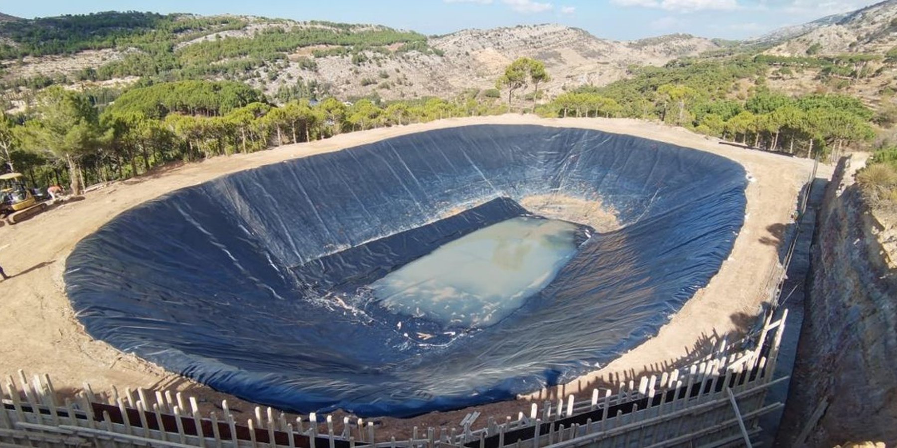
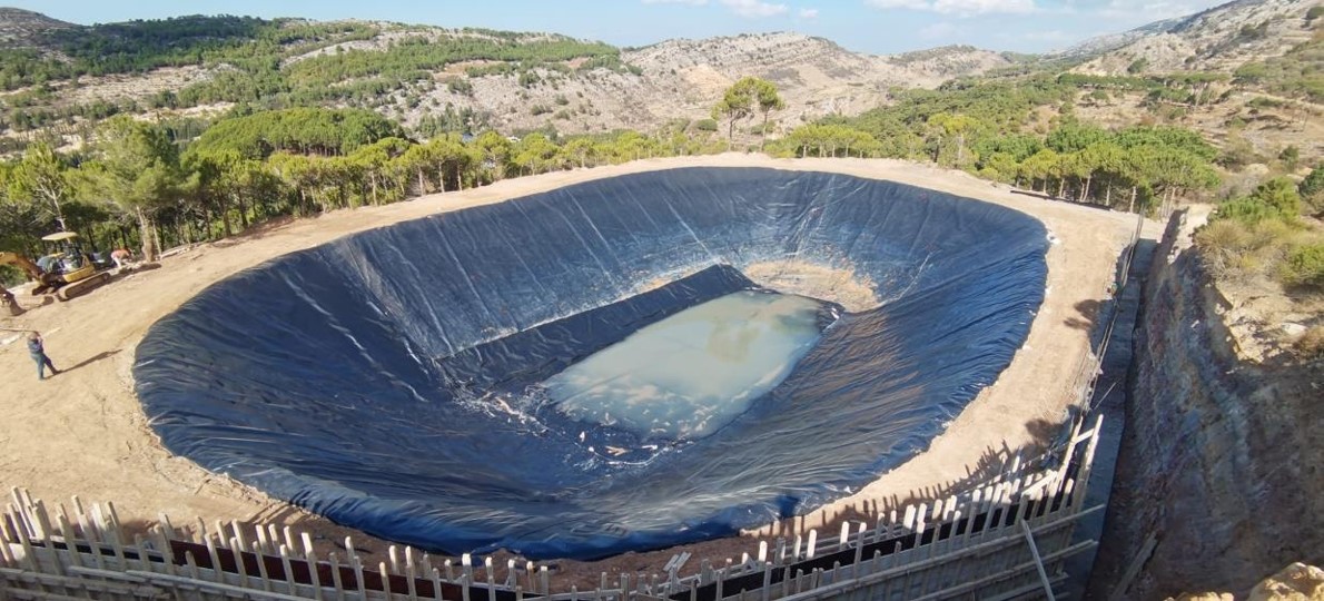
The Al Yakloum pond collects runoff from a local catchment and water is led through a channel system alongside a farm road. Sandy particles are captured in a sediment trap before runoff enters the pond. The pond provides water to approximately 5 ha of orchard - which is irrigated through a precision system.
2.2 Detailed description of the Technology
Description:
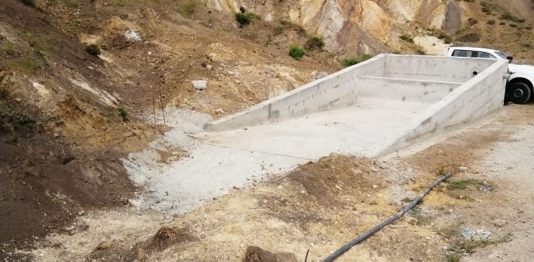
The Al Yakloum Pond is located in a public area within the municipality of Mrusti (Mount Lebanon). Runoff water is collected from a natural catchment and is led to the pond through a channel that runs alongside a farm road. The catchment area is mostly unproductive private land, and extends to approximately 2 ha in total. Sediment is an issue in the catchment due to the fine sandy outcrops. Sandy particles are thus carried in the runoff – and require settling out in a sediment trap to limit the turbidity of water in the pond. Thus runoff first enters a stilling basin (a sediment trap) where the suspended solids are deposited: runoff is then transferred through a pipe leading to the pond.
The pond's volume is around 7500 m3, and it is used to irrigate an orchard of about 5 ha in size, which is planted to apples, cherries and olives. A precision smart irrigation system is used for water application. The system includes IoT sensors that provide real time information about soil humidity and weather conditions that allow to automatize the valve opening depending on the plant needs thus optimizing the water consumptions. The volume of water collected is not enough to fulfil all the theoretical water requirements of the orchard crops, therefore the irrigation is merely supplementary to rainfall, and its impact on production is limited. However, the alternative water resource in the area is groundwater. This is high cost and has negative environmental impacts. Therefore the runoff pond technology is preferable for the sustainability of agriculture in the area. If the efficiency of runoff water collection and its application can be improved, then pump withdrawal requirements from groundwater sources decrease and this will optimize the efficiency of irrigation.
2.3 Photos of the Technology
Media Gallery
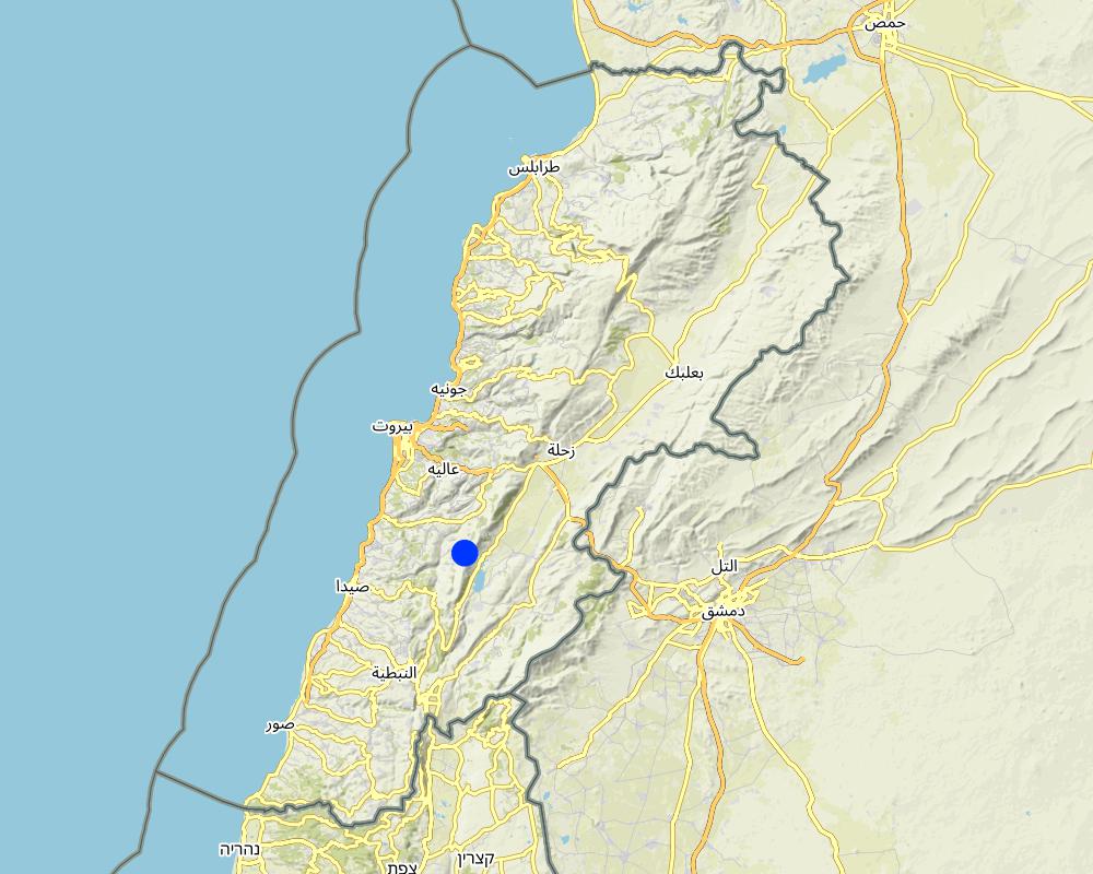
2.5 Country/ region/ locations where the Technology has been applied and which are covered by this assessment
Country:
Lebanon
Region/ State/ Province:
Mount Lebanon
Further specification of location:
Municipality of Mrusti
Specify the spread of the Technology:
- applied at specific points/ concentrated on a small area
Is/are the technology site(s) located in a permanently protected area?
Yes
If yes, specify:
Shouf Biosphere Reserve (SBR) - Buffer Zone
Map
×2.6 Date of implementation
Indicate year of implementation:
2002
If precise year is not known, indicate approximate date:
- 10-50 years ago
2.7 Introduction of the Technology
Specify how the Technology was introduced:
- through projects/ external interventions
Comments (type of project, etc.):
Traditionally the land users used to collect water from springs trough small basins. Following the increase of water demand in the area, in 2002 the pond was built trough an external project. In 2022 the pond was restored and connected to the precision smart irrigation system promoted by the project "Saving Water Growing Crops" implemented by "Istituto OIKOS" in partnership with "Al Shouf Cedar Society", " University of Trento" and "Association for Conservation and Environment" and funded by the European Union.
3. Classification of the SLM Technology
3.1 Main purpose(s) of the Technology
- improve production
- protect a watershed/ downstream areas – in combination with other Technologies
- adapt to climate change/ extremes and its impacts
- create beneficial economic impact
- create beneficial social impact
3.2 Current land use type(s) where the Technology is applied
Land use mixed within the same land unit:
No

Cropland
- Annual cropping
- orchards (apples, cherries, olives ...) vegetables (tomatoes, onions, cucumber...)
Number of growing seasons per year:
- 1
Is intercropping practiced?
Yes
If yes, specify which crops are intercropped:
Mixed production of vegetables and orchards
Is crop rotation practiced?
No

Waterways, waterbodies, wetlands
- Ponds, dams

Unproductive land
Specify:
Unproductive area used as catchment area of approximately 2ha
3.3 Has land use changed due to the implementation of the Technology?
Has land use changed due to the implementation of the Technology?
- No (Continue with question 3.4)
3.4 Water supply
Water supply for the land on which the Technology is applied:
- mixed rainfed-irrigated
3.5 SLM group to which the Technology belongs
- water harvesting
- irrigation management (incl. water supply, drainage)
- water diversion and drainage
3.6 SLM measures comprising the Technology

structural measures
- S5: Dams, pans, ponds
3.7 Main types of land degradation addressed by the Technology

soil erosion by water
- Wt: loss of topsoil/ surface erosion

water degradation
- Hs: change in quantity of surface water
- Hg: change in groundwater/aquifer level
3.8 Prevention, reduction, or restoration of land degradation
Specify the goal of the Technology with regard to land degradation:
- restore/ rehabilitate severely degraded land
4. Technical specifications, implementation activities, inputs, and costs
4.1 Technical drawing of the Technology
Technical specifications (related to technical drawing):
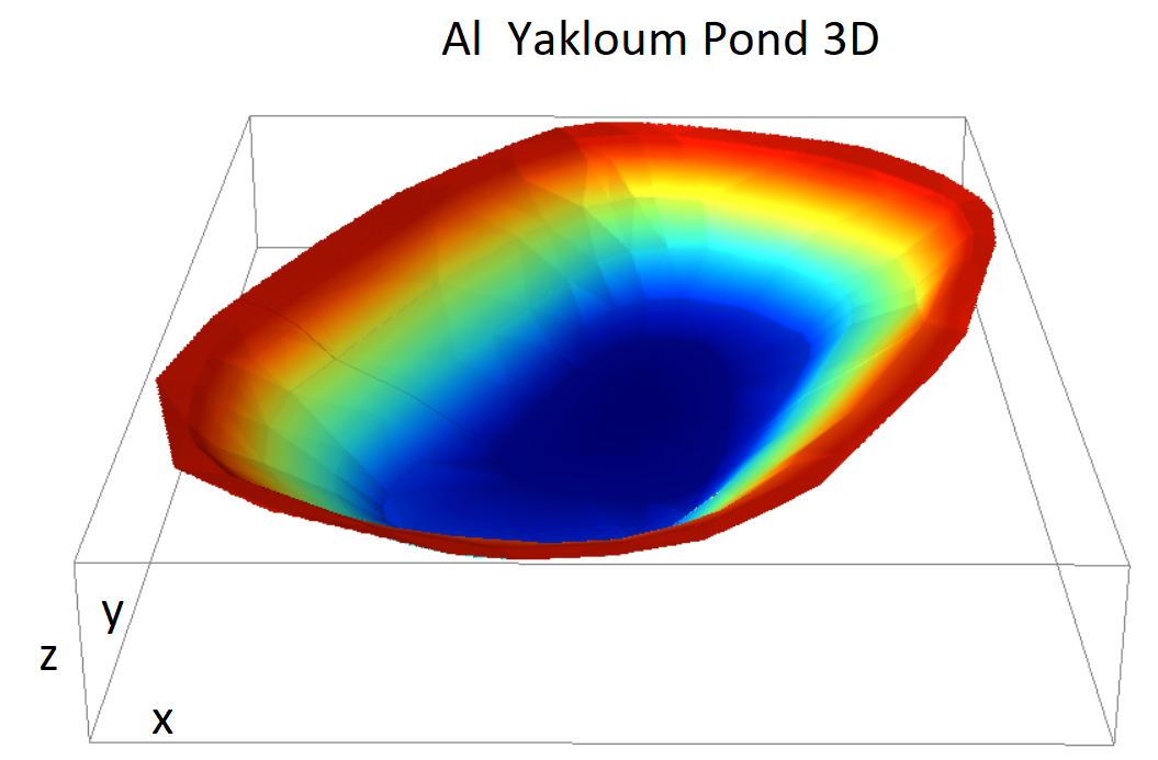
Maximum depth 8 m, Area approximately 35 m x 60 m, bank slope approx 35°
4.3 Establishment activities
| Activity | Timing (season) | |
|---|---|---|
| 1. | Pond Cleaning from sediment | After the irrigation season for the duration of 2 weeks |
| 2. | Geomembrane (HDPE) replacement in damaged spots and compaction of the underneath soil with clay application | Approximately one month |
| 3. | Construction of Retaining Wall to prevent soil erosion on the escarpment close to the pond | Approximately one month |
| 4. | Sedimentation Trap | Approximately two weeks |
| 5. | Rip-rap Channel to convey the water into the Sedimentation Trap | Approximately two weeks |
Comments:
The original cost of the implementation of the structure are unknown. The aforementioned activities refer to the rehabilitation of the pond held among the project "Saving Water Growing Crops" in 2022.
4.4 Costs and inputs needed for establishment
| Specify input | Unit | Quantity | Costs per Unit | Total costs per input | % of costs borne by land users | |
|---|---|---|---|---|---|---|
| Labour | Cleaning of the ponds from sediment and removal of existing backfill | n | 1.0 | 3000.0 | 3000.0 | |
| Labour | Excavations and Backfilling | n | 1.0 | 3600.0 | 3600.0 | |
| Labour | Maintenance of existing HDPE geomembrane | n | 1.0 | 3000.0 | 3000.0 | |
| Equipment | Geomembrane | m^2 | 1727.0 | 8.0 | 13816.0 | |
| Equipment | Sedimentation Trap | n | 1.0 | 7087.0 | 7087.0 | |
| Equipment | Retaining Wall | n | 1.0 | 21.186 | 21.19 | |
| Equipment | Rip-rap channel | m | 60.0 | 6.0 | 360.0 | |
| Equipment | Fence and Gates along the pond including cast-in-place concrete | m | 160.0 | 38.8 | 6208.0 | |
| Total costs for establishment of the Technology | 37092.19 | |||||
| Total costs for establishment of the Technology in USD | 37092.19 | |||||
If land user bore less than 100% of costs, indicate who covered the remaining costs:
Project "Saving Water Growing Crops" the full costs of rehabilitation
Comments:
The original cost of the implementation of the structure are unknown. The aforementioned activities refer to the rehabilitation of the pond implemented among the project "Saving Water Growing Crops" in 2022.
4.6 Costs and inputs needed for maintenance/ recurrent activities (per year)
| Specify input | Unit | Quantity | Costs per Unit | Total costs per input | % of costs borne by land users | |
|---|---|---|---|---|---|---|
| Labour | Cleaning of the sediment trap | times per year | 5.0 | 50.0 | 250.0 | 100.0 |
| Labour | Cleaning of the rip-rap channel | times per year | 5.0 | 20.0 | 100.0 | 100.0 |
| Total costs for maintenance of the Technology | 350.0 | |||||
| Total costs for maintenance of the Technology in USD | 350.0 | |||||
5. Natural and human environment
5.1 Climate
Annual rainfall
- < 250 mm
- 251-500 mm
- 501-750 mm
- 751-1,000 mm
- 1,001-1,500 mm
- 1,501-2,000 mm
- 2,001-3,000 mm
- 3,001-4,000 mm
- > 4,000 mm
Specify average annual rainfall (if known), in mm:
1100.00
Specifications/ comments on rainfall:
Winter rains, mostly in Dec-Jan, normally no rain from May to beg of Sep, apparently the rainy season is shifting to the spring due to climate change
Indicate the name of the reference meteorological station considered:
Maasser Al Shouf
Agro-climatic zone
- sub-humid
5.2 Topography
Slopes on average:
- flat (0-2%)
- gentle (3-5%)
- moderate (6-10%)
- rolling (11-15%)
- hilly (16-30%)
- steep (31-60%)
- very steep (>60%)
Landforms:
- plateau/plains
- ridges
- mountain slopes
- hill slopes
- footslopes
- valley floors
Altitudinal zone:
- 0-100 m a.s.l.
- 101-500 m a.s.l.
- 501-1,000 m a.s.l.
- 1,001-1,500 m a.s.l.
- 1,501-2,000 m a.s.l.
- 2,001-2,500 m a.s.l.
- 2,501-3,000 m a.s.l.
- 3,001-4,000 m a.s.l.
- > 4,000 m a.s.l.
Indicate if the Technology is specifically applied in:
- concave situations
5.3 Soils
Soil depth on average:
- very shallow (0-20 cm)
- shallow (21-50 cm)
- moderately deep (51-80 cm)
- deep (81-120 cm)
- very deep (> 120 cm)
Soil texture (topsoil):
- fine/ heavy (clay)
Soil texture (> 20 cm below surface):
- fine/ heavy (clay)
Topsoil organic matter:
- medium (1-3%)
- low (<1%)
5.4 Water availability and quality
Ground water table:
> 50 m
Availability of surface water:
medium
Water quality (untreated):
good drinking water
Water quality refers to:
ground water
Is water salinity a problem?
No
Is flooding of the area occurring?
No
5.5 Biodiversity
Species diversity:
- medium
Habitat diversity:
- high
Comments and further specifications on biodiversity:
In the buffer zone of the SBR national park
5.6 Characteristics of land users applying the Technology
Sedentary or nomadic:
- Sedentary
Market orientation of production system:
- mixed (subsistence/ commercial)
Off-farm income:
- > 50% of all income
Relative level of wealth:
- average
Individuals or groups:
- groups/ community
- cooperative
Level of mechanization:
- manual work
- mechanized/ motorized
Gender:
- men
Age of land users:
- elderly
5.7 Average area of land used by land users applying the Technology
- < 0.5 ha
- 0.5-1 ha
- 1-2 ha
- 2-5 ha
- 5-15 ha
- 15-50 ha
- 50-100 ha
- 100-500 ha
- 500-1,000 ha
- 1,000-10,000 ha
- > 10,000 ha
Is this considered small-, medium- or large-scale (referring to local context)?
- small-scale
5.8 Land ownership, land use rights, and water use rights
Land ownership:
- group
Land use rights:
- individual
Water use rights:
- individual
Are land use rights based on a traditional legal system?
Yes
5.9 Access to services and infrastructure
health:
- poor
- moderate
- good
education:
- poor
- moderate
- good
technical assistance:
- poor
- moderate
- good
employment (e.g. off-farm):
- poor
- moderate
- good
markets:
- poor
- moderate
- good
energy:
- poor
- moderate
- good
roads and transport:
- poor
- moderate
- good
drinking water and sanitation:
- poor
- moderate
- good
financial services:
- poor
- moderate
- good
Comments:
Related to the specific Municipality of Mrusti
6. Impacts and concluding statements
6.1 On-site impacts the Technology has shown
Socio-economic impacts
Production
crop production
Comments/ specify:
Increase of runoff catchment will have an impact on the amount of water supplied to cultivated area thus increasing the production
crop quality
Comments/ specify:
Increase of runoff catchment will have an impact on the amount of water supplied to cultivated area thus increasing the quality production
production area
Comments/ specify:
The increased amount of runoff water combined with the reduction of losses given by the precision smart irrigation system permitted to extend the area connected to the pipe system
land management
Water availability and quality
irrigation water availability
irrigation water quality
Comments/ specify:
Sedimentation trap will limit the turbidity of the ponds. The catchment area do not include high anthropized area therefore the pollution is very limited.
Ecological impacts
Water cycle/ runoff
harvesting/ collection of water
evaporation
Comments/ specify:
Collecting the water in an uncovered pond leads to an increase of the evaporation.
6.2 Off-site impacts the Technology has shown
downstream flooding
Comments/ specify:
Increasing the amount of water harvested reduces the amount of runoff water in the downstream area, therefore reducing the hydraulic risk and soil erosion during extreme rain events.
downstream siltation
Comments/ specify:
Reduction of runoff and surface water along the earthen channels and the roads decreases the amount of sediment transport showing a positive impact in terms of land degradation.
6.3 Exposure and sensitivity of the Technology to gradual climate change and climate-related extremes/ disasters (as perceived by land users)
Gradual climate change
Gradual climate change
| Season | increase or decrease | How does the Technology cope with it? | |
|---|---|---|---|
| annual temperature | increase | moderately |
6.4 Cost-benefit analysis
How do the benefits compare with the establishment costs (from land users’ perspective)?
Short-term returns:
neutral/ balanced
Long-term returns:
positive
How do the benefits compare with the maintenance/ recurrent costs (from land users' perspective)?
Short-term returns:
positive
Long-term returns:
slightly negative
6.5 Adoption of the Technology
- > 50%
Of all those who have adopted the Technology, how many did so spontaneously, i.e. without receiving any material incentives/ payments?
- 0-10%
Comments:
Referred to the study area connected to the pond
6.6 Adaptation
Has the Technology been modified recently to adapt to changing conditions?
Yes
If yes, indicate to which changing conditions it was adapted:
- climatic change/ extremes
Specify adaptation of the Technology (design, material/ species, etc.):
Rehabilitating the pond to collect more runoff water, which may increase due to rain intensifications due to climate change
6.7 Strengths/ advantages/ opportunities of the Technology
| Strengths/ advantages/ opportunities in the land user’s view |
|---|
| Availability of water for a longer period in a free or cost limited system |
| No need of pump and fuel for irrigating |
| Increase the production |
| Strengths/ advantages/ opportunities in the compiler’s or other key resource person’s view |
|---|
| Environmental low impact solution, efficient use of water resource |
| Making use of surface water that may reduce flood risk in downer slopes |
| Scaling up the practice to similar context |
6.8 Weaknesses/ disadvantages/ risks of the Technology and ways of overcoming them
| Weaknesses/ disadvantages/ risks in the land user’s view | How can they be overcome? |
|---|---|
| Presence of sediment | Anti-erosion intervention, sediment trap |
| Volume insufficient for the whole period | Increasing the efficiency of catchment |
| High bank slope | Good soil compaction |
| Weaknesses/ disadvantages/ risks in the compiler’s or other key resource person’s view | How can they be overcome? |
|---|---|
| Road as diverting structure that doesn't allow the water to naturally flow towards the ponds | Diverting channels |
| Pond and sedimentation trap need to be cleaned | Often maintenance interventions |
7. References and links
7.1 Methods/ sources of information
- field visits, field surveys
Several visits (>100)
- interviews with land users
Several interviews (>100)
- interviews with SLM specialists/ experts
Several meeting with experts (>20)
7.3 Links to relevant online information
Title/ description:
Master thesis - Nicola D'Alberton
URL:
https://abouthydrology.blogspot.com/2021/04/saving-water-growing-crops-ms-thesis-by.html
Links and modules
Expand all Collapse allLinks
No links
Modules
No modules