Implementing Site Quarantine to reduce rangeland degradation in the highlands of Badghis [Afghanistan]
- Creation:
- Update:
- Compiler: Shamsulhaq Shams
- Editors: Mir Wali Khan Lakanwal, Mohammad Mustafa Sahebzada, Obaidullah Durani, Megha bajaj
- Reviewers: Rima Mekdaschi Studer, Illias Animon, Muhammad Ishaq Safi
قرنطینه و مدیریت چرا در ارتفاعات بادغیس برای کاهش تخریب مراتع
technologies_7459 - Afghanistan
- Full summary as PDF
- Full summary as PDF for print
- Full summary in the browser
- Full summary (unformatted)
- Implementing Site Quarantine to reduce rangeland degradation in the highlands of Badghis: March 13, 2025 (inactive)
- Implementing Site Quarantine to reduce rangeland degradation in the highlands of Badghis: March 24, 2025 (inactive)
- Implementing Site Quarantine to reduce rangeland degradation in the highlands of Badghis: May 6, 2025 (public)
View sections
Expand all Collapse all1. General information
1.2 Contact details of resource persons and institutions involved in the assessment and documentation of the Technology
Key resource person(s)
SLM specialist:
SLM specialist:
land user:
Akrami Abdul Ghafar
Deh Beranj Rangeland Management Association
Afghanistan
land user:
Jami Mula Abdul Rhaman
Deh Beranj Rangeland Management Association
Afghanistan
land user:
Baqiri Habibullah
Deh Beranj Rangeland Management Association
Afghanistan
land user:
Sadat Serajulhaq
Deh Beranj RMA
Afghanistan
Name of project which facilitated the documentation/ evaluation of the Technology (if relevant)
Community-based sustainable land and forest management in AfghanistanName of the institution(s) which facilitated the documentation/ evaluation of the Technology (if relevant)
FAO Afghanistan (FAO Afghanistan) - Afghanistan1.3 Conditions regarding the use of data documented through WOCAT
The compiler and key resource person(s) accept the conditions regarding the use of data documented through WOCAT:
Yes
1.4 Declaration on sustainability of the described Technology
Is the Technology described here problematic with regard to land degradation, so that it cannot be declared a sustainable land management technology?
No
2. Description of the SLM Technology
2.1 Short description of the Technology
Definition of the Technology:
Restoring degraded rangelands through quarantine in Qadis district, Badghis Afghanistan.
2.2 Detailed description of the Technology
Description:
The project “Community-based sustainable land and forest management in Afghanistan”, implemented by FAO with the financial support of GEF, aimed to promote biodiversity conservation, climate change mitigation, and rangeland productivity through introducing community-based sustainable land and forest management (SLM/SFM) practices in rangeland and forest areas within five targeted provinces, including Badghis, that benefited rural communities that rely on these ecosystems for their livelihood.
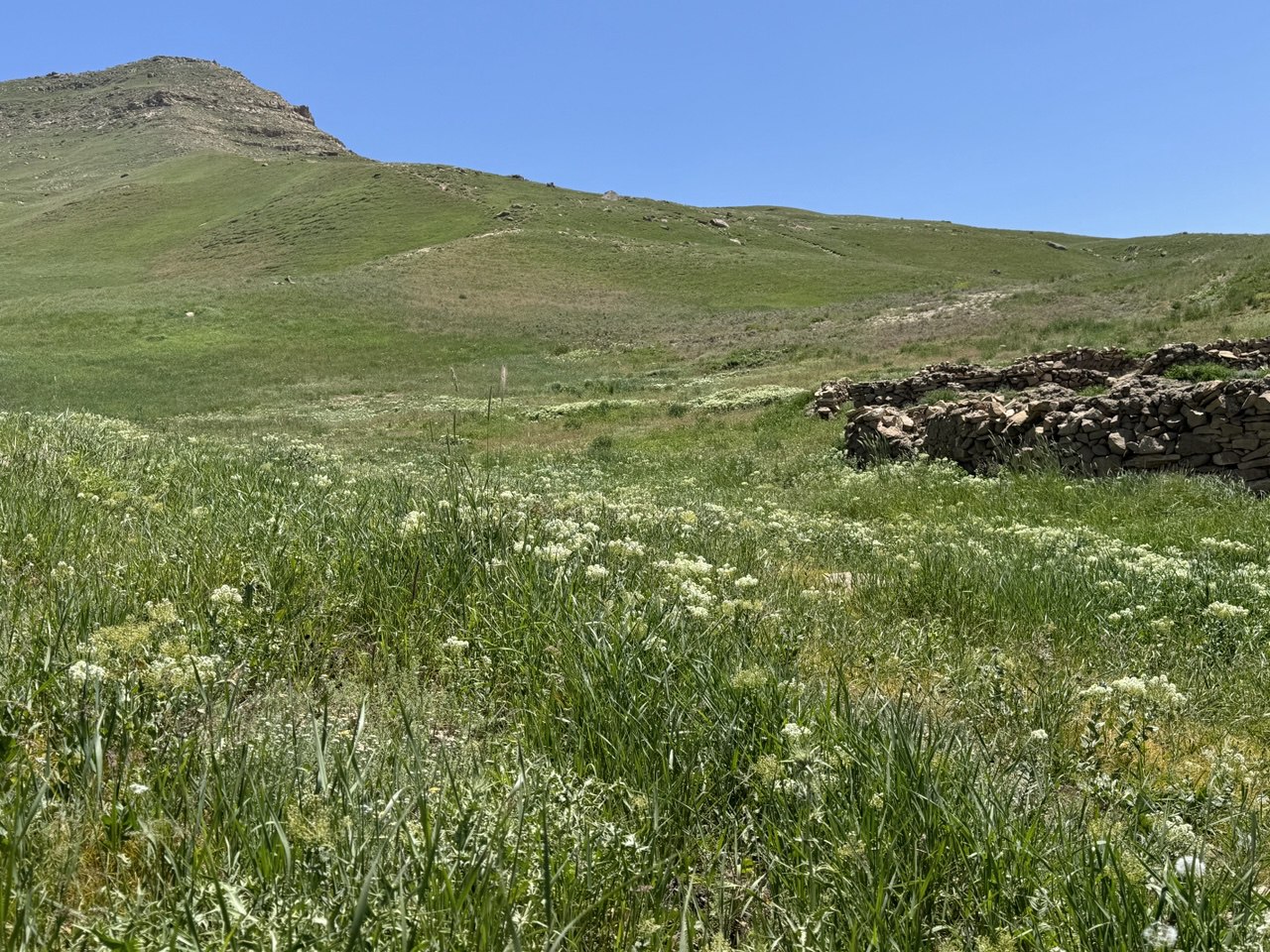
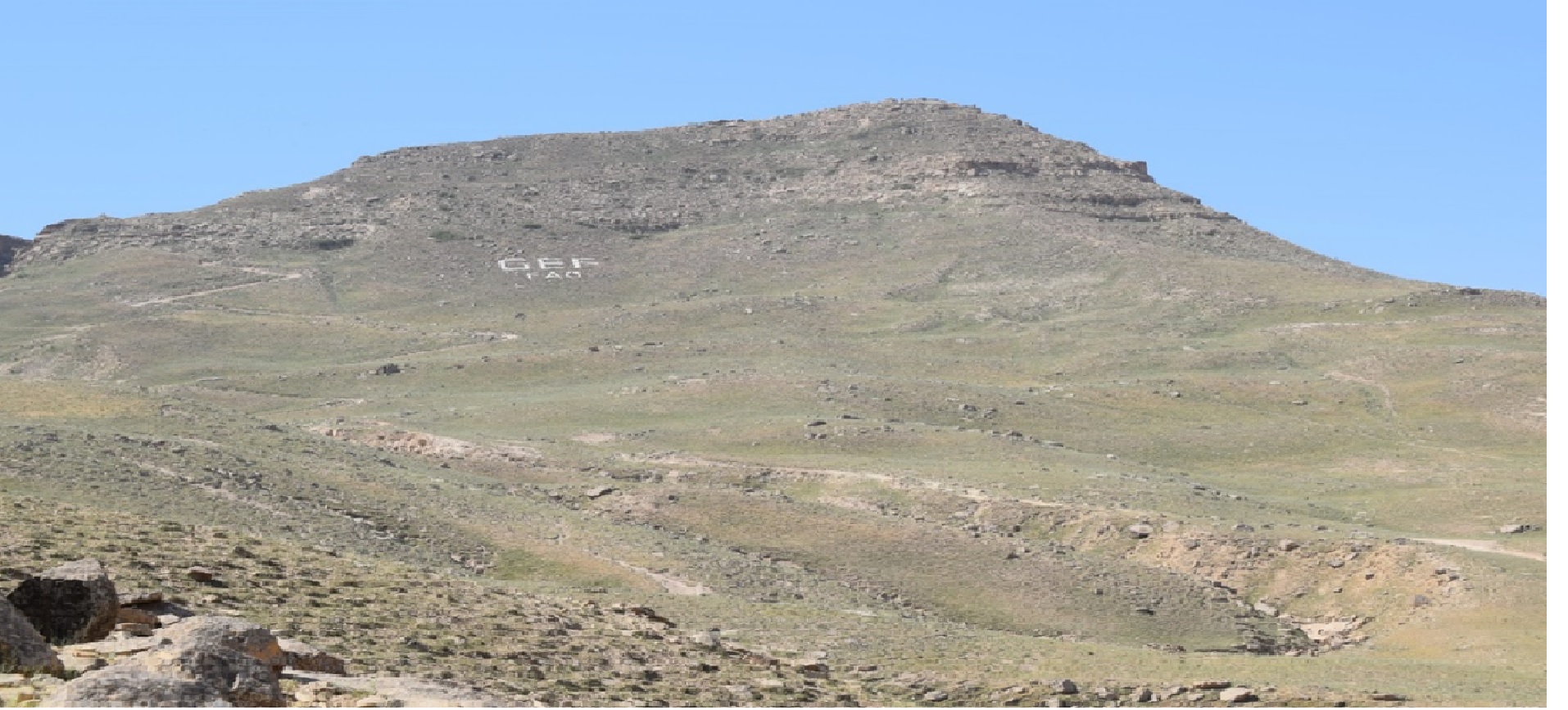
In June 2022, a 1,000-hectare rangeland quarantine area was established to promote the rehabilitation of degraded land and restore the natural vegetation cover. This area was strategically enclosed with clearly marked benchmark boundaries to prevent grazing and ensure its complete protection. By protecting this area from human interference and grazing, the land has been given the opportunity to recover naturally.
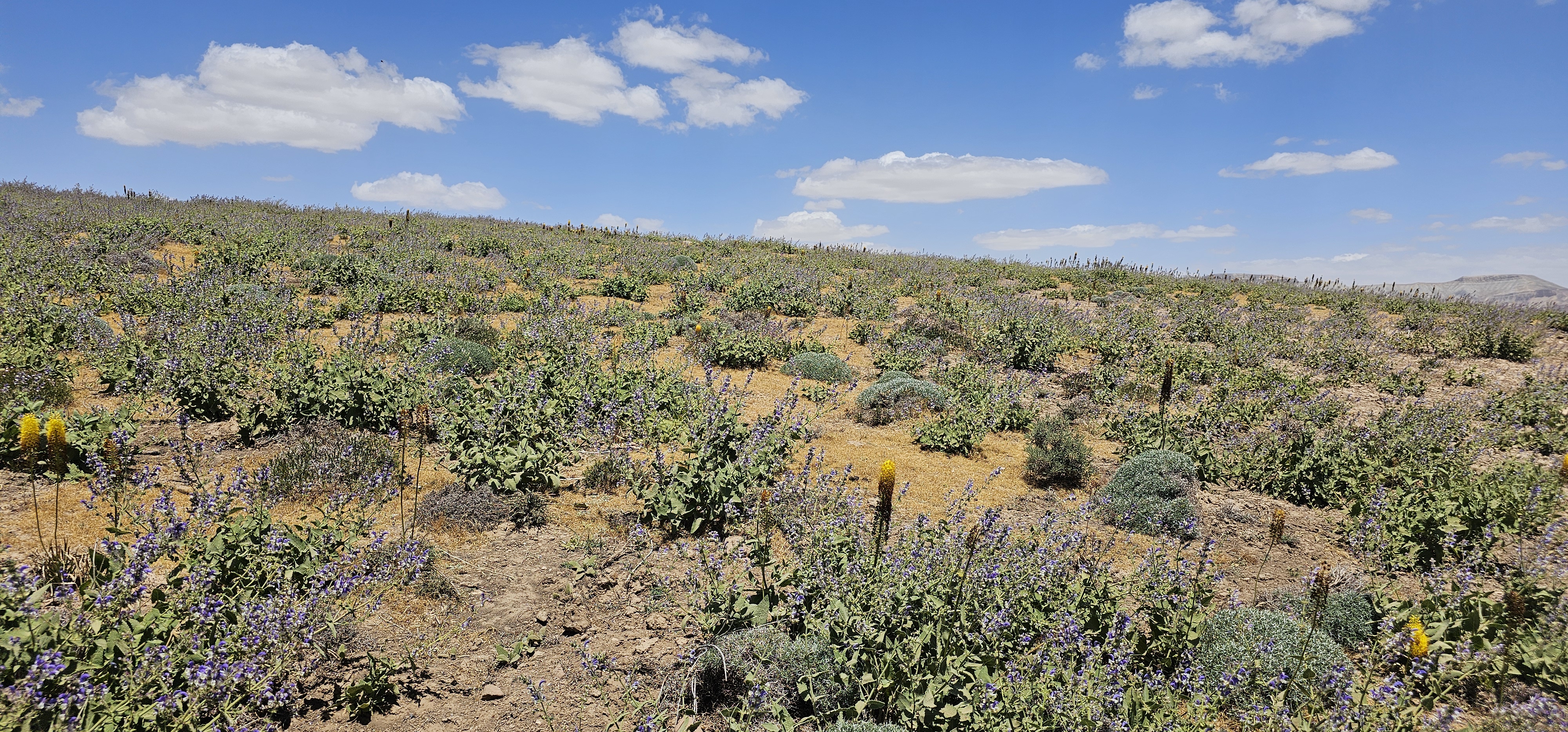
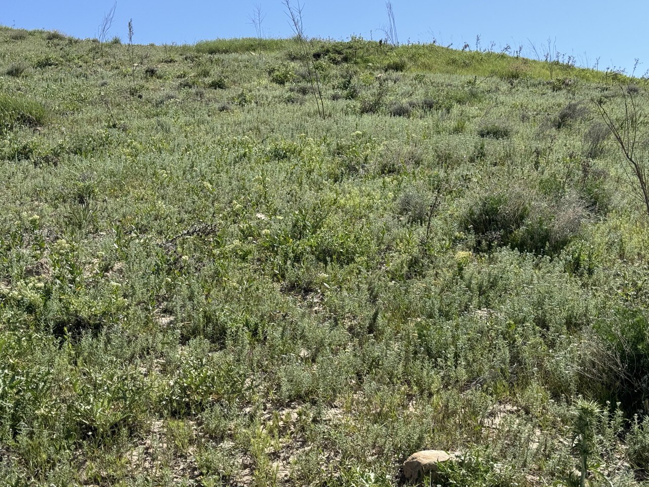
The quarantine area has shown remarkable improvements in the health of its ecosystem. Native grasses, shrubs, and bushes have successfully rehabilitated, with noticeable growth and regeneration. The efforts to protect this area have allowed these plants to thrive without the pressure of overgrazing, leading to the revitalization of the local flora.
A significant outcome of the quarantine area is its role as a natural seed bank. Native seeds collected from this rehabilitated land are now being stored and used for reseeding other degraded rangelands. These seeds, adapted to the local environment, have high potential for successful regeneration when used to restore other areas facing similar ecological challenges. This process not only supports the rehabilitation of nearby rangelands but also contributes to the long-term sustainability and resilience of the local ecosystem.
The success of this quarantine area highlights the importance of protective measures and demonstrates the potential for land recovery through strategic interventions. As a result, this area serves as a model for rangeland rehabilitation. The lessons from the technology applied can be a valuable resource for future restoration efforts across the region.
2.3 Photos of the Technology
Media Gallery
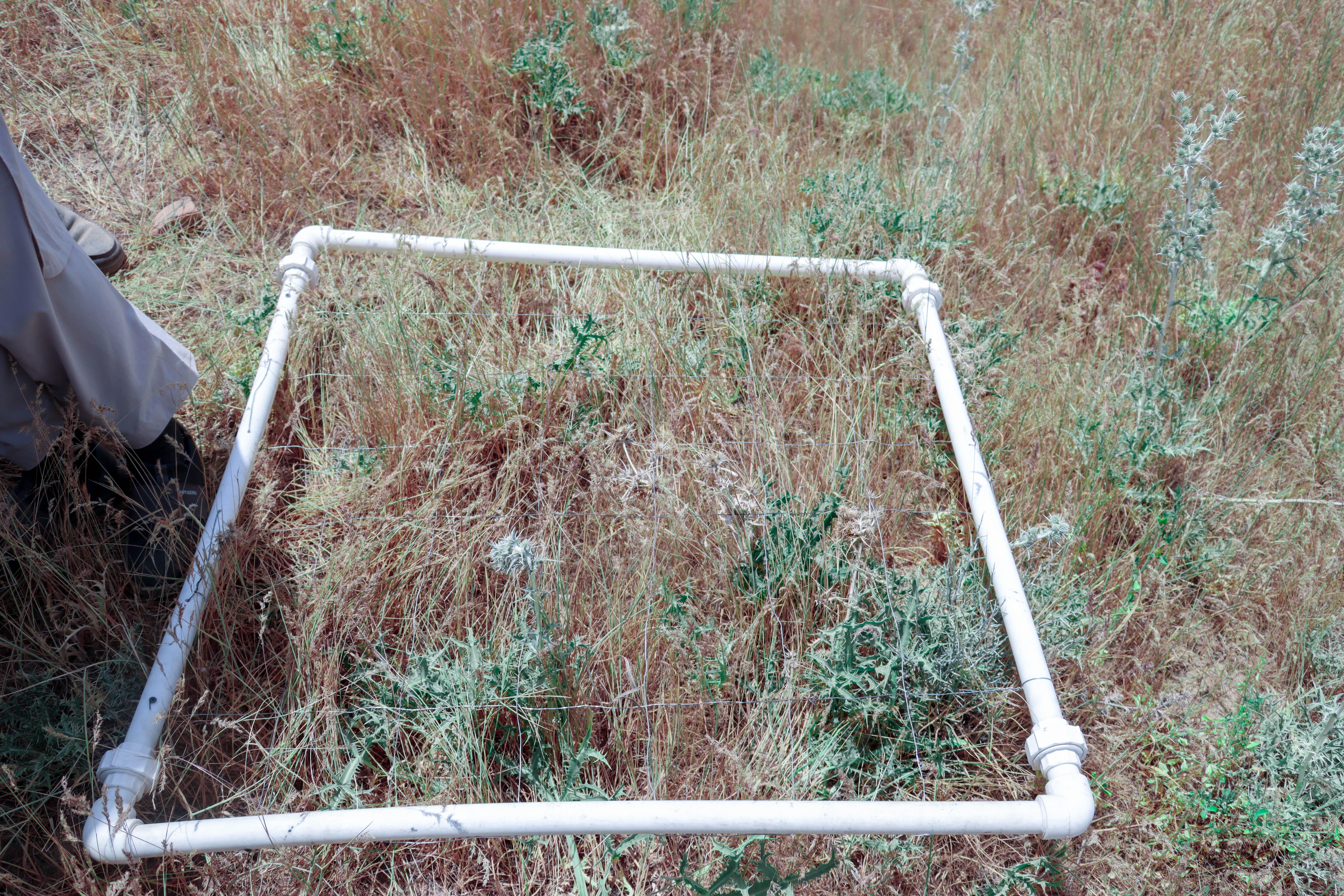
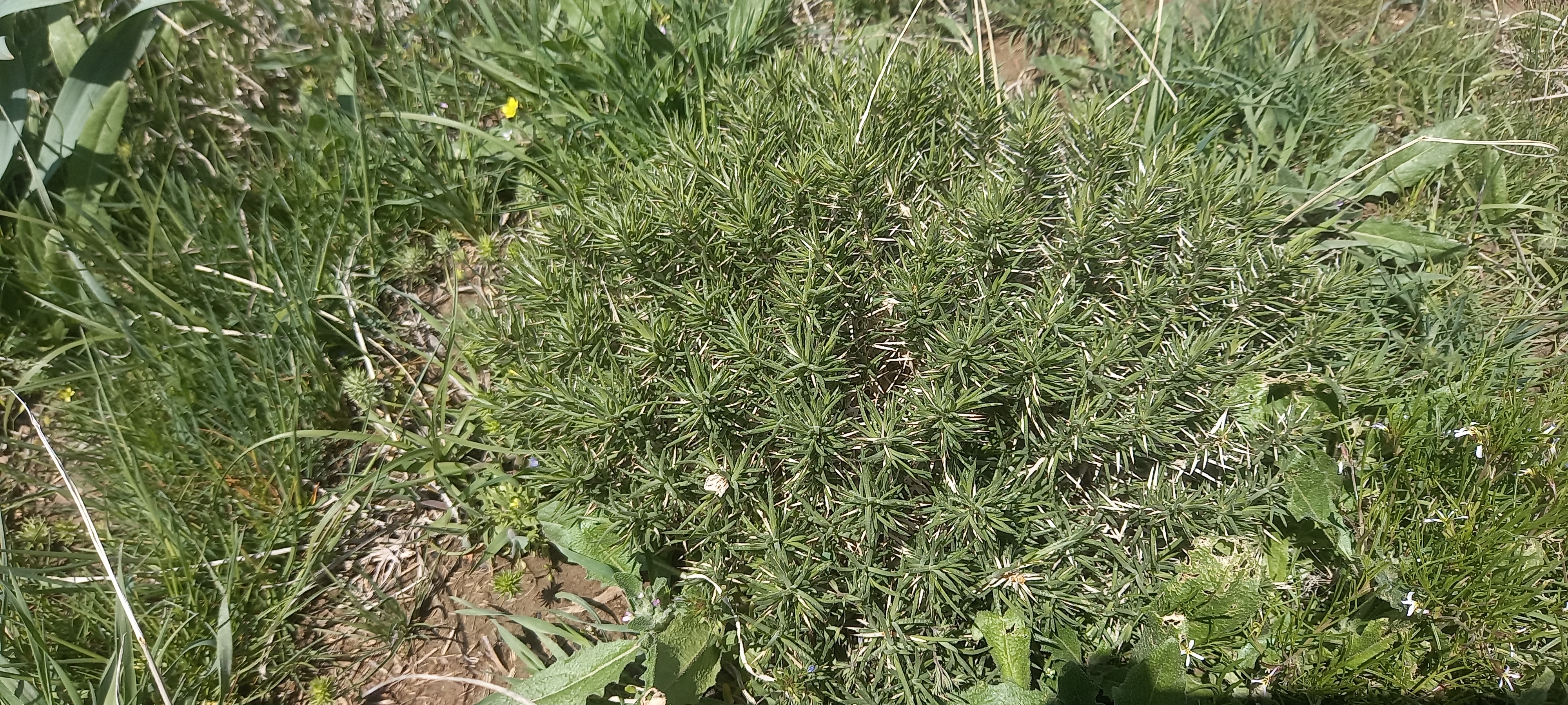
General remarks regarding photos:
Since this area is under rangeland quarantine, we have observed significant changes, such as the natural regeneration of grasses, shrubs, bushes, biodiversity and habitat.
2.4 Videos of the Technology
Date:
28/01/2025
Location:
Deh Beranj village, Qadis district, Badghis Afghanistan
Name of videographer:
Abdullah Kheradmand
2.5 Country/ region/ locations where the Technology has been applied and which are covered by this assessment
Country:
Afghanistan
Region/ State/ Province:
Badghis province
Further specification of location:
Deh Beranj Rangeland Management Association, Qadis district
Specify the spread of the Technology:
- evenly spread over an area
If the Technology is evenly spread over an area, specify area covered (in km2):
10.0
Is/are the technology site(s) located in a permanently protected area?
No
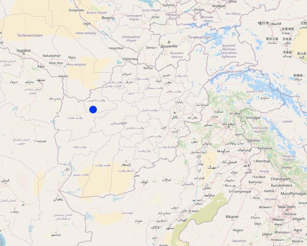
Map
×2.6 Date of implementation
Indicate year of implementation:
2022
2.7 Introduction of the Technology
Specify how the Technology was introduced:
- through projects/ external interventions
Comments (type of project, etc.):
GEF-06 SLM project in Afghanistan
3. Classification of the SLM Technology
3.1 Main purpose(s) of the Technology
- improve production
- reduce, prevent, restore land degradation
- conserve ecosystem
- preserve/ improve biodiversity
- mitigate climate change and its impacts
3.2 Current land use type(s) where the Technology is applied
Land use mixed within the same land unit:
No

Grazing land
Extensive grazing:
- Semi-nomadic pastoralism
Intensive grazing/ fodder production:
- Improved pastures
Animal type:
- sheep
Is integrated crop-livestock management practiced?
No
Products and services:
- meat
- milk
Species:
sheep
Count:
50000
3.4 Water supply
Water supply for the land on which the Technology is applied:
- rainfed
Comments:
Rainfall occurs in December to April
3.5 SLM group to which the Technology belongs
- area closure (stop use, support restoration)
- pastoralism and grazing land management
- improved ground/ vegetation cover
3.6 SLM measures comprising the Technology

vegetative measures
- V1: Tree and shrub cover

management measures
- M5: Control/ change of species composition
- M6: Waste management (recycling, re-use or reduce)
3.7 Main types of land degradation addressed by the Technology

soil erosion by water
- Wt: loss of topsoil/ surface erosion

physical soil deterioration
- Pw: waterlogging

biological degradation
- Bc: reduction of vegetation cover
- Bf: detrimental effects of fires
- Bs: quality and species composition/ diversity decline
3.8 Prevention, reduction, or restoration of land degradation
Specify the goal of the Technology with regard to land degradation:
- reduce land degradation
4. Technical specifications, implementation activities, inputs, and costs
4.1 Technical drawing of the Technology
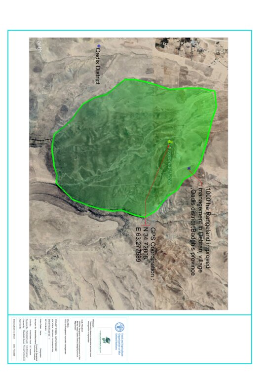
Technical specifications (related to technical drawing):
• Green area indicates where grasses regenerated and the GPS shows exact quarantined area.
• Rangeland quarantine was implemented for three years to facilitate the recovery of grasses. By restricting access to degraded areas, we allowed native vegetation to regenerate without disturbance. The grazing exclusion is by social fencing.
• The boundary mark is not a fence but functions as one. Constructed from rocks (1 x 1.5 x 2 meters), the boundary marks are placed every 100 to 200 meters around the rangeland quarantine area to clearly mark its boundaries and prevent or control grazing, ensuring the area remains closed for its recovery.
• Stakeholder involvement through inclusion of local communities in planning and implementation processes.
Author:
Shamsulhaq Shams
Date:
10/12/2024
4.2 General information regarding the calculation of inputs and costs
Specify how costs and inputs were calculated:
- per Technology area
Indicate size and area unit:
1000 Ha
Specify currency used for cost calculations:
- USD
Indicate average wage cost of hired labour per day:
5 USD
4.3 Establishment activities
| Activity | Timing (season) | |
|---|---|---|
| 1. | Survey and site selection followed by feasibility study | 1st month 10/04/2022 |
| 2. | Preparing construction material (eg. assembling rocks) | 2nd month 08/05/2022 |
| 3. | Construction of boundary marks around the area | 3rd month 01/06/2022 |
| 4. | Capacity building of the target communities | 4th month 05/07/2022 |
| 5. | Hiring guard for patrolling the area | 5th month 01/08/2022 |
4.4 Costs and inputs needed for establishment
| Specify input | Unit | Quantity | Costs per Unit | Total costs per input | % of costs borne by land users | |
|---|---|---|---|---|---|---|
| Labour | Skilled labour for construction of boundary mark | person/day | 60.0 | 11.0 | 660.0 | 100.0 |
| Labour | Unskilled labour for construction of boundary mark | person/day | 130.0 | 5.0 | 650.0 | 100.0 |
| Labour | Guard for patrolling the area | person/day | 2.0 | 1015.0 | 2030.0 | 50.0 |
| Construction material | Rock | M3 | 100.0 | 1.41 | 141.0 | 100.0 |
| Total costs for establishment of the Technology | 3481.0 | |||||
| Total costs for establishment of the Technology in USD | 3481.0 | |||||
If land user bore less than 100% of costs, indicate who covered the remaining costs:
50% of the costs of guards for patrolling the area was paid by the FAO-GEF project
Comments:
Cost of skilled labour for construction of the boundary marks was paid by FAO-GEF project.
4.5 Maintenance/ recurrent activities
| Activity | Timing/ frequency | |
|---|---|---|
| 1. | Patrolling the area | All seasons/regular |
4.6 Costs and inputs needed for maintenance/ recurrent activities (per year)
| Specify input | Unit | Quantity | Costs per Unit | Total costs per input | % of costs borne by land users | |
|---|---|---|---|---|---|---|
| Labour | Guard for patrolling the area (second year) | person/year | 2.0 | 1015.0 | 2030.0 | 50.0 |
| Total costs for maintenance of the Technology | 2030.0 | |||||
| Total costs for maintenance of the Technology in USD | 2030.0 | |||||
4.7 Most important factors affecting the costs
Describe the most determinate factors affecting the costs:
Skilled and unskilled labour
5. Natural and human environment
5.1 Climate
Annual rainfall
- < 250 mm
- 251-500 mm
- 501-750 mm
- 751-1,000 mm
- 1,001-1,500 mm
- 1,501-2,000 mm
- 2,001-3,000 mm
- 3,001-4,000 mm
- > 4,000 mm
Specify average annual rainfall (if known), in mm:
250.00
Specifications/ comments on rainfall:
Winter (January, February, March)
Dry periods start from May till November
Agro-climatic zone
- semi-arid
Annual temperature is 25 degrees
5.2 Topography
Slopes on average:
- flat (0-2%)
- gentle (3-5%)
- moderate (6-10%)
- rolling (11-15%)
- hilly (16-30%)
- steep (31-60%)
- very steep (>60%)
Landforms:
- plateau/plains
- ridges
- mountain slopes
- hill slopes
- footslopes
- valley floors
Altitudinal zone:
- 0-100 m a.s.l.
- 101-500 m a.s.l.
- 501-1,000 m a.s.l.
- 1,001-1,500 m a.s.l.
- 1,501-2,000 m a.s.l.
- 2,001-2,500 m a.s.l.
- 2,501-3,000 m a.s.l.
- 3,001-4,000 m a.s.l.
- > 4,000 m a.s.l.
Indicate if the Technology is specifically applied in:
- concave situations
Comments and further specifications on topography:
1800 m above sea level and slope angle is 20 %
5.3 Soils
Soil depth on average:
- very shallow (0-20 cm)
- shallow (21-50 cm)
- moderately deep (51-80 cm)
- deep (81-120 cm)
- very deep (> 120 cm)
Soil texture (topsoil):
- fine/ heavy (clay)
Soil texture (> 20 cm below surface):
- fine/ heavy (clay)
Topsoil organic matter:
- low (<1%)
5.4 Water availability and quality
Ground water table:
> 50 m
Availability of surface water:
medium
Water quality (untreated):
good drinking water
Water quality refers to:
both ground and surface water
Is water salinity a problem?
No
Is flooding of the area occurring?
No
5.5 Biodiversity
Species diversity:
- high
Habitat diversity:
- medium
Comments and further specifications on biodiversity:
The rangelands are characterized by flora diversity and likely host a variety of plant species that are adapted to arid conditions. These include drought-resistant grasses like Eragrostis species, shrubs like Acantholimon caryophllaceum, Artemisia and some endemic plant species unique to the region (Achillea nabilis, Cardaria draba, Cousinia resinosa).
5.6 Characteristics of land users applying the Technology
Sedentary or nomadic:
- Semi-nomadic
Market orientation of production system:
- mixed (subsistence/ commercial)
Off-farm income:
- less than 10% of all income
Relative level of wealth:
- poor
Individuals or groups:
- groups/ community
Level of mechanization:
- manual work
Gender:
- men
Age of land users:
- middle-aged
5.7 Average area of land used by land users applying the Technology
- < 0.5 ha
- 0.5-1 ha
- 1-2 ha
- 2-5 ha
- 5-15 ha
- 15-50 ha
- 50-100 ha
- 100-500 ha
- 500-1,000 ha
- 1,000-10,000 ha
- > 10,000 ha
Is this considered small-, medium- or large-scale (referring to local context)?
- small-scale
5.8 Land ownership, land use rights, and water use rights
Land ownership:
- communal/ village
Land use rights:
- communal (organized)
Water use rights:
- communal (organized)
Are land use rights based on a traditional legal system?
Yes
Specify:
Traditional land use rights
Comments:
Land use rights are held collectively by communities, reflecting a communal approach to resource management.
5.9 Access to services and infrastructure
health:
- poor
- moderate
- good
education:
- poor
- moderate
- good
technical assistance:
- poor
- moderate
- good
employment (e.g. off-farm):
- poor
- moderate
- good
markets:
- poor
- moderate
- good
energy:
- poor
- moderate
- good
roads and transport:
- poor
- moderate
- good
drinking water and sanitation:
- poor
- moderate
- good
financial services:
- poor
- moderate
- good
6. Impacts and concluding statements
6.1 On-site impacts the Technology has shown
Socio-economic impacts
Production
fodder production
Quantity before SLM:
500 kg fodder/ hectare
Quantity after SLM:
900 kg fodder/hectare
Comments/ specify:
Preventing overgrazing helps maintain plant cover and allows for recovery periods, leading to increased biomass production.
animal production
Quantity before SLM:
0.5 liter per sheep/day
Quantity after SLM:
1 liter per sheep/day
Comments/ specify:
Enhancing the quality and availability of forage provid sheep with a more nutritious diet, which directly impacts milk production.
Water availability and quality
drinking water quality
Quantity before SLM:
Contaminated water with minerals
Quantity after SLM:
Leading to clearer and cleaner water
Comments/ specify:
Effective rangeland management practices enhance the overall health of the ecosystem, leading to improved drinking water quality through better infiltration due to better soil cover and less water runoff.
Socio-cultural impacts
food security/ self-sufficiency
Comments/ specify:
Sustainable rangeland management supports local economies by providing livelihoods through livestock production, which can improve food access and self-sufficiency in communities.
health situation
Quantity before SLM:
Less nutritious animal products
Quantity after SLM:
More nutritious animal products
Comments/ specify:
Enhanced forage quality leads to healthier livestock, which provides better quality meat and dairy products, contributing to improved nutrition for communities.
SLM/ land degradation knowledge
Quantity before SLM:
Little capacity building
Quantity after SLM:
Capacity building for 500 members of the Rangeland Management Association
Comments/ specify:
Training programs for farmers and land managers, increasing their knowledge about sustainable practices and land conservation techniques.
Ecological impacts
Water cycle/ runoff
surface runoff
Comments/ specify:
Rangeland improvement practices can significantly reduce surface runoff, enhance soil health, and improve water quality
excess water drainage
Comments/ specify:
More efficient excess water drainage, enhancing soil structure, reducing waterlogging, and promoting overall ecological health.
Soil
soil cover
Quantity before SLM:
20% soil cover
Quantity after SLM:
80-90% soil cover
Comments/ specify:
Enhanced soil cover leads to healthier ecosystems, improved soil conditions, and increased biodiversity.
Biodiversity: vegetation, animals
Vegetation cover
Quantity before SLM:
20%
Quantity after SLM:
80-90%
Comments/ specify:
Enhanced vegetation cover leads to healthier ecosystems, improved soil conditions, and increased biodiversity
biomass/ above ground C
Quantity before SLM:
20-30% biomass
Quantity after SLM:
80-90% biomass
Comments/ specify:
Rangeland improvement practices significantly boost biomass and above-ground carbon levels, enhancing ecosystem productivity and contributing to carbon sequestration efforts.
plant diversity
Quantity before SLM:
60/plants per square meter
Quantity after SLM:
200/plants per square meter
Comments/ specify:
Enhanced plant diversity leads to healthier ecosystems, increased resilience, and improved overall productivity.
beneficial species
Quantity before SLM:
Limited Beneficial Species
Quantity after SLM:
Increased Beneficial Species
Comments/ specify:
Rangeland improvement practices significantly boost the presence and impact of beneficial species, enhancing soil health, ecosystem stability, and overall productivity.
Climate and disaster risk reduction
drought impacts
Quantity before SLM:
500 kg fodder/ha
Quantity after SLM:
800 kg fodder/ ha
Comments/ specify:
Rangeland improvement practices significantly mitigate the impacts of drought, enhancing soil moisture retention, vegetation resilience by enhancing the land's ability to retain moisture and support vegetation growth, and overall ecosystem stability.
emission of carbon and greenhouse gases
Quantity before SLM:
80000 m3/ winter season
Quantity after SLM:
20000 m3/ winter season
Comments/ specify:
Healthy, diverse plant communities capture and sequester more carbon dioxide through photosynthesis, contributing to greater carbon sequestration and contributing to climate change mitigation efforts.
Specify assessment of on-site impacts (measurements):
N/A
6.2 Off-site impacts the Technology has shown
downstream flooding
Quantity before SLM:
10-12 times /year
Quantity after SLM:
Zero floods per year
Comments/ specify:
Risk and impact of downstream flooding is significantly reduced by enhancing vegetation cover, improving soil health, and promoting better water management.
wind transported sediments
Quantity before SLM:
more sediment transport
Quantity after SLM:
Zero sediment transport
Comments/ specify:
With vegetation cover, there is significantly less sediment being transported by wind
impact of greenhouse gases
Quantity before SLM:
20 tons CO2 removed/year
Quantity after SLM:
50 tons CO2 removed/year
Comments/ specify:
Healthy rangelands help absorb more carbon in plants and soil, which lowers the amount of CO₂ in the atmosphere. When these lands are grazed properly, they allow perennial and annual grasses to regrow. This regrowth not only captures more carbon but also improves soil health.
Specify assessment of off-site impacts (measurements):
N/A
6.3 Exposure and sensitivity of the Technology to gradual climate change and climate-related extremes/ disasters (as perceived by land users)
Gradual climate change
Gradual climate change
| Season | increase or decrease | How does the Technology cope with it? | |
|---|---|---|---|
| annual temperature | decrease | moderately | |
| annual rainfall | increase | moderately |
Climate-related extremes (disasters)
Meteorological disasters
| How does the Technology cope with it? | |
|---|---|
| local windstorm | moderately |
Climatological disasters
| How does the Technology cope with it? | |
|---|---|
| heatwave | moderately |
| drought | moderately |
Hydrological disasters
| How does the Technology cope with it? | |
|---|---|
| flash flood | moderately |
6.4 Cost-benefit analysis
How do the benefits compare with the establishment costs (from land users’ perspective)?
Short-term returns:
slightly positive
Long-term returns:
very positive
How do the benefits compare with the maintenance/ recurrent costs (from land users' perspective)?
Short-term returns:
positive
Long-term returns:
very positive
Comments:
Improved rangelands often lead to higher forage yields, supporting larger and healthier livestock populations. This can result in increased income for land users.
6.5 Adoption of the Technology
- single cases/ experimental
Of all those who have adopted the Technology, how many did so spontaneously, i.e. without receiving any material incentives/ payments?
- 0-10%
6.6 Adaptation
Has the Technology been modified recently to adapt to changing conditions?
No
6.7 Strengths/ advantages/ opportunities of the Technology
| Strengths/ advantages/ opportunities in the land user’s view |
|---|
| Rangeland quarantine allow for better management of pasture resources leading to improved pasture and grass quality. |
| Rangeland quarantine increased productivity can maximize the land's carrying capacity leading to higher livestock productivity per unit area. |
| Rangeland quarantine helps prevent overgrazing, reduces parasite loads, minimizes soil compaction, and allows for more natural feeding behaviors, all of which contribute to overall animal health. |
| Reduce greenhouse gas emissions through carbon sequestration. |
| Properly managed rangeland quarantine can promote biodiversity by creating varied habitats and supporting a range of plant and animal species. |
| Implementing rangeland quarantine can lead to knowledge transfer among farmers, researchers, and agricultural extension services, fostering innovation and best practices in sustainable land management. |
6.8 Weaknesses/ disadvantages/ risks of the Technology and ways of overcoming them
| Weaknesses/ disadvantages/ risks in the land user’s view | How can they be overcome? |
|---|---|
| Ensuring the right number of animals on each grazing area can be challenging, leading to risks of overgrazing or underutilization. | Stocking rate management. |
| Rangeland quarantine can lead to social conflicts among different user groups, such as conflicting interests between livestock owners, conservationists, and indigenous communities. | Facilitating dialogue among stakeholders, promoting collaborative rangeland management approaches, respecting traditional land tenure systems, and fostering community-based conflict resolution mechanisms can help manage. |
| Weaknesses/ disadvantages/ risks in the compiler’s or other key resource person’s view | How can they be overcome? |
|---|---|
| When grazing animals are quarantined, their numbers may increase in certain areas, leading to overgrazing. This can result in habitat degradation and loss of plant diversity. | Implement managed grazing systems to control population densities and prevent overgrazing. This can include rotational grazing practices. |
7. References and links
7.1 Methods/ sources of information
- field visits, field surveys
5
- interviews with land users
12
- interviews with SLM specialists/ experts
2
- compilation from reports and other existing documentation
2
When were the data compiled (in the field)?
23/10/2024
7.4 General comments
This questionnaire serves as an ideal model to showcase the work modality and shared experiences with other regions. By evaluating this type of work model, individuals interested in this field can easily adjust their activities and increase their chances of success.
Links and modules
Expand all Collapse allLinks
No links
Modules
No modules