Learning Site to promote Sustainable Land and Forest Management Practices in Khost [Afghanistan]
- Creation:
- Update:
- Compiler: Mohammad Arif
- Editors: Megha bajaj, Mohammad Aslam Hasand, Afghanistan Safi
- Reviewers: Rima Mekdaschi Studer, Illias Animon, Muhammad Ishaq Safi
په خوست ولایت کی د ځنګل او ځمکی بنسټیزه مدیریت عملی کارونو د پاره دزده کړی ساحی رامینځ ته کول
technologies_7460 - Afghanistan
View sections
Expand all Collapse all1. General information
1.2 Contact details of resource persons and institutions involved in the assessment and documentation of the Technology
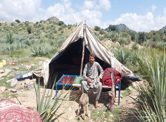
land user:
Akbar Muhajir
Sparkai Forest and Rangeland Management Association
Afghanistan
Name of project which facilitated the documentation/ evaluation of the Technology (if relevant)
Combating land degradation and biodiversity loss by promoting sustainable rangeland management and biodiversity conservation in AfghanistanName of the institution(s) which facilitated the documentation/ evaluation of the Technology (if relevant)
FAO Afghanistan (FAO Afghanistan) - Afghanistan1.3 Conditions regarding the use of data documented through WOCAT
The compiler and key resource person(s) accept the conditions regarding the use of data documented through WOCAT:
Yes
1.4 Declaration on sustainability of the described Technology
Is the Technology described here problematic with regard to land degradation, so that it cannot be declared a sustainable land management technology?
No
1.5 Reference to Questionnaire(s) on SLM Approaches (documented using WOCAT)
Stakeholder collaboration for building Learning Site for landscape … [Afghanistan]
To raise awareness and ensure clear role delineation, a series of consultations were held with the local community, the Forest Management/Rangeland Management (FM/RM) association, and other key stakeholders. Memorandum of Understanding (MoU) that formally outlined the roles and responsibilities of each party was signed. Additionally, the FM/RM association issued a …
- Compiler: Mohammad Arif
2. Description of the SLM Technology
2.1 Short description of the Technology
Definition of the Technology:
The learning site incorporates several key elements of the technology including a solar-powered water lifting system, three reservoirs and an adopted irrigation system. It features demonstration plots for various initiatives, such as tree planting (walnut, almond, pomegranate and mulberry, the cultivation of fodder (alfalfal Mazari palm) and and medicinal plants (e,g, cumin), and a nursery (walnut) established through the community’s own contributions.
2.2 Detailed description of the Technology
Description:
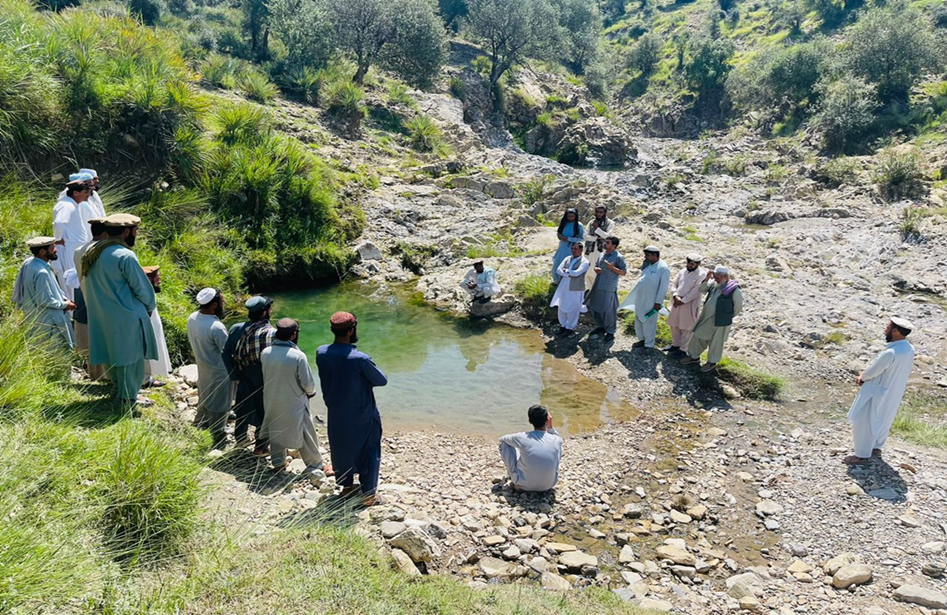
The site was rich in flora and fauna, but human and animal interference has led to significant degradation. Many indigenous plants have been uprooted, and wildlife has migrated due to the loss of habitat. In response, the community has begun to manage and restore the land through practices like rotational grazing and quarantine measures to combat illegal logging. The degradation of natural resources, particularly forests and rangelands, has significantly impacted local communities in Khost. Many residents rely on these resources for fuel, heating, and grazing livestock. However, challenges such as overgrazing, the uprooting of bushes and shrubs, and deforestation for fuel have led to considerable environmental degradation. The lack of proper management of these natural resources has resulted in consistent flooding, which erodes and pollutes agricultural lands. Additionally, local communities often do not recognize the value of these resources, leading to unsustainable land-use practices. Poverty, ongoing conflicts, political instability, and unemployment have driven residents to cut down trees for sale in local markets to support their livelihoods.
To address these challenges, we conducted a participatory assessment involving local communities and stakeholders, aiming to establish a learning site for sustainable land and forest management practices. Our assessment revealed that many local residents were unaware of sustainable practices or the ecological significance of these resources, contributing to ongoing environmental degradation.
After assessing the natural resources and community needs, we established a learning site for sustainable forest and rangeland management. Feasibility studies helped us identify available water sources, assess community interest, and select suitable land next to forests and rangelands. The site selected is easily accessible, located about 10 kilometers from the main road.
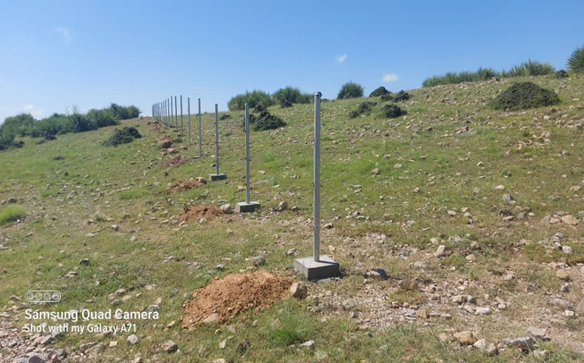
In the initial phase, we installed 26 solar panels on three metal stands, each with a capacity of 400 watts, positioned 200 meters from the water source. At the water source, we installed a 2-inch submersible pump to lift water to the learning site, which encompasses approximately 20 hectares of land across three small hills, each situated 300 meters apart.
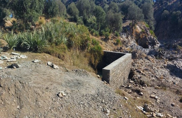
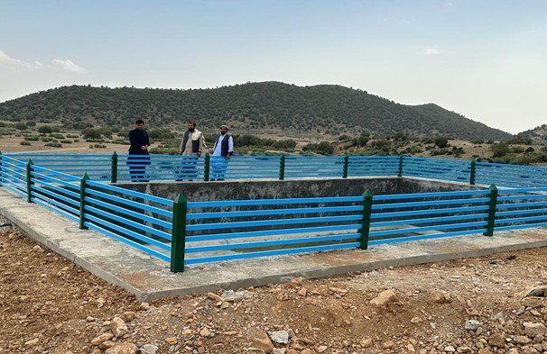
We constructed three reservoirs, each with a capacity of 192 cubic meters. The first reservoir is located 300 meters from the water source and is fed by the solar system. A pipe network system utilizing 2-inch pipes connects the water source to the first reservoir and the other two reservoirs. This system allows the reservoirs to supply water to lower fields or demonstration plots via gravity.
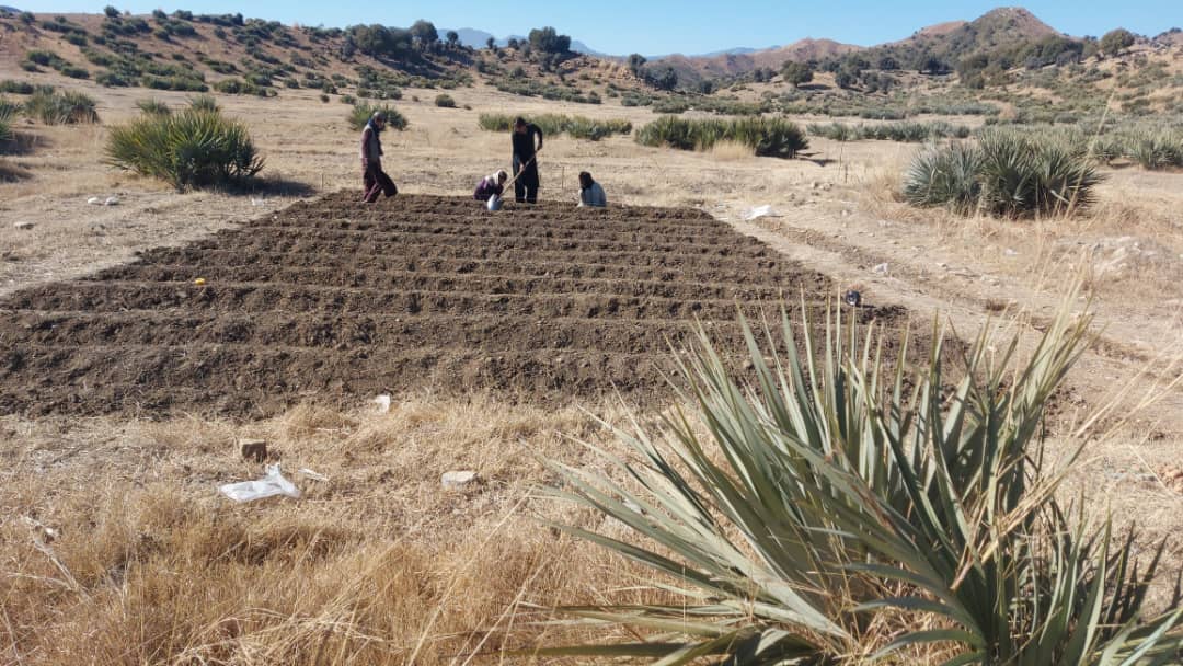
In the demonstration plots, a network of pipes was installed every 50 meters, with taps placed accordingly. We established a 20-hectare learning site focused on sustainable forest and rangeland management practices, featuring demonstration plots for reforestation, fodder and medicinal plant production, reseeding, and a forest nursery. The dimensions of these plots include 10 hectares for reforestation, 2 hectares for fodder production, 0.5 hectares for medicinal plants, and 0.1 hectares for the walnut nursery. A total of 3,000 forest species were planted in the reforestation plot, along with alfalfa and Mazari palm in the fodder plots, and black cumin in the medicinal plot.
These plots are irrigated using flexible 1-inch pipes connected to the taps installed every 50 meters. Given Khost Province's favorable weather conditions, the plants require irrigation primarily from April to August; outside of this interval, the irrigation system provides sufficient water to sustain the site. The site were fenced with barbed wire for protection.
The technology is applied to communal land adjacent to forests and rangelands. It serves as an educational center for the local community, focusing on sustainable landscape restoration and management. A savings box was created, and a Forest and Rangeland Management Association was established. Social funds were set up, along with fencing and hiring guards for the maintenance of the technology.
Key infrastructure was established, including a solar-powered lifting system, constructed reservoirs, and a piping network for irrigation. Various forest species were planted in reforestation plots, while local seeds were planted in fodder and medicinal plots. Additionally, walnut seeds were sown in a nursery for diverse restoration practices. These efforts have revitalized the land. Barbed wire fencing was installed for protection, and the site is now fully operational as a learning site.
The introduction of this technology led to positive changes in the local community. They have successfully quarantined forest and rangeland, implemented rotational grazing, and collected local seeds and cuttings to plant on degraded lands and riverbanks. Community-based nurseries were also established to transplant seedlings into degraded forest areas, helping to revitalize natural resources.
The local community is optimistic about the technology, particularly the reservoir construction and solar-powered lifting systems that ensure water availability, as well as the restoration techniques employed. However, they expressed concerns about interference from neighbors, livestock grazing, floods that can clog pumps, and damage from hail and windstorms to solar panels.
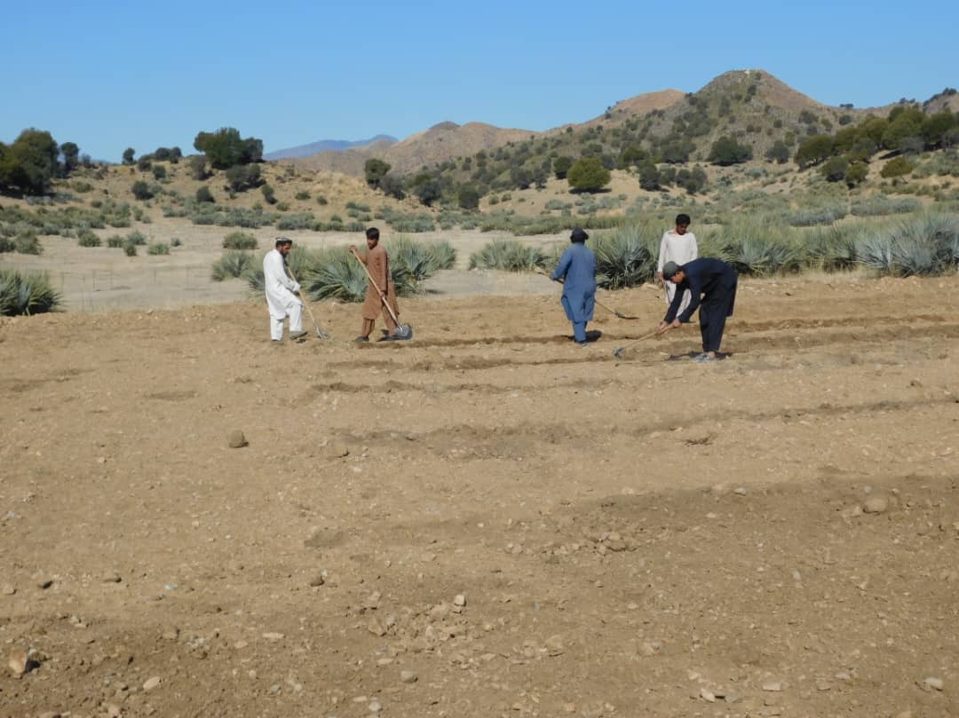
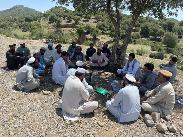
2.3 Photos of the Technology
Media Gallery
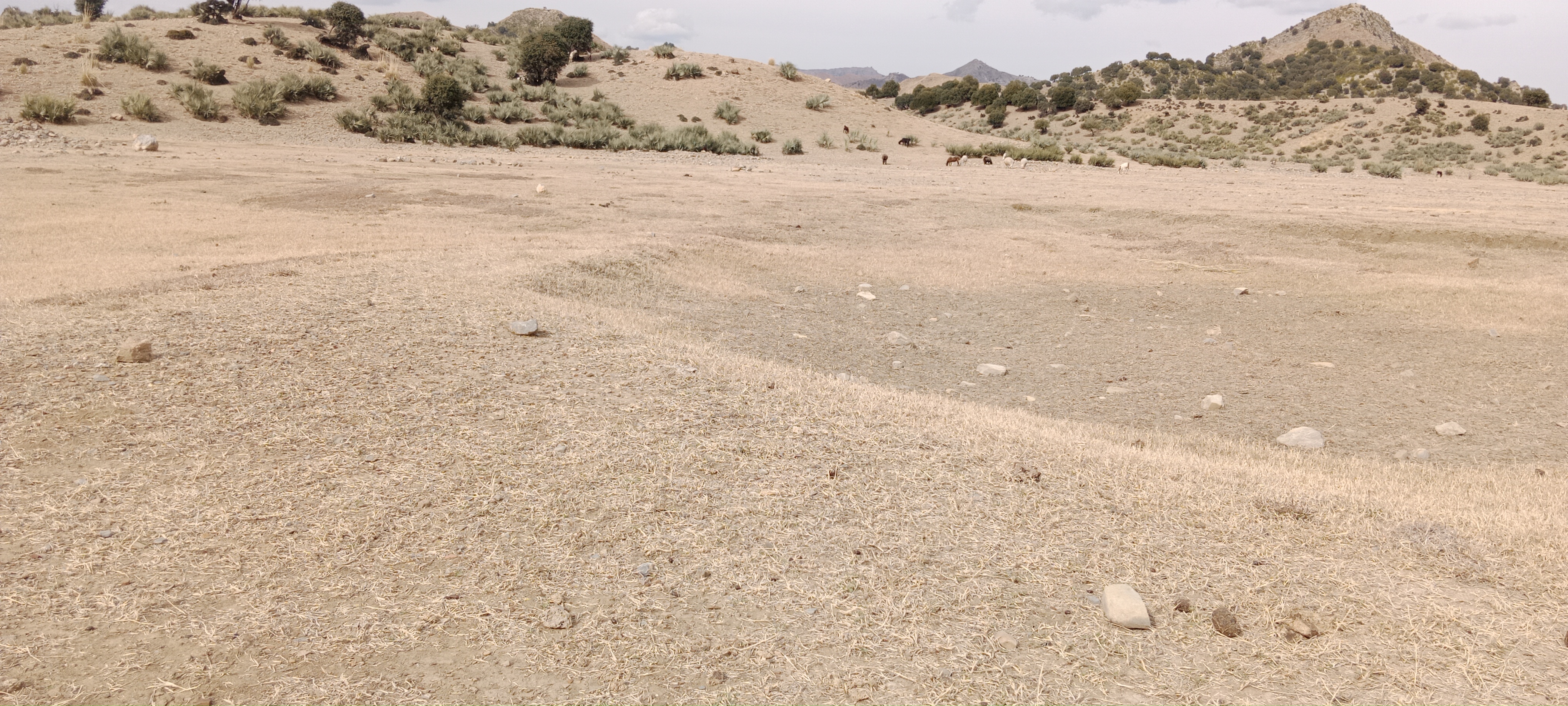
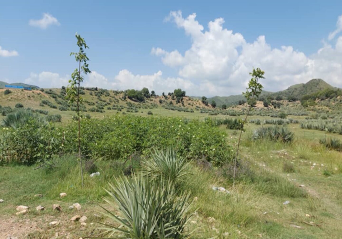
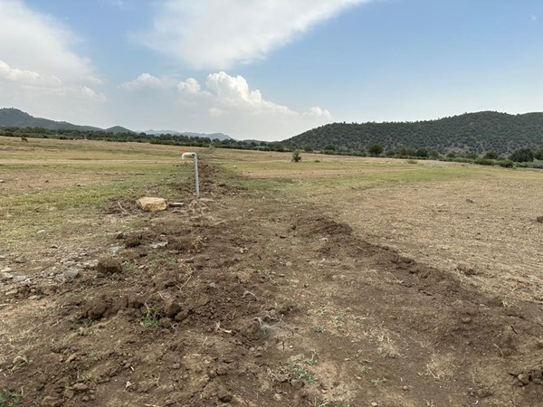

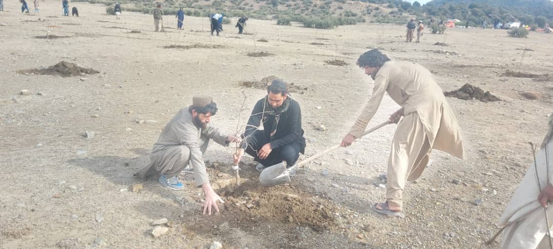
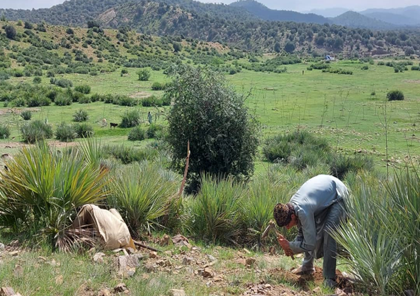
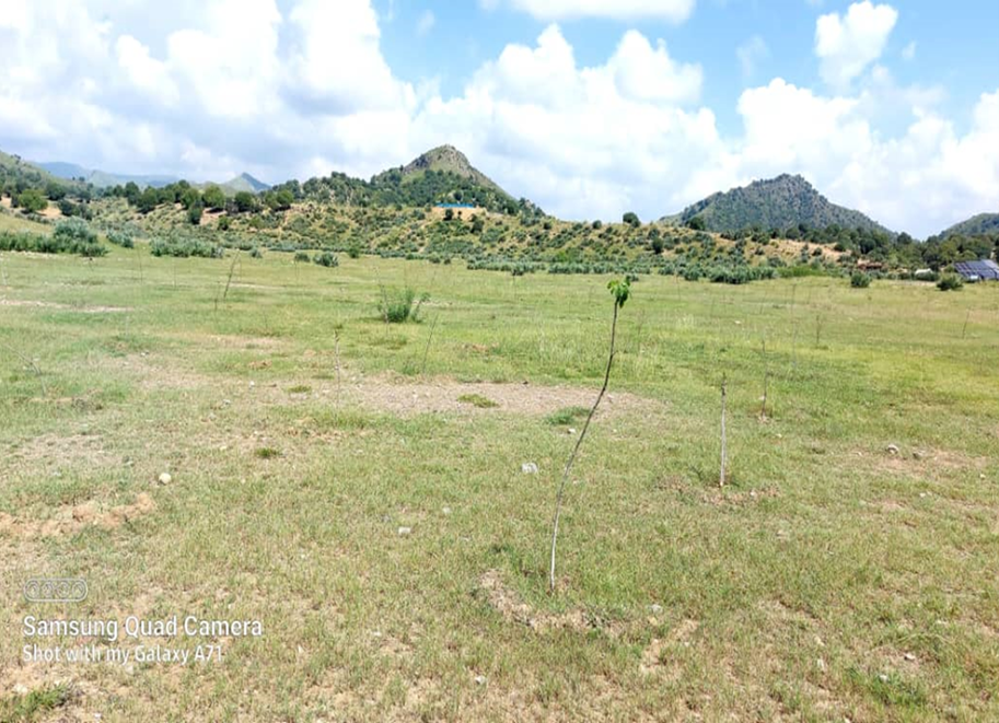
General remarks regarding photos:
The photo was taken with a low-quality smartphone.
2.4 Videos of the Technology
Comments, short description:
N/A
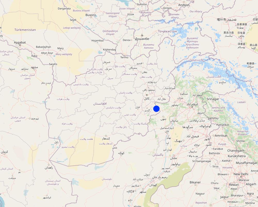
2.5 Country/ region/ locations where the Technology has been applied and which are covered by this assessment
Country:
Afghanistan
Region/ State/ Province:
Khost
Further specification of location:
Stara Mila, Sparkai village of Baak district
Specify the spread of the Technology:
- applied at specific points/ concentrated on a small area
Is/are the technology site(s) located in a permanently protected area?
No
Comments:
The site is situated near a forest and rangeland, approximately 20 km from the Baak main road, extending towards the Zazi Maidan district. It is classified as communal land
Map
×2.6 Date of implementation
Indicate year of implementation:
2023
2.7 Introduction of the Technology
Specify how the Technology was introduced:
- through projects/ external interventions
Comments (type of project, etc.):
FAO- GEF-07 Combating land degradation and biodiversity loss by promoting sustainable rangeland management and biodiversity conservation in Afghanistan (GEF7)
3. Classification of the SLM Technology
3.1 Main purpose(s) of the Technology
- reduce, prevent, restore land degradation
- conserve ecosystem
- preserve/ improve biodiversity
- adapt to climate change/ extremes and its impacts
- serves as educational centre for the local community on sustainable landscape restoration and management
3.2 Current land use type(s) where the Technology is applied
Land use mixed within the same land unit:
Yes
Specify mixed land use (crops/ grazing/ trees):
- Silvo-pastoralism

Cropland
- Tree and shrub cropping
Tree and shrub cropping - Specify crops:
- fruits, other
- tree nuts (brazil nuts, pistachio, walnuts, almonds, etc.)
- walnut, almond, pomegranate, mulberry
Number of growing seasons per year:
- 1
Is intercropping practiced?
No
Is crop rotation practiced?
No

Grazing land
Extensive grazing:
- Nomadism
- Semi-nomadic pastoralism
Intensive grazing/ fodder production:
- Cut-and-carry/ zero grazing
- Improved pastures
Animal type:
- cattle - dairy and beef (e.g. zebu)
- goats
- sheep
Is integrated crop-livestock management practiced?
No
Products and services:
- meat
- milk
Species:
cattle - dairy and beef (e.g. zebu)
Count:
510

Forest/ woodlands
- (Semi-)natural forests/ woodlands
(Semi-)natural forests/ woodlands: Specify management type:
- Dead wood/ prunings removal
- Non-wood forest use
Type of (semi-)natural forest:
- subtropical mountain systems natural vegetation
- wild olive, black thorn, hop bush, Mazari palm, cumin
Are the trees specified above deciduous or evergreen?
- mixed deciduous/ evergreen
Products and services:
- Timber
- Other forest products
- Recreation/ tourism
- Protection against natural hazards
Comments:
Due to poor management, the land has been overgrazed. To address this, we established a learning site focused on restoration through various interventions: reforestation, fodder and medicinal plant demonstration plots, and a 50-square-meter nursery for sapling production. The site is protected by fencing to prevent herders from grazing, allowing them to collect fodder instead. Some fodder is left in the field to produce seeds for natural regeneration.
Forest and Rangeland Management Association focuses on:
Local seed collection: Gathering native seeds to enhance biodiversity and ensure ecosystem resilience.
Ecotourism development: Encouraging visitors to explore the sites, fostering appreciation for local flora and fauna while supporting conservation efforts.
Regeneration of native species: Implementing strategies to restore and regenerate various native plant species, which play crucial roles in maintaining ecological balance.
Fodder production for silage: Cultivating high-quality fodder crops that contribute to livestock nutrition and support sustainable agriculture.
Sapling production through nurseries: Establishing nurseries dedicated to growing saplings of native forest species as well as fruit and nut trees, which can be used for reforestation, habitat restoration efforts and generating income.
3.3 Has land use changed due to the implementation of the Technology?
Has land use changed due to the implementation of the Technology?
- Yes (Please fill out the questions below with regard to the land use before implementation of the Technology)
Land use mixed within the same land unit:
Yes
Specify mixed land use (crops/ grazing/ trees):
- Agro-pastoralism (incl. integrated crop-livestock)
Grazing land
Extensive grazing:
- Nomadism
- Semi-nomadic pastoralism
Intensive grazing/ fodder production:
- Cut-and-carry/ zero grazing
- Improved pastures
Animal type:
- cattle - dairy and beef (e.g. zebu)
- goats
- sheep
Is integrated crop-livestock management practiced?
No
Products and services:
- meat
- milk
Species:
cattle - dairy and beef (e.g. zebu)
Count:
510
Forest/ woodlands
- (Semi-)natural forests/ woodlands
(Semi-)natural forests/ woodlands: Specify management type:
- Dead wood/ prunings removal
Type of (semi-)natural forest:
- subtropical mountain systems natural vegetation
- wild olive, Mazari palm, hop bush, black thorn and grasses
Are the trees specified above deciduous or evergreen?
- mixed deciduous/ evergreen
Products and services:
- Timber
- Fuelwood
- Recreation/ tourism
- Protection against natural hazards
Comments:
The area is a dry mountainous terrain with natural vegetation including wild olive, mazari palm, hopbush, and grasses. It supports nomadic and semi-nomadic pastoralism, primarily grazing goats, sheep, and cows.
3.4 Water supply
Water supply for the land on which the Technology is applied:
- mixed rainfed-irrigated
Comments:
Near the learning site, a gully and springs provide a year-round water source. We have installed a solar-powered lifting system and constructed three reservoirs to distribute water across 20 hectares, including the planted areas and demonstration plots. A network of pipes and taps with flexible hoses ensures efficient water distribution. This water source is exclusively for this site and does not affect neighboring villages or farmers.
3.5 SLM group to which the Technology belongs
- forest plantation management
- improved ground/ vegetation cover
- irrigation management (incl. water supply, drainage)
3.6 SLM measures comprising the Technology

vegetative measures
- V1: Tree and shrub cover
- V2: Grasses and perennial herbaceous plants

structural measures
- S6: Walls, barriers, palisades, fences
- S7: Water harvesting/ supply/ irrigation equipment
- S10: Energy saving measures

management measures
- M2: Change of management/ intensity level
- M3: Layout according to natural and human environment
Comments:
The whole area 20 hectares have been fenced with barbed wire, under the structure measures, reservoirs have been constructed and dug pits for plants.
3.7 Main types of land degradation addressed by the Technology

soil erosion by water
- Wt: loss of topsoil/ surface erosion

biological degradation
- Bc: reduction of vegetation cover
- Bh: loss of habitats
- Bs: quality and species composition/ diversity decline

water degradation
- Hs: change in quantity of surface water
- Hg: change in groundwater/aquifer level
- Hp: decline of surface water quality
- Hq: decline of groundwater quality
Comments:
The local community relies on natural resources for their livelihoods, leading to deforestation, overgrazing, and the uprooting of shrubs and bushes for fuel. Severe runoff, droughts, and climate change have further contributed to environmental degradation.
3.8 Prevention, reduction, or restoration of land degradation
Specify the goal of the Technology with regard to land degradation:
- restore/ rehabilitate severely degraded land
- adapt to land degradation
Comments:
An educational center (learning site) has been established on degraded land to enhance the capacity of the local community and other stakeholders about best practices for landscape restoration.
4. Technical specifications, implementation activities, inputs, and costs
4.1 Technical drawing of the Technology
Technical specifications (related to technical drawing):
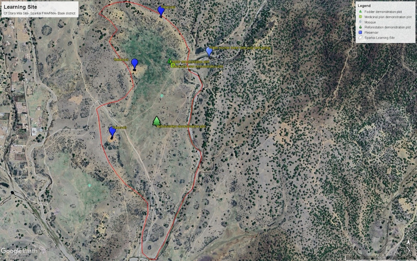
This GIS map highlights learning site elements. The blue pins indicate water source and reservoirs, while the green rectangular pins represent fodder demonstration plot. Yellow squire pin mark area dedicated to medicinal plants, and green tree-shaped pin indicate reforestation plot. Finally, the red track pin indicates location of barbed wire fencing. The site map has been prepared after the completion of intervention.
Author:
Mohammad Omar Dost
Date:
17/09/2024
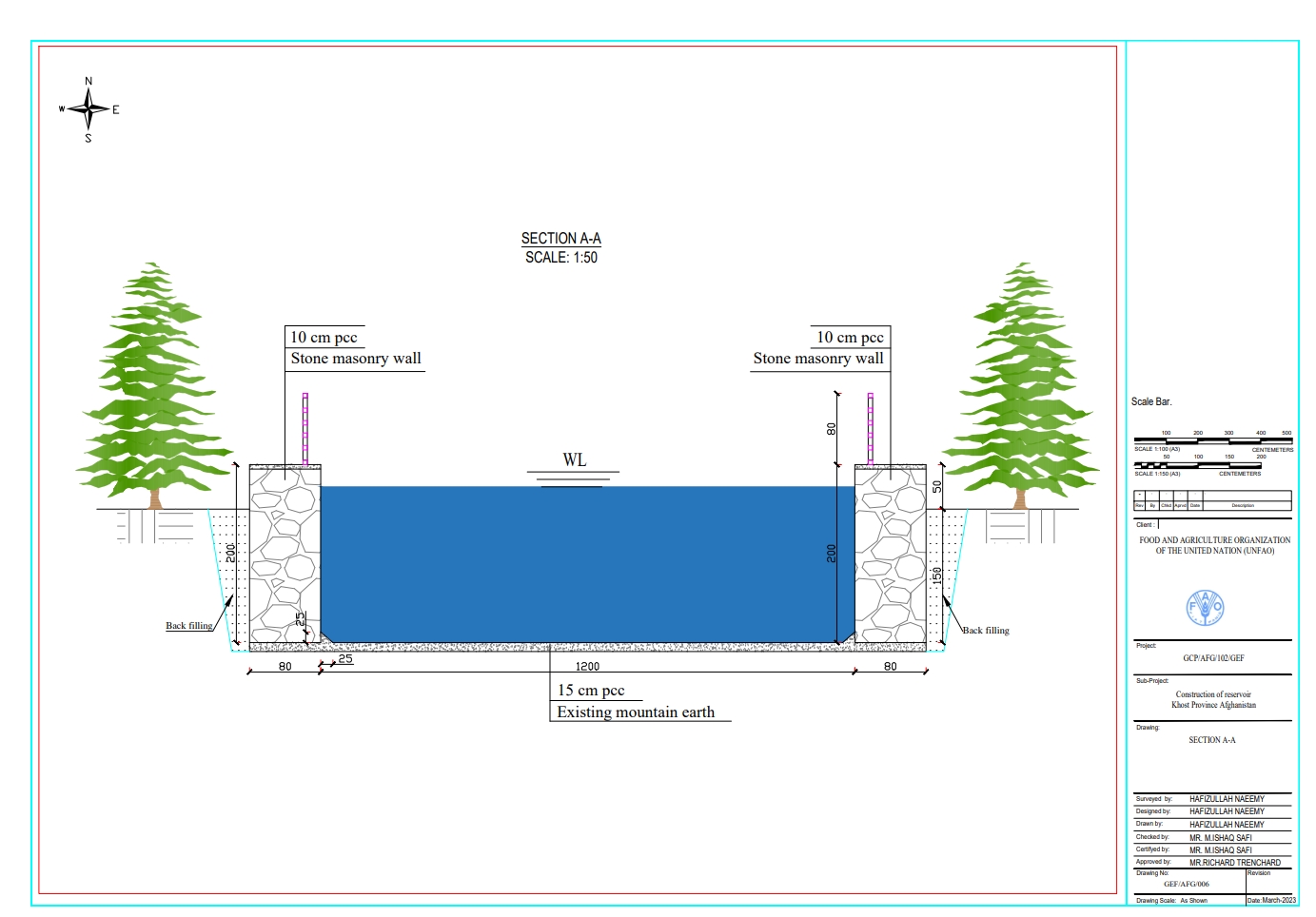
Technical specifications (related to technical drawing):
Each of the three reservoirs measures 2m x 8m x 12m with a water depth of 2m, holding a total capacity of 192 cubic meters.
Author:
Hafizullah Naeemy
Date:
18/01/2023
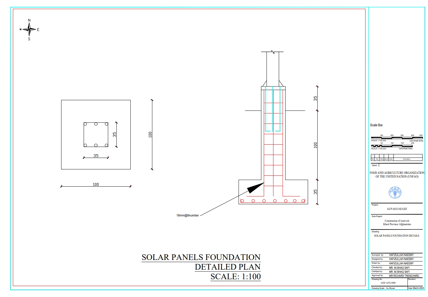
Technical specifications (related to technical drawing):
The solar panel stands, including their foundations, are 2 meters in height, with each panel measuring 1.2 meters high and 0.6 meters wide. The panels are installed at a 45° slope angle.
Author:
Hafizullah Naeemy
Date:
22/01/2023
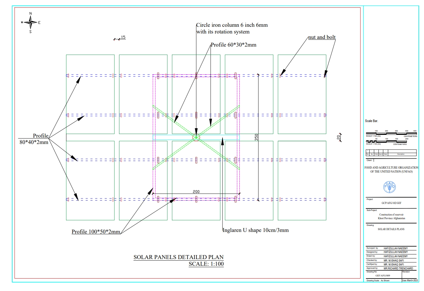
Technical specifications (related to technical drawing):
Detailed plan for solar panel installation: Three metal stands designed to support and rotate 26 solar panels, optimizing sunlight exposure throughout the day.
Author:
Hafizullah Naeemy
Date:
23/01/2023
4.2 General information regarding the calculation of inputs and costs
Specify how costs and inputs were calculated:
- per Technology area
Indicate size and area unit:
20 Hectares
Specify currency used for cost calculations:
- USD
Indicate average wage cost of hired labour per day:
5 USD
4.3 Establishment activities
| Activity | Timing (season) | |
|---|---|---|
| 1. | Conduction of survey, feasibility study, and site selection | 1st month |
| 2. | Finding of water source | 2nd month |
| 3. | Installation of solar power lifting system | 4rd month |
| 4. | Construction of reservoirs | 5th month |
| 5. | Installation of irrigation piping system | 12th-1st month of the year |
| 6. | Saplings delivered by supplier to the site from contracted nurseries | 1st-2th month |
| 7. | Planting of saplings | 2-3rdmonth |
| 8. | Preparation of two demonstration plots for fodder and medicinal plants | 3rd month |
| 9. | Planting of seeds for fodder and medicinal plants | 3rd month |
| 10. | Installation of barbed wire fencing for 20 hectares | 7-9th month |
| 11. | Ensurance of operation and maintenance of all systems | 24th month |
4.4 Costs and inputs needed for establishment
| Specify input | Unit | Quantity | Costs per Unit | Total costs per input | % of costs borne by land users | |
|---|---|---|---|---|---|---|
| Labour | Installation of solar system and pipe installation | Person/day | 100.0 | 6.0 | 600.0 | |
| Labour | Digging pits, plantation and irrigation of Plants | Person/day | 453.0 | 6.0 | 2718.0 | 100.0 |
| Labour | Excavation of foundation | Person/day | 80.0 | 5.0 | 400.0 | |
| Labour | Preparing demonstration plots for fodder and medicinal plants | Square meter | 25000.0 | 0.13 | 3250.0 | 100.0 |
| Labour | Stone Masonry | Person/day | 136.0 | 6.0 | 816.0 | |
| Labour | Plastering | Person/day | 72.0 | 5.0 | 360.0 | |
| Labour | Plain cement concrete | Person/day | 57.0 | 5.0 | 285.0 | |
| Labour | Plain cement concrete PCC M20 | Person/day | 390.0 | 5.0 | 1950.0 | |
| Equipment | Entrance Gate | Number | 1.0 | 200.0 | 200.0 | |
| Equipment | Solar panel 400W | Sheet | 26.0 | 140.0 | 3640.0 | |
| Equipment | Rotating PV panel mount | Number | 3.0 | 350.0 | 1050.0 | |
| Equipment | Submersible pump 2 inch (10PH-7500W) | Number | 1.0 | 300.0 | 300.0 | |
| Equipment | DC-AC current inverter 7.5-11kw | Number | 1.0 | 200.0 | 200.0 | |
| Equipment | Distribution board | Number | 1.0 | 75.0 | 75.0 | |
| Equipment | Sign board | Number | 3.0 | 3.0 | 9.0 | |
| Equipment | Sign board | Number | 1.0 | 150.0 | 150.0 | |
| Plant material | Walnut | Sapling | 2000.0 | 0.56 | 1120.0 | |
| Plant material | Almond | Sapling | 500.0 | 0.67 | 335.0 | |
| Plant material | Mulberry | Sapling | 100.0 | 0.44 | 44.0 | |
| Plant material | Pomegranate | Sapling | 500.0 | 0.51 | 255.0 | |
| Plant material | Alfalfa seed | Kg | 50.0 | 2.72 | 136.0 | |
| Plant material | Black Cumin seed | Kg | 15.0 | 6.72 | 100.8 | |
| Construction material | Tap | Number | 30.0 | 3.0 | 90.0 | |
| Construction material | Flexon 1 inch rubberized pipes | Meter | 1250.0 | 2.0 | 2500.0 | |
| Construction material | DC current wire | Meter | 100.0 | 2.0 | 200.0 | |
| Construction material | AC current wire | Meter | 150.0 | 2.0 | 300.0 | |
| Construction material | Polyethylene pipe 1.5 inch | Meter | 2000.0 | 2.0 | 4000.0 | |
| Construction material | Polyethylene pipe 2 inch | Meter | 780.0 | 3.0 | 2340.0 | |
| Construction material | Polyethylene pipe 3 inch | Meter | 300.0 | 5.0 | 1500.0 | |
| Other | Delivery to the site | Lump sum | 1.0 | 300.0 | 300.0 | |
| Other | Galvanized iron pipe 2 inch for pillar | Meter | 125.0 | 5.0 | 625.0 | |
| Other | Galvanized iron pipe 1.5 inch for bracing | Number | 470.0 | 10.5 | 4935.0 | |
| Other | Fence | Meter | 15.0 | 25.0 | 375.0 | |
| Other | Double strand galvanized barbed wire for fencing | Meter | 4200.0 | 0.25 | 1050.0 | |
| Total costs for establishment of the Technology | 36208.8 | |||||
| Total costs for establishment of the Technology in USD | 36208.8 | |||||
If land user bore less than 100% of costs, indicate who covered the remaining costs:
FAO under GEF-7 project
Comments:
The land users contributed primarily by digging pits for planting, preparing demonstration plots, and maintaining the system. Additionally, they hired guards to protect the area from disturbances. All other costs associated with the project were covered by the FAO GEF-7.
4.5 Maintenance/ recurrent activities
| Activity | Timing/ frequency | |
|---|---|---|
| 1. | Removal of sediment from reservoirs | Spring/annually |
| 2. | Safeguarding the site such as solar system, and on-site interventions | All seasons/regular |
| 3. | Repairing solar system & water pump and pipes | Regularly |
| 4. | Demonstration plots maintenance (pest-diseases control, mulching, weeding and Irrigation | Spring & Automn/annually |
| 5. | Replacing dead and dried plants | Feb/two times (1st & 2nd year) |
| 6. | Repairing fencing | Year around |
4.6 Costs and inputs needed for maintenance/ recurrent activities (per year)
| Specify input | Unit | Quantity | Costs per Unit | Total costs per input | % of costs borne by land users | |
|---|---|---|---|---|---|---|
| Labour | Labour for cleaning the reservoir from sediment annually | Person/day | 15.0 | 5.0 | 75.0 | 100.0 |
| Labour | Hiring guards for safeguarding the site | Person/day | 12.0 | 100.0 | 1200.0 | 100.0 |
| Labour | Fixing pump when needed | Lump sum | 1.0 | 50.0 | 50.0 | 100.0 |
| Labour | Repairing pipes | Lump Sum | 1.0 | 100.0 | 100.0 | 100.0 |
| Labour | Repairing solar panel when required | Lump sum | 1.0 | 1000.0 | 1000.0 | 100.0 |
| Labour | Weed control | Person/day | 10.0 | 5.0 | 50.0 | 100.0 |
| Labour | Integrated Pest Management | Lump sum | 1.0 | 5.0 | 5.0 | 100.0 |
| Labour | Irrigation | Person/day | 8.0 | 50.0 | 400.0 | 100.0 |
| Plant material | Saplings | Number | 1500.0 | 0.56 | 840.0 | 100.0 |
| Plant material | Local Seed | Kg | 15.0 | 26.0 | 390.0 | 100.0 |
| Construction material | Barbed wire | meter | 3000.0 | 0.14 | 420.0 | 100.0 |
| Other | Replacing dead and dried plants | Lump sum | 1.0 | 300.0 | 300.0 | |
| Total costs for maintenance of the Technology | 4830.0 | |||||
| Total costs for maintenance of the Technology in USD | 4830.0 | |||||
4.7 Most important factors affecting the costs
Describe the most determinate factors affecting the costs:
Construction materials cost
5. Natural and human environment
5.1 Climate
Annual rainfall
- < 250 mm
- 251-500 mm
- 501-750 mm
- 751-1,000 mm
- 1,001-1,500 mm
- 1,501-2,000 mm
- 2,001-3,000 mm
- 3,001-4,000 mm
- > 4,000 mm
Agro-climatic zone
- semi-arid
5.2 Topography
Slopes on average:
- flat (0-2%)
- gentle (3-5%)
- moderate (6-10%)
- rolling (11-15%)
- hilly (16-30%)
- steep (31-60%)
- very steep (>60%)
Landforms:
- plateau/plains
- ridges
- mountain slopes
- hill slopes
- footslopes
- valley floors
Altitudinal zone:
- 0-100 m a.s.l.
- 101-500 m a.s.l.
- 501-1,000 m a.s.l.
- 1,001-1,500 m a.s.l.
- 1,501-2,000 m a.s.l.
- 2,001-2,500 m a.s.l.
- 2,501-3,000 m a.s.l.
- 3,001-4,000 m a.s.l.
- > 4,000 m a.s.l.
Indicate if the Technology is specifically applied in:
- convex situations
Comments and further specifications on topography:
The site is situated near a forest and rangeland, with a gentle slope of approximately 45 degrees and an elevation of 1,279.49 meters above sea level. Surrounding mountains are covered with wild olive forests.
5.3 Soils
Soil depth on average:
- very shallow (0-20 cm)
- shallow (21-50 cm)
- moderately deep (51-80 cm)
- deep (81-120 cm)
- very deep (> 120 cm)
Soil texture (topsoil):
- medium (loamy, silty)
Soil texture (> 20 cm below surface):
- medium (loamy, silty)
Topsoil organic matter:
- low (<1%)
5.4 Water availability and quality
Ground water table:
5-50 m
Availability of surface water:
good
Water quality (untreated):
good drinking water
Water quality refers to:
both ground and surface water
Is water salinity a problem?
No
Is flooding of the area occurring?
Yes
Regularity:
episodically
Comments and further specifications on water quality and quantity:
The water quality meets site requirements; however, seasonal fluctuations occur due to droughts. Floods in the lower gully, carry debris and sediments that can impact the source.
5.5 Biodiversity
Species diversity:
- medium
Habitat diversity:
- medium
Comments and further specifications on biodiversity:
The site was rich in flora and fauna, but human and animal interference has led to significant degradation. Many indigenous plants have been uprooted, and wildlife has migrated due to the loss of habitat. In response, the community has begun to manage and restore the land through practices like rotational grazing and quarantine measures to combat illegal logging.
5.6 Characteristics of land users applying the Technology
Sedentary or nomadic:
- Sedentary
Market orientation of production system:
- mixed (subsistence/ commercial)
Off-farm income:
- less than 10% of all income
Relative level of wealth:
- poor
Individuals or groups:
- groups/ community
Level of mechanization:
- manual work
Gender:
- men
Age of land users:
- middle-aged
5.7 Average area of land used by land users applying the Technology
- < 0.5 ha
- 0.5-1 ha
- 1-2 ha
- 2-5 ha
- 5-15 ha
- 15-50 ha
- 50-100 ha
- 100-500 ha
- 500-1,000 ha
- 1,000-10,000 ha
- > 10,000 ha
Is this considered small-, medium- or large-scale (referring to local context)?
- small-scale
Comments:
The land in question is communal and remains undivided, with no plans for future distribution. Most users have limited agricultural land downstream, typically no more than 0.5 hectares per household for crop cultivation. The learning site has been dedicated by the local community for future generations and educational purposes. Previously, this land was unused and primarily designated for grazing.
5.8 Land ownership, land use rights, and water use rights
Land ownership:
- communal/ village
Land use rights:
- communal (organized)
Water use rights:
- communal (organized)
Are land use rights based on a traditional legal system?
Yes
Specify:
Land use rights in traditional legal systems are generally straightforward, with each family in a village having equal access to natural resources.
Comments:
Overall, this traditional approach emphasizes community and family roles in resource management, balancing individual rights with communal responsibilities
5.9 Access to services and infrastructure
health:
- poor
- moderate
- good
education:
- poor
- moderate
- good
technical assistance:
- poor
- moderate
- good
employment (e.g. off-farm):
- poor
- moderate
- good
markets:
- poor
- moderate
- good
energy:
- poor
- moderate
- good
roads and transport:
- poor
- moderate
- good
drinking water and sanitation:
- poor
- moderate
- good
financial services:
- poor
- moderate
- good
Comments:
Due to three to four decades of political conflict, people lack access to essential services and infrastructure. This situation has been largely overlooked, with insufficient attention given to providing these services. Additionally, there has been a lack of budget allocation and support from the government and NGOs. As a result, communities continue to suffer from inadequate resources and infrastructure development.
6. Impacts and concluding statements
6.1 On-site impacts the Technology has shown
Socio-economic impacts
Production
animal production
Comments/ specify:
The local community is adopting rotational grazing and quarantine measures on rangeland, while also exploring silage-making and hay production techniques. Additionally, they are identifying alternative winter feed options for their animals.
forest/ woodland quality
Comments/ specify:
The local community has successfully quarantined all forest areas, effectively controlling illegal logging and managing grazing. As a result, the forest has been revitalized and is undergoing natural regeneration
non-wood forest production
Comments/ specify:
The local community is utilizing Mazari palm for handcrafted products while also focusing on agroforestry. They have established fruit orchards and are collecting blackthorn, which they sell in the bazaar to support their livelihoods.
production area
Comments/ specify:
Previously, the community overgrazed the land and cut down trees for their livelihoods. However, after implementing quarantine measures and rotational grazing practices, the area is now showing signs of regeneration and has the potential to become a productive landscape in the future.
land management
Comments/ specify:
Following these practices, the local community has effectively managed more land under proper stewardship, including forest and rangeland quarantine and controlled grazing. They are now applying these methods in their vicinity, leading to the successful management of additional areas.
Water availability and quality
irrigation water availability
Comments/ specify:
Through revegetation and improved land cover, water seeps into the ground, recharging the water table and increasing availability for irrigation.
Income and costs
diversity of income sources
Socio-cultural impacts
recreational opportunities
Comments/ specify:
FAO and Forest and Rangeland Management Association have successfully revitalized this area, transforming it into a lush and green landscape. Many of the previously destroyed species regenerated, creating a thriving ecosystem. This site is now a focal point, surrounded by majestic mountains and rich forests, with water flowing from the upper watershed. It has become a popular destination for picnics and visits, where people can enjoy the soothing sounds of birds and the vibrant greenery of the surroundings.
community institutions
national institutions
SLM/ land degradation knowledge
conflict mitigation
Ecological impacts
Water cycle/ runoff
water quantity
harvesting/ collection of water
surface runoff
Soil
soil moisture
soil cover
soil loss
Biodiversity: vegetation, animals
Vegetation cover
Comments/ specify:
Through applying quarantine, rotational grazing, control grazing the vegetation covered increased.
biomass/ above ground C
Comments/ specify:
Biomass above the ground is increased
plant diversity
Comments/ specify:
most of the seed regenerating and all the cut trees and bushes revegetated.
animal diversity
Comments/ specify:
Various migratory animals and birds have returned to the area due to the protection measures in place and the prohibition of human activities.
Climate and disaster risk reduction
flood impacts
Comments/ specify:
Most of the riverbanks have been successfully revegetated through effective control measures, including water filtration during rain and floods. Local communities have also learned to plant cuttings along the riverbanks and shorelines, contributing to the restoration of these vital ecosystems.
drought impacts
emission of carbon and greenhouse gases
Comments/ specify:
Healthy ecosystems like forests and wetlands act as carbon sinks, absorbing more CO2 through photosynthesis. Improved soil health and vegetation cover also enhance carbon storage, while restoring habitats promotes biodiversity, creating a more resilient ecosystem that sequesters carbon effectively.
6.2 Off-site impacts the Technology has shown
water availability
Comments/ specify:
Through revegetation and improved land cover, water seeps into the ground, recharging the water table.
groundwater/ river pollution
wind transported sediments
damage on public/ private infrastructure
impact of greenhouse gases
6.3 Exposure and sensitivity of the Technology to gradual climate change and climate-related extremes/ disasters (as perceived by land users)
Gradual climate change
Gradual climate change
| Season | increase or decrease | How does the Technology cope with it? | |
|---|---|---|---|
| annual temperature | decrease | not well at all | |
| annual rainfall | increase | not well at all | |
| seasonal rainfall | summer | increase | not well at all |
Climate-related extremes (disasters)
Meteorological disasters
| How does the Technology cope with it? | |
|---|---|
| local snowstorm | not well at all |
Climatological disasters
| How does the Technology cope with it? | |
|---|---|
| heatwave | not well at all |
| drought | not well at all |
Hydrological disasters
| How does the Technology cope with it? | |
|---|---|
| flash flood | not well at all |
Comments:
Before the implementation of the project land users faced severe challenges, including drought, high temperatures, water scarcity for irrigation, reduced yields, and a lack of winter feed alternatives for livestock.
Following the introduction of sustainable rangeland management and biodiversity conservation, local communities adopted rotational grazing practices and protected forests from cutting, which had previously been their main source of income. As a result, vegetation cover improved, carbon stocks increased, and rainwater began to seep into the ground, recharging the water table, springs, canals, and Karezes. These efforts reulted in a more resilient and productive environment.
6.4 Cost-benefit analysis
How do the benefits compare with the establishment costs (from land users’ perspective)?
Short-term returns:
slightly positive
Long-term returns:
positive
How do the benefits compare with the maintenance/ recurrent costs (from land users' perspective)?
Short-term returns:
slightly positive
Long-term returns:
very positive
6.5 Adoption of the Technology
- 1-10%
Of all those who have adopted the Technology, how many did so spontaneously, i.e. without receiving any material incentives/ payments?
- 0-10%
Comments:
The adoption of the technology in the specified area has primarily been spontaneous, significantly influenced by the support provided by the project. While a small percentage of land users may have received material incentives, the majority embraced the technology due to its demonstrated benefits and the project's educational efforts. This support helped to build trust and confidence among the land users, enabling them to implement the technology effectively in their practices. Overall, this highlights the importance of community engagement and capacity building in fostering sustainable land management practices.
6.6 Adaptation
Has the Technology been modified recently to adapt to changing conditions?
No
6.7 Strengths/ advantages/ opportunities of the Technology
| Strengths/ advantages/ opportunities in the land user’s view |
|---|
| It is crucial for local communities to learn sustainable land and forest restoration techniques. These methods are not only accessible but also involve minimal operational costs. By empowering land users with this knowledge. |
| We can adopt sustainable land and forest management practices to revitalize our degraded land. This learning process is straightforward and easily applicable. |
| We have great opportunities and abundant resources to utilize. This area serves as a hub for scaling sustainable practices, allowing us to learn, observe, and implement solutions that will benefit future generations. |
| We can efficiently use surface water for irrigation instead of groundwater, helping to restore degraded land through these initiatives. |
| Reduce greenhouse gas emissions through effective carbon sequestration. |
| Learn regeneration techniques, rainwater harvesting, and grazing management methods like rotational grazing. Focus on producing fodder and medicinal plants, while understanding indigenous plants and shrubs for the future. |
| Strengths/ advantages/ opportunities in the compiler’s or other key resource person’s view |
|---|
| This site is highly accessible, surrounded by dense forests and extensive rangelands that can be utilized sustainably. |
| Local community members, university students, and stakeholders can easily visit this site. |
| This site is an excellent destination for tourists to visit, enjoy, and learn about the importance of natural resources and their management techniques. |
| The local community can easily adopt these simple techniques to learn sustainable land and forest restoration practices. |
| The local community has hired guards to maintain the site effectively. They are gaining knowledge and enhancing their capacity for future interventions, contributing positively to development initiatives. |
6.8 Weaknesses/ disadvantages/ risks of the Technology and ways of overcoming them
| Weaknesses/ disadvantages/ risks in the land user’s view | How can they be overcome? |
|---|---|
| Insufficient maintenance and repair services for the technology. | Establishing strong linkages with service providers and maintenance support. This also facilitates nationwide technology transfer, enabling broader adoption and implementation of sustainable practices. |
| There is a lack of qualified professionals on-site to teach visitors the technical aspects of the technology. This gap hinders effective learning and limits the ability of visitors to fully understand and engage with the technology. | Hire on-farm officers to oversee and manage the learning site and provide information to visitors. |
| A check dam is required in the gully to store water for sustainability, especially during drought seasons when water availability decreases. | Construct a check dam in the lower section of the gully to store water for sustainability, allowing visitors to learn about water harvesting techniques. |
| There are currently no available resources for replacing the dead plants. | Establish nurseries for forest species to produce saplings that can replace dead and dried plants in the future. |
| Weaknesses/ disadvantages/ risks in the compiler’s or other key resource person’s view | How can they be overcome? |
|---|---|
| There are concerns about windstorms and hail potentially damaging the solar panels. | The local community should establish a social fund to cover repairs for any damage to solar panels caused by windstorms or hail, as well as to fund the installation of fencing around the solar panel stands. |
| Concerns have arisen regarding land disputes as the local community acts on land distribution amidst a growing population. | All villagers should receive a formal guaranteed letter, signed by the district governor, ensuring that no future actions will be taken to redistribute this site among the villagers. |
| There is a lack of essential water structures, such as percolation tanks and detention ponds, for effective rainwater harvesting. | Construct percolation tanks and detention ponds to harvest rainwater, which can be used to water livestock. Additionally, this initiative will provide an opportunity to learn and implement dryland farming techniques. |
| Too much water is wasted through flexible pipe basin irrigation methods. Additionally, required live hedges for fencing and windbreaks. | Install a drip irrigation system with an efficient piping layout and plant pine, poplar, and other trees alongside barbed wire to create a windbreak and a natural barrier for site protection. This will also provide an opportunity to learn various agricultural techniques. |
7. References and links
7.1 Methods/ sources of information
- field visits, field surveys
20
- interviews with land users
11
- interviews with SLM specialists/ experts
5
- compilation from reports and other existing documentation
3
When were the data compiled (in the field)?
10/10/2024
Comments:
The project was actively involved in all phases, from selection to implementation. Data was collected from local community volunteers, as well as SLM specialists and engineers.
7.2 References to available publications
Title, author, year, ISBN:
N/A
7.3 Links to relevant online information
Title/ description:
N/A
7.4 General comments
The questionnaire is well-structured, but some sections, particularly 6.2 and 6.3, need simplification. Additionally, the database should provide outputs during data processing, highlighting both best practices and common mistakes related to the technology. This will help us generate a comprehensive report that showcases effective practices and identifies areas for improvement.
Links and modules
Expand all Collapse allLinks
Stakeholder collaboration for building Learning Site for landscape … [Afghanistan]
To raise awareness and ensure clear role delineation, a series of consultations were held with the local community, the Forest Management/Rangeland Management (FM/RM) association, and other key stakeholders. Memorandum of Understanding (MoU) that formally outlined the roles and responsibilities of each party was signed. Additionally, the FM/RM association issued a …
- Compiler: Mohammad Arif
Modules
No modules