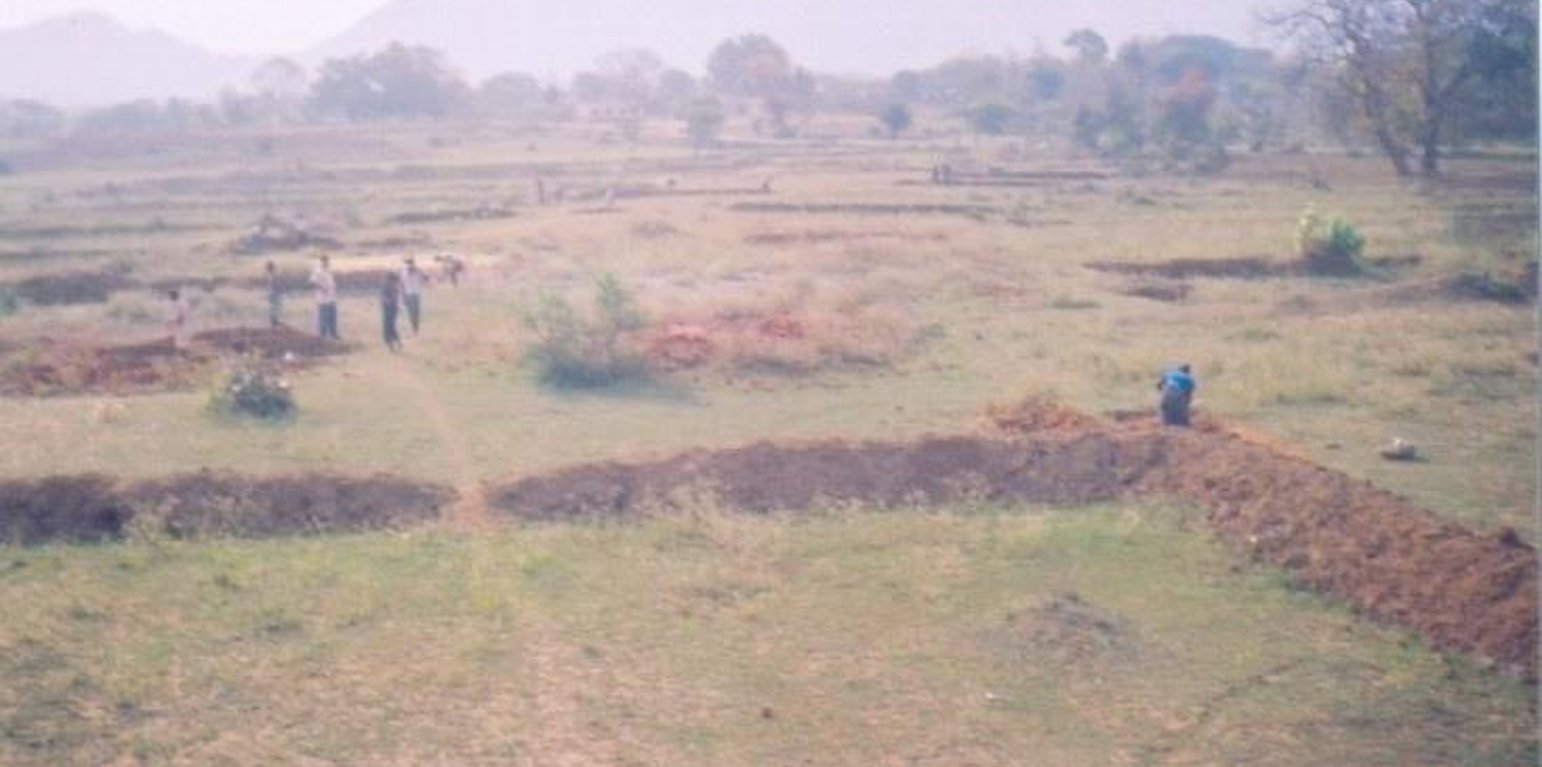
Contour V ditch in Larki
V-shaped structures on contour line .The size of the V ditch varies according to slope, depth of soil and soil texture. The V-ditch can be laid eithr in staggered or continuous. Purpose- 1. To control sheet and reel erosion 2. Retention of in situ soil moisture 3. To increase vegetative cover. Establishment/maintenance -- 1. Bunding, 2. Terracing, 3. Turfing, 4. Provisioin of outlets in contour lines. Environment:- Bio-Physical-1-Cropland-Annual 2. Grazing land-Extensive, 3. Forest, Socio-Economic- 1. land ownership-User Group (32 Members) 2. Land use rights-Usufructary Rights.
地点: Orissa/Nuapada, Orissa, 印度
分析的技术场所数量:
技术传播:
实施日期: 不到10年前(最近)
介绍类型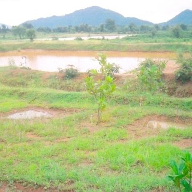


技术规范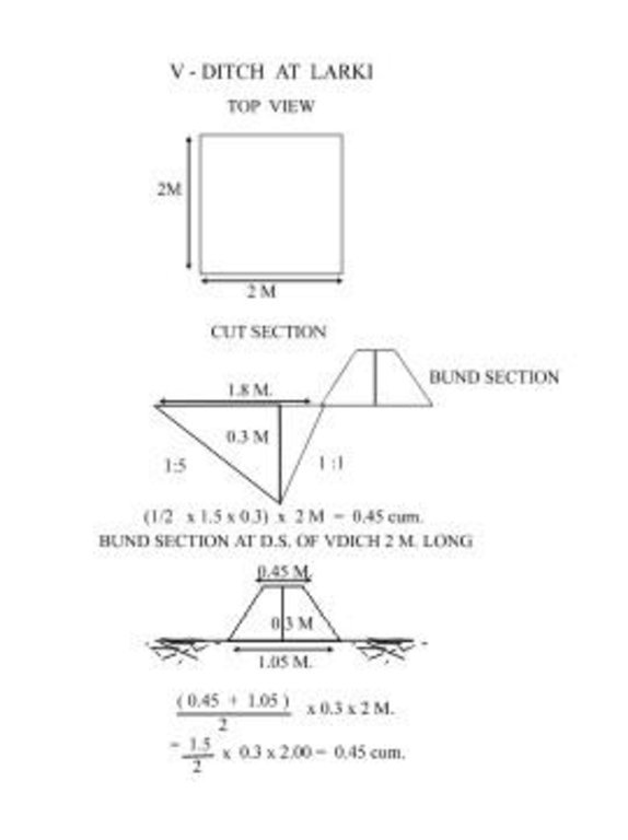
V-Ditch technical drawing
Location: QTInd16TechDraw.jpg Technical knowledge required for field staff / advisors: moderate Technical knowledge required for land users: low Main technical functions: control of dispersed runoff: retain / trap Secondary technical functions: control of dispersed runoff: impede / retard, increase of infiltration, increase / maintain water stored in soil, increase in soil fertility Vegetative measure: Turfing of bund Vegetative material: G : grass Vertical interval between rows / strips / blocks (m): 2 Spacing between rows / strips / blocks (m): 1 Vertical interval within rows / strips / blocks (m): 2 Width within rows / strips / blocks (m): 1.5 Vegetative measure: Vegetative material: G : grass Vegetative measure: Vegetative material: G : grass Vegetative measure: Vegetative material: G : grass Grass species: Vetiver/Berunbuta Slope (which determines the spacing indicated above): 8.00% If the original slope has changed as a result of the Technology, the slope today is (see figure below): 6.00% Gradient along the rows / strips: 0.00% Structural measure: Contour V ditch Vertical interval between structures (m): 2 Spacing between structures (m): 1 Depth of ditches/pits/dams (m): average Width of ditches/pits/dams (m): 2 Length of ditches/pits/dams (m): 1.5 Height of bunds/banks/others (m): 0.3 Width of bunds/banks/others (m): Bottom=0.8 Top=0.2 Length of bunds/banks/others (m): 1.5 Construction material (earth): Soil excavated from the ditches are used to construct banks/bunds Slope (which determines the spacing indicated above): 8% If the original slope has changed as a result of the Technology, the slope today is: 6% Lateral gradient along the structure: 0% Vegetation is used for stabilisation of structures. |
|||||||||||
| 对投入进行具体说明 | 单位 | 数量 | 单位成本 (Rupee) | 每项投入的总成本 (Rupee) | 土地使用者承担的成本% |
| 劳动力 | |||||
| Labour | ha | 1.0 | 35.0 | 35.0 | |
| 施工材料 | |||||
| Stone | ha | 1.0 | 5.0 | 5.0 | |
| 技术建立所需总成本 | 40.0 | ||||
Nil
Nil
Cover crop, Agro forestry,Fruit crops and Tuber crops taken up
Rs. 500/- per Ha. Rs. 10/- per day
Needs maintenance timely.
Users groups formed and functioning.
By the users
Community mobilisation is requirede to solve conflicts.
SLM之前的数量: 65
SLM之后的数量: 40
Crops grown and supplemental irrigation
Waste weir disposal
Vegetation established
Due to fertility


