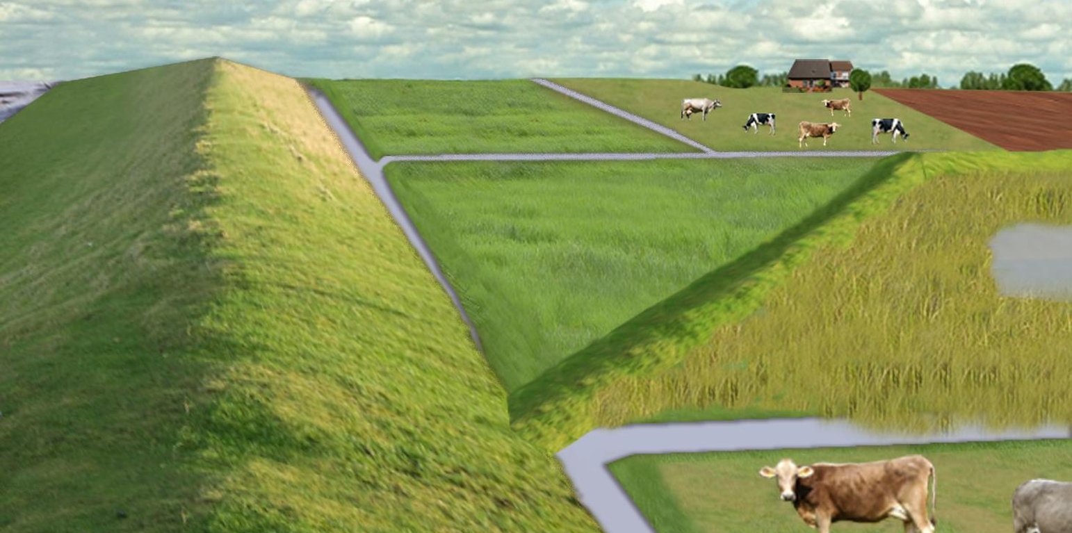
Water retention area at the primary sea wall with the delineation of the retention area and the land use as developed in a participatory process with local experts (Research project 'COMTESS')
In the 19th and 20th century land was reclaimed from the sea to make use of the exposed fertile soils for agriculture through a process known as ‘impoldering’. The reclaimed land is now characterized by intensive grazing and cropland. This is a region where agriculture is the most important form of land use. However, the land needs to be regularly drained. Given the expected increase in precipitation in winter due to climate change, the corresponding increase in freshwater discharge needs to be managed. Furthermore, the periods when natural discharge into the sea oc-curs are likely to decrease – because of rising sea levels also caused by climate change. Consequently, in winter and spring, greater quantities of freshwater will need to be pumped into the sea rather than discharged naturally at the low or ‘ebb’ tide. Specially embanked water retention polders will be required to temporarily impound water as part of a multifunctional approach to coastal zone management.
Purpose of the Technology: These retention polders could be a cost-effective alternative to expensive invest-ments in extra pumping capacities to prevent submergence of low-lying cultivated areas. The primary aim is to restrict floods to the retention polders when the drain-age network is overburdened and cannot deal with the predicted extra demands in the future. The high evapotranspiration from the open waterbody, and the reeds growing within, will also help with reducing the amount of water. During dry sum-mers, the water in the retention polder could also be put to creative use as a source of irrigation. Another potential advantage is that subsurface saltwater intrusion in the region could be prevented by the freshwater-filled polders. During extreme storm surges and in the rare case of breaches in the sea wall, the retention polders would serve as an extra line of defence by holding seawater.
Establishment / maintenance activities and inputs: An embankment enclosing approx. 500 ha will be able to store up to 2,500,000 m³ of water. This will improve the drainage of an area of approx. 49,000 ha. The invest-ment for building this water retention area is high – but for the reasons stated it serves a necessary purpose at a cost which is lower than the alternative – increased pumped drainage installations. Maintenance costs will be lower than the drainage alternative as only the integrity of the embankment needs to be monitored regularly. Currently, agricultural land use within the polders is adapted to higher water levels and occasional flooding. Within the embanked area there will be a change from the current use of mainly crop land to extensive grazing, open water and reed stands.
Natural / human environment: Some parts within the retention polder will be used for agricultural purposes, while the wetter parts will be set aside. In these latter sections, undisturbed natural regen-eration will take place. A landscape comprising various different elements, without any extreme forms of intensive land use such as large areas of monocultures will be the result. Thus requirements for agricultural use and tourism will be addressed.
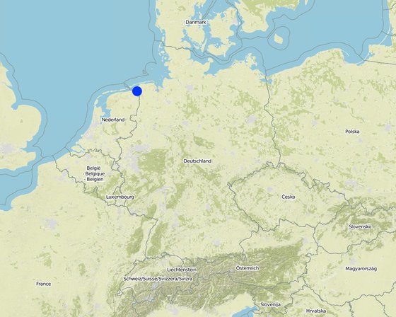
地点: Landkreis Aurich, Germany, Lower Saxony, 德国
分析的技术场所数量:
技术传播:
在永久保护区?:
实施日期: 10-50年前
介绍类型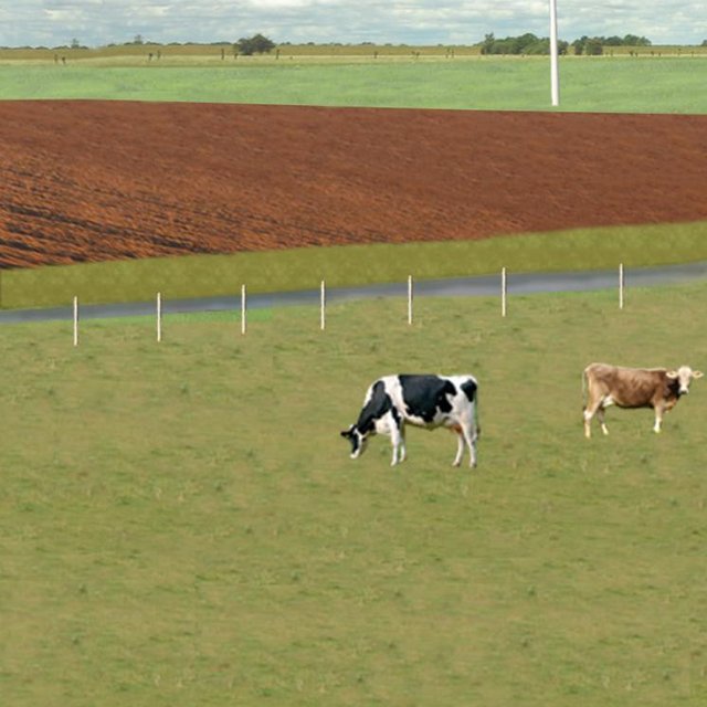


| 对投入进行具体说明 | 单位 | 数量 | 单位成本 (Euro) | 每项投入的总成本 (Euro) | 土地使用者承担的成本% |
| 劳动力 | |||||
| Labour | Dam | 1.0 | 10000000.0 | 10000000.0 | |
| 设备 | |||||
| Machine use | Dam | 1.0 | 4000000.0 | 4000000.0 | |
| 施工材料 | |||||
| Earth | Dam | 1.0 | 112000.0 | 112000.0 | |
| 技术建立所需总成本 | 14'112'000.0 | ||||
| 技术建立总成本,美元 | 15'012'765.96 | ||||
| 对投入进行具体说明 | 单位 | 数量 | 单位成本 (Euro) | 每项投入的总成本 (Euro) | 土地使用者承担的成本% |
| 劳动力 | |||||
| Labour | Dam | 1.0 | 500.0 | 500.0 | |
| 设备 | |||||
| Machine use | Dam | 1.0 | 200.0 | 200.0 | |
| 施工材料 | |||||
| Earth | Dam | 1.0 | 100.0 | 100.0 | |
| 其它 | |||||
| Maintenance per km ditch | Dam | 1.0 | 2270.7 | 2270.7 | |
| 技术维护所需总成本 | 3'070.7 | ||||
| 技术维护总成本,美元 | 3'266.7 | ||||
Under wet conditions in the retention area a crop production is not possible any more.
Under wet conditions in the retention area an intensive fodder production is not possible any more.
Under wet conditions in the retention area the optiomal fodder quality can not ensured any more.
Regarding crops: The retention area is used for excess water and may be flooded during growing season.
Only adjusted land use takes place, therefore the expenses are reduced nearly to 0.
Due to land use adapted to the conditions the typical land use is not possible and a diversitfication will take place with reed mowing and extensive grazing in the retention area.
Diversification of landscape by building the retention area will increase the attractivity for recreation and tourists.
Typical for the region are wet situations. These typical wet conditions are restored by cessation of drainage system within the retention area.
Updwelling of saline groundwater is prevented by increased water level in the retention area.
By water in the retention are the recharge of groundwater will increase and prevent salinization.
Instead of pumping water into the sea a higher amount is evapotranspirated naturally.
Typical for the region are wet situations. These typical wet conditions are restored by cessation of drainage system within the retention area.
By water in the retention are the recharge of groundwater will increase and prevent salinization.
By wetter conditions the soil organic matter will be increased.
By diversification of land use the number of species will be increased, especially due to extensive land use.
By diversification of land use the number of species will be increased, especially due to extensive land use.
By diversification of land use the number of habitats will be increased.
Modelled is the global warming potential by gas emissions. Not yet clear if it is benefit or disadvantage. Model will show.
Water stored in retention area can be used for irrigation during dry summer months.
Measured m3 of excess water in the catchment area, leading to floods or needs to be pumped. Exact values from modelling will be added as soon as possible!


