Dug-Out Well
(印度)
Chahala
描述
It can be defined as combination of structural & agronomic measures where along with other technology like Water harvesting structures & field bunding on the upper reaches & a dug out well is constructed in the periphery of the drainage line which is a govt land. The 15 acres of land near to its sphere of influence which reamained fallow earlier could yield good production system throughout the year.It is in the semi-arid climatic zone with moderate slope in medium soil depth conditions. The whole idea is to avail water & link with self-subsistance & market oriented production systems from private lands.
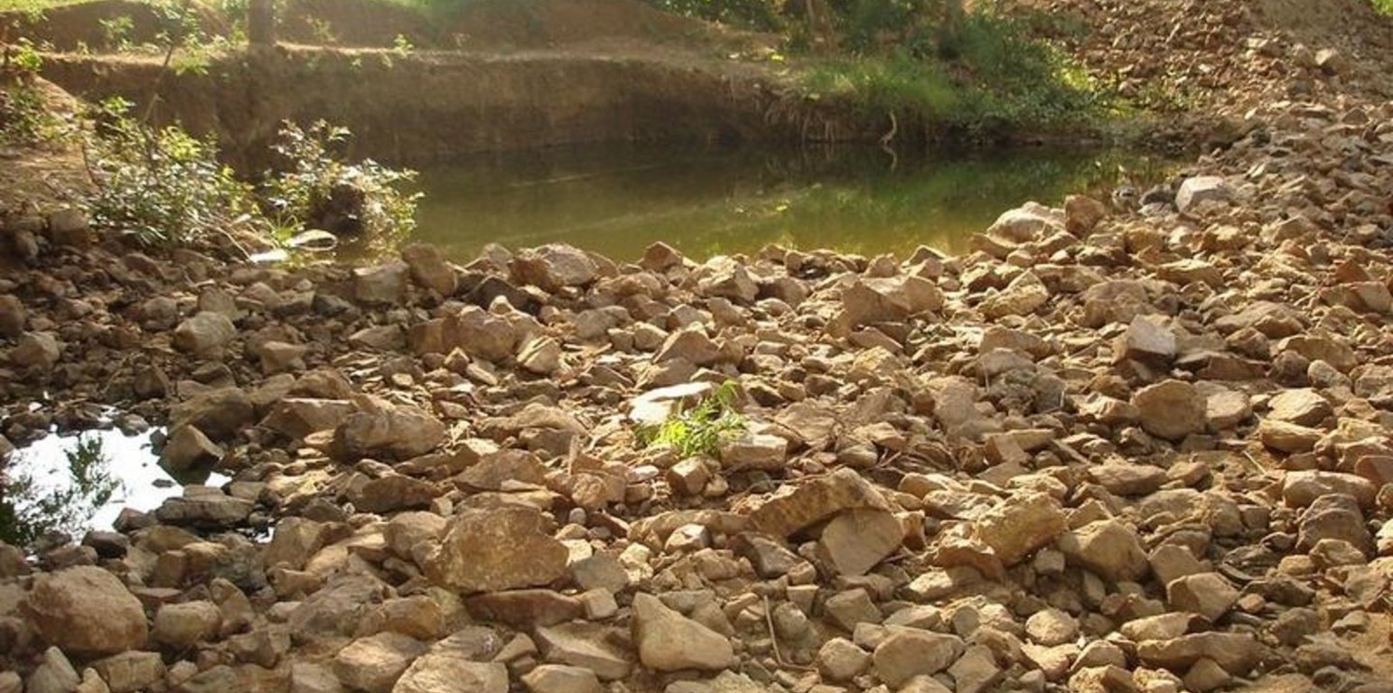
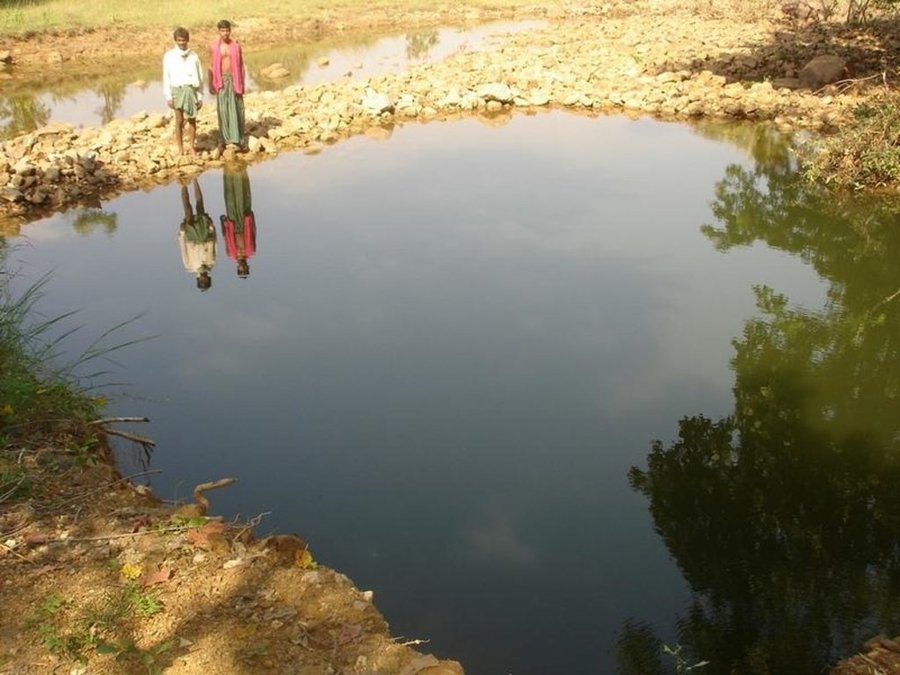
The area is located at the foot-slopes on the major drainage line of the watershed. The technology area is located near the main drainage line, therefore, the sub-surface water availability is more & can be utilised for cultivation of crop even in dry spell of the year. Earlier the farmers near to this place tried to dig a small well & could irrigate for only 2-3 months of the year to get some subsistence crops. Therefore, water availability throughout the year is a first priority of the farmers. At the outset, a livelihood focused micro-plan had been prepared by the villagers stating the details of the base-line data along with problems & alternative solutions. The patch was identified to be the worst affected & the owners of the land are poor people (defined by villagers). Usually the land users used to migrate in search of labour due to loss in the agriculture. It is because the water availability is not there at the time of requirement. The people of this patch are ready to contribute at least 10% of the cost as the structure is to be constructed in government land. In the mean time the project sent the PIA to Water technology centre for eastern region, Bhubneswar to study the linking of water harvesting structure & dug-out well & its relevance in this context of our situation. The technology was done in the village Chareimara which is one out of 3 villages of one watershed, located at the lower reach of the watershed. In the meantime many water harvesting structures & field bunds were constructed due to which the water could be stored in the recharge zone. This area is again a mix of stony patches in the crop land. One water harvesting structure was constructed just at the upper reaches. The surrounding area was totally unbunded with clay loam soil. Therefore, land users are of opinion to go for a deeper dug well which can feed water through out to at least 15 acre of land. The requirement of land users was to get some water in each farmers land to protect the Kharif & rabi crop including summer vegetables. A four-day in field training was conducted by the project to community link workers (SWC), particularly on patch treatment, use of levelling instruments like A-frame, proper planning, design, lay-out of different type of structure in a map & ground. At the same time there was a blind belief that large water harvesting structures are more useful to farmers. So the land users demanded for a large WHS on the drainage bed which requires huge investment & high maintenance cost. But when some farmers of that watershed could get good result by digging well these land users also started thinking about a "community dug-well". After many rounds of discussion with the land users by the SWC specialist followed by a detail transact along with land users, the results of first round transact was mentioned in the micro-plan. But the aim behind subsequent transact was to looking at problems & demarcating on the map. After that estimate was prepared & lay-out of the well was done by SWC specialist with the help of community link workers & land users. The lay-out is also little bit different from traditional well i.e. square shaped in stead of round shape. The work was implemented by the land users & 7 outside labourers with the supervision of the User's group leader & monitoring was done by the SWC specialist. The priority by the land users was agronomic measures like changing the crop in the land. Training was conducted on the probable alternatives of agronomic measures like taking of crop which is of little longer duration, intercrops & cash crops etc. The structural measures are subsidised by the project & the agronomic measures was taken up on loan basis. The development fund was also generated out of contribution from the land users which was deposited in a separate account for future maintenance cost.
地点
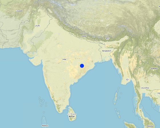
地点: Orissa, Balangir, Suktel/Mahanadi, 印度
分析的技术场所数量:
技术传播: 均匀地分布在一个区域 (0.6 km²)
在永久保护区?:
实施日期: 不到10年前(最近)
介绍类型
-
通过土地使用者的创新
-
作为传统系统的一部分(> 50 年)
-
在实验/研究期间
-
通过项目/外部干预
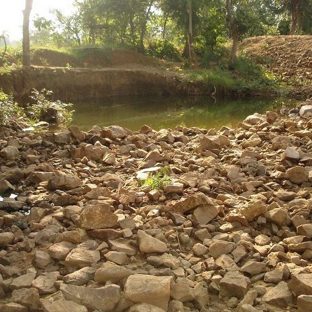
Dug Well in Chareimara
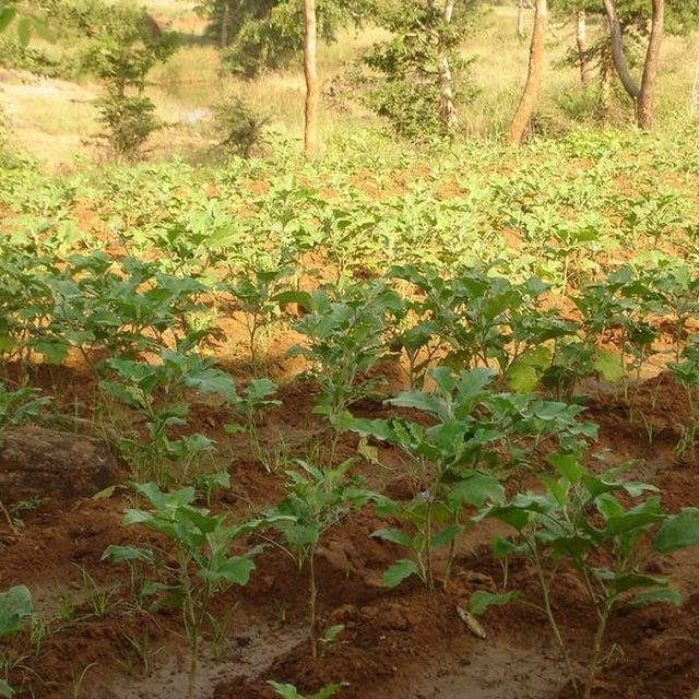
Land irrigated from well
主要目的
-
改良生产
-
减少、预防、恢复土地退化
-
保护生态系统
-
结合其他技术保护流域/下游区域
-
保持/提高生物多样性
-
降低灾害风险
-
适应气候变化/极端天气及其影响
-
减缓气候变化及其影响
-
创造有益的经济影响
-
创造有益的社会影响
土地利用
-
农田
- 一年一作: 蔬菜 - 香瓜、南瓜、南瓜或葫芦, 蔬菜 - 其他, 蔬菜 - 根茎类蔬菜(胡萝卜、洋葱、甜菜等), rice
- 多年一作(非木材): 甘蔗
每年的生长季节数: 2
采用间作制度了吗?: 是
供水
-
雨养
-
混合雨水灌溉
-
充分灌溉
-
all of them
土地退化相关的目的
-
防止土地退化
-
减少土地退化
-
修复/恢复严重退化的土地
-
适应土地退化
-
不适用
SLM措施
-
农艺措施 - A1:植被和土壤覆盖层, A2:有机质/土壤肥力, A5:种子管理,改良品种, A7:其它
技术图纸
技术规范
Dug Well in Chareimara
Technical knowledge required for field staff / advisors: low
Technical knowledge required for land users: low
Main technical functions: control of dispersed runoff: retain / trap, water harvesting / increase water supply
Secondary technical functions: control of concentrated runoff: impede / retard, water spreading
Better crop cover
Material/ species: paddy, vegetables,
Quantity/ density: Average
Remarks: Paddy for subsistence & vegetables in the land with rainfed & market demand.
Mixed cropping / intercropping
Material/ species: Gourd, Brinjal, onion, sugarcane,water melon
Quantity/ density: ealy harve
Remarks: After the Kharif crop
Manure / compost / residues
Material/ species: 4 -5 cartloads of cow-dung
Mineral (inorganic) fertilizers
Material/ species: Minimum basal doses
Rotations / fallows
Material/ species: the cultivation of crop started after the availability of water.
Remarks: Rainfed paddy with vegetables
Breaking compacted topsoil
Remarks: As the land was fallow earlier, breaking of compact soil is necessary.
Deep tillage / double digging
Remarks: The land where vegetables was grown, deep tillage was required
Structural measure: diversion ditch / cut-off drain
Depth of ditches/pits/dams (m): 26ft
Width of ditches/pits/dams (m): 35ft
Length of ditches/pits/dams (m): 33ft
Construction material (stone): Stone excavetd from the well was put as protection embankment
Construction material (concrete): A concrete guard wall will be put on the periphery of well which will be started in the current year
For water harvesting: the ratio between the area where the harvested water is applied and the total area from which water is collected is: 1:150
Change of land use type: After paddy & kharif vegetables,rabi & summer vegetables .Th e bunds of the patch need to be covered with plants
Change of land use practices / intensity level: Inter crops, mixed crops have to be practiced to get optimum benefit.
Layout change according to natural and human environment: Grazing was restricted in these areas & land was optimally used, like bund cultivation.
Major change in timing of activities: Early varieties of vegetables will fetch at least double benefit.
Control / change of species composition: The improved varities seed need to be introduced
技术建立与维护:活动、投入和费用
投入和成本的计算
- 计算的成本为:
- 成本计算使用的货币:Rupee
- 汇率(换算为美元):1 美元 = 50.0 Rupee
- 雇用劳工的每日平均工资成本:1.00
影响成本的最重要因素
Stones are to be excavated from such a height of 26 ft.
技术建立活动
-
Survey (时间/频率: April-May)
-
Demarkation on map (时间/频率: April-May)
-
Estimate & lay-Out (时间/频率: April-May)
-
Implementation of work (时间/频率: May-July)
-
Survey & demarkation of water line (时间/频率: April)
-
Digging of well (时间/频率: May-July)
-
Water-way (时间/频率: August)
技术建立的投入和成本
| 对投入进行具体说明 |
单位 |
数量 |
单位成本 (Rupee) |
每项投入的总成本 (Rupee) |
土地使用者承担的成本% |
|
劳动力
|
| Medium |
hectare |
1.0 |
1250.0 |
1250.0 |
|
| 技术建立所需总成本 |
1'250.0 |
|
| 技术建立总成本,美元 |
25.0 |
|
技术维护活动
-
Ploughing (时间/频率: April-May /)
-
Intercultural operation with manure & compost application (时间/频率: June /)
-
Sowing of paddy & rainfed vegetables (时间/频率: July & sep for two crops /)
-
weeding & intercultural operation, if required. (时间/频率: July /)
-
Harvesting of paddy orvegetables or sugarcane. (时间/频率: Nov /)
-
Winter early variety vegetables like onion, brinjal, leafy vegetables, gourds etc. (时间/频率: Dec /)
-
Harvesting of winter spices & vegetables (时间/频率: Feb-March /)
-
Sowing of summer vegetables like water melon etc (时间/频率: March /)
-
Intercultural operation (时间/频率: April /)
-
Harvesting of vegetables (时间/频率: May /)
-
Management of surplus water (时间/频率: Rainy Season/annual)
-
Collapsing of bund (时间/频率: annual)
-
Well must be desilted (时间/频率: Dry season/each cropping season)
-
Control of surplus water-flow (时间/频率: August-Sep / annual)
-
Stabilisation of bund at weak points (时间/频率: Nov-Dec / annual)
-
Desiltation of well (时间/频率: April-may / annual)
自然环境
年平均降雨量
-
< 250毫米
-
251-500毫米
-
501-750毫米
-
751-1,000毫米
-
1,001-1,500毫米
-
1,501-2,000毫米
-
2,001-3,000毫米
-
3,001-4,000毫米
-
> 4,000毫米
关于气候的规范
不适用
斜坡
-
水平(0-2%)
-
缓降(3-5%)
-
平缓(6-10%)
-
滚坡(11-15%)
-
崎岖(16-30%)
-
陡峭(31-60%)
-
非常陡峭(>60%)
海拔
-
0-100 m a.s.l.
-
101-500 m a.s.l.
-
501-1,000 m a.s.l.
-
1,001-1,500 m a.s.l.
-
1,501-2,000 m a.s.l.
-
2,001-2,500 m a.s.l.
-
2,501-3,000 m a.s.l.
-
3,001-4,000 m a.s.l.
-
> 4,000 m a.s.l.
土壤深度
-
非常浅(0-20厘米)
-
浅(21-50厘米)
-
中等深度(51-80厘米)
-
深(81-120厘米)
-
非常深(> 120厘米)
土壤质地(表土)
-
粗粒/轻(砂质)
-
中粒(壤土、粉土)
-
细粒/重质(粘土)
土壤质地(地表以下>20厘米)
-
粗粒/轻(砂质)
-
中粒(壤土、粉土)
-
细粒/重质(粘土)
水质(未处理)
-
良好饮用水
-
不良饮用水(需要处理)
-
仅供农业使用(灌溉)
-
不可用
应用该技术的土地使用者的特征
非农收入
-
低于全部收入的10%
-
收入的10-50%
-
> 收入的50%
个人或集体
-
个人/家庭
-
团体/社区
-
合作社
-
员工(公司、政府)
每户使用面积
-
< 0.5 公顷
-
0.5-1 公顷
-
1-2 公顷
-
2-5公顷
-
5-15公顷
-
15-50公顷
-
50-100公顷
-
100-500公顷
-
500-1,000公顷
-
1,000-10,000公顷
-
> 10,000公顷
土地所有权
-
州
-
公司
-
社区/村庄
-
团体
-
个人,未命名
-
个人,有命名
采用和适应
在所有采用这种技术的人当中,有多少人在没有获得物质奖励的情况下采用了这种技术?
-
0-10%
-
11-50%
-
51-90%
-
91-100%
最近是否对该技术进行了修改以适应不断变化的条件?
什么样的变化条件?
-
气候变化/极端气候
-
不断变化的市场
-
劳动力可用性(例如,由于迁移)
结论和吸取的教训
长处: 土地使用者的观点
-
Water availilbilty
-
A vibrant community institution could be strngthed.
-
A well is much better than a large water harvesting structure, it became a eye opener in the surrounding villages.
长处: 编制者或其他关键资源人员的观点
-
Water availability in the dry spell
How can they be sustained / enhanced? Integrated & threes season land use practice
-
The water availability will be there through out the year.Therefore, 15 acres of land can be irrigated & three seasonal crop can be taken up.
弱点/缺点/风险: 土地使用者的观点如何克服
弱点/缺点/风险: 编制者或其他关键资源人员的观点如何克服
参考文献
审查者
-
Alexandra Gavilano
-
Fabian Ottiger
实施日期: June 3, 2011
上次更新: April 16, 2019
资源人
-
Monoranjan Kar - SLM专业人员
-
Rajib Mohanty - SLM专业人员
文件编制者
机构
- Watershed Office DRDA - 印度
项目