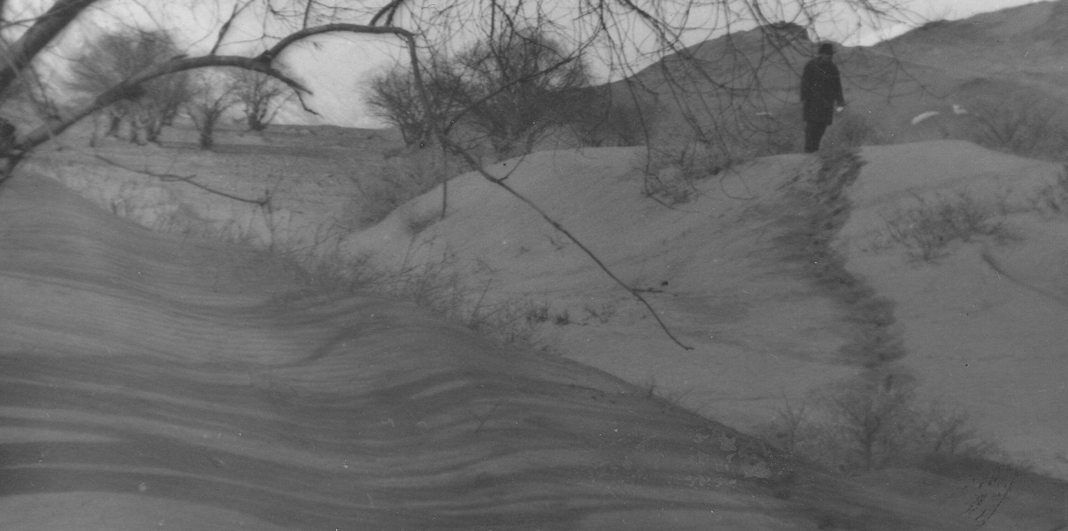
The sandy landscape before implementation of the technology (Kosumbekov Anoyatbek (Forestry department of GBAO))
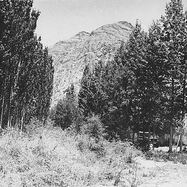
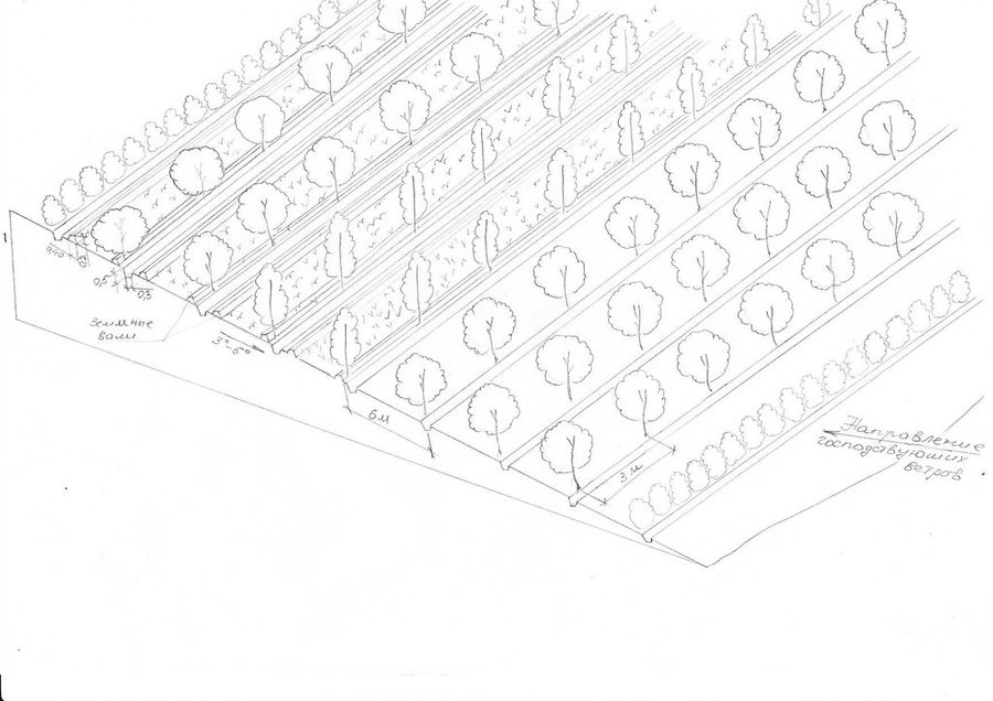
The 24m wide shelterbelt consists of eight rows of trees. Three plots, 50m wide and 350m long were left in-between the trees to intercrop with lucerne and other perennial herbs. Thus, the total area which includes the shelterbelts, meadows and irrigation ditches makes up nearly 10 ha. The shelterbelt was established perpendicular to the direction of the strong winds. Past trials have shown that under the harsh climatic conditions of the Pamir region, shelterbelts in sandy and pebbly areas should include at least eight rows of trees and shrubs.
Purpose of the Technology: The purpose of this technology was to intercrop the shelterbelts with lucerne in order to help protect crops from wind erosion.
Establishment / maintenance activities and inputs: Shelterbelts were planted by hand, not using any machinery. Trees and shrubs were planted in accordance with their physiological characteristics and their tolerance to deflation. The eight rows were planted in the following order: 1st row: sea-buckthorn, 2nd: Shugnan willows, 3rd: Thuran willows, 4th: Pamir poplars, 5th: Bolle's poplars, 6th: Wilhelm’s willows, 7th: Shugnan willows and 8th: Sea Buckthorn. The distance between trees in each row was 4m. Willows and poplars were planted as cuttings, around 1.5–3m in length cut off at the point at which the diameter of the base was around 6cm. Sea buckthorn was planted as seeds at a depth of 4-6cm. Horizontal planting, which increases the growth by 25%, was used instead of vertical planting. The trees were planted between late March and early April. Furrow irrigation ditches were dug before the actual planting of the trees. The irrigation ditches were 0.3m deep and 0.5m wide. The plot was then watered before the actual planting of the trees and the Lucerne, to increase the soil moisture and improve the subsequent growth of the trees. Further watering of the area was carried out every 4-7 days depending on the weather conditions and levels of moisture in the soil. These willow and poplar trees can be pruned 5-6 years after the initial planting. At this stage the branches will be 1-3 m long and can be used by the local population.
Natural / human environment: The plot is located in an arid zone which has sandy and pebbly soil with low fertility. Initially this area was covered by Tugai forest and used as grazing land as well as for timber production. However, as a result of deforestation, the land in this area has become highly unstable and poses a threat to the irrigated lands upslope. 80% of the soil consists of stones and sand. Vegetation cover is mainly composed of sagebrush deserts. These shelterbelts were established during Soviet times and when the civil war broke out after independence, many of the poplar trees were cut down by the local population for construction- and firewood. Therefore only parts of the original shelterbelts are still in place today.
地点: Ishkashim, GBAO, 塔吉克斯坦
分析的技术场所数量:
技术传播:
在永久保护区?:
实施日期: 50多年前(传统)
介绍类型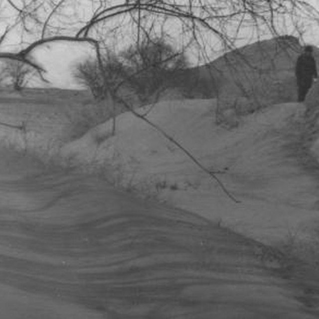


| 对投入进行具体说明 | 单位 | 数量 | 单位成本 (美元) | 每项投入的总成本 (美元) | 土地使用者承担的成本% |
| 劳动力 | |||||
| Digging of pits for tree | Persons/day | 10.0 | 18.0 | 180.0 | 100.0 |
| Planting of trees | Persons/day | 10.0 | 10.0 | 100.0 | 100.0 |
| Sowing of the alfa-alfa in drills | Persons/day | 8.0 | 3.125 | 25.0 | 100.0 |
| Construction of irrigation canals | Persons/day | 15.0 | 15.0 | 225.0 | 100.0 |
| 设备 | |||||
| Shovels and other tools | pieces | 30.0 | 1.0 | 30.0 | |
| 植物材料 | |||||
| Seedling | pieces | 400.0 | 0.11 | 44.0 | |
| Alfalfa sees | kg | 20.0 | 0.65 | 13.0 | |
| 肥料和杀菌剂 | |||||
| Fertilizer | kg | 45.0 | 2.244444 | 101.0 | |
| 技术建立所需总成本 | 718.0 | ||||
| 技术建立总成本,美元 | 718.0 | ||||
| 对投入进行具体说明 | 单位 | 数量 | 单位成本 (美元) | 每项投入的总成本 (美元) | 土地使用者承担的成本% |
| 劳动力 | |||||
| Sanitary cutting and pruning | Persons/day | 3.0 | 3.333 | 10.0 | 100.0 |
| Cutting of alfa alfa | Persons/day | 5.0 | 12.0 | 60.0 | 100.0 |
| Maintenance of the irrigation system | Persons/day | 2.0 | 22.5 | 45.0 | 100.0 |
| 设备 | |||||
| Scissors | pieces | 3.0 | 10.0 | 30.0 | |
| Tools | pieces | 7.0 | 1.0 | 7.0 | |
| 技术维护所需总成本 | 152.0 | ||||
| 技术维护总成本,美元 | 152.0 | ||||
irrigation canals are protected and therefore don't have to be cleaned from sediments every year
SLM之前的数量: 0%
SLM之后的数量: 80%
technology increases yield from croplands
SLM之前的数量: 0%
SLM之后的数量: 50%
during field work farmers acquire knowledges about erosion and methods to prevent it
SLM之前的数量: 0%
SLM之后的数量: 50%
poor farmers get opportunity to use more croplands
Because of increased knowledge of the local farmers about erosion, reduce wind storm related diseases
SLM之前的数量: 0%
SLM之后的数量: 50%
SLM之前的数量: 0%
SLM之后的数量: 20%
windbreak rows conserve soil moisture
SLM之前的数量: 100%
SLM之后的数量: 20%
SLM之前的数量: 100%
SLM之后的数量: 20%


