Dugout Sunken Pond with Catchment Treatment [印度]
- 创建:
- 更新:
- 编制者: Unknown User
- 编辑者: –
- 审查者: Fabian Ottiger
Bandha/ Pokhari (Oriya)
technologies_1475 - 印度
查看章节
全部展开 全部收起1. 一般信息
1.2 参与该技术评估和文件编制的资源人员和机构的联系方式
关键资源人
SLM专业人员:
Patnaik Kishore Chandra
印度
SLM专业人员:
Pradhan Gandhi
印度
SLM专业人员:
Tripathy Dasarathi
MALKANGIRI (ORISSA) INDIA
印度
SLM专业人员:
Panda R.K
Central Soil & Water Conservation Research & Training Institute
Semiliguda, Koraput, Orissa, India
印度
SLM专业人员:
Mohanty K.C
Sahid Laxman Naik Development Society
Malkangiri Orissa India
印度
SLM专业人员:
Mishra BIJAYALAXMI
IDCWDP
Koraput
印度
有助于对技术进行记录/评估的机构名称(如相关)
Central Soil & Water Conservation Research & Training Institute - 印度有助于对技术进行记录/评估的机构名称(如相关)
Sahid Laxman Naik Development Society - 印度有助于对技术进行记录/评估的机构名称(如相关)
IDCWDP (IDCWDP) - 印度1.3 关于使用通过WOCAT记录的数据的条件
(现场)数据是什么时候汇编的?:
20/08/2004
编制者和关键资源人员接受有关使用通过WOCAT记录数据的条件。:
是
1.5 请参阅有关SLM方法的问卷
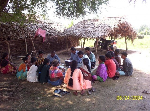
PARTICIPATORY APPROACH IN IDCWDP, DANIDA [印度]
Participatory approach for holistic and intigrated development of the defined area on watershed basis involving all level of stake holders.
- 编制者: Srikanta Kumar Parida
2. SLM技术的说明
2.1 技术简介
技术定义:
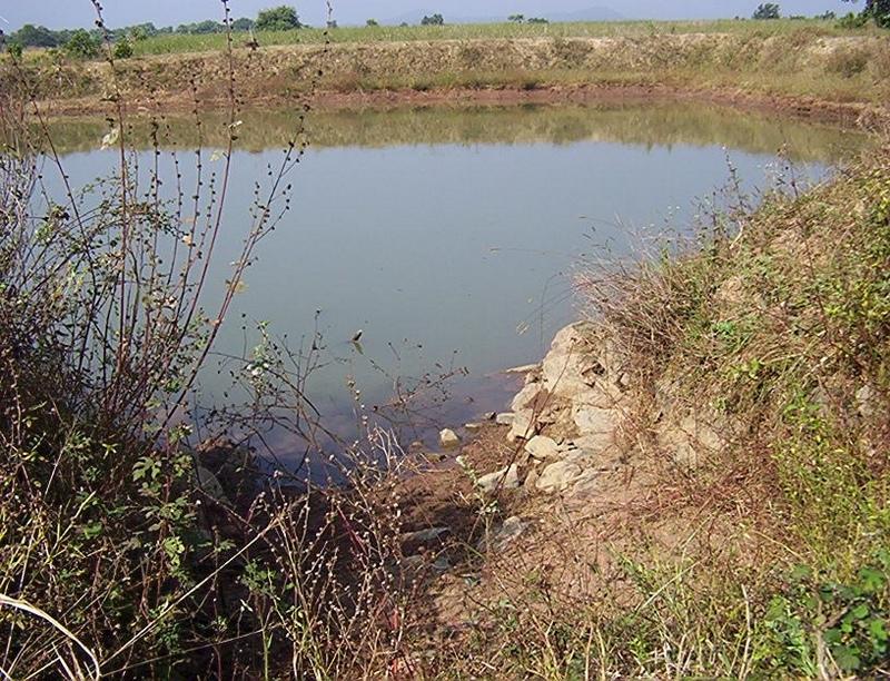
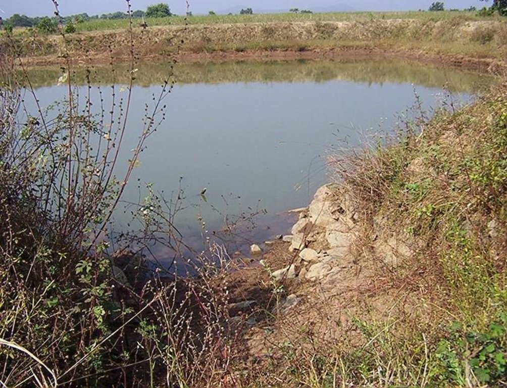
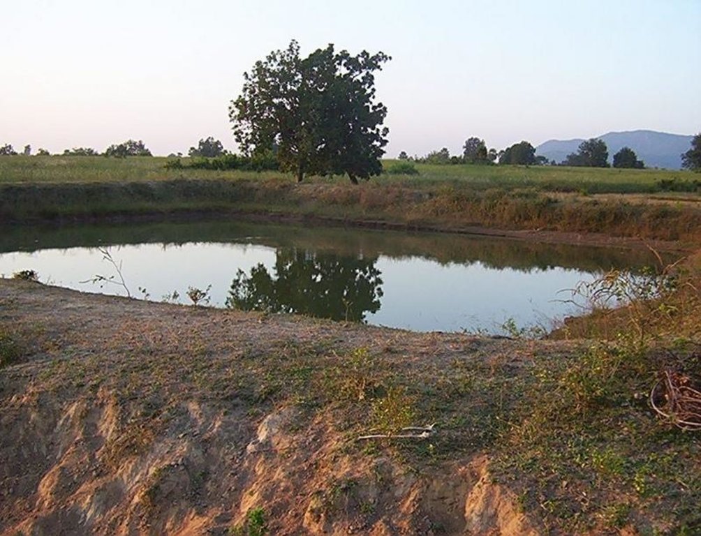
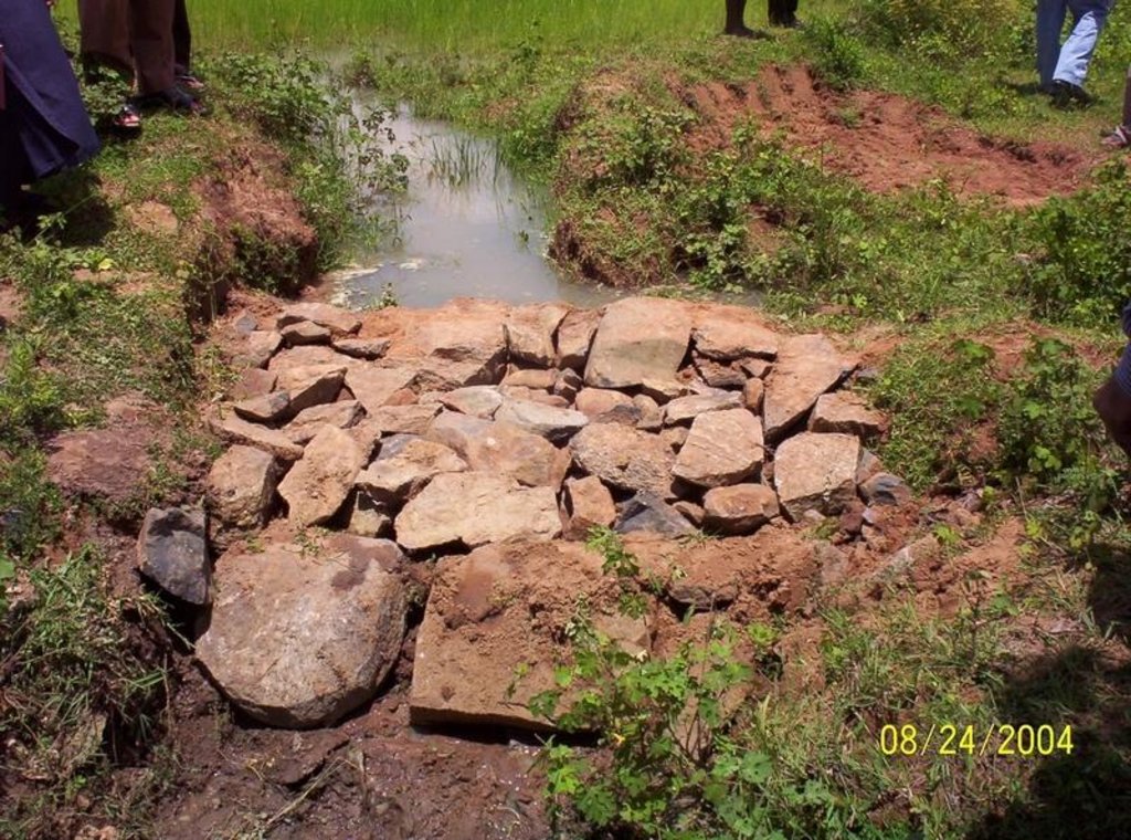
Dugout sunken pond with catchment treatment.
2.2 技术的详细说明
说明:
(1) Total size of the project area = 4.75 Ha.
(2) Different structures taken up in the project area are
(i) Brushwood check dam- 6 Nos.
(ii) Drop structure- 8 Nos.
(iii) Dugout sunken pond - 1 No.
(3) All the above structures were positioned to ridge to valley treatment
(Ref.QT-6/2.1.2/a)
Purpose of the Technology: 1) Storage of runoff for cattle and human use.
2) Construction of structures to check soil erosion and sand casting.
3) Pisciculture.
Establishment / maintenance activities and inputs: Establishment :-
1) SWC specialist selected sites for dugout sunken pond, layout the design.
2) SWC specialist also selected sites for drop structures, brushwood check
dams in gullied portion of project area with reference to vertical interval
of slope gradient and space between structures.
3) The execution of work were done by concerned villagers on payment basis.
4) During execution, 20% of the total cost of the dugout sunken pond was
contributed by the villagers in shape of labour.
5) Training on technical know how imparted to the villagrs during execution
of pond, bund, drop structure and brush wood check dam.
Maintenance:-
1) The dugout sunken pond requires (a) Desiltation once in two years (b)
Repair of earthern bund around inlet and outlet every year.
2) The drop structure & brushwood check dams requires little maintenance when
ever requires.
3) One management group has formed in the same village & funds has been
raised by doing pisciculture in the pond.
4) The management group is taking major reponsibility for its maintenance.
Natural / human environment: (1) Drainage line stablilized (2) Adjuscant area cultivated (3) Users group
formed and pisciculture taken up for the Ist time in the village.
2.3 技术照片
2.5 已应用该技术的、本评估所涵盖的国家/地区/地点
国家:
印度
区域/州/省:
Orissa
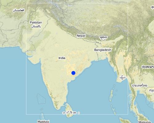
有关地点的进一步说明:
Orissa/ Malkangiri
Map
×2.6 实施日期
如果不知道确切的年份,请说明大概的日期:
- 不到10年前(最近)
2.7 技术介绍
详细说明该技术是如何引入的:
- 通过项目/外部干预
注释(项目类型等):
National Watershed Development Project for Rainfed Area (NWDPRA)
3. SLM技术的分类
3.1 该技术的主要目的
- 改良生产
3.2 应用该技术的当前土地利用类型

农田
- 一年一作
主要农作物(经济作物及粮食作物):
Major food crop: Paddy

牧场
注释:
Major land use problems (compiler’s opinion):
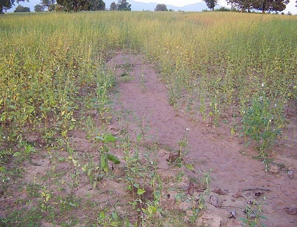
1) A fellow, undulating, gullied piece of land.
2) Acute sand casting at the down stream cropland.
3) About 40% of the project area were practicing local paddy which suffers from erratic rainfall.
Major land use problems (land users’ perception): A piece of land which depends upon the mercy of the Rain God for annual production.
3.3 有关土地利用的更多信息
该技术所应用土地的供水:
- 雨养
每年的生长季节数:
- 1
具体说明:
Longest growing period in days: 150 Longest growing period from month to month: Jul - Nov
3.4 该技术所属的SLM组
- 集水
- 养蜂、养殖业、家禽业、养兔业、养蚕业等
3.5 技术传播
具体说明该技术的分布:
- 均匀地分布在一个区域
如果该技术均匀地分布在一个区域上,请注明覆盖的大致区域。:
- < 0.1 平方千米(10 公顷)
注释:
Total area covered by the SLM Technology is 0.0475 km2.
A fellow, understanding, gullied piece ofland selected for the technology which suffers from sand casting and uncertainity of rain.
3.6 包含该技术的可持续土地管理措施
3.7 该技术强调的主要土地退化类型

土壤水蚀
- Wt:表土流失/地表侵蚀
- Wg:冲沟侵蚀/沟蚀
注释:
Main type of degradation addressed: Wt: loss of topsoil / surface erosion
Secondary types of degradation addressed: Wg: gully erosion / gullying
Main causes of degradation: other human induced causes (specify) (agricultural causes - Coordination of traditional method of agricultural practices like along the slope, use of long term local varieity of seeds etc.), poverty / wealth (lack of captial)
Secondary causes of degradation: other natural causes (avalanches, volcanic eruptions, mud flows, highly susceptible natural resources, extreme topography, etc.) specify (Erosion problem), education, access to knowledge and support services (lack of knowledge), Common social practices
3.8 防止、减少或恢复土地退化
具体数量名该技术与土地退化有关的目标:
- 防止土地退化
- 减少土地退化
注释:
Main goals: mitigation / reduction of land degradation
Secondary goals: prevention of land degradation
4. 技术规范、实施活动、投入和成本
4.1 该技术的技术图纸
4.2 技术规范/技术图纸说明
Aerial view of dugout sunken pond
Location: Siadimal, Korkonda. Malkangiri/Orissa/ India
Date: 15.3.2005
Technical knowledge required for field staff / advisors: moderate
Technical knowledge required for land users: moderate
Main technical functions: control of dispersed runoff: retain / trap
Secondary technical functions: reduction of slope angle, water harvesting / increase water supply, Control of sand casting
Aligned: -contour
Vegetative material: G : grass
Vertical interval within rows / strips / blocks (m): 0.15
Width within rows / strips / blocks (m): 0.45
Vegetative measure: In earthern bund slope
Vegetative material: G : grass
Vertical interval within rows / strips / blocks (m): Compact
Width within rows / strips / blocks (m): 3.7
Vegetative measure: Vegetative material: G : grass
Vegetative measure: Vegetative material: G : grass
Vegetative measure: Vegetative material: G : grass
Grass species: Vertivera and local grass slods
Structural measure: Sediment/Sand/Trap/brushwood check dam
Vertical interval between structures (m): 0.6
Spacing between structures (m): 10
Height of bunds/banks/others (m): 0.6
Width of bunds/banks/others (m): 1.5
Length of bunds/banks/others (m): 3
Structural measure: Sediment/Sand/Trap/ drop structure
Vertical interval between structures (m): 9
Spacing between structures (m): 15
Height of bunds/banks/others (m): 1.05
Width of bunds/banks/others (m): 5.3
Length of bunds/banks/others (m): 3
Structural measure: Dam/Pan/Dugout sunken pond
Depth of ditches/pits/dams (m): 0.6
Width of ditches/pits/dams (m): 28/26/24/22
Length of ditches/pits/dams (m): 28/26/24/22
Structural measure: Bund/Trapizoidal
Height of bunds/banks/others (m): 1.85
Width of bunds/banks/others (m): 1.50+8.9/2
Length of bunds/banks/others (m): 157
Construction material (earth): Soil excavated from pond is used to built bund around pond.
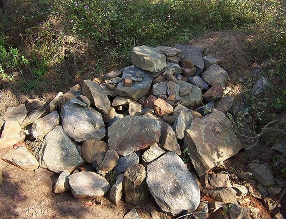
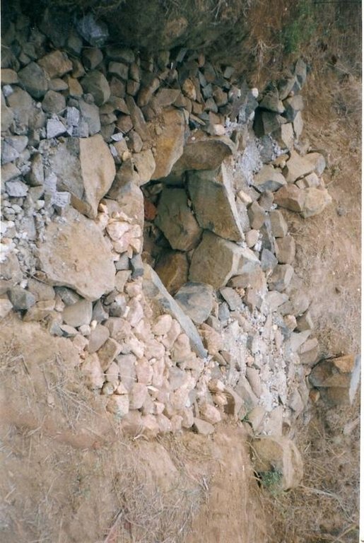
Construction material (stone): Inlet and outlet of pond and drop structure are made up of stone
Construction material (wood): Brush wood check dams are made up of wooden poles and bush wood.
Slope (which determines the spacing indicated above): 8%
If the original slope has changed as a result of the Technology, the slope today is: 3%
For water harvesting: the ratio between the area where the harvested water is applied and the total area from which water is collected is: 1:41
Vegetation is used for stabilisation of structures.
4.3 有关投入和成本计算的一般信息
其它/国家货币(具体说明):
Rupee
注明美元与当地货币的汇率(如相关):1美元=:
45.0
注明雇用劳工的每日平均工资成本:
0.89
4.4 技术建立活动
| 活动 | 措施类型 | 时间 | |
|---|---|---|---|
| 1. | Collection grass sods and vertivera slips | 植物性的 | beginning of rainy season |
| 2. | Transporting grass sods on established banks | 植物性的 | beginning of rainy season |
| 3. | Watering | 植物性的 | When dry in Ist. Season |
| 4. | Dugout sunken pond-Surveying | 结构性的 | Summer season |
| 5. | Dugout sunken pond- soil excavated from pondage area used in trapizodical bund around leaving inlet & outlet portion. | 结构性的 | Summer season |
| 6. | Dugout sunken pond- Collection and transporting stone to inlet & outlet site | 结构性的 | Summer season |
| 7. | Dugout sunken pond- construction of inlet & outlet with stone | 结构性的 | Summer season |
| 8. | Dugout sunken pond- collection of local grass sods & vertiver slops | 结构性的 | Onset of rain |
| 9. | Dugout sunken pond- turfing the bund slopes and planting of vertiver slips in rows at up stream and down steam side of inlet and outlet | 结构性的 | On set of rain |
| 10. | Brushwood check dam- surveying | 结构性的 | Summer season |
| 11. | Brushwood check dam- collection of wooden poles and brush wood | 结构性的 | Summer season |
| 12. | Brushwood check dam- collection of picked up stones | 结构性的 | Summer season |
| 13. | Brushwood check dam- fixing of wooden pole, weiving with brush wood, filling up the gaps with picked up stones | 结构性的 | Summer season |
| 14. | Brushwood check dam- collection of vertiver slips and planting in upstream and downstream of each structure | 结构性的 | On set of rain |
| 15. | Drop structure- surveying | 结构性的 | Summer season |
| 16. | Drop structure- collection & transportation of stones to work spot | 结构性的 | Summer season |
| 17. | Drop structure- construction of drop structure with stones | 结构性的 | Summer season |
| 18. | Drop structure- collection of vertiver slips and planting at up stream and down stream of structure | 结构性的 | On set of rain |
4.5 技术建立所需要的费用和投入
| 对投入进行具体说明 | 单位 | 数量 | 单位成本 | 每项投入的总成本 | 土地使用者承担的成本% | |
|---|---|---|---|---|---|---|
| 劳动力 | Labour | ha | 1.0 | 225.0 | 225.0 | 14.0 |
| 设备 | Animal traction | ha | 1.0 | 49.0 | 49.0 | |
| 设备 | Tools | ha | 1.0 | 4.0 | 4.0 | |
| 其它 | Royalty charges for stones | ha | 1.0 | 6.0 | 6.0 | |
| 其它 | Fishery and feed | ha | 1.0 | 9.0 | 9.0 | |
| 其它 | Field bunding | ha | 1.0 | 73.0 | 73.0 | 100.0 |
| 其它 | Water way | ha | 1.0 | 6.0 | 6.0 | 100.0 |
| 技术建立所需总成本 | 372.0 | |||||
4.6 维护/经常性活动
| 活动 | 措施类型 | 时间/频率 | |
|---|---|---|---|
| 1. | Collecting vertiver slips & grass sods for gap filling | 植物性的 | Onset of rain /annual |
| 2. | Collection of grass sods and gap fillling to bund layers | 结构性的 | On set of rain/Annualy |
| 3. | Desiltation | 结构性的 | Before on set of rain/Biannualy |
4.7 维护/经常性活动所需要的费用和投入(每年)
| 对投入进行具体说明 | 单位 | 数量 | 单位成本 | 每项投入的总成本 | 土地使用者承担的成本% | |
|---|---|---|---|---|---|---|
| 劳动力 | Labour | ha | 1.0 | 18.0 | 18.0 | 100.0 |
| 其它 | Field bunding | ha | 1.0 | 2.0 | 2.0 | 100.0 |
| 其它 | Water way | ha | 1.0 | 1.0 | 1.0 | 100.0 |
| 技术维护所需总成本 | 21.0 | |||||
注释:
The above calculation is based on the total establishment/ recurring cost both born by the project and land users is devided by the total project area i.e 4.75 ha. To get average hect. cost.
4.8 影响成本的最重要因素
描述影响成本的最决定性因素:
Availability of stone affects the cost from implementing SWC
5. 自然和人文环境
5.1 气候
年降雨量
- < 250毫米
- 251-500毫米
- 501-750毫米
- 751-1,000毫米
- 1,001-1,500毫米
- 1,501-2,000毫米
- 2,001-3,000毫米
- 3,001-4,000毫米
- > 4,000毫米
指定年平均降雨量(若已知),单位为mm:
1760.00
农业气候带
- 半湿润
South Eastern Ghat Agro Climatic Zone
5.2 地形
平均坡度:
- 水平(0-2%)
- 缓降(3-5%)
- 平缓(6-10%)
- 滚坡(11-15%)
- 崎岖(16-30%)
- 陡峭(31-60%)
- 非常陡峭(>60%)
地形:
- 高原/平原
- 山脊
- 山坡
- 山地斜坡
- 麓坡
- 谷底
垂直分布带:
- 0-100 m a.s.l.
- 101-500 m a.s.l.
- 501-1,000 m a.s.l.
- 1,001-1,500 m a.s.l.
- 1,501-2,000 m a.s.l.
- 2,001-2,500 m a.s.l.
- 2,501-3,000 m a.s.l.
- 3,001-4,000 m a.s.l.
- > 4,000 m a.s.l.
关于地形的注释和进一步规范:
Altitudinal zone: 101-500 m a.s.l. (423 m a.s.l.)
Landforms: Plateau/plains (2-7% slope)
5.3 土壤
平均土层深度:
- 非常浅(0-20厘米)
- 浅(21-50厘米)
- 中等深度(51-80厘米)
- 深(81-120厘米)
- 非常深(> 120厘米)
土壤质地(表土):
- 中粒(壤土、粉土)
表土有机质:
- 中(1-3%)
如有可能,附上完整的土壤描述或具体说明可用的信息,例如土壤类型、土壤酸碱度、阳离子交换能力、氮、盐度等。:
Soil fertility: Medium
Soil drainage/infiltration: Good
Soil water storage capacity: Medium
5.6 应用该技术的土地使用者的特征
非农收入:
- 收入的10-50%
相对财富水平:
- 贫瘠
- 平均水平
机械化水平:
- 手工作业
- 畜力牵引
说明土地使用者的其他有关特征:
Population density: < 10 persons/km2
Annual population growth: < 0.5%
30% of the land users are average wealthy and own 60% of the land.
70% of the land users are poor and own 40% of the land.
Off-farm income specification: Land users from SWC technology area proctise contour plough, line sowing and using HYV paddy have increased their income significantly.
Level of mechanization: Manual labour and aniaml traction (bullock plough, both ranked 1)
Market orientation of production system: Pisciculture (Selling at village level)
5.7 应用该技术的土地使用者拥有或租用的平均土地面积
- < 0.5 公顷
- 0.5-1 公顷
- 1-2 公顷
- 2-5公顷
- 5-15公顷
- 15-50公顷
- 50-100公顷
- 100-500公顷
- 500-1,000公顷
- 1,000-10,000公顷
- > 10,000公顷
5.8 土地所有权、土地使用权和水使用权
土地所有权:
- 社区/村庄
土地使用权:
- 自由进入(无组织)
6. 影响和结论性说明
6.1 该技术的现场影响
社会经济效应
生产
作物生产
产品多样性
注释/具体说明:
Fish add to their income
生产区域
注释/具体说明:
Closure of land by pondage area
水资源可用性和质量
家畜用水的可用性
注释/具体说明:
Pisciculture support to live stock, dirnking water for cattle
社会文化影响
社区机构
注释/具体说明:
Management group formed and strengthened due to continurous income from pisciculture.
SLM/土地退化知识
注释/具体说明:
Training conducted
Linkage with other institutions
注释/具体说明:
Due to different activities in the pond linkage to other institution has increased like Horticulture, Fishery etc.
生态影响
水循环/径流
地表径流
SLM之前的数量:
90
SLM之后的数量:
40
多余水的排放
土壤
土壤水分
注释/具体说明:
Due to water storage
土壤流失
SLM之前的数量:
87
SLM之后的数量:
45
其它生态影响
Biodiversity
6.2 该技术的场外影响已经显现
下游淤积
Soil moisture regime
6.4 成本效益分析
技术收益与技术建立成本相比如何(从土地使用者的角度看)?
短期回报:
稍微积极
长期回报:
积极
技术收益与技术维护成本/经常性成本相比如何(从土地使用者的角度看)?
短期回报:
中性/平衡
长期回报:
中性/平衡
6.5 技术采用
在所有采用这项技术的人当中,有多少人是自发地采用该技术,即未获得任何物质奖励/付款?:
- 90-100%
注释:
100% of land user families have adopted the Technology without any external material support
19 land user families have adopted the Technology without any external material support
Comments on spontaneous adoption: survey results
There is a moderate trend towards spontaneous adoption of the Technology
Comments on adoption trend: If the community find the technology is low cost to teke up and gets eye catching benefits, then the treand of adoption is good.
6.7 该技术的优点/长处/机会
| 土地使用者眼中的长处/优势/机会 |
|---|
|
Water problem for human and cattle solved How can they be sustained / enhanced? Regular maintenance of pond needed |
|
Damage of crops reduced by construction of series of structures How can they be sustained / enhanced? More field bunding, vegetative cover should be imparted. |
|
Users group brings villagers closure How can they be sustained / enhanced? Manageent group to be reorganised annuly |
| 编制者或其他关键资源人员认为的长处/优势/机会 |
|---|
|
Water scarcity of the area partly solved How can they be sustained / enhanced? Regular desilting shound be done. |
|
Heavy sand casting and soil loss controled How can they be sustained / enhanced? More vegetative cover required for catchement area |
|
Crop production increased in the project area How can they be sustained / enhanced? Should be replicated by the people. |
|
Pisciculture added extra income to the villagers How can they be sustained / enhanced? Hybrid fingerlings to be adopted |
6.8 技术的弱点/缺点/风险及其克服方法
| 编制者或其他关键资源人员认为的弱点/缺点/风险 | 如何克服它们? |
|---|---|
| Sand casting could not be checked fully | By full vegetative cover and more structural measures it can be checked. |
| Sediment deposit in down stream area decreased | The loss can be over come by increasing crop yield. |
7. 参考和链接
7.2 参考可用出版物
标题、作者、年份、ISBN:
Watershed Survey Report
可以从哪里获得?成本如何?
Director of Soil Conservation, Orissa, Bhubaneswar
标题、作者、年份、ISBN:
Plan and Estimate
可以从哪里获得?成本如何?
-do-
链接和模块
全部展开 全部收起链接

PARTICIPATORY APPROACH IN IDCWDP, DANIDA [印度]
Participatory approach for holistic and intigrated development of the defined area on watershed basis involving all level of stake holders.
- 编制者: Srikanta Kumar Parida
模块
无模块


