Couloirs de passage [尼日尔 ]
- 创建:
- 更新:
- 编制者: Lemma Ababu
- 编辑者: –
- 审查者: Alexandra Gavilano
technologies_1353 - 尼日尔
查看章节
全部展开 全部收起1. 一般信息
1.2 参与该技术评估和文件编制的资源人员和机构的联系方式
有助于对技术进行记录/评估的机构名称(如相关)
GREAD (GREAD) - 尼日尔1.3 关于使用通过WOCAT记录的数据的条件
编制者和关键资源人员接受有关使用通过WOCAT记录数据的条件。:
是
1.5 请参阅有关SLM方法的问卷
2. SLM技术的说明
2.1 技术简介
技术定义:
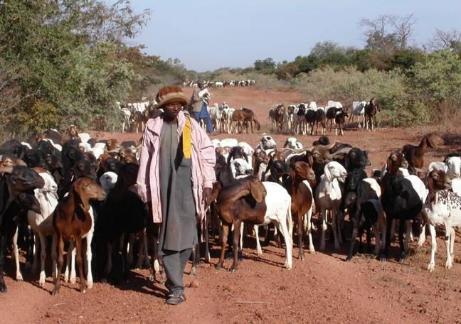
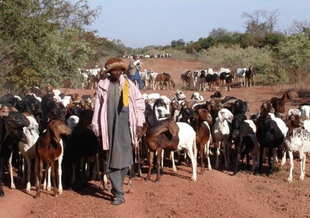
The ‘couloirs de passage’ are formally defined passageways which channel the movements of livestock herds in the agro-pastoral zones of Niger, by linking pastures, water points and coralling areas, be it within village areas (internal couloirs) or on open land (external couloirs).
2.2 技术的详细说明
说明:
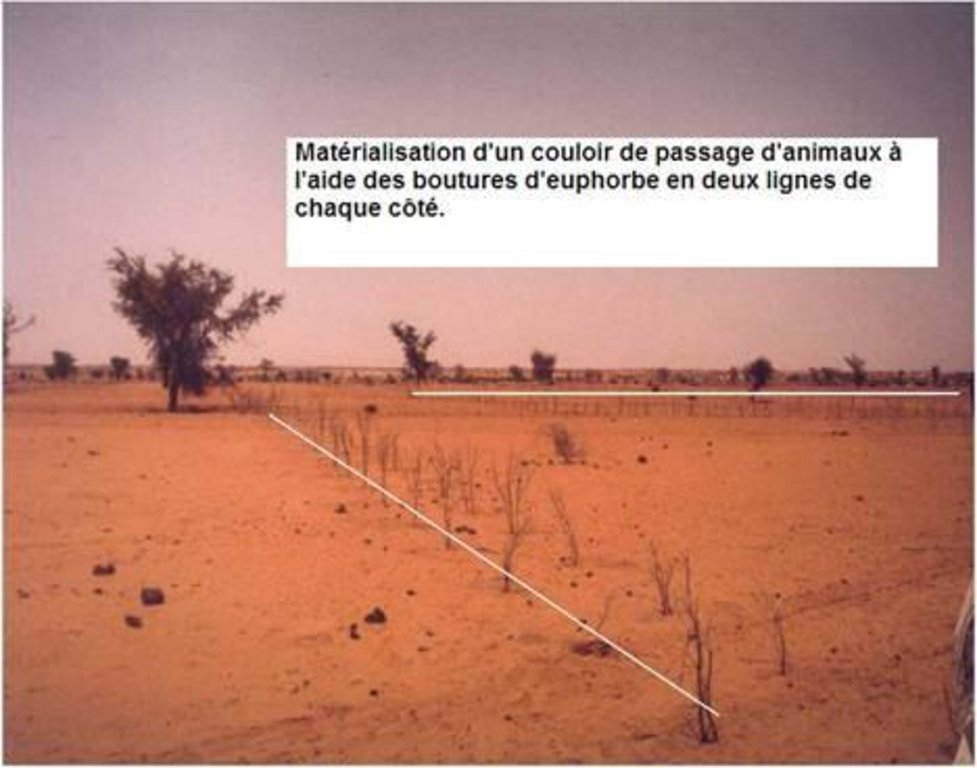
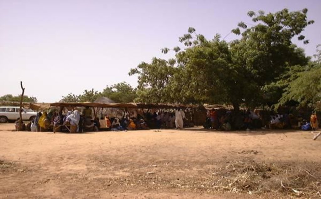
The main goal of the couloirs is the prevention of conflict between agriculturalists and pastoralists regarding the use of limited land and water resources. These conflicts are often provoked by cattle entering cropping areas. The establishment of demarcated passageways allows the livestock to access water points and pastures without causing damage to cropland. The corridors are regulated through the ‘code rural’ – a national law defining the land use rights of the pastoralists. Demarcation of couloirs is based on a consensual decision of all concerned interest groups. Internal couloirs are negotiated in a general on-site assembly involving all stakeholders (farmers, breeders, women’s groups, local authorities). For the demarcation of external couloirs the involvement of transhumance herders and neighboring villages is indispensable. Once an agreement on the course of the couloir is achieved, demarcation with stones and/or boundary planting with selected tree species is carried out by the local land users - with financial and technical assistance of the government or NGOs. Common species involve: Euphorbia balsamifera, Acacia spp. (A. nilotica; A. senegal); and Faidherbia albida. Management committees at the community level draw up regulations for the management of the couloirs (maintenance and protection of vegetation). Protection of plants is achieved through dead branches (at the initial stage), daily control by forest guards, and information campaigns. The technology is a sustainable solution to the described conflicts. As a valuable by-product the trees along the demarcation lines provide of wood and non-woody by-products.
2.3 技术照片
2.5 已应用该技术的、本评估所涵盖的国家/地区/地点
国家:
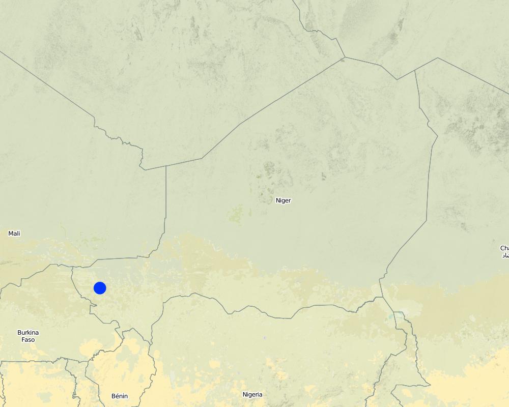
尼日尔
区域/州/省:
Tillabéri North
Map
×2.7 技术介绍
详细说明该技术是如何引入的:
- 通过项目/外部干预
3. SLM技术的分类
3.1 该技术的主要目的
- 创造有益的社会影响
3.2 应用该技术的当前土地利用类型

混合(作物/放牧/树木),包括农林
- 农牧业
注释:
Major land use problems (land users’ perception): Soil erosion by water, soil erosion by wind and biological degradation; Primary problem addressed is conflicts between livestock and agriculture producers around natural resources
Semi-nomadism / pastoralism: Yes
Future (final) land use (after implementation of SLM Technology): Mixed: Ms: Silvo-pastoralism
如果由于技术的实施而导致土地用途发生变化,则在技术实施前说明土地利的用途。:
Cropland: Ca: Annual cropping
3.3 有关土地利用的更多信息
该技术所应用土地的供水:
- 雨养
3.4 该技术所属的SLM组
- 畜牧业和牧场管理
3.5 技术传播
具体说明该技术的分布:
- 适用于特定场所/集中在较小区域
3.6 包含该技术的可持续土地管理措施

植物措施
- V1:乔木和灌木覆盖层

管理措施
- M3:根据自然和人文环境进行布局
注释:
Type of vegetative measures: scattered / dispersed
3.7 该技术强调的主要土地退化类型

土壤水蚀
- Wt:表土流失/地表侵蚀

土壤风蚀
- Et:表土流失

生物性退化
- Bc:植被覆盖的减少
注释:
Main type of degradation addressed: Wt: loss of topsoil / surface erosion, Et: loss of topsoil, Bc: reduction of vegetation cover
3.8 防止、减少或恢复土地退化
具体数量名该技术与土地退化有关的目标:
- 防止土地退化
4. 技术规范、实施活动、投入和成本
4.2 技术规范/技术图纸说明
Technical knowledge required for field staff / advisors: high (facilitator of code rural)
Technical knowledge required for land users: low (pastors and workers)
Main technical functions: increase of biomass (quantity), promotion of vegetation species and varieties (quality, eg palatable fodder)
Trees/ shrubs species: Euphorbia balsamifera, Acacia spp. (A. nilotica; A. senegal) and Faidherbia albida
4.3 有关投入和成本计算的一般信息
具体说明成本计算所用货币:
- 美元
注明雇用劳工的每日平均工资成本:
1.5
4.4 技术建立活动
| 活动 | 措施类型 | 时间 | |
|---|---|---|---|
| 1. | Identification of an existing couloir or definition of a new passageway by means of a general assembly | 植物性的 | |
| 2. | Alignment of corridor boundaries e.g. by establishing stone lines. Internal couloirs are 10 to 50 m wide, whereas external couloirs exceed a width of 50 m | 植物性的 | |
| 3. | Digging 40 cm deep pits; tree planting along boundaries (with a spacing of 1-3 meters, depending on the species selected and the secondary objective) | 植物性的 |
4.5 技术建立所需要的费用和投入
| 对投入进行具体说明 | 单位 | 数量 | 单位成本 | 每项投入的总成本 | 土地使用者承担的成本% | |
|---|---|---|---|---|---|---|
| 劳动力 | Identification of an existing couloir or definition of a new passageway | persons/day | 25.0 | 1.5 | 37.5 | 5.0 |
| 植物材料 | Tree planting along boundaries (seedlings) | pieces | 670.0 | 2.05 | 1373.5 | 5.0 |
| 技术建立所需总成本 | 1411.0 | |||||
如果土地使用者负担的费用少于100%,请注明由谁负担其余费用:
Government or NGO's
4.6 维护/经常性活动
| 活动 | 措施类型 | 时间/频率 | |
|---|---|---|---|
| 1. | Protection of trees (through dead branches, guards, information campaigns) | 植物性的 | |
| 2. | Replanting tree seedlings to fill gaps (annually, beginning of rainy season) | 植物性的 |
4.7 维护/经常性活动所需要的费用和投入(每年)
| 对投入进行具体说明 | 单位 | 数量 | 单位成本 | 每项投入的总成本 | 土地使用者承担的成本% | |
|---|---|---|---|---|---|---|
| 劳动力 | Protection of trees | persons/day | 4.0 | 1.5 | 6.0 | 100.0 |
| 植物材料 | Replanting tree seedlings | pieces | 67.0 | 2.0448 | 137.0 | 100.0 |
| 技术维护所需总成本 | 143.0 | |||||
注释:
Costs for seedlings were calculated for a couloir length of 1 km and a spacing of 3 m between plants (one tree line on each side). Seedling production is financed by projects, only transport costs are met by land users.
4.8 影响成本的最重要因素
描述影响成本的最决定性因素:
The costs of the planning meeting (general assembly) and the stones for delimitation were not taken into account. Daily salary for field work is US$ 1.5.
5. 自然和人文环境
5.1 气候
年降雨量
- < 250毫米
- 251-500毫米
- 501-750毫米
- 751-1,000毫米
- 1,001-1,500毫米
- 1,501-2,000毫米
- 2,001-3,000毫米
- 3,001-4,000毫米
- > 4,000毫米
农业气候带
- 半干旱
Thermal climate class: tropics
5.2 地形
平均坡度:
- 水平(0-2%)
- 缓降(3-5%)
- 平缓(6-10%)
- 滚坡(11-15%)
- 崎岖(16-30%)
- 陡峭(31-60%)
- 非常陡峭(>60%)
地形:
- 高原/平原
- 山脊
- 山坡
- 山地斜坡
- 麓坡
- 谷底
垂直分布带:
- 0-100 m a.s.l.
- 101-500 m a.s.l.
- 501-1,000 m a.s.l.
- 1,001-1,500 m a.s.l.
- 1,501-2,000 m a.s.l.
- 2,001-2,500 m a.s.l.
- 2,501-3,000 m a.s.l.
- 3,001-4,000 m a.s.l.
- > 4,000 m a.s.l.
5.3 土壤
平均土层深度:
- 非常浅(0-20厘米)
- 浅(21-50厘米)
- 中等深度(51-80厘米)
- 深(81-120厘米)
- 非常深(> 120厘米)
土壤质地(表土):
- 粗粒/轻(砂质)
表土有机质:
- 低(<1%)
如有可能,附上完整的土壤描述或具体说明可用的信息,例如土壤类型、土壤酸碱度、阳离子交换能力、氮、盐度等。:
Soil fertility is medium
Soil drainage / infiltration is good but low in case of soil crusting
5.6 应用该技术的土地使用者的特征
生产系统的市场定位:
- 生计(自给)
- 混合(生计/商业
个人或集体:
- 团体/社区
机械化水平:
- 畜力牵引
说明土地使用者的其他有关特征:
Population density: 10-50 persons/km2
5.7 应用该技术的土地使用者拥有或租用的平均土地面积
- < 0.5 公顷
- 0.5-1 公顷
- 1-2 公顷
- 2-5公顷
- 5-15公顷
- 15-50公顷
- 50-100公顷
- 100-500公顷
- 500-1,000公顷
- 1,000-10,000公顷
- > 10,000公顷
5.8 土地所有权、土地使用权和水使用权
土地所有权:
- 个人,有命名
土地使用权:
- 社区(有组织)
- 个人
6. 影响和结论性说明
6.1 该技术的现场影响
社会经济效应
生产
作物生产
饲料生产
饲料质量
畜牧生产
收入和成本
农业收入
社会文化影响
文化机会
社区机构
注释/具体说明:
Through mutual aid in technology implementation
国家机构
注释/具体说明:
Code rural secretariat
SLM/土地退化知识
生态影响
土壤
土壤覆盖层
土壤流失
养分循环/补给
生物多样性:植被、动物
生物量/地上C
动物多样性
减少气候和灾害风险
火灾风险
风速
6.2 该技术的场外影响已经显现
风力搬运沉积物
对邻近农田的破坏
对公共/私人基础设施的破坏
6.3 技术对渐变气候以及与气候相关的极端情况/灾害的暴露和敏感性(土地使用者认为的极端情况/灾害)
注释:
Technology is sensitive to climatic extremes (such as droughts and floods)
6.4 成本效益分析
技术收益与技术建立成本相比如何(从土地使用者的角度看)?
短期回报:
积极
长期回报:
非常积极
技术收益与技术维护成本/经常性成本相比如何(从土地使用者的角度看)?
短期回报:
积极
长期回报:
非常积极
注释:
Peace between communities is the key result on short term and on long term. Ecological and economic benefits are linked to the plantation of trees and the improved management of natural resources
6.5 技术采用
在所有采用这项技术的人当中,有多少人是自发地采用该技术,即未获得任何物质奖励/付款?:
- 0-10%
注释:
There is a strong trend towards spontaneous adoption of the Technology
Comments on adoption trend: for prevention of conflicts and land degradation
6.7 该技术的优点/长处/机会
| 编制者或其他关键资源人员认为的长处/优势/机会 |
|---|
| The technology provides a sustainable solution to conflicts between agriculturalists and pastoralists |
6.8 技术的弱点/缺点/风险及其克服方法
| 土地使用者认为的弱点/缺点/风险 | 如何克服它们? |
|---|---|
| Implementation constraints: plant production is very expensive and reaching a consensus on the transformation of private cropland to communal passageways is very difficult | definition of the couloirs as public infrastructure and enhancement of organizational capacities of the local population through training and information sessions |
| Maintenance constraints: maintenance can only be realized by adjacent land owners, as the community organizations are weak | reinforce the institutional capacities of livestock owners and farmers to manage the couloirs |
| In the pastoral zone the couloirs lead to conflicts between pastoralists and private ranches | establish community-based land tenure commissions and introduce new laws on land property in the pastoral zone |
7. 参考和链接
7.2 参考可用出版物
标题、作者、年份、ISBN:
Projet LUCOP/Tillabéry. 2004. Referential des measures techniques de recuperation, de protection et d’exploitation durable des terres, 2nd edition, 2004, 51 pp
标题、作者、年份、ISBN:
Hiernaux P., E. Tielkes, E. Schlecht. 2001. Elevage et gestion des parcours au Sahel, Workshop proceedings organised by Eric Tielkes et Abdoulaye Soumaila, Verlag Ulrich E. Grauer, Beuren, Stuttgart, Germany, 2001
7.3 链接到网络上可用的相关信息
标题/说明:
Soumaila A.S. 2003. Base de données du code rural
URL:
www.case.ibimet.cnr.it/den/Documents/code_rural/start.html
链接和模块
全部展开 全部收起链接
无链接
模块
无模块


