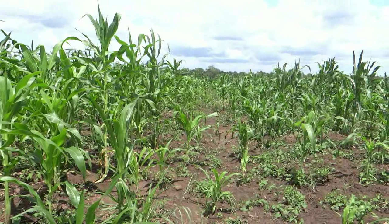
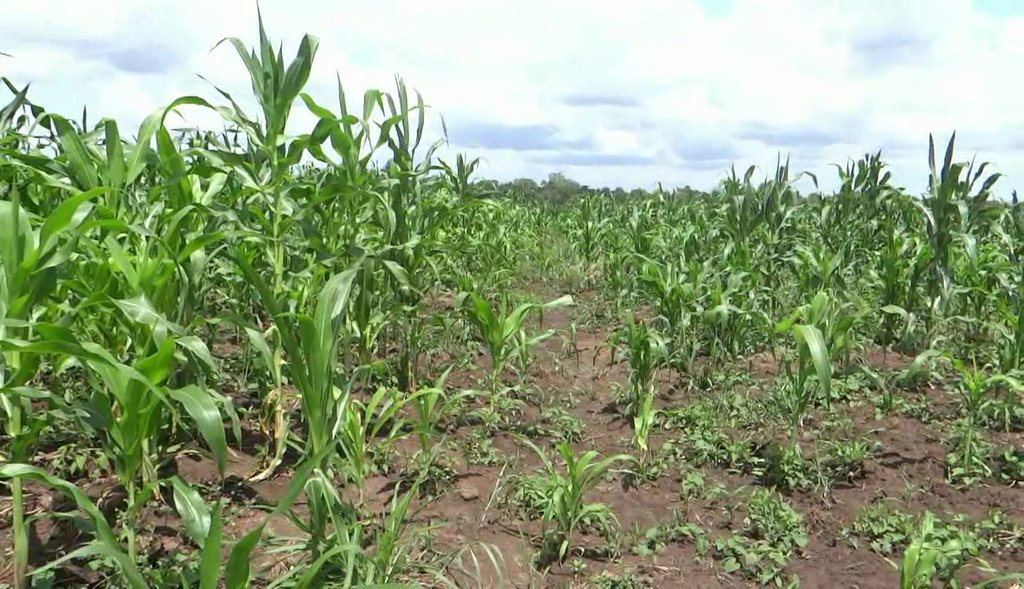
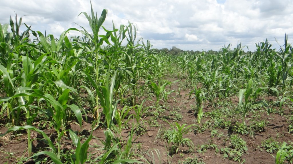
Maize (zea mays) growing with contours [乌干达]
- 创建:
- 更新:
- 编制者: betty adoch
- 编辑者: JOY TUKAHIRWA, Bernard Fungo, Kamugisha Rick Nelson
- 审查者: John Stephen Tenywa, Nicole Harari, Renate Fleiner
Poto Anywagi idye Tule.
technologies_2836 - 乌干达
查看章节
全部展开 全部收起1. 一般信息
1.2 参与该技术评估和文件编制的资源人员和机构的联系方式
关键资源人
土地使用者:
Tabu Geoffrey
0773682327
Gulu district.
awac sub county, paromo parish, gwengdiya village.
乌干达
有助于对技术进行记录/评估的项目名称(如相关)
Scaling-up SLM practices by smallholder farmers (IFAD)有助于对技术进行记录/评估的机构名称(如相关)
Uganda Landcare Network (ULN) - 乌干达1.3 关于使用通过WOCAT记录的数据的条件
(现场)数据是什么时候汇编的?:
25/05/2017
编制者和关键资源人员接受有关使用通过WOCAT记录数据的条件。:
是
1.4 所述技术的可持续性声明
这里所描述的技术在土地退化方面是否存在问题,导致无法被认为是一种可持续的土地管理技术?:
否
注释:
contour ploughing conserves soil from land degradation by erosion.
2. SLM技术的说明
2.1 技术简介
技术定义:
Contour farming is a practice of ploughing and/or planting across a slope following its elevation contour lines. The contour lines create a water break which reduces rill and gully forms of soil erosion in case of heavy storms. The water break allows more time for more water to percolate/sink into the soil, thus reducing the amount of water left to run off the surface.
2.2 技术的详细说明
说明:
Improved Maize variety (Longe 10) is popularly grown in Northern Uganda due to its high yielding ability. Northern Uganda has a generally flat landscape although along the river banks it is slopy with high risk of soil erosion. This has motivated the land user to grow his maize along the slope using contour ploughing which is a sustainable land management practice. Contour farming is a practice of ploughing and/or planting across a slope following its elevation contour lines. The contour lines create a water break which reduces rill and gully forms of soil erosion in case of heavy storms. The water break allows more time for more water to percolate/sink into the soil, thus reducing the amount of water left to run off the surface. Northern Uganda has a tropical savanna climate with one growing season. Rainfall is usually moderate ranging from 1000-1500 mm per annum and sometimes occurs with heavy storms. Rainfall is received from April to November with a dry spell in June and July which affects crop growth.
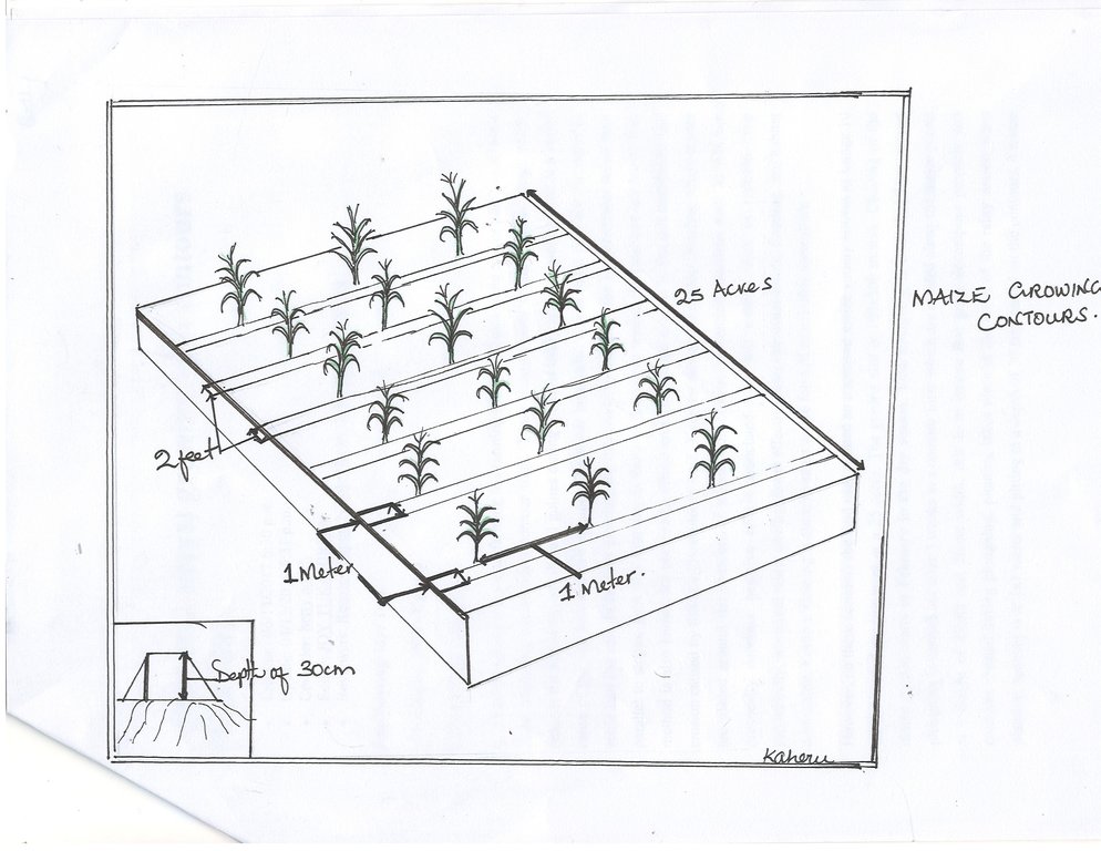
The maize was grown for commercial purposes in a 25 x 25 acres of land on contour lines with the aim of controlling soil erosion, and increase plant nutrients, soil moisture, productivity and household income. The maize is planted along the contour lines at a spacing of 30 cm between the maize plants and of 1 meter between the rows that runs across the contour field. Holes for planting maize are dug at a depth of 30 cm along the contours with four maize seeds planted per hole and covered with soil immediately since the contours creates a water break which reduces the formation of rills and gullies during heavy water run-off which is a major cause of soil erosion.
The activities involved in establishing such a technology include clearing the field during the dry season in March and second ploughing in early April to alter the soil and allow proper decomposition of the grass and also creating contours during planting in early April at the onset of the rainy season. Weeding is done twice, first two weeks after maize germination in late April, and lastly in June.
Inputs needed to establish the technology include ox-plough, hoes, and pangas used to clear the field. Inputs for maintaining the technology include hoes for weeding the maize crop and also checking that the contours are not destroyed by the run-off.
The technology is liked because it is good at controlling soil erosion on the gently sloping field, increases plant nutrients and soil moisture, and increases productivity. But it is disadvantageous when contours collapse which is accelerating the speed of surface run-off.
2.3 技术照片
2.4 技术视频
注释、简短说明:
maize field along contour lines
日期:
25/05/2017
位置:
Gulu district
摄影师的名字:
Betty Adoch
2.5 已应用该技术的、本评估所涵盖的国家/地区/地点
国家:
乌干达
区域/州/省:
Northern Uganda.
有关地点的进一步说明:
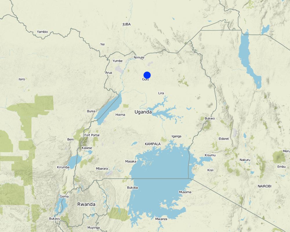
Gulu district
注释:
GPS points shows the maize field
Map
×2.6 实施日期
如果不知道确切的年份,请说明大概的日期:
- 不到10年前(最近)
2.7 技术介绍
详细说明该技术是如何引入的:
- 通过土地使用者的创新
注释(项目类型等):
The land user visited other farmers and copied the ideas of contour ploughing. These farmers include Sam Kolo, Otema Awany amongst others.
3. SLM技术的分类
3.1 该技术的主要目的
- 改良生产
- 减少、预防、恢复土地退化
- 适应气候变化/极端天气及其影响
- 创造有益的经济影响
- 创造有益的社会影响
3.2 应用该技术的当前土地利用类型

农田
- 一年一作
主要农作物(经济作物及粮食作物):
maize
注释:
contours prevent soil erosion by surface runoff
如果由于技术的实施而导致土地用途发生变化,则在技术实施前说明土地利的用途。:
uncultivated land
3.3 有关土地利用的更多信息
该技术所应用土地的供水:
- 雨养
每年的生长季节数:
- 1
3.4 该技术所属的SLM组
- 最小的土壤扰动
- 土壤肥力综合管理
3.5 技术传播
具体说明该技术的分布:
- 均匀地分布在一个区域
如果该技术均匀地分布在一个区域上,请注明覆盖的大致区域。:
- < 0.1 平方千米(10 公顷)
3.6 包含该技术的可持续土地管理措施

农艺措施
- A1:植被和土壤覆盖层
- A2:有机质/土壤肥力
- A3:土壤表面处理
- A5:种子管理,改良品种
注释:
this technology improves soil nutrients and results in higher yields
3.7 该技术强调的主要土地退化类型

土壤水蚀
- Wt:表土流失/地表侵蚀
- Wg:冲沟侵蚀/沟蚀
3.8 防止、减少或恢复土地退化
具体数量名该技术与土地退化有关的目标:
- 防止土地退化
- 减少土地退化
注释:
contour maize growing promotes sustainable land utilisation
4. 技术规范、实施活动、投入和成本
4.1 该技术的技术图纸
4.2 技术规范/技术图纸说明
Contours are created on a gentle slope using ox-plough. Maize holes are dug at a depth of 30 cm and a spacing of 30 x 30 cm. The distance between the contours are 1 x 1 meter. The contours are helpful in improving infiltration rates and controlling soil erosion.
4.3 有关投入和成本计算的一般信息
具体说明成本和投入是如何计算的:
- 每个技术区域
注明尺寸和面积单位:
25 acres
其它/国家货币(具体说明):
UGX
注明雇用劳工的每日平均工资成本:
5000 shs
4.4 技术建立活动
| 活动 | 措施类型 | 时间 | |
|---|---|---|---|
| 1. | Clearing garden | 农业学的 | March |
| 2. | Ox-ploughing to create contours | 农业学的 | April |
| 3. | Planting | 农业学的 | April |
| 4. | Weeding | 农业学的 | Late April |
| 5. | Thinning | 农业学的 | Late April |
注释:
Easy to establish the contours.
4.5 技术建立所需要的费用和投入
| 对投入进行具体说明 | 单位 | 数量 | 单位成本 | 每项投入的总成本 | 土地使用者承担的成本% | |
|---|---|---|---|---|---|---|
| 劳动力 | Clearing land | days | 30.0 | 5000.0 | 150000.0 | 100.0 |
| 劳动力 | Ox-ploughing | days | 5.0 | 40000.0 | 200000.0 | 100.0 |
| 设备 | Ox-plough | pices | 5.0 | 20000.0 | 100000.0 | 100.0 |
| 设备 | Hoes for digging left over grass | pices | 10.0 | 12000.0 | 120000.0 | 100.0 |
| 设备 | Pangas for cutting tress in the field | pices | 10.0 | 12000.0 | 120000.0 | 100.0 |
| 植物材料 | Seedlings | kgs | 150.0 | 6000.0 | 900000.0 | 100.0 |
| 技术建立所需总成本 | 1590000.0 | |||||
如果土地使用者负担的费用少于100%,请注明由谁负担其余费用:
no one
4.6 维护/经常性活动
| 活动 | 措施类型 | 时间/频率 | |
|---|---|---|---|
| 1. | Weeding | 农业学的 | Late April |
| 2. | Thinning | 农业学的 | Late April |
4.7 维护/经常性活动所需要的费用和投入(每年)
| 对投入进行具体说明 | 单位 | 数量 | 单位成本 | 每项投入的总成本 | 土地使用者承担的成本% | |
|---|---|---|---|---|---|---|
| 劳动力 | Weeding | days | 10.0 | 5000.0 | 50000.0 | 100.0 |
| 劳动力 | Thining | days | 10.0 | 5000.0 | 50000.0 | 100.0 |
| 技术维护所需总成本 | 100000.0 | |||||
如果土地使用者负担的费用少于100%,请注明由谁负担其余费用:
No one
4.8 影响成本的最重要因素
描述影响成本的最决定性因素:
High costs of weeding and thinning the crop.
5. 自然和人文环境
5.1 气候
年降雨量
- < 250毫米
- 251-500毫米
- 501-750毫米
- 751-1,000毫米
- 1,001-1,500毫米
- 1,501-2,000毫米
- 2,001-3,000毫米
- 3,001-4,000毫米
- > 4,000毫米
指定年平均降雨量(若已知),单位为mm:
1000.00
有关降雨的规范/注释:
Rainfall is heavy in the months of April, May, August, September and October. This facilitates crop growth.
注明所考虑的参考气象站名称:
Gulu weather station.
农业气候带
- 半湿润
Tropical savanna climate
5.2 地形
平均坡度:
- 水平(0-2%)
- 缓降(3-5%)
- 平缓(6-10%)
- 滚坡(11-15%)
- 崎岖(16-30%)
- 陡峭(31-60%)
- 非常陡峭(>60%)
地形:
- 高原/平原
- 山脊
- 山坡
- 山地斜坡
- 麓坡
- 谷底
垂直分布带:
- 0-100 m a.s.l.
- 101-500 m a.s.l.
- 501-1,000 m a.s.l.
- 1,001-1,500 m a.s.l.
- 1,501-2,000 m a.s.l.
- 2,001-2,500 m a.s.l.
- 2,501-3,000 m a.s.l.
- 3,001-4,000 m a.s.l.
- > 4,000 m a.s.l.
说明该技术是否专门应用于:
- 凸形情况
关于地形的注释和进一步规范:
Gently sloped landscapes
5.3 土壤
平均土层深度:
- 非常浅(0-20厘米)
- 浅(21-50厘米)
- 中等深度(51-80厘米)
- 深(81-120厘米)
- 非常深(> 120厘米)
土壤质地(表土):
- 中粒(壤土、粉土)
土壤质地(地表以下> 20厘米):
- 中粒(壤土、粉土)
表土有机质:
- 中(1-3%)
5.4 水资源可用性和质量
地下水位表:
5-50米
地表水的可用性:
好
水质(未处理):
良好饮用水
水的盐度有问题吗?:
否
该区域正在发生洪水吗?:
否
关于水质和水量的注释和进一步规范:
fresh water is suitable for human consumption
5.5 生物多样性
物种多样性:
- 中等
栖息地多样性:
- 中等
5.6 应用该技术的土地使用者的特征
定栖或游牧:
- 定栖的
生产系统的市场定位:
- 混合(生计/商业
非农收入:
- 收入的10-50%
相对财富水平:
- 平均水平
个人或集体:
- 个人/家庭
机械化水平:
- 手工作业
性别:
- 女人
- 男人
土地使用者的年龄:
- 中年人
说明土地使用者的其他有关特征:
.
5.7 应用该技术的土地使用者拥有或租用的平均土地面积
- < 0.5 公顷
- 0.5-1 公顷
- 1-2 公顷
- 2-5公顷
- 5-15公顷
- 15-50公顷
- 50-100公顷
- 100-500公顷
- 500-1,000公顷
- 1,000-10,000公顷
- > 10,000公顷
这被认为是小规模、中规模还是大规模的(参照当地实际情况)?:
- 中等规模的
5.8 土地所有权、土地使用权和水使用权
土地所有权:
- 个人,未命名
土地使用权:
- 个人
用水权:
- 社区(有组织)
5.9 进入服务和基础设施的通道
健康:
- 贫瘠
- 适度的
- 好
教育:
- 贫瘠
- 适度的
- 好
技术援助:
- 贫瘠
- 适度的
- 好
就业(例如非农):
- 贫瘠
- 适度的
- 好
市场:
- 贫瘠
- 适度的
- 好
能源:
- 贫瘠
- 适度的
- 好
道路和交通:
- 贫瘠
- 适度的
- 好
饮用水和卫生设施:
- 贫瘠
- 适度的
- 好
金融服务:
- 贫瘠
- 适度的
- 好
6. 影响和结论性说明
6.1 该技术的现场影响
社会经济效应
生产
作物生产
SLM之前的数量:
low
SLM之后的数量:
high
注释/具体说明:
SLM knowledge gained
作物质量
SLM之前的数量:
low
SLM之后的数量:
high
注释/具体说明:
SLM knowledge acquired
收入和成本
农业收入
SLM之前的数量:
low
SLM之后的数量:
high
注释/具体说明:
proper method of farming leading to increased yield and income through SLM knowledge
社会文化影响
食品安全/自给自足
SLM之前的数量:
low
SLM之后的数量:
high
注释/具体说明:
knowledge of SLM leading to increased yield
SLM/土地退化知识
SLM之前的数量:
low
SLM之后的数量:
high
注释/具体说明:
proper method of farming along a gentle slope using contours
生态影响
水循环/径流
水的回收/收集
SLM之前的数量:
low
SLM之后的数量:
high
注释/具体说明:
water is collected in the trenches between the contours increasing the infiltration rates and leading to high moisture content in the soil.
地表径流
SLM之前的数量:
high
SLM之后的数量:
low
注释/具体说明:
the contours reduce the high rate of surface run-off.
土壤
土壤水分
SLM之前的数量:
low
SLM之后的数量:
high
注释/具体说明:
high soil moisture due to high rate of infiltration along contour lines
土壤流失
SLM之前的数量:
high
SLM之后的数量:
low
注释/具体说明:
contours reduces the rate of soil loss through erosion.
6.2 该技术的场外影响已经显现
下游淤积
SLM之前的数量:
high
SLM之后的数量:
low
注释/具体说明:
the low rate of soil erosion along the contours reduces sediment deposition downstream.
6.3 技术对渐变气候以及与气候相关的极端情况/灾害的暴露和敏感性(土地使用者认为的极端情况/灾害)
渐变气候
渐变气候
| 季节 | 气候变化/极端天气的类型 | 该技术是如何应对的? | |
|---|---|---|---|
| 年温度 | 增加 | 适度 | |
| 年降雨量 | 减少 | 适度 | |
| 季雨量 | 湿季/雨季 | 减少 | 适度 |
气候有关的极端情况(灾害)
气象灾害
| 该技术是如何应对的? | |
|---|---|
| 热带风暴 | 适度 |
气候灾害
| 该技术是如何应对的? | |
|---|---|
| 热浪 | 适度 |
| 干旱 | 适度 |
6.4 成本效益分析
技术收益与技术建立成本相比如何(从土地使用者的角度看)?
短期回报:
积极
长期回报:
积极
技术收益与技术维护成本/经常性成本相比如何(从土地使用者的角度看)?
短期回报:
积极
长期回报:
积极
6.5 技术采用
- 10-50%
如若可行,进行量化(住户数量和/或覆盖面积):
50
在所有采用这项技术的人当中,有多少人是自发地采用该技术,即未获得任何物质奖励/付款?:
- 10-50%
6.6 适应
最近是否对该技术进行了修改以适应不断变化的条件?:
是
若是,说明它适应了哪些变化的条件:
- 气候变化/极端气候
具体说明技术的适应性(设计、材料/品种等):
improved maize variety longe 10
6.7 该技术的优点/长处/机会
| 土地使用者眼中的长处/优势/机会 |
|---|
| source of food |
| source of income |
| 编制者或其他关键资源人员认为的长处/优势/机会 |
|---|
| creates social interactions |
| promote food security |
6.8 技术的弱点/缺点/风险及其克服方法
| 土地使用者认为的弱点/缺点/风险 | 如何克服它们? |
|---|---|
| drought prone | water harvesting within the garden |
| take long to mature | adapt fast maturing maize variety |
| 编制者或其他关键资源人员认为的弱点/缺点/风险 | 如何克服它们? |
|---|---|
| pests and diseases | weeding and spraying to be done |
7. 参考和链接
7.1 信息的方法/来源
- 实地考察、实地调查
1
- 与土地使用者的访谈
1
链接和模块
全部展开 全部收起链接
无链接
模块
无模块


