Solar Cooker [Botswana]
- Creation:
- Update:
- Compiler: Julius Atlhopheng
- Editor: –
- Reviewer: Fabian Ottiger
Setofo sa marang a letsatsi
technologies_1385 - Botswana
View sections
Expand all Collapse all1. General information
1.2 Contact details of resource persons and institutions involved in the assessment and documentation of the Technology
SLM specialist:
Name of the institution(s) which facilitated the documentation/ evaluation of the Technology (if relevant)
University of Botswana (University of Botswana) - Botswana1.3 Conditions regarding the use of data documented through WOCAT
When were the data compiled (in the field)?
18/02/2009
The compiler and key resource person(s) accept the conditions regarding the use of data documented through WOCAT:
Ja
2. Description of the SLM Technology
2.1 Short description of the Technology
Definition of the Technology:
Harnessing solar energy through solar cookers
2.2 Detailed description of the Technology
Description:
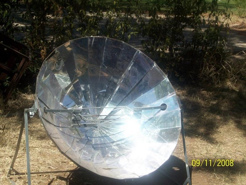
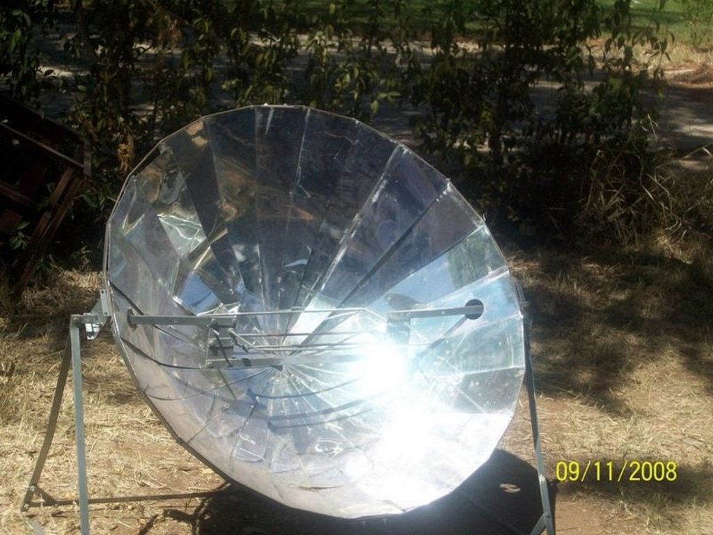
The basic principle of all solar cookers is to concentrate sunlight using a mirror or some type of reflective metal. It is used to concentrate light and heat from the sun into a small cooking area making the energy more concentrated and therefore more potent. Parabolic shaped solar cookers - when a three dimensional parabolic is aimed at the sun, all the light that falls upon its mirrored surface is reflected to a point known as the focus.
The technology is supplied by the Rural Industries Innovation Centre (RIIC) in Botswana. The solar cooker is maintained by cleaning the reflector mirrors with soft cloth soaked in soap and rinse with clean water. Turn reflector anti-clockwise until it hits the stand leg to lock it in place when it not in use. The solar cooker requires frequent adjustment and supervision for safe operation.
The solar cooker is best used in an open atmosphere with direct sunlight. A solar cooker needs an outdoor spot that is sunny for several hours and protected from strong winds and where food will be safe. Solar cookers do not work at night or on cloudy days
2.3 Photos of the Technology
2.5 Country/ region/ locations where the Technology has been applied and which are covered by this assessment
Country:
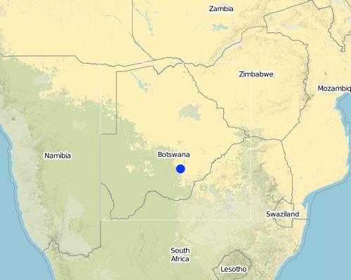
Botswana
Region/ State/ Province:
Botswana
Further specification of location:
Southern District
Map
×2.7 Introduction of the Technology
Specify how the Technology was introduced:
- through projects/ external interventions
3. Classification of the SLM Technology
3.1 Main purpose(s) of the Technology
- reduce, prevent, restore land degradation
- conserve ecosystem
3.2 Current land use type(s) where the Technology is applied

Mixed (crops/ grazing/ trees), incl. agroforestry
- Agro-pastoralism
Main products/ services:
Main products semi-nomadism/pastoralism: Beef cattle/goats,chicken/sheep,donkeys
Main products ranching: Beef cattle
Major cash crop seasonal cropping: Sorghum
Major food crop seasonal cropping: Maize
Major other crop seasonal cropping: Beans,Melons

Settlements, infrastructure
- Solar cooker
Comments:
Major land use problems (compiler’s opinion): Overgrazing the commons, droughts, saline water and overharvesting of fuelwood for heating and cooking purposes leading to deforestation and land degradation
Major land use problems (land users’ perception): Same as above
Grazingland comments: Technology not applied in Boteti at the moment
Future (final) land use (after implementation of SLM Technology): Forests / woodlands: Fn: Natural
Type of cropping system and major crops comments: Mixed cropping is the traditional practice but government extension advice promotes monocropping which majority find expensive and risky.
Constraints of settlement / urban: No constraint
3.3 Further information about land use
Water supply for the land on which the Technology is applied:
- rainfed
Number of growing seasons per year:
- 1
Specify:
Longest growing period from month to month: Oct - Mar
Livestock density (if relevant):
1-10 LU /km2
3.4 SLM group to which the Technology belongs
- energy efficiency technologies
3.5 Spread of the Technology
Specify the spread of the Technology:
- evenly spread over an area
If the Technology is evenly spread over an area, indicate approximate area covered:
- < 0.1 km2 (10 ha)
Comments:
SLM is point specific
3.6 SLM measures comprising the Technology
3.7 Main types of land degradation addressed by the Technology

soil erosion by water
- Wt: loss of topsoil/ surface erosion

soil erosion by wind
- Et: loss of topsoil

biological degradation
- Bc: reduction of vegetation cover
- Bs: quality and species composition/ diversity decline
Comments:
Main type of degradation addressed: Bc: reduction of vegetation cover, Bs: quality and species composition /diversity decline
Secondary types of degradation addressed: Wt: loss of topsoil / surface erosion, Et: loss of topsoil
Main causes of degradation: deforestation / removal of natural vegetation (incl. forest fires) (Most rural households use fuelwood for cooking, heating and lighting and sometimes cut live trees)
Secondary causes of degradation: over-exploitation of vegetation for domestic use (The study area is prone to drought), droughts, land tenure (The study area is communal grazing land), poverty / wealth (There are few employment opportunities in the study area and poor agric production hence most residents do not have adequate income to buy alternative sources of energy.)
3.8 Prevention, reduction, or restoration of land degradation
Specify the goal of the Technology with regard to land degradation:
- prevent land degradation
Comments:
Secondary goals: mitigation / reduction of land degradation, rehabilitation / reclamation of denuded land
4. Technical specifications, implementation activities, inputs, and costs
4.2 Technical specifications/ explanations of technical drawing
Technical knowledge required for field staff / advisors: high
Technical knowledge required for land users: moderate
Main technical functions: control of raindrop splash, improvement of ground cover
Secondary technical functions: increase in organic matter, increase in nutrient availability (supply, recycling,…), increase of infiltration, increase / maintain water stored in soil, increase of groundwater level / recharge of groundwater, reduction in wind speed, increase of biomass (quantity), control of fires
Construction material (other): Metal + reflective mirrors or shiny alluminium sheets
4.3 General information regarding the calculation of inputs and costs
other/ national currency (specify):
Pula
Indicate exchange rate from USD to local currency (if relevant): 1 USD =:
6.6
4.5 Costs and inputs needed for establishment
Comments:
Duration of establishment phase: 0.3 month(s)
4.7 Costs and inputs needed for maintenance/ recurrent activities (per year)
Comments:
Material + Labour -these are current date costs
4.8 Most important factors affecting the costs
Describe the most determinate factors affecting the costs:
Material followed by labour
5. Natural and human environment
5.1 Climate
Annual rainfall
- < 250 mm
- 251-500 mm
- 501-750 mm
- 751-1,000 mm
- 1,001-1,500 mm
- 1,501-2,000 mm
- 2,001-3,000 mm
- 3,001-4,000 mm
- > 4,000 mm
Specifications/ comments on rainfall:
Seasonal summer rains in 6 months dry (LGP=75-179 days)
Agro-climatic zone
- semi-arid
Thermal climate class: subtropics. Subtropical thermal climate. Semi-arid with dry winters (LGP=75-179 days)
5.2 Topography
Slopes on average:
- flat (0-2%)
- gentle (3-5%)
- moderate (6-10%)
- rolling (11-15%)
- hilly (16-30%)
- steep (31-60%)
- very steep (>60%)
Landforms:
- plateau/plains
- ridges
- mountain slopes
- hill slopes
- footslopes
- valley floors
Altitudinal zone:
- 0-100 m a.s.l.
- 101-500 m a.s.l.
- 501-1,000 m a.s.l.
- 1,001-1,500 m a.s.l.
- 1,501-2,000 m a.s.l.
- 2,001-2,500 m a.s.l.
- 2,501-3,000 m a.s.l.
- 3,001-4,000 m a.s.l.
- > 4,000 m a.s.l.
Comments and further specifications on topography:
Altitudinal zone: 501-1000 m a.s.l. (part of the Makgadikgadi Basin)
5.4 Water availability and quality
Ground water table:
> 50 m
Availability of surface water:
poor/ none
Comments and further specifications on water quality and quantity:
Ground water table; >50m (ranked 1, for boreholes) and 5-50 m (ranked 2, wells in Boteti River bed)
Availabilty of surface: Poor/none (unreliable river flows and rainfalls)
Water quality (untreated): poor drinking water (treatment required, unusable, sometimes too salty even for animal/livestock consumption) and poor drinking water (treatement required, salty waters in most areas ) Both ranked 1.
5.5 Biodiversity
Species diversity:
- low
Comments and further specifications on biodiversity:
Biodiversity: Low (ranked 1, a grazing zone with some arable agriculture.However, the area is sandwiched between Central Kalahari and Makgadikgadi game reserves) and high (ranked 2, several national parks/game reserves nearby)
5.6 Characteristics of land users applying the Technology
Off-farm income:
- less than 10% of all income
Relative level of wealth:
- very poor
- very rich
Individuals or groups:
- individual/ household
Level of mechanization:
- animal traction
Gender:
- women
- men
Indicate other relevant characteristics of the land users:
Land users applying the Technology are mainly common / average land users
Difference in the involvement of women and men: N/A
Population density: < 10 persons/km2
Annual population growth: 2% - 3%
(Rich cattle barons (0.1 and 0.5%)).
(Most inhabitants (0.6 and 0.3%)).
(Subsistence farmers (0.3 and 0.2%)).
Off-farm income specification: Save labour time to fetch firewood and helps consrve forests.Limited off-farm income opportunities for everyone,including non-adopters of the technology.
Market orientation of production system: subsistence (self-supply), subsistence (self-supply), commercial/ market
5.7 Average area of land owned or leased by land users applying the Technology
- < 0.5 ha
- 0.5-1 ha
- 1-2 ha
- 2-5 ha
- 5-15 ha
- 15-50 ha
- 50-100 ha
- 100-500 ha
- 500-1,000 ha
- 1,000-10,000 ha
- > 10,000 ha
Is this considered small-, medium- or large-scale (referring to local context)?
- small-scale
Comments:
Average area of land owned or leased by land users applying the Technology:
Cropland: 2-5 ha
Grazing land: 1,000-10,000 ha (ranked 1, ranches and cattle posts) and 5-15 ha (ranked 2, subsistence farming)
5.8 Land ownership, land use rights, and water use rights
Land ownership:
- communal/ village
- individual, titled
Land use rights:
- open access (unorganized)
- individual
Water use rights:
- communal (organized)
- individual
Comments:
The SLM technology can be used by anybody, it is not group specific.
5.9 Access to services and infrastructure
health:
- poor
- moderate
- good
education:
- poor
- moderate
- good
technical assistance:
- poor
- moderate
- good
employment (e.g. off-farm):
- poor
- moderate
- good
markets:
- poor
- moderate
- good
energy:
- poor
- moderate
- good
roads and transport:
- poor
- moderate
- good
drinking water and sanitation:
- poor
- moderate
- good
financial services:
- poor
- moderate
- good
6. Impacts and concluding statements
6.1 On-site impacts the Technology has shown
Socio-economic impacts
Production
wood production
energy generation
Income and costs
workload
Comments/ specify:
With respect to firewood collection
Socio-cultural impacts
recreational opportunities
SLM/ land degradation knowledge
conflict mitigation
situation of socially and economically disadvantaged groups
Comments/ specify:
Less demand on the time and labour of women and the girl child who are the main collectors of firewood
Improved livelihoods and human well-being
Comments/ specify:
It provides cheaper alternative sources of energy.Reduced workload for firewood collectors(women and girl child)
Ecological impacts
Water cycle/ runoff
water quantity
water quality
harvesting/ collection of water
surface runoff
excess water drainage
groundwater table/ aquifer
evaporation
Soil
soil moisture
soil cover
soil loss
soil crusting/ sealing
soil compaction
nutrient cycling/ recharge
salinity
soil organic matter/ below ground C
Biodiversity: vegetation, animals
biomass/ above ground C
plant diversity
animal diversity
beneficial species
habitat diversity
pest/ disease control
Climate and disaster risk reduction
emission of carbon and greenhouse gases
fire risk
wind velocity
6.2 Off-site impacts the Technology has shown
water availability
reliable and stable stream flows in dry season
downstream flooding
downstream siltation
groundwater/ river pollution
buffering/ filtering capacity
wind transported sediments
damage on neighbours' fields
damage on public/ private infrastructure
6.3 Exposure and sensitivity of the Technology to gradual climate change and climate-related extremes/ disasters (as perceived by land users)
Gradual climate change
Gradual climate change
| Season | Type of climatic change/ extreme | How does the Technology cope with it? | |
|---|---|---|---|
| annual temperature | increase | well |
Climate-related extremes (disasters)
Meteorological disasters
| How does the Technology cope with it? | |
|---|---|
| local windstorm | not well |
Climatological disasters
| How does the Technology cope with it? | |
|---|---|
| drought | well |
Other climate-related consequences
Other climate-related consequences
| How does the Technology cope with it? | |
|---|---|
| Cloudy weather | not well |
Comments:
N/A
6.4 Cost-benefit analysis
How do the benefits compare with the establishment costs (from land users’ perspective)?
Short-term returns:
positive
Long-term returns:
positive
How do the benefits compare with the maintenance/ recurrent costs (from land users' perspective)?
Short-term returns:
very positive
Long-term returns:
very positive
6.5 Adoption of the Technology
Comments:
1% of land user families have adopted the Technology with external material support
There is a little trend towards spontaneous adoption of the Technology
6.7 Strengths/ advantages/ opportunities of the Technology
| Strengths/ advantages/ opportunities in the land user’s view |
|---|
|
Helps conserve trees,otherwise cut for fuelwood-saves 1 ton of wood per year How can they be sustained / enhanced? Disseminate the technology to rural household |
|
Reduces labour time for gathering fuelwood How can they be sustained / enhanced? Improve incomes of rural household so that they could afford the technology |
| Strengths/ advantages/ opportunities in the compiler’s or other key resource person’s view |
|---|
|
1) Helps conserve trees,otherwise cut for fuelwood-saves 1 ton of wood per year How can they be sustained / enhanced? Disseminate the technology to rural household |
|
2Reduces labour time for gathering fuelwood How can they be sustained / enhanced? Improve income of rural households so that they could afford the technology |
| Solar energy is renewable and entirely non-polluting |
| Smoke free cooking |
| Solar energy is free |
6.8 Weaknesses/ disadvantages/ risks of the Technology and ways of overcoming them
| Weaknesses/ disadvantages/ risks in the land user’s view | How can they be overcome? |
|---|---|
| Strong winds can upset cookers and pots on them if not sheltered | Build unroofed shelter around cooking area |
| Open cooking exposes food to dust |
| Weaknesses/ disadvantages/ risks in the compiler’s or other key resource person’s view | How can they be overcome? |
|---|---|
| 1)Only cook when it is sunny | Safe storage facility |
| 2)Parabolic cookers need frequent adjustment | Build unroofed shelter around cooking area |
| Need to stole cooker during rainy season | |
| Strong winds can upset cookers and pots on them if not sheltered | |
| Open cooking exposes food to dust |
Links and modules
Expand all Collapse allLinks
No links
Modules
No modules


