Natural spring catchment protection [Tajikistan]
- Creation:
- Update:
- Compiler: Giuseppe Bonati
- Editor: –
- Reviewers: David Streiff, Alexandra Gavilano
technologies_1465 - Tajikistan
View sections
Expand all Collapse all1. General information
1.2 Contact details of resource persons and institutions involved in the assessment and documentation of the Technology
SLM specialist:
Name of the institution(s) which facilitated the documentation/ evaluation of the Technology (if relevant)
CESVI (CESVI) - Tajikistan1.3 Conditions regarding the use of data documented through WOCAT
When were the data compiled (in the field)?
19/05/2011
The compiler and key resource person(s) accept the conditions regarding the use of data documented through WOCAT:
Ja
2. Description of the SLM Technology
2.1 Short description of the Technology
Definition of the Technology:
The construction of a natural spring catchment pit for the collection and distribution of uncontaminated ground water.
2.2 Detailed description of the Technology
Description:
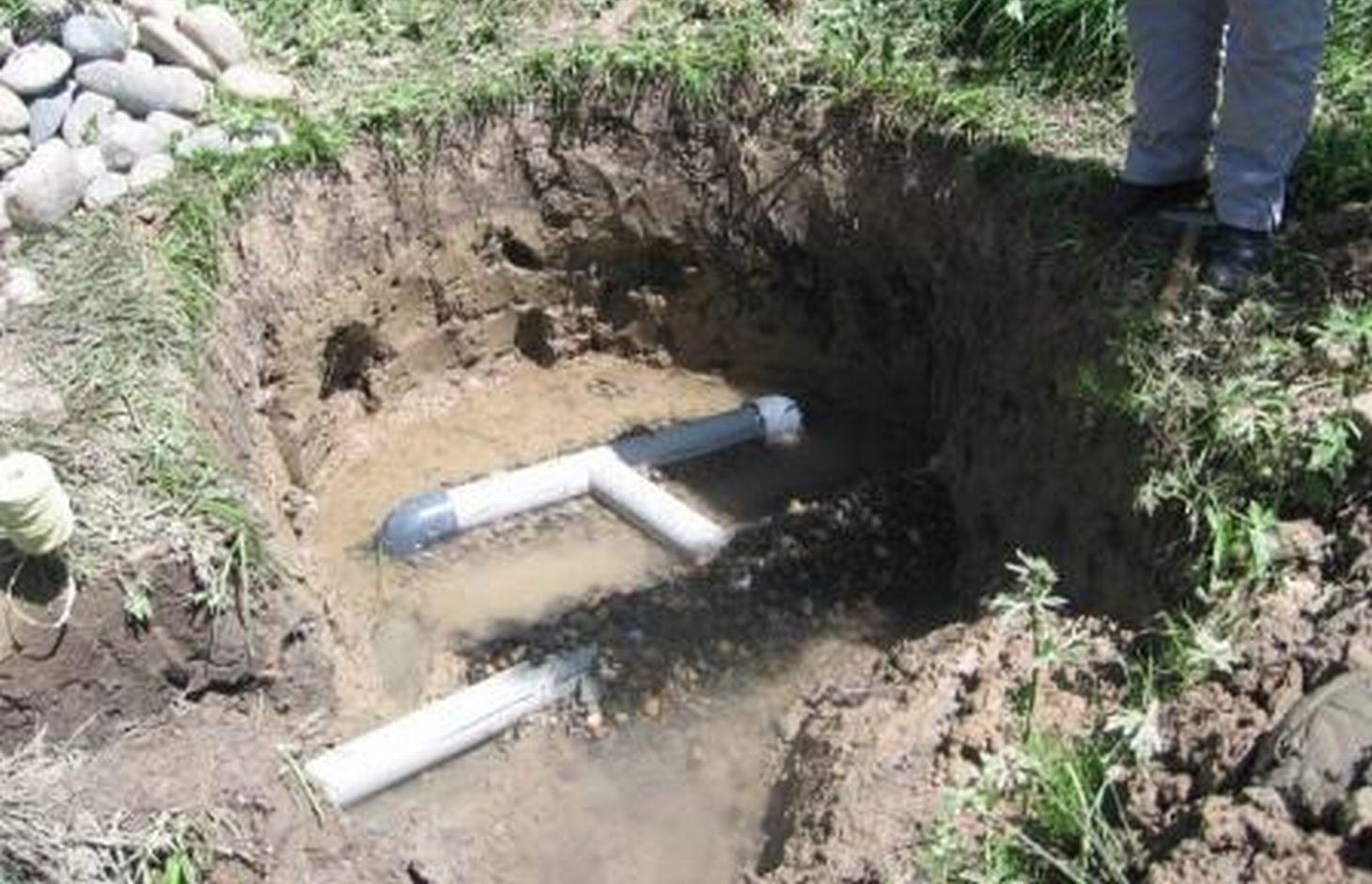
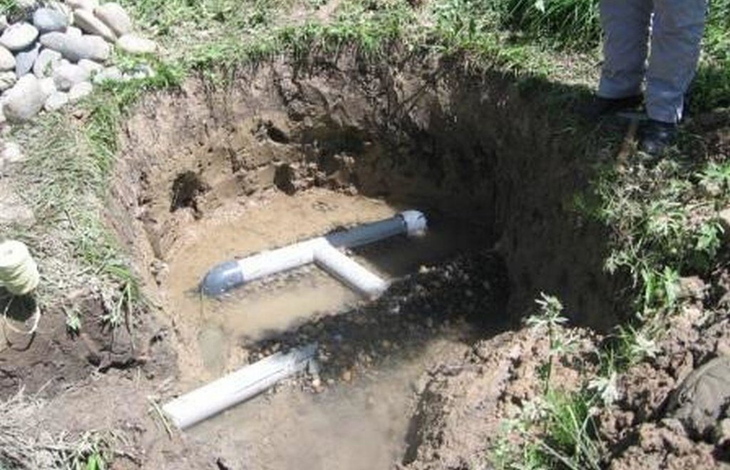
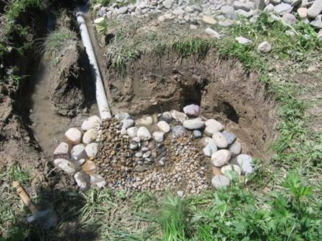
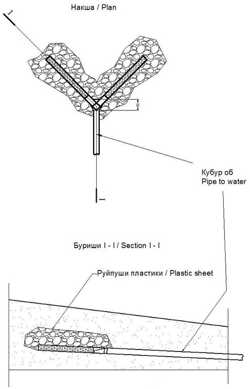
The technolgy consists of digging of a pit around the spring outlet and placing a 15cm perforated plastic pipe on a bed of gravel. The gravel acts as a natural sediment filter and protects the pipe from clogging. The pipe is buried in more gravel and covered with a plastic sheet to prevent animals from contaminating the spring source. The plastic pipe can be extended and attached to a flexible pipe to deliver clean ground water to the final destination.
Purpose of the Technology: There are two main aims of the technology, the first is to prevent contamination of the spring source from livestock which uses the spring head as a watering hole. The second goal is to optimise the springs capacity for irrigation and human consumption by capturing the water in the perforated pipe and channelling to the usage point.
Establishment / maintenance activities and inputs: The construction of the spring catchment is relatively straight forward. A 1m deep pit is dug around the spring head approximately 2m wide. A bed of washed gravel is placed in the foot of the pit, and a 15cm perforated plastic pipe is embedded into the gravel, this is attached to a flexible tube to transport the clean water away. The perforated pipe is covered in more clean gravel and covered with a heavy polythene sheet and covered in earth. The construction process can be completed in one day if the materials are available.
The only substantial maintenance required would be the cleaning of the pipe and gravel if it gets clogged with earth.
Natural / human environment: In many parts of Tajikistan water for human use and irrigation is scarce and plays a critical role in securing the livelihoods of the local population. The construction of the spring catchment increases not only the volume but also improves the quality of water available. This can and does have a dramatic effect on the productivity of the land and the health of the land users.
2.3 Photos of the Technology
2.5 Country/ region/ locations where the Technology has been applied and which are covered by this assessment
Country:
Tajikistan
Region/ State/ Province:
Khatlon region
Further specification of location:
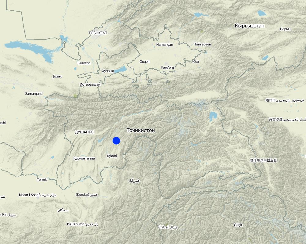
Khovaling
Map
×2.6 Date of implementation
If precise year is not known, indicate approximate date:
- less than 10 years ago (recently)
2.7 Introduction of the Technology
Specify how the Technology was introduced:
- through projects/ external interventions
Comments (type of project, etc.):
Spring Protection Project
3. Classification of the SLM Technology
3.1 Main purpose(s) of the Technology
- improved access to water
3.2 Current land use type(s) where the Technology is applied

Forest/ woodlands
Tree plantation, afforestation:
- Monoculture local variety
Products and services:
- Fuelwood
- Fruits and nuts
- Protection against natural hazards
Comments:
Major land use problems (compiler’s opinion): Lack of access to water. Contamination of the water due to animals using the spring.
Major land use problems (land users’ perception): Provides a better cleaner source of water for the land and the people.
Plantation forestry: Fruit tree orchards.
Problems / comments regarding forest use: The spring is located in natural woodland, however the water supply is directed towards the fruit orchards.
Forest products and services: fuelwood, fruits and nuts, protection against natural hazards
Future (final) land use (after implementation of SLM Technology): Forests / woodlands: Fn: Natural
If land use has changed due to the implementation of the Technology, indicate land use before implementation of the Technology:
Forests / woodlands: Fn: Natural
3.3 Further information about land use
Number of growing seasons per year:
- 1
Specify:
Longest growing period in days: 180Longest growing period from month to month: april - october
3.4 SLM group to which the Technology belongs
- water harvesting
3.5 Spread of the Technology
Specify the spread of the Technology:
- evenly spread over an area
If the Technology is evenly spread over an area, indicate approximate area covered:
- < 0.1 km2 (10 ha)
Comments:
This technology is in one location.
3.6 SLM measures comprising the Technology

structural measures
- S3: Graded ditches, channels, waterways

management measures
- M6: Waste management (recycling, re-use or reduce)
Comments:
Main measures: structural measures
3.7 Main types of land degradation addressed by the Technology

soil erosion by water
- Wt: loss of topsoil/ surface erosion
- Wm: mass movements/ landslides

biological degradation
- Bc: reduction of vegetation cover

water degradation
- Hs: change in quantity of surface water
- Hp: decline of surface water quality
Comments:
Main type of degradation addressed: Bc: reduction of vegetation cover, Hs: change in quantity of surface water, Hp: decline of surface water quality
Secondary types of degradation addressed: Wt: loss of topsoil / surface erosion, Wm: mass movements / landslides
Main causes of degradation: other natural causes (avalanches, volcanic eruptions, mud flows, highly susceptible natural resources, extreme topography, etc.) specify (The land degradation was caused by uncontrolled natural spring run off.)
3.8 Prevention, reduction, or restoration of land degradation
Specify the goal of the Technology with regard to land degradation:
- prevent land degradation
- reduce land degradation
Comments:
Main goals: mitigation / reduction of land degradation
Secondary goals: prevention of land degradation
4. Technical specifications, implementation activities, inputs, and costs
4.1 Technical drawing of the Technology
4.2 Technical specifications/ explanations of technical drawing
Basic sketch of perferated drainage collecting the spring water and flowing into a pipe. To take an increased quantity of water you can install more pipes (See section 2.1.3).
Location: Gulizor Nursary. Khovaling/Khatlo/Tajikistan
Date: 19/05/2011
Technical knowledge required for field staff / advisors: high (After training to increase their capacity)
Technical knowledge required for land users: high (After training to increase their capacity)
Main technical functions: control of concentrated runoff: drain / divert, water harvesting / increase water supply
Diversion ditch/ drainage
Depth of ditches/pits/dams (m): 1
Width of ditches/pits/dams (m): 1.5
Length of ditches/pits/dams (m): 1.5
Construction material (earth): The spring head is dug into the earth.
Construction material (stone): The stone is used to line the base of the spring head.
4.3 General information regarding the calculation of inputs and costs
other/ national currency (specify):
TJS
Indicate exchange rate from USD to local currency (if relevant): 1 USD =:
4.5
Indicate average wage cost of hired labour per day:
25
4.4 Establishment activities
| Activity | Type of measure | Timing | |
|---|---|---|---|
| 1. | Digging of the spring head | Structural | Spring |
| 2. | pipe positioning | Structural | Spring |
| 3. | Gravel positioning and covering with plastic sheet | Structural | Spring |
| 4. | Fill back the drainage | Structural | Spring |
4.5 Costs and inputs needed for establishment
| Specify input | Unit | Quantity | Costs per Unit | Total costs per input | % of costs borne by land users | |
|---|---|---|---|---|---|---|
| Labour | Digging of the spring head | Persons/day | 2.0 | 25.0 | 50.0 | 100.0 |
| Labour | Pipe positioning | Persons/day | 2.0 | 25.0 | 50.0 | 100.0 |
| Labour | Gravel positioning | Persons/day | 2.0 | 25.0 | 50.0 | 100.0 |
| Labour | Fill back the drainage | Persons/day | 2.0 | 25.0 | 50.0 | 100.0 |
| Equipment | Tools | Pieces | 4.0 | 10.0 | 40.0 | 100.0 |
| Equipment | Drill | Pieces | 1.0 | 250.0 | 250.0 | |
| Construction material | Drainage pipe | meter | 10.0 | 1.5 | 15.0 | |
| Construction material | Stone | tons | 0.5 | 136.0 | 68.0 | |
| Construction material | Plastic sheet to cover | sq m | 1.5 | 5.333333 | 8.0 | |
| Total costs for establishment of the Technology | 581.0 | |||||
If land user bore less than 100% of costs, indicate who covered the remaining costs:
CESVI
Comments:
Duration of establishment phase: 1 month(s)
4.6 Maintenance/ recurrent activities
| Activity | Type of measure | Timing/ frequency | |
|---|---|---|---|
| 1. | Cleaning the water channel after drainage | Structural | Spring |
4.7 Costs and inputs needed for maintenance/ recurrent activities (per year)
| Specify input | Unit | Quantity | Costs per Unit | Total costs per input | % of costs borne by land users | |
|---|---|---|---|---|---|---|
| Labour | Cleaning the water channel | Persons/day | 2.0 | 25.0 | 50.0 | 100.0 |
| Equipment | Tools | Pieces | 2.0 | 10.0 | 20.0 | 100.0 |
| Total costs for maintenance of the Technology | 70.0 | |||||
Comments:
Machinery/ tools: Shovel
Costs are based upon one spring at a depth of 1m at 2010 prices.
4.8 Most important factors affecting the costs
Describe the most determinate factors affecting the costs:
The cost is determined by the depth of the spring head. If it needs to be deeper it requires additonal labour and material costs.
5. Natural and human environment
5.1 Climate
Annual rainfall
- < 250 mm
- 251-500 mm
- 501-750 mm
- 751-1,000 mm
- 1,001-1,500 mm
- 1,501-2,000 mm
- 2,001-3,000 mm
- 3,001-4,000 mm
- > 4,000 mm
Agro-climatic zone
- semi-arid
Thermal climate class: temperate
5.2 Topography
Slopes on average:
- flat (0-2%)
- gentle (3-5%)
- moderate (6-10%)
- rolling (11-15%)
- hilly (16-30%)
- steep (31-60%)
- very steep (>60%)
Landforms:
- plateau/plains
- ridges
- mountain slopes
- hill slopes
- footslopes
- valley floors
Altitudinal zone:
- 0-100 m a.s.l.
- 101-500 m a.s.l.
- 501-1,000 m a.s.l.
- 1,001-1,500 m a.s.l.
- 1,501-2,000 m a.s.l.
- 2,001-2,500 m a.s.l.
- 2,501-3,000 m a.s.l.
- 3,001-4,000 m a.s.l.
- > 4,000 m a.s.l.
5.3 Soils
Soil depth on average:
- very shallow (0-20 cm)
- shallow (21-50 cm)
- moderately deep (51-80 cm)
- deep (81-120 cm)
- very deep (> 120 cm)
Soil texture (topsoil):
- fine/ heavy (clay)
Topsoil organic matter:
- medium (1-3%)
If available, attach full soil description or specify the available information, e.g. soil type, soil PH/ acidity, Cation Exchange Capacity, nitrogen, salinity etc.
Soil fertility is low
Soil drainage / infiltration is medium
Soil water storage capacity is medium
5.4 Water availability and quality
Ground water table:
< 5 m
Availability of surface water:
good
Water quality (untreated):
good drinking water
Comments and further specifications on water quality and quantity:
Availability of surface water is good at the location of the spring, but medium where the water is needed for the lands.
5.5 Biodiversity
Species diversity:
- medium
5.6 Characteristics of land users applying the Technology
Off-farm income:
- 10-50% of all income
Relative level of wealth:
- very poor
- poor
Individuals or groups:
- groups/ community
Gender:
- women
- men
Indicate other relevant characteristics of the land users:
Land users applying the Technology are mainly Leaders / privileged
Population density: 10-50 persons/km2
Annual population growth: 1% - 2%
80% of the land users are poor.
20% of the land users are poor.
5.7 Average area of land owned or leased by land users applying the Technology
- < 0.5 ha
- 0.5-1 ha
- 1-2 ha
- 2-5 ha
- 5-15 ha
- 15-50 ha
- 50-100 ha
- 100-500 ha
- 500-1,000 ha
- 1,000-10,000 ha
- > 10,000 ha
Is this considered small-, medium- or large-scale (referring to local context)?
- large-scale
5.8 Land ownership, land use rights, and water use rights
Land ownership:
- state
Land use rights:
- communal (organized)
Water use rights:
- communal (organized)
5.9 Access to services and infrastructure
health:
- poor
- moderate
- good
education:
- poor
- moderate
- good
technical assistance:
- poor
- moderate
- good
employment (e.g. off-farm):
- poor
- moderate
- good
markets:
- poor
- moderate
- good
energy:
- poor
- moderate
- good
roads and transport:
- poor
- moderate
- good
drinking water and sanitation:
- poor
- moderate
- good
financial services:
- poor
- moderate
- good
6. Impacts and concluding statements
6.1 On-site impacts the Technology has shown
Socio-economic impacts
Water availability and quality
drinking water availability
irrigation water availability
Socio-cultural impacts
food security/ self-sufficiency
health situation
SLM/ land degradation knowledge
Livelihood and human well-being
Comments/ specify:
It has improved access to running water for sanitation, hygiene, irrigation and animal husbandry purposes.
Ecological impacts
Water cycle/ runoff
water quantity
water quality
harvesting/ collection of water
surface runoff
excess water drainage
Climate and disaster risk reduction
drought impacts
6.2 Off-site impacts the Technology has shown
water availability
reliable and stable stream flows in dry season
downstream flooding
6.3 Exposure and sensitivity of the Technology to gradual climate change and climate-related extremes/ disasters (as perceived by land users)
Gradual climate change
Gradual climate change
| Season | Type of climatic change/ extreme | How does the Technology cope with it? | |
|---|---|---|---|
| annual temperature | increase | well |
Climate-related extremes (disasters)
Meteorological disasters
| How does the Technology cope with it? | |
|---|---|
| local rainstorm | well |
| local windstorm | well |
Climatological disasters
| How does the Technology cope with it? | |
|---|---|
| drought | well |
Hydrological disasters
| How does the Technology cope with it? | |
|---|---|
| general (river) flood | not known |
Other climate-related consequences
Other climate-related consequences
| How does the Technology cope with it? | |
|---|---|
| reduced growing period | well |
6.4 Cost-benefit analysis
How do the benefits compare with the establishment costs (from land users’ perspective)?
Short-term returns:
slightly positive
Long-term returns:
positive
How do the benefits compare with the maintenance/ recurrent costs (from land users' perspective)?
Short-term returns:
positive
Long-term returns:
positive
6.5 Adoption of the Technology
- single cases/ experimental
If available, quantify (no. of households and/ or area covered):
1 houshold
Of all those who have adopted the Technology, how many have did so spontaneously, i.e. without receiving any material incentives/ payments?
- 0-10%
Comments:
Comments on spontaneous adoption: In the course of the project 24 springs will be refurbished (2011-2013).
There is no trend towards spontaneous adoption of the Technology
Comments on adoption trend: The technology is new and in its infancy.
6.7 Strengths/ advantages/ opportunities of the Technology
| Strengths/ advantages/ opportunities in the land user’s view |
|---|
| Pleased at the increase in water and ability to improve the yield of his crops. |
| Strengths/ advantages/ opportunities in the compiler’s or other key resource person’s view |
|---|
|
Increased access to water through controlled piping. How can they be sustained / enhanced? Provision of guidance of which pipes to use. |
| Reduced the contamination at the spring head by animals. |
|
It is quick and cheap to install. How can they be sustained / enhanced? provide further training and support on maintenance. |
| It is easy to teach people how to install it. |
6.8 Weaknesses/ disadvantages/ risks of the Technology and ways of overcoming them
| Weaknesses/ disadvantages/ risks in the land user’s view | How can they be overcome? |
|---|---|
| Difficult at times to find good cheap plastic pipe. |
| Weaknesses/ disadvantages/ risks in the compiler’s or other key resource person’s view | How can they be overcome? |
|---|---|
| It incurs an initial financial outlay, which may be considerable if the spring is located far from where the water is needed. |
Links and modules
Expand all Collapse allLinks
No links
Modules
No modules


