'Forage Christine' [بوركينا فاسو]
- تاريخ الإنشاء:
- تحديث:
- جامع المعلومات: Nouhoun Zampaligré
- المحرر: –
- المراجعون: Rima Mekdaschi Studer, Simone Verzandvoort, Donia Mühlematter
Forage Christine
technologies_2994 - بوركينا فاسو
عرض الأقسام
توسيع الكل طي الكل1. معلومات عامة
1.2 تفاصيل الاتصال بالأشخاص الرئيسيين لمصدر المعلومات والمؤسسات المشاركة في تقييم وتوثيق التقنية
اسم المشروع الذي سهّل توثيق/تقييم التقنية (إذا كان ذلك على صلة)
Book project: Guidelines to Rangeland Management in Sub-Saharan Africa (Rangeland Management)اسم المؤسسة (المؤسسات) التي سهلت توثيق/تقييم التقنية (إذا كان ذلك على صلة)
INERA Institut de l'environnement et de recherches agricoles (INERA Institut de l'environnement et de recherches agricoles) - بوركينا فاسو1.3 الشروط المتعلقة باستخدام البيانات الموثقة من خلال WOCAT
متى تم تجميع البيانات (ميدانيا)؟:
01/06/2017
يوافق جامع المعلومات والشخص (لاشخاص) الرئيسي لمصدر المعلومات على الشروط المتعلقة باستخدام البيانات الموثقة من خلال WOCAT:
نعم
1.4 إعلان بشأن استدامة التقنية الموصوفة
هل التقنية الموصوفة هنا تمثل مشكلة فيما يتعلق بتدهور الأراضي، بحيث لا يمكن إعلانها تقنية مستدامة لإدارة الأراضي؟:
كلا
2. وصف تقنيةالإدارة المستدامي للأراضي
2.1 وصف مختصر للتقنية
تعريف التقنية:
A modern hydraulic complex in the centre of the Sahelian region of Burkina Faso for watering livestock in the dry season.
2.2 وصف تفصيلي للتقنية
الوصف:
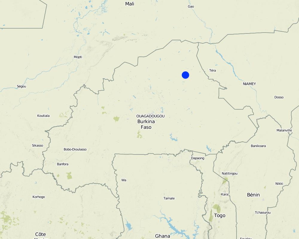
'Forage Christine' is a major water infrastructure, established in the northern part of the Sahel region in Burkina Faso between longitude 0°45’W and latitude 14°48’N, providing drinking water to herds within an area of 100 to 300 km from its central location between Burkina Faso, Mali and Niger. It was established in 1971 in the context of major droughts that had affected the Sahel, and it was opened for the first time in 1972. It is located in the middle of the Sahel region of Burkina Faso, at two km from the pond of Tin-Arkachen in the department of Déou, at approximately 45 km from the capital of the department, and 85 km from Gorom-Gorom. At the sub-regional level, the well is a around ten km from the border with Mali, and at 100 km from the border with Niger. The climate is of Sahelian type, and has a rainy season of 3 to 4 months (from June-July to September), which is subject to strong temporal and spatial variations in precipitation, and a dry season of 8 to 9 months. The climatic conditions are characterized by highly irregular winds, precipitation, evapotranspiration and moisture due to fluctuations in atmospheric circulation patterns. Annual precipitation is around 500 mm on average, with roughly 30 rainy days, and is marked by significant inter-annual variations. The stream network of the region consists of several streams, with one permanent river: Béli. To this river, ponds and many depressions are connected, which disappear after the month of January. The soils are very diverse in general, and mostly of sandy texture. They do not provide a good medium for plant growth due to the low permeability, which reduces water infiltration. Therefore water availability appears to be one of the major limitations for rainfed agriculture, in addition to the limited retention and availability of nutrients. According to the phytogeographic division of Burkina Faso (Fontes and Guinko, 1995), the area of 'Forage Christine' is situated in the northern or strict Sahelian phytogeographic sector. This sector is characterized by a set of typical Saharan and Sahelian vegetation species which mainly occur in shrub and woody steppes (48.85%) and grassy steppes (24.37%), which form the larger part of the rangelands (***). This vegetation provides the most important natural grazing land to livestock.
With regard to the human environment, the last General Population and Housing Census mentions a population of 25321 inhabitants for the municipality of Déou. Yet this number varies significantly due to the seasonal migration of people from other regions to use water and forage resources. The ethnic groups in the region are mainly Fulbé, Kurumba, Songhai, Tuareg, Mossi and Hausa people.
Economic activities in the region are livestock keeping, farming, craftmanship, fishing, trade, tourism and hunting. Several socio-economic groups are guiding these activities. Some 60 farmer groups, 53 groups of livestock keepers, six of which for female livestock keepers, and three organisations for environmental protection. With regard to infrastructure for education, sanitation and socio-economical conditions, the municipality of Déou has three markets, 18 schools, one middle school, 47 permanent functional literacy centers (CPAF), one recreation center, six cereal banks, three healthcare and welfare centers (CSPS), three medical stores, one tourist camp and one financial institution.
Farming and livestock keeping continue to be the most important socio-economic activities. The agricultural crops produced include millet, sorghum, maize, cowpea, rice and groundnut. In 2009, a total area of 345.5 ha was sown for these crops. The Sahel region in Burkina Faso has excellent conditions for livestock keeping. The animal species found in the region are mainly cattle, sheep, goats, pigs, camels, donkeys and horses and poultry. Several facilities and installations for water supply to pastoral areas are available in the region, as well as storage facilities for agricultural and agro-industrial by-products (SPAI) and infrastructure for trade and animal health care. The municipality of Déou disposes of one reservoir, five artificial ponds, 43 firm wells, ten vaccination centers, one store for agricultural and agro-industrial by-products (SPAI), one animal shelter, a facility for slaughtering and a livestock market.
The well called 'Forage Christine' was constructed in 1971 by a French engineer, which named it after his wife, and opened it for the first time in 1972. Due to conflicts between Burkina and Mali it was ruined in 1976, and then again in 1985. In 1996 the National Office for Wells and Boreholes (ONFP), a government agency, rehabilitated the well and made two supplementary boreholes. The complex consists of a main well with an operating flow rate of 120 m3/h, having a submersible pump of brand KSB, type OPA 150s-65/8, and a pump capacity of 60 m3/h. Next to the main well there is a secondary well, which is equipped with a hand-operated pump with a capacity of 18 m3/h.
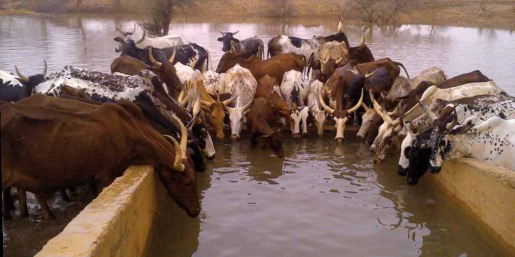
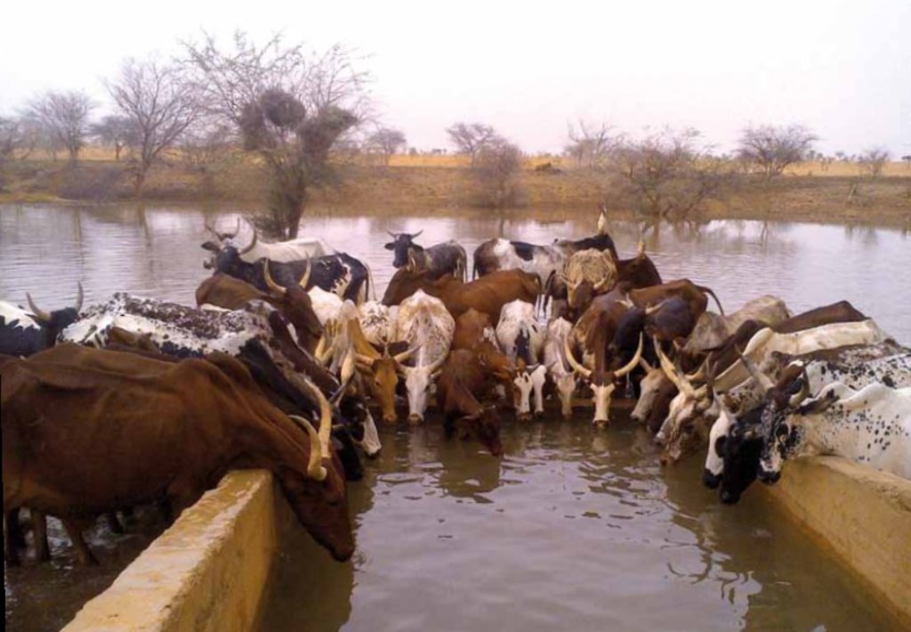
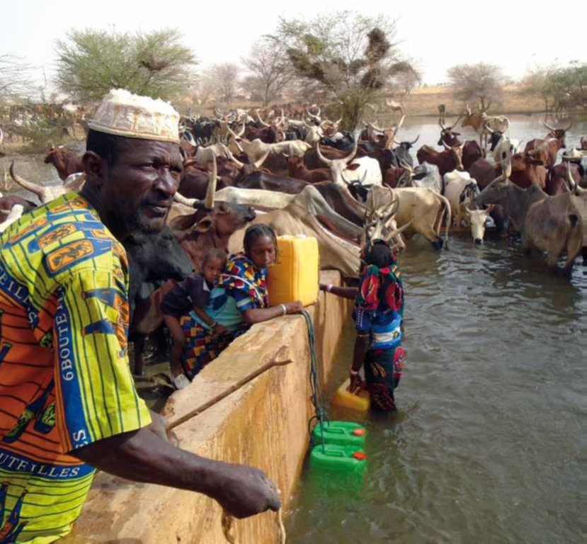
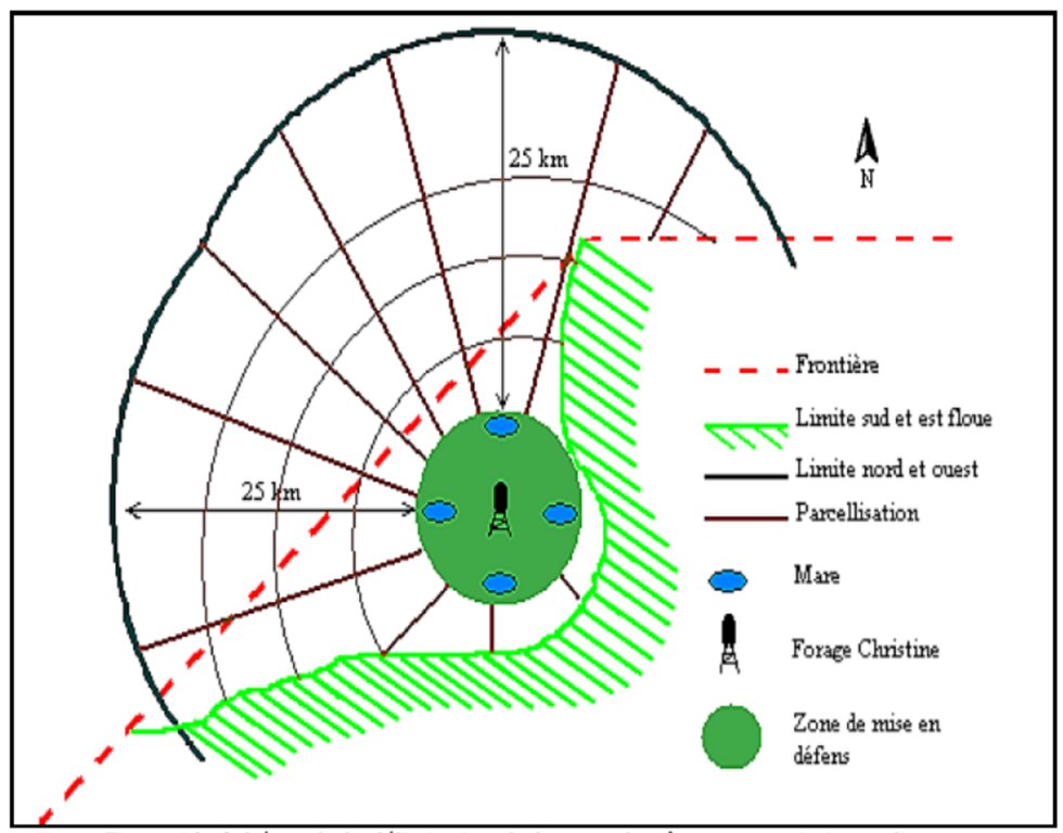
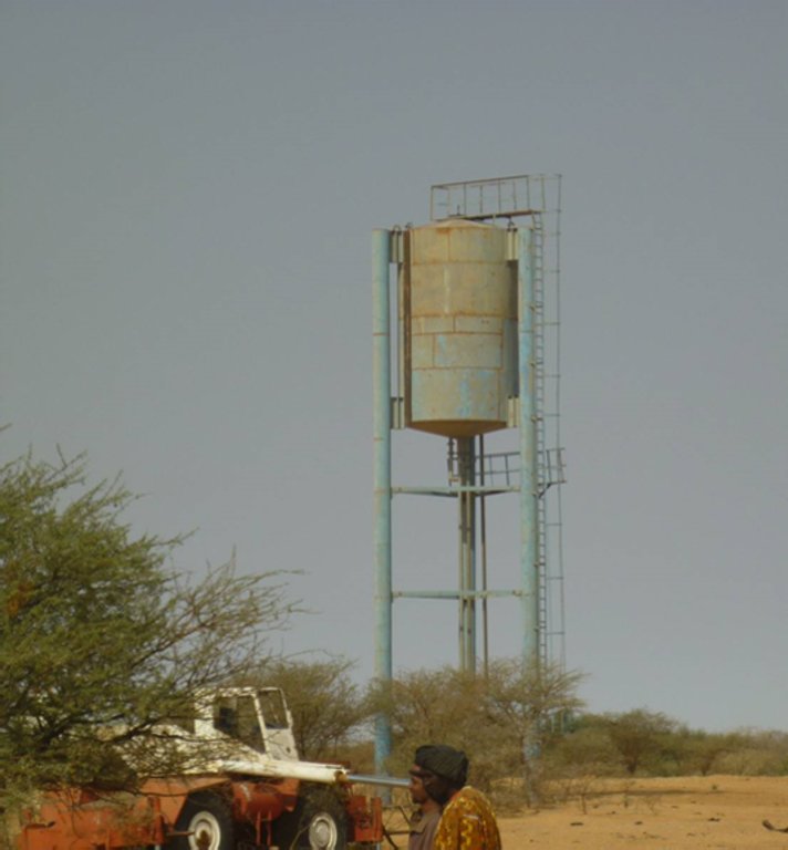
The energy for pumping water from the wells is provided by a generator with an engine of brand DEUTZ (type: F3 - 6L 912) and a switch of brand LEROY SOMER – Type LSA 42.1 L8L C1/4, a voltage of 400 V and continuous power of 50 kW. The generator has a switch and a battery. A diesel tank with a volume of approximately 9 m3 was installed for the power supply to the generator. The pumped water is stored in an elevated water tank, which is located at a distance of about 200 m from the well, and has a volume of 50 m3. The water from the elevated water tank is distributed to four artificial ponds with a dimension of 50 m x 50 m x 1.5 m at equal distances on all sides of the central reservoir. The water is conducted to the artificial ponds through PVC piping, which is buried underground over a distance of 8 km, or 2 km for each pond. The water flow is controlled by nine valves of type Nr. 4000, Reg. Nr. W 1.129, installed on the pipes. The hydraulic complex was installed in 1996 by the National Agency for Water and Sanitation (ONEA). The complex is managed by the livestock keepers through the User Association of 'Forage Christine' (AUFC). The statutes of this organisation were adopted on 2 May 2014. The well is managed according to a set of requirements which specify the terms for access to water: date of opening and closure of the well, the amount to be paid per animal and the management of the cash money provided.
2.3 صور التقنية
2.4 فيديوهات عن التقنية
تعليقات، وصف موجز:
No video
2.5 البلد/المنطقة/المواقع التي تم تنفيذ التقنية فيها والتي يغطيها هذا التقييم
البلد:
بوركينا فاسو
المنطقة/الولاية/المحافظة:
Sahel/Oudalan
مزيد من التفاصيل حول الموقع:
Déou
التعليقات:
The infrastructure was created in 1971, but the facilities for use were installed in 1996.
Map
×2.6 تاريخ التنفيذ
اذكر سنة التنفيذ:
1971
2.7 إدخال التقنية
حدد كيف تم إدخال التقنية:
- من خلال المشاريع/ التدخلات الخارجية
التعليقات (نوع المشروع، الخ):
A French aid worker introduced the technology with support from the government of Burkina Faso, through the National Agency for Water and Sanitation (ONEA).
3. تصنيف تقنية الإدارة المستدامي للأراضي
3.1 الغرض الرئيسي ( الأغراض الرئيسية) للتقنية
- التكيف مع تغير المناخ/الظواهر المتطرفة وآثارها
- خلق أثر اقتصادي مفيد
- خلق أثر اجتماعي مفيد
3.2 نوع (أنواع) استخدام الأراضي الحالية حيث يتم تطبيق التقنية

الأراضي الزراعية

أراضي الرعي
أراضي الرعي الواسع النطاق:
- رعي شبه مرتحل
الأنواع والمنتجات الحيوانية الرئيسية:
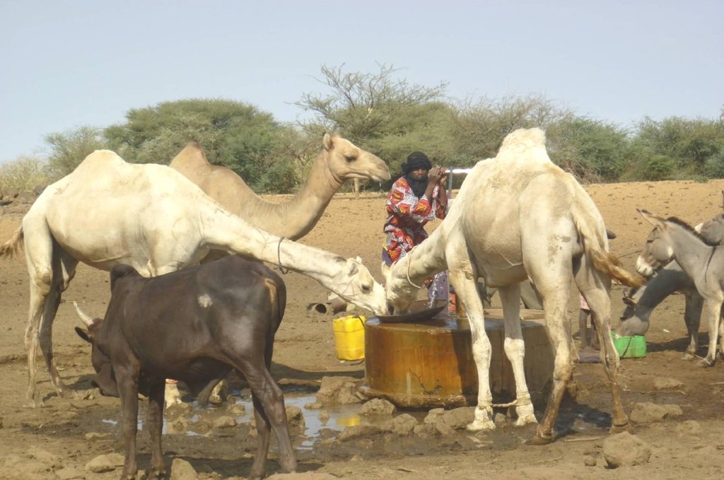
Animal species: cattle, sheep, camels, donkeys and goats.
التعليقات:
In addition to livestock keeping, subsistence farming is practiced. The main crops are sorghum, millet, groundnut and cowpea. The size of the fields varies between 0.5 and 3 ha. The farm type is family-based.
إذا تغير استخدام الأراضي بسبب التقنية، قم بالإشارة إلى استخدام الأرض قبل تنفيذ التقنية:
No change in land use due to the implementation of the technology.
3.3 مزيد من المعلومات حول استخدام الأراضي
إمدادات المياه للأرض التي يتم تنفيذ التقنية عليها:
- بعلية
عدد مواسم الزراعة في السنة:
- 1
حدد:
Mid-June to September
3.4 مجموعةالإدارة المستدامة للأراضي التي تنتمي إليها هذه التقنية
- الرعي وإدارة المراعي
- إدارة المياه الجوفية
3.5 انتشار التقنية
حدد انتشار التقنية:
- يتم تطبيقها في نقاط محددة/ تتركز على مساحة صغيرة
التعليقات:
The well is located in the municipality of Déou, but is used for livestock from the entire Sahel region in Burkina Faso, Mali and Niger.
3.6 التدابير التقنية في مجال إلادارة المستدامة للأراضي

التدابير البنيوية
- S7: معدات حصاد المياه/الإمداد/الري
3.7 الأنواع الرئيسية من تدهور الأراضي التي تناولتها التقنية

تدهور المياه
- (Ha): التجفيف
- (Hs): التغيير في كمية المياه السطحية
- (Hg): التغير في مستوى المياه الجوفية/الطبقة المائية الجوفية
- (Hp): تدهور نوعية المياه السطحية

آخر
التعليقات:
The technology aims to remediate water scarcity for livestock during the dry season.
3.8 منع أو حد أو عكس تدهور الأراضي
تحديد هدف التقنية فيما يتعلق بتدهور الأراضي:
- الحد من تدهور الأراضي
4. المواصفات الفنية، وأنشطة التنفيذ، والمدخلات، والتكاليف
4.1 الرسم الفني للتقنية
4.2 المواصفات الفنية/شروحات الرسم الفني
1. Main well, flow rate 120 m3/h.
2. Secondary well, flow rate 18 m3/h.
3. Submersible pump, brand KSB, type OPA 150s-65/8, flow rate 60m3/h, year of constrcuction1996
4. Elevated water storage tank, volume 50 m3.
5. Four ponds of 50 m x 50 m x 1.5 m.
4.3 معلومات عامة بخصوص حساب المدخلات والتكاليف
حدد كيفية احتساب التكاليف والمدخلات:
- لكل وحدة تقنية
عملة أخرى/ عملة وطنية (حدد):
FCFA
أشر إلى سعر الصرف من الدولار الأمريكي إلى العملة المحلية (إذا كان ذا صلة): 1 دولار أمريكي =:
550,0
اذكر متوسط تكلفة أجر العمالة المستأجرة في اليوم الواحد:
35 000 per month
4.4 أنشطة التأسيس
| النشاط | نوع التدبير | التوقيت | |
|---|---|---|---|
| 1. | Main well | بنيوية أو هيكلية | |
| 2. | Elevated water storage tank | بنيوية أو هيكلية | |
| 3. | Artificial ponds | بنيوية أو هيكلية |
التعليقات:
Not evaluated.
4.5 التكاليف والمدخلات اللازمة للتأسيس
التعليقات:
Not applicable.
4.6 الصيانة/الأنشطة المتكررة
| النشاط | نوع التدبير | التوقيت/الوتيرة | |
|---|---|---|---|
| 1. | Use of diesel | إدارية | year |
| 2. | Use of oil and filters | إدارية | year |
| 3. | Periodic maintenance of the generator | إدارية | year |
| 4. | Fuel delivery | إدارية | year |
| 5. | Transport costs of the maintenance operator | إدارية | year |
| 6. | Wage of the guard | إدارية | year |
| 7. | Compensation of the manager of the generator | إدارية | year |
| 8. | Charges for accounting | إدارية | year |
4.7 التكاليف والمدخلات اللازمة للصيانة/للأنشطة المتكررة (سنويًا)
| تحديد المدخلات | الوحدة | الكمية | التكاليف لكل وحدة | إجمالي التكاليف لكل مدخل | % من التكاليف التي يتحملها مستخدمو الأراضي | |
|---|---|---|---|---|---|---|
| العمالة | Periodic maintenance of the generator | season | 1,0 | 150000,0 | 150000,0 | |
| العمالة | Compensation of the GE manager | person-month | 12,0 | 37500,0 | 450000,0 | |
| العمالة | Charges for accounting | person-month | 12,0 | 175,0 | 2100,0 | |
| العمالة | Wage of the guard | person-month | 12,0 | 50000,0 | 600000,0 | |
| غير ذلك | Use of diesel | season | 1,0 | 2921000,0 | 2921000,0 | |
| غير ذلك | Use of oil, filters | season | 1,0 | 68000,0 | 68000,0 | |
| غير ذلك | Reparations to the hydraulic complex | season | ||||
| غير ذلك | Fuel delivery | season | 1,0 | 125000,0 | 125000,0 | |
| غير ذلك | Transport costs of maintenance operator | season | 1,0 | 60000,0 | 60000,0 | |
| إجمالي تكاليف صيانة التقنية | 4376100,0 | |||||
إذا تحمل مستخدم الأرض أقل من 100% من التكاليف، حدد من قام بتغطية التكاليف المتبقية:
The municipality, the management committee and the NGOs operating in the area (SNV).
4.8 أهم العوامل المؤثرة على التكاليف
قدم وصفا لأهم العوامل التي تؤثر على التكاليف:
1. Availability of fuel for the generator.
2. Failures in the functioning of the generator to fill the storage tanks.
5. البيئة الطبيعية والبشرية
5.1 المناخ
هطول الأمطار السنوي
- < 250 مم
- 251- 500 ملم
- 501 - 750ملم
- 1,000-751 ملم
- 1,500-1,100 ملم
- 2,000-1,500 ملم
- 3,000-2,001 ملم
- 4,000-3,100 ملم
- > 4000 ملم
حدد متوسط هطول الأمطار السنوي (إذا كان معروفًا)، بالملليمتر:
500,00
المواصفات/التعليقات على هطول الأمطار:
Mean annual rainfall is around 500 mm, with approximately 30 rainy days and characterized by a strong variation between years. The water system has many streams, of which only one is permanent (the Béli river). To this river, ponds and many depressions are connected, which disappear after the month of January.
الإشارة إلى اسم محطة الأرصاد الجوية المرجعية المعنية:
Station of Gorom-Gorom
المنطقة المناخية الزراعية
- شبه قاحلة
The climate is of Sahelian type, and has a rainy season of 3 to 4 months (from June-July to September), which is subject to strong temporal and spatial variations in precipitation, and a dry season of 8 to 9 months. The climatic conditions are characterized by highly irregular winds, precipitation, evapotranspiration and moisture due to fluctuations in atmospheric circulation patterns.
5.2 طوبوغرافيا
متوسط الانحدارات:
- مسطح (0-2%)
- بسيط (3-5%)
- معتدل (6-10%)
- متدحرج (11-15%)
- تلال (16-30%)
- شديدة الانحدار(31-60%)
- فائقة الانحدار (>60%)
التضاريس:
- هضاب/سهول
- أثلام مرتفعة
- المنحدرات الجبلية
- منحدرات التلال
- منحدرات في السفوح
- قاع الوادي
المنطقة الارتفاعية:
- 100-0 متر فوق سطح البحر
- 500-101 متر فوق سطح البحر
- 1,000-501 متر فوق سطح البحر
- 1,500-1,001 متر فوق سطح البحر
- 2,000-1,501 متر فوق سطح البحر
- 2,500-2,100 متر فوق سطح البحر
- 3,000-2,501 متر فوق سطح البحر
- 4,000-3,001 متر فوق سطح البحر
- > 4000 متر فوق سطح البحر
5.3 التربة
متوسط عمق التربة:
- ضحل جدًا (0-20 سم)
- ضحلة (21-50 سم)
- متوسطة العمق (51-80 سم)
- عميقة (81-120 سم)
- عميقة جدًا (> 120 سم)
قوام التربة (التربة السطحية):
- خشن / خفيف (رملي)
قوام التربة (> 20 سم تحت السطح):
- خشن / خفيف (رملي)
المواد العضوية في التربة السطحية:
- منخفضة (<1%)
إذا كان متاحًا، قم بإرفاق وصف كامل للتربة أو تحديد المعلومات المتوفرة، على سبيل المثال نوع التربة، الرقم الهيدروجيني/ درجة حموضة التربة، قدرة التبادل الكاتيوني، النيتروجين، الملوحة وما إلى ذلك.
The soils are very diverse in general, and mostly of sandy texture. They do not provide a good medium for plant growth due to the low permeability, which reduces water infiltration.
5.4 توافر المياه ونوعيتها
منسوب المياه الجوفية:
سطحية
توافر المياه السطحية:
ضعيف/ غير متوافر
نوعية المياه (غير المعالجة):
مياه الشرب سيئة (تتطلب معالجة)
هل تعتبر ملوحة الماء مشكلة؟:
كلا
هل تحدث فيضانات في المنطقة؟:
كلا
تعليقات ومواصفات أخرى بشأن نوعية المياه وكميتها:
Limited water availability appears to be one of the major limitations for rainfed agriculture, in addition to the low retention and availability of nutrients.
5.5 التنوع البيولوجي
تنوع الأنواع:
- متوسط
تنوع الموائل:
- منخفض
التعليقات والمواصفات الإضافية بشأن التنوع البيولوجي:
The area around the 'Forage Christine' is characterized by a variety of typical Saharan and Sahelian vegetation units which mainly occur in shrub and woody steppes (48.85%) and grassy steppes (24.37%), and which form the larger part of the rangelands.
5.6 خصائص مستخدمي الأراضي الذين يطبقون التقنية
مستقر أو مرتحل:
- غير المترحل
- شبه مرتحل
التوجه السوقي لنظام الإنتاج:
- الكفاف (الإمداد الذاتي)
الدخل من خارج المزرعة:
- أقل من % 10من كامل الدخل
المستوى النسبي للثروة:
- ضعيف جدا
- ضعيف
أفراداً أو مجموعات:
- فرد/أسرة معيشية
- المجموعات/ المجتمع المحلي
مستوى المكننة:
- عمل يدوي
- الجر الحيواني
الجنس:
- نساء
- رجال
عمر مستخدمي الأرضي:
- شباب
- متوسط العمر
اذكر الخصائص الأخرى ذات الصلة لمستخدمي الأراضي:
Several socio-economic groups are guiding the activities of land users. These include 60 farmer groups, 53 groups of livestock keepers, six of which for female livestock keepers, and three organisations for environmental protection.
5.7 متوسط مساحة الأرض المملوكة أو المستأجرة من قبل مستخدمي الأراضي الذين يطبقون التقنية
- < 0.5 هكتارا
- 0.5 - 1 هكتار
- 1 -2 هكتار
- 2 - 5 هكتار
- 5 - 15 هكتار
- 15 - 50 هكتار
- 50 - 100هكتار
- 500-100 هكتار
- 1,000-500 هكتار
- 10,000-1,000 هكتار
- > 10,000 هكتار
هل يعتبر هذا نطاقًا صغيرًا أو متوسطًا أو واسعا (في إشارة إلى السياق المحلي)؟:
- على نطاق صغير
- على نطاق متوسط
التعليقات:
Most of the agro pastoralist are smallholder farmers, livestock keeping is their main livelihood activity.
5.8 ملكية الأراضي، وحقوق استخدام الأراضي، وحقوق استخدام المياه
ملكية الارض:
- دولة
- مجتمعي/قروي
حقوق استخدام الأراضي:
- وصول مفتوح (غير منظم)
- مجتمعي (منظم)
حقوق استخدام المياه:
- وصول مفتوح (غير منظم)
- مجتمعي (منظم)
5.9 الوصول إلى الخدمات والبنية التحتية
الصحة:
- ضعيف
- معتدل
- جيد
التعليم:
- ضعيف
- معتدل
- جيد
المساعدة التقنية:
- ضعيف
- معتدل
- جيد
العمل (على سبيل المثال خارج المزرعة):
- ضعيف
- معتدل
- جيد
الأسواق:
- ضعيف
- معتدل
- جيد
الطاقة:
- ضعيف
- معتدل
- جيد
الطرق والنقل:
- ضعيف
- معتدل
- جيد
مياه الشرب وخدمات الصرف الصحي:
- ضعيف
- معتدل
- جيد
الخدمات المالية:
- ضعيف
- معتدل
- جيد
6. الآثار والتصريحات الختامية
6.1 الآثار التي أظهرتها التقنية في الموقع
الآثار الاجتماعية والاقتصادية
الإنتاج
إنتاج حيواني
توافر المياه ونوعيتها
توافر المياه للماشية
نوعية المياه للماشية
الآثار الاجتماعية والثقافية
استخدام الأراضي / حقوق المياه
الآثار الايكولوجية
الحد من مخاطر المناخ والكوارث
آثار الجفاف
6.2 الآثار التي أظهرتها التقنية خارج الموقع
توافر المياه
تدفقات مائية موثوقة ومستقرة في موسم الجفاف
6.3 تعرض التقنية وحساسيتها لتغير المناخ التدريجي والظواهر المتطرفة/الكوارث المرتبطة بالمناخ (كما يراها مستخدمو الأراضي)
الظواهر المتطرفة / الكوارث المرتبطة بالمناخ
الكوارث المناخية
| كيف تتعامل التقنية مع ذلك؟ | |
|---|---|
| جفاف | جيدة جدا |
6.4 تحليل التكلفة والعائد
كيف يمكن مقارنة العوائد نسبة لتكاليف الإنشاء (من وجهة نظر مستخدمي الأراضي)؟
عوائد قصيرة الأجل:
ايجابي جدا
عوائد طويلة الأجل:
ايجابي جدا
كيف تتم مقارنة العوائدمع كلفة الصيانة/التكاليف المتكررة (من وجهة نظر مستخدمي الأراضي)؟
عوائد قصيرة الأجل:
ايجابي جدا
عوائد طويلة الأجل:
ايجابي جدا
6.5 اعتماد التقنية
- أكثر من 50%
التعليقات:
Not applicable
6.6 التكيف
هل تم تعديل التقنية مؤخرًا لتتكيف مع الظروف المتغيرة؟:
كلا
6.7 نقاط القوة / المزايا / الفرص التي توفرها التقنية
| نقاط القوة/ المزايا/ الفرص من وجهة نظر مستخدمي الأراضي |
|---|
| Existence of a temporary coordinating committee on the site of the well, acting as an interface between the authorities and the livestock keepers using the well. |
| The arrangement of the use of the artificial ponds according to the terms set by the authorities and the technical services. |
| Monitoring of animal health and informing the livestock keeping service in case of suspected infectious diseases. |
| نقاط القوة/ المزايا/ الفرص من وجهة نظر جامع المعلومات أو غيره من الاشخاص الرئيسيين لمصدر المعلومات |
|---|
| Water availability and access to water for users when the well is operational; potential users are willing to contribute to the operation of the well. |
| Water availability for livestock. |
| Strong involvement of the authorities and the technical services in issues relating to 'Forage Christine'. |
| Implementation of several methods to solve management problems. |
| Good organisation of the management of the water source. |
6.8 نقاط ضعف / مساوىء / مخاطر التقنية وسبل التغلب عليها
| نقاط الضعف/ المساوىء/ المخاطر من وجهة نظر مستخدم الأراضي | كيف يمكن التغلب عليها؟ |
|---|---|
| Lack of transparency in the use and management of contributions intended to cover the functioning and the maintenance of the generator and the wage of the guard, who also operates the generator and supervises the related installations. | Good functioning of the management committee and committee meetings will enable to overcome this disadvantage. |
| A low level of representation of the different population groups in the management committee (only the Djelgobé of Gandéfabou are members; these people settled in the area in Boula and claim to be the indigenous people in the area). | Involving all groups using the well more closely in order to have an appropriate representative in the management committee. |
| Lack of consultation between the management committee and the livestock keepers having their residence in the area. | Stimulating the management committee to communicate more closely with the neighboring livestock keepers through a framework for consultation on the way in which they manage the infrastructure of the 'Forage Christine'. |
| Insufficient awareness of the roles and responsibilities of the management committee by the livestock keepers (only the role of the guard is known to the livestock keepers). | |
| The undemocratic establishment of the management committee (self-appointed members), which explains why livestock keepers consider the committee as an imposed structure. |
| نقاط الضعف/ المساوىء/ المخاطر من وجهة نظر جامع المعلومات أو غيره من الاشخاص الرئيسيين لمصدر المعلومات | كيف يمكن التغلب عليها؟ |
|---|---|
| The non-involvement of livestock keepers (potential users) in the management of the well in some management methods (concession to RMC); their weak involvement in the management of the well, and their continued low representation in the committees (2 to 3 persons). | Involving livestock keepers more closely in the management committees and in the decision-making bodies related to 'Forage Christine'. Increasing the number of representatives of livestock keepers in the management bodies of the well. |
| The failure to address the concerns of livestock keepers in the implementation of the management methods. | Ensuring that the livestock keepers are considered by the management committee, and that they can effectively participate in the committee. |
| The inappropriate use of contributions from users of the well for operating the facilities of the well in a sustainable way. | Ensuring that the funds generated by the well are managed properly by the management committee. |
| Competition for water between humans and animals. | Providing wells or pumps for human consumption of water. |
| Huge inflow of animals which overgraze the area, thereby threatening the environment. | Raising awareness among livestock keepers and herders on the need to manage the natural resources properly in the area influenced by 'Forage Christine', with the aim to mitigate the environmental degradation that could result from overgrazing. |
7. المراجع والروابط
7.1 طرق جمع/مصادر المعلومات
- زيارات ميدانية، مسوحات ميدانية
03
- التجميع من التقارير والوثائق الأخرى الموجودة
03
7.2 المراجع للمنشورات المتاحة
العنوان، المؤلف، السنة، النظام القياسي الدولي لترقيم الكتب ISBN:
Boundaoné et al., 2015. Textes fondamentaux et outils de gestion du forage Christine, PGP-FC/GRP, SVN, 60 p.
العنوان، المؤلف، السنة، النظام القياسي الدولي لترقيم الكتب ISBN:
SNV, 2011. Etude pour la sécurisation des ressources foncières pastorales autour du Forage Christine dans la province de l’Oudalan. Final report, 142 p.
7.3 روابط للمعلومات ذات الصلة المتوفرة على الإنترنت
العنوان/الوصف:
News paper article: Elevage dans le Sahel : "Christine" ou le symbole de l’hydraulique pastorale.
عنوان الرابط URL:
http://lefaso.net/spip.php?article31821
الروابط والوحدات المواضيعية
توسيع الكل طي الكلالروابط
لا يوجد روابط
الوحدات المواضيعية
لا يوجد وحدات مواضيعية


