Grassing of Recharge Areas [الجمهورية التشيكية]
- تاريخ الإنشاء:
- تحديث:
- جامع المعلومات: Antonín Zajíček
- المحرر: –
- المراجعون: William Critchley, Rima Mekdaschi Studer
Zatravnění zdrojové oblasti
technologies_5934 - الجمهورية التشيكية
عرض الأقسام
توسيع الكل طي الكل1. معلومات عامة
1.2 تفاصيل الاتصال بالأشخاص الرئيسيين لمصدر المعلومات والمؤسسات المشاركة في تقييم وتوثيق التقنية
مستخدم الأرض:
اسم المشروع الذي سهّل توثيق/تقييم التقنية (إذا كان ذلك على صلة)
OPtimal strategies to retAIN and re-use water and nutrients in small agricultural catchments across different soil-climatic regions in Europe (OPTAIN)اسم المشروع الذي سهّل توثيق/تقييم التقنية (إذا كان ذلك على صلة)
New approaches to the revitalization of main drainage facilities in relation to drainage systems in terms of water retention in the landscape (TH02030397)اسم المشروع الذي سهّل توثيق/تقييم التقنية (إذا كان ذلك على صلة)
Approaches for design and realization of complex effective measures for tile drained agricultural catchments by land consolidations (QK21010341)اسم المؤسسة (المؤسسات) التي سهلت توثيق/تقييم التقنية (إذا كان ذلك على صلة)
Research Institute for Soil and Water Conservation (VUMOP) - الجمهورية التشيكية1.3 الشروط المتعلقة باستخدام البيانات الموثقة من خلال WOCAT
يوافق جامع المعلومات والشخص (لاشخاص) الرئيسي لمصدر المعلومات على الشروط المتعلقة باستخدام البيانات الموثقة من خلال WOCAT:
نعم
1.4 إعلان بشأن استدامة التقنية الموصوفة
هل التقنية الموصوفة هنا تمثل مشكلة فيما يتعلق بتدهور الأراضي، بحيث لا يمكن إعلانها تقنية مستدامة لإدارة الأراضي؟:
كلا
1.5 الإشارة إلى الاستبيان (الاستبيانات) حول مناهج الإدارة المستدامة للأراضي (موثقة باستخدام WOCAT)
Catchment Approach [كينيا]
A focused approach to integrated land and water management, including soil and water conservation, where the active participation of the villagers - often organised through common interest groups - is central.
- جامع المعلومات: James Gatero Njuki
2. وصف تقنيةالإدارة المستدامي للأراضي
2.1 وصف مختصر للتقنية
تعريف التقنية:
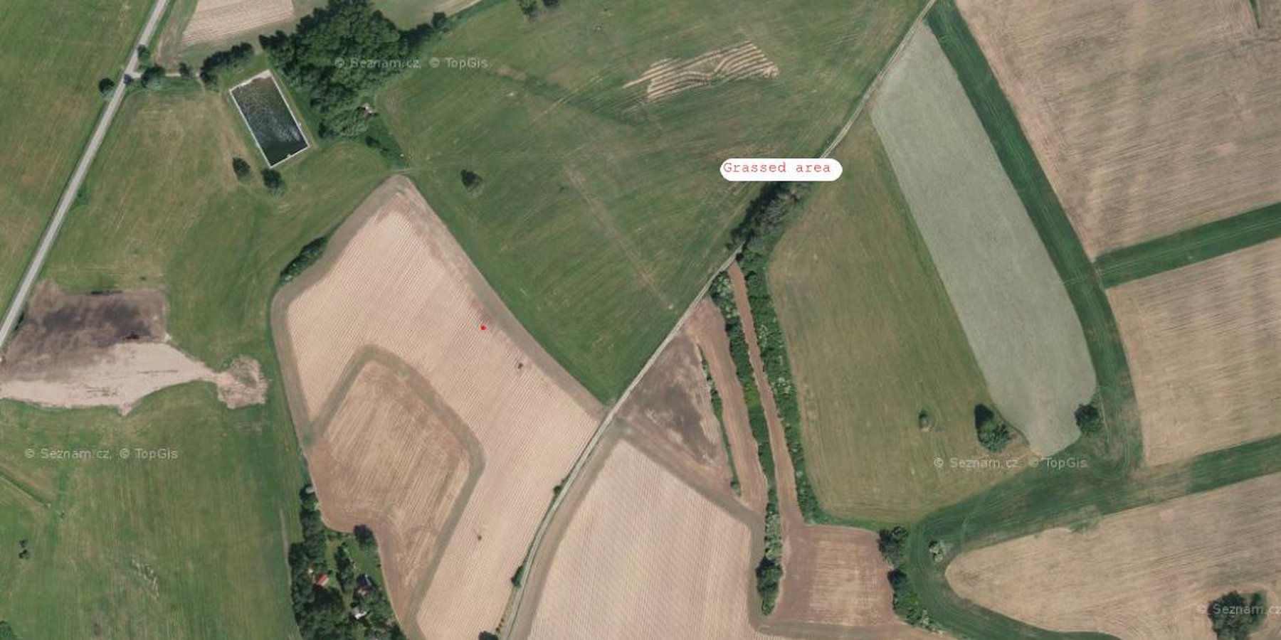
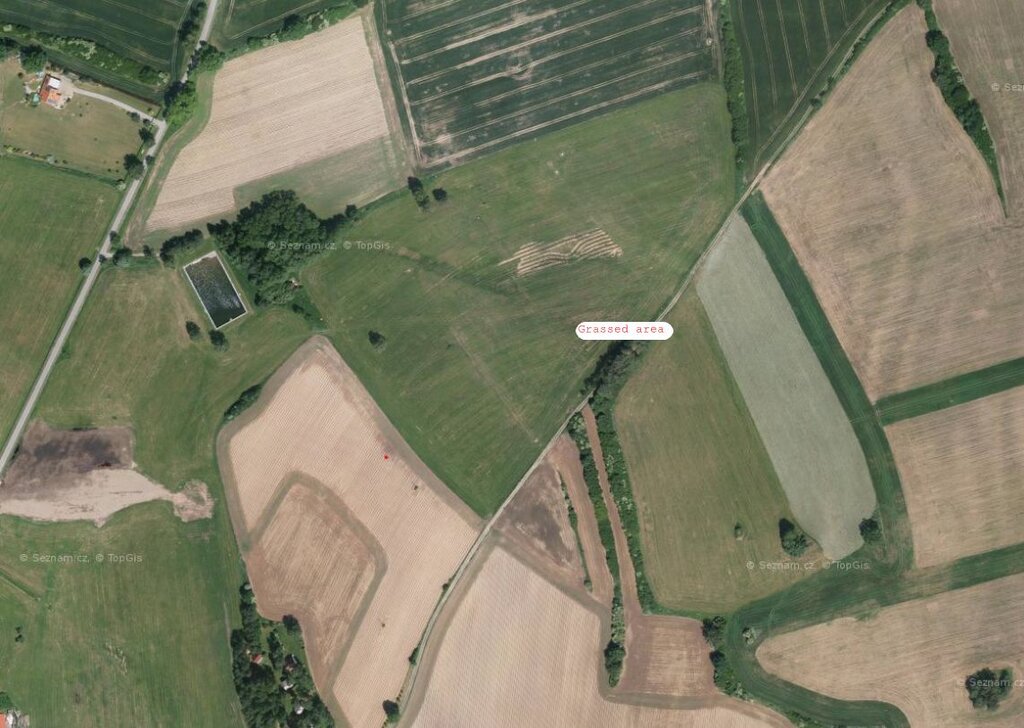
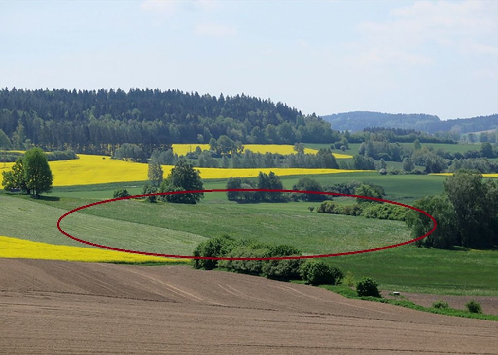
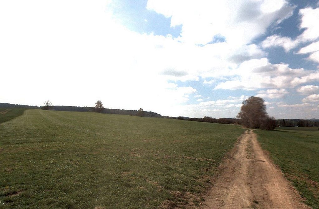
Grassing recharge zones of agricultural drainage systems significantly improves the quality of drainage water. It can be a useful, effective and relatively cheap measure for improvement of shallow groundwater quality.
2.2 وصف تفصيلي للتقنية
الوصف:
Grassing of recharge zones of agricultural drainage systems significantly improves the quality of drainage water: it can be a useful, effective and relatively cheap measure. Grassing is an effective preventative strategy to prevent nitrogen pollution. Reduction of nitrate pollution by grassland occurs mainly through grassland’s ability to absorb and use large amounts of nitrogen compared with field crops, and this capacity remains effective for a longer period of the year. Permanent grasslands cover the soil year-round and have a large stock of active subsurface biomass in the root system, which can immobilize a significant amount of soil nitrogen. Moreover, grassland has a greater amount of active soil microbes than under field crops (Griffiths et al. 2008). Besides nitrogen remedial ability, grasslands offer other regulation and supporting ecosystem service (ES) benefits (Hönigová et al., 2012) – for example carbon sequestration, erosion prevention and water flow regulation. On the other hand, used too widely, grassland can be seen as a negative ES provider, in the sense that it reduces the area of crop production (Hauck et al., 2014). That is why it is recommended to limit the use of grassing so that it acts within relatively small areas focused on the catchment area. The effectiveness of grassing has been evaluated statistically, when Fučík et al. (2008) reported that an increase in grassed area of 10% can decrease the C90 (90% probability of non-exceedance) nitrate value in the waters of streams (small water courses) by 6.4 mg/l.
2.3 صور التقنية
2.5 البلد/المنطقة/المواقع التي تم تنفيذ التقنية فيها والتي يغطيها هذا التقييم
البلد:
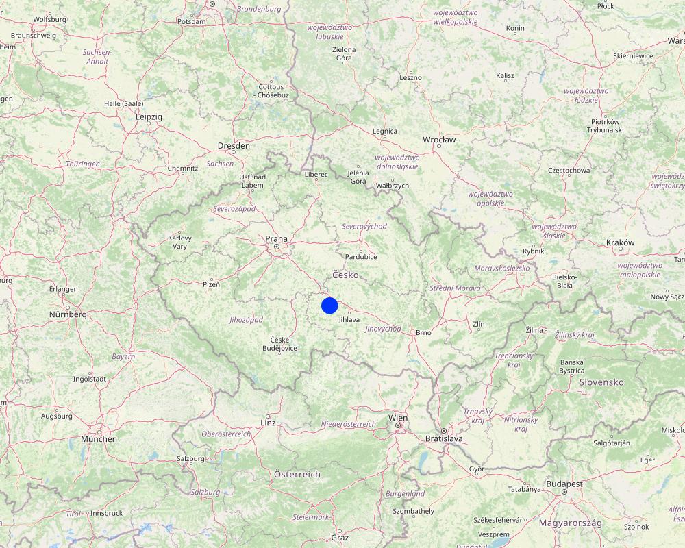
الجمهورية التشيكية
المنطقة/الولاية/المحافظة:
Bohemian - Moravian Highlands
مزيد من التفاصيل حول الموقع:
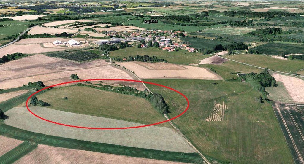
Kojčice
حدد انتشار التقنية:
- منتشرة بالتساوي على مساحة
إذا كانت التقنيةا موزعة بالتساوي على منطقة ما، حدد المساحة المغطاة (بالكيلومتر المربع):
0,05
إذا كانت المساحة الدقيقة غير معروفة، فيرجى الإشارة إلى المنطقة التقريبية المغطاة:
- < 0.1 كم2 (10 هكتار)
هل يقع موقع/مواقع التقنية في منطقة محمية بشكل دائم؟:
كلا
Map
×2.6 تاريخ التنفيذ
اذكر سنة التنفيذ:
2006
2.7 إدخال التقنية
حدد كيف تم إدخال التقنية:
- أثناء التجارب/الأبحاث
- من خلال المشاريع/ التدخلات الخارجية
التعليقات (نوع المشروع، الخ):
Linking of the land use in the source areas to drainage water quality has been tested in several research projects since the first decade of the 21st Century. The methodology for defining source areas has been developed by the Research Institute for Soil and Water Conservation for a long time. Nowadays this measure has become part of the Czech Ministry of Agriculture subsidy and farmers can use it themselves.
3. تصنيف تقنية الإدارة المستدامي للأراضي
3.1 الغرض الرئيسي ( الأغراض الرئيسية) للتقنية
- الحد من تدهور الأراضي ومنعه وعكسه
- حماية مستجمعات المياه / المناطق الواقعة في اتجاه مجرى النهر - مع تقنيات أخرى
- التكيف مع تغير المناخ/الظواهر المتطرفة وآثارها
3.2 نوع (أنواع) استخدام الأراضي الحالية حيث يتم تطبيق التقنية
استخدامات الأراضي مختلطة ضمن نفس وحدة الأرض:
كلا

الأراضي الزراعية
- زراعة معمرة (غير خشبية)
الزراعات المعمرة (غير الخشبية) - حدد المحاصيل:
- محاصيل الأعلاف - الأعشاب
عدد مواسم الزراعة في السنة:
- 1
هل يتم ممارسة الزراعة البينية؟:
كلا
هل تتم ممارسة تناوب المحاصيل؟:
نعم
3.3 هل تغير استخدام الأراضي نتيجة لتنفيذ التقنية؟
هل تغير استخدام الأراضي نتيجة لتنفيذ التقنية؟:
- نعم (يرجى ملء الأسئلة أدناه فيما يتعلق باستخدام الأراضي قبل تنفيذ التقنية)
استخدامات الأراضي مختلطة ضمن نفس وحدة الأرض:
كلا

الأراضي الزراعية
- زراعة سنوية
الزراعة السنوية - حدد المحاصيل:
- الحبوب - الشعير
- الحبوب - الذرة
- الحبوب - قمح (شتوي)
- المحاصيل الزيتية - عباد الشمس، بذور اللفت، وغيرها
- المحاصيل الجذرية/الدرنية - البطاطس
هل يتم ممارسة الزراعة البينية؟:
نعم
إذا كانت الإجابة بنعم، حدد المحاصيل التي يتم زراعتها بشكل بيني:
In some seasons, spring cereal mix, legume-cereal mix or undersown clover is used as an intercrop
هل تتم ممارسة تناوب المحاصيل؟:
نعم
إذا كانت الإجابة بنعم، حدد:
five-year or seven-year crop rotation with winter cereals, spring cereals, potatoes, red clover, oil seed rape and maize
3.4 إمدادات المياه
إمدادات المياه للأرض التي يتم تنفيذ التقنية عليها:
- بعلية
3.5 مجموعةالإدارة المستدامة للأراضي التي تنتمي إليها هذه التقنية
- تحسين الغطاء الأرضي/النباتي
3.6 التدابير التقنية في مجال إلادارة المستدامة للأراضي

التدابير النباتية
- V2: الأعشاب والنباتات العشبية المعمرة

التدابير الإدارية
- M1: التغيير في نوع استخدام الأراضي
3.7 الأنواع الرئيسية من تدهور الأراضي التي تناولتها التقنية

تآكل التربة بالمياه
- الوزن(Wt): فقدان التربة السطحية/تآكل السطح

تدهور المياه
- (Hp): تدهور نوعية المياه السطحية
- (Hq): تدهور نوعية المياه الجوفية
3.8 منع أو حد أو عكس تدهور الأراضي
تحديد هدف التقنية فيما يتعلق بتدهور الأراضي:
- الحد من تدهور الأراضي
4. المواصفات الفنية، وأنشطة التنفيذ، والمدخلات، والتكاليف
4.1 الرسم الفني للتقنية
المواصفات الفنية (المتعلقة بالرسم الفني):
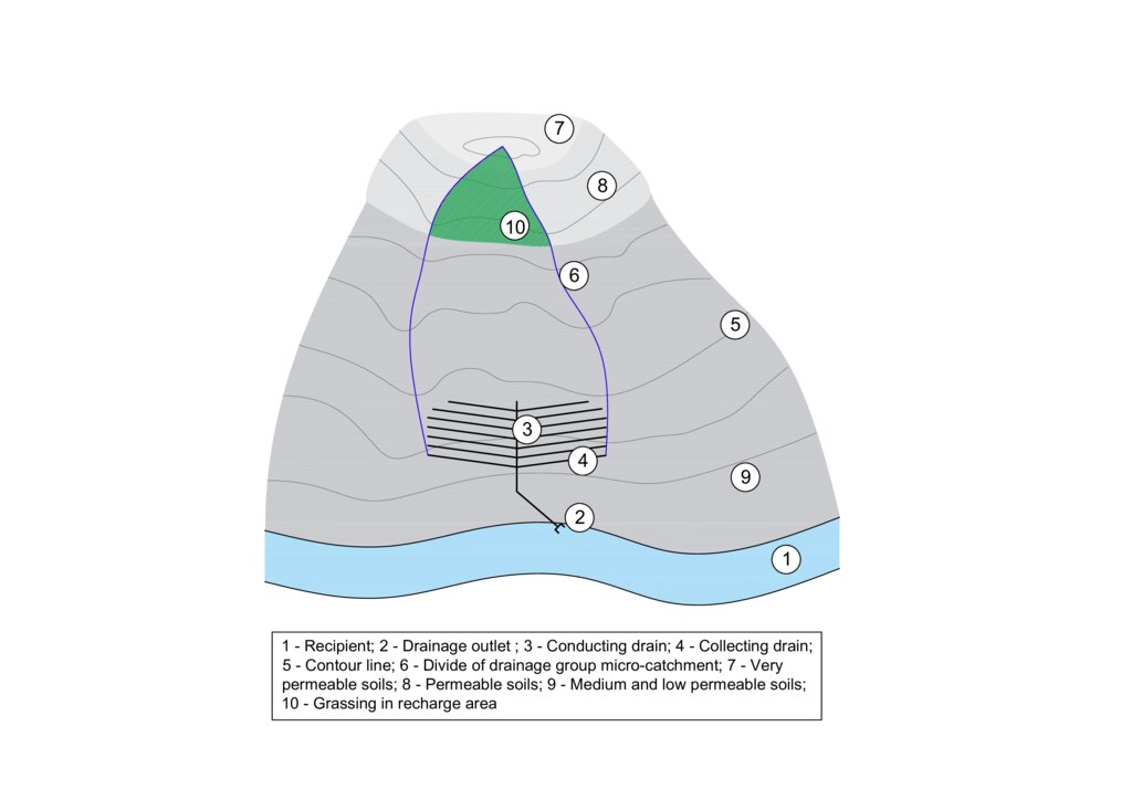
The figure shows a model example of a drainage structure built at the bottom of a slope (3, 4). In this case, a substantial portion of the drainage runoff consists of water that infiltrates in areas with shallow soils that are highly permeable to water, nutrients, and other pollutants (7 and 8). In the case of drainage constructed in this way, the entire micro-catchment of the drainage group must be taken into account in terms of runoff generation and drainage water quality (6). The area where the microwatershed of a drainage group intersects with an area of shallow permeable soils is the source area for drainage runoff and it is to these locations that the grassed area should be directed (10).
المؤلف:
Antonín Zajíček and Tomáš Hejduk
التاريخ:
12/10/2022
4.2 معلومات عامة بخصوص حساب المدخلات والتكاليف
حدد كيفية احتساب التكاليف والمدخلات:
- حسب مساحة تنفيذ التقنية
الإشارة إلى حجم ووحدة المساحة:
3.5 hectares
عملة أخرى/ عملة وطنية (حدد):
EUR
إذا كان ذا صلة، وضح سعر الصرف من الدولار الأمريكي إلى العملة المحلية (على سبيل المثال، 1 دولار أمريكي = 79.9 ريال برازيلي): 1 دولار أمريكي =:
0,92
اذكر متوسط تكلفة أجر العمالة المستأجرة في اليوم الواحد:
60
4.3 أنشطة التأسيس
| النشاط | التوقيت (الموسم) | |
|---|---|---|
| 1. | Vulnerable area delimitation | one year before establishment |
| 2. | Obtaining the consent of the owners and users of the affected land | one year before establishment |
| 3. | Grass sowing | after harvest of previous crops |
4.4 التكاليف والمدخلات اللازمة للتأسيس
| تحديد المدخلات | الوحدة | الكمية | التكاليف لكل وحدة | إجمالي التكاليف لكل مدخل | % من التكاليف التي يتحملها مستخدمو الأراضي | |
|---|---|---|---|---|---|---|
| العمالة | Work for delimitation | person - days | 3,0 | 130,0 | 390,0 | |
| العمالة | Project and administration | person - days | 4,0 | 150,0 | 600,0 | 90,0 |
| العمالة | Manual work on the field | ha | 5,0 | 30,0 | 150,0 | 90,0 |
| معدات | Machinery - sowing machine, chopper | ha | 5,0 | 200,0 | 1000,0 | 89,0 |
| معدات | Fuel | ha | 5,0 | 60,0 | 300,0 | 90,0 |
| المواد النباتية | Seeds | ha | 5,0 | 40,0 | 200,0 | 90,0 |
| الأسمدة والمبيدات الحيوية | Feritilizers (mostly urea and pig slurry digestate) | ha | 5,0 | 30,0 | 150,0 | 90,0 |
| الأسمدة والمبيدات الحيوية | Biocides (only the year of establishment) | ha | 5,0 | 60,0 | 300,0 | 90,0 |
| غير ذلك | Fixed costs | ha | 5,0 | 180,0 | 900,0 | 90,0 |
| إجمالي تكاليف إنشاء التقنية | 3990,0 | |||||
| إجمالي تكاليف إنشاء التقنية بالدولار الأمريكي | 4336,96 | |||||
إذا تحمل مستخدم الأرض أقل من 100% من التكاليف، حدد من قام بتغطية التكاليف المتبقية:
Czech Ministry of Agriculture
التعليقات:
The amount of agricultural subsidies in the Czech Republic is currently (2024) variable depending on the size of the farm. For a farm with an average size of 1500 ha, the subsidy is approximately EUR 160. For the conversion of arable land to permanent grassland in vulnerable areas, an additional subsidy of approximately EUR 310 per hectare is available from the Ministry of Agriculture.
4.5 الصيانة/الأنشطة المتكررة
| النشاط | التوقيت/الوتيرة | |
|---|---|---|
| 1. | re-sowing | before vegetation season if needed |
| 2. | harrowing | if needed once per season after re-sowing |
| 3. | fertilising | once or twice per season |
| 4. | harvesting | twice or three times per season |
4.6 التكاليف والمدخلات اللازمة للصيانة/للأنشطة المتكررة (سنويًا)
| تحديد المدخلات | الوحدة | الكمية | التكاليف لكل وحدة | إجمالي التكاليف لكل مدخل | % من التكاليف التي يتحملها مستخدمو الأراضي | |
|---|---|---|---|---|---|---|
| العمالة | Manual work on the field | ha | 5,0 | 25,0 | 125,0 | 85,0 |
| معدات | Machinery - sowing machine, chopper, tractor | ha | 5,0 | 200,0 | 1000,0 | 85,0 |
| معدات | Fuel | ha | 5,0 | 60,0 | 300,0 | 85,0 |
| المواد النباتية | seeds | ha | 5,0 | 20,0 | 100,0 | 85,0 |
| الأسمدة والمبيدات الحيوية | Feritilizers (mostly urea and pig slurry digestate) | ha | 5,0 | 25,0 | 125,0 | 85,0 |
| الأسمدة والمبيدات الحيوية | Biocides (when needed) | ha | 5,0 | 30,0 | 150,0 | 85,0 |
| غير ذلك | Fixed costs | ha | 5,0 | 150,0 | 750,0 | 85,0 |
| إجمالي تكاليف صيانة التقنية | 2550,0 | |||||
| إجمالي تكاليف صيانة التقنية بالدولار الأمريكي | 2771,74 | |||||
إذا تحمل مستخدم الأرض أقل من 100% من التكاليف، حدد من قام بتغطية التكاليف المتبقية:
Czech Ministry of Agriculture
4.7 أهم العوامل المؤثرة على التكاليف
قدم وصفا لأهم العوامل التي تؤثر على التكاليف:
Fuel prices, level of subsidies
5. البيئة الطبيعية والبشرية
5.1 المناخ
هطول الأمطار السنوي
- < 250 مم
- 251- 500 ملم
- 501 - 750ملم
- 1,000-751 ملم
- 1,500-1,100 ملم
- 2,000-1,500 ملم
- 3,000-2,001 ملم
- 4,000-3,100 ملم
- > 4000 ملم
حدد متوسط هطول الأمطار السنوي (إذا كان معروفًا)، بالملليمتر:
666,00
المنطقة المناخية الزراعية
- شبه رطبة
5.2 طوبوغرافيا
متوسط الانحدارات:
- مسطح (0-2%)
- بسيط (3-5%)
- معتدل (6-10%)
- متدحرج (11-15%)
- تلال (16-30%)
- شديدة الانحدار(31-60%)
- فائقة الانحدار (>60%)
التضاريس:
- هضاب/سهول
- أثلام مرتفعة
- المنحدرات الجبلية
- منحدرات التلال
- منحدرات في السفوح
- قاع الوادي
المنطقة الارتفاعية:
- 100-0 متر فوق سطح البحر
- 500-101 متر فوق سطح البحر
- 1,000-501 متر فوق سطح البحر
- 1,500-1,001 متر فوق سطح البحر
- 2,000-1,501 متر فوق سطح البحر
- 2,500-2,100 متر فوق سطح البحر
- 3,000-2,501 متر فوق سطح البحر
- 4,000-3,001 متر فوق سطح البحر
- > 4000 متر فوق سطح البحر
وضح ما إذا كانت التقنية مطبقة على وجه التحديد في:
- غير ذات صلة
5.3 التربة
متوسط عمق التربة:
- ضحل جدًا (0-20 سم)
- ضحلة (21-50 سم)
- متوسطة العمق (51-80 سم)
- عميقة (81-120 سم)
- عميقة جدًا (> 120 سم)
قوام التربة (التربة السطحية):
- خشن / خفيف (رملي)
المواد العضوية في التربة السطحية:
- متوسطة (1-3%)
إذا كان متاحًا، قم بإرفاق وصف كامل للتربة أو تحديد المعلومات المتوفرة، على سبيل المثال نوع التربة، الرقم الهيدروجيني/ درجة حموضة التربة، قدرة التبادل الكاتيوني، النيتروجين، الملوحة وما إلى ذلك.
The substrate is formed by partially migmatized paragneiss in various degrees of degradation.
Quaternary sediments are represented by slope sands and loams reaching 1–2 m thickness. The representation of soils (according to the World Reference Base for Soil Resources
2006) is variable, with Gleyed Cambisols, Gleysols, and sporadically Histosols. In the recharge area, the soil cover is more homogenous, with prevailing Modal, Ranker and Arenic Cambisols.
5.4 توافر المياه ونوعيتها
منسوب المياه الجوفية:
< 5 م
توافر المياه السطحية:
متوسط
نوعية المياه (غير المعالجة):
للاستخدام الزراعي فقط (الري)
تشير جودة المياه إلى:
المياه الجوفية والسطحية
هل تعتبر ملوحة الماء مشكلة؟:
كلا
هل تحدث فيضانات في المنطقة؟:
كلا
تعليقات ومواصفات أخرى بشأن نوعية المياه وكميتها:
Water quality from agricultural drainage systems
(both tiles and ditches) has been discussed by the studies which draw attention to the reduced
quality of drainage waters caused by elevated concentrations of nutrients (N, P, C) and/or
pesticides.
5.5 التنوع البيولوجي
تنوع الأنواع:
- متوسط
تنوع الموائل:
- متوسط
5.6 خصائص مستخدمي الأراضي الذين يطبقون التقنية
مستقر أو مرتحل:
- غير المترحل
التوجه السوقي لنظام الإنتاج:
- تجاري/سوق
الدخل من خارج المزرعة:
- أقل من % 10من كامل الدخل
المستوى النسبي للثروة:
- متوسط
أفراداً أو مجموعات:
- تعاونية
مستوى المكننة:
- ميكانيكية/ مزودة بمحرك
الجنس:
- نساء
- رجال
عمر مستخدمي الأرضي:
- متوسط العمر
5.7 متوسط مساحة الأرض التي يستخدمها مستخدمو الأراضي الذين يطبقون التقنية
- < 0.5 هكتارا
- 0.5 - 1 هكتار
- 1 -2 هكتار
- 2 - 5 هكتار
- 5 - 15 هكتار
- 15 - 50 هكتار
- 50 - 100هكتار
- 500-100 هكتار
- 1,000-500 هكتار
- 10,000-1,000 هكتار
- > 10,000 هكتار
هل يعتبر هذا نطاقًا صغيرًا أو متوسطًا أو واسعا (في إشارة إلى السياق المحلي)؟:
- على نطاق متوسط
التعليقات:
The Czech Republic is characterised by a significant size of agricultural holdings. During the socialist era (1948-1989), large agricultural cooperatives were established. Today, most agricultural land is still farmed by similar enterprises, whether in the form of cooperatives, limited liability companies or joint stock companies.
5.8 ملكية الأراضي، وحقوق استخدام الأراضي، وحقوق استخدام المياه
ملكية الارض:
- شركة
- فردية، لا يوجد سند ملكية
حقوق استخدام الأراضي:
- مؤجر
- فردي
حقوق استخدام المياه:
- وصول مفتوح (غير منظم)
هل تعتمد حقوق استخدام الأراضي على نظام قانوني تقليدي؟:
كلا
5.9 الوصول إلى الخدمات والبنية التحتية
الصحة:
- ضعيف
- معتدل
- جيد
التعليم:
- ضعيف
- معتدل
- جيد
المساعدة التقنية:
- ضعيف
- معتدل
- جيد
العمل (على سبيل المثال خارج المزرعة):
- ضعيف
- معتدل
- جيد
الأسواق:
- ضعيف
- معتدل
- جيد
الطاقة:
- ضعيف
- معتدل
- جيد
الطرق والنقل:
- ضعيف
- معتدل
- جيد
مياه الشرب وخدمات الصرف الصحي:
- ضعيف
- معتدل
- جيد
الخدمات المالية:
- ضعيف
- معتدل
- جيد
6. الآثار والتصريحات الختامية
6.1 الآثار التي أظهرتها التقنية في الموقع
الآثار الاجتماعية والاقتصادية
الإنتاج
إنتاج المحاصيل
التعليقات/ حدد:
Farmers will lose land for growing commercially viable crops (cereals, potatoes, rape) and grass production (hay, haylage) will increase.
الآثار الاجتماعية والثقافية
المعرفة بالإدارة المستدامة للأراضي/تدهور الأراضي
التعليقات/ حدد:
Permanent grassland in the recharge area will protect the shallow soils especially from accelerated erosion.
الآثار الايكولوجية
دورة المياه / الجريان السطحي
كمية المياه
التعليقات/ حدد:
This measure will reduce the intensity of surface and subsurface runoff from the catchment.
جودة المياه
الجريان السطحي
التعليقات/ حدد:
Grassing will slowdwn the surface runoff especially during intensive rainfall-runoff events.
التربة
رطوبة التربة
التعليقات/ حدد:
Reducing surface runoff will promote infiltration of rainwater into the soil profile and increase soil moisture.
غطاء التربة
التعليقات/ حدد:
Permanent grasslands cover the soil year round.
فقدان التربة
التعليقات/ حدد:
This measure prevents soil loss from the accelerated erosion.
المادة العضوية في التربة/تحت الطبقة c
التعليقات/ حدد:
Permanent grasslands have a big stock of active subsurface biomass in the root system, which can immobilize a significant amount of soil nitrogen. Moreover, it has bigger amount and increased activity of soil microbes supporting e.g. carbon sequestration.
التنوع البيولوجي: الغطاء النباتي، الحيوانات
الغطاء النباتي
التعليقات/ حدد:
Unlike arable land, permanent grassland provides full land cover even in the non-growing season.
التنوع الحيواني
التعليقات/ حدد:
Properly managed grasslans will increase biodiversity (compared to the arable lands), especially amount of insect.
6.2 الآثار التي أظهرتها التقنية خارج الموقع
تلوث المياه الجوفية/الأنهار
التعليقات/ حدد:
In intensively drained catchments, drainage structures have a significant contribution to total runoff and water pollution.Grassing in recharge zone will significantly mitigate water pollution, especially nutrients and pesticides loads.
الأضرار التي لحقت بحقول الجيران
التعليقات/ حدد:
Decrease in rapid erosive runoff will reduce the risk of sediment input to lower lying lands.
الضرر على البنية التحتية العامة/ الخاصة
التعليقات/ حدد:
Decrease in rapid erosive runoff will reduce the risk of sediment input into the intravilane of lower lying villages or public roads.
6.3 تعرض التقنية وحساسيتها لتغير المناخ التدريجي والظواهر المتطرفة/الكوارث المرتبطة بالمناخ (كما يراها مستخدمو الأراضي)
تغير مناخ تدريجي
تغير مناخ تدريجي
| الموسم | زيادة أو نقصان | كيف تتعامل التقنية مع ذلك؟ | |
|---|---|---|---|
| هطول الأمطار الموسمية | الصيف | زيادة | جيدا |
التعليقات:
Gradual climatic has been causing changes in precipitation distribution in course of year. In winter, the period with snow cover shortens and in summer, precipitation often takes the form of rapid and intense episodes. Permanent grassland will mitigate these rainfall extremes by its ability to slow down both surface and subsurface runoff and to increase water retention in agricultural catchments.
6.4 تحليل التكلفة والعائد
كيف يمكن مقارنة العوائد نسبة لتكاليف الإنشاء (من وجهة نظر مستخدمي الأراضي)؟
عوائد قصيرة الأجل:
سلبي قليلا
عوائد طويلة الأجل:
سلبي قليلا
كيف تتم مقارنة العوائدمع كلفة الصيانة/التكاليف المتكررة (من وجهة نظر مستخدمي الأراضي)؟
عوائد قصيرة الأجل:
محايد/متوازن
عوائد طويلة الأجل:
محايد/متوازن
التعليقات:
From an economic point of view, the increase in the area of grasslands will clearly reduce the turnover of the agricultural entity. The fall in costs and income will also lead to a reduction in profits, which is partly offset by higher subsidies for permanent grasslands. However, the increase in dependence on subsidies is dangerous in terms of the long-term stability of the farming entity, as the amount and focus of subsidies can change from year to year. It is also important to note that the production of grass biomass only make sense if the farmer also runs livestock production or a biogas plant, taking into account the amount of grass that the farmer is able to process.
6.5 اعتماد التقنية
- حالات فردية/تجريبية
من بين جميع الذين تبنوا التقنية، كم عدد الذين فعلوا ذلك بشكل تلقائي، أي دون تلقي أي حوافز مادية/مدفوعات؟:
- 91-100%
6.6 التكيف
هل تم تعديل التقنية مؤخرًا لتتكيف مع الظروف المتغيرة؟:
كلا
6.7 نقاط القوة / المزايا / الفرص التي توفرها التقنية
| نقاط القوة/ المزايا/ الفرص من وجهة نظر مستخدمي الأراضي |
|---|
| A relatively low-cost measure in terms of finance and agricultural management |
| نقاط القوة/ المزايا/ الفرص من وجهة نظر جامع المعلومات أو غيره من الاشخاص الرئيسيين لمصدر المعلومات |
|---|
| grassing focused to the proper catchment area (recharge zone) can be a useful, effective and relatively cheap measure for improvement of shallow groundwater quality, or optionally the quality of local drinking water sources |
| stabilise of catchment area with shallow soils - can lead to decrease in soil erosion. |
6.8 نقاط ضعف / مساوىء / مخاطر التقنية وسبل التغلب عليها
| نقاط الضعف/ المساوىء/ المخاطر من وجهة نظر مستخدم الأراضي | كيف يمكن التغلب عليها؟ |
|---|---|
| Increasing areas of grasslands would lead to decrease of landscape productive service, farm turnover and profit and the bigger dependence on subsidies. | The grassing should be applied in small, precisely defined parts of the catchment, which are real recharge (infiltration) areas. |
| Possible sudden change in the subsidy system | It is necessary to consider the non-productive functions of grasslands also as public service, taking into account the saves in water cleaning costs and the price of increased water retention |
| Excess amout of grass or hay, especially for farms without livestock production | Balanced share of grasslands and arablale lands in cultivated field blocks, support for livestock production |
| نقاط الضعف/ المساوىء/ المخاطر من وجهة نظر جامع المعلومات أو غيره من الاشخاص الرئيسيين لمصدر المعلومات | كيف يمكن التغلب عليها؟ |
|---|---|
| An incorrectly defined source area will lead to ineffective measures | Careful preparation |
| Unwillingness of conservative companies and farmers to adopt this measure | Properly set up subsidy policy |
7. المراجع والروابط
7.1 طرق جمع/مصادر المعلومات
- زيارات ميدانية، مسوحات ميدانية
The effectiveness of this measure was tested withim the long-term survey(2006-2016) at the pilot site of Dehtáře (Bohemian-Moravian Highlands, Czech Republic). During the research, drainage water quality indicators, meteorological and hydrological characteristics of the experimental site and agricultural management were monitored.
- مقابلات مع مستخدمي الأراضي
The research was primarily carried out in cooperation with one agricultural cooperative; the implementation of the measures is being carried out in discussions with more than thirty agricultural enterprises, mainly in the catchment area of the Švihov reservoir on Želivka - the largest potable water reservoir in the central Europe.
متى تم تجميع البيانات (ميدانيا)؟:
2016
7.2 المراجع للمنشورات المتاحة
العنوان، المؤلف، السنة، النظام القياسي الدولي لترقيم الكتب ISBN:
Kvítek, T.; Zajíček, A.; Dostál, T.; Fučík, P.; Krása, J.; Bauer, M.; Jáchymová, B.; Kulhavý, Z.; Pavel, M. Slowing Down Quick Runoff—A New Approach for the Delineation and Assessment of Critical Points, Contributing Areas, and Proposals of Measures to Reduce Non-Point Water Pollution from Agricultural Land. Water 2023, 15, 1247.
متاح من أين؟كم التكلفة؟:
https://doi.org/10.3390/w15061247
العنوان، المؤلف، السنة، النظام القياسي الدولي لترقيم الكتب ISBN:
Zajíček, A., Hejduk, T., Sychra, L., Vybíral, T., Fučík, P. (2022): How to Select a Location and a Design of Measures on Land Drainage – A Case Study from the Czech Republic. Journal of Ecological Engineering 2022, 23(4), 43–57. ISSN 2299–8993.
متاح من أين؟كم التكلفة؟:
https://doi.org/10.12911/22998993/146270
العنوان، المؤلف، السنة، النظام القياسي الدولي لترقيم الكتب ISBN:
ZAJÍČEK, A., FUČÍK, P., DUFFKOVÁ, R., MAXOVÁ, J. 2018. How does targeted grassing of arable land influence drainage water quality and farm economic indicators? Int. J. Environ. Impacts, 1(3): 344–352.
متاح من أين؟كم التكلفة؟:
DOI 10.2495/EI-V1-N3-344-352
العنوان، المؤلف، السنة، النظام القياسي الدولي لترقيم الكتب ISBN:
Fučík P., Zajíček A., Kaplická M., Duffková R., Peterková J., Maxová J., Takáčová Š. 2017. Incorporating rainfall-runoff events into nitrate-nitrogen and phosphorus load assessments for small tile-drained catchments. Water, 9, 712; (ISSN Print:2575-1867 ISSN Online: 2575-1875)
متاح من أين؟كم التكلفة؟:
doi:10.3390/w9090712
العنوان، المؤلف، السنة، النظام القياسي الدولي لترقيم الكتب ISBN:
Janglová R., Kvítek T., Novák P. 2003. Soil infiltration capacity categorization based on geoinformatic processing of soil survey data. Soil and Water Scientific Studies, 2, 61–81.
7.3 روابط للمعلومات ذات الصلة على الإنترنت
العنوان/الوصف:
ZAJÍČEK, A., SYCHRA, L., VYBÍRAL, T., HEJDUK, T., ČMELÍK, M., FUČÍK, P., KAPLICKÁ, M. 2021: Design of the Revitalization measures on the Main drainage facilities and hydrologically related Detailed drainage facilities (In Czech)
عنوان الرابط URL:
DOI: 10.13140/RG.2.2.34421.50403
7.4 تعليقات عامة
Grassing focused on the catchment area (recharge zone) can be a useful, effective and relatively cheap measure for improvement of shallow groundwater quality, or optionally the quality of local drinking water sources.
الروابط والوحدات المواضيعية
توسيع الكل طي الكلالروابط

Catchment Approach [كينيا]
A focused approach to integrated land and water management, including soil and water conservation, where the active participation of the villagers - often organised through common interest groups - is central.
- جامع المعلومات: James Gatero Njuki
الوحدات المواضيعية
لا يوجد وحدات مواضيعية


