Agro-forestry [الهند]
- تاريخ الإنشاء:
- تحديث:
- جامع المعلومات: Unknown User
- المحرر: –
- المراجعون: Fabian Ottiger, Alexandra Gavilano
Kaadu, Vilai, Thottam (Tamil)
technologies_1083 - الهند
عرض الأقسام
توسيع الكل طي الكل1. معلومات عامة
1.3 الشروط المتعلقة باستخدام البيانات الموثقة من خلال WOCAT
يوافق جامع المعلومات والشخص (لاشخاص) الرئيسي لمصدر المعلومات على الشروط المتعلقة باستخدام البيانات الموثقة من خلال WOCAT:
نعم
2. وصف تقنيةالإدارة المستدامي للأراضي
2.1 وصف مختصر للتقنية
تعريف التقنية:
Development of degraded lands through plantation of productive tree species for long term benefit (conservation and economic) and cultivation of intercrop for short term benefit.
2.2 وصف تفصيلي للتقنية
الوصف:
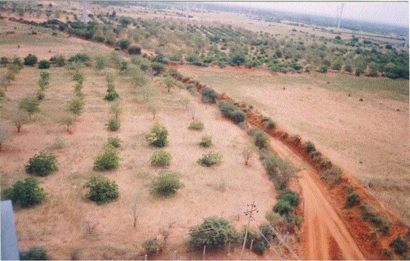
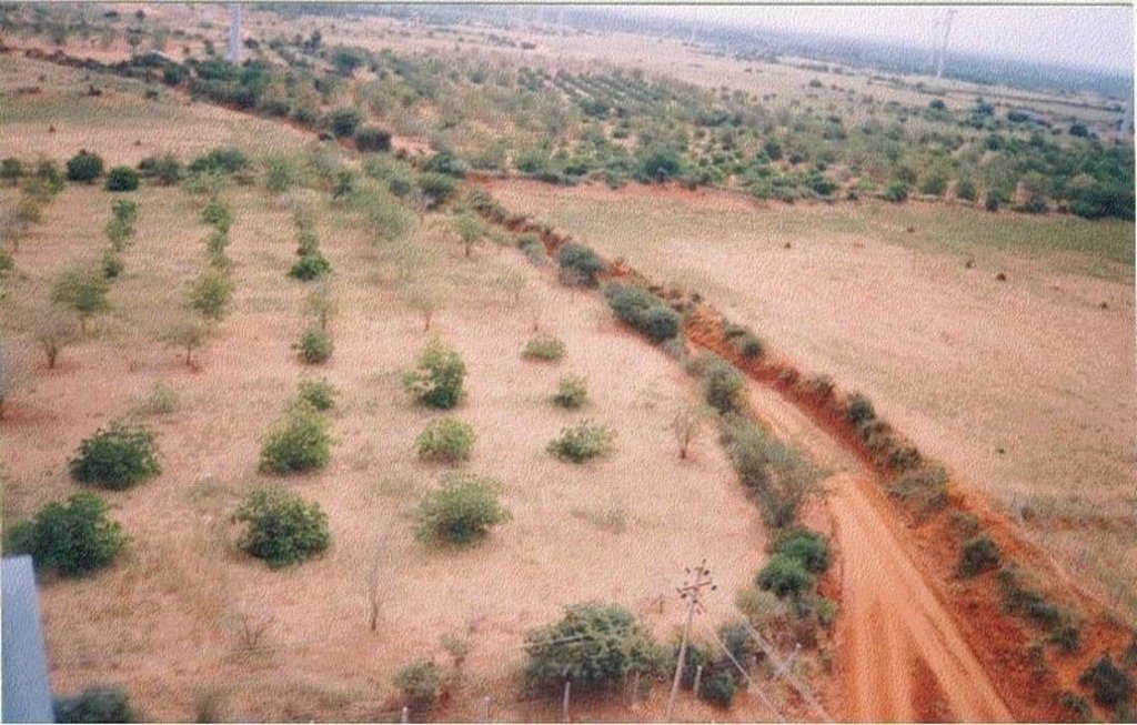
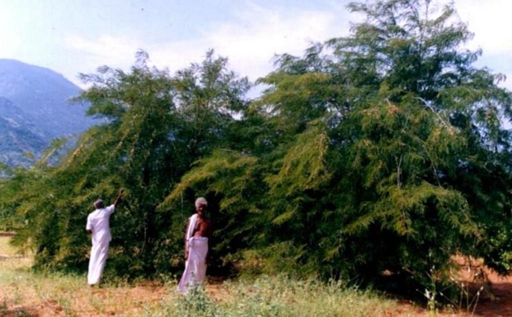
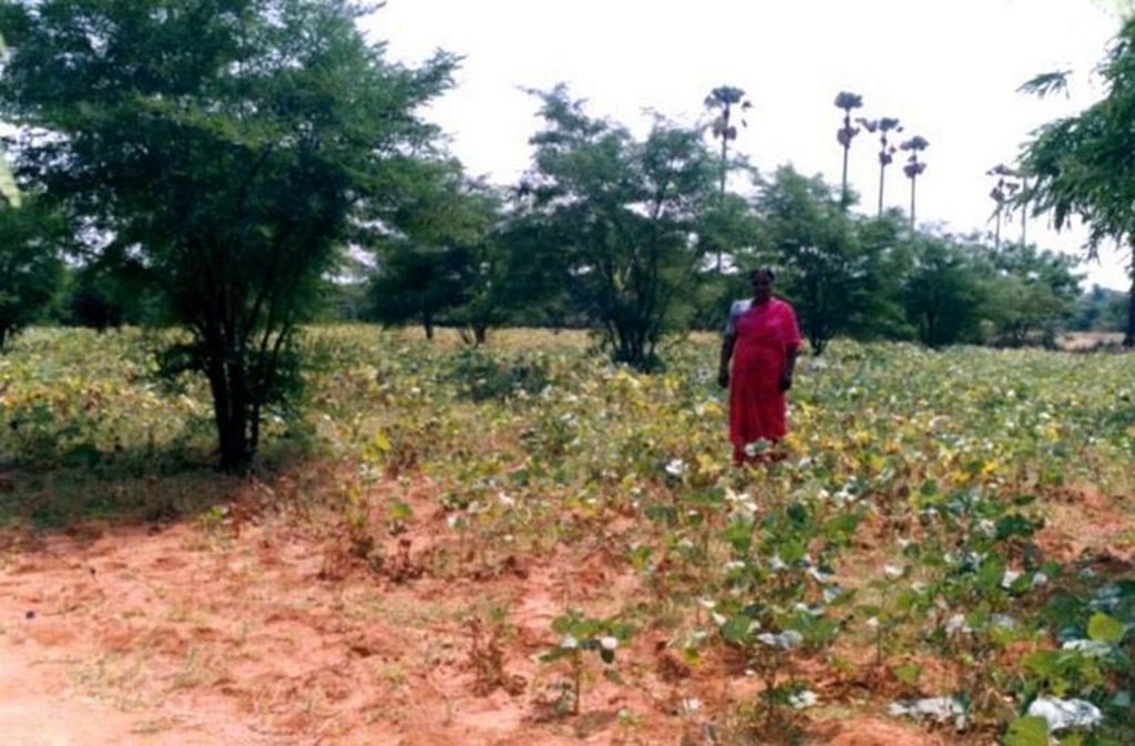
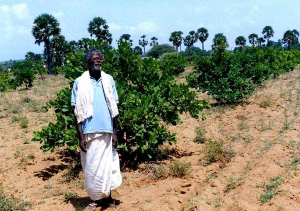
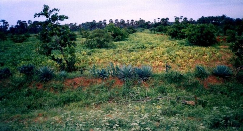
The technology can be described as a combination of tree cultivation ( mainly horticulture species) along with intercrop of pulse crops on degraded private lands, supported by in-situ measures for soil and water conservation. The supportive technology required is provision of water for protective irrigation during establishment phase.
Purpose of the Technology: the technology serves the folowing purposes 1. Short and long term economic benefits to land owners 2. Employment generation leading to reduced migration 3. Conservation of soil and water through vegetative and mechanical measures.
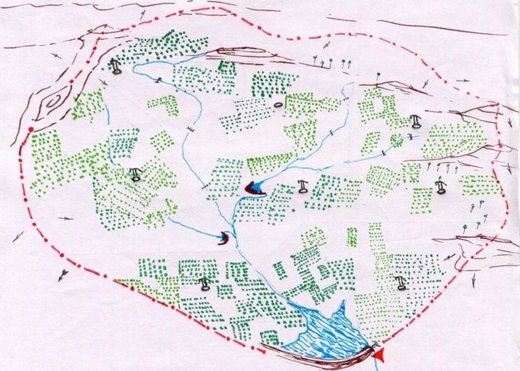
Establishment / maintenance activities and inputs: 1. Community organisation, formation of Village Development Association, Identification and training of beneficiaries 2. Delineation of micro-watersheds and plantation blocks. 3. Establishment of farmers's nurseries 4. Land preparation, sinking bore-well, plantation and inter-cropping 5. Watch and ward.
Natural / human environment: The environment is semi-arid, drought prone and subject to wind erosion. Soil depth is good.
2.3 صور التقنية
2.5 البلد/المنطقة/المواقع التي تم تنفيذ التقنية فيها والتي يغطيها هذا التقييم
البلد:
الهند
المنطقة/الولاية/المحافظة:
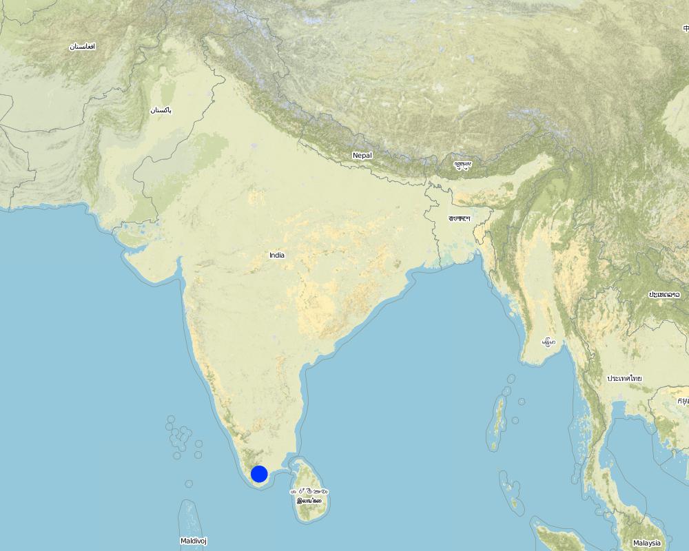
Tamilnadu
حدد انتشار التقنية:
- منتشرة بالتساوي على مساحة
إذا كانت التقنيةا موزعة بالتساوي على منطقة ما، حدد المساحة المغطاة (بالكيلومتر المربع):
3,83
التعليقات:
Total area covered by the SLM Technology is 3.83 km2.
The area is predominantly degraded land affected by wind erosion. The annual rainfall is <600 mm, however distribution is erratic resulting in drought conditions. People are mostly small farmers engaged in rainfed agriculture, however large areas have been abandoned due to frequent crop failure. The technology has been applied in a gross area of over 300 sq.km.
Map
×2.6 تاريخ التنفيذ
في حالة عدم معرفة السنة بالتحديد، يرجى الإشارة إلى التاريخ التقريبي:
- منذ أكثر من 50 عامًا (تقليدي)
2.7 إدخال التقنية
حدد كيف تم إدخال التقنية:
- من خلال المشاريع/ التدخلات الخارجية
التعليقات (نوع المشروع، الخ):
The technology evolved out farmers suggestions and project experiences while implementing the shelter programme to combat wind erosion.
3. تصنيف تقنية الإدارة المستدامي للأراضي
3.1 الغرض الرئيسي ( الأغراض الرئيسية) للتقنية
- تحسين الإنتاج
- الحد من تدهور الأراضي ومنعه وعكسه
3.2 نوع (أنواع) استخدام الأراضي الحالية حيث يتم تطبيق التقنية
استخدامات الأراضي مختلطة ضمن نفس وحدة الأرض:
نعم
حدد استخدام الأراضي المختلطة (المحاصيل / الرعي / الأشجار):
- الحراجة الزراعية

الأراضي الزراعية
- زراعة سنوية
- زراعة الأشجار والشجيرات
الزراعة السنوية - حدد المحاصيل:
- الحبوب البقولية والبقول- الفاصوليا
- الحبوب البقولية والبقول - أخرى
- المحاصيل الزيتية - الفول السوداني
- euphorbia sp.
زراعة الأشجار والشجيرات -حدد المحاصيل:
- الكاجو
- فواكه أخرى
- المانجو، المانغوستين، الجوافة
- Tamarandus indicus, Emblica officianalis
عدد مواسم الزراعة في السنة:
- 1
حدد:
Longest growing period in days: 100 Longest growing period from month to month: Oct - Jan

الغابات/ الأراضي الحرجية
نوع الشجرة:
- شجرة النيم Azadirachta indica
- Albizia lebeck
التعليقات:
Crop: agace, euphorbia sp.
Trees/ shrubs species: Azadirachta indica, Albizia lebeck
Fruit trees / shrubs species: Anacardium occidentale, Tamarandus indicus, Emblica officianalis, Mangifera incica
Other species: Phaseolus mungo, Arachis hypogea
Major land use problems (compiler’s opinion): Uncontrolled grazing on un-cultivated lands, abandonment of fields by poor farmers due to recurrent crop failure as a result of drought.
Major land use problems (land users’ perception): Crop lands are not economocal to cultivate due to recurrent crop failure as a result of drought. This has lead to abandonment of fields and increase in numbers of small livestock which are left free to graze.
Type of cropping system and major crops comments: The area is single cropped and hence only one food crop is taken per year.
3.4 إمدادات المياه
إمدادات المياه للأرض التي يتم تنفيذ التقنية عليها:
- مختلط بعلي-مروي
3.5 مجموعةالإدارة المستدامة للأراضي التي تنتمي إليها هذه التقنية
- الحراجة الزراعية
3.6 التدابير التقنية في مجال إلادارة المستدامة للأراضي

التدابير الزراعية
التعليقات:
Type of agronomic measures: better crop cover, mixed cropping / intercropping, mulching, pits, deep tillage / double digging
3.7 الأنواع الرئيسية من تدهور الأراضي التي تناولتها التقنية

تآكل التربة بالمياه
- الوزن(Wt): فقدان التربة السطحية/تآكل السطح
- (Wg):الانجراف الخلجاني/ الخلجان

تآكل التربة الناتج عن الرياح
- (Et): فقدان التربة السطحية
التعليقات:
Main type of degradation addressed: Et: loss of topsoil
Secondary types of degradation addressed: Wt: loss of topsoil / surface erosion, Wg: gully erosion / gullying
4. المواصفات الفنية، وأنشطة التنفيذ، والمدخلات، والتكاليف
4.1 الرسم الفني للتقنية
المواصفات الفنية (المتعلقة بالرسم الفني):
Technical Drawing Agro-forestry
Technical knowledge required for field staff / advisors: high
Technical knowledge required for land users: moderate
Main technical functions: improvement of ground cover
Secondary technical functions: control of raindrop splash, reduction in wind speed
Better crop cover
Material/ species: trees + legume crops
Quantity/ density: 125 trees/
Remarks: Block plantation/ intercorp
Mixed cropping / intercropping
Material/ species: trees + legume crops
Quantity/ density: 125 trees/
Remarks: Block plantation/ intercorp
Mulching
Material/ species: soil mulch
Quantity/ density: 125 basins
Remarks: 1 m. diameter basin per tree
Agronomic measure: vegetative hedges
Material/ species: agace, euphorbia sp.
Quantity/ density: 15 cm. Spa
Remarks: Along field boundries
Pits
Remarks: 125 pits/ha., 9 m. spacing. 45*45*45 cm for local species & 60*60*60 cm for grafts.
Deep tillage / double digging
Remarks: disc ploughing before pitting in first year, tiller ploughing annually at sowing of intercorp..
Trees/ shrubs species: Azadirachta indica, Albizia lebeck
Fruit trees / shrubs species: Anacardium occidentale, Tamarandus indicus, Emblica officianalis, Mangifera incica
Other species: Phaseolus mungo, Arachis hypogea
Slope (which determines the spacing indicated above): 3.00%
Change of land use type: open grazing, cropping to agro-forestry
Change of land use practices / intensity level: open access to protected
Layout change according to natural and human environment: borewell blocks formed as per human environment but within watershed boundary.
Control / change of species composition: scrub clearance followed by plantation of agro-horticulture species.
Other type of management: VDA established - to manage all activities at village level
المؤلف:
D. Samraj, Tiruneveli, Tamilna
4.2 معلومات عامة بخصوص حساب المدخلات والتكاليف
عملة أخرى/ عملة وطنية (حدد):
Indian Rupee
إذا كان ذا صلة، وضح سعر الصرف من الدولار الأمريكي إلى العملة المحلية (على سبيل المثال، 1 دولار أمريكي = 79.9 ريال برازيلي): 1 دولار أمريكي =:
48,85
اذكر متوسط تكلفة أجر العمالة المستأجرة في اليوم الواحد:
1.00
4.3 أنشطة التأسيس
| النشاط | التوقيت (الموسم) | |
|---|---|---|
| 1. | Nursery raising | May - Nov |
| 2. | Planting in pits | Oct -Dec, onset of monsoon |
| 3. | Life watering | immediately after plantation |
| 4. | Planting of vegetative hedges | Oct - Dec |
| 5. | Sowing of intercrop (broadcasting, dibbling) | Premonsoon-groundnut, monsoon-legumes |
| 6. | Application of FYM to intercrop | September during tiller ploughing |
| 7. | Selection of village as per criteria | Mar/Apr, dry season |
| 8. | Rapport building, awareness generation | |
| 9. | VDA formation | April / May |
| 10. | Development of watershed plan including agroforestry | May / June |
| 11. | Trainings for VDA, farmers, nursery etc. | Jun - Aug |
4.4 التكاليف والمدخلات اللازمة للتأسيس
التعليقات:
Duration of establishment phase: 24 month(s)
4.5 الصيانة/الأنشطة المتكررة
| النشاط | التوقيت/الوتيرة | |
|---|---|---|
| 1. | scrub clearance | Sept/Oct,dry season / once before planting |
| 2. | deep ploughing | Oct/Nov,onset of monsoon / once before planting |
| 3. | pitting | Oct/Nov / once before planting |
| 4. | manuring | Oct/Nov / once before planting |
| 5. | filling pits, planting, forming basins | Nov / once before planting |
| 6. | life watering | Nov / after planting |
| 7. | tiller ploughing & sowing | Oct/Nov / annually after onset of monsoon |
| 8. | maintenance of tree basins | Oct / after annual tiller ploughing |
| 9. | Periodical watering | dry months 1st year /weekly |
| 10. | Weed removal | Nov / Dec /once during annual crop |
| 11. | Application of pesticides | Dec - Feb /as necessary |
| 12. | Pruning | Nov /annually |
| 13. | Casualty replacement | Nov /One year after plantation |
| 14. | Monitoring by VDA | - / monthly |
| 15. | Hand pump maintenance | / as required |
| 16. | Protection against animals | Year one / full time |
4.6 التكاليف والمدخلات اللازمة للصيانة/للأنشطة المتكررة (سنويًا)
التعليقات:
- The costs were calculated for establishment of one block (average area 12.5 ha.) of horticulture plantation with project support. The agriculture component was implemented by farmer with project support for seeds during first monsoon and tiller ploughing during second monsoon.
4.7 أهم العوامل المؤثرة على التكاليف
قدم وصفا لأهم العوامل التي تؤثر على التكاليف:
- Establishment of the technology requires high labor input, specially for watering and watch & ward, which adds significantly to the cost. - Presence of hard pan necessiates deep ploughing with machinery. - Horticulture tree species were selected over forest species.
5. البيئة الطبيعية والبشرية
5.1 المناخ
هطول الأمطار السنوي
- < 250 مم
- 251- 500 ملم
- 501 - 750ملم
- 1,000-751 ملم
- 1,500-1,100 ملم
- 2,000-1,500 ملم
- 3,000-2,001 ملم
- 4,000-3,100 ملم
- > 4000 ملم
المواصفات/التعليقات على هطول الأمطار:
680 mm, however the rainfall over the past few years has been < 500 mm.
المنطقة المناخية الزراعية
- شبه قاحلة
Since past few years arid conditions prevail in the area
5.2 طوبوغرافيا
متوسط الانحدارات:
- مسطح (0-2%)
- بسيط (3-5%)
- معتدل (6-10%)
- متدحرج (11-15%)
- تلال (16-30%)
- شديدة الانحدار(31-60%)
- فائقة الانحدار (>60%)
التضاريس:
- هضاب/سهول
- أثلام مرتفعة
- المنحدرات الجبلية
- منحدرات التلال
- منحدرات في السفوح
- قاع الوادي
المنطقة الارتفاعية:
- 100-0 متر فوق سطح البحر
- 500-101 متر فوق سطح البحر
- 1,000-501 متر فوق سطح البحر
- 1,500-1,001 متر فوق سطح البحر
- 2,000-1,501 متر فوق سطح البحر
- 2,500-2,100 متر فوق سطح البحر
- 3,000-2,501 متر فوق سطح البحر
- 4,000-3,001 متر فوق سطح البحر
- > 4000 متر فوق سطح البحر
التعليقات والمواصفات الإضافية بشأن التضاريس:
Landforms: Plateau/plains (level lands lying between hill slopes of Western mountain range & East coast of south India.)
Slopes on average: Flat (level land with some gullies passing through (originating in upper hilly area))
5.3 التربة
متوسط عمق التربة:
- ضحل جدًا (0-20 سم)
- ضحلة (21-50 سم)
- متوسطة العمق (51-80 سم)
- عميقة (81-120 سم)
- عميقة جدًا (> 120 سم)
قوام التربة (التربة السطحية):
- متوسط ( طميي، سلتي)
المواد العضوية في التربة السطحية:
- متوسطة (1-3%)
إذا كان متاحًا، قم بإرفاق وصف كامل للتربة أو تحديد المعلومات المتوفرة، على سبيل المثال نوع التربة، الرقم الهيدروجيني/ درجة حموضة التربة، قدرة التبادل الكاتيوني، النيتروجين، الملوحة وما إلى ذلك.
Soil depth on average: Moderately deep (ranked 1) and deep (ranked 2, patches of deep soil)
Soil texture: Medium (sandy loam)
Soil fertility: Medium (loss of top soil due to erosion)
Topsoil organic matter: Medium (originally low before agro-forestry)
Soil drainage/infiltration level: Medium (presence of hardpan below six inch depth. However, no waterlogging is observed due to runoff.)
Soil water storage capacity: Medium (has improved due to deep ploughing post treatment)
5.6 خصائص مستخدمي الأراضي الذين يطبقون التقنية
الدخل من خارج المزرعة:
- 10-50% من جميع الإيرادات
المستوى النسبي للثروة:
- ضعيف
- متوسط
اذكر الخصائص الأخرى ذات الصلة لمستخدمي الأراضي:
Population density: 100-200 persons/km2
Annual population growth: 1% - 2%
11% of the land users are rich and own 18% of the land (large holdings > 2 ha.).
50% of the land users are average wealthy and own 56% of the land (holdings of 1 to 2 ha.).
39% of the land users are poor and own 26% of the land (holdings < 1 ha.).
Off-farm income specification: Off farm sources are; poor - rolling beedis (locally made cigarettes), daily wage labor in fields and brick kilns. Average / rich; Business, livestock.
Level of mechanization: Manual labour (ranked 1, pitting, planting, watering, cultivating, watch and ward), mechanised (ranked 2, deep ploughing, tiller ploughing, drilling borewell) and animal traction (ranked 3, ploughing)
5.8 ملكية الأراضي، وحقوق استخدام الأراضي، وحقوق استخدام المياه
ملكية الارض:
- فردية، يوجد سند ملكية
حقوق استخدام الأراضي:
- فردي
6. الآثار والتصريحات الختامية
6.4 تحليل التكلفة والعائد
كيف يمكن مقارنة العوائد نسبة لتكاليف الإنشاء (من وجهة نظر مستخدمي الأراضي)؟
عوائد قصيرة الأجل:
سلبي قليلا
عوائد طويلة الأجل:
إيجابي
كيف تتم مقارنة العوائدمع كلفة الصيانة/التكاليف المتكررة (من وجهة نظر مستخدمي الأراضي)؟
عوائد قصيرة الأجل:
سلبي قليلا
عوائد طويلة الأجل:
ايجابي جدا
6.5 اعتماد التقنية
التعليقات:
99% of land user families have adopted the Technology with external material support
284 land user families have adopted the Technology with external material support
Comments on acceptance with external material support: estimates
1% of land user families have adopted the Technology without any external material support
2 land user families have adopted the Technology without any external material support
Comments on spontaneous adoption: estimates
There is a little trend towards spontaneous adoption of the Technology
Comments on adoption trend: Farmers are purchasing seedlings for plantation on their fields in small patches around existing water sources - Farmers who did not participate initially are now expressing a desire to treat their lands under the project.
7. المراجع والروابط
7.1 طرق جمع/مصادر المعلومات
7.2 المراجع للمنشورات المتاحة
العنوان، المؤلف، السنة، النظام القياسي الدولي لترقيم الكتب ISBN:
Review reports.
متاح من أين؟كم التكلفة؟:
Chief Engineer, Agriculture Engineering Department, Anna Salai-439, Nandanam, Chennai-600035
العنوان، المؤلف، السنة، النظام القياسي الدولي لترقيم الكتب ISBN:
Project Implementation Plan. 2001.
متاح من أين؟كم التكلفة؟:
Programme Coordinator, WDCU, 11/1 Sarvapriya Vihar, New Delhi-110016.
العنوان، المؤلف، السنة، النظام القياسي الدولي لترقيم الكتب ISBN:
Participatory Impact Evaluation. 2001.
الروابط والوحدات المواضيعية
توسيع الكل طي الكلالروابط
لا يوجد روابط
الوحدات المواضيعية
لا يوجد وحدات مواضيعية


