Water-spreading weirs for the development of degraded dry river valleys [تشاد]
- تاريخ الإنشاء:
- تحديث:
- جامع المعلومات: Unknown User
- المحرر: –
- المراجعون: Fabian Ottiger, Joana Eichenberger
Seuils d’épandage pour la valorisation des vallées d'oued dégradées
technologies_1536 - تشاد
عرض الأقسام
توسيع الكل طي الكل1. معلومات عامة
1.2 تفاصيل الاتصال بالأشخاص الرئيسيين لمصدر المعلومات والمؤسسات المشاركة في تقييم وتوثيق التقنية
الشخص (الأشخاص) الرئيسي لمصدر المعلومات
متخصص في الإدارة المستدامة للأراضي:
Bender Heinz
اسم المشروع الذي سهّل توثيق/تقييم التقنية (إذا كان ذلك على صلة)
Book project: Water Harvesting – Guidelines to Good Practice (Water Harvesting)1.3 الشروط المتعلقة باستخدام البيانات الموثقة من خلال WOCAT
يوافق جامع المعلومات والشخص (لاشخاص) الرئيسي لمصدر المعلومات على الشروط المتعلقة باستخدام البيانات الموثقة من خلال WOCAT:
نعم
2. وصف تقنيةالإدارة المستدامي للأراضي
2.1 وصف مختصر للتقنية
تعريف التقنية:
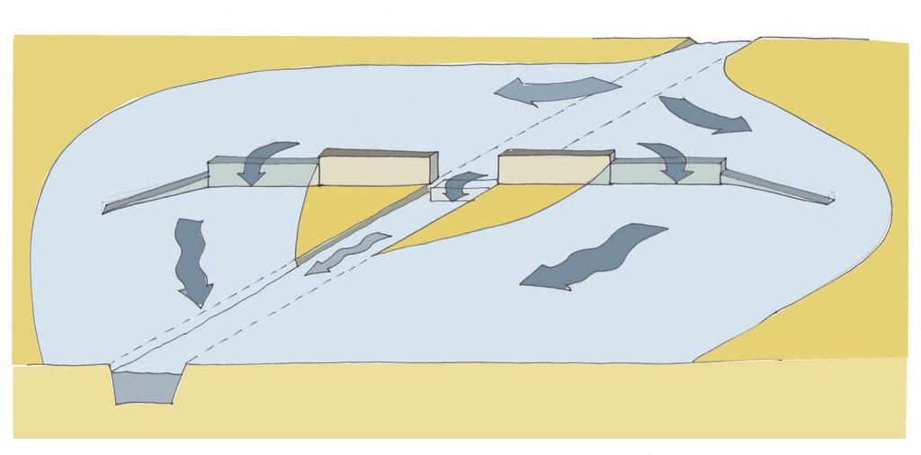
Water-spreading weirs are structures that span the entire width of a valley to spread floodwater over the adjacent land area.
2.2 وصف تفصيلي للتقنية
الوصف:
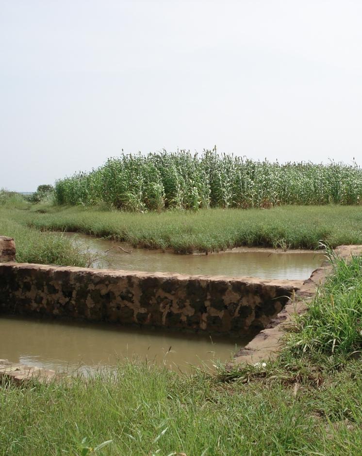
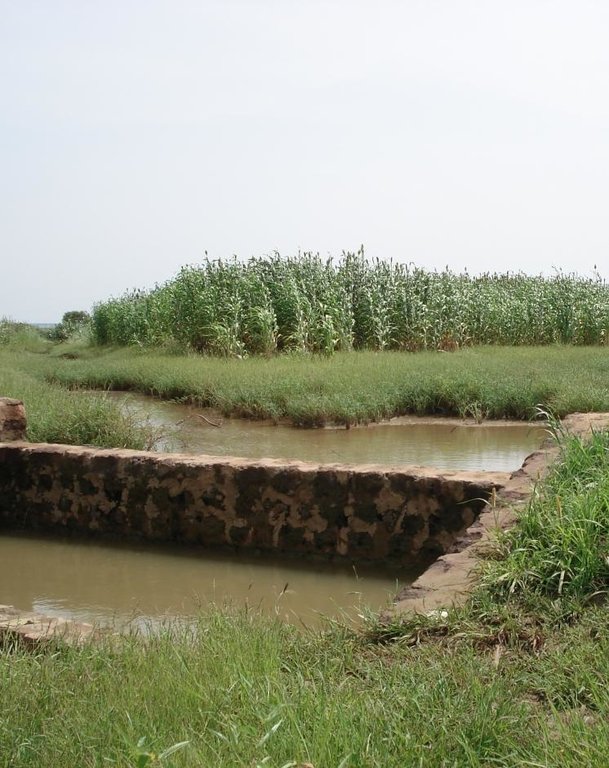
Over the last 12 years water-spreading weirs have been introduced and improved as a new rehabilitation technique for degraded dry valleys in Burkina Faso, Niger and Chad. In Chad 104 water-spreading weirs were constructed in the scope of the two development projects, initiated by the German Technical Cooperation (GIZ) and the Swiss Development Cooperation (SDC) in the 1990s. Water-spreading weirs are made of natural stones and cement, and consist of a spillway in the actual riverbed and lateral abutments and wings. Floodwaters are spread over the adjacent land area above the structure, where they eventually overflow the lateral wings and then slowly flow back towards the riverbed below the structure. As a result the land area below the weir is flooded. The lateral spreading of the water causes the land area above and below the structure to be flooded and supplies it with sediment. Water infiltrates, gullies in the valley are filled and the riverbed is raised. Thanks to the infiltration, the groundwater table also rises in a few years.
Purpose of the Technology: In dry valleys in which water flows in the rivers for only a few days a year, the weirs serve to distribute the incoming runoff over the valley floor and allow as much water as possible to infiltrate the soil. The aquifer is thus replenished and is then available for agricultural use. In contrast to the various types of dams, the goal of water-spreading weirs is not to create reservoirs for later use. What water-spreading weirs do is cause a temporary flooding of the adjacent land area above and below the weir. Depending on user preferences, the primary goal may be 1) agricultural use, 2) sylvo-pastoral use or 3) the replenishment and rising of the water table.
Establishment / maintenance activities and inputs: Water-spreading weirs require detailed technical planning and experienced engineering and construction firms. The bulk of the work is performed using local materials and by village craftsmen and helpers.
Natural / human environment: Compared to small impoundment dams, retention basins and microweirs, water-spreading weirs are especially well-suited for shallow, wide valleys that, due to severe gully erosion, are no longer inundated by small and medium
volume floodwaters. The flooding no longer takes place because the actual riverbed has been deeply eroded and enlarged. However, water-spreading weirs are also suitable for improving agricultural productivity in more or less intact valley floors. Water-spreading weirs are successful in regions where precipitation during the growing season is erratic and where the weirs ensure a more evenly distributed water supply for crops, as well as in zones in which water enrichment makes one or two additional growing seasons possible. At the present time they are in use in a broad area where annual rainfall ranges from 50 to 1,200 mm/year.
2.3 صور التقنية
2.5 البلد/المنطقة/المواقع التي تم تنفيذ التقنية فيها والتي يغطيها هذا التقييم
البلد:
تشاد
المنطقة/الولاية/المحافظة:
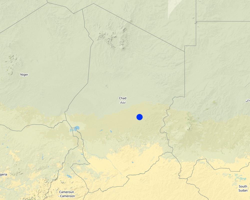
Eastern Chad
حدد انتشار التقنية:
- منتشرة بالتساوي على مساحة
إذا كانت المساحة الدقيقة غير معروفة، فيرجى الإشارة إلى المنطقة التقريبية المغطاة:
- 100-10 كم2
Map
×2.6 تاريخ التنفيذ
في حالة عدم معرفة السنة بالتحديد، يرجى الإشارة إلى التاريخ التقريبي:
- منذ 10-50 سنة
2.7 إدخال التقنية
حدد كيف تم إدخال التقنية:
- من خلال المشاريع/ التدخلات الخارجية
التعليقات (نوع المشروع، الخ):
The first water-spreading weirs were introduced during the 1990s in Chad through Swiss cooperation
3. تصنيف تقنية الإدارة المستدامي للأراضي
3.1 الغرض الرئيسي ( الأغراض الرئيسية) للتقنية
- تحسين الإنتاج
- الحد من تدهور الأراضي ومنعه وعكسه
3.2 نوع (أنواع) استخدام الأراضي الحالية حيث يتم تطبيق التقنية

الأراضي الزراعية
- زراعة سنوية

أراضي الرعي
الرعي الواسع النطاق:
- رعي شبه مرتحل
التعليقات:
Major land use problems (compiler’s opinion): Substantial degradation of drainage basins in the Sahel due to population growth and intense land-use pressure has been observed since the 1960s. Climate change has further amplified this trend. The expansion of agriculture and intensification of grazing and logging have caused the natural vegetation cover to decline. This process has been accelerated by severe droughts and has led to the degradation of the soils. Sparse vegetation cover and structurally damaged soils reduce rainfall infiltration into the soil, resulting in more runoff and soil erosion on plateaus and slopes. Runoff is concentrated in the valleys, in which heavy floodwaters
wash away fertile soils and lead to deep erosion of the riverbed. The annual, recurrent small and medium-size floods that normally cause temporary inundation of the valleys and deposition of fertile sediments no longer occur.
3.4 إمدادات المياه
أخرى (مثل ما بعد الفيضانات):
- Post-flooding
التعليقات:
Water supply: Also mixed rainfed - irrigated and rainfed
3.5 مجموعةالإدارة المستدامة للأراضي التي تنتمي إليها هذه التقنية
- التدابير المتقاطعة للمنحدرات
- إدارة الري (بما في ذلك إمدادات المياه والصرف الصحي)
- تحويل المياه والصرف
3.6 التدابير التقنية في مجال إلادارة المستدامة للأراضي

التدابير البنيوية
- S6: الجدران والحواجز وسياجات القش، والسياجات
3.7 الأنواع الرئيسية من تدهور الأراضي التي تناولتها التقنية

تآكل التربة بالمياه
- الوزن(Wt): فقدان التربة السطحية/تآكل السطح
- (Wg):الانجراف الخلجاني/ الخلجان

تدهور المياه
- (Hg): التغير في مستوى المياه الجوفية/الطبقة المائية الجوفية
التعليقات:
Main type of degradation addressed: Wt: loss of topsoil / surface erosion, Wg: gully erosion / gullying, Hg: change in groundwater / aquifer level
Main causes of degradation: soil management (abandonment of fallow periods), deforestation / removal of natural vegetation (incl. forest fires) (for agricultural expansion), over-exploitation of vegetation for domestic use, droughts, population pressure
Secondary causes of degradation: overgrazing
3.8 منع أو حد أو عكس تدهور الأراضي
تحديد هدف التقنية فيما يتعلق بتدهور الأراضي:
- الحد من تدهور الأراضي
- اصلاح/إعادة تأهيل الأراضي المتدهورة بشدة
التعليقات:
Main goals: rehabilitation / reclamation of denuded land
Secondary goals: mitigation / reduction of land degradation
4. المواصفات الفنية، وأنشطة التنفيذ، والمدخلات، والتكاليف
4.1 الرسم الفني للتقنية
4.3 أنشطة التأسيس
| النشاط | التوقيت (الموسم) | |
|---|---|---|
| 1. | Excavating the steps | |
| 2. | Excavating the wall foundations | |
| 3. | Pouring the foundations | |
| 4. | Building the walls | |
| 5. | Finishing the walls and filling the stilling basin |
4.4 التكاليف والمدخلات اللازمة للتأسيس
| تحديد المدخلات | الوحدة | الكمية | التكاليف لكل وحدة | إجمالي التكاليف لكل مدخل | % من التكاليف التي يتحملها مستخدمو الأراضي | |
|---|---|---|---|---|---|---|
| العمالة | Labour | ha | 1,0 | 750,0 | 750,0 | 100,0 |
| معدات | Total costs for equipment | ha | 1,0 | 750,0 | 750,0 | |
| مواد البناء | Stone | ha | 1,0 | 750,0 | 750,0 | |
| إجمالي تكاليف إنشاء التقنية | 2250,0 | |||||
4.6 التكاليف والمدخلات اللازمة للصيانة/للأنشطة المتكررة (سنويًا)
| تحديد المدخلات | الوحدة | الكمية | التكاليف لكل وحدة | إجمالي التكاليف لكل مدخل | % من التكاليف التي يتحملها مستخدمو الأراضي | |
|---|---|---|---|---|---|---|
| العمالة | Labour | ha | 1,0 | 50,0 | 50,0 | 100,0 |
| معدات | Total costs for equipment | ha | 1,0 | 50,0 | 50,0 | |
| مواد البناء | Stone | ha | 1,0 | 50,0 | 50,0 | |
| إجمالي تكاليف صيانة التقنية | 150,0 | |||||
التعليقات:
The costs were calculated per structure (one diversion weir). The length of the weir varies depending on the width of the valley it is constructed in. The weir has to span the whole valley which is usually between 100 and 1000 m wide.
5. البيئة الطبيعية والبشرية
5.1 المناخ
هطول الأمطار السنوي
- < 250 مم
- 251- 500 ملم
- 501 - 750ملم
- 1,000-751 ملم
- 1,500-1,100 ملم
- 2,000-1,500 ملم
- 3,000-2,001 ملم
- 4,000-3,100 ملم
- > 4000 ملم
المواصفات/التعليقات على هطول الأمطار:
251-500 mm Ranked 1
<250 mm Ranked 2
150-400 mm / year
المنطقة المناخية الزراعية
- شبه قاحلة
Thermal climate class: tropics
5.2 طوبوغرافيا
متوسط الانحدارات:
- مسطح (0-2%)
- بسيط (3-5%)
- معتدل (6-10%)
- متدحرج (11-15%)
- تلال (16-30%)
- شديدة الانحدار(31-60%)
- فائقة الانحدار (>60%)
التضاريس:
- هضاب/سهول
- أثلام مرتفعة
- المنحدرات الجبلية
- منحدرات التلال
- منحدرات في السفوح
- قاع الوادي
المنطقة الارتفاعية:
- 100-0 متر فوق سطح البحر
- 500-101 متر فوق سطح البحر
- 1,000-501 متر فوق سطح البحر
- 1,500-1,001 متر فوق سطح البحر
- 2,000-1,501 متر فوق سطح البحر
- 2,500-2,100 متر فوق سطح البحر
- 3,000-2,501 متر فوق سطح البحر
- 4,000-3,001 متر فوق سطح البحر
- > 4000 متر فوق سطح البحر
5.3 التربة
متوسط عمق التربة:
- ضحل جدًا (0-20 سم)
- ضحلة (21-50 سم)
- متوسطة العمق (51-80 سم)
- عميقة (81-120 سم)
- عميقة جدًا (> 120 سم)
قوام التربة (التربة السطحية):
- ناعم/ثقيل (طيني)
المواد العضوية في التربة السطحية:
- عالية (>3%)
- متوسطة (1-3%)
إذا كان متاحًا، قم بإرفاق وصف كامل للتربة أو تحديد المعلومات المتوفرة، على سبيل المثال نوع التربة، الرقم الهيدروجيني/ درجة حموضة التربة، قدرة التبادل الكاتيوني، النيتروجين، الملوحة وما إلى ذلك.
Soil fertility: High
Soil drainage/infiltration: Medium (ranked 1) and good (ranked 2)
Soil water storage capacity: Medium
5.4 توافر المياه ونوعيتها
منسوب المياه الجوفية:
50-5 م
توافر المياه السطحية:
ضعيف/ غير متوافر
نوعية المياه (غير المعالجة):
مياه شرب جيدة
تعليقات ومواصفات أخرى بشأن نوعية المياه وكميتها:
Availability of surface water: excess (during heavy rainfalls in the rainy season) or poor/ none (in the dry season)
5.5 التنوع البيولوجي
تنوع الأنواع:
- متوسط
5.6 خصائص مستخدمي الأراضي الذين يطبقون التقنية
التوجه السوقي لنظام الإنتاج:
- مختلط (كفاف/ تجاري)
الدخل من خارج المزرعة:
- أقل من % 10من كامل الدخل
المستوى النسبي للثروة:
- ضعيف
أفراداً أو مجموعات:
- المجموعات/ المجتمع المحلي
اذكر الخصائص الأخرى ذات الصلة لمستخدمي الأراضي:
Population density: < 10 persons/km2
70% of the land users are poor.
Market orientation: Mixed (rainfed crops are for subsistence, post-rainy season crops and irrigated crops (vegetables) mainly for market)
5.7 متوسط مساحة الأرض التي يستخدمها مستخدمو الأراضي الذين يطبقون التقنية
- < 0.5 هكتارا
- 0.5 - 1 هكتار
- 1 -2 هكتار
- 2 - 5 هكتار
- 5 - 15 هكتار
- 15 - 50 هكتار
- 50 - 100هكتار
- 500-100 هكتار
- 1,000-500 هكتار
- 10,000-1,000 هكتار
- > 10,000 هكتار
5.8 ملكية الأراضي، وحقوق استخدام الأراضي، وحقوق استخدام المياه
ملكية الارض:
- مجتمعي/قروي
حقوق استخدام الأراضي:
- مؤجر
التعليقات:
In Chad, only the rainfed fields are in private family ownership and inheritable. Reclaimed irrigated fields and vegetable production fields go back to the community and can be redistributed.
6. الآثار والتصريحات الختامية
6.1 الآثار التي أظهرتها التقنية في الموقع
الآثار الاجتماعية والاقتصادية
الإنتاج
إنتاج المحاصيل
الكمية قبل الإدارة المستدامة للأراضي:
158 kg/ha
الكمية بعد الإدارة المستدامة للأراضي:
653 kg/ha
التعليقات/ حدد:
Increase of millet yield in Chad
إنتاج الأعلاف
جودة العلف
إنتاج حيواني
الكمية قبل الإدارة المستدامة للأراضي:
6,000 cattle head
الكمية بعد الإدارة المستدامة للأراضي:
16,000 cattle heads
التعليقات/ حدد:
The increase in groundwater level has led to a significant increase in the number of cattle heads that can be watered
خطر فشل الإنتاج
تنوع المنتج
منطقة الإنتاج
الكمية قبل الإدارة المستدامة للأراضي:
2.85 ha
الكمية بعد الإدارة المستدامة للأراضي:
5.29 ha
التعليقات/ حدد:
The numbers are from a study on water-spreading weirs in Niger, but for Chad the situation is comparable
الدخل والتكاليف
دخل المزرعة
التعليقات/ حدد:
Users of water-spreading weirs had 112% higher incomes compared to farmers outside the impact zone from sales of vegetables and surplus grain
عبء العمل
التعليقات/ حدد:
The workload of women is eased thanks to the availability of and easier access to water due to the shallower water table
آثار اجتماعية واقتصادية أخرى
Income for the community
التعليقات/ حدد:
Temporary income was generated for the local workers during the weir construction. About 231 Euros per user family.
الآثار الاجتماعية والثقافية
الأمن الغذائي / الاكتفاء الذاتي
التعليقات/ حدد:
Food security assured through crop and livestock farming
الوضع الصحي
التعليقات/ حدد:
Children have a healthier, more diverse diet due to the vegetable production and the introduction of new crops
المؤسسات المجتمعية
التعليقات/ حدد:
The weirs are becoming an element of interaction and social integration for the inhabitants of surrounding villages
المعرفة بالإدارة المستدامة للأراضي/تدهور الأراضي
التعليقات/ حدد:
Through training
التخفيف من حدة الصراع
التعليقات/ حدد:
Decline in conflicts between farmers and livestock raisers over water rights owing to the fact that sufficient water is now available
وضع الفئات المحرومة اجتماعيا واقتصاديا
التعليقات/ حدد:
Temporary emigration to Sudan and Lybia has declined and in some villages people who had long since emigrated returned home
Diversification and creation of activities
التعليقات/ حدد:
In the vicinity of the weirs activities such as trading of agricultural products, fishing, watering livestock and making clay tiles have emerged
Training for weir construction
التعليقات/ حدد:
Numerous local masons were trained
Improved planning skills
التعليقات/ حدد:
Village people, service providers, communal representatives, government technical sectors have improved their skills in organisation, planning and implementation
Poverty
Poverty
الآثار الايكولوجية
دورة المياه / الجريان السطحي
كمية المياه
حصاد / جمع المياه
التعليقات/ حدد:
More and longer-lasting bodies of surface water
الجريان السطحي
مستوى المياه الجوفية/ الطبقة المائية الجوفية
التعليقات/ حدد:
In some communities groundwater has risen to a depth of 6m below surface
التربة
رطوبة التربة
فقدان التربة
التعليقات/ حدد:
Gullies are filled in
دورة المغذيات/إعادة الشحن
التعليقات/ حدد:
Deposition of nutrients
المادة العضوية في التربة/تحت الطبقة c
التعليقات/ حدد:
Deposition of organic matter
التنوع البيولوجي: الغطاء النباتي، الحيوانات
الكتلة الحيوية/ طبقة الكربون فوق التربة
التعليقات/ حدد:
Spread of natural vegetation around the rehabilitated valley plains
التنوع النباتي
التعليقات/ حدد:
Vanished plant species return
التنوع الحيواني
التعليقات/ حدد:
Vanished animal species return
تنوع الموائل
6.2 الآثار التي أظهرتها التقنية خارج الموقع
توافر المياه
الفيضان في اتجاه مجرى النهر
تراكم الطمي باتجاه مصب النهر
القدرة على التخفيف / الترشيح
6.3 تعرض التقنية وحساسيتها لتغير المناخ التدريجي والظواهر المتطرفة/الكوارث المرتبطة بالمناخ (كما يراها مستخدمو الأراضي)
تغير مناخ تدريجي
تغير مناخ تدريجي
| الموسم | زيادة أو نقصان | كيف تتعامل التقنية مع ذلك؟ | |
|---|---|---|---|
| درجة الحرارة السنوية | زيادة | جيدا |
الظواهر المتطرفة / الكوارث المرتبطة بالمناخ
الكوارث الجوية
| كيف تتعامل التقنية مع ذلك؟ | |
|---|---|
| عاصفة ممطرة محلية | جيدا |
| عاصفة هوائية محلية | جيدا |
الكوارث الهيدرولوجية
| كيف تتعامل التقنية مع ذلك؟ | |
|---|---|
| فيضان عام (نهر) | جيدا |
6.4 تحليل التكلفة والعائد
كيف يمكن مقارنة العوائد نسبة لتكاليف الإنشاء (من وجهة نظر مستخدمي الأراضي)؟
عوائد قصيرة الأجل:
سلبي
عوائد طويلة الأجل:
ايجابي جدا
كيف تتم مقارنة العوائدمع كلفة الصيانة/التكاليف المتكررة (من وجهة نظر مستخدمي الأراضي)؟
عوائد قصيرة الأجل:
إيجابي قليلا
عوائد طويلة الأجل:
ايجابي جدا
التعليقات:
Depending upon the users' experience and the availability of labour, it may take anywhere from 2 to 10 years before the rehabilitated land area reaches its optimum use potential.
6.5 اعتماد التقنية
من بين جميع الذين تبنوا التقنية، كم عدد الذين فعلوا ذلك بشكل تلقائي، أي دون تلقي أي حوافز مادية/مدفوعات؟:
- 10-0%
التعليقات:
100% of land user families have adopted the Technology with external material support
6000 land user families have adopted the Technology with external material support
Comments on acceptance with external material support: Between 4000 and 8000 households are direct beneficiaries of the construction of water-spreading weirs in Eastern Chad.
There is no trend towards spontaneous adoption of the Technology
Comments on adoption trend: It is unlikely that communities will be able to adopt this technology without external funding. Even for maintenance activities it remains to be seen if the communities will be capable of funding more extensive maintenance work with their low budgets.
6.7 نقاط القوة / المزايا / الفرص التي توفرها التقنية
| نقاط القوة/ المزايا/ الفرص من وجهة نظر جامع المعلومات أو غيره من الاشخاص الرئيسيين لمصدر المعلومات |
|---|
|
Through the construction of water-spreading weirs, soils are regularly flooded and supplied with water and sediment. Thus, the arable land area and the yields of the rainy season crops serving as staple food increase. How can they be sustained / enhanced? Ensure proper maintenance of the system. |
| The more frequent flooding of the soils results in increased infiltration, and the groundwater level rises substantially. |
|
Prior to rehabilitation, in most of the sites, it was only possible to grow a rainfed crop and perhaps an irrigated crop on some small areas of land. After, in addition to the rainfed crop grown on larger areas of land, it became possible to grow a post-rainy season crop (culture de contresaison) and, once the water table had risen, an irrigated crop (culture de décrue) as well. How can they be sustained / enhanced? Upscale water-spreading weirs to increase the number of people benefitting. |
|
Post-rainy season crops and irrigated crops diversify agricultural production. They are used as a means of earning cash income. How can they be sustained / enhanced? Improve access to markets. |
| With their capacity to regulate annual floodwaters and harness them to stabilise production, water-spreading weirs are an effective measure for adapting to climate change in regions experiencing increasing variability in rainfall. |
6.8 نقاط ضعف / مساوىء / مخاطر التقنية وسبل التغلب عليها
| نقاط الضعف/ المساوىء/ المخاطر من وجهة نظر جامع المعلومات أو غيره من الاشخاص الرئيسيين لمصدر المعلومات | كيف يمكن التغلب عليها؟ |
|---|---|
| It can be assumed that one third of the weirs will require complete renovation every 20 years | The renovation of these weirs can be done for approximately 10% of the initial construction costs |
| Maintenance of the weirs by the management committees is still a weak area. Funds expected from user fees for the plots are often inadequately collected and too low to cover costs. Some management committees lose their drive and neglect their duties. | New fundings sources have to be found and tapped. |
| In spite of the great potential for the use of water-spreading weirs and the very promising results, implementation will continue to depend in the medium term on outside funding, as it is unlikely that the communal budgets will be able to fund investments of this size. | The existing knowledge hast to be spread. |
| Know-how and experience for the construction of water-spreading weirs are still concentrated among a few countries. |
7. المراجع والروابط
7.1 طرق جمع/مصادر المعلومات
7.2 المراجع للمنشورات المتاحة
العنوان، المؤلف، السنة، النظام القياسي الدولي لترقيم الكتب ISBN:
Deutsche Gesellschaft für Internationale Zusammenarbeit (GIZ) (2011). Water-spreading weirs for the development of degraded dry river valleys. Experience from the Sahel. Frankfurt and Eschborn, GIZ and KFW.
متاح من أين؟كم التكلفة؟:
http://www.gtz.de/de/dokumente/giz2012-en-water-spreading-weirs-sahel.pdf
العنوان، المؤلف، السنة، النظام القياسي الدولي لترقيم الكتب ISBN:
Direction du développement et de la coopération DDC (2012). Gestion des eaux de ruissellement dans le Tchad sahélien. Bern, DDC.
متاح من أين؟كم التكلفة؟:
http://www.gopa.de/uploads/tx_bdojobopps/PRODOC_Tchad.pdf
الروابط والوحدات المواضيعية
توسيع الكل طي الكلالروابط
لا يوجد روابط
الوحدات المواضيعية
لا يوجد وحدات مواضيعية


