Area closure and reforestation with Acacia [Tunisia]
- Creation:
- Update:
- Compiler: Maarten De Boever
- Editor: –
- Reviewer: Fabian Ottiger
technologies_1568 - Tunisia
View sections
Expand all Collapse all1. General information
1.2 Contact details of resource persons and institutions involved in the assessment and documentation of the Technology
Key resource person(s)
SLM specialist:
Hamdi Lazar
Direction générale des fôrets
Avenue Alain Savary, Tunis
Tunisia
SLM specialist:
SLM specialist:
Name of the institution(s) which facilitated the documentation/ evaluation of the Technology (if relevant)
Direction générale des fôrets - TunisiaName of the institution(s) which facilitated the documentation/ evaluation of the Technology (if relevant)
Institut des Régions Arides de Médenine (Institut des Régions Arides de Médenine) - TunisiaName of the institution(s) which facilitated the documentation/ evaluation of the Technology (if relevant)
Ghent University (UGent) - Belgium1.3 Conditions regarding the use of data documented through WOCAT
When were the data compiled (in the field)?
23/04/2013
The compiler and key resource person(s) accept the conditions regarding the use of data documented through WOCAT:
Yes
2. Description of the SLM Technology
2.1 Short description of the Technology
Definition of the Technology:
Protection and reforestation of degraded arid lands in pre-Saharan Tunisia.
2.2 Detailed description of the Technology
Description:
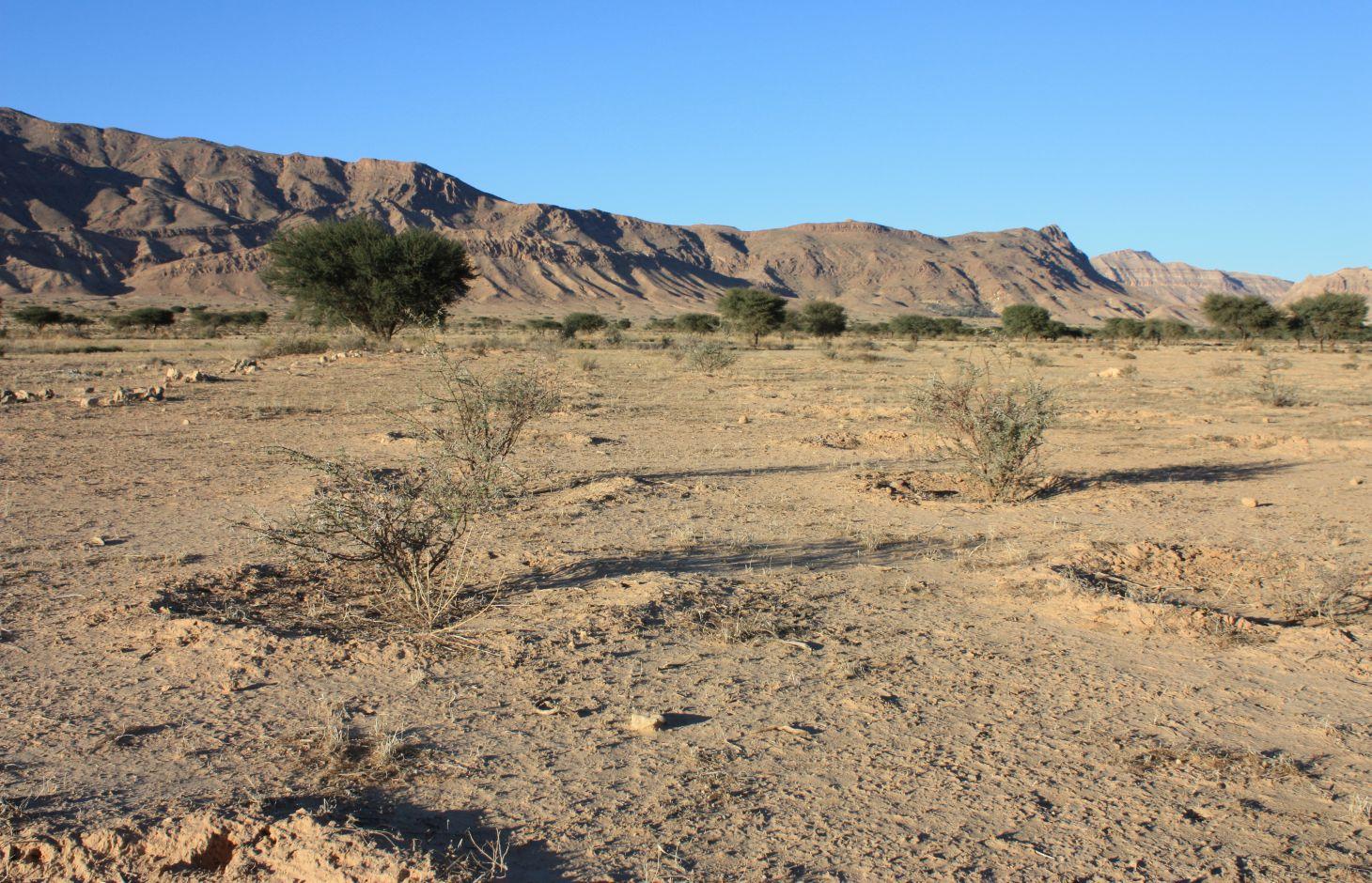
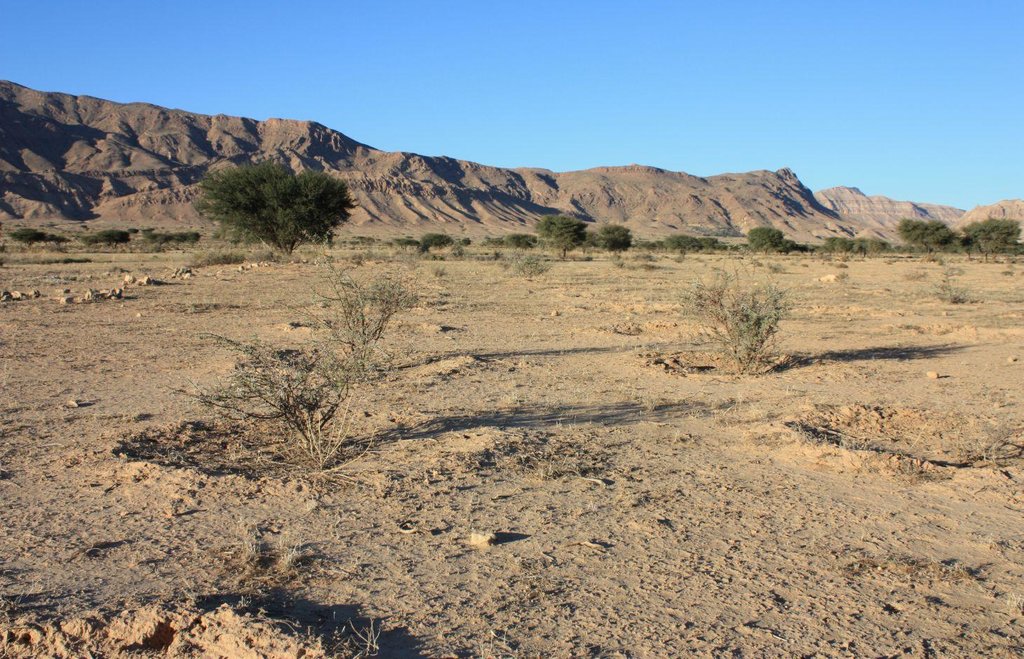
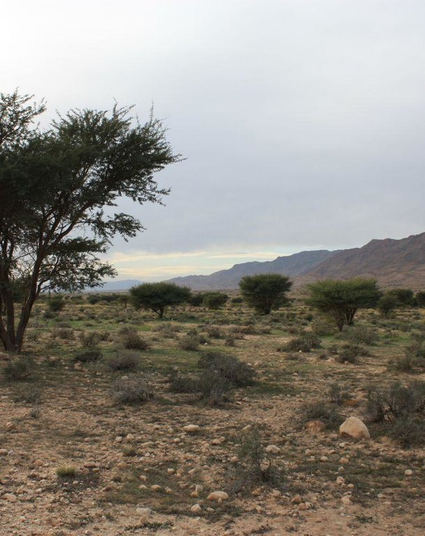
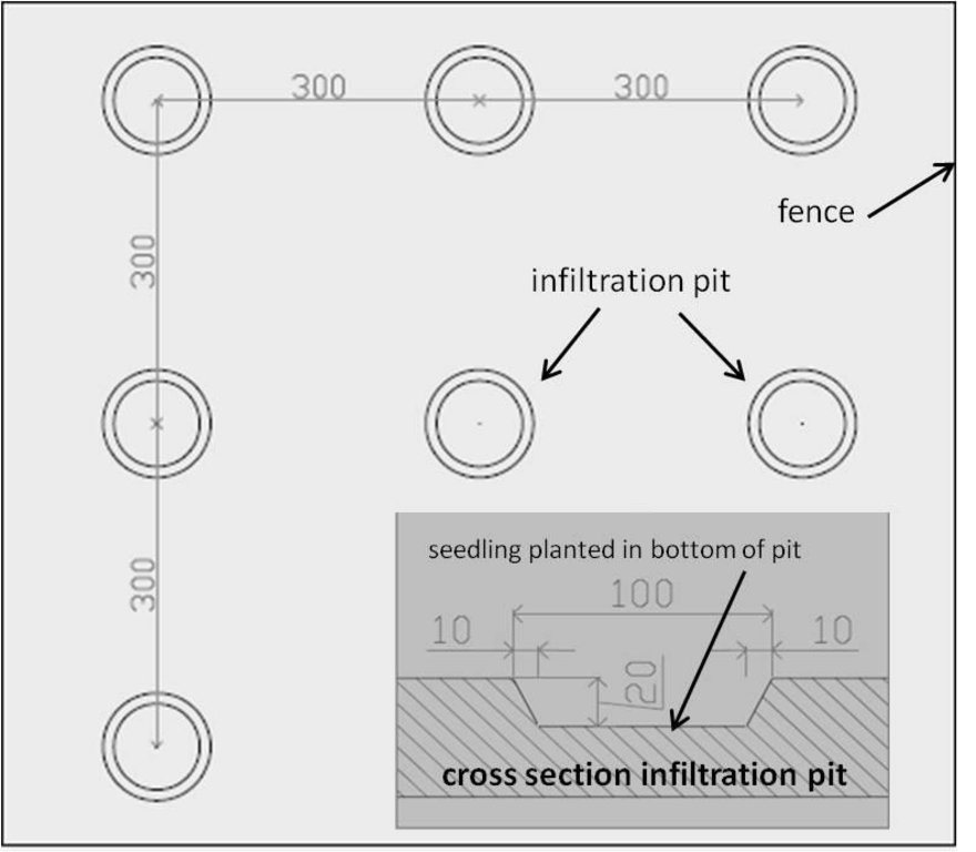
Protection and reforestation of degraded arid lands in central and southern Tunisia (Bled Talah region) with tree species Acacia tortilis subsp. raddiana. A. raddiana is a native trees species which is able to tolerate extreme droughts and to persist on the edge of the Sahara desert. Acacia plantations are set up following a 3m x 3m grid using seedlings of A. raddiana. Seedlings are planted in the bottom of infiltration pits which are constructed for rainwater harvesting. Protection of the plantation area is established by means of a fence.
Purpose of the Technology: The purpose of afforestation is the rehabilitation of degraded drylands and restoration of the original forest-steppe ecosystem in the Bled Talah region, which suffered for over a century from overexploitation of natural resources and intensification of agricultural activities. Focus is put on the synergy between the protection of the natural resources with the involvement of local people and the improvement of their livelihoods.
Establishment / maintenance activities and inputs: The protection of the Bled Talah region was initiated in 1936 and from then on several actions were undertaken such as the construction of a tree nursery and the creation of Integral Protection Zones through complete fencing. The Bled Talah area was designated as a UNESCO Biosphere Reserve in 1977. Bou Hedma National Park was officially created by the Ministry of Forests in 1980 covering an area of approximately 16.000 ha. The park consists of three Integral Protection Zones or core areas which are completely fenced, two agricultural zones and two buffer zones. Since the 1970s, several reforestation campaigns with A. raddiana are conducted in the Integral Protection Zones.
Natural / human environment: Arid Tunisia, i.e. the central and southern part of Tunisia, is characterized by an extremely irregular spatiotemporal rainfall pattern, a limited amount of rain (350 mm maximum per year), a limited number of days of rain (15 to 40 days a year) and a high average annual temperature (18 to 21 °C).
2.3 Photos of the Technology
2.5 Country/ region/ locations where the Technology has been applied and which are covered by this assessment
Country:
Tunisia
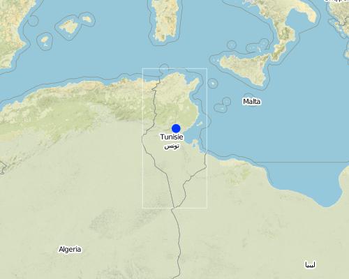
Region/ State/ Province:
Sidi Bouzid/Gafsa
Map
×2.6 Date of implementation
If precise year is not known, indicate approximate date:
- 10-50 years ago
2.7 Introduction of the Technology
Specify how the Technology was introduced:
- through projects/ external interventions
3. Classification of the SLM Technology
3.2 Current land use type(s) where the Technology is applied

Grazing land

Forest/ woodlands
Comments:
Major land use problems (compiler’s opinion): Overexploitation of natural resources such as tree cutting for fuelwood and intensification of agriculture such as intensive grazing of cattle lead to increased pressure on the environment causing severe degradation of the orginal ecosystem.
Major land use problems (land users’ perception): Less arable land and reduced fodder availability in the region.
Semi-nomadism / pastoralism: Yes
Selective felling of (semi-) natural forests: Yes
Forest products and services: timber, fuelwood, grazing / browsing
Future (final) land use (after implementation of SLM Technology): Forests / woodlands: Fp: Plantations, afforestations
If land use has changed due to the implementation of the Technology, indicate land use before implementation of the Technology:
Grazing land: Ge: Extensive grazing land
3.3 Further information about land use
Water supply for the land on which the Technology is applied:
- rainfed
Livestock density (if relevant):
> 100 LU /km2
3.4 SLM group to which the Technology belongs
- area closure (stop use, support restoration)
3.5 Spread of the Technology
Comments:
Total area covered by the SLM Technology is 165 m2.
3.6 SLM measures comprising the Technology

vegetative measures
- V1: Tree and shrub cover
- V2: Grasses and perennial herbaceous plants

structural measures
- S6: Walls, barriers, palisades, fences
Comments:
Main measures: vegetative measures, structural measures
Type of vegetative measures: aligned: -linear
3.7 Main types of land degradation addressed by the Technology

soil erosion by water
- Wt: loss of topsoil/ surface erosion

soil erosion by wind
- Et: loss of topsoil

chemical soil deterioration
- Cn: fertility decline and reduced organic matter content (not caused by erosion)

physical soil deterioration
- Pk: slaking and crusting

biological degradation
- Bc: reduction of vegetation cover
- Bs: quality and species composition/ diversity decline
- Bl: loss of soil life

water degradation
- Hg: change in groundwater/aquifer level
Comments:
Main type of degradation addressed: Et: loss of topsoil, Cn: fertility decline and reduced organic matter content, Bc: reduction of vegetation cover, Bs: quality and species composition /diversity decline, Bl: loss of soil life
Secondary types of degradation addressed: Wt: loss of topsoil / surface erosion, Pk: sealing and crusting, Hg: change in groundwater / aquifer level
Main causes of degradation: deforestation / removal of natural vegetation (incl. forest fires) (tree cutting for fuel), over-exploitation of vegetation for domestic use (fodder), overgrazing (intensive grazing), population pressure
Secondary causes of degradation: land tenure, poverty / wealth
3.8 Prevention, reduction, or restoration of land degradation
Comments:
Main goals: rehabilitation / reclamation of denuded land
Secondary goals: mitigation / reduction of land degradation
Third goals: prevention of land degradation
4. Technical specifications, implementation activities, inputs, and costs
4.1 Technical drawing of the Technology
4.2 Technical specifications/ explanations of technical drawing
Fenced plantation with Acacia trees on a 3m x 3m grid with cross section of infiltration pit (length given in cm)
Location: National Park Bou Hedma. Sidi Bouzid
Date: 2014-02-04
Technical knowledge required for field staff / advisors: high
Technical knowledge required for land users: moderate
Main technical functions: control of dispersed runoff: retain / trap, improvement of ground cover, improvement of surface structure (crusting, sealing), improvement of topsoil structure (compaction), stabilisation of soil (eg by tree roots against land slides), increase in organic matter, increase in nutrient availability (supply, recycling,…), increase of infiltration, increase / maintain water stored in soil, increase of biomass (quantity), promotion of vegetation species and varieties (quality, eg palatable fodder)
Secondary technical functions: control of raindrop splash, control of dispersed runoff: impede / retard, increase of surface roughness, improvement of water quality, buffering / filtering water, sediment retention / trapping, sediment harvesting, reduction in wind speed
Aligned: -linear
Vegetative material: T : trees / shrubs
Number of plants per (ha): 1000
Vertical interval between rows / strips / blocks (m): 3
Vertical interval within rows / strips / blocks (m): 3
Trees/ shrubs species: Acacia raddiana
Slope (which determines the spacing indicated above): 0%
Gradient along the rows / strips: 0%
Construction material (other): wire fence
4.3 General information regarding the calculation of inputs and costs
other/ national currency (specify):
Tunisian Dinar
Indicate exchange rate from USD to local currency (if relevant): 1 USD =:
1.65
Indicate average wage cost of hired labour per day:
6.00
4.4 Establishment activities
| Activity | Type of measure | Timing | |
|---|---|---|---|
| 1. | seed collection | Vegetative | June/July/August |
| 2. | tree nursery | Vegetative | July/August |
| 3. | plantation | Vegetative | rainy season (sept-->dec) |
| 4. | installation fence | Structural | 1 day |
4.5 Costs and inputs needed for establishment
| Specify input | Unit | Quantity | Costs per Unit | Total costs per input | % of costs borne by land users | |
|---|---|---|---|---|---|---|
| Labour | Labour | ha | 1.0 | 330.0 | 330.0 | |
| Construction material | Iron wire fence | ha | 1.0 | 1600.0 | 1600.0 | |
| Construction material | iron poles | ha | 1.0 | 800.0 | 800.0 | |
| Total costs for establishment of the Technology | 2730.0 | |||||
Comments:
Duration of establishment phase: 8 month(s)
4.6 Maintenance/ recurrent activities
| Activity | Type of measure | Timing/ frequency | |
|---|---|---|---|
| 1. | follow up plantation (irrigation) | Vegetative | weekly 1 day by 2 workers for 1 year |
4.7 Costs and inputs needed for maintenance/ recurrent activities (per year)
| Specify input | Unit | Quantity | Costs per Unit | Total costs per input | % of costs borne by land users | |
|---|---|---|---|---|---|---|
| Labour | Labour | ha | 1.0 | 30.0 | 30.0 | |
| Total costs for maintenance of the Technology | 30.0 | |||||
Comments:
The above costs were calculated for the establishment of a 1 ha fenced plantation with 1000 seedlings on a 3m x 3m grid. From collecting seeds to planting of the seedlings and fencing the plantation it takes about 8 months. Irrigation through the first year after planting is done to ensure survival of the seedlings.
4.8 Most important factors affecting the costs
Describe the most determinate factors affecting the costs:
The most determinate factor affecting the costs is tree nursing. This factor is not only labour intersive but also high in water demand.
5. Natural and human environment
5.1 Climate
Annual rainfall
- < 250 mm
- 251-500 mm
- 501-750 mm
- 751-1,000 mm
- 1,001-1,500 mm
- 1,501-2,000 mm
- 2,001-3,000 mm
- 3,001-4,000 mm
- > 4,000 mm
Specifications/ comments on rainfall:
Rainy season September-December
Agro-climatic zone
- arid
Thermal climate class: subtropics
5.2 Topography
Slopes on average:
- flat (0-2%)
- gentle (3-5%)
- moderate (6-10%)
- rolling (11-15%)
- hilly (16-30%)
- steep (31-60%)
- very steep (>60%)
Landforms:
- plateau/plains
- ridges
- mountain slopes
- hill slopes
- footslopes
- valley floors
Altitudinal zone:
- 0-100 m a.s.l.
- 101-500 m a.s.l.
- 501-1,000 m a.s.l.
- 1,001-1,500 m a.s.l.
- 1,501-2,000 m a.s.l.
- 2,001-2,500 m a.s.l.
- 2,501-3,000 m a.s.l.
- 3,001-4,000 m a.s.l.
- > 4,000 m a.s.l.
5.3 Soils
Soil depth on average:
- very shallow (0-20 cm)
- shallow (21-50 cm)
- moderately deep (51-80 cm)
- deep (81-120 cm)
- very deep (> 120 cm)
Soil texture (topsoil):
- coarse/ light (sandy)
- medium (loamy, silty)
Topsoil organic matter:
- medium (1-3%)
- low (<1%)
If available, attach full soil description or specify the available information, e.g. soil type, soil PH/ acidity, Cation Exchange Capacity, nitrogen, salinity etc.
Soil texture: coarse/medium (loamy sand/sandy loam)
Soil fertility is low
Soil drainage/infiltration is medium - poor
Soil water storage is low - medium
5.4 Water availability and quality
Ground water table:
5-50 m
Availability of surface water:
poor/ none
Water quality (untreated):
for agricultural use only (irrigation)
5.5 Biodiversity
Species diversity:
- medium
5.6 Characteristics of land users applying the Technology
Market orientation of production system:
- subsistence (self-supply)
- mixed (subsistence/ commercial
Off-farm income:
- 10-50% of all income
Relative level of wealth:
- poor
Individuals or groups:
- employee (company, government)
Gender:
- men
Indicate other relevant characteristics of the land users:
Land users applying the Technology are mainly Leaders / privileged
Difference in the involvement of women and men: Mainly men are involved because the establishment of a plantation is labour intensive.
Population density: < 10 persons/km2
Annual population growth: 2% - 3%
5.7 Average area of land owned or leased by land users applying the Technology
- < 0.5 ha
- 0.5-1 ha
- 1-2 ha
- 2-5 ha
- 5-15 ha
- 15-50 ha
- 50-100 ha
- 100-500 ha
- 500-1,000 ha
- 1,000-10,000 ha
- > 10,000 ha
Is this considered small-, medium- or large-scale (referring to local context)?
- large-scale
Comments:
Average area of land owned or leased by land users applying the Technology: < 0.5 ha, < 0.5 ha, 0.5-1 ha, 1-2 ha
5.8 Land ownership, land use rights, and water use rights
Land ownership:
- group
- individual, titled
Land use rights:
- individual
Water use rights:
- communal (organized)
5.9 Access to services and infrastructure
health:
- poor
- moderate
- good
education:
- poor
- moderate
- good
technical assistance:
- poor
- moderate
- good
employment (e.g. off-farm):
- poor
- moderate
- good
markets:
- poor
- moderate
- good
energy:
- poor
- moderate
- good
roads and transport:
- poor
- moderate
- good
drinking water and sanitation:
- poor
- moderate
- good
financial services:
- poor
- moderate
- good
6. Impacts and concluding statements
6.1 On-site impacts the Technology has shown
Socio-economic impacts
Production
fodder production
fodder quality
wood production
production area
Income and costs
farm income
Socio-cultural impacts
food security/ self-sufficiency
SLM/ land degradation knowledge
conflict mitigation
Improved livelihoods and human well-being
Comments/ specify:
The technology improves the livelihoods of local people directly through income generation from employment in the park and indirectly by the improvement of climatological conditions in the neighbourhood of the park.
Ecological impacts
Water cycle/ runoff
harvesting/ collection of water
surface runoff
excess water drainage
groundwater table/ aquifer
evaporation
Soil
soil moisture
soil cover
soil loss
soil crusting/ sealing
soil compaction
soil organic matter/ below ground C
Biodiversity: vegetation, animals
biomass/ above ground C
plant diversity
habitat diversity
Climate and disaster risk reduction
emission of carbon and greenhouse gases
6.2 Off-site impacts the Technology has shown
buffering/ filtering capacity
wind transported sediments
6.3 Exposure and sensitivity of the Technology to gradual climate change and climate-related extremes/ disasters (as perceived by land users)
Gradual climate change
Gradual climate change
| Season | Type of climatic change/ extreme | How does the Technology cope with it? | |
|---|---|---|---|
| annual temperature | increase | well |
Climate-related extremes (disasters)
Meteorological disasters
| How does the Technology cope with it? | |
|---|---|
| local windstorm | well |
Climatological disasters
| How does the Technology cope with it? | |
|---|---|
| drought | not well |
Other climate-related consequences
Other climate-related consequences
| How does the Technology cope with it? | |
|---|---|
| reduced growing period | not well |
6.4 Cost-benefit analysis
How do the benefits compare with the establishment costs (from land users’ perspective)?
Short-term returns:
neutral/ balanced
Long-term returns:
slightly positive
How do the benefits compare with the maintenance/ recurrent costs (from land users' perspective)?
Short-term returns:
neutral/ balanced
Long-term returns:
neutral/ balanced
6.5 Adoption of the Technology
Of all those who have adopted the Technology, how many have did so spontaneously, i.e. without receiving any material incentives/ payments?
- 0-10%
Comments:
Comments on acceptance with external material support: Until now no land users have implemented the technology because the government does not provide any incentives/subsidies.
There is no trend towards spontaneous adoption of the Technology
6.7 Strengths/ advantages/ opportunities of the Technology
| Strengths/ advantages/ opportunities in the compiler’s or other key resource person’s view |
|---|
|
protection (less soil degradation) and rehabilitation of the natural ecosystem How can they be sustained / enhanced? involvement of local people |
|
direct and indirect improvement of the livelihoods of local people How can they be sustained / enhanced? awareness raising |
|
improved soil carbon stocks How can they be sustained / enhanced? maintenance of existing and establishment of new plantations |
|
increased biodiversity (trees act as fertility islands facilitating the growth of ground cover plants) How can they be sustained / enhanced? maintenance of existing and establishment of new plantations |
6.8 Weaknesses/ disadvantages/ risks of the Technology and ways of overcoming them
| Weaknesses/ disadvantages/ risks in the compiler’s or other key resource person’s view | How can they be overcome? |
|---|---|
| no tree planting initiatives undertaken by local people | incentives/subsidies from government |
| no public awareness of importance to conserve natural resources | set up of a large educational program with regular activities in the park and further elaboration of the small ecological museum |
Links and modules
Expand all Collapse allLinks
No links
Modules
No modules


