Wind forest strips for land protection against wind erosion on sandy soils [Tajikistan]
- Creation:
- Update:
- Compiler: Aslam Qadamov
- Editor: –
- Reviewers: David Streiff, Alexandra Gavilano
technologies_1451 - Tajikistan
- Full summary as PDF
- Full summary as PDF for print
- Full summary in the browser
- Full summary (unformatted)
- Wind forest strips for land protection against wind erosion on sandy soils: March 14, 2017 (inactive)
- Wind forest strips for land protection against wind erosion on sandy soils: July 19, 2017 (inactive)
- Wind forest strips for land protection against wind erosion on sandy soils: Aug. 21, 2019 (inactive)
- Wind forest strips for land protection against wind erosion on sandy soils: Nov. 2, 2021 (public)
View sections
Expand all Collapse all1. General information
1.2 Contact details of resource persons and institutions involved in the assessment and documentation of the Technology
SLM specialist:
Kosumbekov Ahoyatbek
Name of the institution(s) which facilitated the documentation/ evaluation of the Technology (if relevant)
Forestry Department of GBAO - TajikistanName of the institution(s) which facilitated the documentation/ evaluation of the Technology (if relevant)
Pamir Biological Institute (Pamir Biological Institute) - Tajikistan1.3 Conditions regarding the use of data documented through WOCAT
When were the data compiled (in the field)?
09/04/2011
The compiler and key resource person(s) accept the conditions regarding the use of data documented through WOCAT:
Yes
2. Description of the SLM Technology
2.1 Short description of the Technology
Definition of the Technology:
Establishment of an 8-row shelterbelt consisting of different varieties of willow, poplar and sea-buckthorn to protect irrigated cropland with poor quality soil in the high Pamir region from wind erosion.
2.2 Detailed description of the Technology
Description:
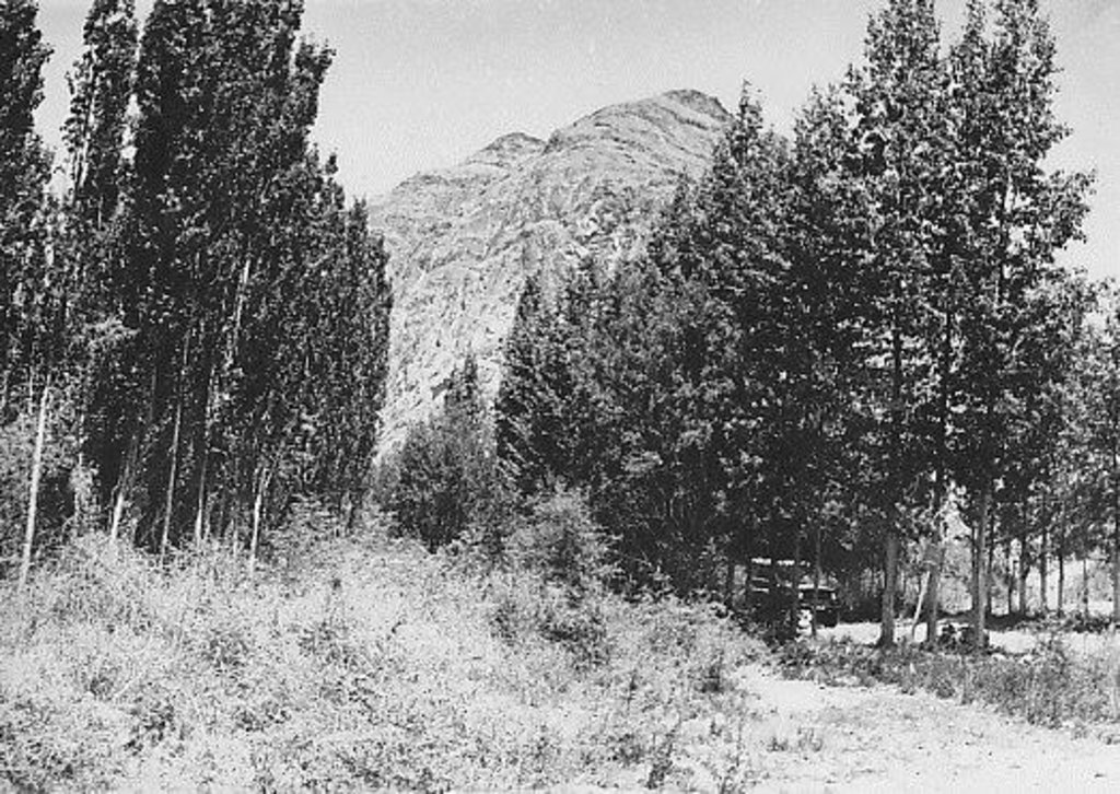
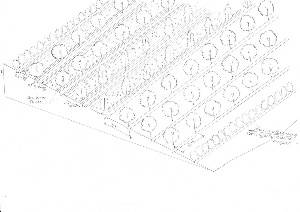
The 24m wide shelterbelt consists of eight rows of trees. Three plots, 50m wide and 350m long were left in-between the trees to intercrop with lucerne and other perennial herbs. Thus, the total area which includes the shelterbelts, meadows and irrigation ditches makes up nearly 10 ha. The shelterbelt was established perpendicular to the direction of the strong winds. Past trials have shown that under the harsh climatic conditions of the Pamir region, shelterbelts in sandy and pebbly areas should include at least eight rows of trees and shrubs.
Purpose of the Technology: The purpose of this technology was to intercrop the shelterbelts with lucerne in order to help protect crops from wind erosion.
Establishment / maintenance activities and inputs: Shelterbelts were planted by hand, not using any machinery. Trees and shrubs were planted in accordance with their physiological characteristics and their tolerance to deflation. The eight rows were planted in the following order: 1st row: sea-buckthorn, 2nd: Shugnan willows, 3rd: Thuran willows, 4th: Pamir poplars, 5th: Bolle's poplars, 6th: Wilhelm’s willows, 7th: Shugnan willows and 8th: Sea Buckthorn. The distance between trees in each row was 4m. Willows and poplars were planted as cuttings, around 1.5–3m in length cut off at the point at which the diameter of the base was around 6cm. Sea buckthorn was planted as seeds at a depth of 4-6cm. Horizontal planting, which increases the growth by 25%, was used instead of vertical planting. The trees were planted between late March and early April. Furrow irrigation ditches were dug before the actual planting of the trees. The irrigation ditches were 0.3m deep and 0.5m wide. The plot was then watered before the actual planting of the trees and the Lucerne, to increase the soil moisture and improve the subsequent growth of the trees. Further watering of the area was carried out every 4-7 days depending on the weather conditions and levels of moisture in the soil. These willow and poplar trees can be pruned 5-6 years after the initial planting. At this stage the branches will be 1-3 m long and can be used by the local population.
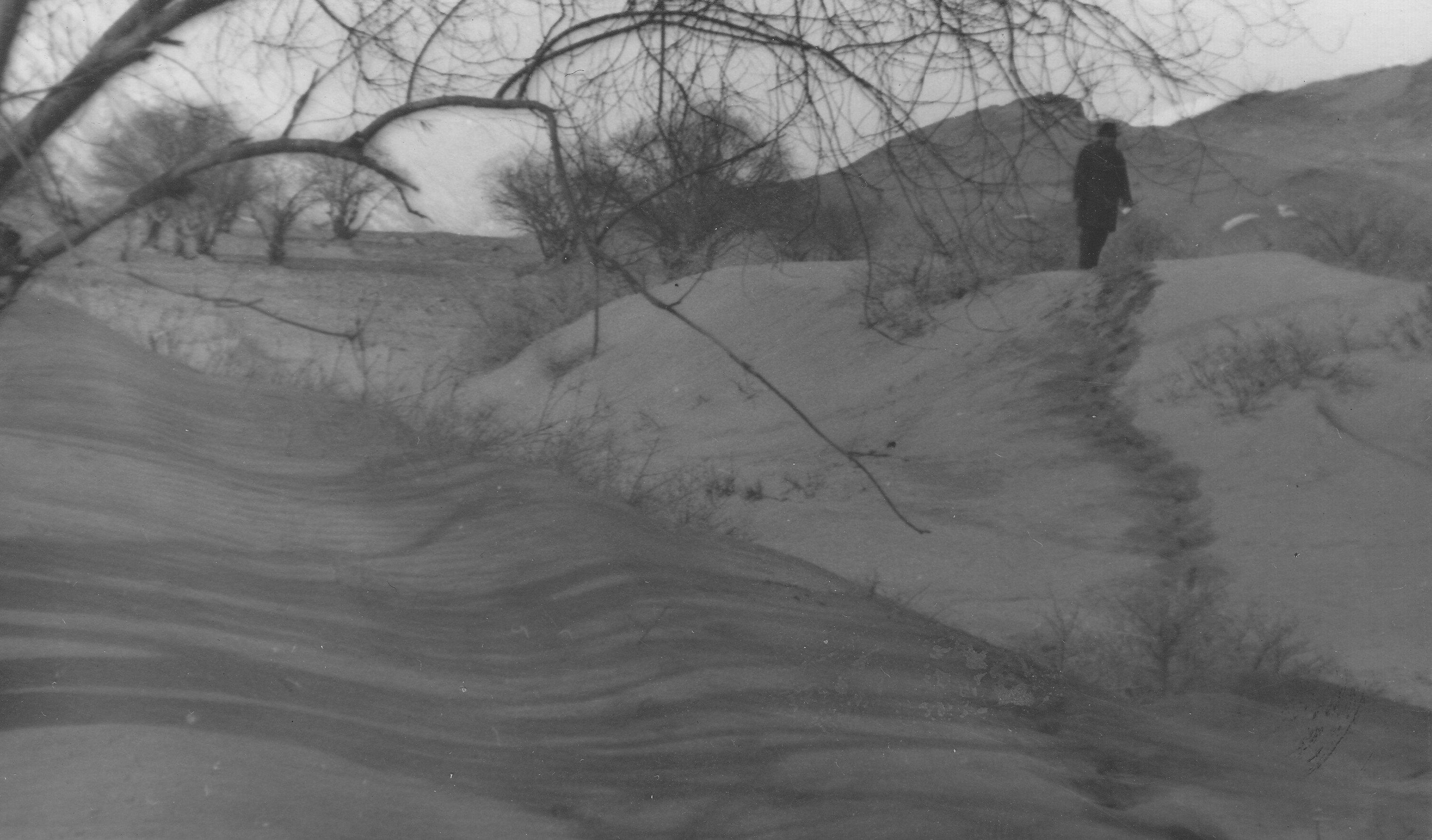
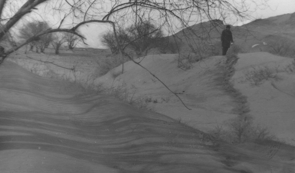
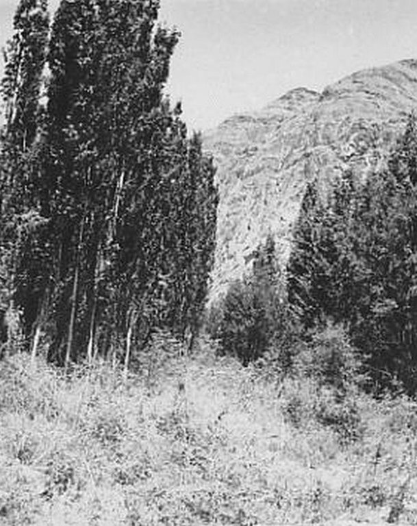
Natural / human environment: The plot is located in an arid zone which has sandy and pebbly soil with low fertility. Initially this area was covered by Tugai forest and used as grazing land as well as for timber production. However, as a result of deforestation, the land in this area has become highly unstable and poses a threat to the irrigated lands upslope. 80% of the soil consists of stones and sand. Vegetation cover is mainly composed of sagebrush deserts. These shelterbelts were established during Soviet times and when the civil war broke out after independence, many of the poplar trees were cut down by the local population for construction- and firewood. Therefore only parts of the original shelterbelts are still in place today.
2.3 Photos of the Technology
2.5 Country/ region/ locations where the Technology has been applied and which are covered by this assessment
Country:
Tajikistan
Region/ State/ Province:
GBAO
Further specification of location:
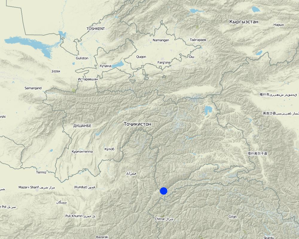
Ishkashim
Comments:
Boundary points of the Technology area: 36.40.46 - 71.47.28 36.40.37 - 71.47.26 36.4051 - 71.47.01 36.40.36 - 71.47.02
Map
×2.6 Date of implementation
If precise year is not known, indicate approximate date:
- more than 50 years ago (traditional)
2.7 Introduction of the Technology
Specify how the Technology was introduced:
- during experiments/ research
Comments (type of project, etc.):
58 years ago
3. Classification of the SLM Technology
3.1 Main purpose(s) of the Technology
- reduce, prevent, restore land degradation
3.2 Current land use type(s) where the Technology is applied

Cropland
- Annual cropping
- Perennial (non-woody) cropping
- Tree and shrub cropping
Main crops (cash and food crops):
major cash crop: potato, alfa alfa, poplar
major food crop: potato, alfa alfa, poplar
other: carrot, onion, cabbage and willow

Forest/ woodlands
Products and services:
- Fuelwood
- Fruits and nuts
- Grazing/ browsing
- Nature conservation/ protection
- Protection against natural hazards
Comments:
Major land use problems (compiler’s opinion): land loss, soil fertility decrease, desertification of the area, poverty,
Major land use problems (land users’ perception): land degradation, land fertility decrease, deforestation, poverty
Plantation forestry: Yes
Forest products and services: fuelwood, fruits and nuts, grazing / browsing, nature conservation / protection, protection against natural hazards
Future (final) land use (after implementation of SLM Technology): Forests / woodlands: Fp: Plantations, afforestations
Livestock is grazing on crop residues
If land use has changed due to the implementation of the Technology, indicate land use before implementation of the Technology:
Other: Oo: Other: wastelands, deserts, glaciers, swamps, recreation areas, etc
3.3 Further information about land use
Water supply for the land on which the Technology is applied:
- full irrigation
Number of growing seasons per year:
- 1
Specify:
Longest growing period in days: 150Longest growing period from month to month: from May to September
3.4 SLM group to which the Technology belongs
- windbreak/ shelterbelt
- improved ground/ vegetation cover
3.5 Spread of the Technology
Comments:
Total area covered by the SLM Technology is 0.1 m2.
about 10 ha
3.6 SLM measures comprising the Technology

agronomic measures
- A1: Vegetation/ soil cover

vegetative measures
- V1: Tree and shrub cover

structural measures
- S11: Others

management measures
- M1: Change of land use type
Comments:
Main measures: vegetative measures
Type of vegetative measures: aligned: -against wind, aligned: -linear
3.7 Main types of land degradation addressed by the Technology

soil erosion by wind
- Ed: deflation and deposition
Comments:
Main type of degradation addressed: Ed: deflation and deposition
Main causes of degradation: deforestation / removal of natural vegetation (incl. forest fires) (excessive cutting of natural trees and shrubs), wind storms / dust storms (during the wind storm sand covers the cultivated lands), land tenure (more of the forests destroyed in transition period), poverty / wealth (shortage of electricity was the main reason of forest degradation)
Secondary causes of degradation: over-exploitation of vegetation for domestic use (grass was used for livestock), overgrazing (overgrazing of the natural forests by livestock)
3.8 Prevention, reduction, or restoration of land degradation
Specify the goal of the Technology with regard to land degradation:
- reduce land degradation
- restore/ rehabilitate severely degraded land
Comments:
Main goals: prevention of land degradation
Secondary goals: mitigation / reduction of land degradation, rehabilitation / reclamation of denuded land
4. Technical specifications, implementation activities, inputs, and costs
4.1 Technical drawing of the Technology
4.2 Technical specifications/ explanations of technical drawing
Восьмирядная лесополоса из тополей, ивы и облепихи устраиваеться против направления господствуюших ветров. Первый ряд состоит из облепихи которая очень устойчива к воздействии пыльных бур. В междурядья в тыльной части высеиыается люцерна.
Location: GBAO. Ishkashim
Date: 20.04.2011
Technical knowledge required for field staff / advisors: moderate (All the works are simple for implementaton)
Technical knowledge required for land users: moderate (All the works are simple for implementaton)
Main technical functions: improvement of ground cover, improvement of surface structure (crusting, sealing), improvement of topsoil structure (compaction), stabilisation of soil (eg by tree roots against land slides), increase in nutrient availability (supply, recycling,…), reduction in wind speed, increase of biomass (quantity), promotion of vegetation species and varieties (quality, eg palatable fodder), spatial arrangement and diversification of land use
Secondary technical functions: increase of surface roughness, improvement of subsoil structure (hardpan), increase in organic matter, increase of infiltration, increase / maintain water stored in soil, increase of groundwater level / recharge of groundwater
Aligned: -against wind
Vegetative material: T : trees / shrubs
Number of plants per (ha): 390
Vertical interval between rows / strips / blocks (m): 1
Spacing between rows / strips / blocks (m): 6
Vertical interval within rows / strips / blocks (m): 3
Aligned: -linear
Vegetative material: G : grass
Number of plants per (ha): 20 kg seeds
Width within rows / strips / blocks (m): 4
Trees/ shrubs species: sea-buckthorns, willows and poplars
Perennial crops species: alfa alfa
Grass species: alfa alfa
Slope (which determines the spacing indicated above): 0.00%
If the original slope has changed as a result of the Technology, the slope today is (see figure below): 0.00%
Gradient along the rows / strips: 0.20%
4.3 General information regarding the calculation of inputs and costs
Specify currency used for cost calculations:
- US Dollars
Indicate average wage cost of hired labour per day:
3.00
4.4 Establishment activities
| Activity | Type of measure | Timing | |
|---|---|---|---|
| 1. | digging of pits for tree planting | Vegetative | first year |
| 2. | planting of trees | Vegetative | first year |
| 3. | sowing of the alfa-alfa in drills | Vegetative | every 5 years |
| 4. | construction of irrigation canals | Vegetative |
4.5 Costs and inputs needed for establishment
| Specify input | Unit | Quantity | Costs per Unit | Total costs per input | % of costs borne by land users | |
|---|---|---|---|---|---|---|
| Labour | Digging of pits for tree | Persons/day | 10.0 | 18.0 | 180.0 | 100.0 |
| Labour | Planting of trees | Persons/day | 10.0 | 10.0 | 100.0 | 100.0 |
| Labour | Sowing of the alfa-alfa in drills | Persons/day | 8.0 | 3.125 | 25.0 | 100.0 |
| Labour | Construction of irrigation canals | Persons/day | 15.0 | 15.0 | 225.0 | 100.0 |
| Equipment | Shovels and other tools | pieces | 30.0 | 1.0 | 30.0 | |
| Plant material | Seedling | pieces | 400.0 | 0.11 | 44.0 | |
| Plant material | Alfalfa sees | kg | 20.0 | 0.65 | 13.0 | |
| Fertilizers and biocides | Fertilizer | kg | 45.0 | 2.244444 | 101.0 | |
| Total costs for establishment of the Technology | 718.0 | |||||
Comments:
Duration of establishment phase: 1 month(s)
4.6 Maintenance/ recurrent activities
| Activity | Type of measure | Timing/ frequency | |
|---|---|---|---|
| 1. | sanitary cutting and pruning | Vegetative | every year |
| 2. | cutting of alfa alfa | Vegetative | three times per year |
| 3. | maintenance of the irrigation system | Vegetative | every year |
4.7 Costs and inputs needed for maintenance/ recurrent activities (per year)
| Specify input | Unit | Quantity | Costs per Unit | Total costs per input | % of costs borne by land users | |
|---|---|---|---|---|---|---|
| Labour | Sanitary cutting and pruning | Persons/day | 3.0 | 3.333 | 10.0 | 100.0 |
| Labour | Cutting of alfa alfa | Persons/day | 5.0 | 12.0 | 60.0 | 100.0 |
| Labour | Maintenance of the irrigation system | Persons/day | 2.0 | 22.5 | 45.0 | 100.0 |
| Equipment | Scissors | pieces | 3.0 | 10.0 | 30.0 | |
| Equipment | Tools | pieces | 7.0 | 1.0 | 7.0 | |
| Total costs for maintenance of the Technology | 152.0 | |||||
Comments:
wind breakes and grass strips
4.8 Most important factors affecting the costs
Describe the most determinate factors affecting the costs:
seeds and seedlings cost
5. Natural and human environment
5.1 Climate
Annual rainfall
- < 250 mm
- 251-500 mm
- 501-750 mm
- 751-1,000 mm
- 1,001-1,500 mm
- 1,501-2,000 mm
- 2,001-3,000 mm
- 3,001-4,000 mm
- > 4,000 mm
Specifications/ comments on rainfall:
average annual rainfall - 110 mm, during winter - spring times, 5 - 6 month of dry time
Agro-climatic zone
- arid
Thermal climate class: boreal. 3 months below 5°C and 6 months above 5°C
5.2 Topography
Slopes on average:
- flat (0-2%)
- gentle (3-5%)
- moderate (6-10%)
- rolling (11-15%)
- hilly (16-30%)
- steep (31-60%)
- very steep (>60%)
Landforms:
- plateau/plains
- ridges
- mountain slopes
- hill slopes
- footslopes
- valley floors
Altitudinal zone:
- 0-100 m a.s.l.
- 101-500 m a.s.l.
- 501-1,000 m a.s.l.
- 1,001-1,500 m a.s.l.
- 1,501-2,000 m a.s.l.
- 2,001-2,500 m a.s.l.
- 2,501-3,000 m a.s.l.
- 3,001-4,000 m a.s.l.
- > 4,000 m a.s.l.
Comments and further specifications on topography:
Altitudinal zone is 2600 m
Slopes on average are 10 - 14°
5.3 Soils
Soil depth on average:
- very shallow (0-20 cm)
- shallow (21-50 cm)
- moderately deep (51-80 cm)
- deep (81-120 cm)
- very deep (> 120 cm)
Soil texture (topsoil):
- medium (loamy, silty)
Topsoil organic matter:
- low (<1%)
If available, attach full soil description or specify the available information, e.g. soil type, soil PH/ acidity, Cation Exchange Capacity, nitrogen, salinity etc.
Soil texture consists of about 70% of sand and 30% of clay
Soil fertility is low, with humus about 0.2 - 0.3 %
Soil drainage / infiltration is medium and during the summer time soil waters rise up to 1m from top soil
Soil water storage capacity is low because of the sandy soil
5.4 Water availability and quality
Ground water table:
< 5 m
Availability of surface water:
good
Water quality (untreated):
good drinking water
Comments and further specifications on water quality and quantity:
Availability of surface water also medium, but good water availibility during vegetation time
Water quality (untreated) is good because water comes from glaciers
5.5 Biodiversity
Species diversity:
- medium
5.6 Characteristics of land users applying the Technology
Market orientation of production system:
- mixed (subsistence/ commercial
Off-farm income:
- less than 10% of all income
Relative level of wealth:
- very poor
- poor
Individuals or groups:
- groups/ community
Level of mechanization:
- animal traction
- mechanized/ motorized
Gender:
- women
- men
Indicate other relevant characteristics of the land users:
Land users applying the Technology are mainly common / average land users
Population density: < 10 persons/km2
Annual population growth: 0.5% - 1%
10% of the land users are average wealthy and own 5% of the land.
60% of the land users are poor and own 70% of the land.
30% of the land users are poor and own 25% of the land.
Market orientation of production system: Products are for subsistence needs mainly but for sale as well
Level of mechanization: Animal traction is available fro most landusers, but machines only for some landusers.
5.7 Average area of land owned or leased by land users applying the Technology
- < 0.5 ha
- 0.5-1 ha
- 1-2 ha
- 2-5 ha
- 5-15 ha
- 15-50 ha
- 50-100 ha
- 100-500 ha
- 500-1,000 ha
- 1,000-10,000 ha
- > 10,000 ha
Is this considered small-, medium- or large-scale (referring to local context)?
- small-scale
Comments:
< 0.5 ha for forests.
Average land size is 1.5 ha
5.8 Land ownership, land use rights, and water use rights
Land ownership:
- state
Land use rights:
- individual
5.9 Access to services and infrastructure
health:
- poor
- moderate
- good
education:
- poor
- moderate
- good
technical assistance:
- poor
- moderate
- good
employment (e.g. off-farm):
- poor
- moderate
- good
markets:
- poor
- moderate
- good
energy:
- poor
- moderate
- good
roads and transport:
- poor
- moderate
- good
drinking water and sanitation:
- poor
- moderate
- good
financial services:
- poor
- moderate
- good
6. Impacts and concluding statements
6.1 On-site impacts the Technology has shown
Socio-economic impacts
Production
crop production
fodder production
wood production
risk of production failure
product diversity
production area
land management
Income and costs
expenses on agricultural inputs
Comments/ specify:
irrigation canals are protected and therefore don't have to be cleaned from sediments every year
farm income
diversity of income sources
workload
Socio-cultural impacts
food security/ self-sufficiency
Quantity before SLM:
0%
Quantity after SLM:
80%
Comments/ specify:
technology increases yield from croplands
community institutions
national institutions
SLM/ land degradation knowledge
Quantity before SLM:
0%
Quantity after SLM:
50%
Comments/ specify:
during field work farmers acquire knowledges about erosion and methods to prevent it
situation of socially and economically disadvantaged groups
Quantity before SLM:
0%
Quantity after SLM:
50%
Comments/ specify:
poor farmers get opportunity to use more croplands
Livelihoods and human well-being
Comments/ specify:
Because of increased knowledge of the local farmers about erosion, reduce wind storm related diseases
Ecological impacts
Water cycle/ runoff
surface runoff
groundwater table/ aquifer
evaporation
Quantity before SLM:
0%
Quantity after SLM:
50%
Soil
soil moisture
Quantity before SLM:
0%
Quantity after SLM:
20%
Comments/ specify:
windbreak rows conserve soil moisture
soil cover
soil loss
soil crusting/ sealing
soil compaction
nutrient cycling/ recharge
soil organic matter/ below ground C
Biodiversity: vegetation, animals
biomass/ above ground C
plant diversity
animal diversity
beneficial species
habitat diversity
Climate and disaster risk reduction
emission of carbon and greenhouse gases
wind velocity
6.2 Off-site impacts the Technology has shown
wind transported sediments
Quantity before SLM:
100%
Quantity after SLM:
20%
damage on public/ private infrastructure
Quantity before SLM:
100%
Quantity after SLM:
20%
6.3 Exposure and sensitivity of the Technology to gradual climate change and climate-related extremes/ disasters (as perceived by land users)
Gradual climate change
Gradual climate change
| Season | Type of climatic change/ extreme | How does the Technology cope with it? | |
|---|---|---|---|
| annual temperature | increase | well |
Climate-related extremes (disasters)
Meteorological disasters
| How does the Technology cope with it? | |
|---|---|
| local rainstorm | well |
| local windstorm | well |
Climatological disasters
| How does the Technology cope with it? | |
|---|---|
| drought | not well |
Hydrological disasters
| How does the Technology cope with it? | |
|---|---|
| general (river) flood | not well |
Other climate-related consequences
Other climate-related consequences
| How does the Technology cope with it? | |
|---|---|
| reduced growing period | well |
Comments:
No, drought is only a problem if it lasts longterm (for a year or more)
6.4 Cost-benefit analysis
How do the benefits compare with the establishment costs (from land users’ perspective)?
Short-term returns:
slightly positive
Long-term returns:
very positive
How do the benefits compare with the maintenance/ recurrent costs (from land users' perspective)?
Short-term returns:
slightly positive
Long-term returns:
very positive
6.5 Adoption of the Technology
- more than 50%
If available, quantify (no. of households and/ or area covered):
81 Households
Of all those who have adopted the Technology, how many have did so spontaneously, i.e. without receiving any material incentives/ payments?
- 0-10%
Comments:
100% of land user families have adopted the Technology with external material support
81 land user families have adopted the Technology with external material support
There is a little trend towards spontaneous adoption of the Technology
Comments on adoption trend: unfortunately, after the collapse of the Soviet Union and during the civil war people cut down all the shelterbelts for fuelwood, some people have starte to rehabilitate the shelterbelts as they understand their importance, but it is difficult because there is no material support
6.7 Strengths/ advantages/ opportunities of the Technology
| Strengths/ advantages/ opportunities in the compiler’s or other key resource person’s view |
|---|
| Low cost of the technology as compared to other technologies |
| The use of local sorts of trees and shrubs allows to apply this technology in any climatic zone of the Pamir |
| High tolerance of selected sorts of trees and shrubs to sand storms, which has been confirmed by multiple practical surveys |
6.8 Weaknesses/ disadvantages/ risks of the Technology and ways of overcoming them
| Weaknesses/ disadvantages/ risks in the land user’s view | How can they be overcome? |
|---|---|
| Willows and poplar trees are prone to various diseases | use herbicides |
| Weaknesses/ disadvantages/ risks in the compiler’s or other key resource person’s view | How can they be overcome? |
|---|---|
| Forest strips need irrigation | construction of irrigation system |
| Willows and poplar trees are prone to various diseases | use herbicides |
Links and modules
Expand all Collapse allLinks
No links
Modules
No modules


