Agroforestry community garden [Senegal]
- Creation:
- Update:
- Compiler: Julie Zähringer
- Editor: –
- Reviewer: Fabian Ottiger
technologies_1566 - Senegal
View sections
Expand all Collapse all1. General information
1.2 Contact details of resource persons and institutions involved in the assessment and documentation of the Technology
SLM specialist:
Name of the institution(s) which facilitated the documentation/ evaluation of the Technology (if relevant)
CDE Centre for Development and Environment (CDE Centre for Development and Environment) - SwitzerlandName of the institution(s) which facilitated the documentation/ evaluation of the Technology (if relevant)
CSE (CSE) - Senegal1.3 Conditions regarding the use of data documented through WOCAT
When were the data compiled (in the field)?
04/08/2009
The compiler and key resource person(s) accept the conditions regarding the use of data documented through WOCAT:
Yes
2. Description of the SLM Technology
2.1 Short description of the Technology
Definition of the Technology:
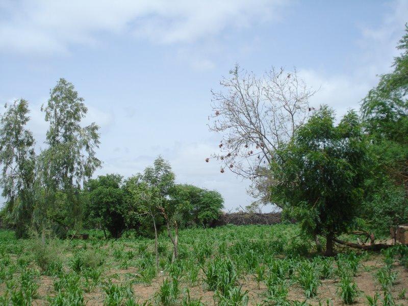
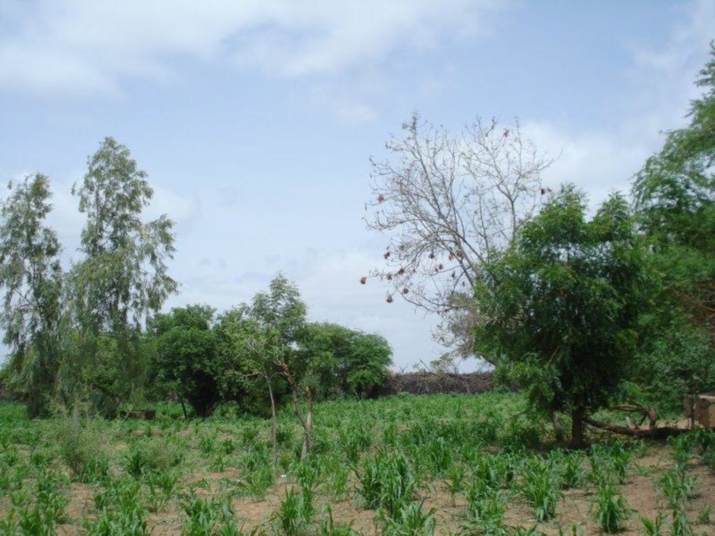
A plot under agroforestry with a rotation of horticulture (during the dry season) and millet (during the rainy season), enclosured and protected by a life fence of Prosopis juliflora
2.2 Detailed description of the Technology
Description:
Main objectives are to increase the availability of vegetables in this zone far from the next market and to create an income source for women in the region. To mitigate the effects of wind erosion and gully formation in the plot and to protect it from cattle roaming a fence of dead wood and Prosopis juliflora seedlings has been constructed around it, which was meant to be a life fence after a certain time.
Establishment / maintenance activities and inputs: The initiative had been taken by a local "technicien agricole" which had assembled women of three villages and searched for local partenaires. The land on which the plot has been established was allocated to the group by the village chief. At the start, the project received support from the NGO Enda Tiers-Monde and the PAPEL (Projet d’Appui à l’Elévage) which has financed the construction of a small retention basin inside the plot to store water tapped from the local borehole. Each woman had the choice of construction 2m of the fence or to pay 1'000 CFA (US-Dollar: 2.25) compensation. Plot maintenance has been assured through the womens voluntary contributions. The extensive agent for "Water and Forest" has provided seedling of P. juliflora and other species on several occasions. Apart from expenses for seeds or seedlings for vegetable production the technology is not requiring any further financial inputs.
Natural / human environment: This SLM technology site is located in the sylvopastoral region of the Ferlo in the north of Sénégal. The agro-climatic zone is classified as semi-arid with mean annual precipitation of 300-400 mm. The main land use type in the area is extensive pastoralism followed by rainfed agriculture. Pastoralism is primarily practiced by transhumant Fula (Peulh) herders and further by Mauritanian Moor herders with herds of dromedaries. Vegetation cover in the area has largely been degraded due to cutting for domestic uses and cattle feeding, bushfires and overgrazing. The soil is exposed to wind erosion which carries away nutrients in the topsoil and therefore declines soil fertility. During intense rains in the rainy season, surface runoff is accelerated and leads to the formation of gullies and ravines. Quality of water sources has declined as they are being used by the local population for the purposes of body hygiene and laundry. Another factor of degradation are the oversized herds of dromedaries which consume large quantities of biomass, contribute to soil compaction due to the shape of their hooves and whose urine is perceived as noxious to the development of herb cover. Despite the various types of degradation, pastoralism and rainfed agriculture guarantee a certain food security for the local population and they have rarely experienced famines.
2.3 Photos of the Technology
2.5 Country/ region/ locations where the Technology has been applied and which are covered by this assessment
Country:
Senegal
Region/ State/ Province:
Louga
Further specification of location:
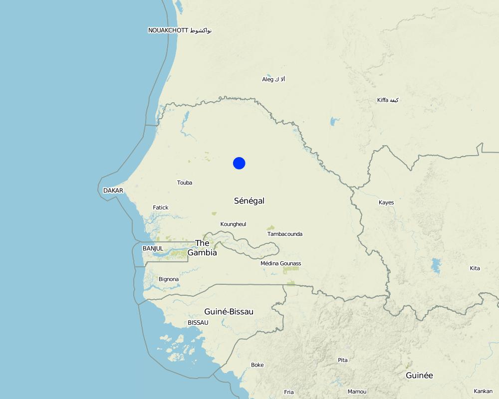
Barkédji
Map
×2.6 Date of implementation
If precise year is not known, indicate approximate date:
- 10-50 years ago
2.7 Introduction of the Technology
Specify how the Technology was introduced:
- through land users' innovation
Comments (type of project, etc.):
1991
3. Classification of the SLM Technology
3.1 Main purpose(s) of the Technology
- improve production
- reduce, prevent, restore land degradation
- create beneficial economic impact
3.2 Current land use type(s) where the Technology is applied

Mixed (crops/ grazing/ trees), incl. agroforestry
- Agroforestry
Main products/ services:
Major cash crop annual cropping: Millet, gombo, chilli, carrot, onion
Major food crop annual cropping: Millet, gombo, chilli, carrot, onion
Major food crop tree and shrub cropping: Balanites aegyptiaca, Ziziphus mauritania
Comments:
Major land use problems (compiler’s opinion): degradation of vegetation cover with wind erosion as a consequence / during the rainy season intensive rainfall leads to gully and ravine formation and to accelerated surface runoff / water management: temporary ponds used for activities like laundry and body hygiene and at the same time as drinking water sources for man and cattle
Major land use problems (land users’ perception): limited access to water from borehole for irrigation purposes as cattle herds are always preferred
3.3 Further information about land use
Water supply for the land on which the Technology is applied:
- rainfed
Comments:
Water supply: Also mixed rainfed - irrigated
Number of growing seasons per year:
- 1
Specify:
Longest growing period in days: 120 Longest growing period from month to month: Jul-Oct
3.4 SLM group to which the Technology belongs
- agroforestry
- windbreak/ shelterbelt
- rotational systems (crop rotation, fallows, shifting cultivation)
3.5 Spread of the Technology
Specify the spread of the Technology:
- evenly spread over an area
If the Technology is evenly spread over an area, indicate approximate area covered:
- < 0.1 km2 (10 ha)
Comments:
The plot located in the village of Diagali has a surface of about 0.5 ha
3.6 SLM measures comprising the Technology

vegetative measures
- V1: Tree and shrub cover
- V5: Others
Comments:
Main measures: vegetative measures
Type of vegetative measures: aligned: -along boundary
3.7 Main types of land degradation addressed by the Technology

soil erosion by water
- Wg: gully erosion/ gullying

soil erosion by wind
- Et: loss of topsoil
- Ed: deflation and deposition

biological degradation
- Bc: reduction of vegetation cover

water degradation
- Ha: aridification
Comments:
Main type of degradation addressed: Et: loss of topsoil, Ed: deflation and deposition
Secondary types of degradation addressed: Wg: gully erosion / gullying, Bc: reduction of vegetation cover, Ha: aridification
Main causes of degradation: deforestation / removal of natural vegetation (incl. forest fires), over-exploitation of vegetation for domestic use (for domestic uses), overgrazing (oversized herds of cattle and dromadaires), population pressure, poverty / wealth (need for natural resources), education, access to knowledge and support services
Secondary causes of degradation: Heavy / extreme rainfall (intensity/amounts) (intense rains during rainy season)
3.8 Prevention, reduction, or restoration of land degradation
Specify the goal of the Technology with regard to land degradation:
- prevent land degradation
4. Technical specifications, implementation activities, inputs, and costs
4.2 Technical specifications/ explanations of technical drawing
Technical knowledge required for field staff / advisors: moderate
Technical knowledge required for land users: moderate
Main technical functions: reduction in wind speed, increase of biomass (quantity), promotion of vegetation species and varieties (quality, eg palatable fodder)
Secondary technical functions: increase in organic matter
Aligned: -along boundary
Vegetative material: T : trees / shrubs
Number of plants per (ha): 84
Trees/ shrubs species: Prosopis juliflora (planteds)
4.3 General information regarding the calculation of inputs and costs
other/ national currency (specify):
CFA
Indicate exchange rate from USD to local currency (if relevant): 1 USD =:
455.0
4.4 Establishment activities
| Activity | Type of measure | Timing | |
|---|---|---|---|
| 1. | Establishment of tree nursery for P.juliflora | Vegetative | |
| 2. | Bedding out of seedlings along plot boundary | Vegetative |
4.5 Costs and inputs needed for establishment
| Specify input | Unit | Quantity | Costs per Unit | Total costs per input | % of costs borne by land users | |
|---|---|---|---|---|---|---|
| Other | Water | ha | 1.0 | 40.0 | 40.0 | |
| Total costs for establishment of the Technology | 40.0 | |||||
If land user bore less than 100% of costs, indicate who covered the remaining costs:
NGO Enda Tiers-Monde, Papel and the governement agent for water and forest
4.6 Maintenance/ recurrent activities
| Activity | Type of measure | Timing/ frequency | |
|---|---|---|---|
| 1. | Pruning of P.juliflora | Vegetative | |
| 2. | Growing more seedlings in tree nursery to improve strenght of fence | Vegetative |
4.7 Costs and inputs needed for maintenance/ recurrent activities (per year)
Comments:
The cost of water applies to the need of the 0.5 ha plot and is only important in dry season when there is no other sources of water in the area. There is no other costs for the vegetation measures, as seedlings are given by the extensive agent for "Water and Forest" and all the women work on a voluntary basis
4.8 Most important factors affecting the costs
Describe the most determinate factors affecting the costs:
water from borehole for watering of seedlings in tree nursery
5. Natural and human environment
5.1 Climate
Annual rainfall
- < 250 mm
- 251-500 mm
- 501-750 mm
- 751-1,000 mm
- 1,001-1,500 mm
- 1,501-2,000 mm
- 2,001-3,000 mm
- 3,001-4,000 mm
- > 4,000 mm
Specifications/ comments on rainfall:
300-400 mm during one rainy season / dry season 8-9 months
Agro-climatic zone
- semi-arid
Thermal climate class: tropics, sylvopastoral zone of the Ferlo
5.2 Topography
Slopes on average:
- flat (0-2%)
- gentle (3-5%)
- moderate (6-10%)
- rolling (11-15%)
- hilly (16-30%)
- steep (31-60%)
- very steep (>60%)
Landforms:
- plateau/plains
- ridges
- mountain slopes
- hill slopes
- footslopes
- valley floors
Altitudinal zone:
- 0-100 m a.s.l.
- 101-500 m a.s.l.
- 501-1,000 m a.s.l.
- 1,001-1,500 m a.s.l.
- 1,501-2,000 m a.s.l.
- 2,001-2,500 m a.s.l.
- 2,501-3,000 m a.s.l.
- 3,001-4,000 m a.s.l.
- > 4,000 m a.s.l.
5.3 Soils
Soil depth on average:
- very shallow (0-20 cm)
- shallow (21-50 cm)
- moderately deep (51-80 cm)
- deep (81-120 cm)
- very deep (> 120 cm)
Soil texture (topsoil):
- coarse/ light (sandy)
- medium (loamy, silty)
Topsoil organic matter:
- medium (1-3%)
If available, attach full soil description or specify the available information, e.g. soil type, soil PH/ acidity, Cation Exchange Capacity, nitrogen, salinity etc.
Soil texture: Coarse/light (sol sable-limoneux, sol instable) and medium
Soil fertility: Low (the soil pH is quite basic, it is really rare for this type of soil)
Topsoil organic matter: Medium (labile organic carbon of 0.24 g/kg)
Soil drainage/infiltration: Good
Soil water storage capacity: Low
5.4 Water availability and quality
Availability of surface water:
poor/ none
Water quality (untreated):
poor drinking water (treatment required)
Comments and further specifications on water quality and quantity:
Water quality (untreated): Poor drinking water (treatement required, groundwater accessed through borehole, mainly used in dry season, ranked 1) and for agricultural use only (irrigation, temporary ponds used during rainy season, ranked 2)
5.5 Biodiversity
Species diversity:
- medium
5.6 Characteristics of land users applying the Technology
Market orientation of production system:
- mixed (subsistence/ commercial
Off-farm income:
- 10-50% of all income
Relative level of wealth:
- poor
- average
Individuals or groups:
- cooperative
Level of mechanization:
- manual work
Gender:
- women
Indicate other relevant characteristics of the land users:
Land users applying the Technology are mainly common / average land users
Difference in the involvement of women and men: it's an initiative promoting women of all social classes
Population density: < 10 persons/km2
Annual population growth: 2% - 3%
2% of the land users are rich.
22% of the land users are average wealthy.
76% of the land users are poor.
Off-farm income specification: many women do small scale trading
5.7 Average area of land owned or leased by land users applying the Technology
- < 0.5 ha
- 0.5-1 ha
- 1-2 ha
- 2-5 ha
- 5-15 ha
- 15-50 ha
- 50-100 ha
- 100-500 ha
- 500-1,000 ha
- 1,000-10,000 ha
- > 10,000 ha
Is this considered small-, medium- or large-scale (referring to local context)?
- small-scale
Comments:
Average area of land owned or leased by land users applying the Technology: Also 2-5 ha (ranked 3)
5.8 Land ownership, land use rights, and water use rights
Land ownership:
- state
- individual, not titled
Land use rights:
- communal (organized)
Water use rights:
- communal (organized)
5.9 Access to services and infrastructure
health:
- poor
- moderate
- good
education:
- poor
- moderate
- good
technical assistance:
- poor
- moderate
- good
employment (e.g. off-farm):
- poor
- moderate
- good
markets:
- poor
- moderate
- good
energy:
- poor
- moderate
- good
roads and transport:
- poor
- moderate
- good
drinking water and sanitation:
- poor
- moderate
- good
financial services:
- poor
- moderate
- good
6. Impacts and concluding statements
6.1 On-site impacts the Technology has shown
Socio-economic impacts
Production
product diversity
production area
Water availability and quality
demand for irrigation water
Income and costs
farm income
diversity of income sources
Socio-cultural impacts
food security/ self-sufficiency
situation of socially and economically disadvantaged groups
Improved livelihoods and human well-being
Comments/ specify:
Weak improvement of income
Ecological impacts
Water cycle/ runoff
evaporation
Soil
soil cover
soil organic matter/ below ground C
Biodiversity: vegetation, animals
biomass/ above ground C
plant diversity
Climate and disaster risk reduction
emission of carbon and greenhouse gases
wind velocity
6.3 Exposure and sensitivity of the Technology to gradual climate change and climate-related extremes/ disasters (as perceived by land users)
Gradual climate change
Gradual climate change
| Season | Type of climatic change/ extreme | How does the Technology cope with it? | |
|---|---|---|---|
| annual temperature | increase | not known |
Climate-related extremes (disasters)
Meteorological disasters
| How does the Technology cope with it? | |
|---|---|
| local rainstorm | not well |
| local windstorm | not well |
Climatological disasters
| How does the Technology cope with it? | |
|---|---|
| drought | not well |
Hydrological disasters
| How does the Technology cope with it? | |
|---|---|
| general (river) flood | not well |
Other climate-related consequences
Other climate-related consequences
| How does the Technology cope with it? | |
|---|---|
| reduced growing period | not well |
6.4 Cost-benefit analysis
How do the benefits compare with the establishment costs (from land users’ perspective)?
Short-term returns:
neutral/ balanced
Long-term returns:
slightly positive
How do the benefits compare with the maintenance/ recurrent costs (from land users' perspective)?
Short-term returns:
slightly positive
Long-term returns:
slightly positive
6.5 Adoption of the Technology
Of all those who have adopted the Technology, how many have did so spontaneously, i.e. without receiving any material incentives/ payments?
- 90-100%
Comments:
100% of land user families have adopted the Technology without any external material support
There is a little trend towards spontaneous adoption of the Technology
6.7 Strengths/ advantages/ opportunities of the Technology
| Strengths/ advantages/ opportunities in the land user’s view |
|---|
| gives the women the possibility to gain some independance from their husbands and to improve family income |
| Strengths/ advantages/ opportunities in the compiler’s or other key resource person’s view |
|---|
|
the live fence serves as protection against wind speed, limits evapotranspiration and creates a favorable microclimat for millet and vegetable growth How can they be sustained / enhanced? reinforcement with Prosopis provided by "Water and Forest" |
|
the fact that trees in the plot were not cut down in order to gain space for cultivation helps to maintain biodiversity in the area and to a small extent sequester carbon How can they be sustained / enhanced? practice of assisted natural regeneration |
|
reafforestation with a variety of species provided by "Water and Forest" can help to increase vegetation cover in the area How can they be sustained / enhanced? training for planting techniques needed |
6.8 Weaknesses/ disadvantages/ risks of the Technology and ways of overcoming them
| Weaknesses/ disadvantages/ risks in the land user’s view | How can they be overcome? |
|---|---|
| access to irrigation water from the borehole is limited because of preference of cattle | better water management and distribution between cattle herders and cultivators of the plot |
| little knowledge of the agricultural technologies | more training for agricultural technicians in the area |
| very high mortality of fruit trees in the plot | research needed to find causes |
| Weaknesses/ disadvantages/ risks in the compiler’s or other key resource person’s view | How can they be overcome? |
|---|---|
| the plantation of trees in the plot does not follow any system | training |
| the life fence is instable and weak | reinforce the life fence with Prosopis |
| very low revenues because of fertility problems and therefore reduced plant growth | research needed to find causes |
Links and modules
Expand all Collapse allLinks
No links
Modules
No modules


