Muret [Cape Verde]
- Creation:
- Update:
- Compiler: Jacques Tavares
- Editor: –
- Reviewers: Fabian Ottiger, Alexandra Gavilano
Muretos, Arretos
technologies_1572 - Cape Verde
View sections
Expand all Collapse all1. General information
1.2 Contact details of resource persons and institutions involved in the assessment and documentation of the Technology
SLM specialist:
Varela Larissa
INIDA
Name of the institution(s) which facilitated the documentation/ evaluation of the Technology (if relevant)
INIDA (INIDA) - Cape Verde1.3 Conditions regarding the use of data documented through WOCAT
The compiler and key resource person(s) accept the conditions regarding the use of data documented through WOCAT:
Yes
1.4 Declaration on sustainability of the described Technology
Is the Technology described here problematic with regard to land degradation, so that it cannot be declared a sustainable land management technology?
No
2. Description of the SLM Technology
2.1 Short description of the Technology
Definition of the Technology:
Small walls of stone built on hillsides with slopes generally greater than 40%, second-level curves, which ensures a good infiltration and contributes to reducing the erosive power of water runoff.
2.2 Detailed description of the Technology
Description:
Are usually constructed of stone with a height of 80 to 90 cm and width of 40 to 50 cm and a foundation of 30 cm, usually built on hillsides with slopes greater than 40%. The space between two consecutive Muret varies between six (6) and 15 (fifteen) meters depending on slope, type of soil and plant cover and frequency of rainfall. Top Order capture water runoff by encouraging the development of plant species. When complemented by banquets and entertainment channels to facilitate drainage of surface water to the adjacent lines. Also this technique can be complemented with vegetative measures.
This technique is used mainly for agricultural land in rain with the aim of protecting slopes from erosion, and to practice the culture of Canjanus cajan and other forage species.
2.5 Country/ region/ locations where the Technology has been applied and which are covered by this assessment
Country:
Cape Verde
Region/ State/ Province:
Ribeira Seca
Further specification of location:
S. Lourenço; S. Domingos; Picos; S. Cruz
Specify the spread of the Technology:
- evenly spread over an area
If the Technology is evenly spread over an area, specify area covered (in km2):
71.5
Comments:
Total area covered by the SLM Technology is 71.5 km2.
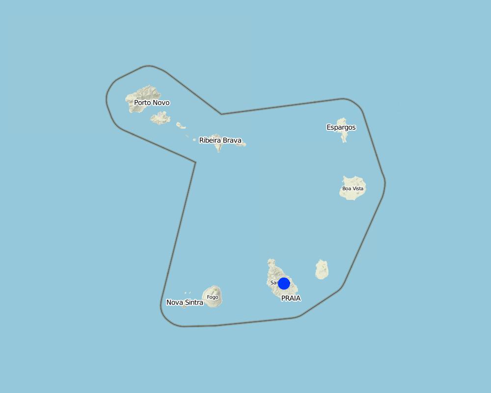
Map
×2.6 Date of implementation
If precise year is not known, indicate approximate date:
- more than 50 years ago (traditional)
2.7 Introduction of the Technology
Specify how the Technology was introduced:
- through projects/ external interventions
3. Classification of the SLM Technology
3.1 Main purpose(s) of the Technology
- reduce, prevent, restore land degradation
3.2 Current land use type(s) where the Technology is applied
Land use mixed within the same land unit:
Yes
Specify mixed land use (crops/ grazing/ trees):
- Agro-pastoralism (incl. integrated crop-livestock)

Cropland
- Annual cropping
- Perennial (non-woody) cropping
Specify:
Longest growing period in days: 90, Longest growing period from month to month: Aug - Oct

Grazing land
Extensive grazing:
- Semi-nomadic pastoralism
- Ranching
Comments:
Major land use problems (compiler’s opinion): Loss of soil by water runoff, reducing its thickness and fertility
Semi-nomadism / pastoralism: Yes
Ranching: Yes
Livestock is grazing on crop residues
3.3 Has land use changed due to the implementation of the Technology?
Has land use changed due to the implementation of the Technology?
- No (Continue with question 3.4)
3.4 Water supply
Water supply for the land on which the Technology is applied:
- rainfed
3.5 SLM group to which the Technology belongs
- agroforestry
- cross-slope measure
3.6 SLM measures comprising the Technology

structural measures
- S5: Dams, pans, ponds
- S6: Walls, barriers, palisades, fences
3.7 Main types of land degradation addressed by the Technology

soil erosion by water
- Wt: loss of topsoil/ surface erosion
- Wg: gully erosion/ gullying
- Wo: offsite degradation effects

water degradation
- Ha: aridification
- Hs: change in quantity of surface water
- Hq: decline of groundwater quality
Comments:
Main causes of degradation: soil management (Inappropriate use of many areas), crop management (annual, perennial, tree/shrub) (Cultivation of maize and groundnut in areas unsuitable especially in highly inclined slopes), over-exploitation of vegetation for domestic use (Cutting of trees for firewood production), Heavy / extreme rainfall (intensity/amounts) (Chuvas irregulares, de pouca duração mas de grande intesidade na maioria das vezes), droughts, poverty / wealth (A pobreza conduz à falta de conhecimento, e a necessidade de um meio de sustento que poderá ser qualquer recurso com mercado), education, access to knowledge and support services (A good education and awareness to help consumers and new opportunities for livelihood for the owners.)
Secondary causes of degradation: deforestation / removal of natural vegetation (incl. forest fires), overgrazing, population pressure (Large population densities lead to over-exploitation of limited resources)
3.8 Prevention, reduction, or restoration of land degradation
Specify the goal of the Technology with regard to land degradation:
- prevent land degradation
- reduce land degradation
4. Technical specifications, implementation activities, inputs, and costs
4.1 Technical drawing of the Technology
Technical specifications (related to technical drawing):
Muret built on land with slopes of 50% with a espassamento of 10 m.
Location: São Jorge dos Órgãos. Cabo Verde
Technical knowledge required for field staff / advisors: moderate (But he must understand the technique and its benefits, he may be to implement it by advice from a specialist.)
Technical knowledge required for land users: high (Should be well briefed)
Main technical functions: control of dispersed runoff: retain / trap
Secondary technical functions: control of dispersed runoff: impede / retard
Wall/ barrier
Vertical interval between structures (m): 5
Spacing between structures (m): 10
Depth of ditches/pits/dams (m): 0.9
Width of ditches/pits/dams (m): 0.4
Length of ditches/pits/dams (m): 100
Construction material (stone): structure made of stone, so this feature should be in place
Slope (which determines the spacing indicated above): 50%
Lateral gradient along the structure: 0.3%
Author:
Jailson Bentub
4.2 General information regarding the calculation of inputs and costs
other/ national currency (specify):
ECV
If relevant, indicate exchange rate from USD to local currency (e.g. 1 USD = 79.9 Brazilian Real): 1 USD =:
80.0
Indicate average wage cost of hired labour per day:
5.94
4.3 Establishment activities
| Activity | Timing (season) | |
|---|---|---|
| 1. | Excavation | |
| 2. | Foundation | |
| 3. | Elevation |
4.4 Costs and inputs needed for establishment
| Specify input | Unit | Quantity | Costs per Unit | Total costs per input | % of costs borne by land users | |
|---|---|---|---|---|---|---|
| Labour | Labour | ha | 1.0 | 11718.0 | 11718.0 | |
| Equipment | Tools | ha | 1.0 | 236.0 | 236.0 | |
| Total costs for establishment of the Technology | 11954.0 | |||||
| Total costs for establishment of the Technology in USD | 149.43 | |||||
Comments:
Duration of establishment phase: 3 month(s)
4.7 Most important factors affecting the costs
Describe the most determinate factors affecting the costs:
Labor; slope.
5. Natural and human environment
5.1 Climate
Annual rainfall
- < 250 mm
- 251-500 mm
- 501-750 mm
- 751-1,000 mm
- 1,001-1,500 mm
- 1,501-2,000 mm
- 2,001-3,000 mm
- 3,001-4,000 mm
- > 4,000 mm
Agro-climatic zone
- sub-humid
- semi-arid
5.2 Topography
Slopes on average:
- flat (0-2%)
- gentle (3-5%)
- moderate (6-10%)
- rolling (11-15%)
- hilly (16-30%)
- steep (31-60%)
- very steep (>60%)
Landforms:
- plateau/plains
- ridges
- mountain slopes
- hill slopes
- footslopes
- valley floors
Altitudinal zone:
- 0-100 m a.s.l.
- 101-500 m a.s.l.
- 501-1,000 m a.s.l.
- 1,001-1,500 m a.s.l.
- 1,501-2,000 m a.s.l.
- 2,001-2,500 m a.s.l.
- 2,501-3,000 m a.s.l.
- 3,001-4,000 m a.s.l.
- > 4,000 m a.s.l.
5.3 Soils
Soil depth on average:
- very shallow (0-20 cm)
- shallow (21-50 cm)
- moderately deep (51-80 cm)
- deep (81-120 cm)
- very deep (> 120 cm)
Soil texture (topsoil):
- coarse/ light (sandy)
- medium (loamy, silty)
Topsoil organic matter:
- medium (1-3%)
If available, attach full soil description or specify the available information, e.g. soil type, soil PH/ acidity, Cation Exchange Capacity, nitrogen, salinity etc.
Soil fertility: Low (ranked 1) and medium (ranked 2)
Soil drainage/infiltration: Medium (ranked 1) and good (ranked 2)
Soil water storage capacity: Low (ranked 1, skeletal soils with low storage capacity) and medium (ranked 2)
5.4 Water availability and quality
Ground water table:
5-50 m
Availability of surface water:
medium
Comments and further specifications on water quality and quantity:
Ground water table: Also >50m (ranked 2)
Availability of surface water: Medium (ranked 1, Often through galleries, springs, wells and dams) and poor/none (ranked 2)
5.5 Biodiversity
Species diversity:
- low
5.6 Characteristics of land users applying the Technology
Market orientation of production system:
- subsistence (self-supply)
- mixed (subsistence/ commercial)
Off-farm income:
- 10-50% of all income
Relative level of wealth:
- poor
- average
Level of mechanization:
- manual work
- mechanized/ motorized
Indicate other relevant characteristics of the land users:
Population density: 50-100 persons/km2
Annual population growth: > 4% (0.5%).
80% of the land users are average wealthy (50%).
3% of the land users are poor (1%).
Level of mechanization: Manual work (Ranked 1, often through galleries, springs, wells and dams) and mechanized (ranked 2, use of tractor in some plots)
5.7 Average area of land used by land users applying the Technology
- < 0.5 ha
- 0.5-1 ha
- 1-2 ha
- 2-5 ha
- 5-15 ha
- 15-50 ha
- 50-100 ha
- 100-500 ha
- 500-1,000 ha
- 1,000-10,000 ha
- > 10,000 ha
5.8 Land ownership, land use rights, and water use rights
Land ownership:
- individual, titled
Land use rights:
- leased
- individual
Water use rights:
- communal (organized)
- individual
5.9 Access to services and infrastructure
health:
- poor
- moderate
- good
education:
- poor
- moderate
- good
technical assistance:
- poor
- moderate
- good
employment (e.g. off-farm):
- poor
- moderate
- good
markets:
- poor
- moderate
- good
roads and transport:
- poor
- moderate
- good
drinking water and sanitation:
- poor
- moderate
- good
financial services:
- poor
- moderate
- good
6. Impacts and concluding statements
6.1 On-site impacts the Technology has shown
Socio-economic impacts
Production
crop production
fodder production
risk of production failure
production area
Income and costs
workload
Socio-cultural impacts
SLM/ land degradation knowledge
Improved livelihoods and human well-being
Comments/ specify:
By implementing this technique it contributes to the increase of yield and consequently to that of the livelihoods of the benefited populations.
Ecological impacts
Water cycle/ runoff
water quantity
water quality
harvesting/ collection of water
groundwater table/ aquifer
Soil
soil moisture
soil loss
6.2 Off-site impacts the Technology has shown
water availability
downstream flooding
downstream siltation
groundwater/ river pollution
6.3 Exposure and sensitivity of the Technology to gradual climate change and climate-related extremes/ disasters (as perceived by land users)
Gradual climate change
Gradual climate change
| Season | increase or decrease | How does the Technology cope with it? | |
|---|---|---|---|
| annual temperature | increase | well |
Climate-related extremes (disasters)
Meteorological disasters
| How does the Technology cope with it? | |
|---|---|
| local rainstorm | well |
6.7 Strengths/ advantages/ opportunities of the Technology
| Strengths/ advantages/ opportunities in the compiler’s or other key resource person’s view |
|---|
| Muret are effective in the stabilization of slopes. |
| Improving significantly the infiltration of rain water especially when complemented with vegetative measures. |
6.8 Weaknesses/ disadvantages/ risks of the Technology and ways of overcoming them
| Weaknesses/ disadvantages/ risks in the compiler’s or other key resource person’s view | How can they be overcome? |
|---|---|
| Relatively expensive and laborious process. |
7. References and links
7.1 Methods/ sources of information
- field visits, field surveys
- interviews with land users
7.2 References to available publications
Title, author, year, ISBN:
Técnica de Conservação de Solos e Água em Cabo Verde, MPAR &CILSS, 1994
Title, author, year, ISBN:
Conservação de Solos e Água (Teoria e Prática), Sabino, António Advino, 1991
Available from where? Costs?
Library of CFA - INIDA
Title, author, year, ISBN:
Field Trip Guid - DESIRA , INIDA, Cape Verde, 2008
Available from where? Costs?
Library of INIDA
Title, author, year, ISBN:
Relatório de Avaliação Inicial Do Impacto das Realizações de Conservvação de Solos e Água em 1993 do PROJECTO WDP, WARD, 1995
Available from where? Costs?
Library of INIDA
Links and modules
Expand all Collapse allLinks
No links
Modules
No modules