Sorjan - growing vegetables on raised beds in waterlogged areas [Bangladesh]
- Creation:
- Update:
- Compiler: Wolfgang Duifhuizen
- Editor: Kiran Sankar Sarker
- Reviewers: Ursula Gaemperli, Rima Mekdaschi Studer
technologies_5613 - Bangladesh
View sections
Expand all Collapse all1. General information
1.2 Contact details of resource persons and institutions involved in the assessment and documentation of the Technology
M&E adviser:
Name of project which facilitated the documentation/ evaluation of the Technology (if relevant)
Char Development and Settlement Project- Bridging (CDSP)Name of the institution(s) which facilitated the documentation/ evaluation of the Technology (if relevant)
International Fund for Agricultural Development (IFAD) - ItalyName of the institution(s) which facilitated the documentation/ evaluation of the Technology (if relevant)
Embassy of the Kingdom of the Netherlands in Dhaka, Bangladesh (Dutch Embassy) - BangladeshName of the institution(s) which facilitated the documentation/ evaluation of the Technology (if relevant)
Government of Bangladesh (Gov BDG) - Bangladesh1.3 Conditions regarding the use of data documented through WOCAT
The compiler and key resource person(s) accept the conditions regarding the use of data documented through WOCAT:
Yes
1.4 Declaration on sustainability of the described Technology
Is the Technology described here problematic with regard to land degradation, so that it cannot be declared a sustainable land management technology?
No
2. Description of the SLM Technology
2.1 Short description of the Technology
Definition of the Technology:
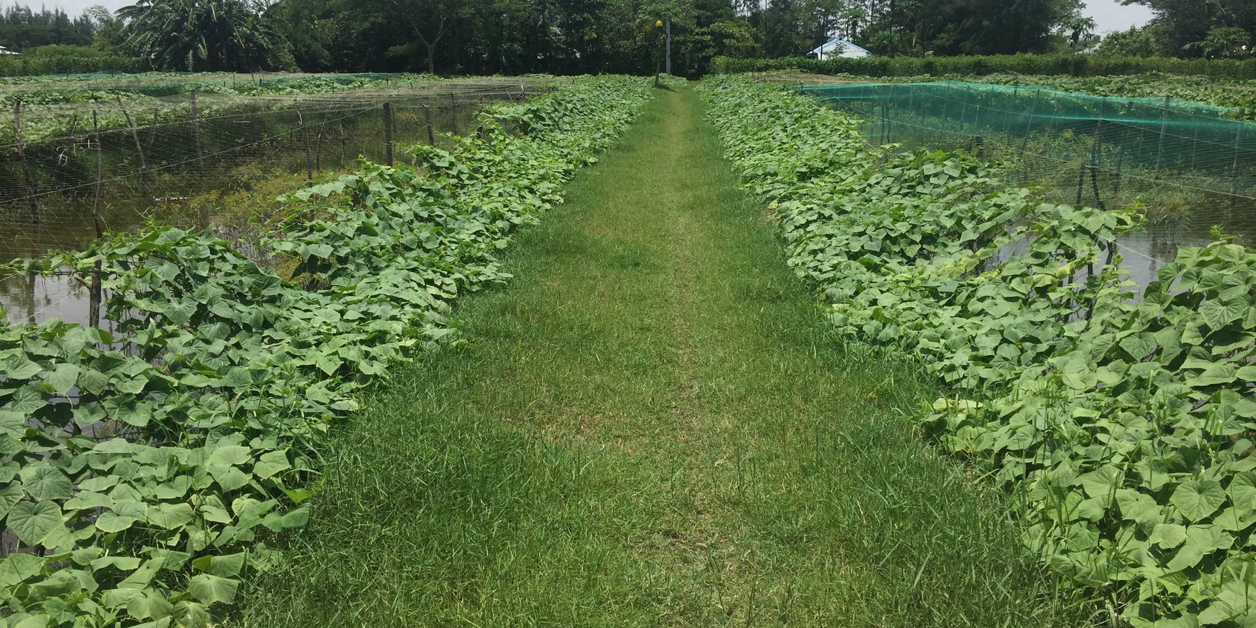
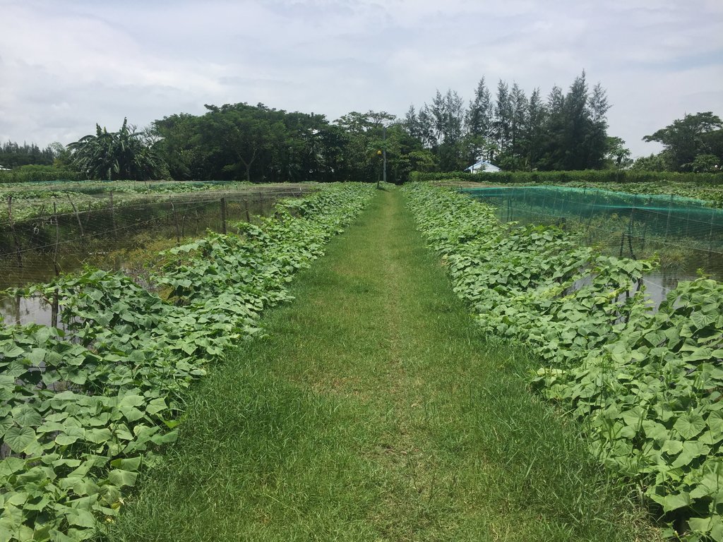
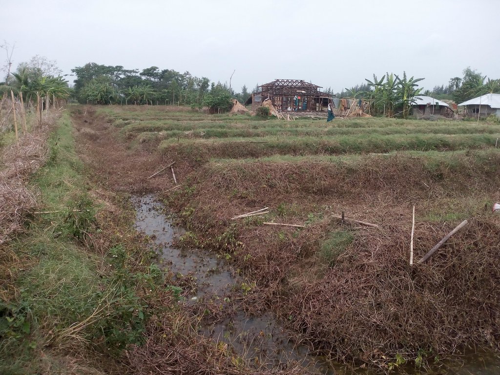
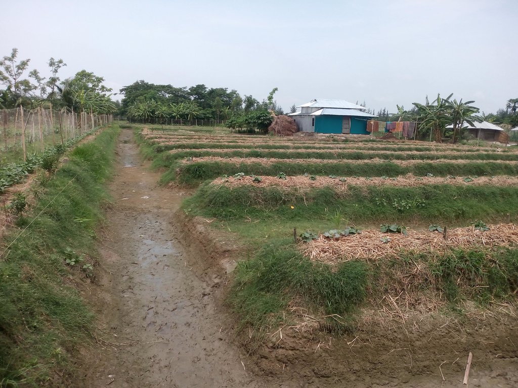
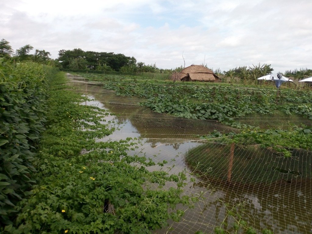
The sorjon system is the cultivation of vegetables on raised beds. Ridges are about 60 to 90 cm high, which means crops are kept above the water, even during the wet season. The ditches between the ridges hold water for six to eight months per year and can be used to keep fish as well as being a source of water to irrigate the crops.
2.2 Detailed description of the Technology
Description:
The Sorjan is a system that serves as an alternate of deep drains (ditches) and raised beds for crop cultivation and fish rearing. In coastal Bangladesh the ridges are mostly around one meter wide at the top and spaced two meters apart – although in places ridges and spacing can be wider than this. The Sorjan system is applied in lowland areas which suffer from water logging and salinization. The widely spread technology is also practiced in Char Nangulia, Noakhali district in the Meghna estuary in Bangladesh. The main economic activities in this area are small-scale agriculture, livestock keeping, fish rearing and informal business. Before introduction of the Sorjan system (by the Bangladesh by Department of Agriculture Extension) only deep-water tolerant traditional low-yielding paddy could be cultivated during the rainy season and in the dry season, the capillary rise of salty ground water led to poor yields for most crops, if they survived at all.
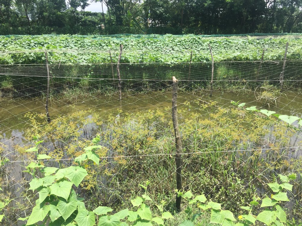
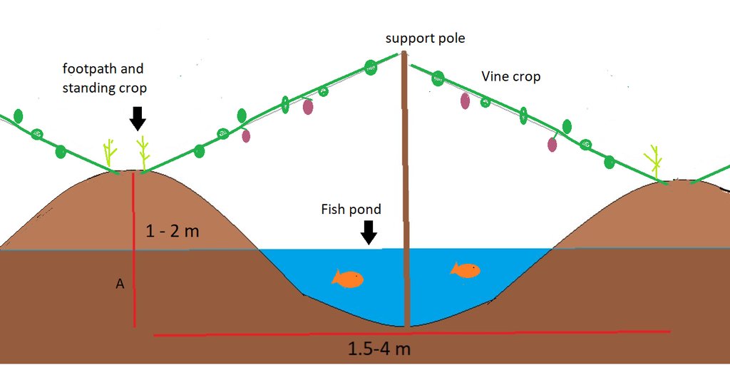
The beds are about 60 to 90 cm high, which means crops are kept above the water, even during the wet season. The ditches between the ridges hold water for six to eight months per year and can be used to rear fish and ducks as well as being a source of water to irrigate the crops. In most cases nets are spanned over the ditches, allow climbing plants to grow over them utilizing the space in an efficient way. The sorjan system is is applied in low land areas and frequently suffer from water logging and sometimes salt water intrusion. This system with raised bed enables the cultivation of vegetables in these locations.
The main function of Sorjan is to grow crops on raised beds so that roots are protected against stagnant water. As the area is partially excavated, the deeper areas can be used for fish rearing whenever inundated and crops such as cucumber and gourds can grow vines on supporting nets spanned over the ditches to maximize productivity of limited space available. In the Philipines Sorjan system, it has also been reported that rice is cultivated in the ditches with shallow water and at the same time, other crops on the beds.
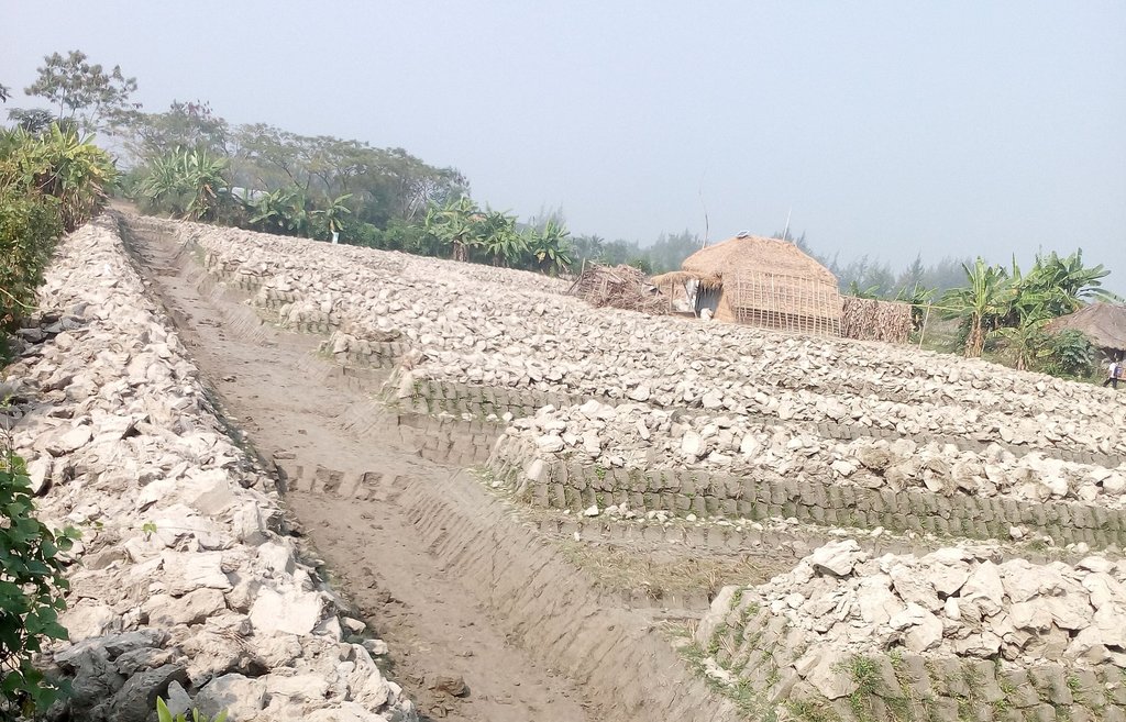
To install Sorjan a farmer needs to make raised beds for planting the crops and rear fish in the deep drains. This is usually done by hand with help of local laborers, in some cases an excavator is rented to do the job. To support the crop to be planted , a framework of bamboo, string and netting is built over the ditches to support a sequence of climbing plants.
Maintenance of the beds is done regularly whenever necessary and the crop netting is replaced every 3 years. In the area farmers predominantly use urea and other chemical fertilizers to lesser extent, few farmers use animal manure and compost. Most Sorjan ridges have a permanent undergrowth of grass to keep the slopes stable. In some cases, during dry season, goats graze the grass in the ditches and slopes.
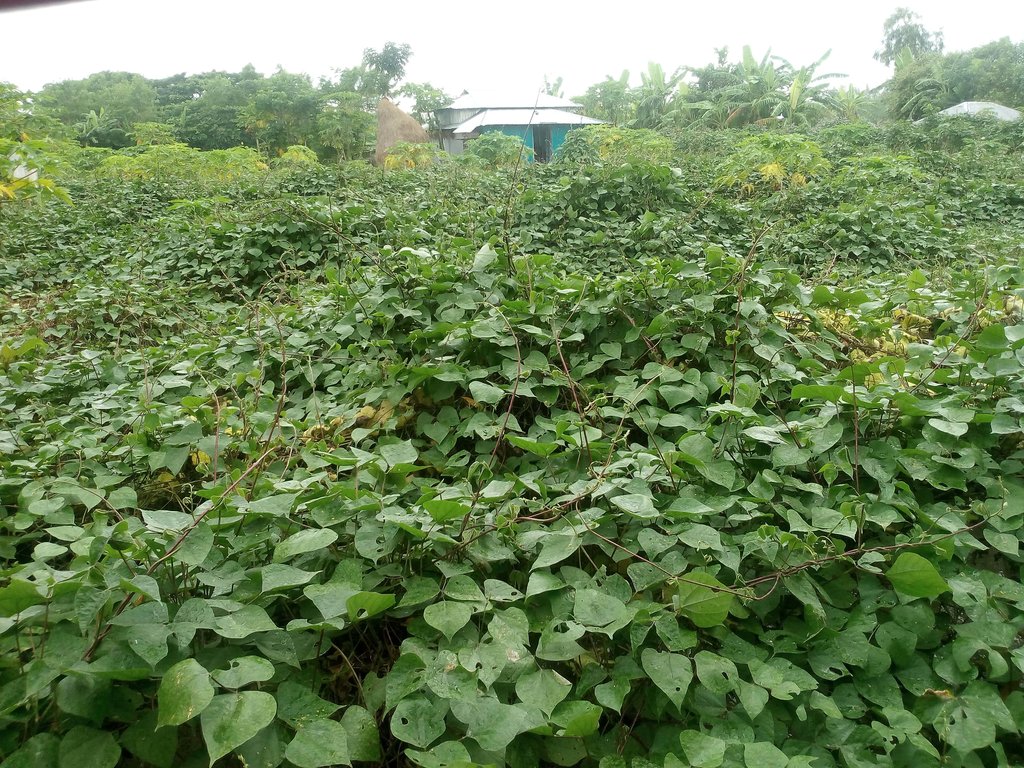
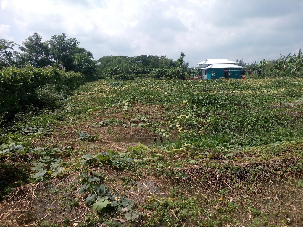
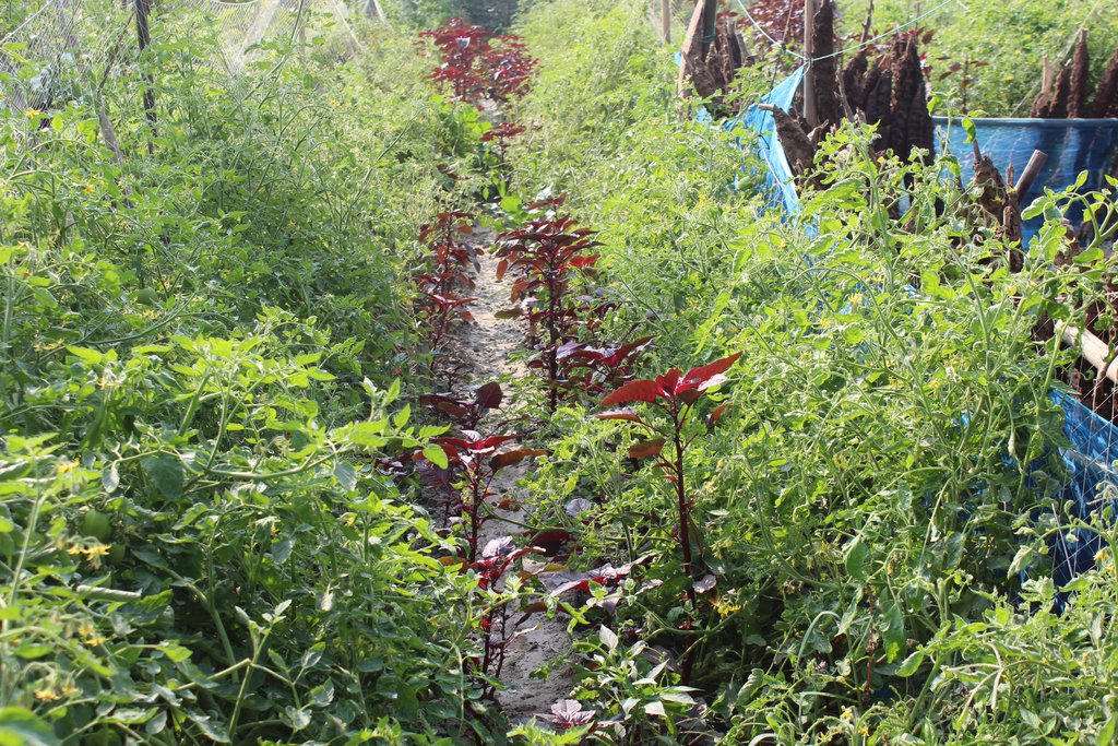
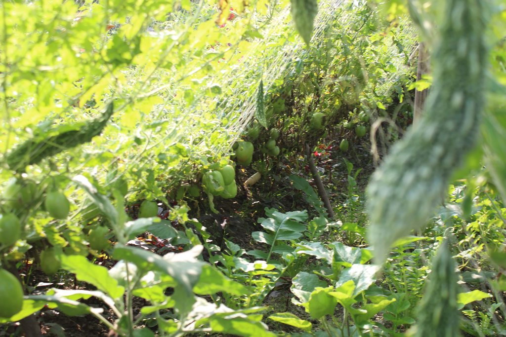
Before the rains start in March, cucumbers are planted, and these are followed by a variety of gourds (including snake, bottle, bitter and ribbed gourds) in the early monsoon, with yard long bean (asparagus bean) and country bean (lablab bean) in the later monsoon, with country beans continuing to be harvested through the dry season up to the following March. During dry season the beans are sometimes intercropped with chillies, tomatoes and amaranth. These crops overlap with each other, with relay cropping allowing continuous harvesting for 9 or 10 months per year (early June to March).
The significant increase of income a small-holder farmer can make in the area alongside having fresh fish and vegetable for the greater part of the year have been reasons for farmers taking up Sorjan. The Sorjan system is propagated as a measure to mitigate effects of increased salinity and/or water logging due to sea-level rise. Sorjan does not facilitate any mechanization as the narrow beds and ditch bottoms are only accessible by foot.
2.3 Photos of the Technology
General remarks regarding photos:
The pictures of Sorjan at homestead in Nangulia are all taken from the same point at different times: 1. establishment of Sorjan 2. and 3. Sorjan with rabi crop in winter time 4. country bean in winter time 5 and 6. gourd crop in summer time
2.5 Country/ region/ locations where the Technology has been applied and which are covered by this assessment
Country:
Bangladesh
Region/ State/ Province:
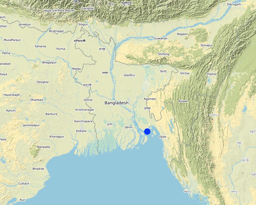
Chittagong Division, Noakhali District
Further specification of location:
Char Nangulia
Specify the spread of the Technology:
- applied at specific points/ concentrated on a small area
Is/are the technology site(s) located in a permanently protected area?
No
Comments:
Also applied elsewhere in Bangladesh, the Philipines and Indonesia.
Map
×2.6 Date of implementation
If precise year is not known, indicate approximate date:
- less than 10 years ago (recently)
2.7 Introduction of the Technology
Specify how the Technology was introduced:
- during experiments/ research
- through projects/ external interventions
Comments (type of project, etc.):
Introduced to Bangladesh by Department of Agriculture Extension and originated in Indonesia.
3. Classification of the SLM Technology
3.1 Main purpose(s) of the Technology
- improve production
- adapt to climate change/ extremes and its impacts
- mitigate climate change and its impacts
- create beneficial economic impact
- create beneficial social impact
3.2 Current land use type(s) where the Technology is applied
Land use mixed within the same land unit:
No

Cropland
- Annual cropping
Annual cropping - Specify crops:
- cereals - rice (wetland)
- legumes and pulses - beans
- legumes and pulses - soya
- oilseed crops - sunflower, rapeseed, other
Number of growing seasons per year:
- 2
Specify:
In case of saline groundwater only one paddy crop can be grown in monsoon season
Is intercropping practiced?
No

Unproductive land
Remarks:
The farmers invest their capital in making land productive by establishing Sorjan or other measures to enable crop cultivian in areas with severe waterlogging
3.3 Has land use changed due to the implementation of the Technology?
Has land use changed due to the implementation of the Technology?
- No (Continue with question 3.4)
3.4 Water supply
Water supply for the land on which the Technology is applied:
- mixed rainfed-irrigated
Comments:
Thesystem is rainfed during the monsoon season (June-October); by storage of water around ridges this water supply will last until January. When planting crop in march water from deep tube wells is used.
3.5 SLM group to which the Technology belongs
- rotational systems (crop rotation, fallows, shifting cultivation)
- improved ground/ vegetation cover
- wetland protection/ management
3.6 SLM measures comprising the Technology

agronomic measures
- A1: Vegetation/ soil cover

structural measures
- S4: Level ditches, pits
- S5: Dams, pans, ponds
3.7 Main types of land degradation addressed by the Technology

chemical soil deterioration
- Cs: salinization/ alkalinization

physical soil deterioration
- Pw: waterlogging
Comments:
Local conditions make crop cultivation difficult due to poor drainage (water logging) in rainy season and capillary rise of sea water in dry season.
3.8 Prevention, reduction, or restoration of land degradation
Specify the goal of the Technology with regard to land degradation:
- adapt to land degradation
Comments:
by growing vegetables on raised beds the crops suffer less from capillary rise of sea water in dry-season and water logging in rainy season.
4. Technical specifications, implementation activities, inputs, and costs
4.1 Technical drawing of the Technology
Technical specifications (related to technical drawing):
Sorjan ridges are usually between 1 to 2 meters in height and have a spacing between 2 to 5 meters. Ridges are usually covered with grass on the sides and straw mulch on the top. The ridge-top has a footpath with crops planted along both sides (standing crop: chillies, amaranth etc.). Vine crops grow (beans, gourds, etc.) onto the netting supported by a pole of 2-3 m high. Fruits or pods are harvested while standing in the pond.
4.2 General information regarding the calculation of inputs and costs
Specify how costs and inputs were calculated:
- per Technology area
Indicate size and area unit:
acre
If using a local area unit, indicate conversion factor to one hectare (e.g. 1 ha = 2.47 acres): 1 ha =:
1 acre = 0.4 ha
other/ national currency (specify):
BDT
If relevant, indicate exchange rate from USD to local currency (e.g. 1 USD = 79.9 Brazilian Real): 1 USD =:
85.0
Indicate average wage cost of hired labour per day:
100-200 BDT
4.3 Establishment activities
| Activity | Timing (season) | |
|---|---|---|
| 1. | digging ditches/sorjan | dry season |
| 2. | putting up bamboo and netting | after earthwork is done |
4.4 Costs and inputs needed for establishment
| Specify input | Unit | Quantity | Costs per Unit | Total costs per input | % of costs borne by land users | |
|---|---|---|---|---|---|---|
| Labour | excavation, bed construction and suspending of nets | person-days | 40.0 | 200.0 | 8000.0 | 100.0 |
| Equipment | shovels, baskets and other equipment | lump sum | 2000.0 | 100.0 | ||
| Construction material | poles + netting | lump sum | 1.0 | 30000.0 | 30000.0 | |
| Total costs for establishment of the Technology | 38000.0 | |||||
| Total costs for establishment of the Technology in USD | 447.06 | |||||
Comments:
Excavation is often done with help of day labourers. Costs reduce if excavation can be done by excavator.
4.5 Maintenance/ recurrent activities
| Activity | Timing/ frequency | |
|---|---|---|
| 1. | repair of ridges | annual |
| 2. | replace bamboo and netting | every third year |
| 3. | fertilizer | several times every growing season |
| 4. | planting/sowing crops | several times a year |
| 5. | mulching | annual |
| 6. | fish fry | annual |
Comments:
Maintenance activities are highly specific to situation and crop.
4.6 Costs and inputs needed for maintenance/ recurrent activities (per year)
| Specify input | Unit | Quantity | Costs per Unit | Total costs per input | % of costs borne by land users | |
|---|---|---|---|---|---|---|
| Labour | repair of beds | |||||
| Labour | replacement of netting structure | |||||
| Plant material | Inputs production (seeds crops, fertilizers and fish feed) | |||||
| Other | fish fry |
If you are unable to break down the costs in the table above, give an estimation of the total costs of maintaining the Technology:
400.0
Comments:
Costs of maintenance are highly variable depending on crop type and management. In most cases external labour is only required for establishment of Sorjan. The quanity of mulch spread on the beds is dependent on what material is available at farm-level.
4.7 Most important factors affecting the costs
Describe the most determinate factors affecting the costs:
Number of labour-days required to establish and repair earthworks and netting structure
5. Natural and human environment
5.1 Climate
Annual rainfall
- < 250 mm
- 251-500 mm
- 501-750 mm
- 751-1,000 mm
- 1,001-1,500 mm
- 1,501-2,000 mm
- 2,001-3,000 mm
- 3,001-4,000 mm
- > 4,000 mm
Specify average annual rainfall (if known), in mm:
2980.00
Specifications/ comments on rainfall:
monsoon climate; 70% of precipitation occurs during 4 months (July-September)
Indicate the name of the reference meteorological station considered:
Noakhali
Agro-climatic zone
- humid
5.2 Topography
Slopes on average:
- flat (0-2%)
- gentle (3-5%)
- moderate (6-10%)
- rolling (11-15%)
- hilly (16-30%)
- steep (31-60%)
- very steep (>60%)
Landforms:
- plateau/plains
- ridges
- mountain slopes
- hill slopes
- footslopes
- valley floors
Altitudinal zone:
- 0-100 m a.s.l.
- 101-500 m a.s.l.
- 501-1,000 m a.s.l.
- 1,001-1,500 m a.s.l.
- 1,501-2,000 m a.s.l.
- 2,001-2,500 m a.s.l.
- 2,501-3,000 m a.s.l.
- 3,001-4,000 m a.s.l.
- > 4,000 m a.s.l.
Indicate if the Technology is specifically applied in:
- not relevant
Comments and further specifications on topography:
Reclaimed lands in estuarine area
5.3 Soils
Soil depth on average:
- very shallow (0-20 cm)
- shallow (21-50 cm)
- moderately deep (51-80 cm)
- deep (81-120 cm)
- very deep (> 120 cm)
Soil texture (topsoil):
- medium (loamy, silty)
Soil texture (> 20 cm below surface):
- medium (loamy, silty)
Topsoil organic matter:
- medium (1-3%)
- low (<1%)
5.4 Water availability and quality
Ground water table:
< 5 m
Availability of surface water:
excess
Water quality (untreated):
unusable
Water quality refers to:
ground water
Is water salinity a problem?
Yes
Specify:
In dry season the root zone is exposed to capillary rise of saline ground water
Is flooding of the area occurring?
Yes
Regularity:
episodically
Comments and further specifications on water quality and quantity:
In monsoon season there are frequent problems with waterlogging. In dry season the fresh water lens evaporates and saline ground water is to be found 2-5 meters below ground.
5.5 Biodiversity
Species diversity:
- medium
Habitat diversity:
- medium
5.6 Characteristics of land users applying the Technology
Sedentary or nomadic:
- Sedentary
Market orientation of production system:
- mixed (subsistence/ commercial)
Off-farm income:
- > 50% of all income
Relative level of wealth:
- poor
Individuals or groups:
- individual/ household
Level of mechanization:
- manual work
- animal traction
Gender:
- women
- men
Age of land users:
- middle-aged
5.7 Average area of land used by land users applying the Technology
- < 0.5 ha
- 0.5-1 ha
- 1-2 ha
- 2-5 ha
- 5-15 ha
- 15-50 ha
- 50-100 ha
- 100-500 ha
- 500-1,000 ha
- 1,000-10,000 ha
- > 10,000 ha
Is this considered small-, medium- or large-scale (referring to local context)?
- small-scale
5.8 Land ownership, land use rights, and water use rights
Land ownership:
- individual, not titled
- individual, titled
Land use rights:
- individual
- occupied
Water use rights:
- communal (organized)
Are land use rights based on a traditional legal system?
No
Specify:
Though government project (Char Development and Settlement Project) many settlers have obtained land rights to small pieces of land
5.9 Access to services and infrastructure
health:
- poor
- moderate
- good
education:
- poor
- moderate
- good
technical assistance:
- poor
- moderate
- good
employment (e.g. off-farm):
- poor
- moderate
- good
markets:
- poor
- moderate
- good
energy:
- poor
- moderate
- good
roads and transport:
- poor
- moderate
- good
drinking water and sanitation:
- poor
- moderate
- good
financial services:
- poor
- moderate
- good
Comments:
Areas which received support of the Char Development and Settlement Project have much better access to infrastructure and services.
6. Impacts and concluding statements
6.1 On-site impacts the Technology has shown
Socio-economic impacts
Production
crop production
Comments/ specify:
single annual low-yield rice crop (< 1 t/ha) to year-round vegetables
animal production
Comments/ specify:
fish rearing activities in areas previously used for paddy only
risk of production failure
Comments/ specify:
reduced risk of crop losses due to flooding or salinity
product diversity
Comments/ specify:
single annual rice crop to year-round various vegetables
production area
Comments/ specify:
Measure does not increase production area, but does allow more than 1 cropping season per year.
Income and costs
diversity of income sources
Comments/ specify:
higher diversity of income sources: vegetables, fish etcetera.
Socio-cultural impacts
food security/ self-sufficiency
Comments/ specify:
Farmers using Sorjan report to cultivate more cash crops than before and are no longer dependent on food purchase for vegetables
Ecological impacts
Soil
soil cover
Comments/ specify:
Fallow period has become shorter by (almost) continuous cropping
salinity
Comments/ specify:
No decrease of overall salinity, but effect on crop has shown to decrease
soil organic matter/ below ground C
Comments/ specify:
continuous crop cover is likely increase soil organic matter
Biodiversity: vegetation, animals
plant diversity
Comments/ specify:
increased diversity of crops cultivated in area
habitat diversity
Comments/ specify:
from plane field to alternated high ridges and low wet areas.
6.3 Exposure and sensitivity of the Technology to gradual climate change and climate-related extremes/ disasters (as perceived by land users)
Climate-related extremes (disasters)
Meteorological disasters
| How does the Technology cope with it? | |
|---|---|
| extra-tropical cyclone | well |
Climatological disasters
| How does the Technology cope with it? | |
|---|---|
| drought | moderately |
Other climate-related consequences
Other climate-related consequences
| How does the Technology cope with it? | |
|---|---|
| sea level rise | well |
6.4 Cost-benefit analysis
How do the benefits compare with the establishment costs (from land users’ perspective)?
Short-term returns:
positive
Long-term returns:
very positive
How do the benefits compare with the maintenance/ recurrent costs (from land users' perspective)?
Short-term returns:
positive
Long-term returns:
very positive
6.5 Adoption of the Technology
- 11-50%
If available, quantify (no. of households and/ or area covered):
11% of farming households
Of all those who have adopted the Technology, how many did so spontaneously, i.e. without receiving any material incentives/ payments?
- 91-100%
6.6 Adaptation
Has the Technology been modified recently to adapt to changing conditions?
No
6.7 Strengths/ advantages/ opportunities of the Technology
| Strengths/ advantages/ opportunities in the land user’s view |
|---|
| Land user's view is congruent with the key resource person's view. |
| Strengths/ advantages/ opportunities in the compiler’s or other key resource person’s view |
|---|
| Allows for a more diverse source of income for farmers, as instead of just 1-2 low-yielding crops per year as in Sorjan the same area becomes suitable to grow vegetables almost continuously and rear fish. |
| Increase of food security due to a higher diversity of locally-grown food crops. |
| Higher farm-income per land area unit with Sorjan than with traditional paddy field. |
6.8 Weaknesses/ disadvantages/ risks of the Technology and ways of overcoming them
| Weaknesses/ disadvantages/ risks in the land user’s view | How can they be overcome? |
|---|---|
| Land user's view is congruent with the key resource person's view. |
| Weaknesses/ disadvantages/ risks in the compiler’s or other key resource person’s view | How can they be overcome? |
|---|---|
| Sorjan does not allow mechanized farming. | Apply farm management which does not require machienery usage. |
7. References and links
7.1 Methods/ sources of information
- field visits, field surveys
Case studies done under TR 25 'Agricultural developments'. These list effects of project interventions to farmers.
- compilation from reports and other existing documentation
Comments:
mostly based on reports retrieved at https://cdsp.org.bd/cdsp-iv-reports/
Technical report 20 and 25
7.3 Links to relevant online information
Title/ description:
CDSP IV reports
URL:
https://cdsp.org.bd/cdsp-iv-reports/
Links and modules
Expand all Collapse allLinks
No links
Modules
No modules


